Patagonia is an area that encompasses the southern end of South America, governed by Argentina and Chile. The region comprises the southern section of the Andes Mountains with lakes, fjords, temperate rainforests, and glaciers in the west and deserts, tablelands and steppes to the east. Patagonia is bounded by the Pacific Ocean on the west, the Atlantic Ocean to the east, and the many bodies of water that connect them, such as the Strait of Magellan, the Beagle Channel, and the Drake Passage to the south.
Torres del Paine National Park, Chile
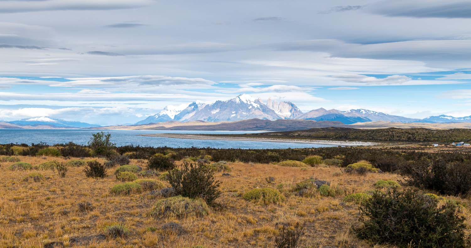
Torres del Paine National Park is known for its soaring mountains, bright blue icebergs that cleave from glaciers and golden pampas grasslands that shelter rare wildlife such as llama-like Guanacos. The most iconic site is the Paine mountain range or Paine Massif, with the Torres del Paine distinctive three granite peaks, and the horn-shaped peaks called Cuernos del Paine. At over 700 sq miles in size, the park is one of the largest and most visited in Chile.
We spent 4 days, in two hotels, exploring the National Park, in what is their Summer. The weather was totally different to what we have previously experienced so far on this holiday, which we knew would be the case. In Patagonia you can experience all four seasons in day, and we did. High winds bring changeable weather by the minute, which can often create very dramatic landscapes and wet clothing!
Here are some of the best bits of our trips into the Torres del Paine National Park.
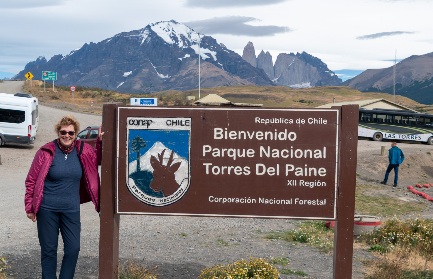 One of the three National Park entrances – The National Park was founded in 1959, following the Chilean Government’s compulsory purchase of the land from cattle ranchers. Visitors to the park increased over the next two decades and in 1979 is was classified as a UN Biosphere Reserve.
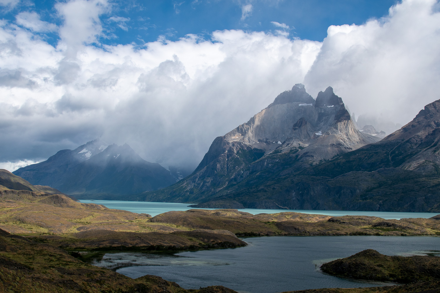
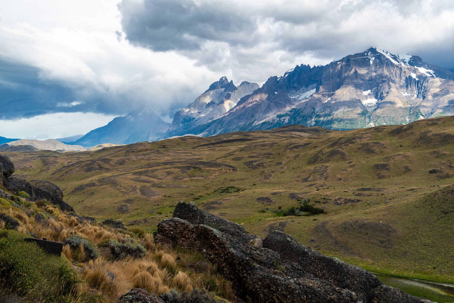
The Three Granite Towers are part of the Torres Massif, which was formed 12 million years ago. At this time sedimentary layers of the earth were lifted up and later worn down through glacial erosion. What was left was the hard, resistant granite rock that is seen today.
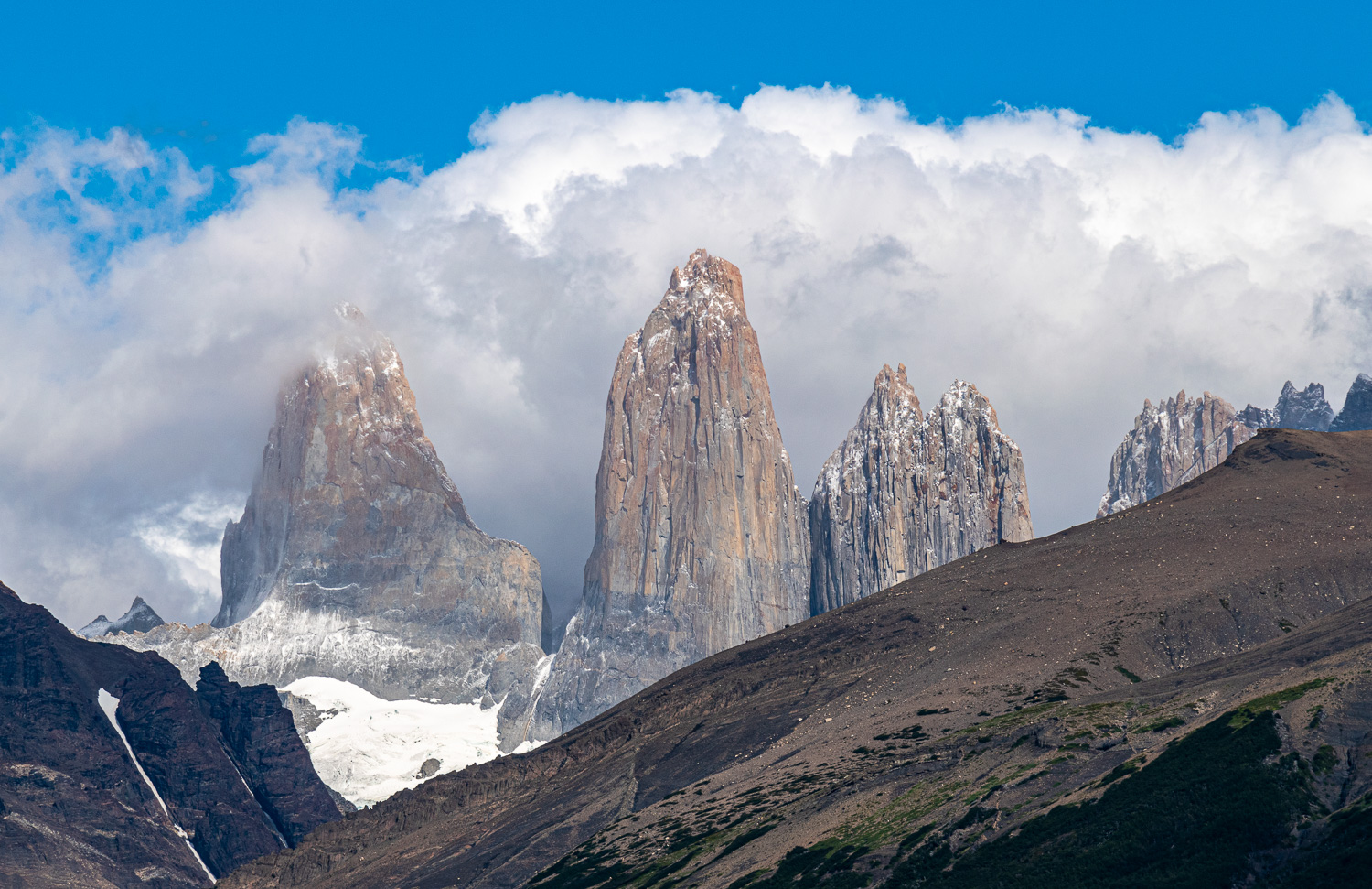 The three towers almost fully visible
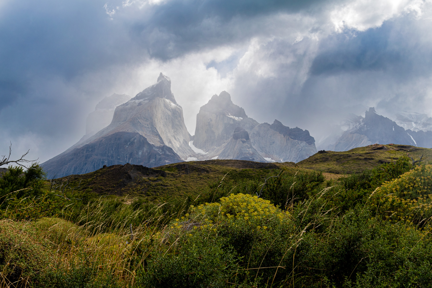 The Torres Massif visible through a stormy sky
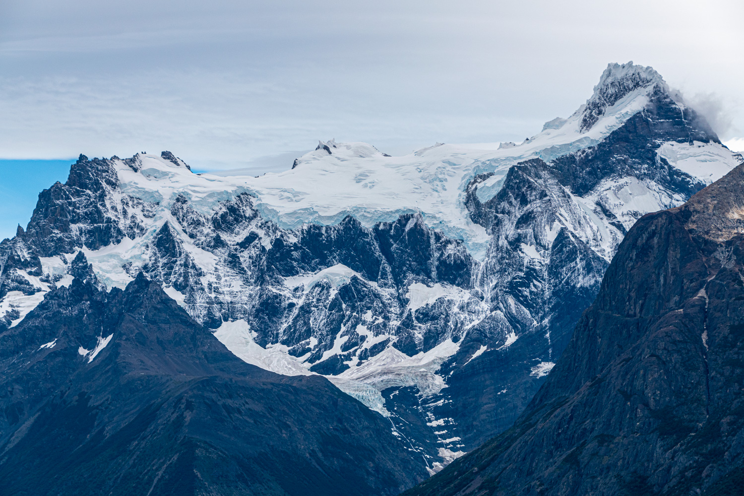 The horn-shaped peaks called Cuernos del Paine, are part of the Torres Massif and have a large hanging glacier between the two horns, which had had a fresh covering of snow the day before
 Lake Sarmiento, is the largest lake in the park. Discovered in 1583, the lake covers an area of 35 sq. miles. It’s the only salty lake in the park and is not supplied by glacier melt-water. The white sediment on the shoreline is Selenite (Calcium Carbonate).
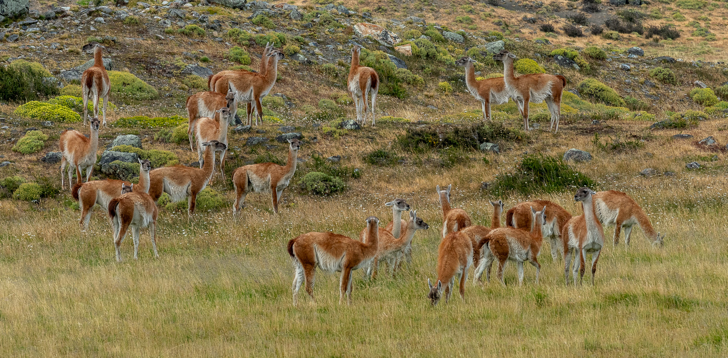 A large gathering of juvenile Guanacos on the pampas. These groups have one dominant alpha male who mates with all of the females, who then produce one offspring per year. All these juveniles would have had one father. The dominant male is typically replaced every year. The dominant male’s main job is to observe and protect the herd, always on the lookout for Puma.
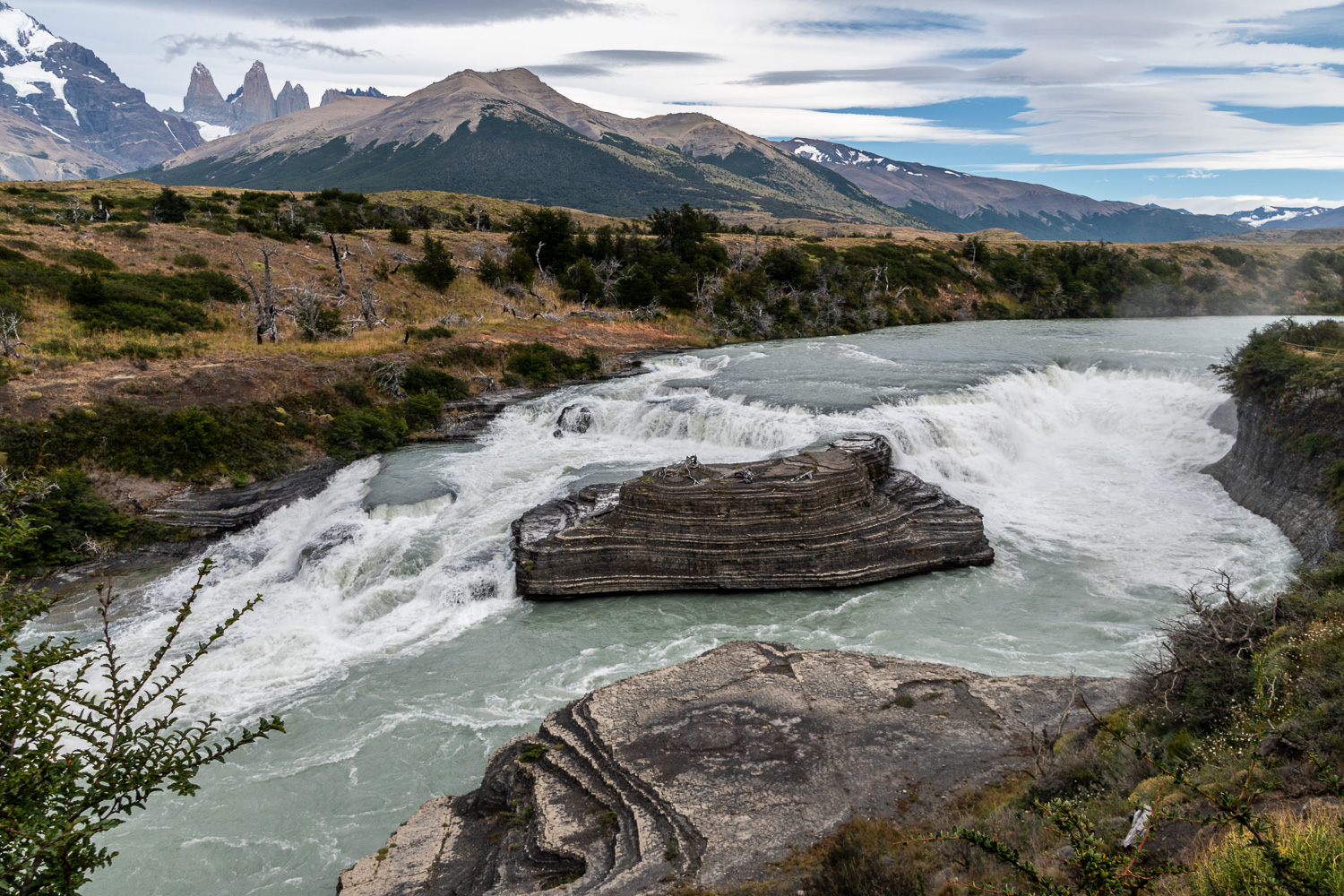 Cascada Paine is a 49ft waterfall on the River Paine, which is fed from glaciers, and feeds other lakes and rivers in the park, eventually feeding into Pacific Ocean, after passing Puerto Natales.
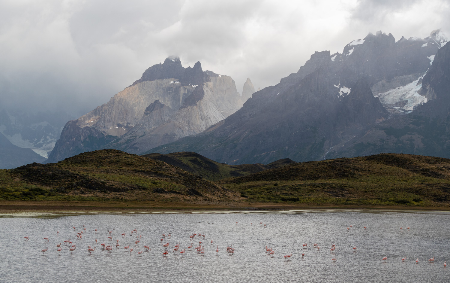 Laguna de los Cisnes – These migratory Chilean Flamingoes fly north during the Patagonian winter
 The majestic Lake Nordenskjöld, named after Otto Nordenskiöld, the Swedish geologist, geographer and polar explorer, who discovered the lake in the beginning of the 20th century.
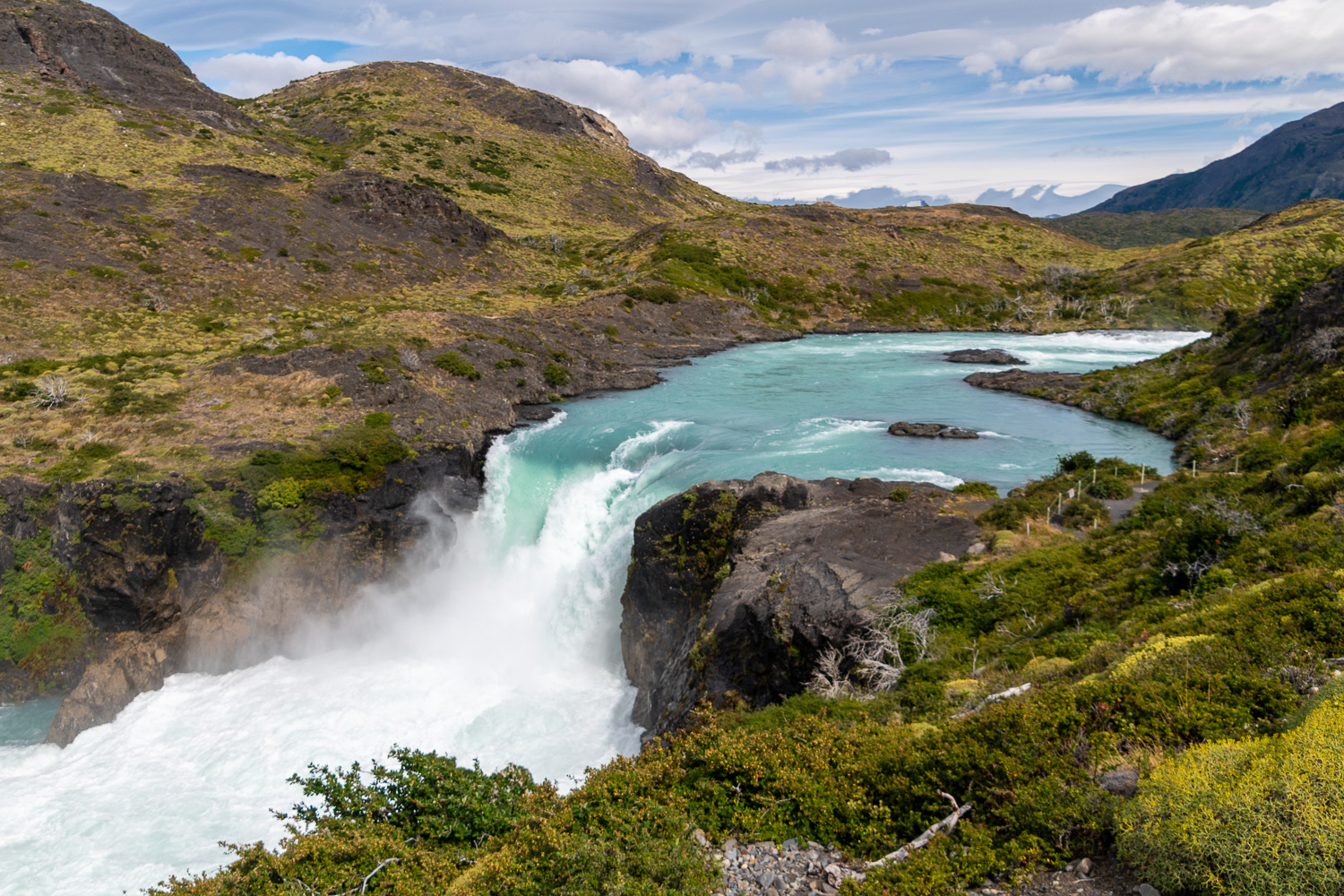 The Salto Grande (Big Jump!) waterfall is fed from Lake Nordenskjöld and continues to flow into Lake Pehoé
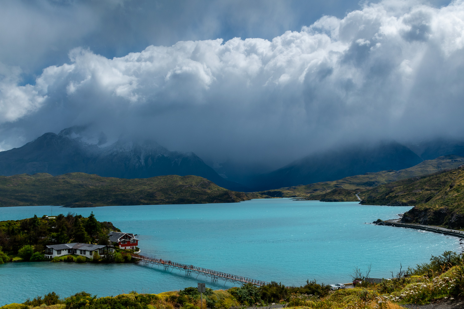 Lake Pehoé, with a 1960s built hotel, which is scheduled to be converted into a new visitor’s centre
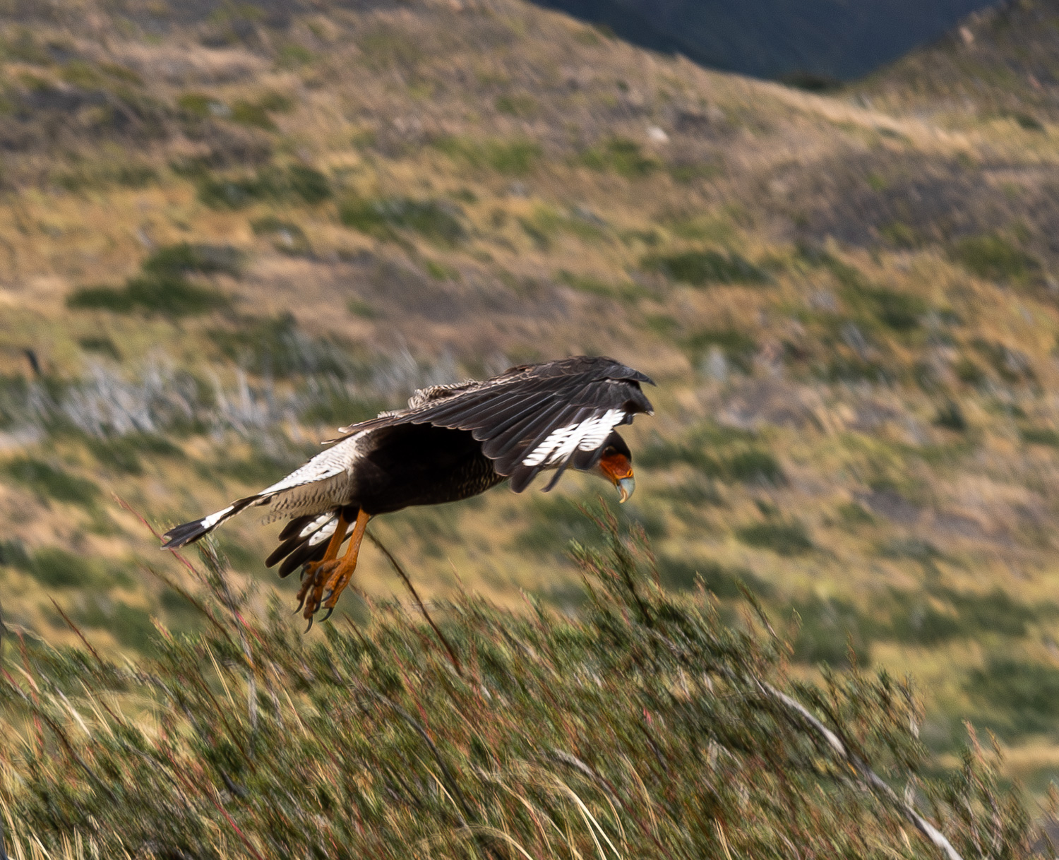 A Black-crested Caracara coming into land
Chile’s national bird, the majestic Andean Condor, is one of the world’s largest flying birds, with an 11-foot wingspan. Condors have become rare in northern South America due to hunting and habitat loss, but remain present in Patagonia and abundant in certain areas.
A pair of Condors lay one egg every 2 to 3 years and the young chick is brought up by both parents until the they are about three years old. At that time the parents stop feeding them, forcing them them to become independent. Condors glide on thermals and are scavengers, cleaning up the carcasses after Pumas have killed and had their fill.
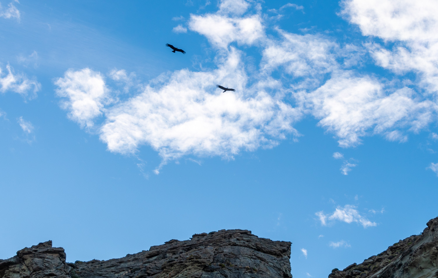 Condors soaring on thermals
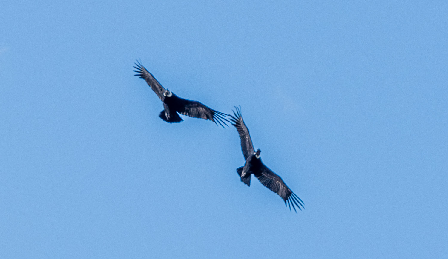 An adult pair of Condors
Rhea are flightless birds, related to ostriches and emus. The alpha male mates with a number of females and all the eggs are laid in the same nest. It takes 56 days to incubate the eggs, with the father sitting on the nest. He remains with the chicks until they are three years old, as the mothers have no mothering instincts. The group we saw were all juveniles being looked after by dad.
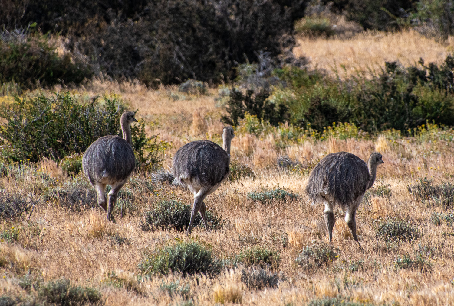 Rhea are shy birds, and these three youngsters were soon moving away from our presence
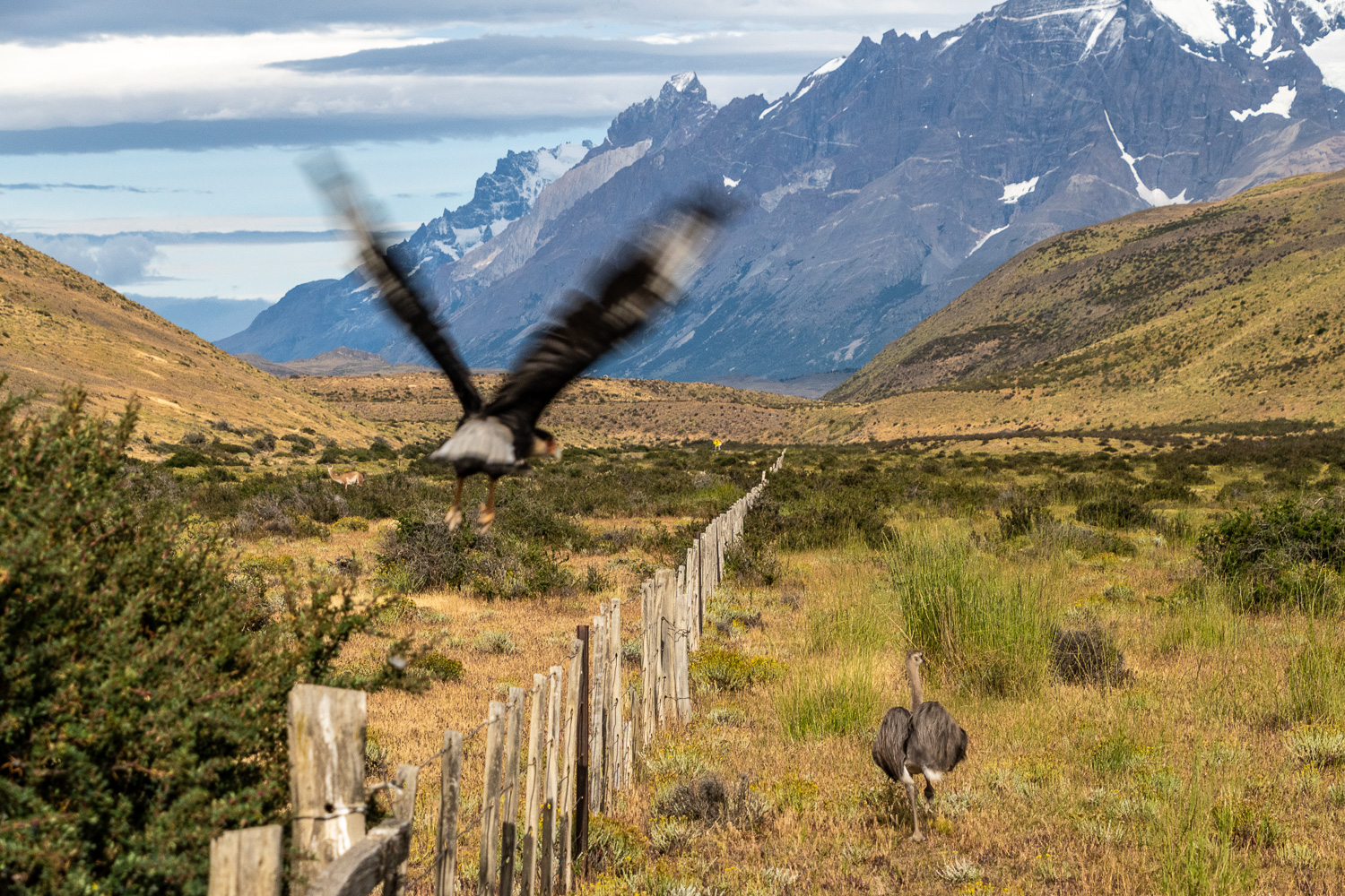 This young Rhea was startled by a Black-crested Caracara taking flight
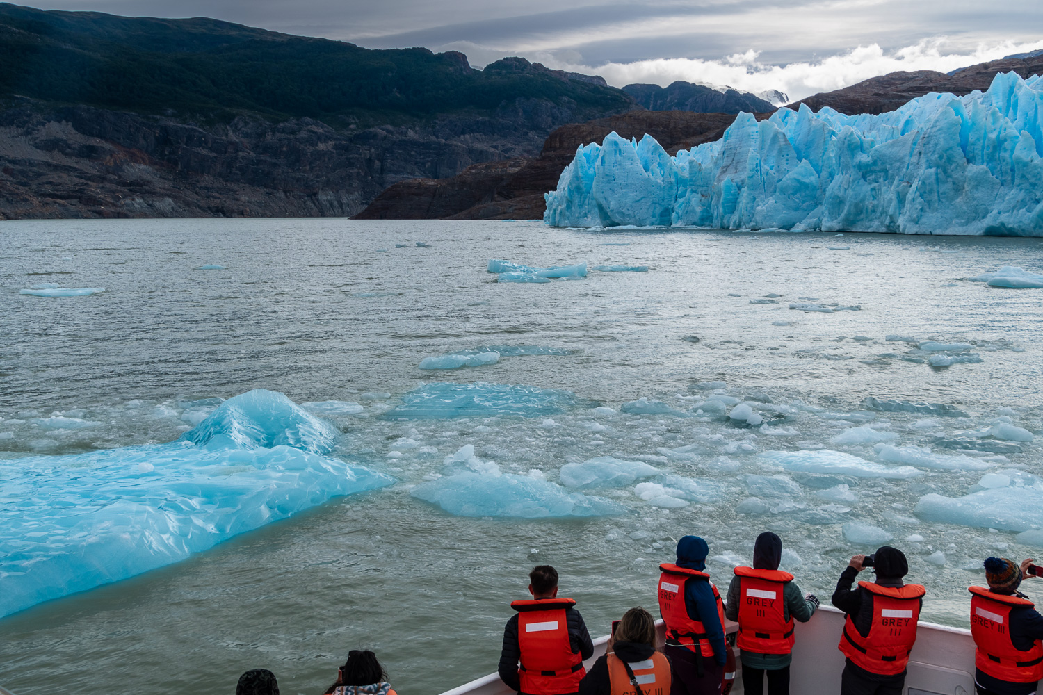
Grey Glacier is located in the Southern Patagonian Ice Field. It flows into the lake of the same name. Before dividing in two at its front end, the glacier is 3.7 miles wide and over 100 feet high. The sediment from the melting glacier, gives the water its grey colour and the lake and glacier their names. A two hour round-trip by boat allows visitors to get a close-up view of the faces of the two sides of the glacier.
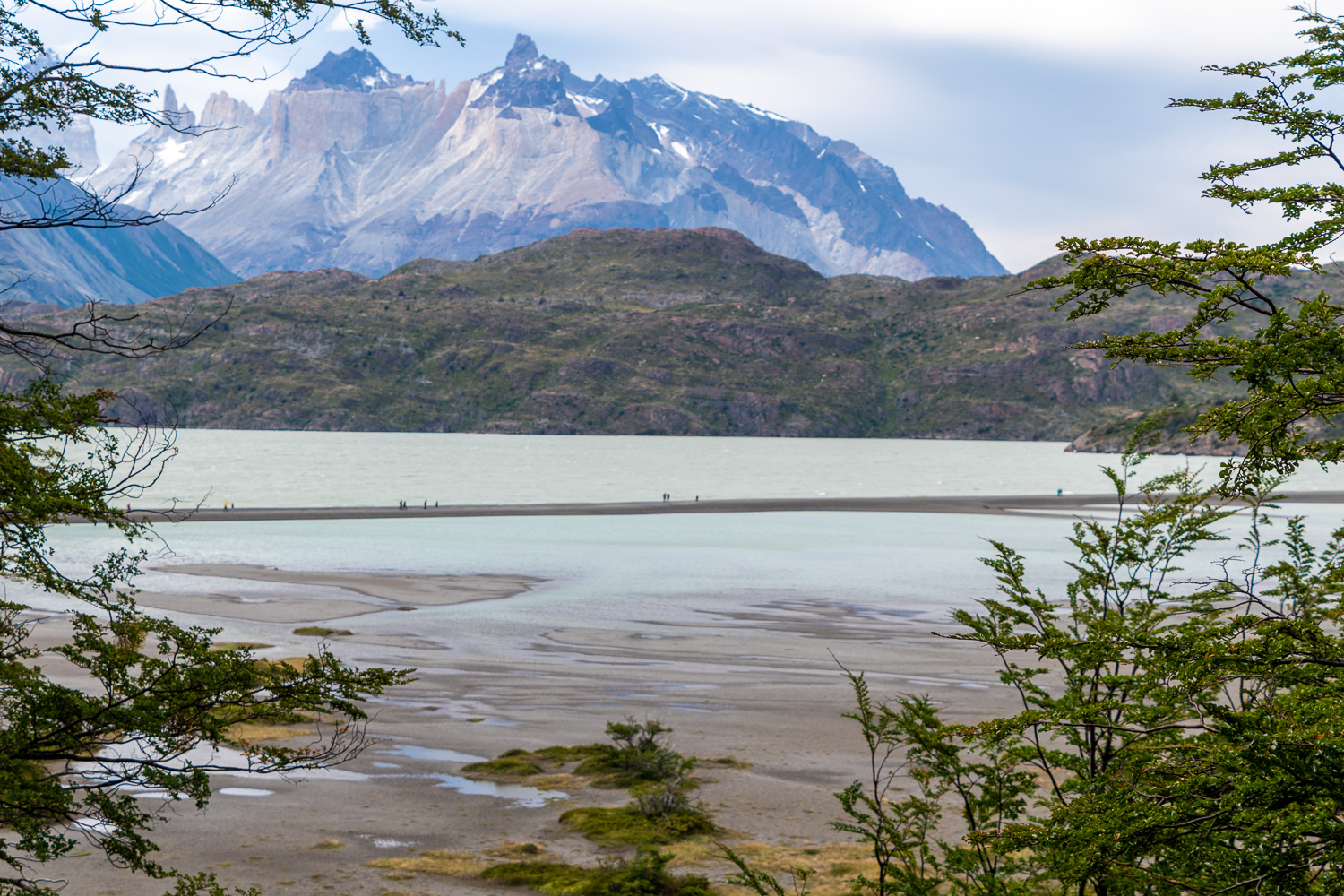 There is a very windy 40 minute walk along a sand bar in the Grey Lake to embark the boat
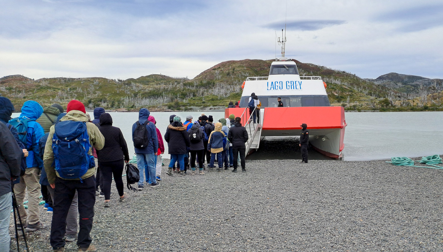 Everyone is well wrapped up as they embark the ‘Lago Grey’ Catamaran for the trip to the glacier
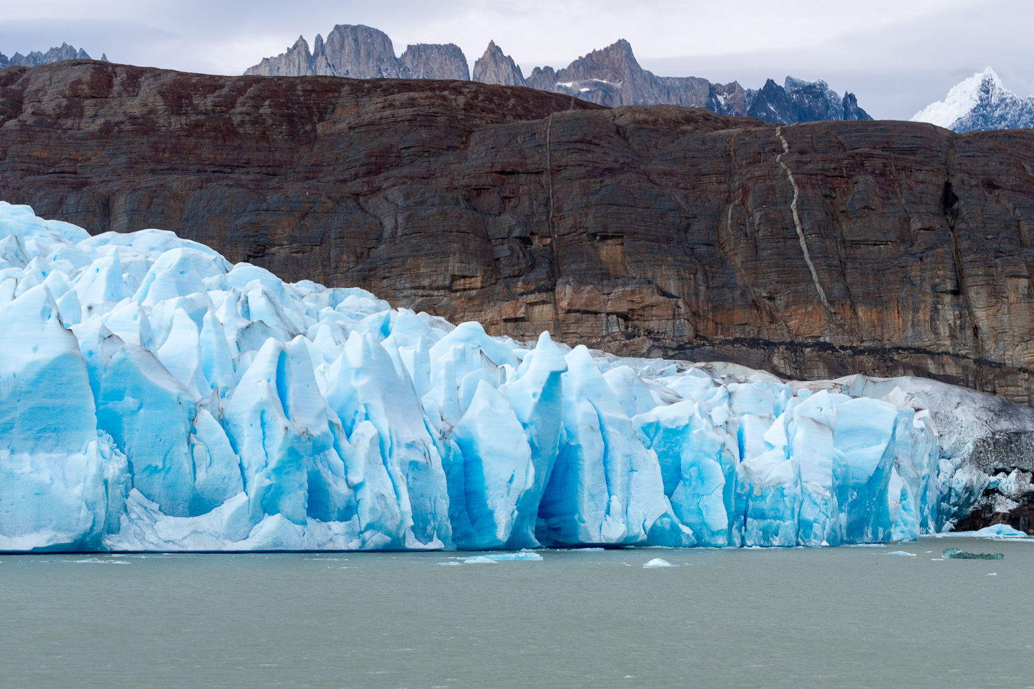 Getting close to the first side of the glacier
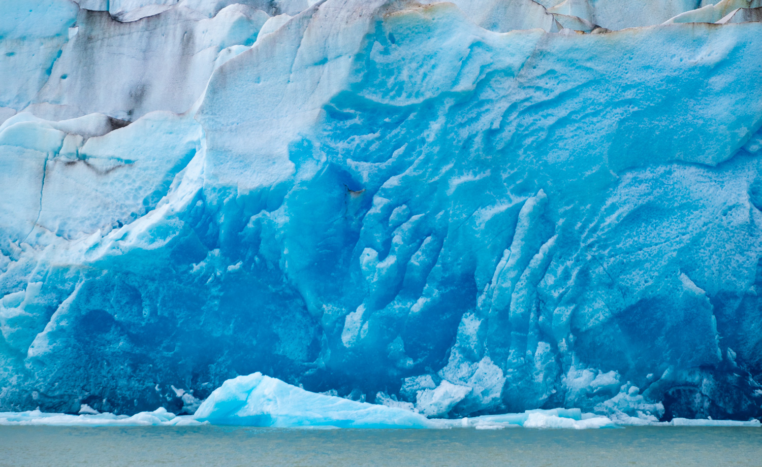
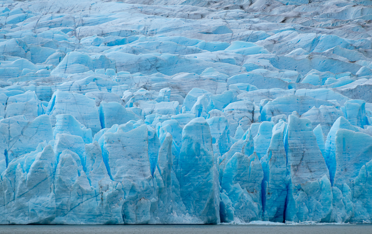 Amazing ice formations
 Approaching the the second of the two sides of the glacier
 Looks like hands in the ice
Our final trip on the Chilean side of Patagonia was to visit the Pinturas Rupestres Cave Paintings. These were accessed by a 2-mile hike through Patagonian Steppe within the park. The Patagonian Steppe is a combination of windswept grassland devoid of trees with a range of plateaus, plains, hills and river valleys. It is ideal hunting ground for the Puma, who can hide amongst the grasses and scrub when stalking Guanaco, who are much taller and cannot hide and therefore are vulnerable to attack.
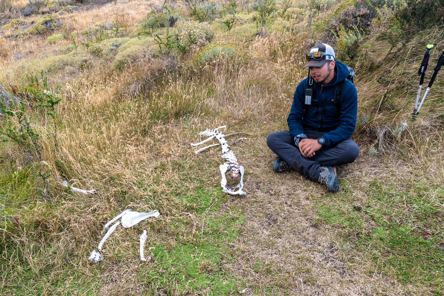 Our guide showed us the skeleton of a Guananco that was recently killed by a Puma and cleaned by a series of scavengers from Condors to worms
 Hiking across the Steppe to the cave at the top of the hill
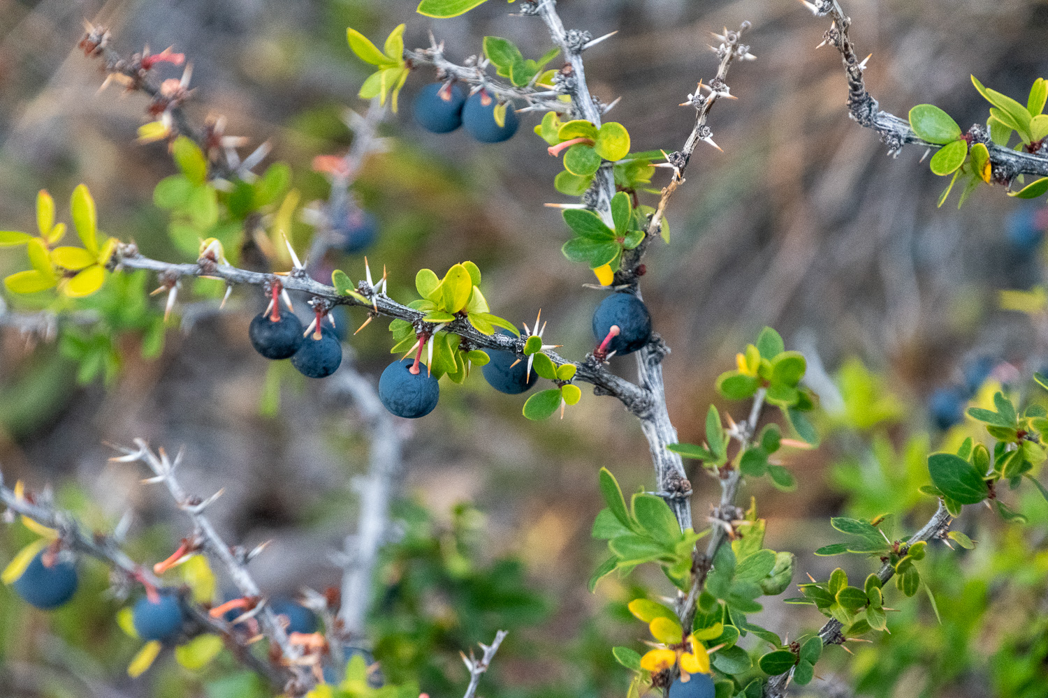 Calafate shrub, is native to the region and produces a small, edible blueberry like fruit – very tasty!
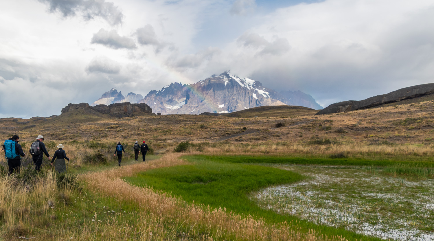
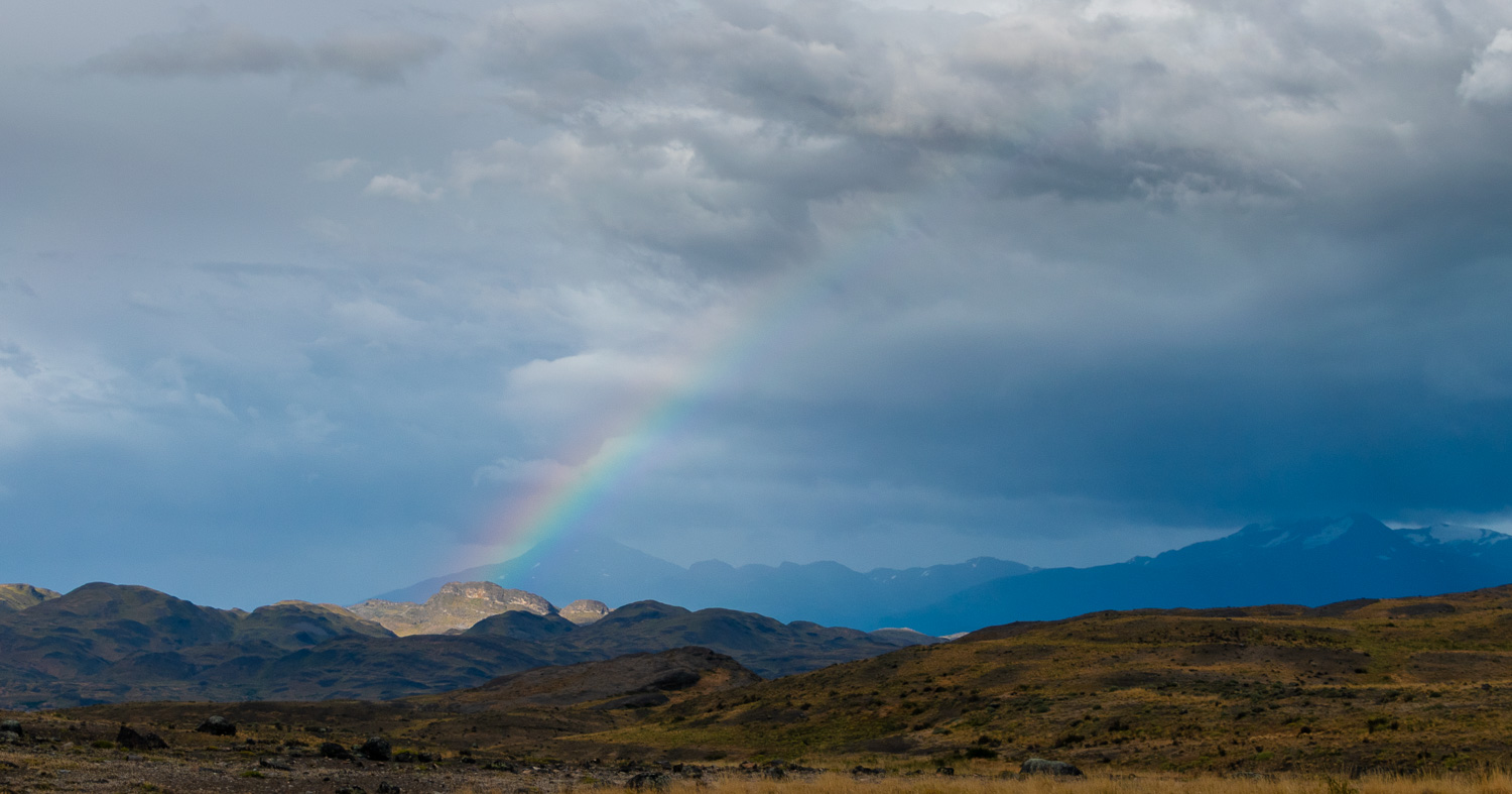 A rainbow over the Steppe
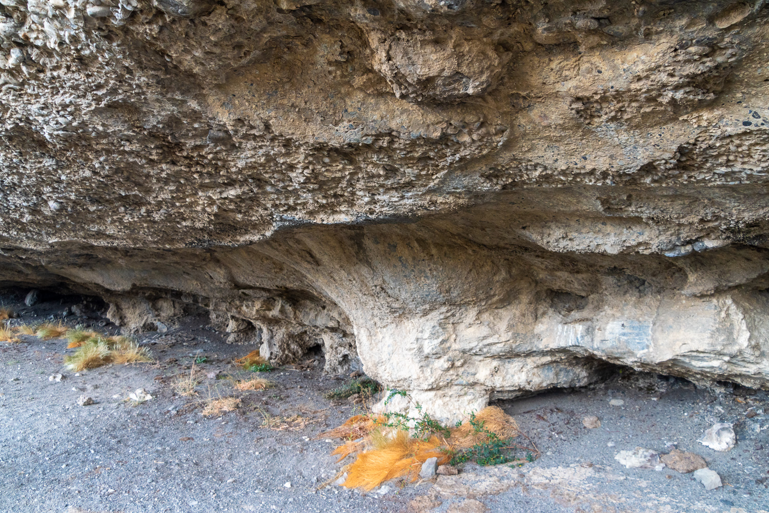 The small, shallow cave provided cover and protection for the Aónikenk people who lived here and created the paintings on the ceiling of the cave.
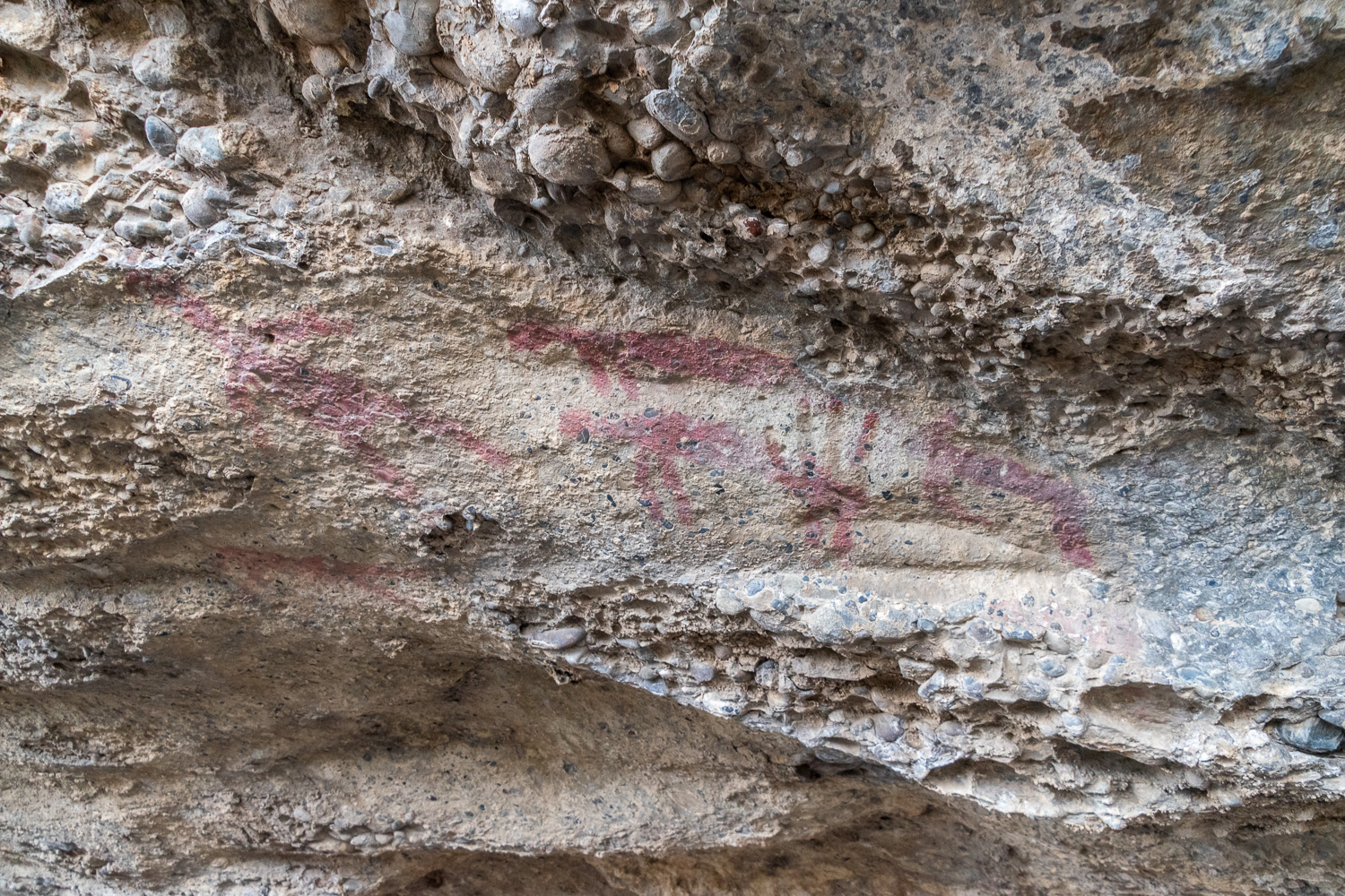 The Aónikenk, who were nomadic hunter gathers, were skilled horseman and were over 6-feet tall. They used fruit, stems and roots from the Calafate shrub, mixed with a binder to produce these cave paintings, which are thought to be over 6,500 years old. They represent, Puma, human and Guanacos.
 View from the cave across to Torres Massif
We now headed for Argentina, to continue our Patagonian exploration.
Argentina
Argentina is located in the southern half of South America and covers an area of approx. 1 m sq miles, making it the second-largest country after Brazil, the fourth-largest country in the Americas, and the eighth-largest country in the world. It has a population of approx. 46 m and encompasses immense plains, deserts, tundra, and forests, as well as tall mountains, rivers, and thousands of miles of ocean shoreline.
After a 5-hour public coach trip from Puerto de Natales and across the boarder, we arrived at El Calafate, our next stop for three nights. El Calafate is a town that lies on the southern end of Lake Argentino, near the edge of the Southern Patagonian Ice Field. It’s mainly known as the gateway to Los Glaciares National Park, home to the massive Perito Moreno Glacier.
Lake Argentino is the source of the Santa Cruz river that flows into the Atlantic Ocean. It is the third largest lake in South America, with a surface area of 580 sq. miles. It is 37 miles long and up to 13 miles wide with a depth of 3,000 ft in parts. The special colour of the water due to a very fine blue powder, produced by glacier abrasion, called glacial melt-water.
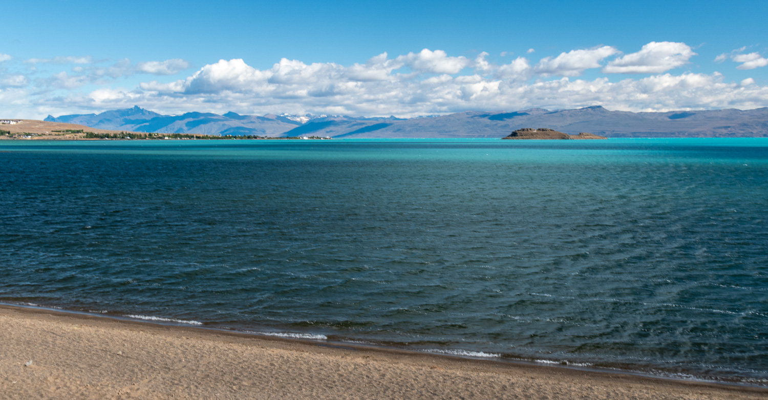 View across the lake from El Calafate. The bright blue colour of the main body of the lake, is in contrast to the duller water in the shallow bay by the town. On this windy day waves were visible on the lake.
On the lake shoreline in El Calafate they have created a wetlands reserve, which we spent several hours exploring and looking at its varied bird life.
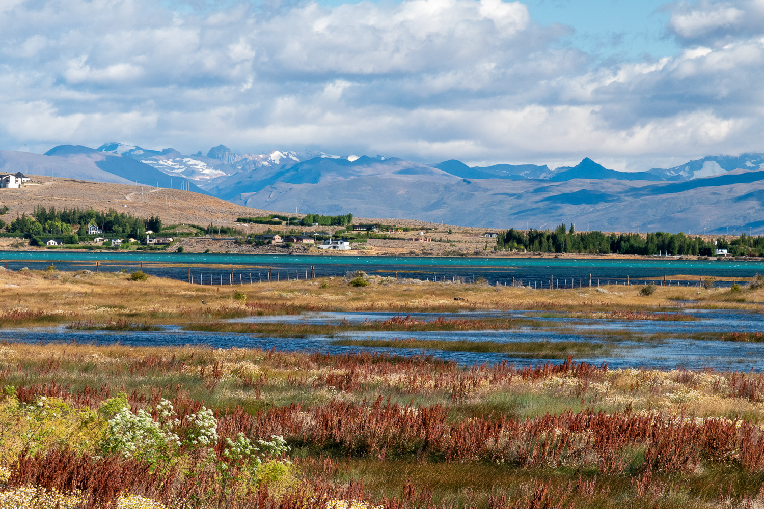 The wetland reserve
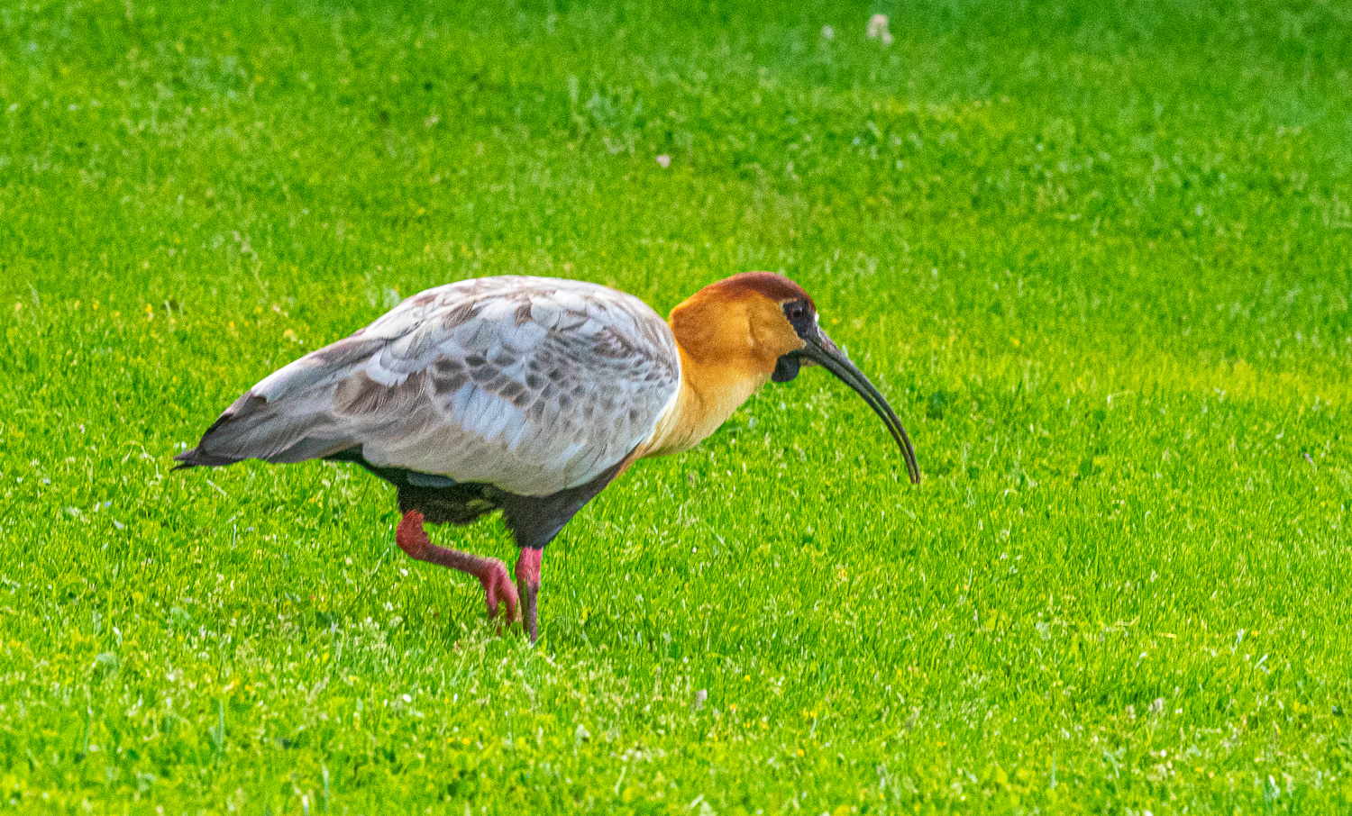
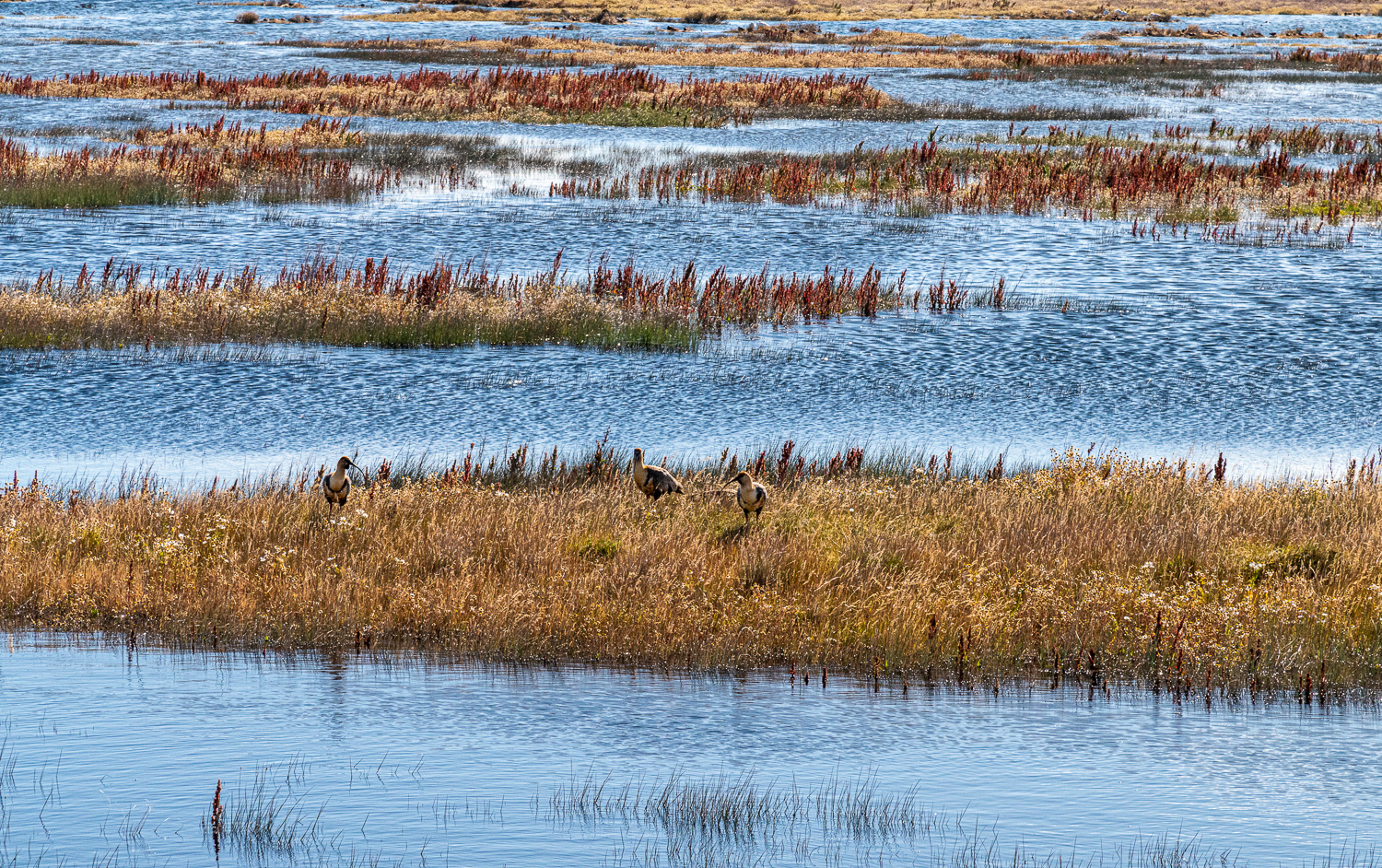 A group of Black-faced Ibis birds feeding in the wetlands
 … they also like dry grass!
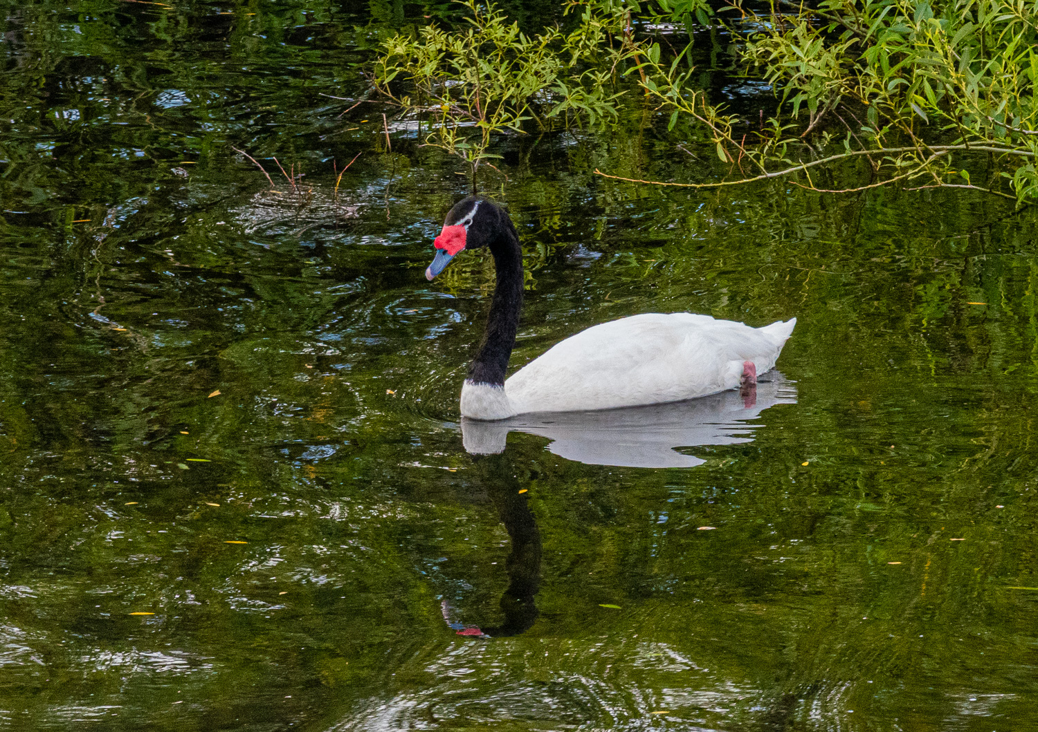 Black-necked Swan
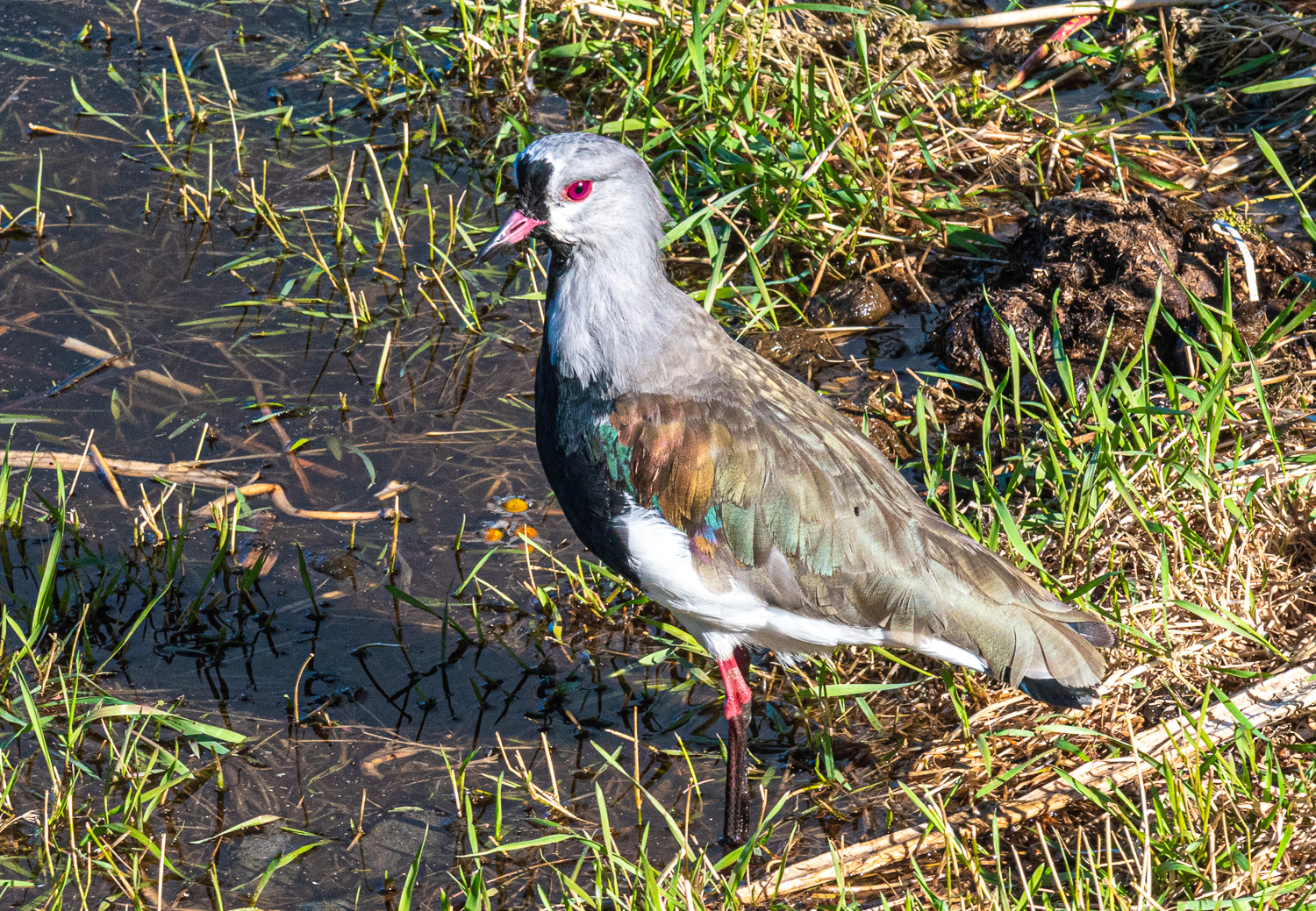 Southern Lapwing
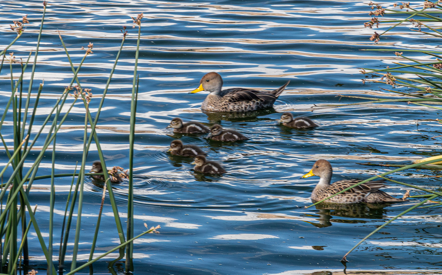 Where there are wetlands, there are ducks! This a family of Yellow-billed Pintail ducks.
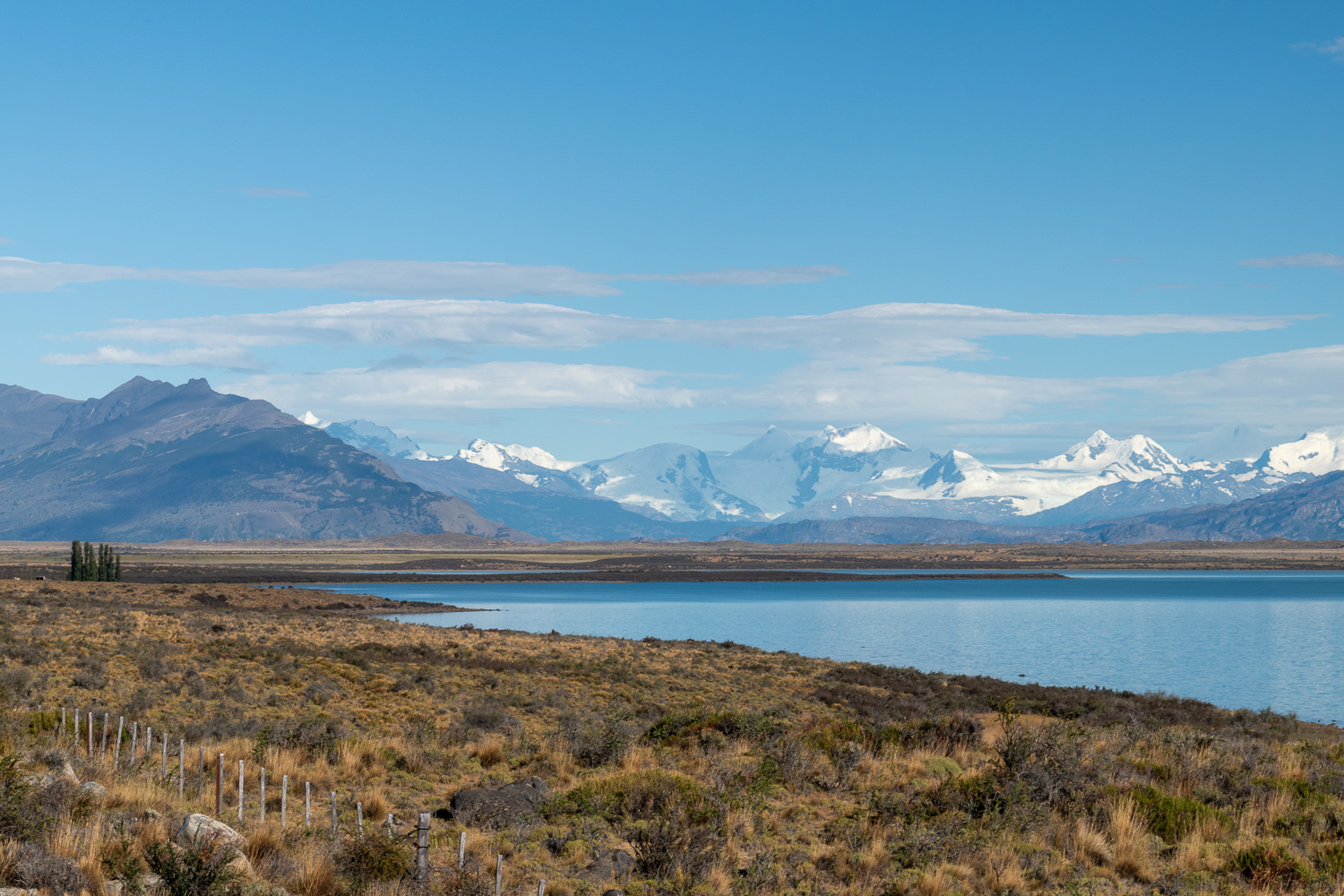 On route to visit the Perito Moreno Glacier, we followed the lake through the Patagonian Steppe. Here the lake has the backdrop of the snow-capped Andes Mountain range.
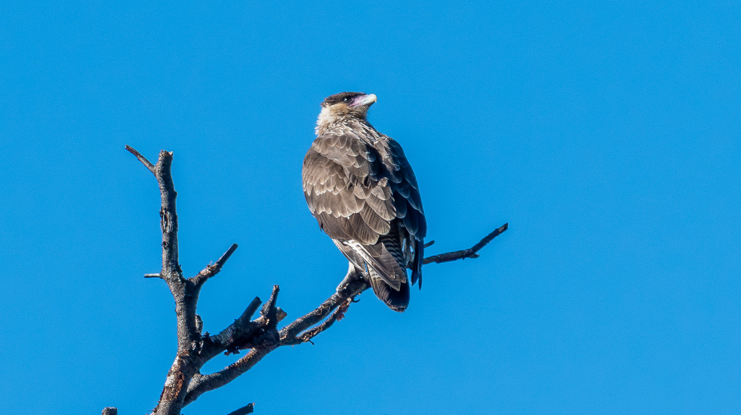 Nearby a juvenile Black-crested Caracara
Perito Moreno Glacier, Argentina
The Perito Moreno Glacier is one of the most important tourist attractions in Argentine Patagonia. The 100 sq mi ice formation, 19 mi in length, is one of 48 glaciers fed by the Southern Patagonian Ice Field located in the Andes Mountain range shared with Chile. Perito Moreno Glacier is the world’s third largest reserve of fresh water. Unlike many glaciers worldwide that are retreating, this is one of the few that maintains a state of equilibrium.
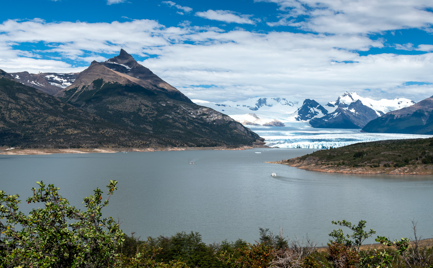 Perito Moreno Glacier as seen from a viewpoint that is approx. 5 miles away from the glacier face. We took one the of many boats that regularly take visitors to the face of the glacier.
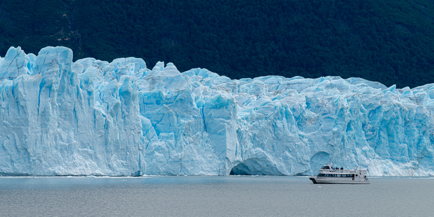 A sightseeing boat explores some of the semicircular caves on face of the glacier. The face of the glacier is up to 200 ft tall.
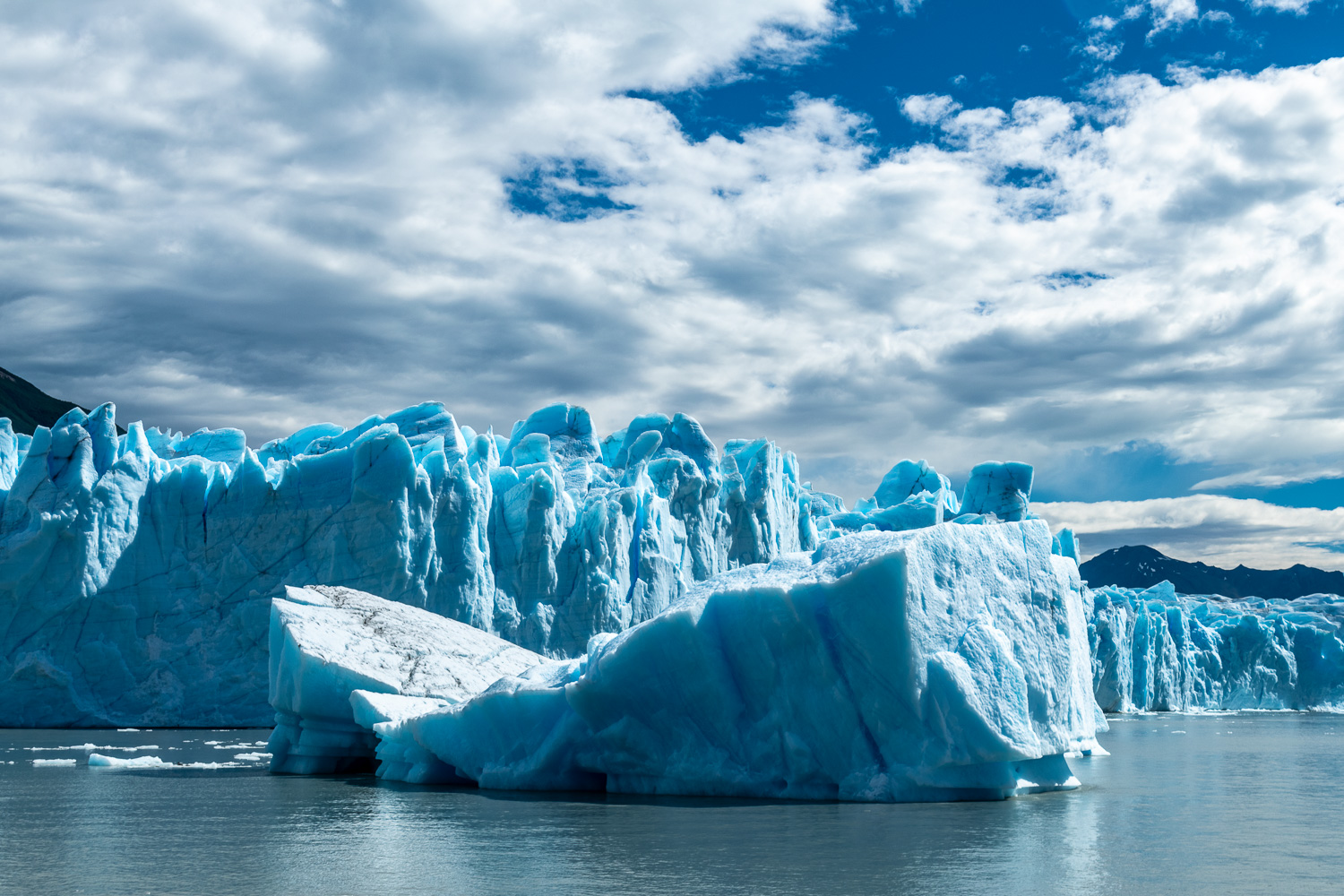 A large iceberg floats in front of the glacier. Typically only 10% of an iceberg is visible above the water.
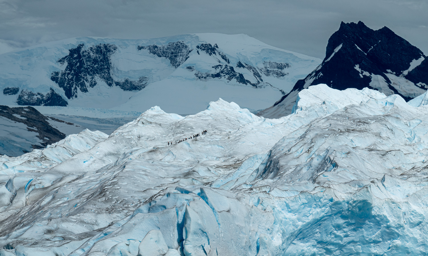 A group climbs the South side of the glacier. The mountain behind is Mount Pietrobelli, which at 9,700 ft is the tallest peak in the National Park.
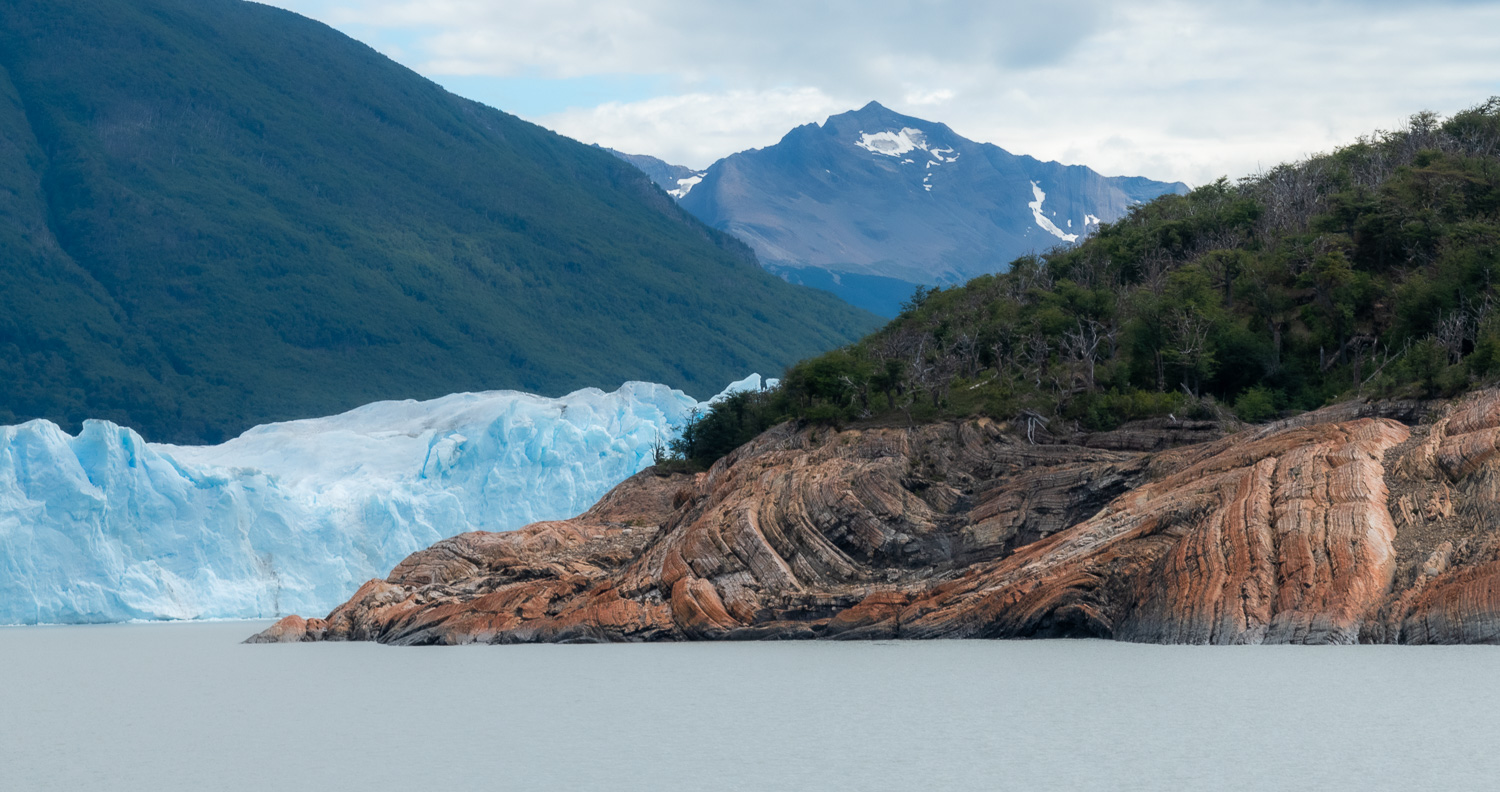 Interesting patterns created on the surrounding rocks over time by the glacier
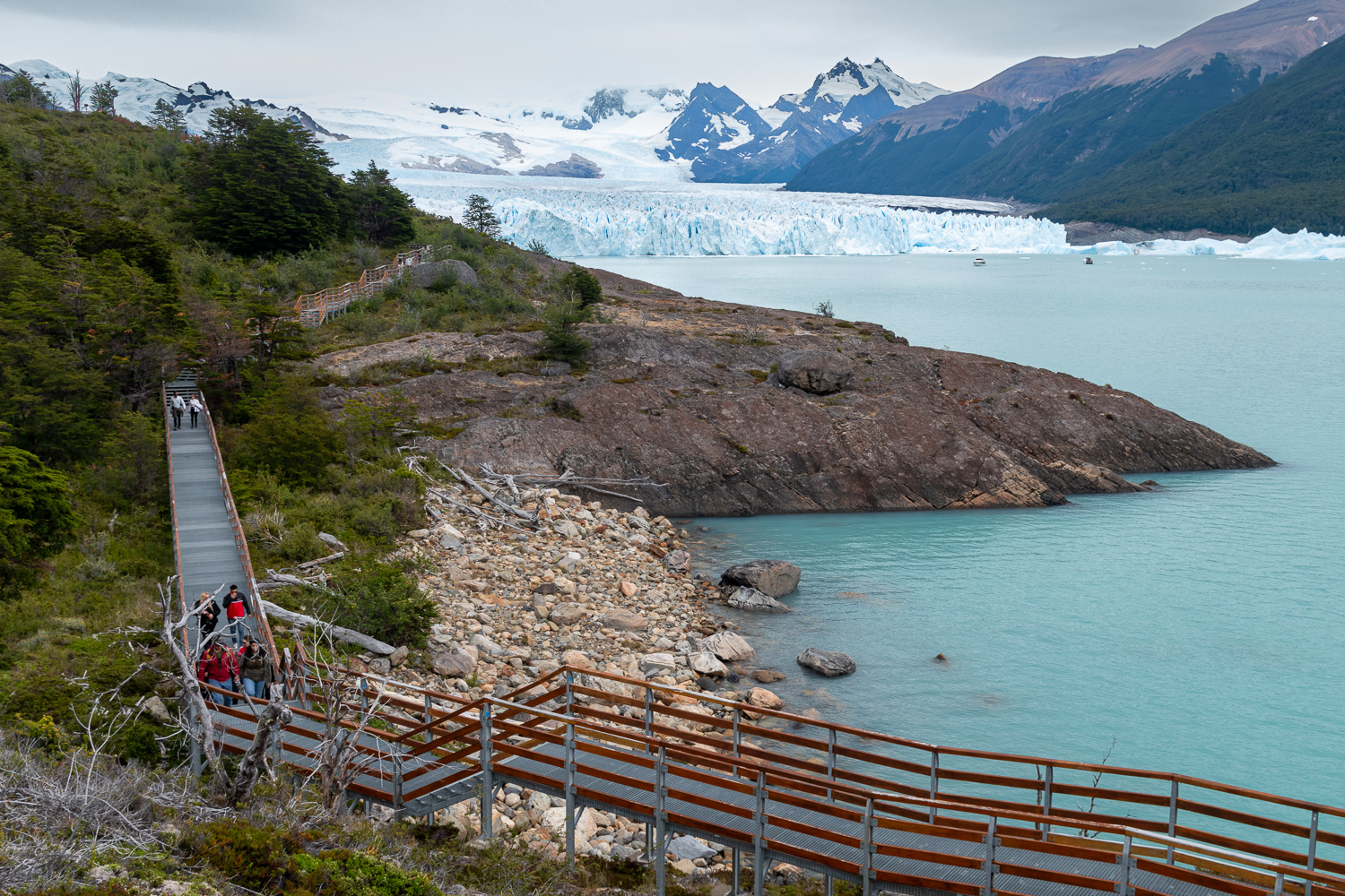 Walkways that spread out along the cliffs directly opposite the face of the glacier give visitors a close up view of the splendour of the Perito Moreno Glacier. In the background is the North face of the glacier.
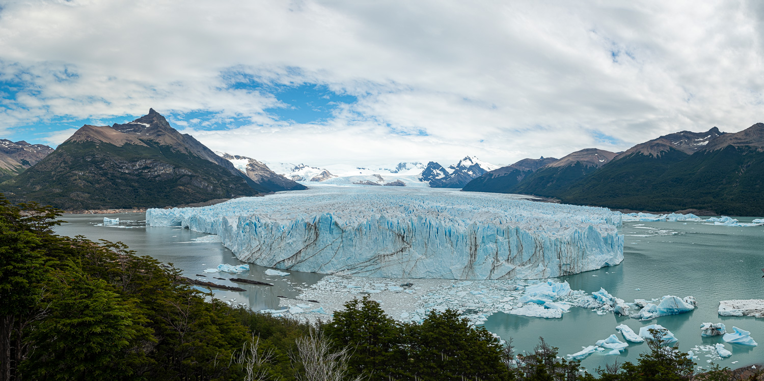 Panoramic view of the South and North faces of the glacier. The 5,000ft tall Mount Perito Moreno Glacier on the left is the source of the glacier. In parts the glacier is 2,000 ft thick.
 A huge lump of ice carving from the glacier
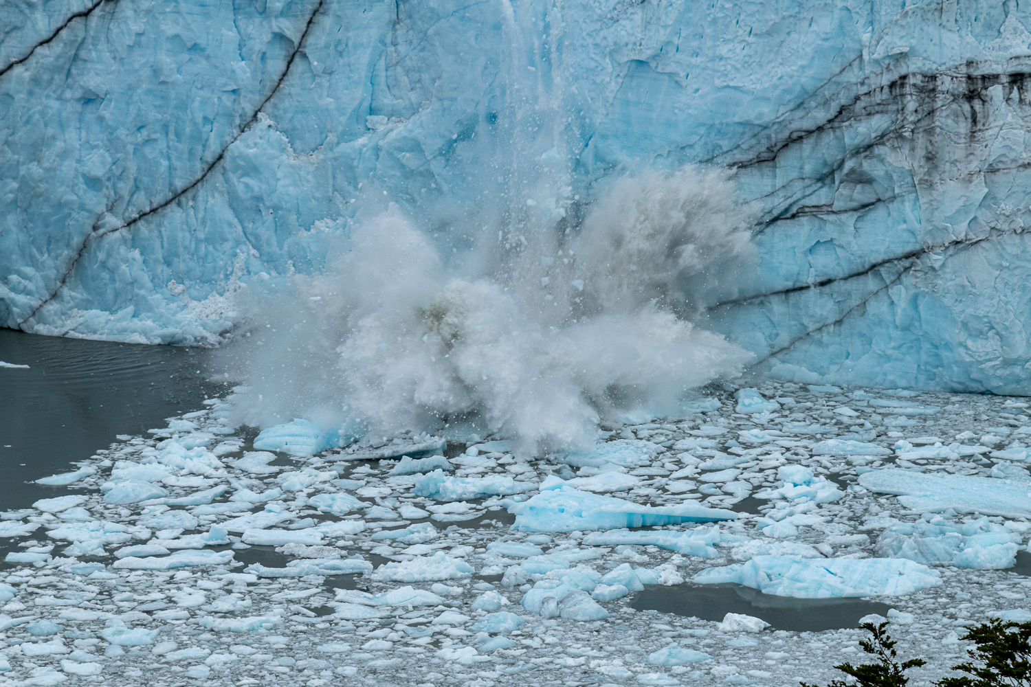 … and crashing into the water
