Ushuaia, Argentina
A resort town located on the Tierra del Fuego archipelago, the southernmost tip of South America, nicknamed the ‘End of the World.’ The windswept town, perched on a steep hill, is surrounded by the Martial Mountains and the Beagle Channel. It’s the gateway to Antarctica cruises and tours to nearby Isla Yécapasela, known as ‘Penguin Island’ for its penguin colonies and Tierra del Fuego National Park.
Before heading off on the cruise we spent a couple of days exploring the town, and visiting the national park.
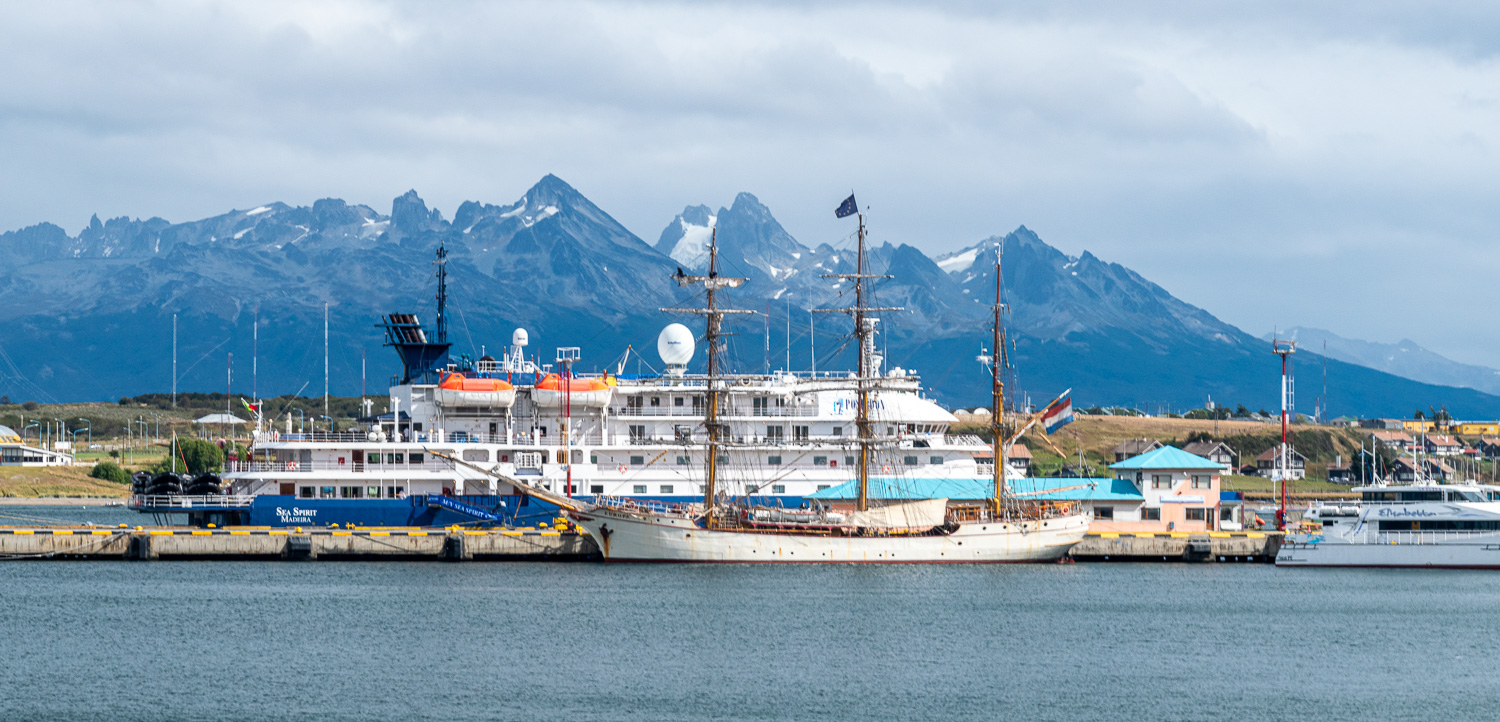 Gateway to the Antarctic – Ushuaia Harbour is full of different types of ships that are used for Polar cruises, from 200+ passenger mini-liners to tall ships
In the heart Ushuaia is Plaza Malvinas, which has an inscribed monument that is a touching reminder of the Falkland Islands War (La Guerra de Las Malvinas) of 1982. The centrepiece of the plaza is a large sculpture which depicts the shapes of the Falkland Islands. It was very moving to see and to reflect on the history of this time, both from our perspective and from the peoples’ perspective in Ushuaia, as many soldiers were conscripted from this community.
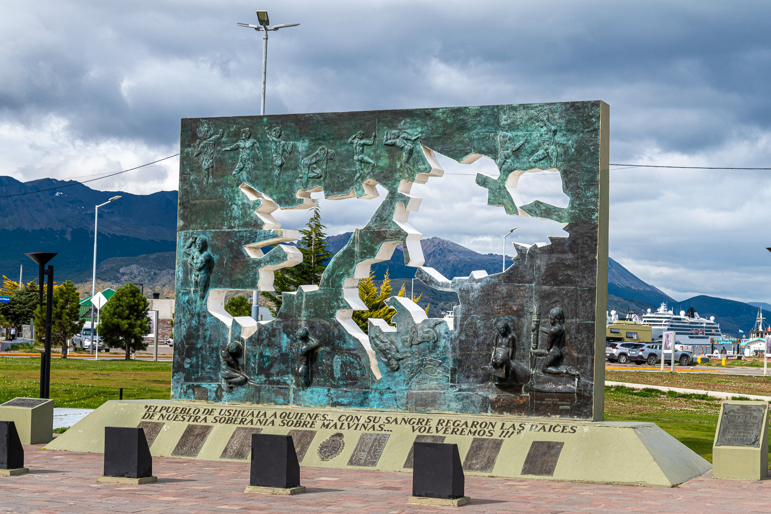 The bronze sculpture at the centre of the war memorial.
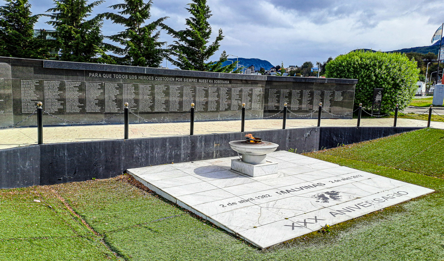 On the 30th anniversary of the war, an eternal fame was lit, next to the the memorial wall, which has inscribed the list of 649 servicemen killed in the conflict
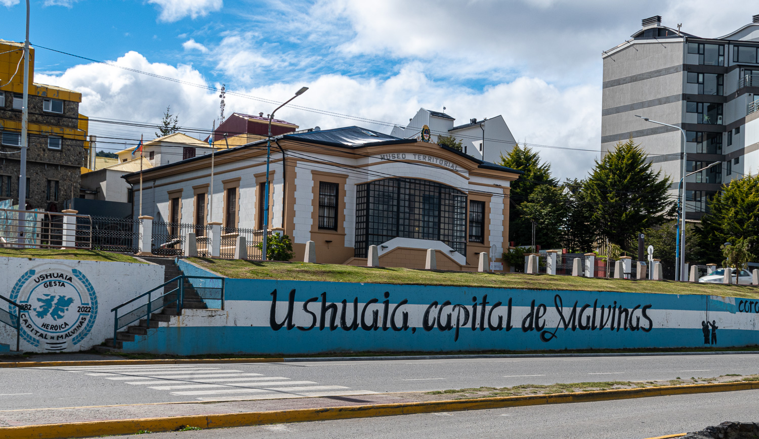 Ushuaia, has another moniker: Argentina’s capital of the Malvinas. There are references to the islands everywhere, as many here feel their absence.
Terra del Fuego National Park (The Land of Fires)
Argentina’s southernmost National Park protects the Andean-Patagonian forests that form the meeting of the Andes Mountain Range with the sea in the Beagle Channel, which connects the Atlantic and South Pacific oceans.
The ‘Land of Fires’ was the name given by explorers when they saw bonfires lit by the original inhabitants of the land, the Yámanas.
The national park is the last leg of the 19,000 mile long Pan-American Highway; a continuous network of roads from Prudhoe Bay, Alaska to the tip of South America. The Argentinian Route 3 finishes at Lapataia Bay, which leads out to the the Beagle Channel.
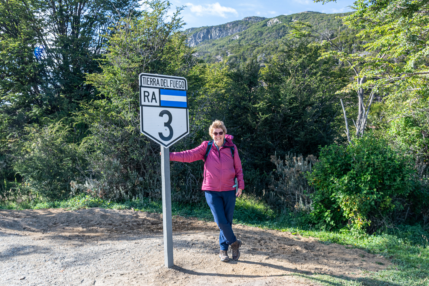 The sign that marks the official end of Route 3.
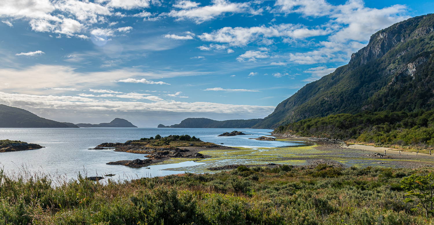 Lapataia Bay and the Beagle Channel in the distance.
We travelled North to Alakush, where we walked along the Lapataia River to Lake Roca O Acigami. The lake is dominated by Mount Condor, which at 17,000 ft is the largest peak in the park. Both the mountain and the lake straddle the border between Argentina and Chile.
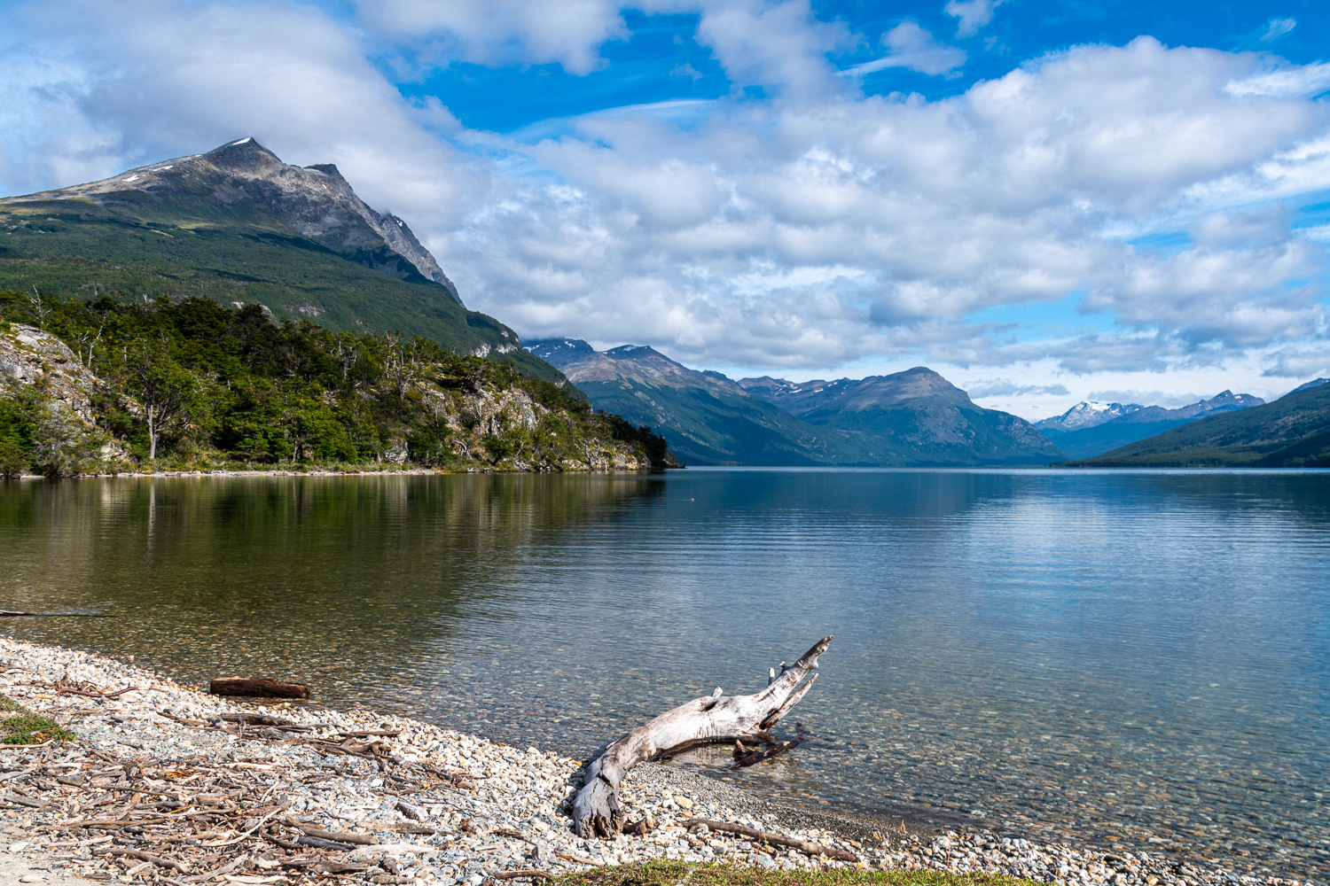 Lake Roca O Acigami, with Mount Condor on the left
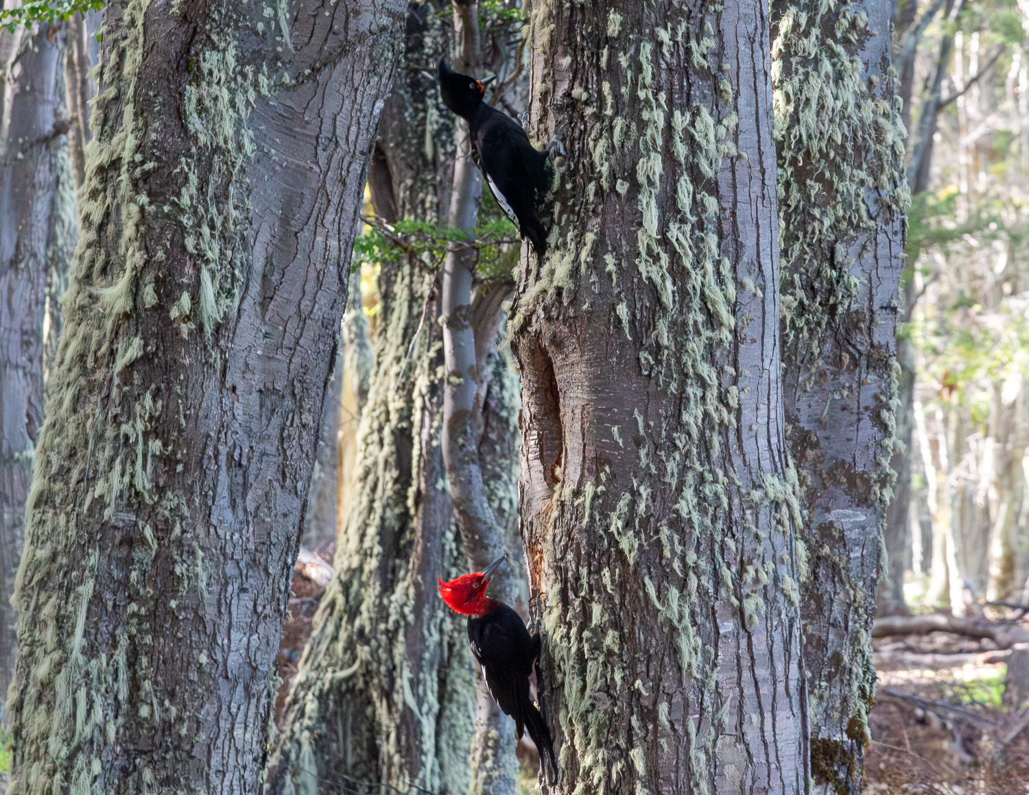 Male and female Crested Woodpeckers in the lakeside forest
In the heart of Tierra del Fuego National Park, at the southernmost tip of Argentina, sits the ‘Post Office at the End of the World’. Constructed of corrugated metal and wooden piles, this small shack on a short pier, posts letters and parcels from the absolute last stop in the Americas. The post office sits at the end of Lapataia Bay facing the Beagle Channel.
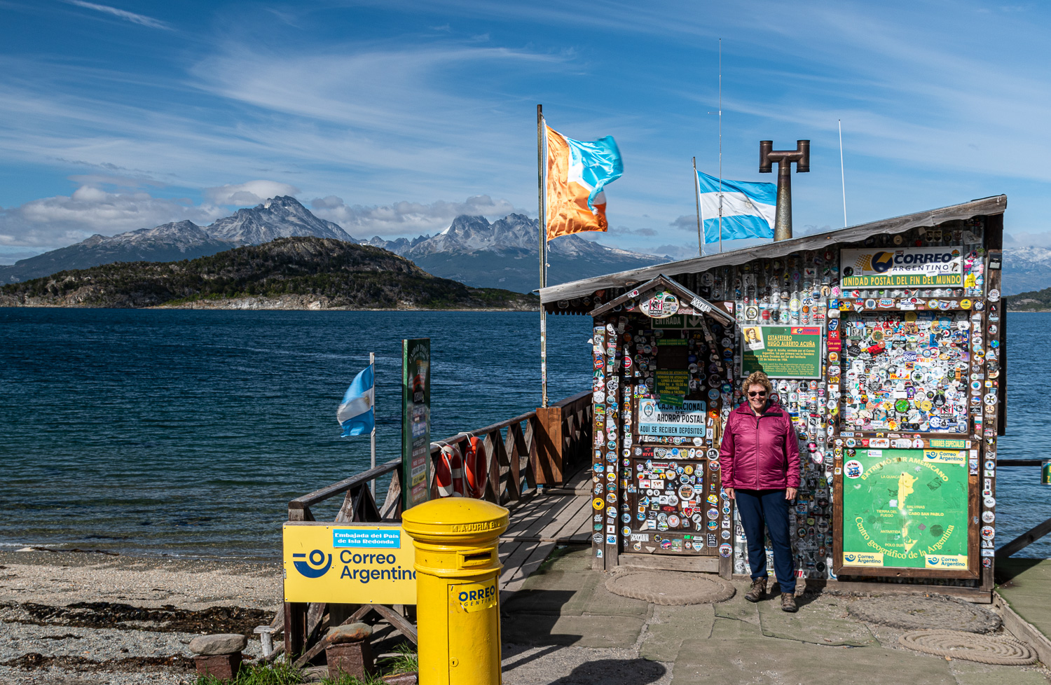 Charlotte visits the post office, where they stamped our passports
The narrow-gauge Southern Fuegian Railway, better known as the ‘End of the World Train’, is the southernmost railway in the world. In 1896, Argentina created a penal colony in Ushuaia, in order to provide cheap labour to develop the town. Timber was the main building material, which had to be felled and then transported from the forest. The prisoners built a railway to achieve this. Today’s modern railway runs along the same route as the original and reminds visitors of the extreme hardships that the prisoners had to endure.
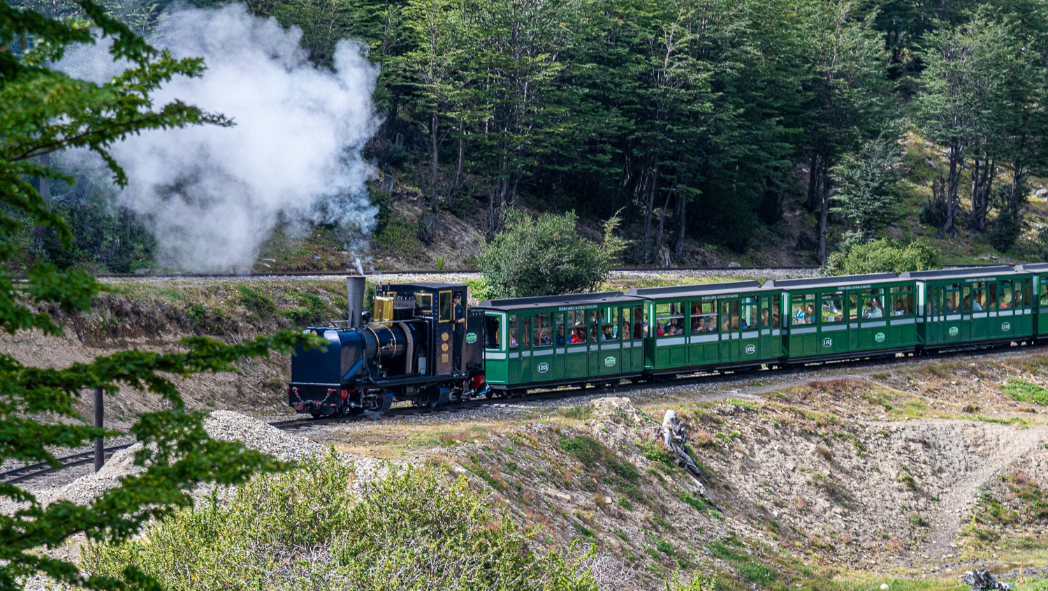 The steam train running through the forest
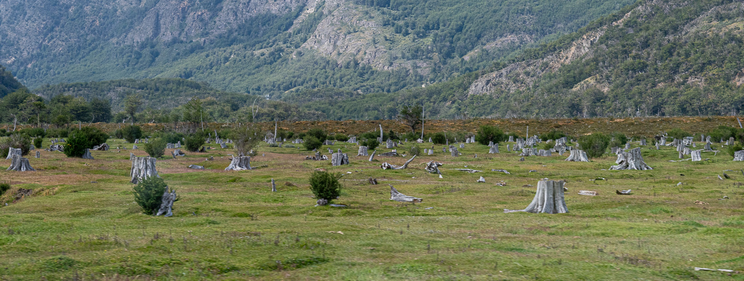 As the train winds through the valley, another reminder of the past is seen; the Cemetery of the Trees, whose stumps remain as witnesses of a past time
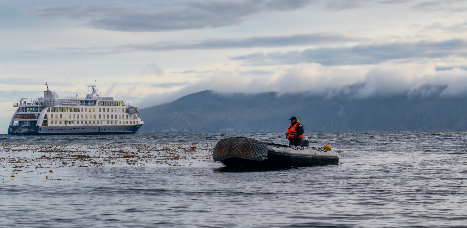
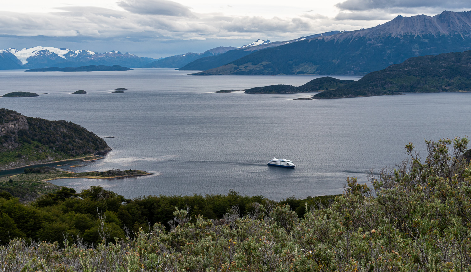
Cape Horn Cruise
A 5-day adventure cruise on the 200-passenger ship Ventus Australis, around the Southern Patagonia Fjords and Cape Horn. Departing from Ushuaia, the ship immediately entered Chilean waters and remained in the Chilean part of Patagonia, finishing in Punta Arenas.
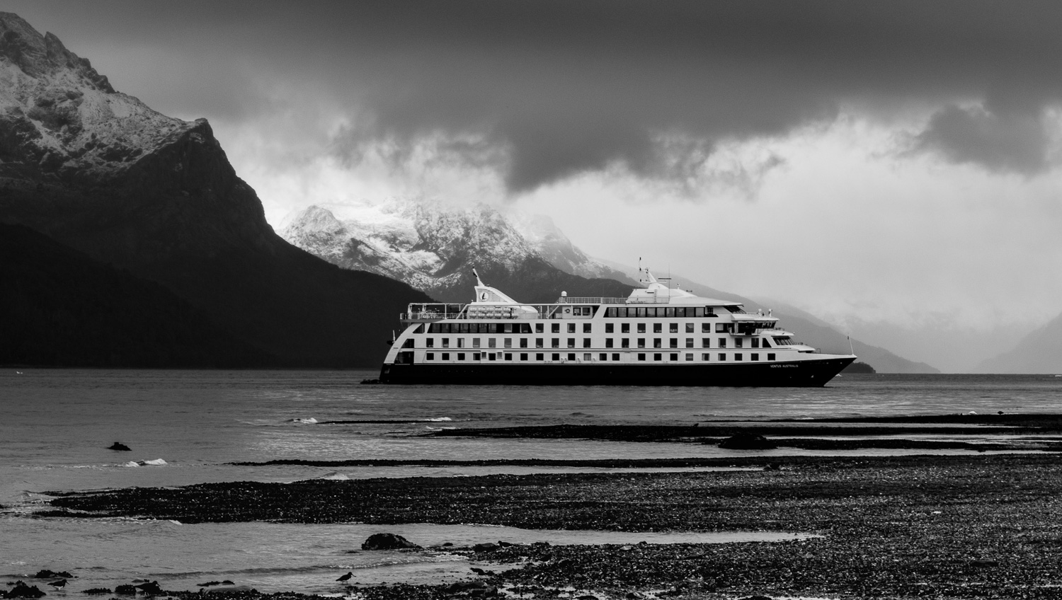
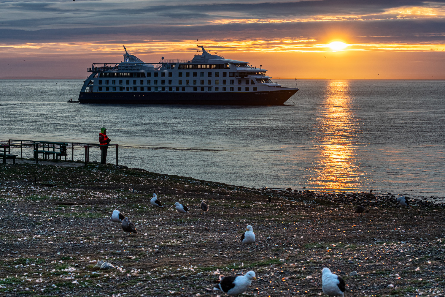
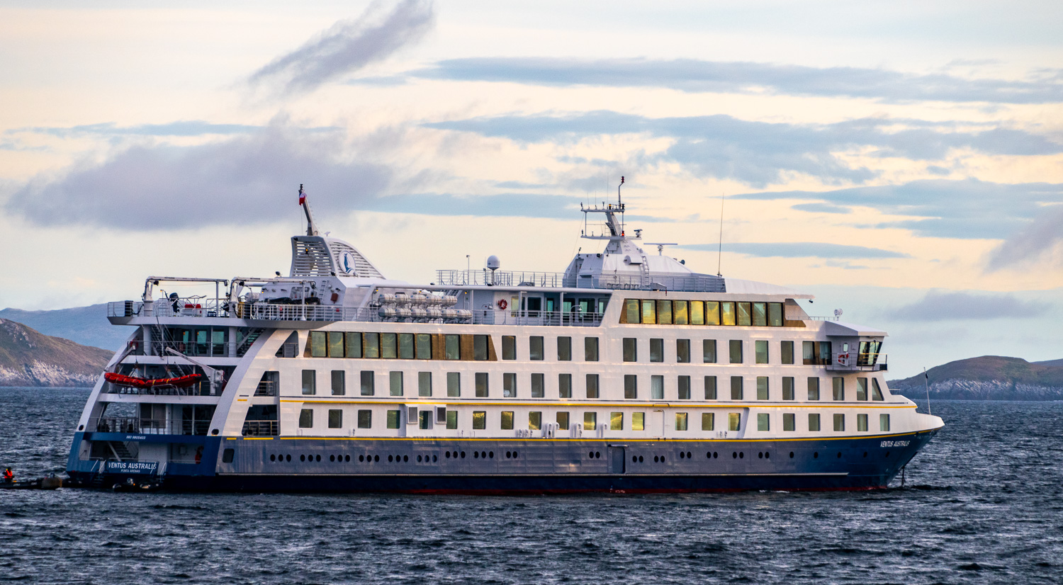 Ventus Australis at anchor during sunrise
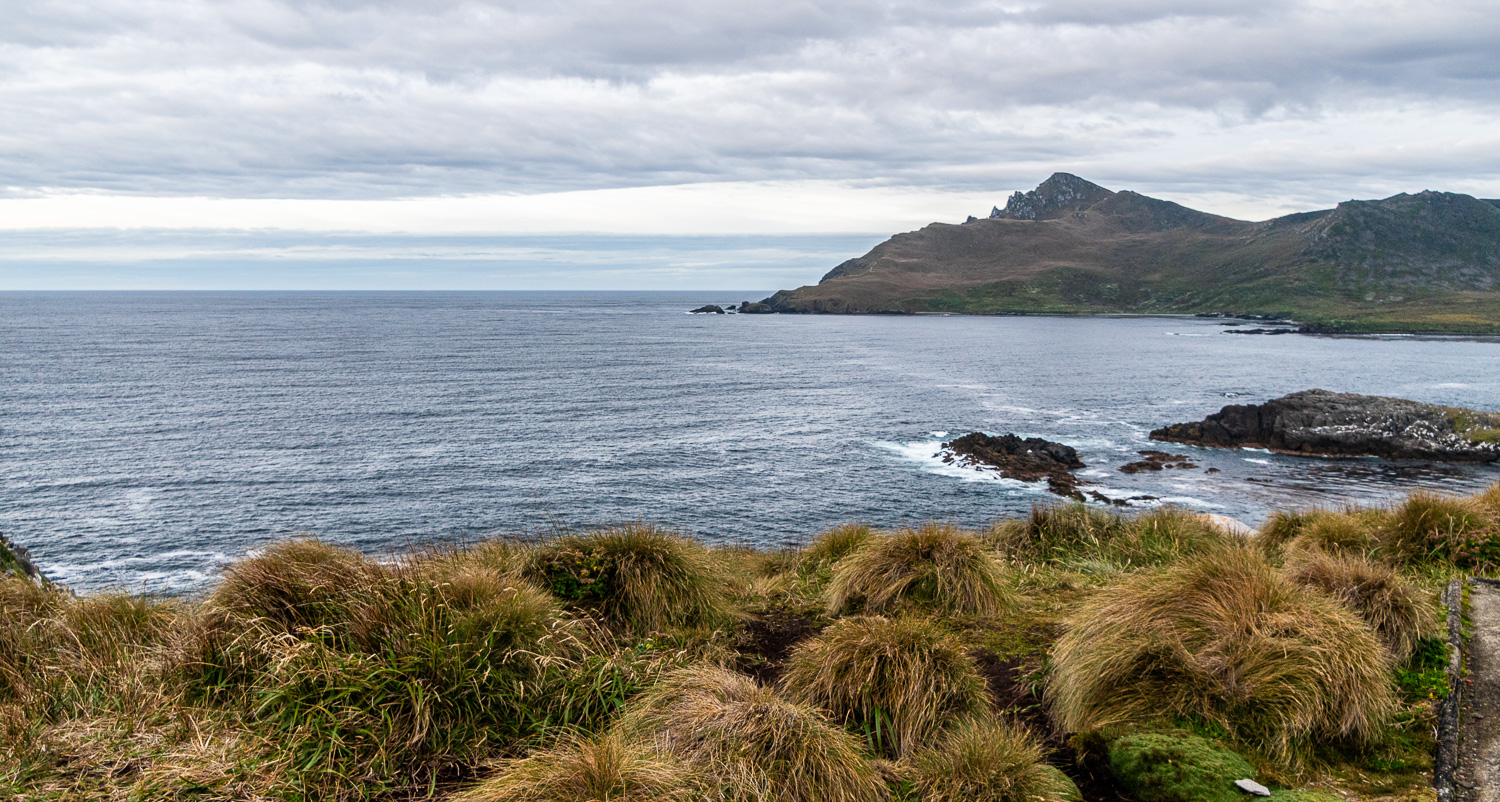
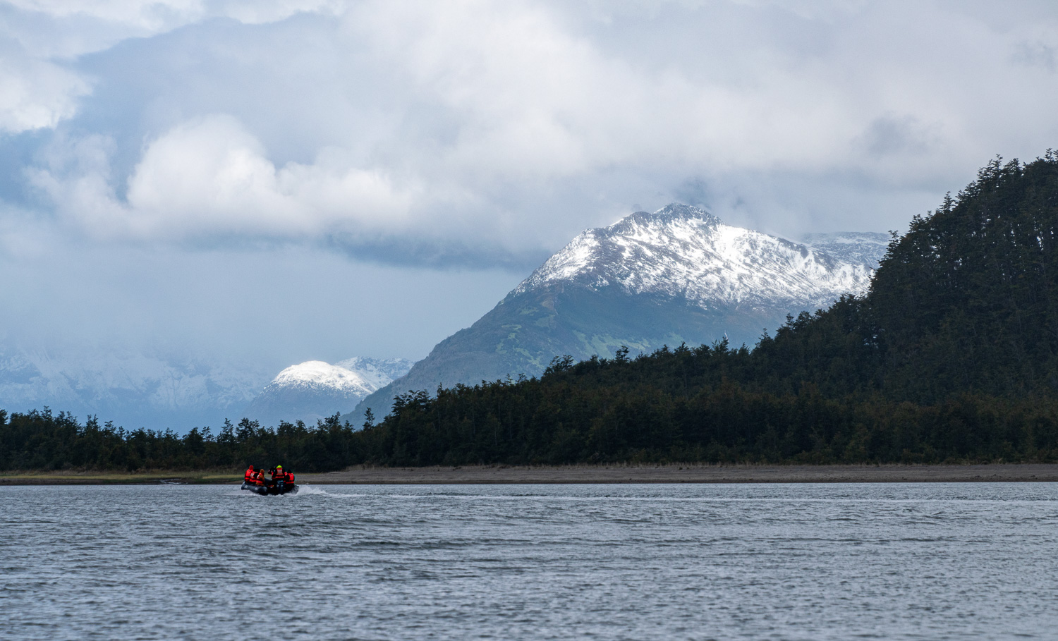
After sailing overnight from Ushuaia, around the break of dawn, the Ventus Australis crossed Nassau Bay and entered the remote archipelago that comprises Cape Horn National Park. We went ashore on Zodiacs on to the normally windswept island that harbours the legendary Cape Horn. However, for us, the weather was calm, dry and temperate.
Discovered in 1616 by a Dutch maritime expedition, and named after the town of Hoorn in West Friesland, Cape Horn is a sheer 1,394-foot high rocky promontory overlooking the turbulent waters of the Drake Passage. For many years it was the only navigation route between the Pacific and Atlantic Oceans, and was often referred to as the ‘End of the Earth.’ It is estimated that between the 16th and 20th centuries, more than 800 ships were lost in the stormy waters off Cape Horn, burying no fewer than 10,000 men.
The park was declared a World Biosphere Reserve by UNESCO in 2005. The Chilean navy maintains a permanent lighthouse on the island, staffed by a lighthouse keeper and his family, as well as the tiny Stella Maris Chapel and the modern Cape Horn Monument.
The monument was erected in 1992, in memory of the seamen who died. The 20-foot high monument shows an albatross in flight, to scale.
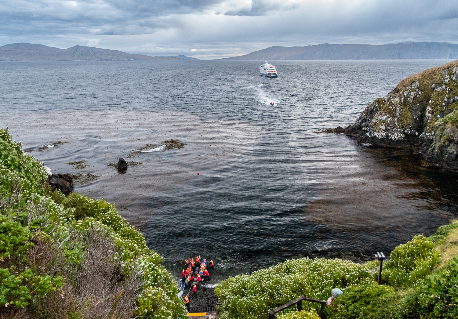 To reach the lighthouse and monument, we landed from Zodiacs and climbed up steep steps to the top of the cliff.
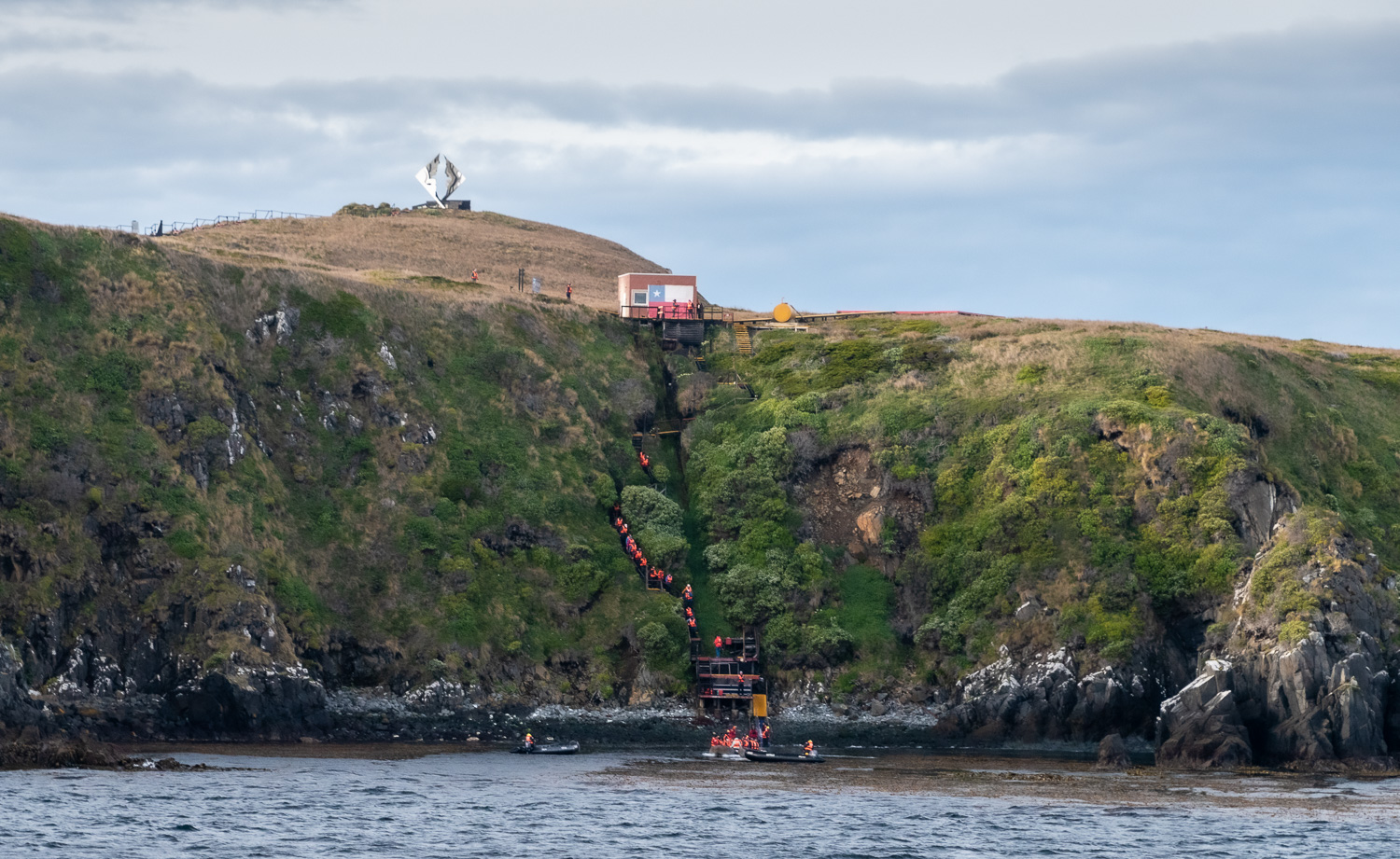 Climbing the cliff; the monument shines atop the hill
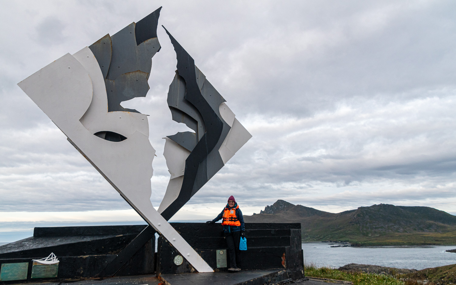 The outline and scale of the Albatross can clearly be seen in this close up of Charlotte next to the monument
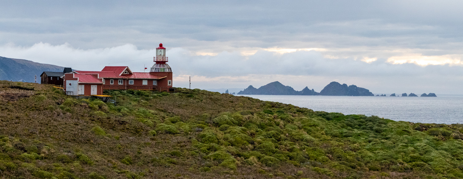 The lighthouse
 EL Cabo (The Cape), to the right, is the highest peak on Cape Horn and overlooks the Drake Passage
 The ‘Uber’ arrives to take us back to the ship!
After leaving Cape Horn, we sailed back across Nassau Bay and anchored at Wulaia Bay, one of the few places in the archipelago where the human history is just as compelling as the natural environment. Originally the site of one of the region’s largest Yámana aboriginal settlements, the bay was described by Charles Darwin and sketched by Captain FitzRoy in the 1830s during their voyages on HMS Beagle. Following another zodiac landing we hiked up through Magellanic forest, to reach a panoramic viewpoint overlooking the bay.
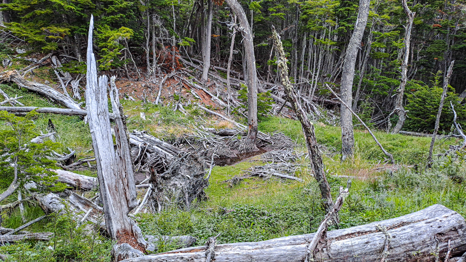 Part way through the forest, we came across this woodland area, which had been destroyed by Beavers – 20 beavers were introduced into Patagonia by the military in 1946, as a way of making money from their pelts. Through a change in fashion and the fact that their coats changed due to the environment and their diet, the enterprise was a failure. So the beavers were left alone. In many parts of Patagonia the beavers had no predators, so their numbers multiplied. Estimates today suggest up to 100,000 exist in the region. Many believe that within a couple of decades the woodland environment in many parts of Patagonia will change due to the beavers’ behaviour.
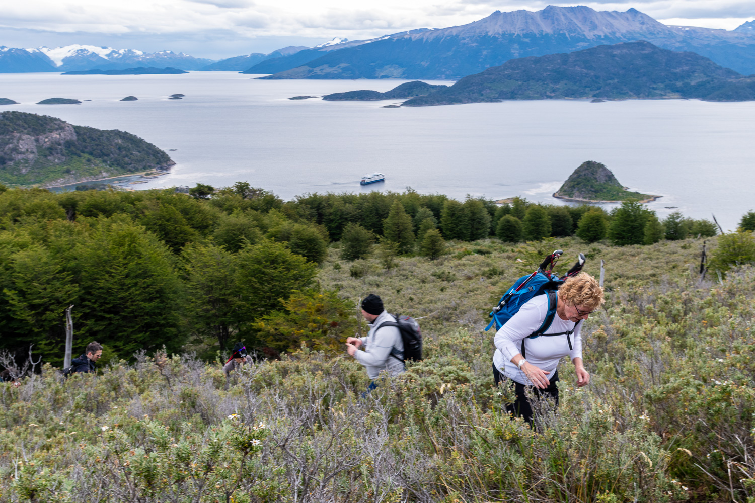 Charlotte and others, completing the very last steep section of the path to the hilltop
 The shipped anchored in the Bay
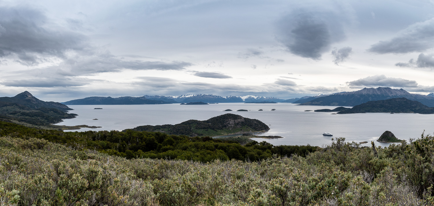 Panorama of Wulaia Bay from the hilltop viewpoint
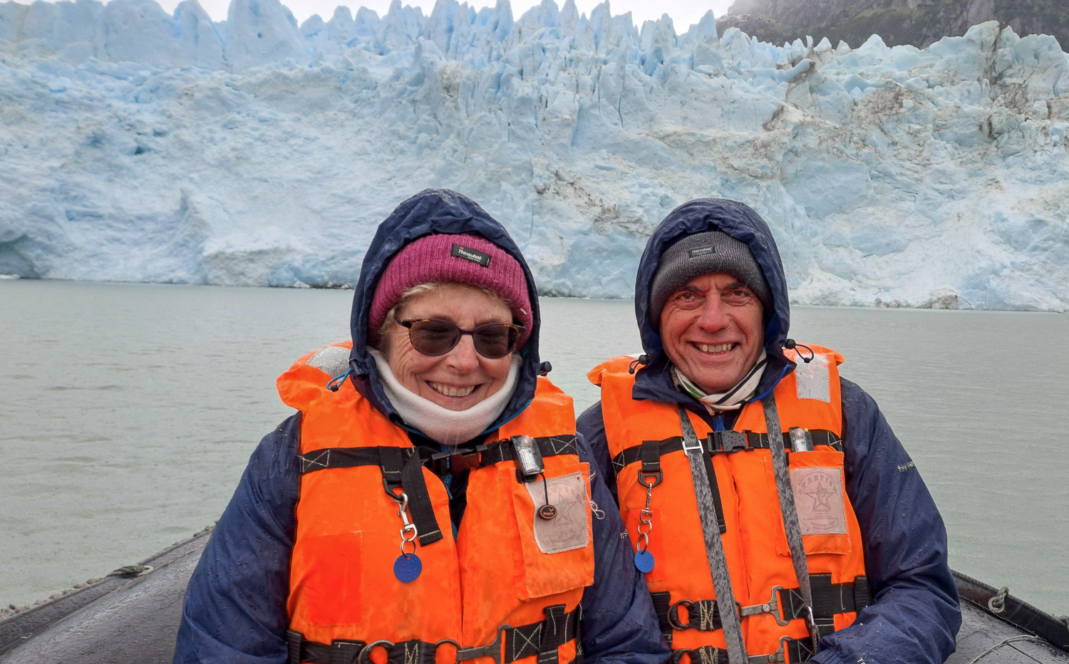
At sunrise the next day, we ran along the part of the Beagle Channel nicknamed ‘Glacier Alley’. At first we laid in bed watching the glaciers go by our window, them we decamped (fully clothed), with camera, to the outside deck.
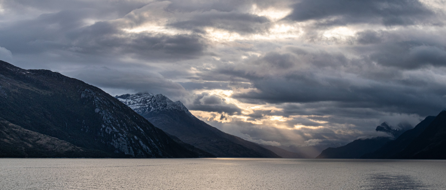 Looking back down the Beagle Channel as the sun rises
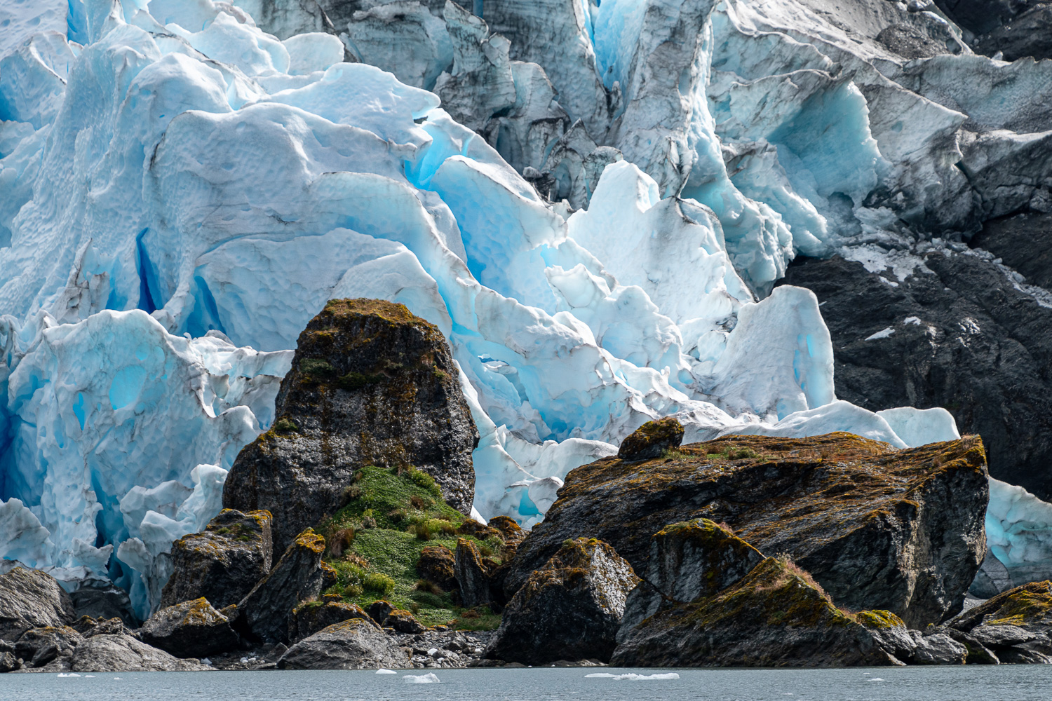
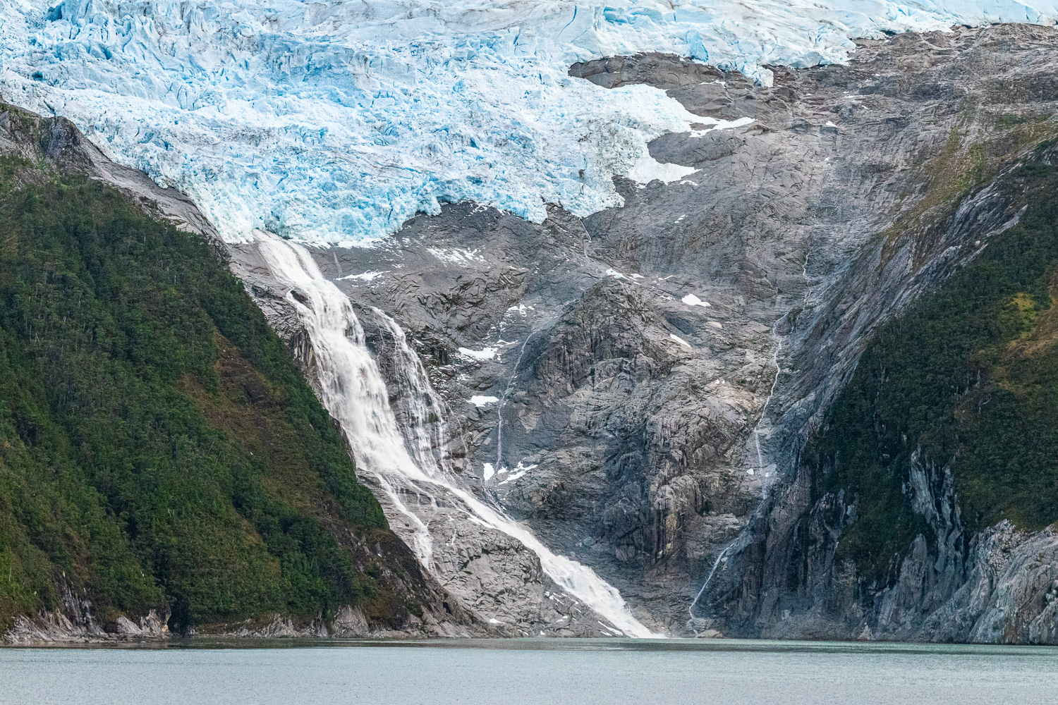 This majestic glacier is connected to the Channel by a beautiful waterfall
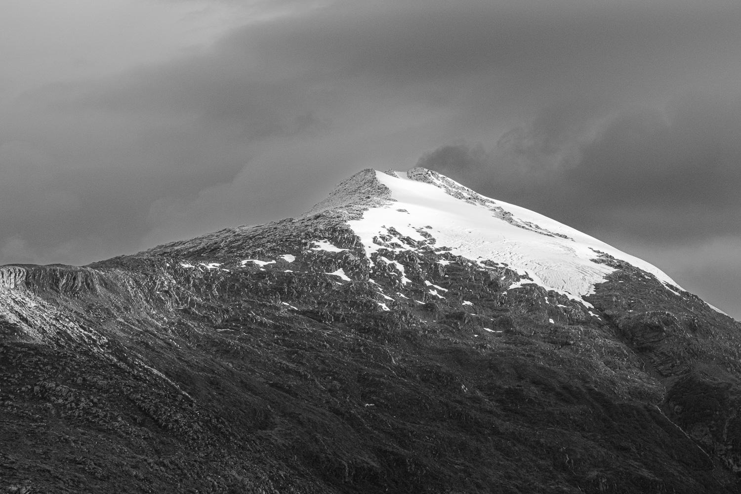 The early morning light catches the fresh snowfall on the mountain summit
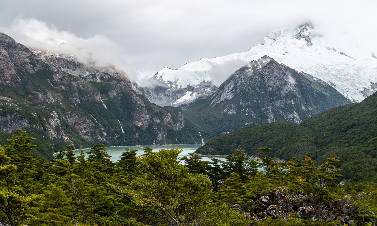
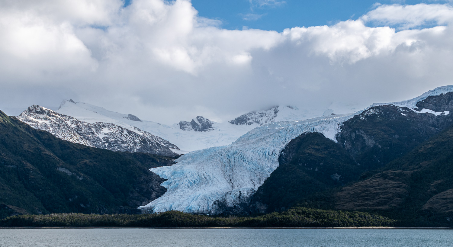
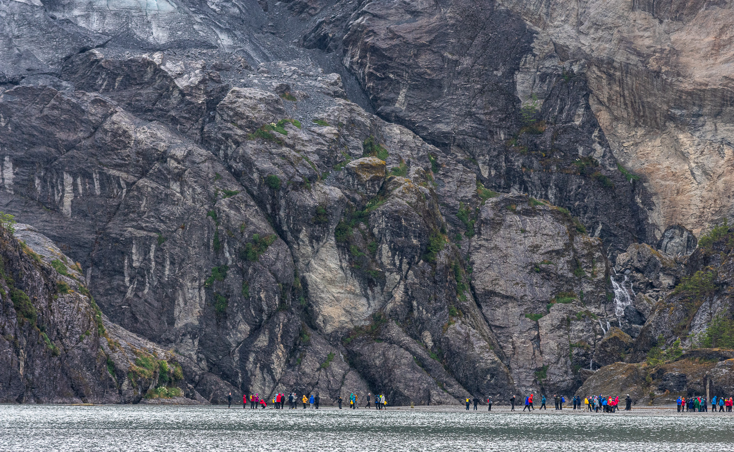
We continued to navigate the northwest arm of the Beagle Channel to enter and disembark in Pía Fjord. From there we took a short, steep, rocky hike to a lookout to see the Pía Glacier extending from the top of the mountain range all the way down to the Fjord.
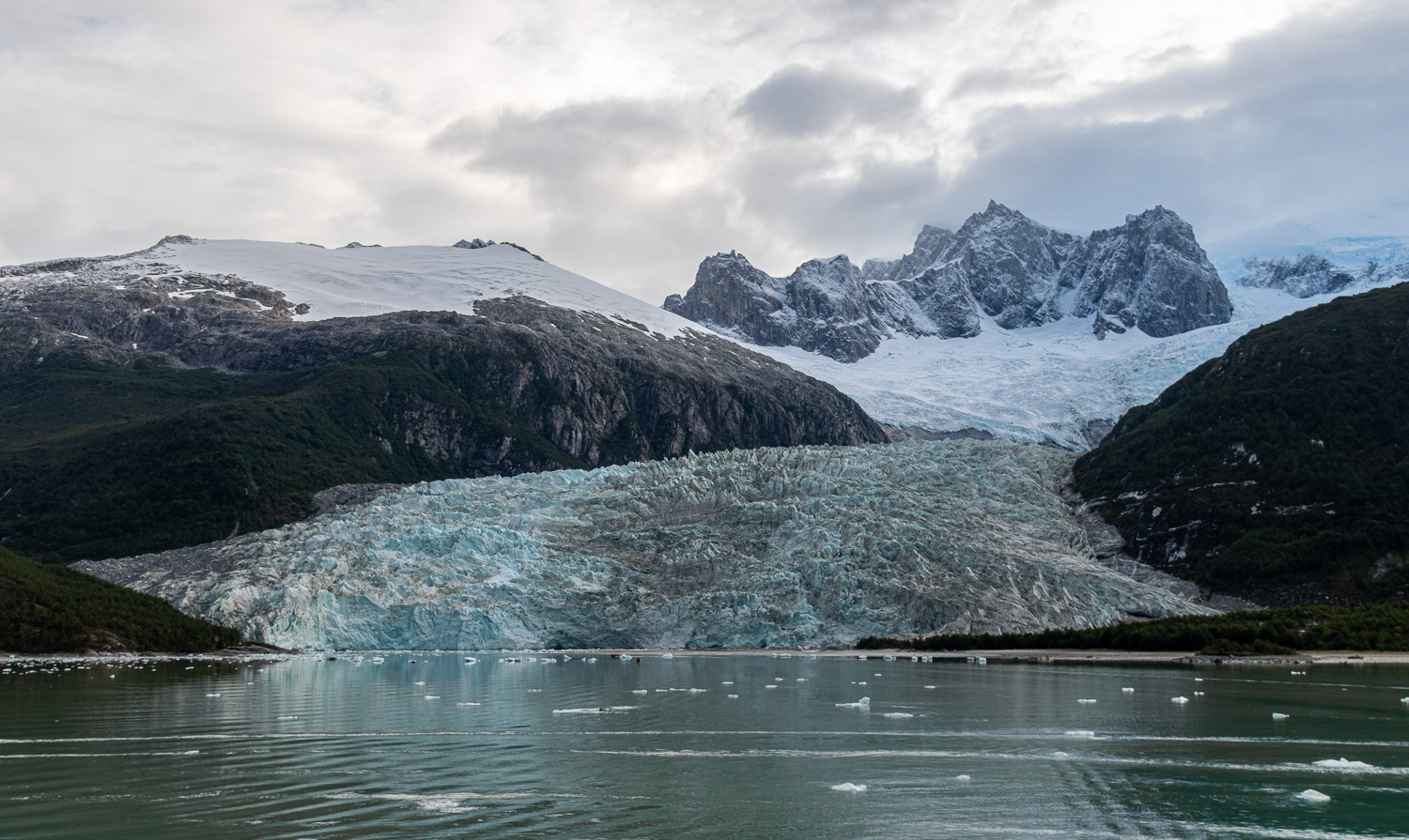 View of Pía Glacier as the ship sails into the fjord
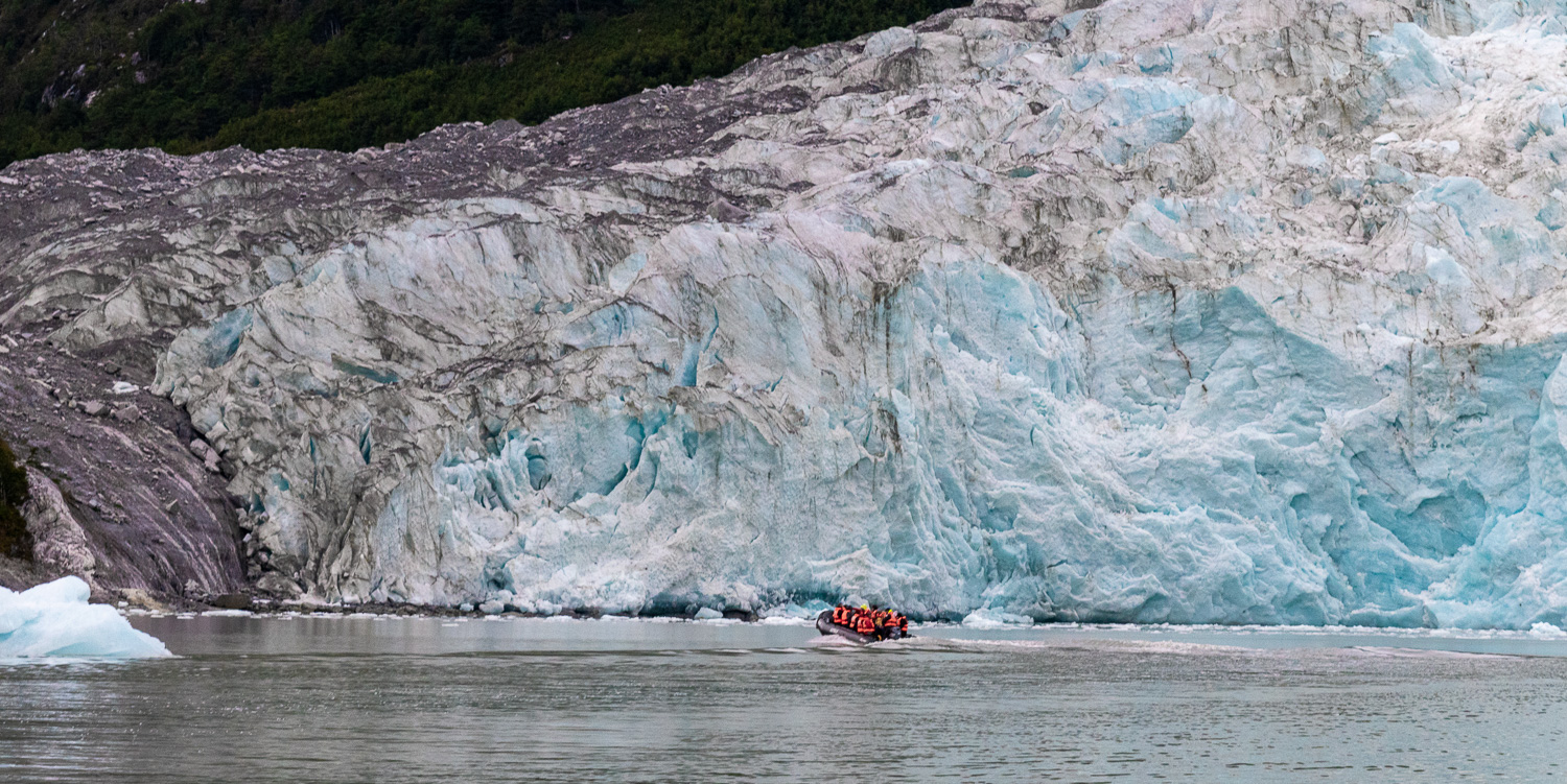 The Zodiac runs alongside the glacier face before disembarking on the shoreline
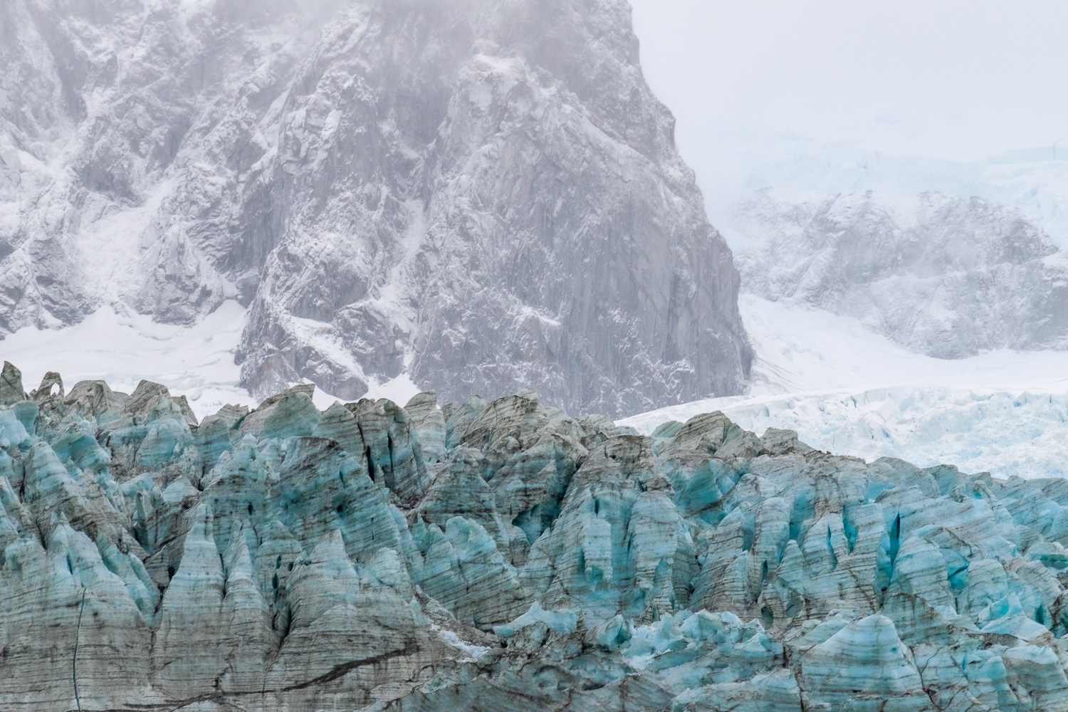 The face of the glacier contrasts with the mountains and snow behind
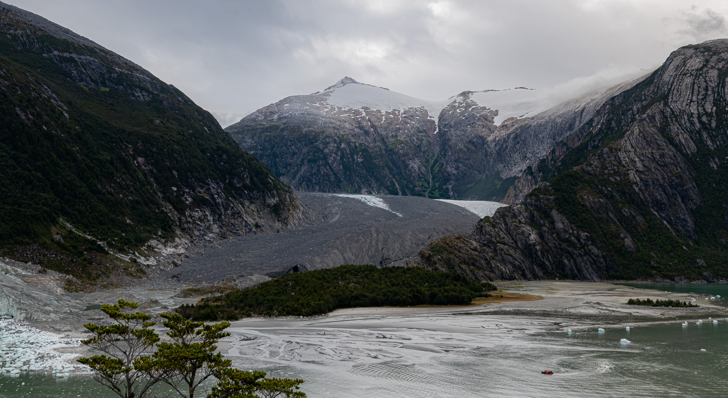 To the right of Pía Glacier, is a second glacier that is protected by cover of sediment that the glacier had collected on route.
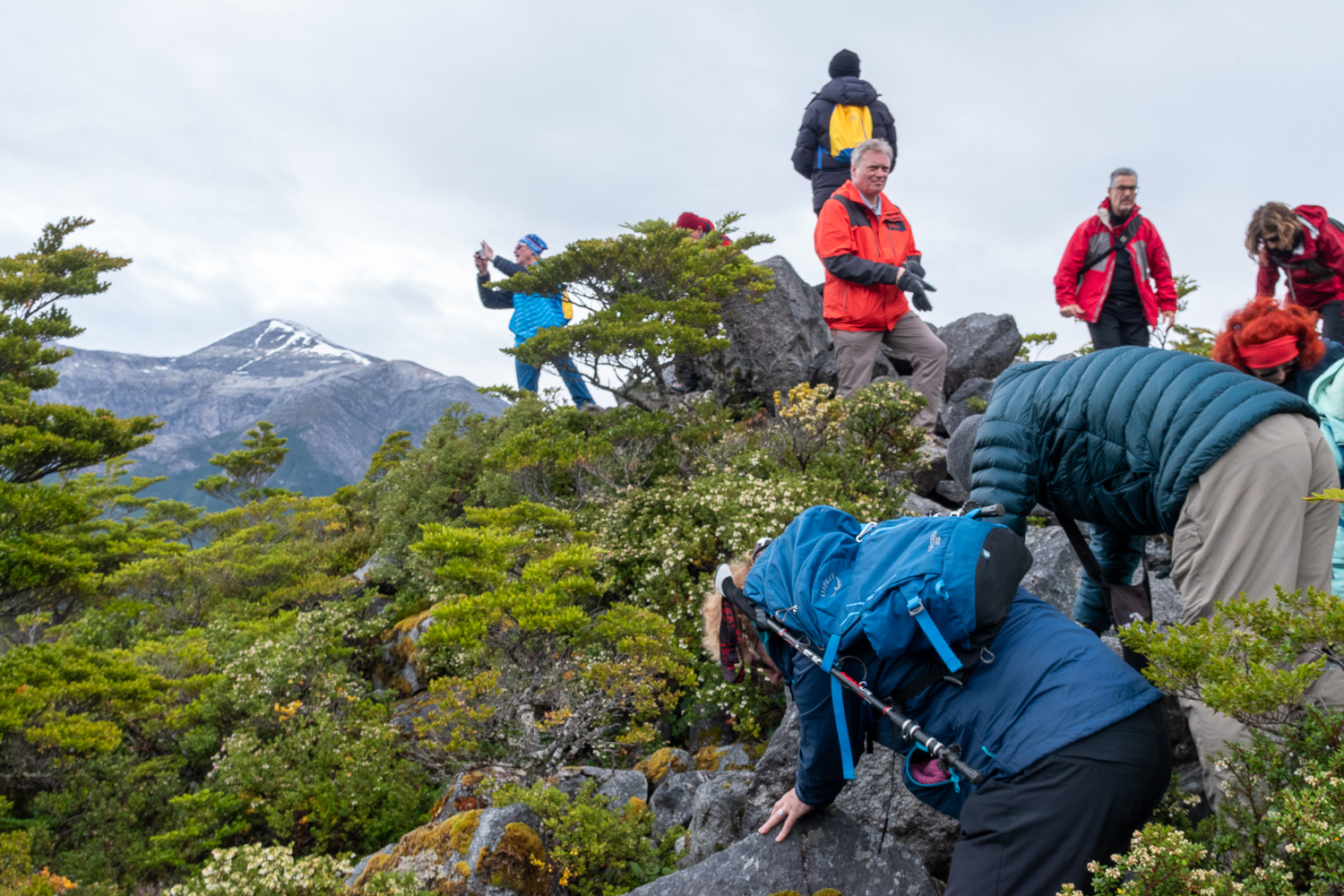 Charlotte, scrambling up the rocks to the summit
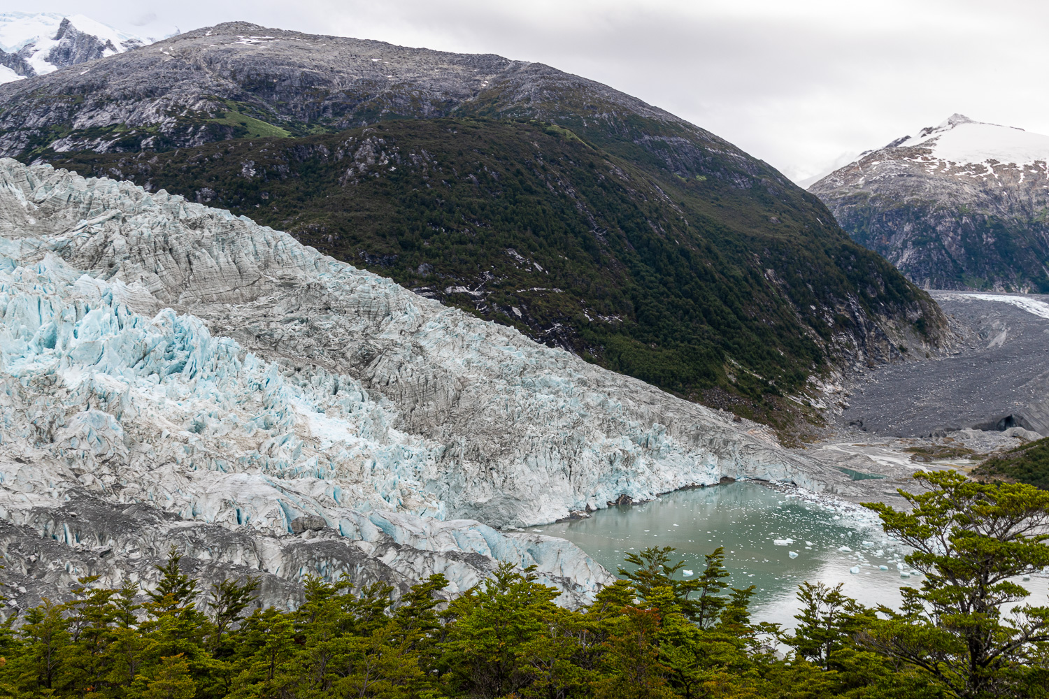 The depth of the glacier can be seen from the summit viewpoint
 Porter Fjord visible from the summit on the far side
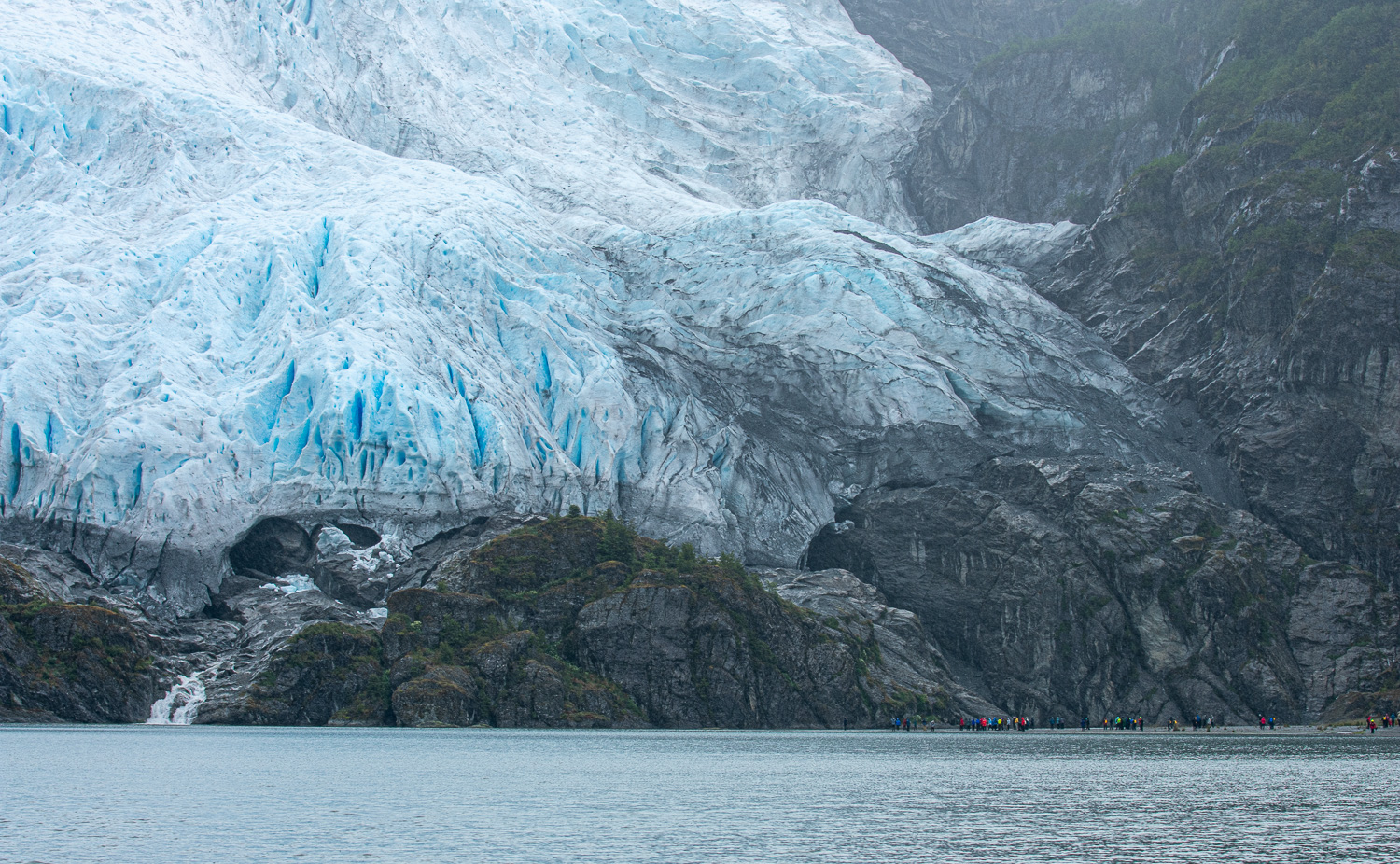
Later that day we explored the nearby Porter Glacier in a Zodiac, while it was raining hail, and extremely cold.
 Enjoying the boat ride to the glacier – Smile, it can only get better!
Overnight we left the Beagle Channel and headed into a very choppy Pacific Ocean. The ship headed north along the coast for a couple hours, then headed east into the calmer waters of the Magellan Straight.
We then headed into the Cockburn Channel and entered the Agostini Sound. From there it is possible to see the glaciers that descend from the middle of the Darwin Mountain Range, some of them reaching the water, including Águila and Cóndor Glaciers.
 Early morning arrival in Agostini Sound
Following a zodiac landing, we took an easy walk around a lagoon, which was formed by the melting of the Águila Glacier, reaching a spot right in front of the glacier that provided stunning views.
 View of Águila Glacier from the ship
 A chance to see the rock face by the edge of the glacier close up….
 … zoom out and it shows the scale of the glacier face!
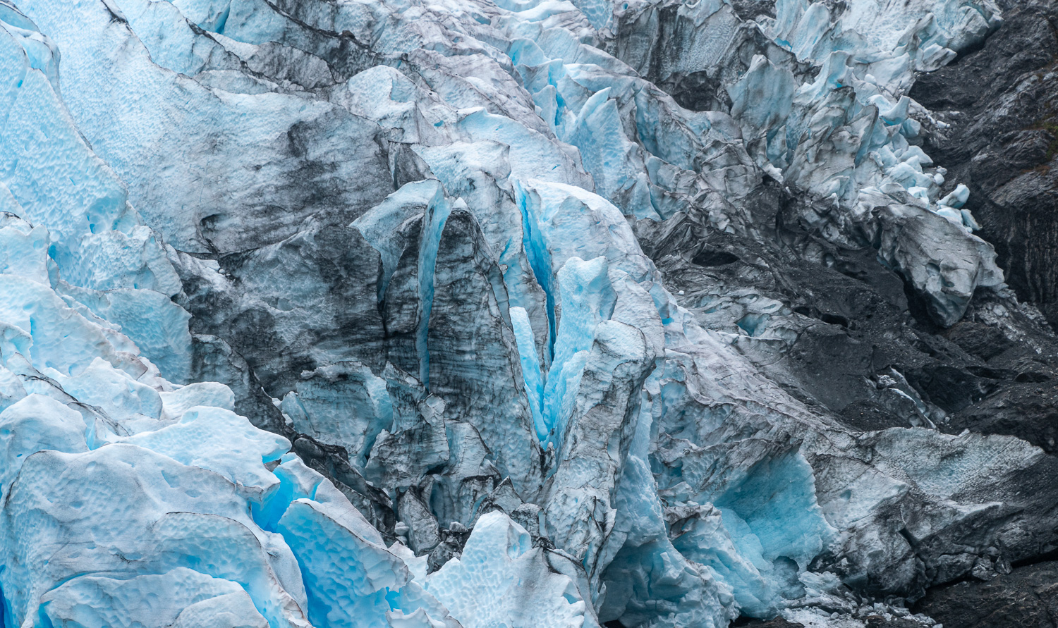 The blue of the glacier intertwined with the sediment carried down with the ice
In the afternoon we approached the Cóndor Glacier via Zodiac
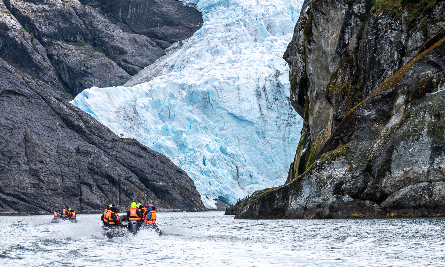 Heading for the face of the glacier
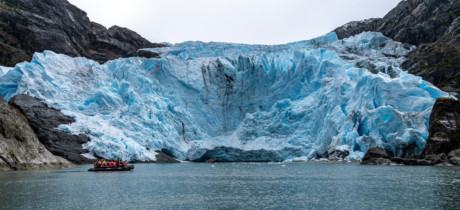 Face of the glacier
 Unlike most glaciers, this one has been expanding in recent years – the rock formation in front of the face of the glacier used to be an island that the zodiacs went around!
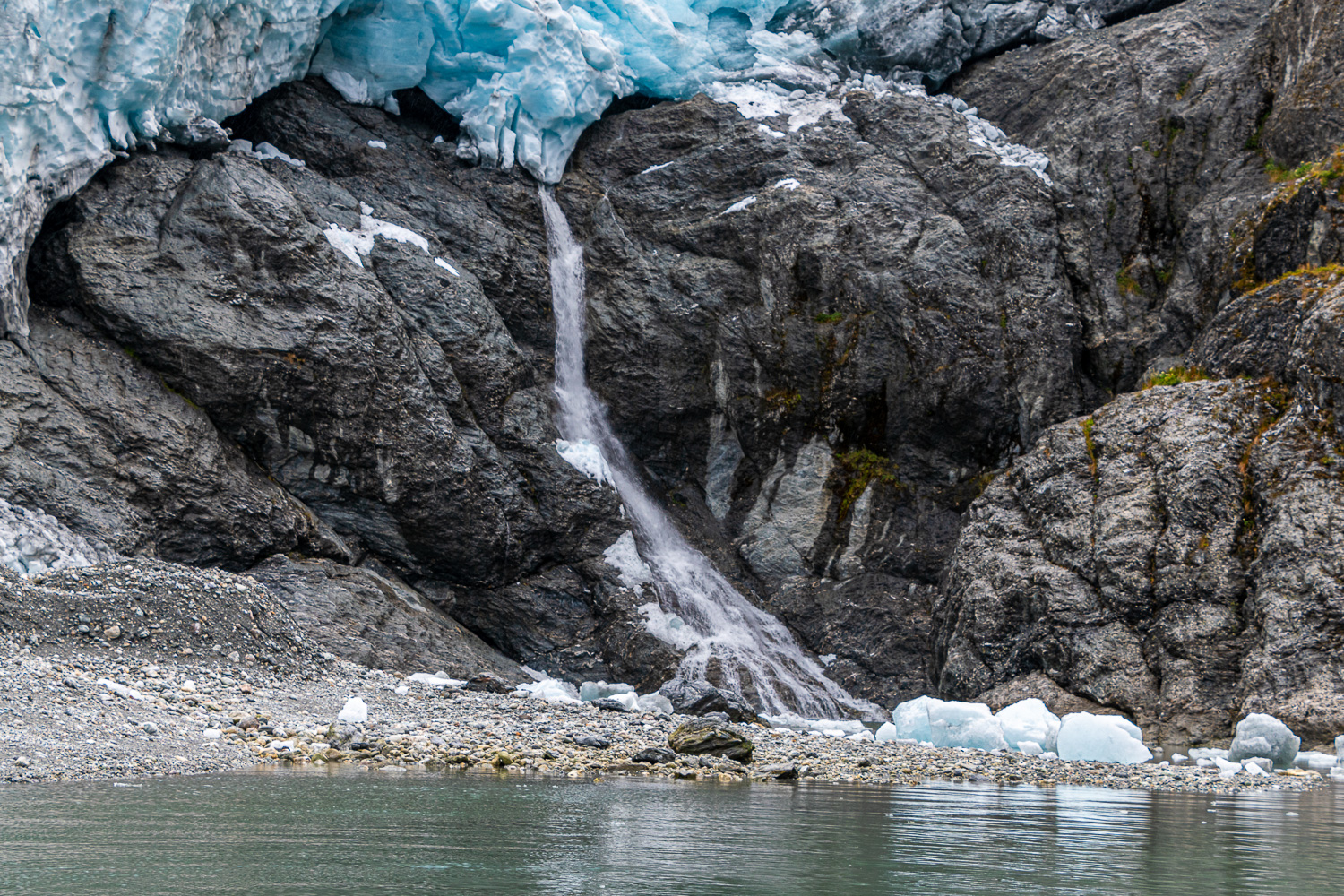 Waterfall to the side of the glacier
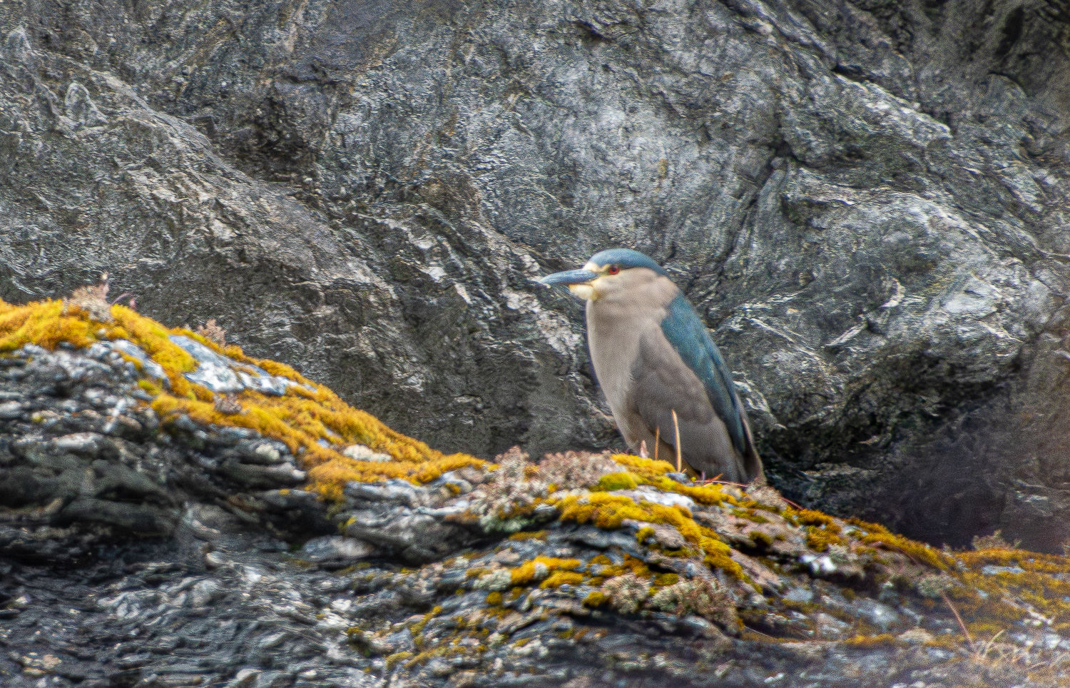 Night Heron
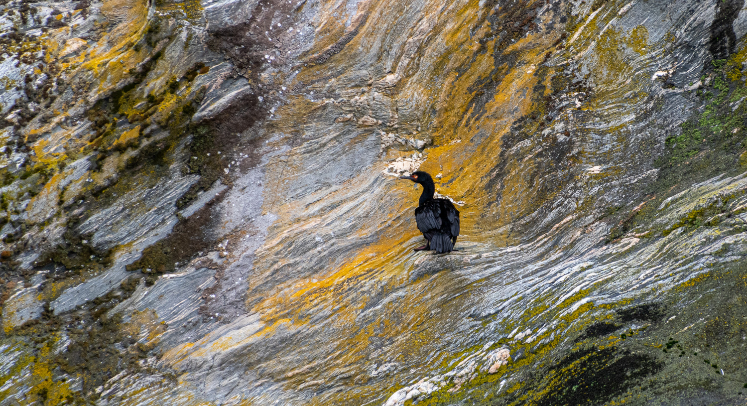 A lone Rock Cormorant perches on the colourful rock face
 Returning to the Ship
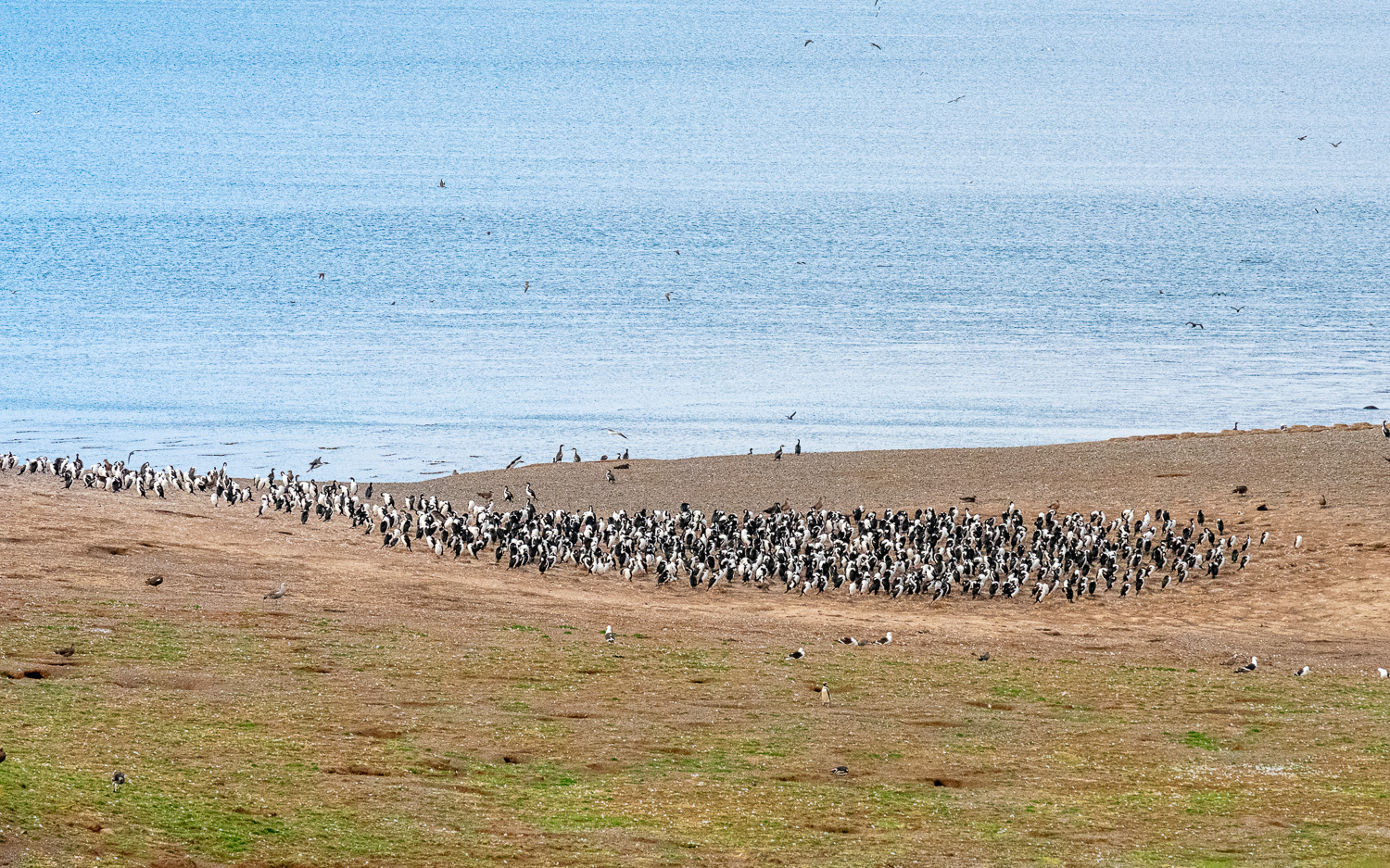
After an overnight cruise through the Strait of Magellan, and for our last day afloat, we anchored off Magdalena Island, which lies about halfway between Tierra del Fuego and the Chilean mainland. Crowned by a distinctive lighthouse, the island used to be an essential source of supplies for navigators and explorers and is inhabited by an immense colony of Magellanic Penguins, estimated to be around 200,000 at its peak. Many other bird species are also found on the island, including many thousands of nesting Kelp Gulls.
The average height of a Magellanic penguin is 28in. Adults have black backs and white abdomens, whilst chicks and younger penguins have grey-blue backs, with a more faded grey-blue colour on their chest.
 Coming ashore at sunrise
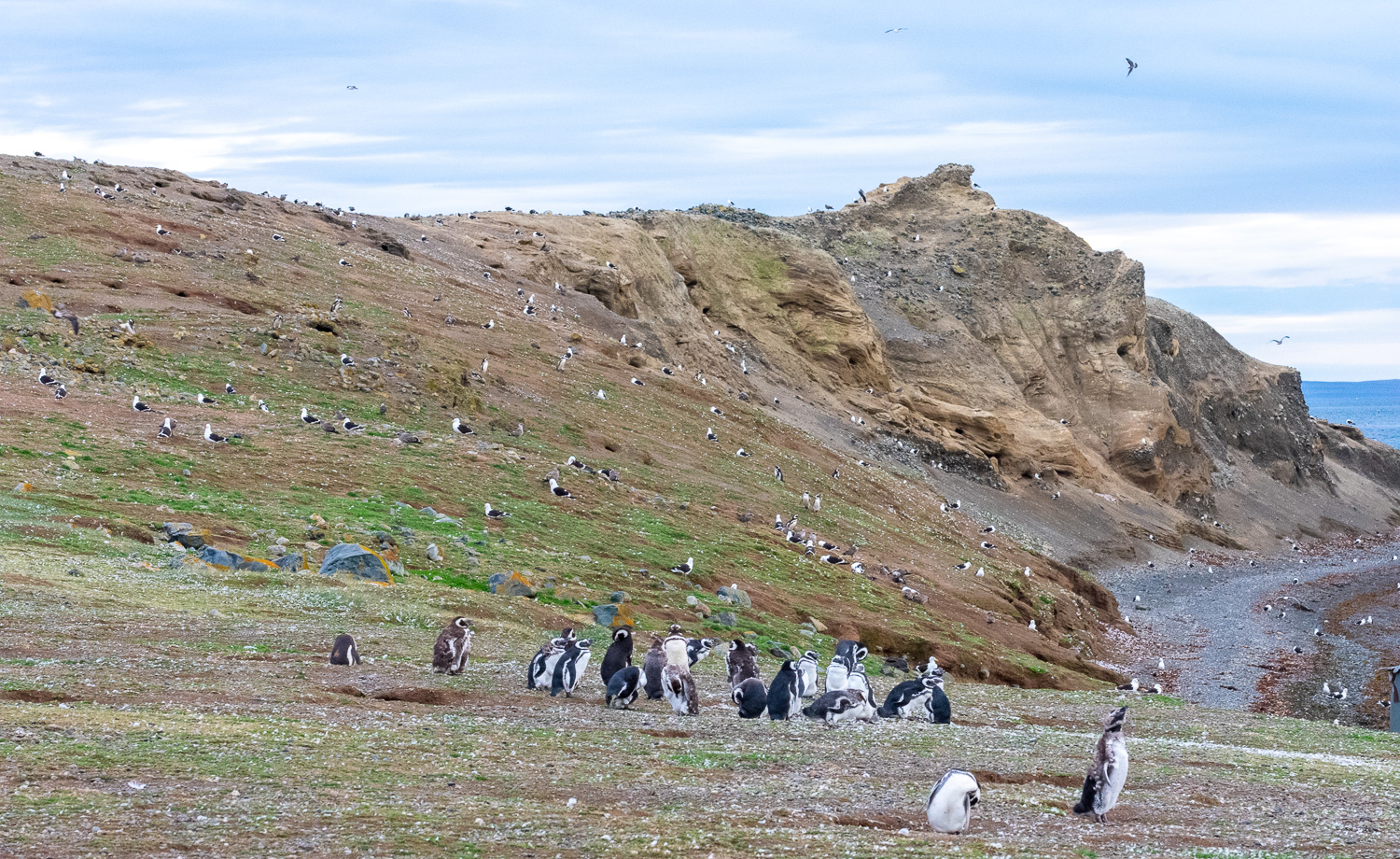 Thousands of nesting Gulls and Penguins co-exist on this small island
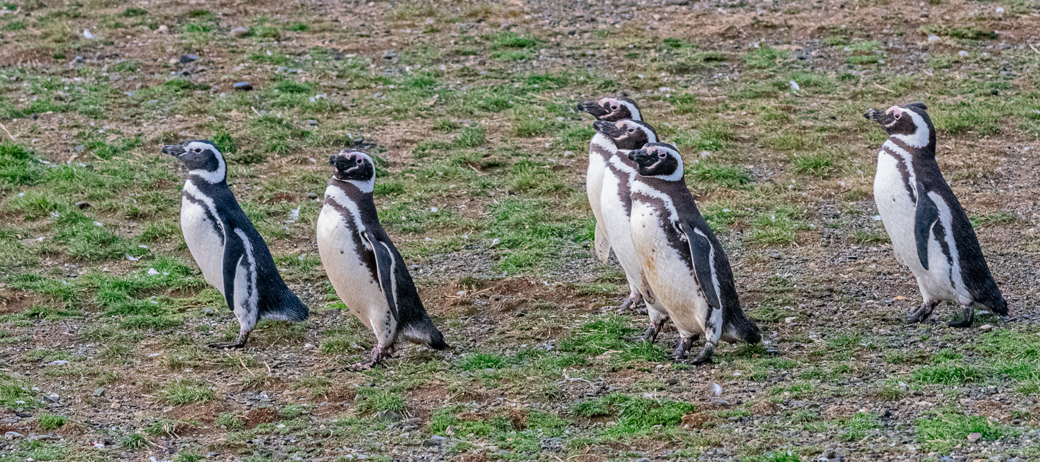 Magellan Penguins on the march
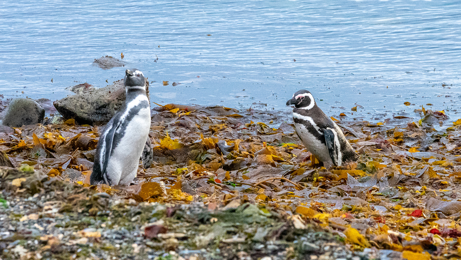
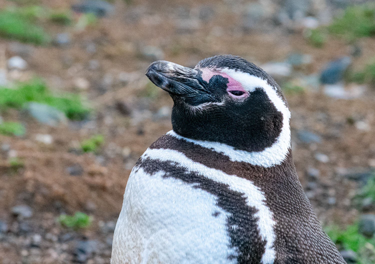 A proud adult penguin posing for the camera
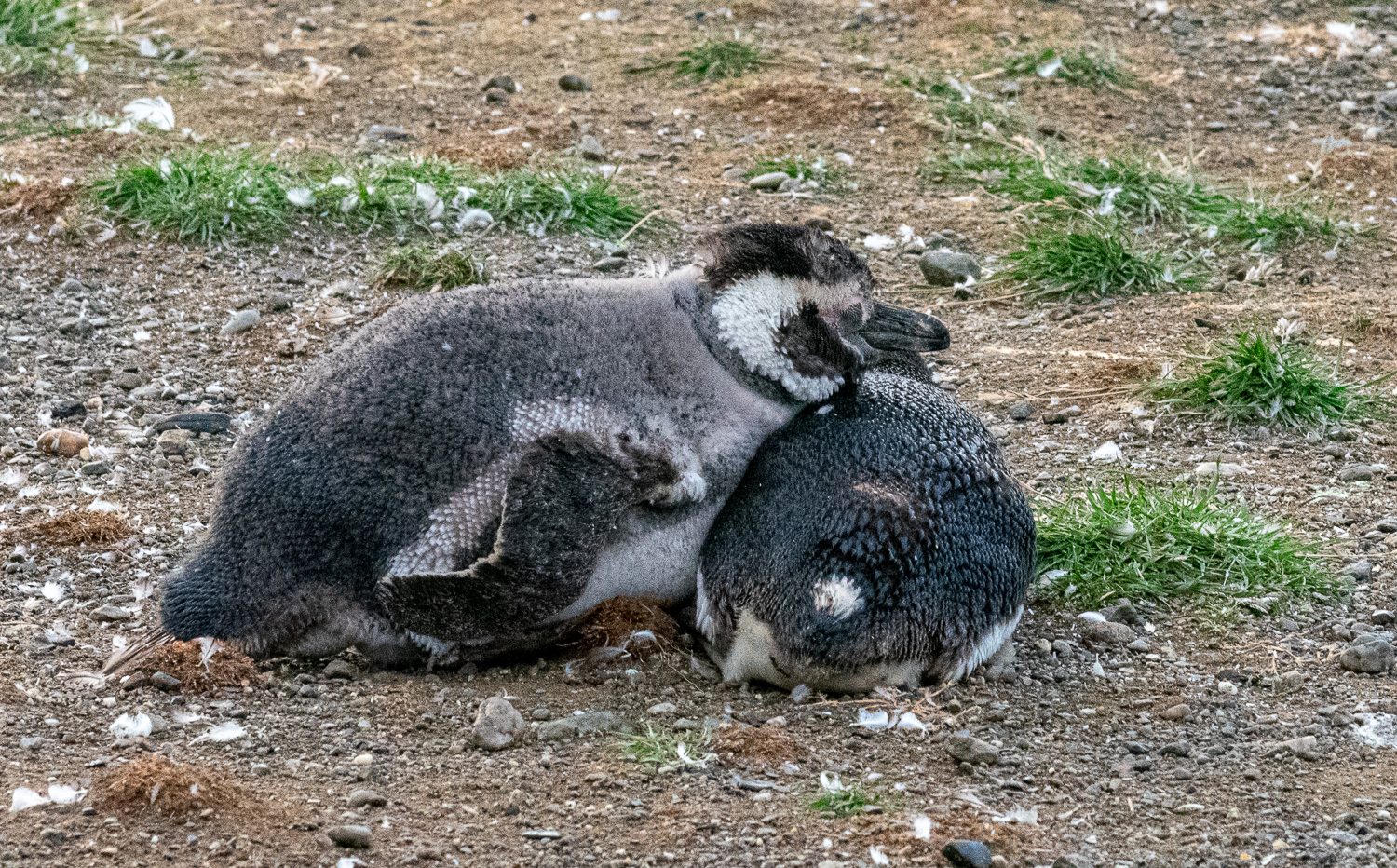 A youngster using his friend as a pillow!
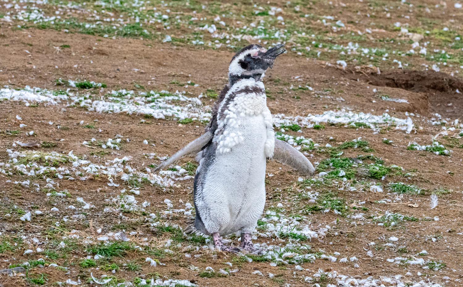 Adult Penguins shed their coat each year, which takes a couple of weeks. During this time they cannot swim and therefore they stop eating
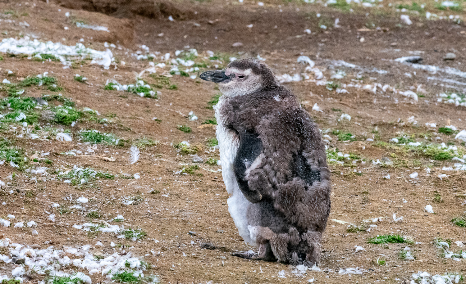 A juvenile moulting
 Playing on the beach
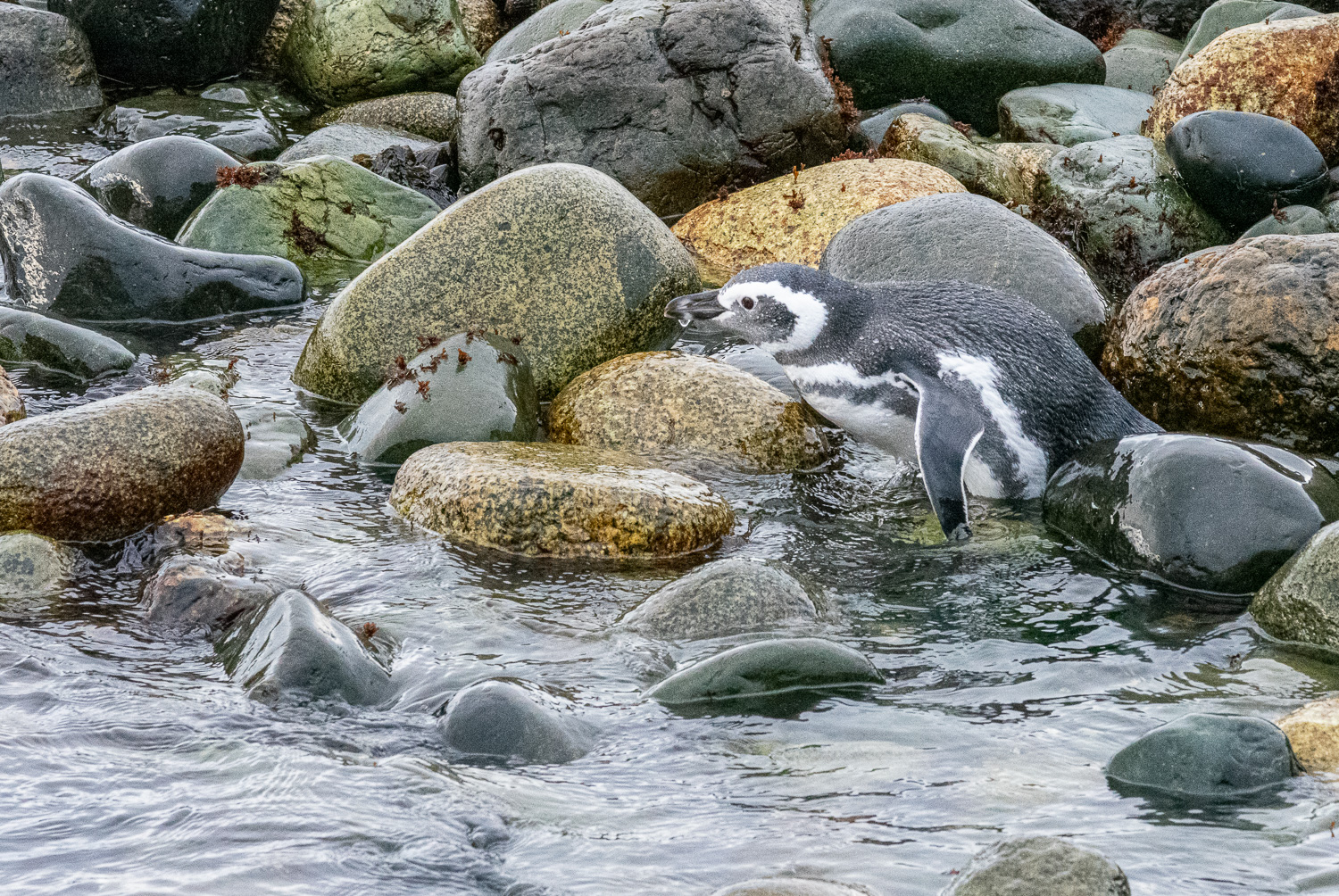 Going for a swim
 A large group of adult penguins prepare to leave the island to feed, they normally travel in large groups when hunting
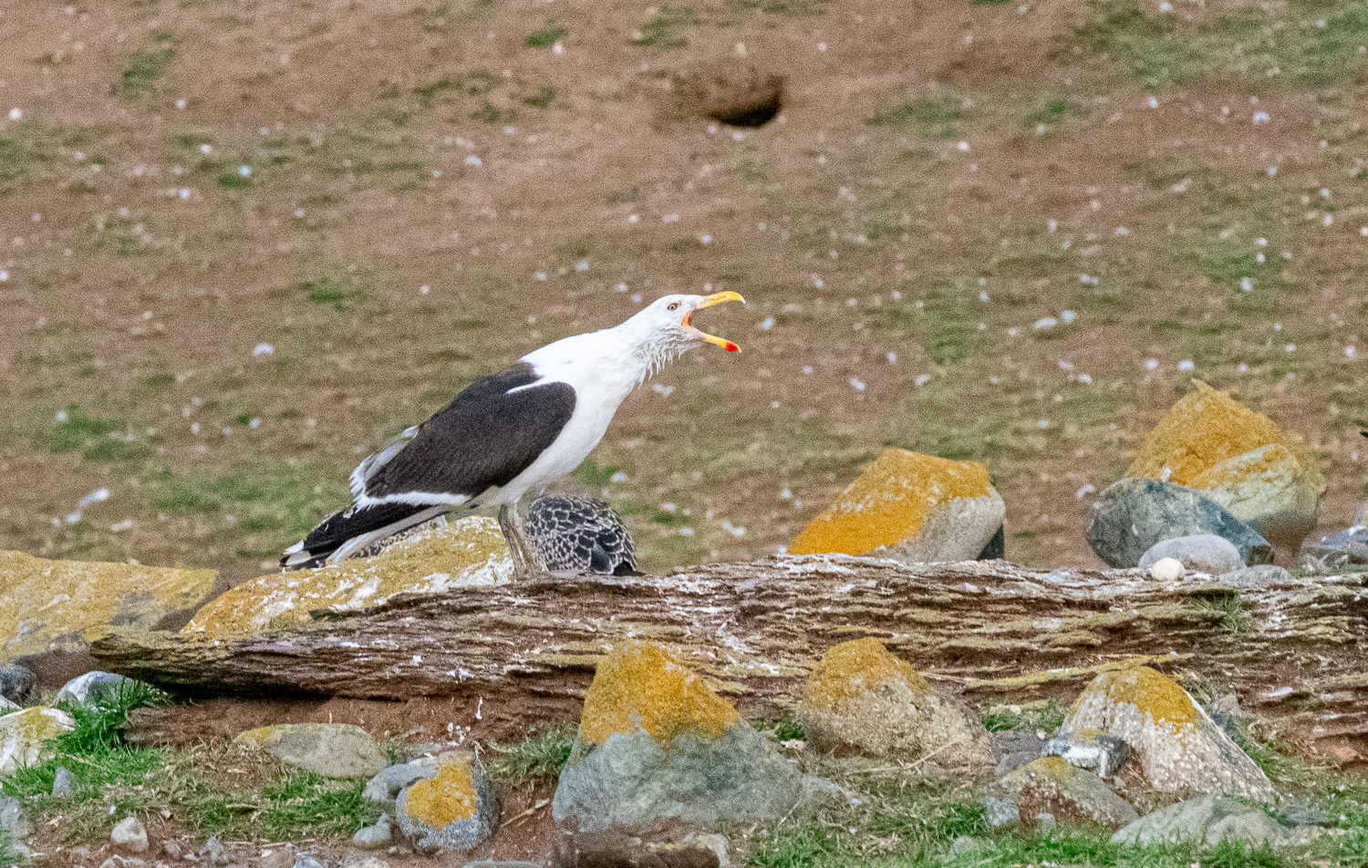 I’m the king of the castle – A Kelp Gull warns others to keep their distance
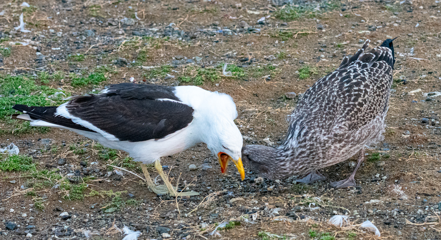 Mother Kelp Gull feeding chick
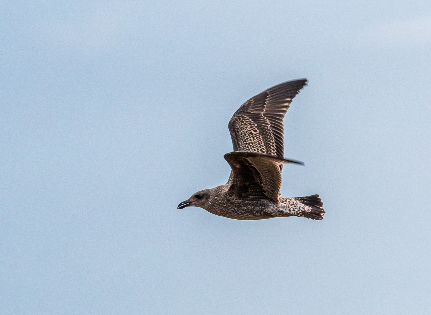 A juvenile Kelp Gull in flight
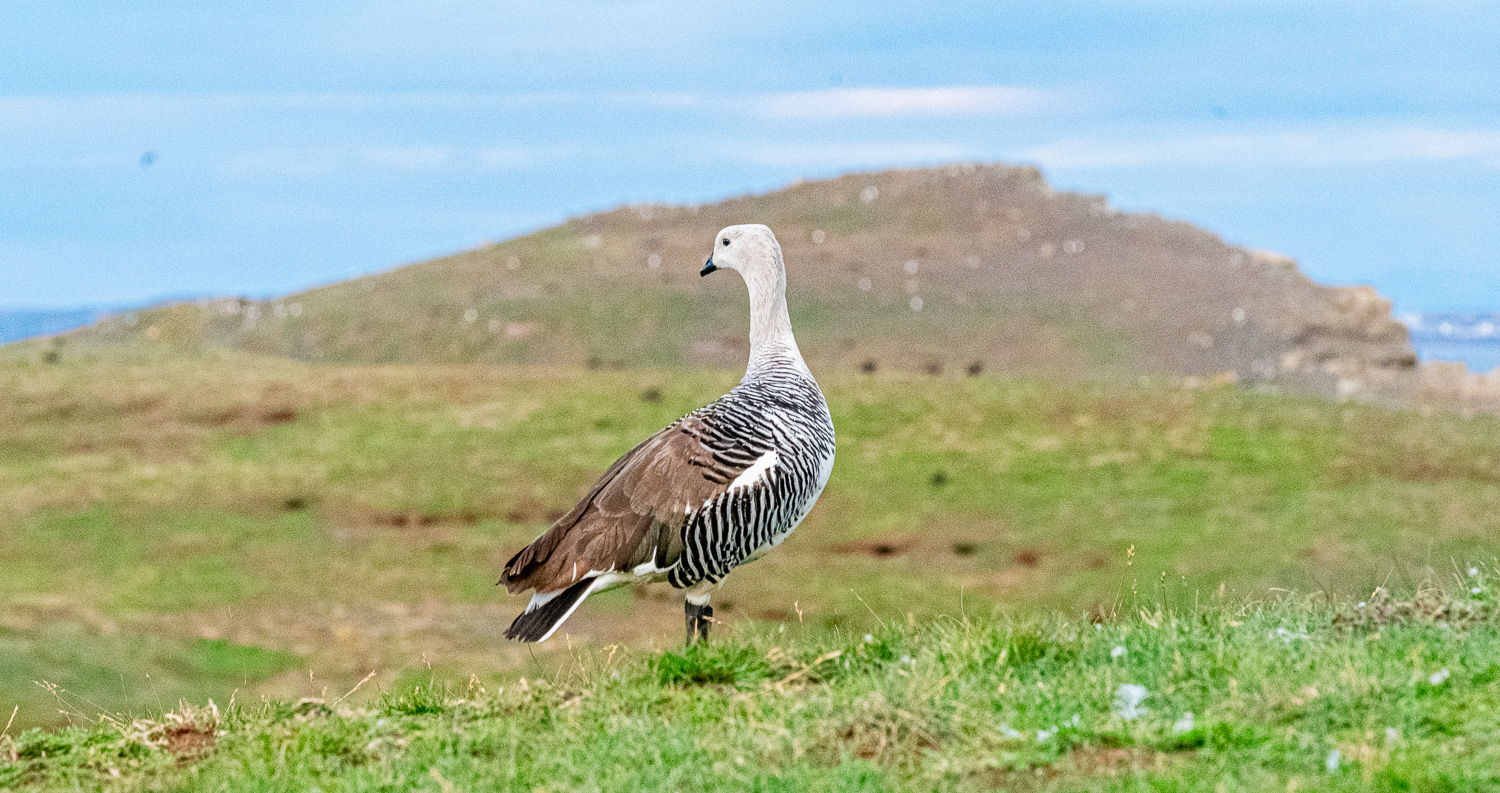 Female Magellan Goose
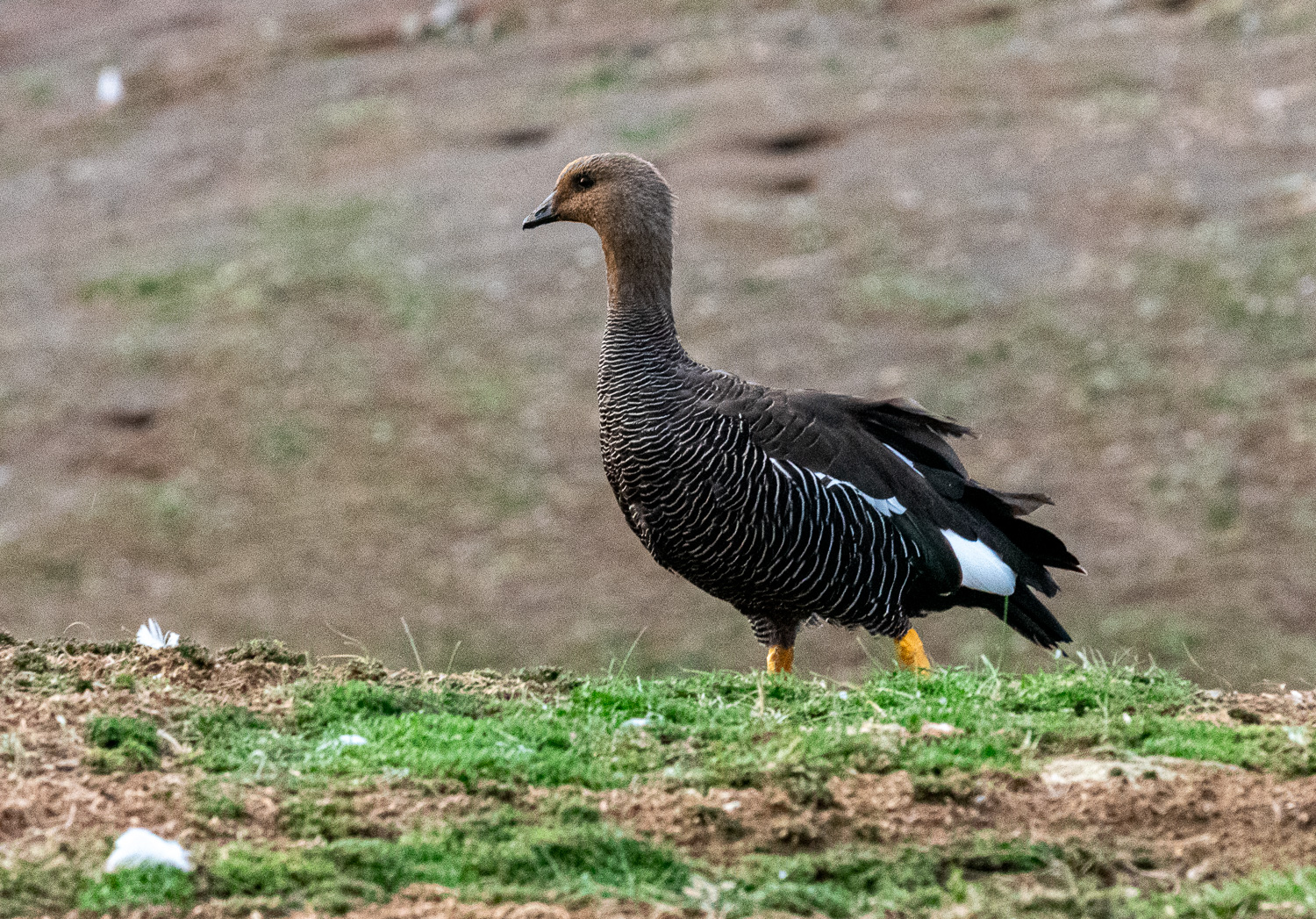 Male Magellan Goose
This was a fitting end to our travels around Patagonia. Next we are heading north for the last leg of our trip….
