The last leg of our holiday started in Santiago, continued in Buenos Aires and then to Iguazú Falls, and finally to Rio de Janeiro.
Santiago, Chile
Santiago is the capital and largest city of Chile and one of the largest cities in the Americas. It is located in the country’s central valley and is the centre of the Santiago Metropolitan Region, which has a population of 7 million, representing nearly 40% of Chile’s total inhabitants. Most of the city is situated between 1,600 and 2,000 feet above sea level.
The Plaza de Armas is the main square of Santiago, and is surrounded by both historic and government buildings. The square is popular with locals throughout the year, as a place to meet and relax, and on weekends groups meet here to engage in a variety of activities. You can see chess players, dancers, street performers, food vendors and more.
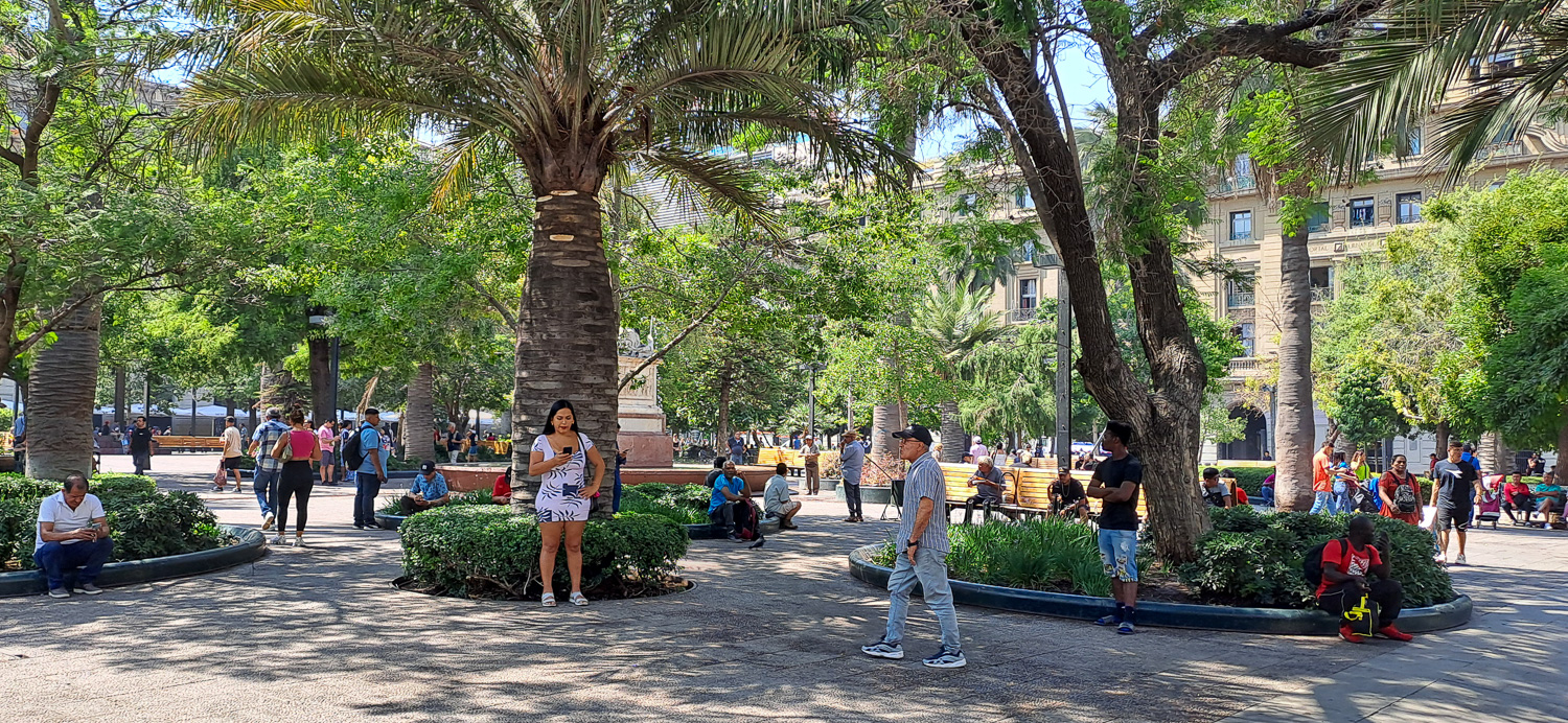 Plaza de Armas
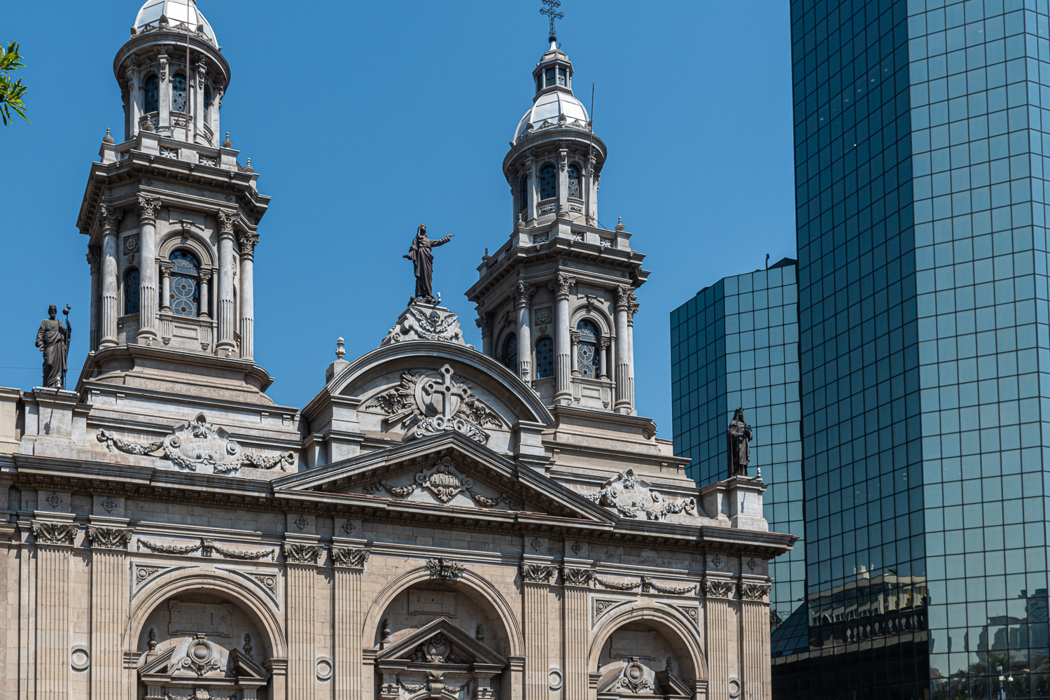 The old and the new – The Metropolitan Cathedral, Chile’s main Catholic church, sits in the Plaza de la Armas in contrast to the modern skyscraper behind
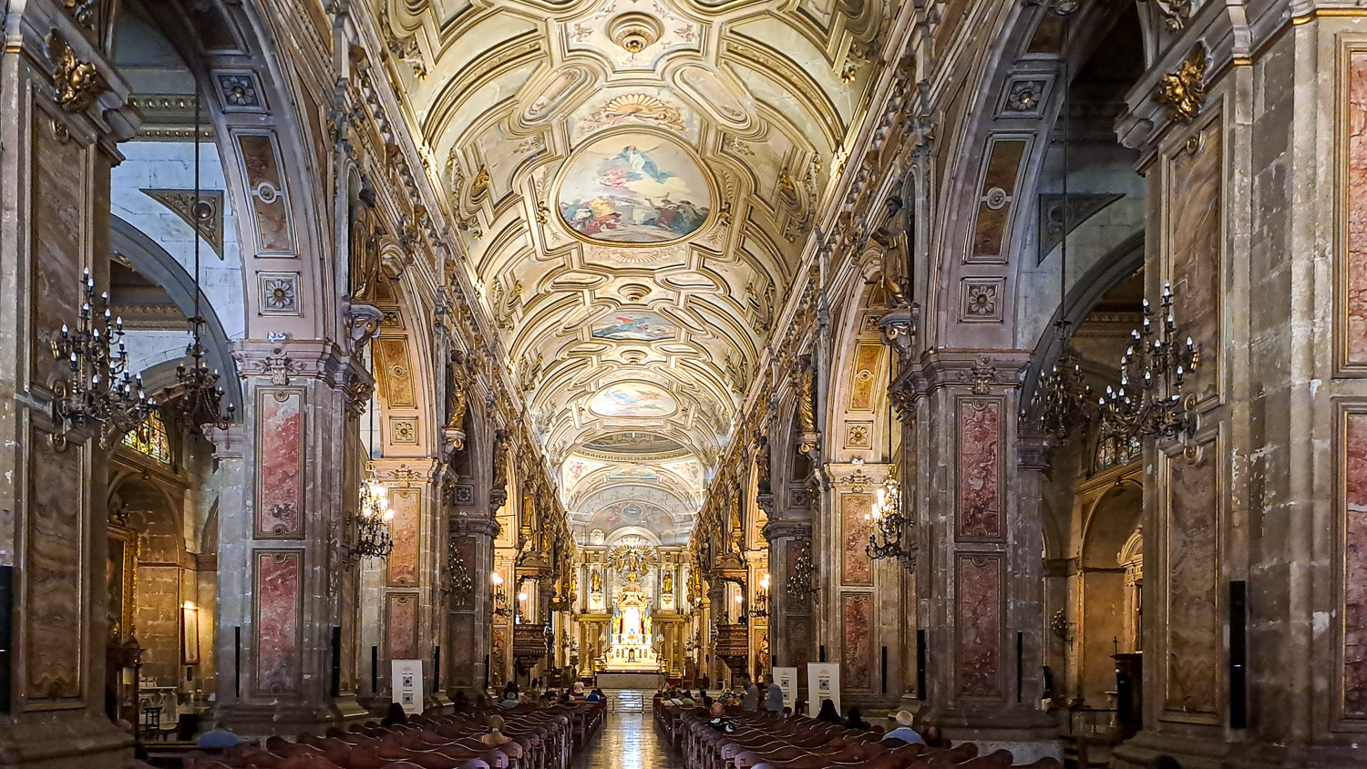 Inside this beautiful Cathedral
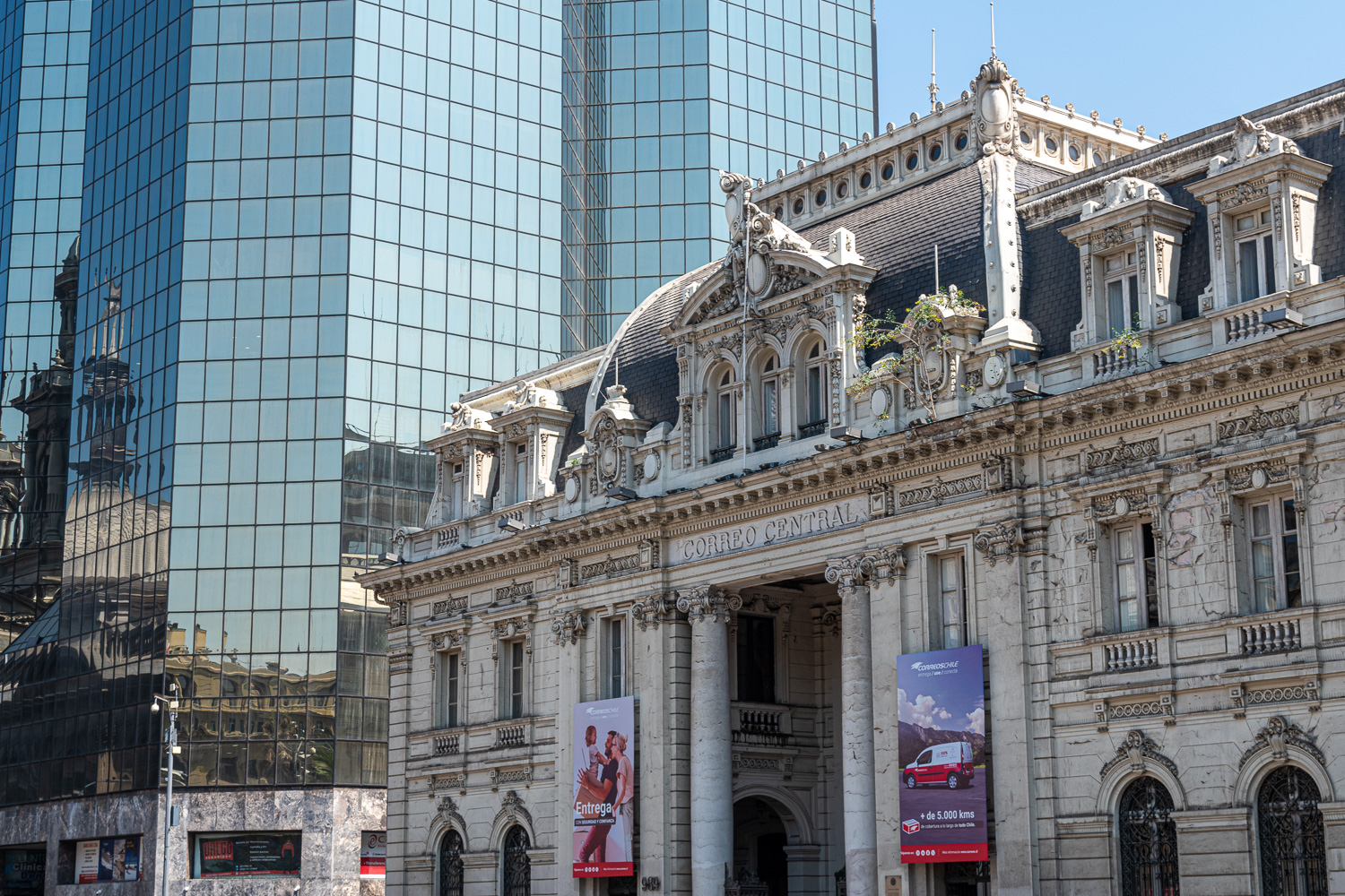 The Central Post Office, again in contrast to the modern architecture
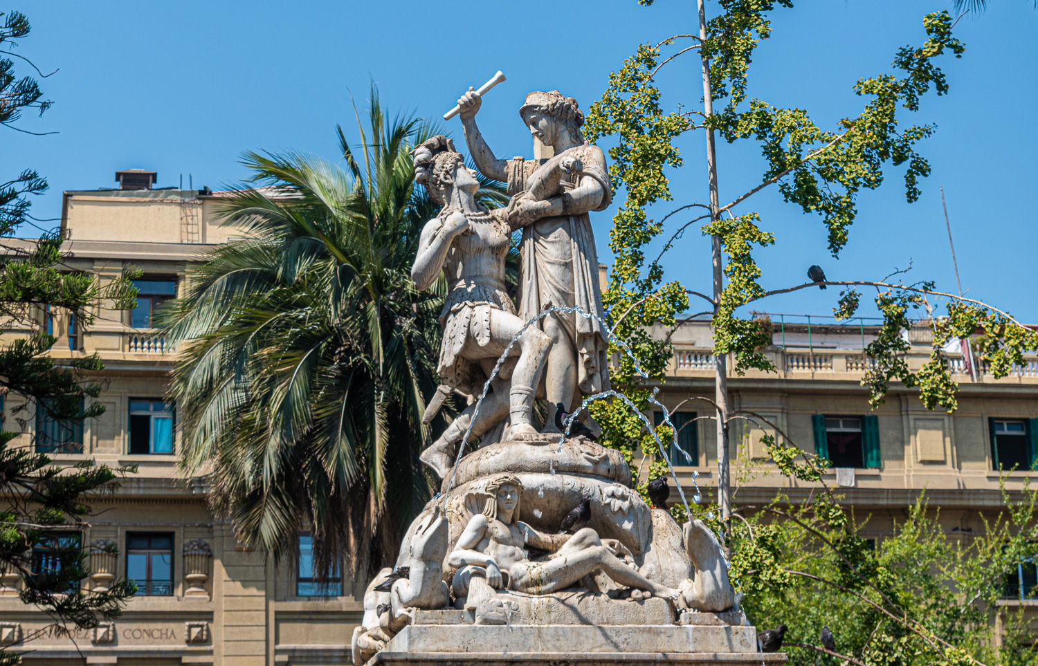 A fountain celebrating Simón Bolívar stands in the centre of the square. He was a Venezuelan military and political leader who led what are currently the countries of Colombia, Venezuela, Ecuador, Peru, Panama, and Bolivia to independence from the Spanish Empire. He is known colloquially as El Libertador, or the Liberator of America.
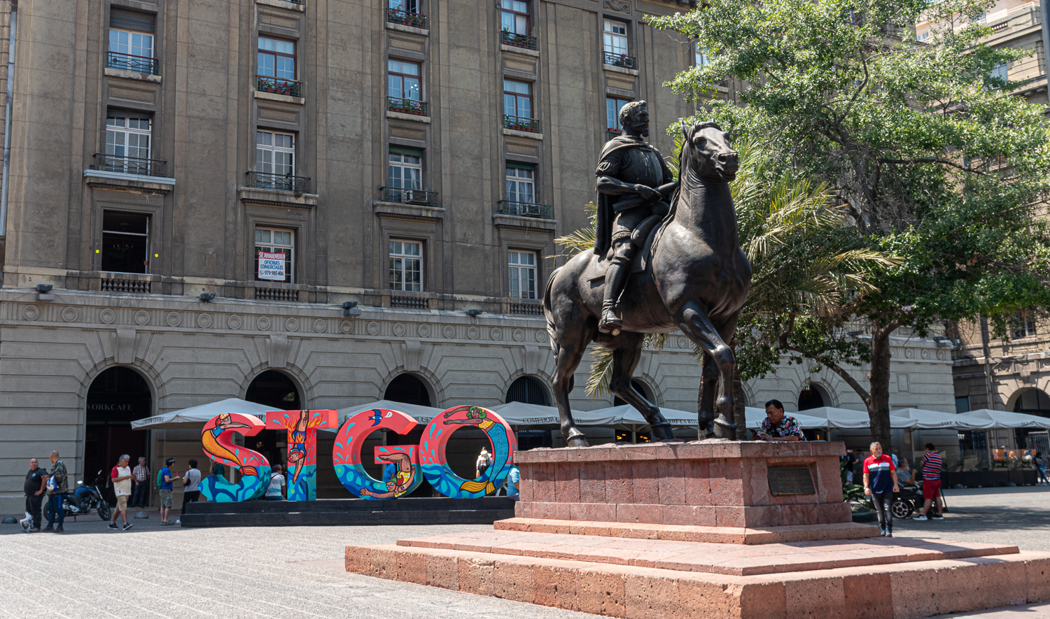 The equestrian statue of Pedro de Valdivia sits next to the STGO sign, which is the city’s abbreviation for Santiago. This Spanish conquistador was a ruthless military leader against Peru and the indigenous people. His success led him to become the First Royal Governor of Chile in the mid-16th century. He is also considered to be the founder of Santiago in 1541.
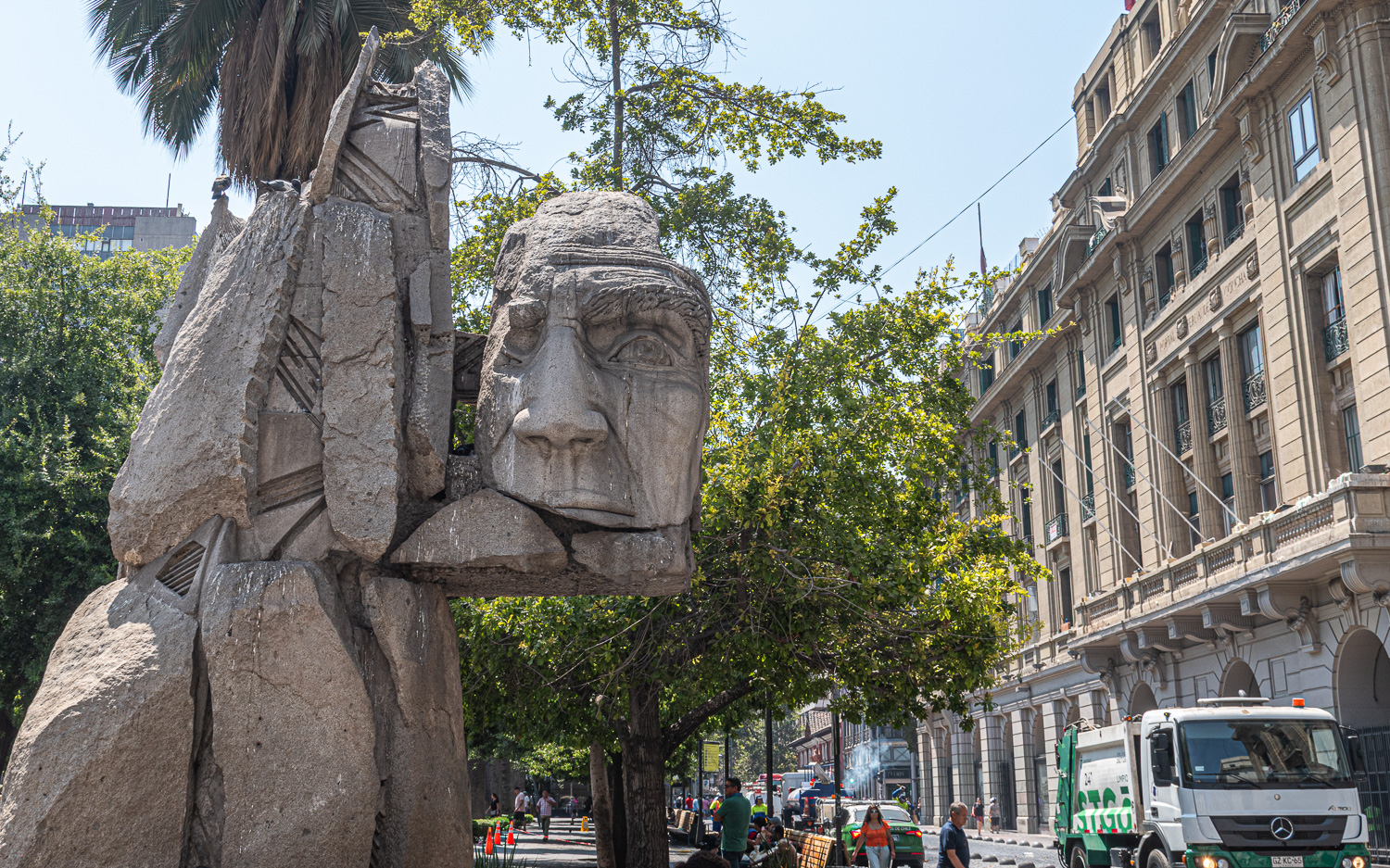 In contrast to the traditional statues, this modern controversal sculpture is a monument to the indigenous peoples of Chile
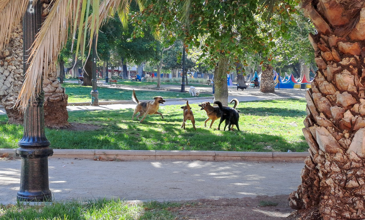 Wild domestic dogs – this is a sight we have seen throughout Chile and Argentina. We have been told that these dogs are domesticated and have owners, but the roam free around towns and cities!
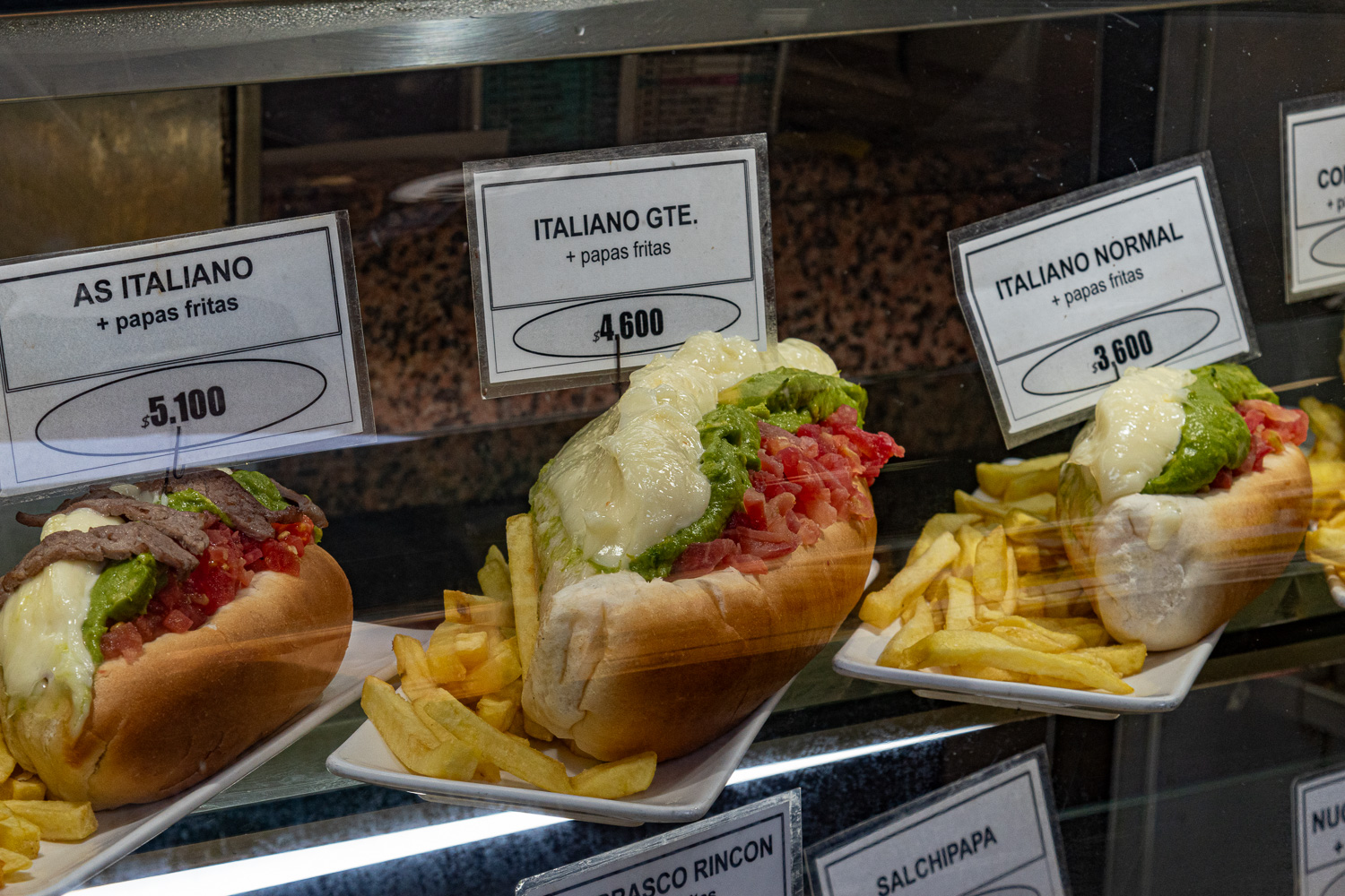 While we are talking about dogs, hot dogs are a popular snack in Chile. One the favourites is the Italiano, so called because the colours are the same as the Italian Flag, and no we didn’t try one!
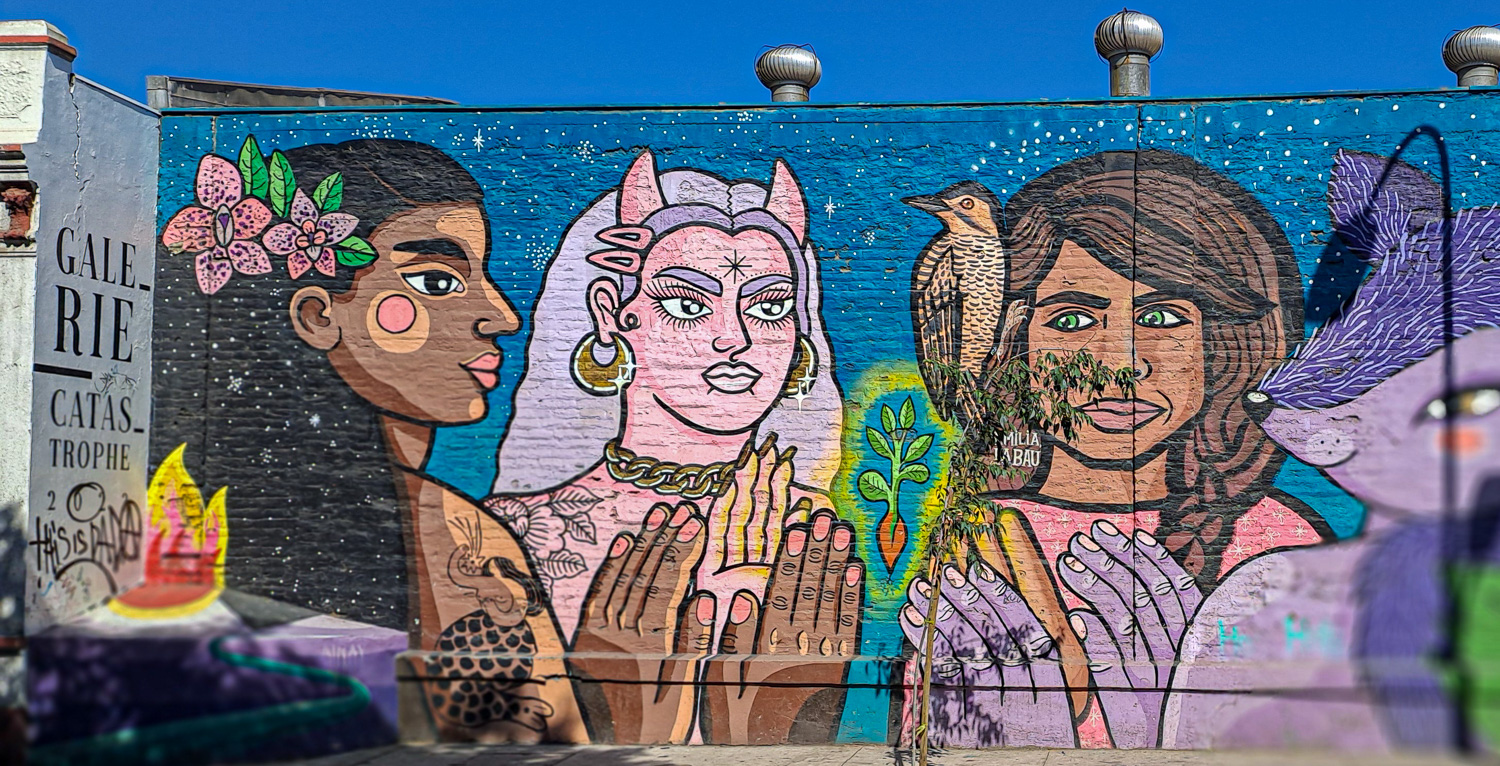
Graffiti and street art has a long tradition in Santiago, where it was widely used in the 1970s to protest against the military rule of Gen Augusto Pinochet and to ferment social change. Ever since, all kinds of graffiti – urban, feminist, political and social – have flourished here.
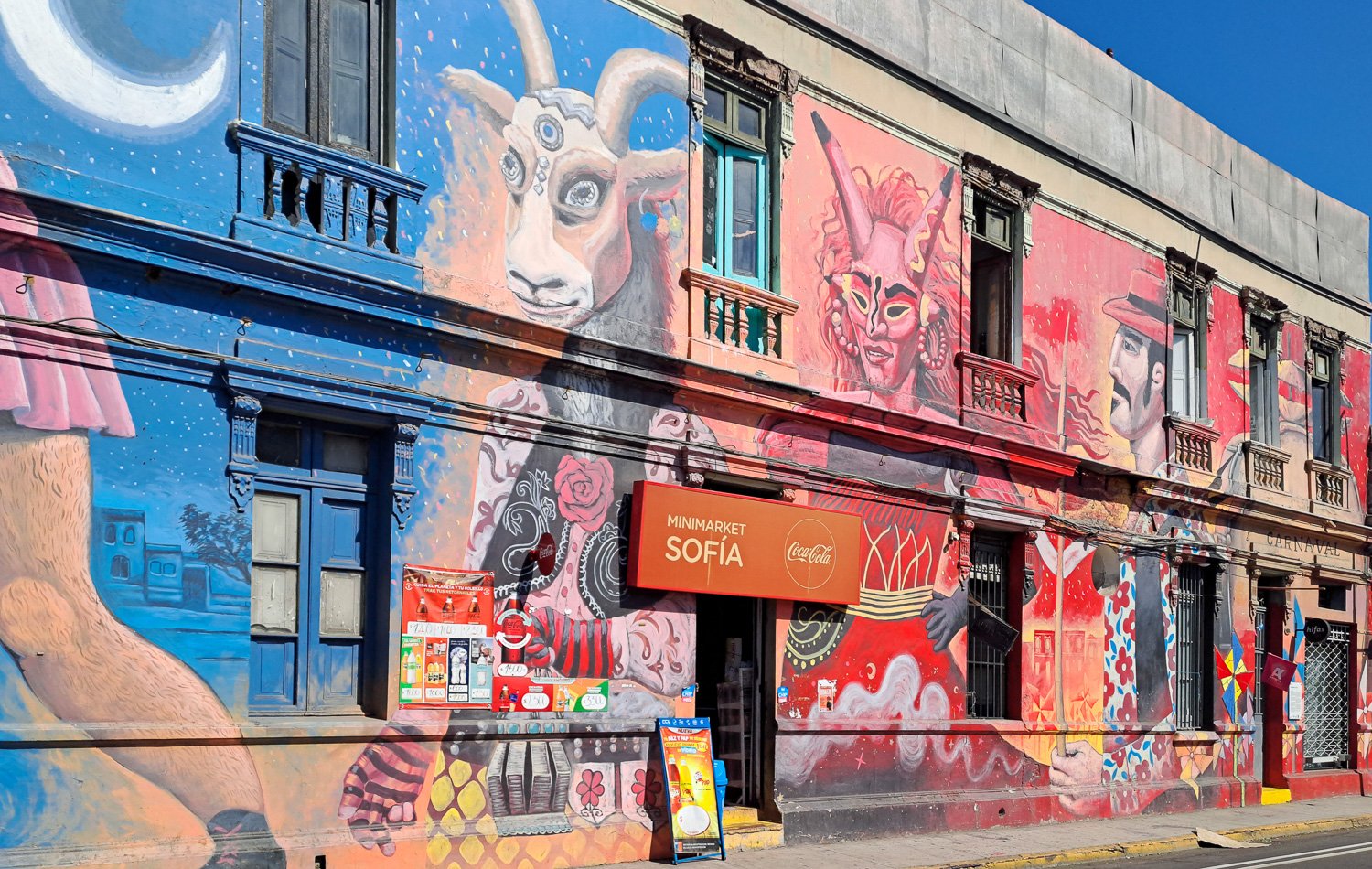 Wouldn’t it be great if our local Sainsbury could look like this!
The Museum of Memory and Human Rights commemorates the victims of human rights violations during the military dictatorship led by Augusto Pinochet between 1973 and 1990. The museum houses torture devices used during the Pinochet dictatorship, letters to family members by prisoners in detention centres, newspaper clippings, testimony from survivors, and more. This was a very moving experience and was hard believe it only came to an end 34 years ago.
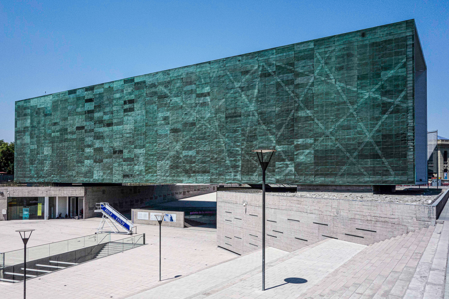 The impressive museum building
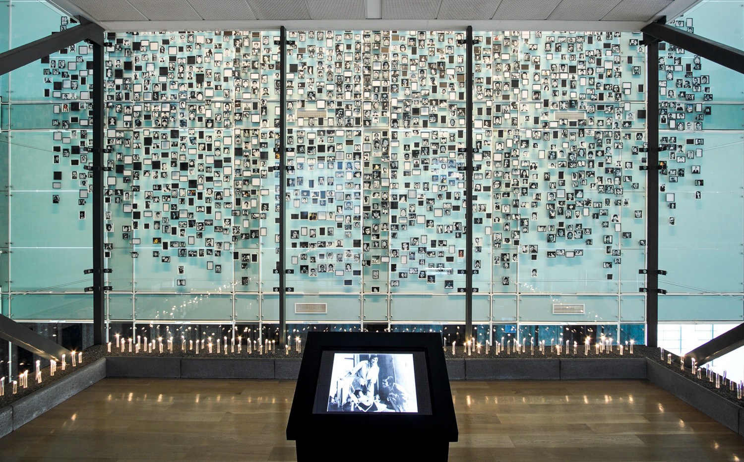 This photo mural of victims of the brutal regime, was very moving
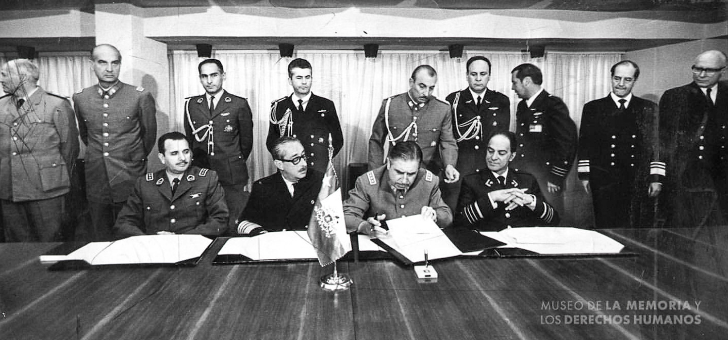 The famous photo from 1973 of Pinochet and his Junta signing the legislation that started the new era of dictatorship
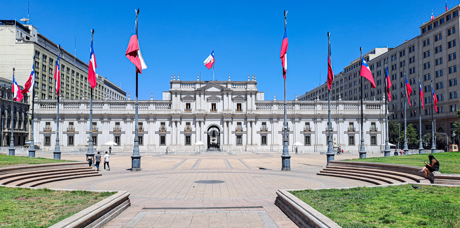 Presidential Palace – they do like their flags!
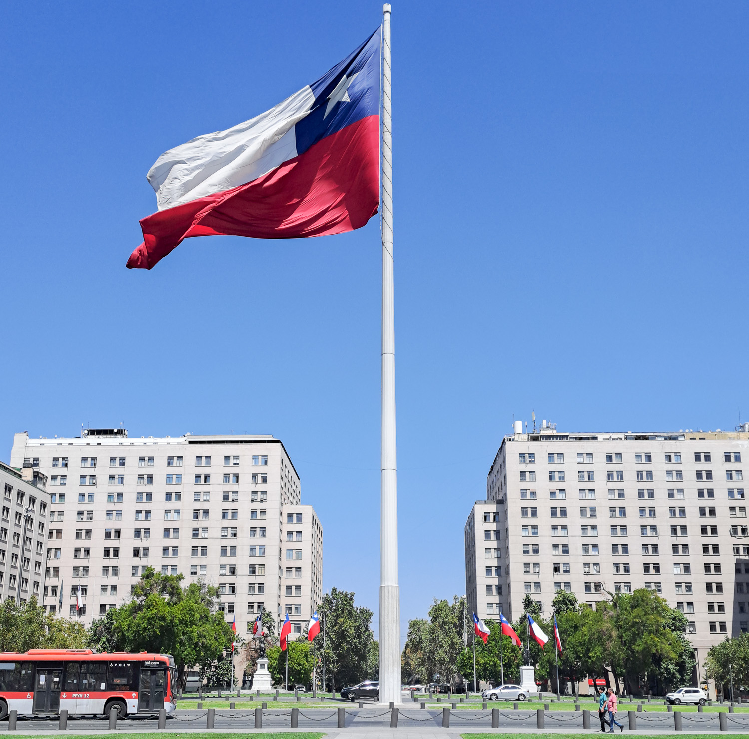
Staying on the theme of flags, at the Plaza de la Ciudadanía stands the Chilean Bicentennial Flag. Raised on September 17, 2010 to pay tribute to the 200th anniversary of the beginning of Chilean Independence, this huge flag is 90 ft wide and 60 ft high. A 200 ft-high galvanized steel flagpole enables this giant flag to wave in the wind.
An inscription at the base of the flagpole, signed by the then President of Chile, Sebastian Piñera, reads: ‘In commemoration of the Bicentennial of Chile, this flag has been raised to flutter with the wind as a symbol of brotherhood among the Chilean people, an engagement with freedom and a hopeful future’.
 Chilean Bicentennial Flag
Santa Lucía Hill comprises a 16 acre park adorned with ornate facades, stairways and fountains. At the top of the hill there are two forts dating back to 1816 and at the highest point there is a viewpoint with a 360 deg view of the Santiago skyline.
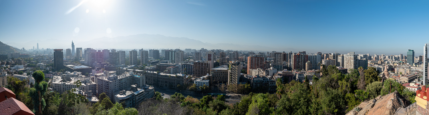 Skyline panorama from the hill top fort
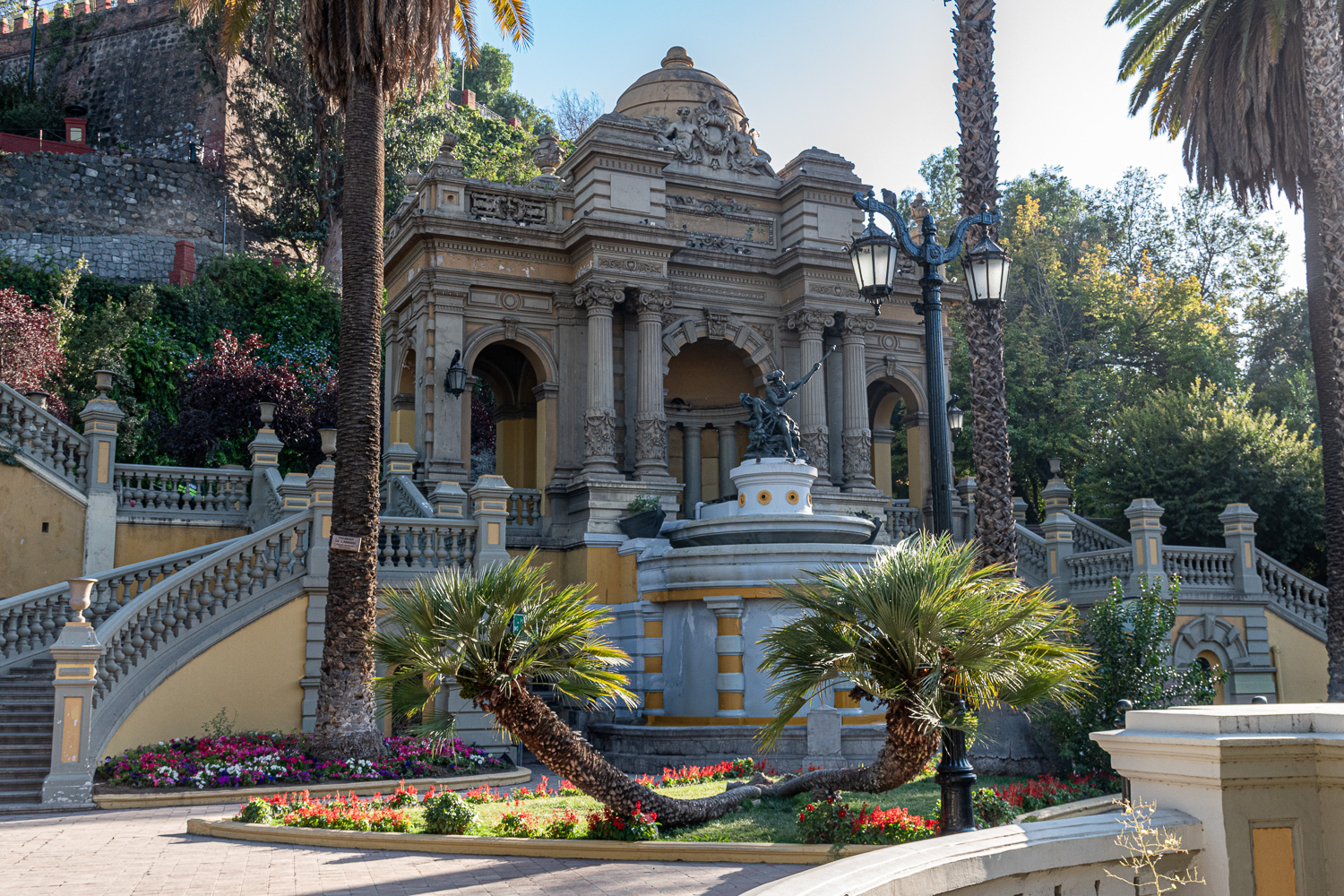 Neptune’s Fountain is at the centre of this wonderful entrance to the park.
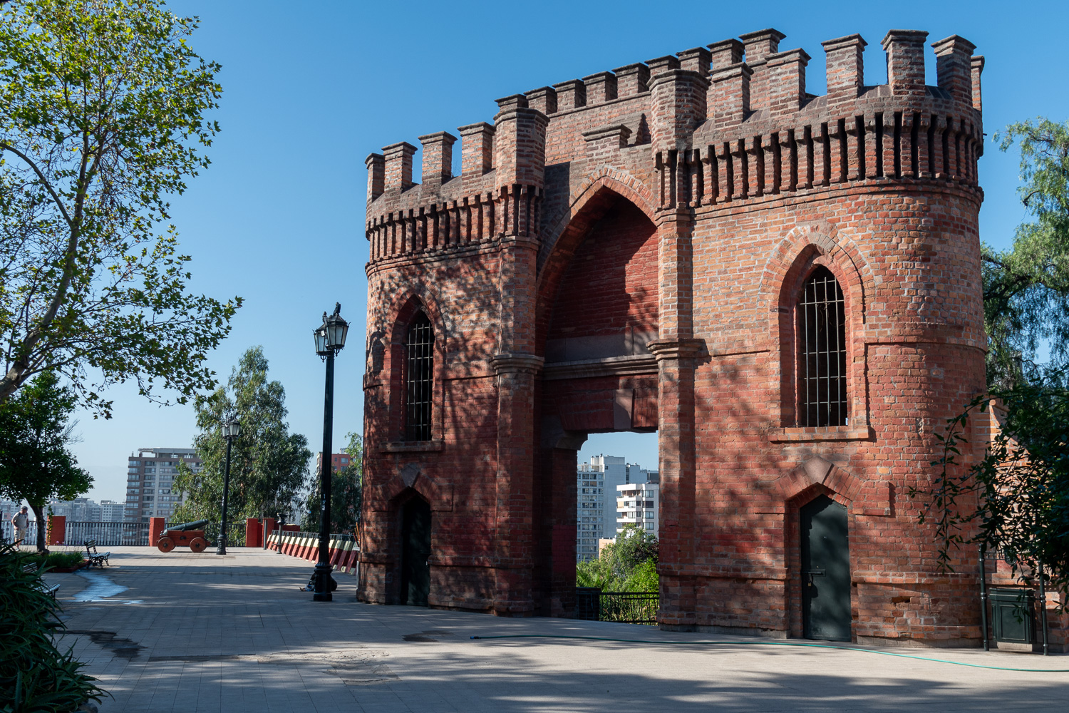 Hill top fortifications
Buenos Aires, Argentina
Buenos Aires is Argentina’s big, cosmopolitan capital city. Its centre is the Plaza de Mayo, lined with stately 19th-century buildings including Casa Rosada, the iconic, balconied presidential palace. Other major attractions include Teatro Colón, a grand 1908 opera house with nearly 2,500 seats and historic cobbled streets of San Telmo. Here are some of the highlights from our 2-day stay in this lovely city.
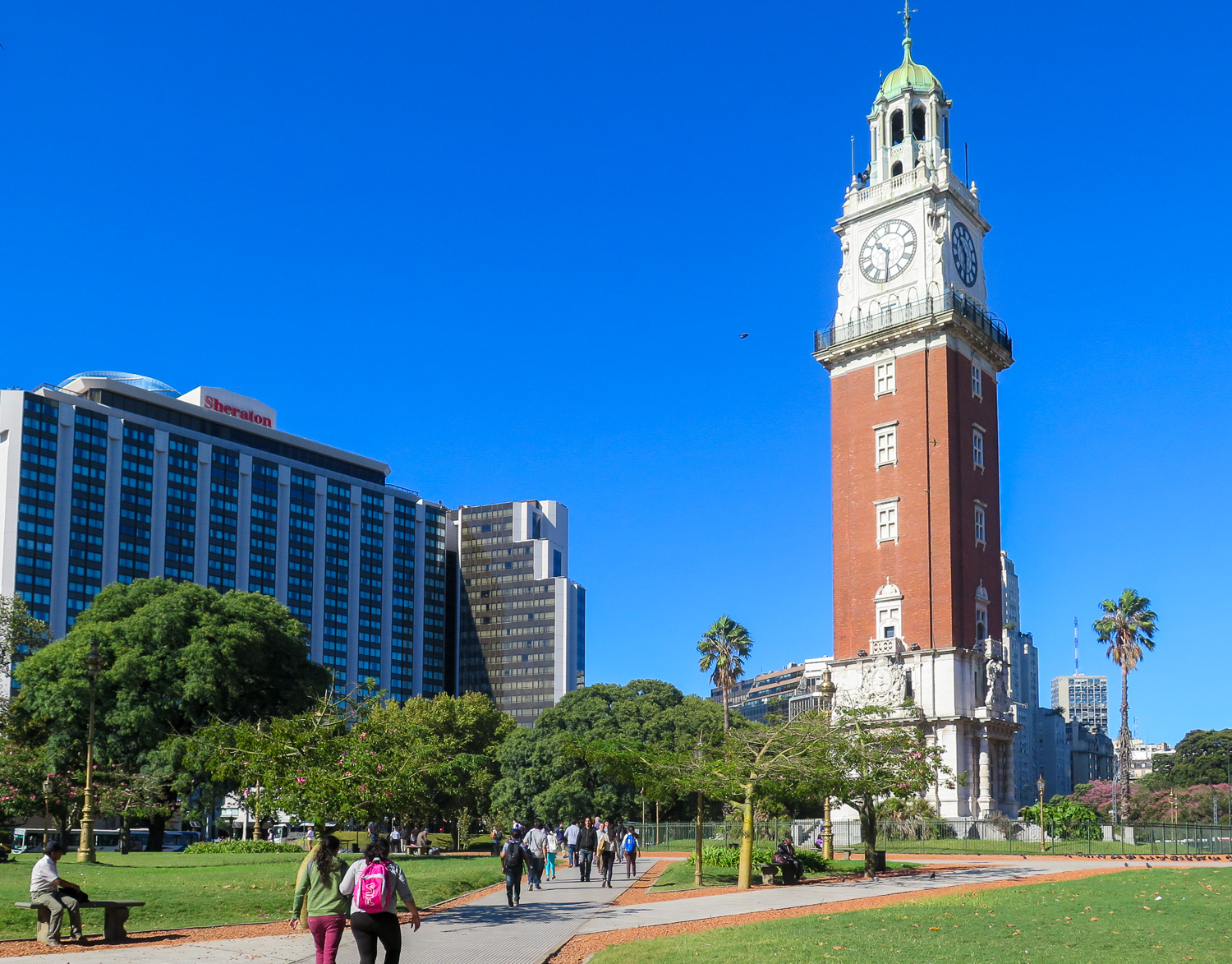 Torre de los Ingleses (Tower of the English) – This Renaissance-style clock tower was built in 1916. It was a gift from the Buenos Aires’ British community to celebrate the centenary of Argentina’s independence. The clock tower is 180 ft tall and the bricks and stone that were used for its construction were imported from England. It is often referred to as Buenos Aires’ Big Ben!
Eva Perón, nickname Evita, was an Argentine politician, activist, actress, and philanthropist who served as First Lady of Argentina from June 1946 until her death in July 1952, as the wife of Argentine President Juan Perón. She was very popular with the working class, but often seen as controversal by the traditional elite. Evita has never left the collective consciousness of Argentines and is still today celebrated through various statues and memorials around the city.
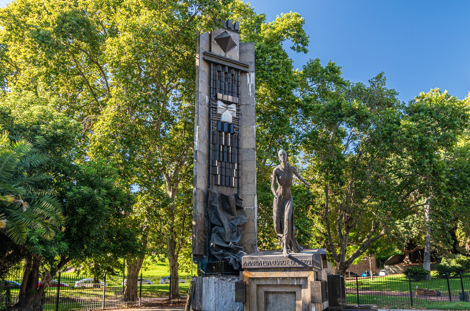 Monument to Eva Perón, inaugurated in 1999, is located in what is now known as Evita Square
There are two huge images found in the Ministry of Public Works Building, on each side of the south and north facades. The 90 ft high and 75 ft wide steel figures were installed in 2011. The face that looks towards the south of Buenos Aires, has the portrait of Evita, kind and smiling, since the working-class neighbourhoods and factory areas are located on this side of the city. On the north side, the most aristocratic area of the city, there is an image of a more combative Eva, giving a speech to the people. Denoting that the murals align with the historical division of Buenos Aires.
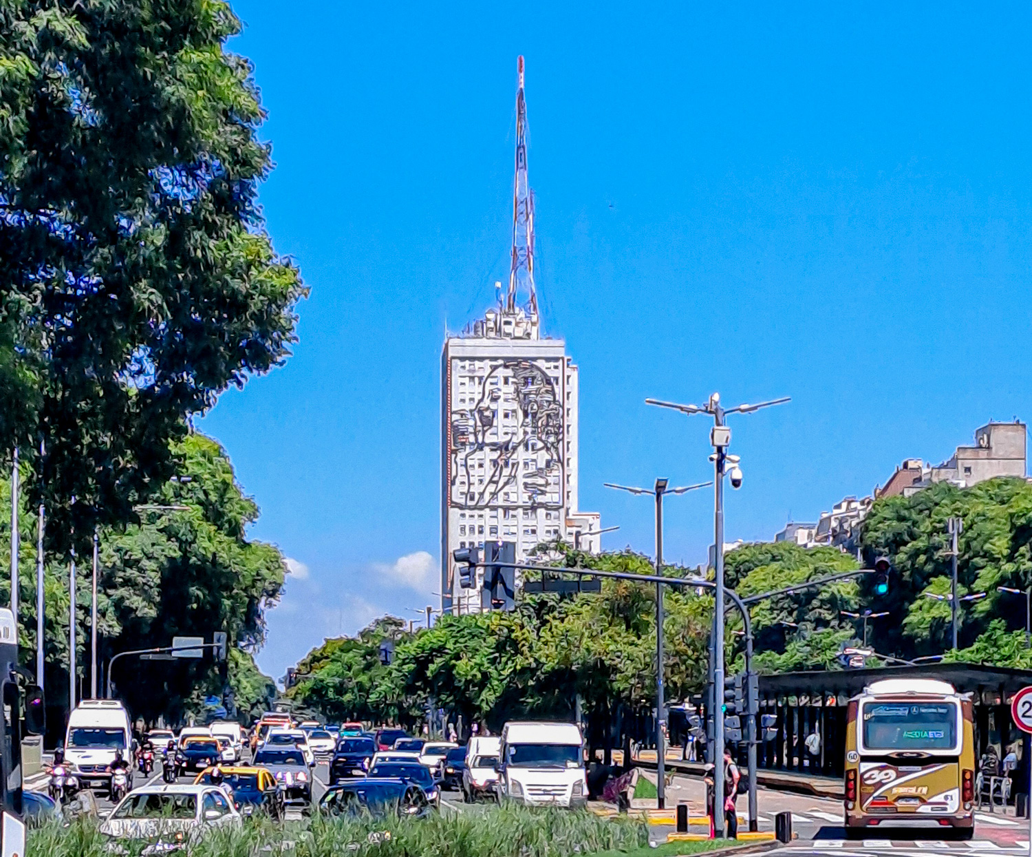 North facing image of Evita
 South facing image of Evita
Recoleta Cemetery became the city’s first public cemetery in 1822. It is an eerily beautiful place, with shadowed walkways and towering marble mausoleums rich in Art Deco, Art Nouveau, baroque and neo-gothic architectural styles, Masonic symbols and powerful religious iconography.
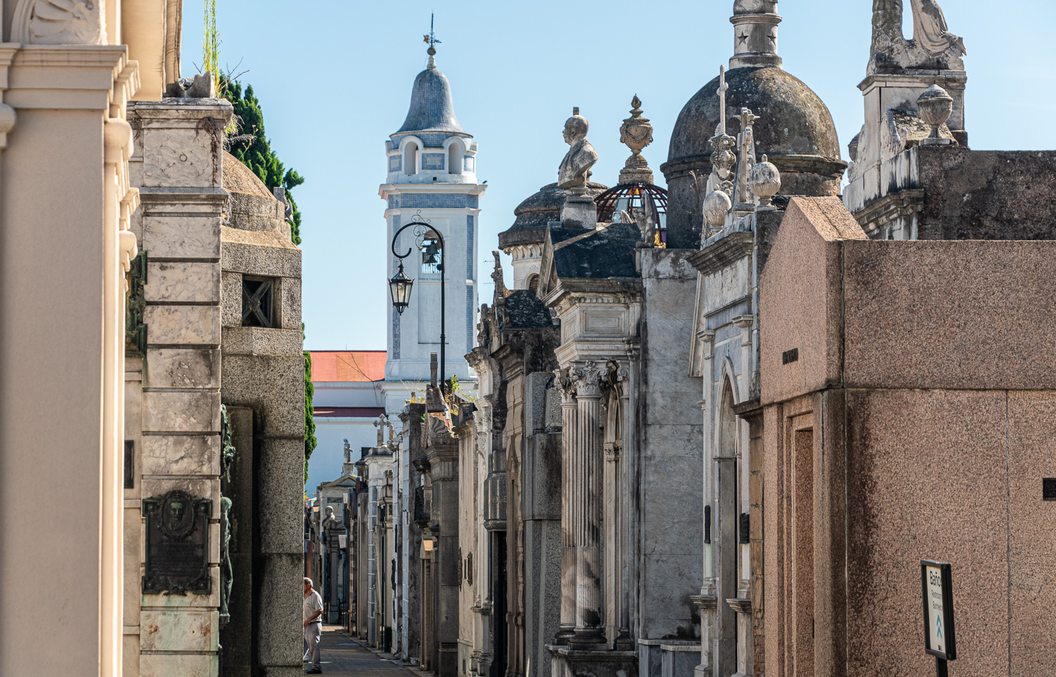 Over 90 of its tombs are listed as national historical monuments.
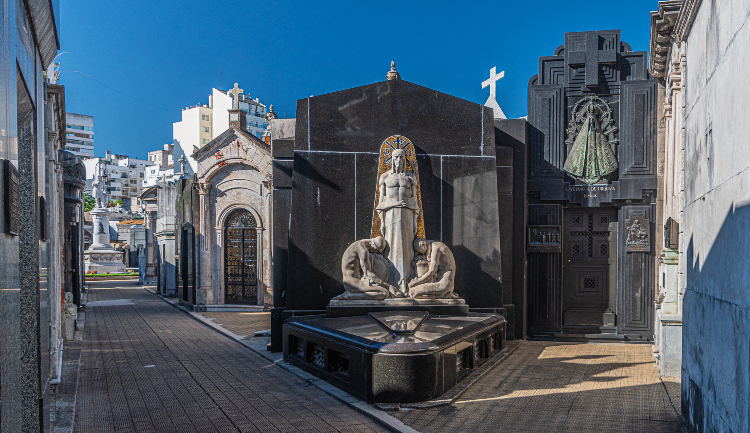 The cemetery remains the resting place for those who own a family plot or are wealthy enough to purchase a new one.
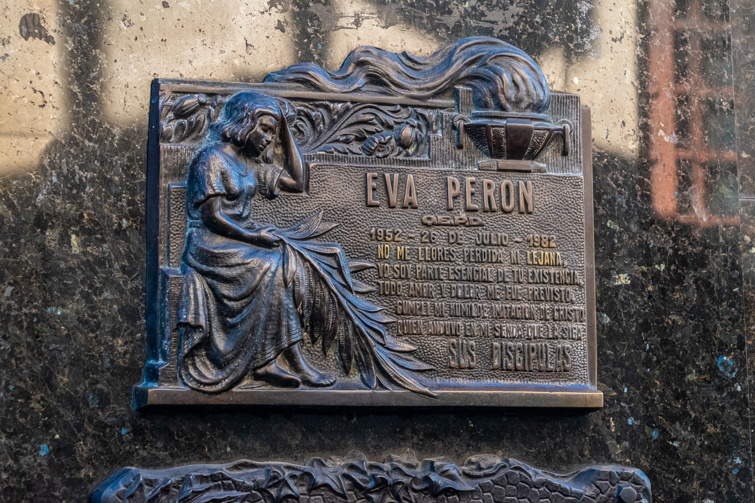 One of the most visited plots is the final resting place of Eva Perón, whose remains are in the Duarte family mausoleum.
 Next to the cemetery was this unusually decorated theatre
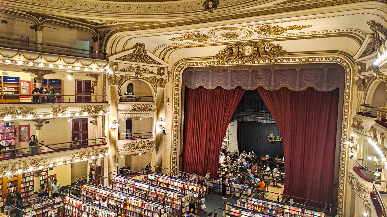 A former theatre, the Grand Splendid is one of the world’s most beautiful book stores. The venue was converted into a book store in the year 2000, and preserves the splendour and elegance of the former Gran Splendid theatre/cinema.
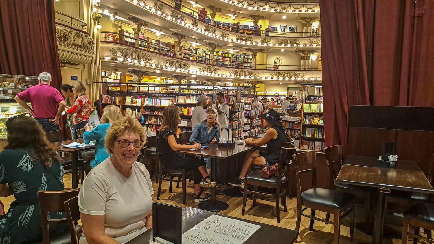 The store stocks around 120,000 books and there is a cafe on what was the stage area of the theatre, which of course we had to try!
Located in La Boca, the Caminito (little path, in Spanish) is a street museum of colourful painted houses typical of the immigrant dwellings that came to characterise this waterfront area towards the end of the 19th and start of the 20th century.
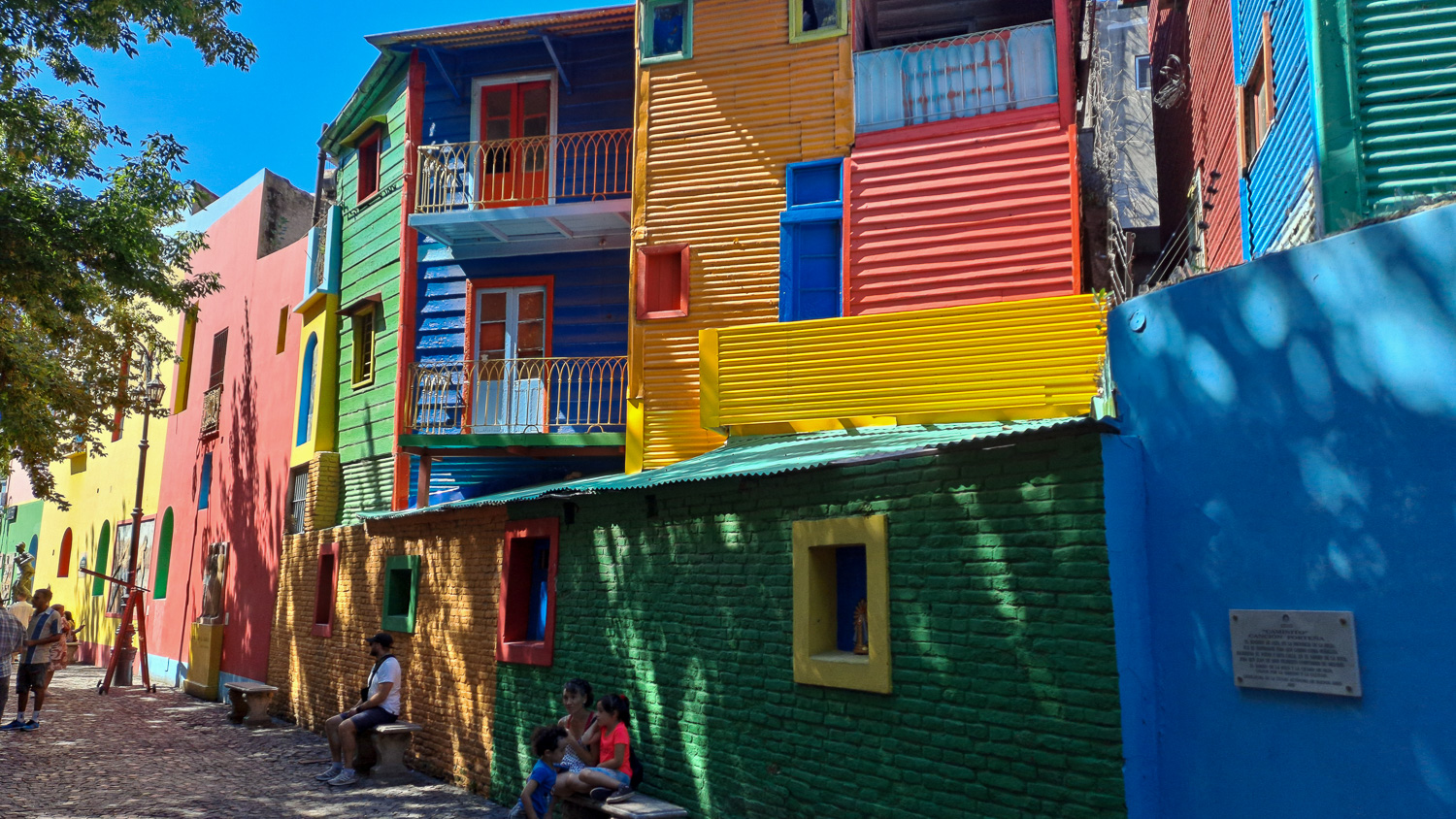 Lovely colourful buildings
 The area was largely abandoned until the 1950s, when a group of artists regenerated the area and made it the colourful attraction it is today.
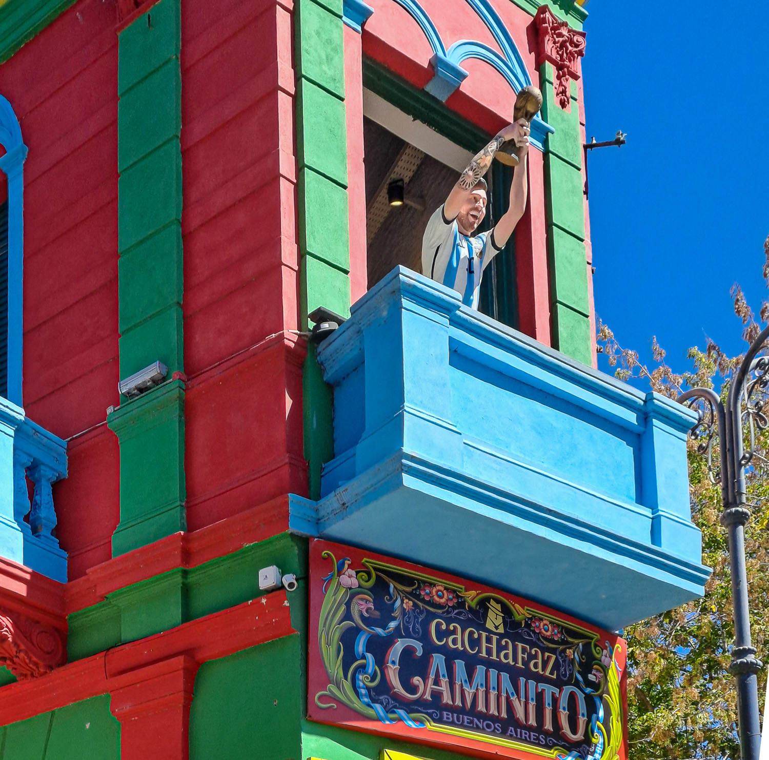 This corner building is one of the most popular sights in the area, helped by the a well known Argentinian football player!
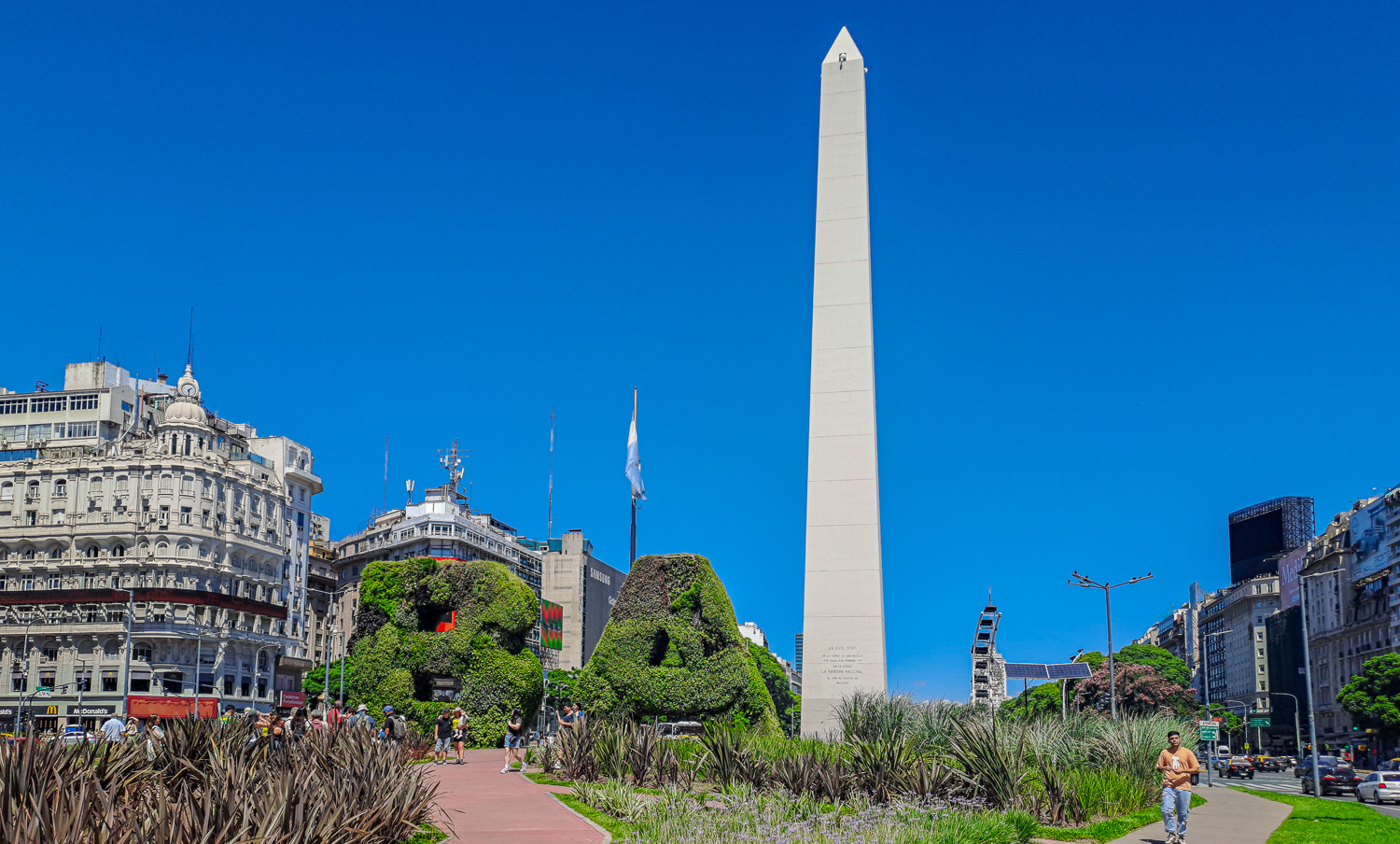 The Obelisk is one of the city’s most iconic landmarks, built in 1936 to mark the fourth centenary of the city’s first foundation. The 220-ft high monument marks the spot where the Argentine national flag was raised in the city for the first time. It is located in the middle of Avenida 9 de Julio, which is often credited as being the widest street in the world, with an incredible 16 lanes at some points.
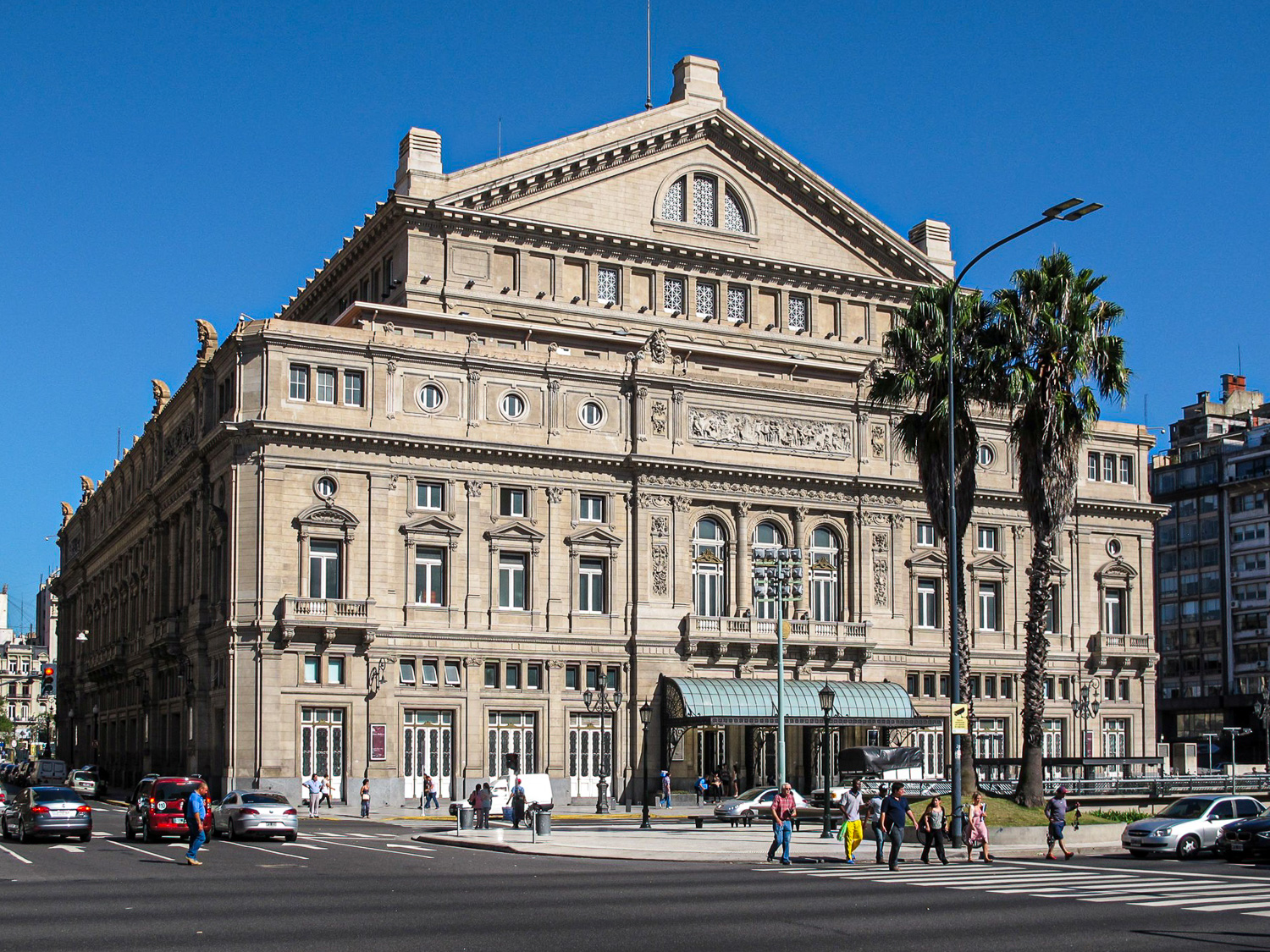 The Colón Theatre opened in 1908, and is considered to be one of the best opera houses in the world
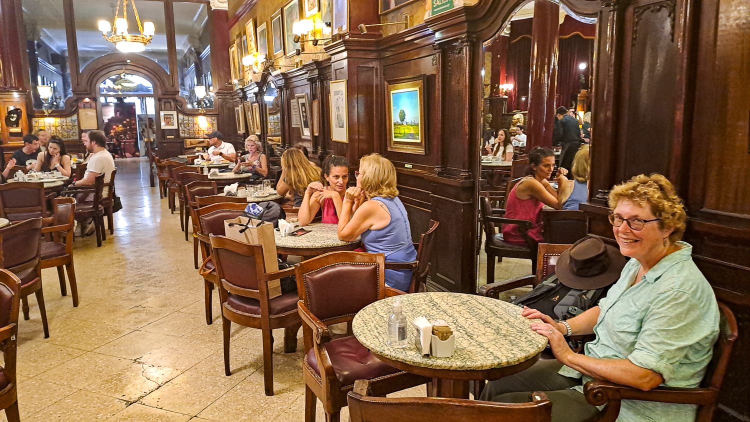 We visited the famous Café Tortoni for a coffee and cake. It is the oldest and perhaps best preserved of the city’s many officially recognised historic cafés. Founded in 1858 in the neighbourhood of Monserrat, this elegant venue was frequented by important politicians and cultural icons of the time.
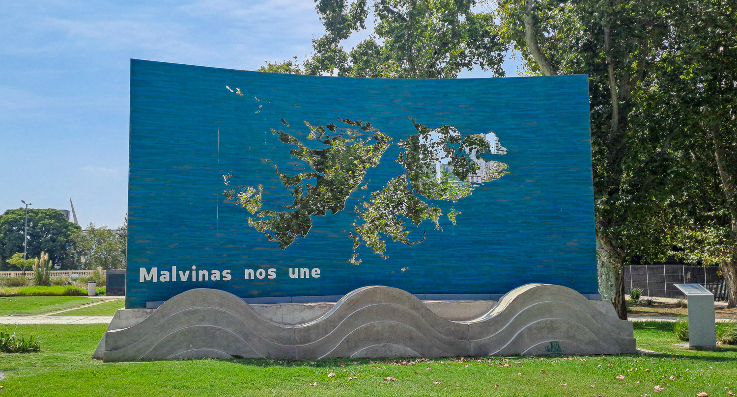 The Malvinas nos une (Malvinas unites us) sculpture – another reminder of the Falklands conflict
Plaza de Mayo is a city square that was first created in the 1580s, and named after the month of May, in recognition of the 1810 May Revolution, which helped bring about Argentina’s independence from Spain. Plaza de Mayo has been the scene of the most momentous events in Argentine history, as well as the largest popular demonstrations in the country. Here some of the main buildings and monuments in the square.
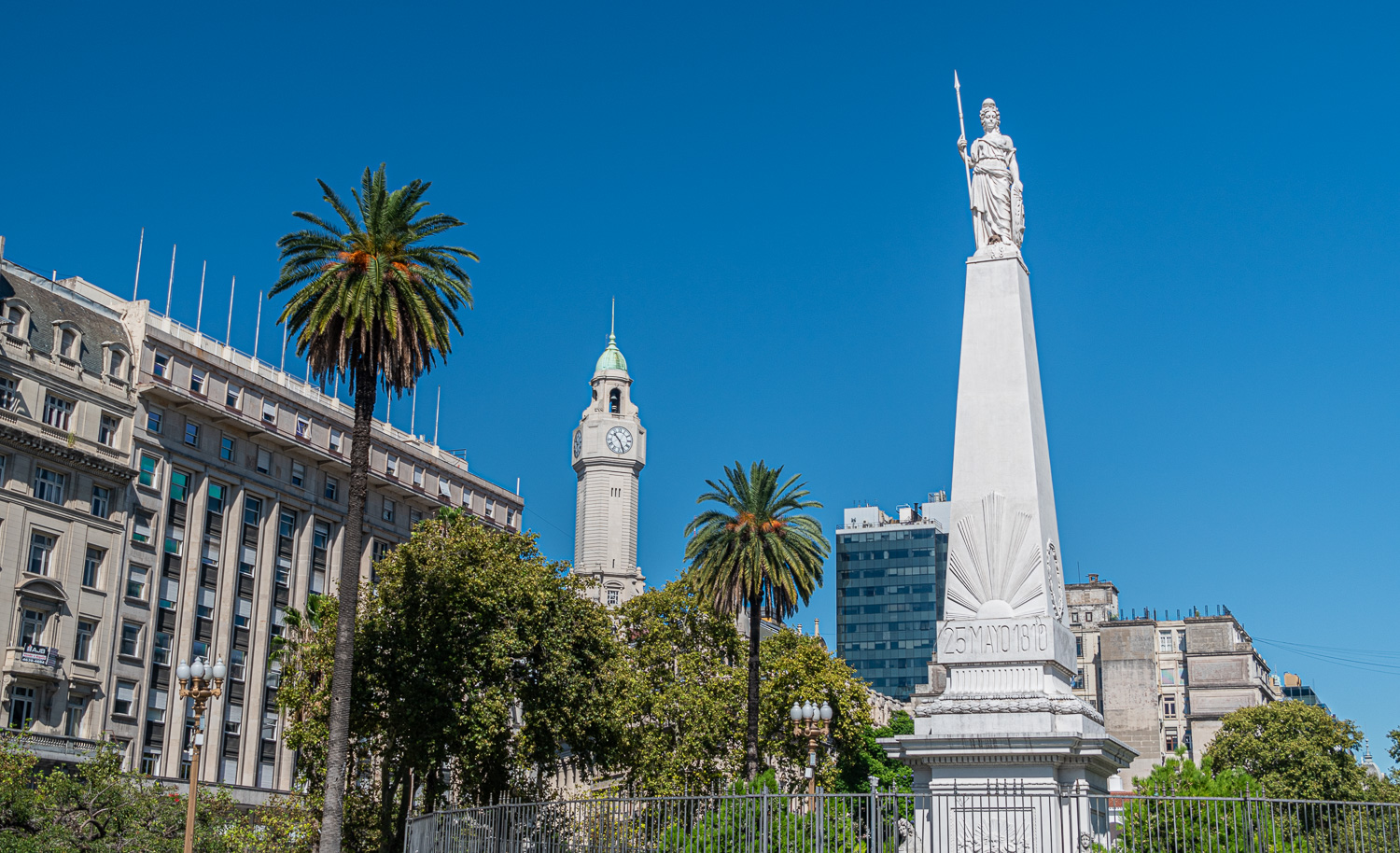 Pirámide de Mayo also known as the May pyramid is the oldest national monument in the City of Buenos Aires. It is located at the hub of the Plaza de Mayo. It was first constructed in 1811 to celebrate the first anniversary of the May Revolution.
 The Metropolitan Cathedral is the main Catholic church of the nation. Pope Francis was the Cardinal of this cathedral before he was made Pontif in 2013. It was first built in the 16th century and is a mix of architectural styles.
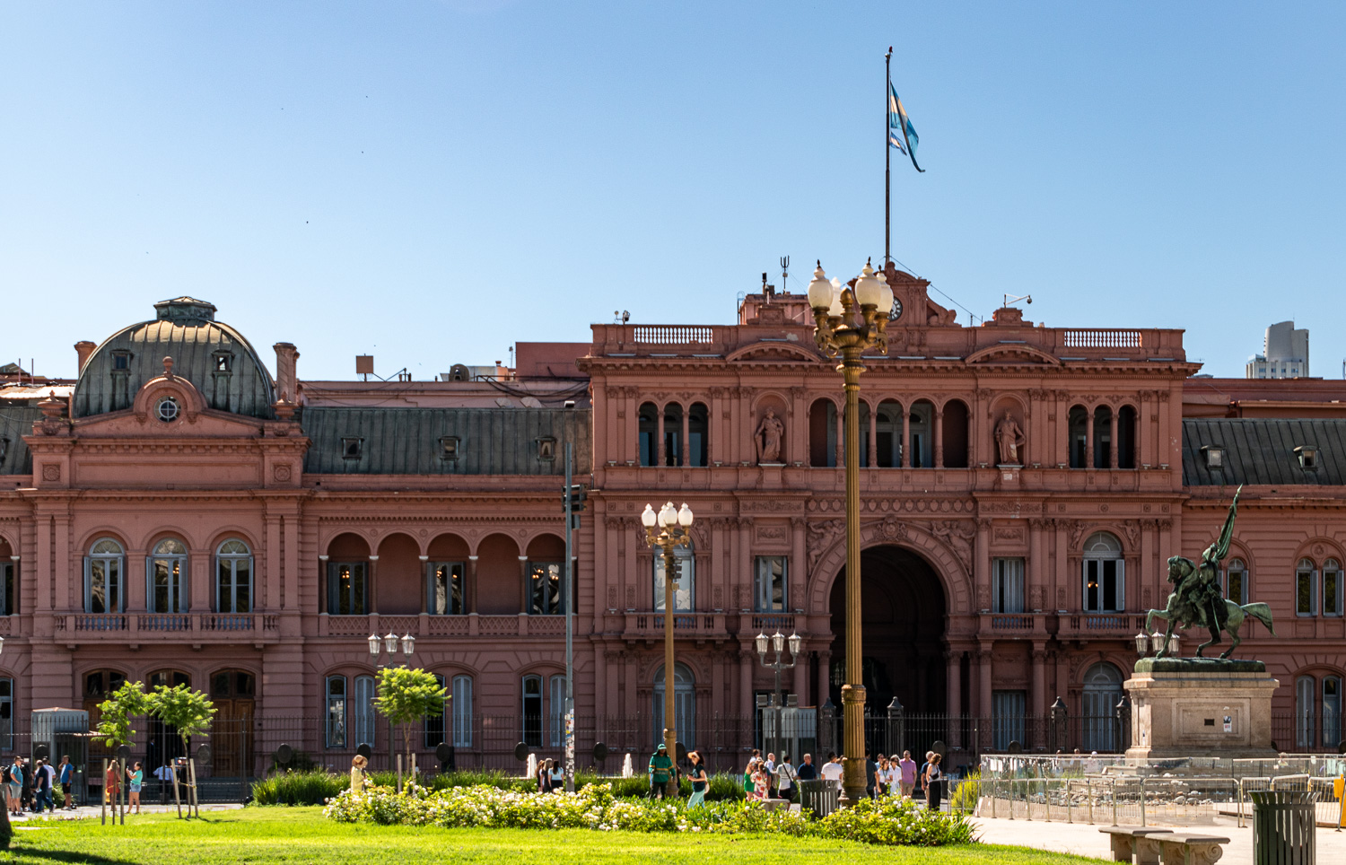 Dominating the Plaza de Mayo, the Casa Rosada, or pink house, is the seat of the Argentine national government and houses the president’s office. Witness to much of the city’s history, it was from the balconies of the Casa Rosada that Juan and ‘Evita’ Perón addressed the masses during the late 1940s and early 1950s.
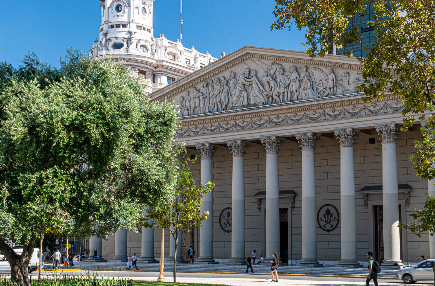
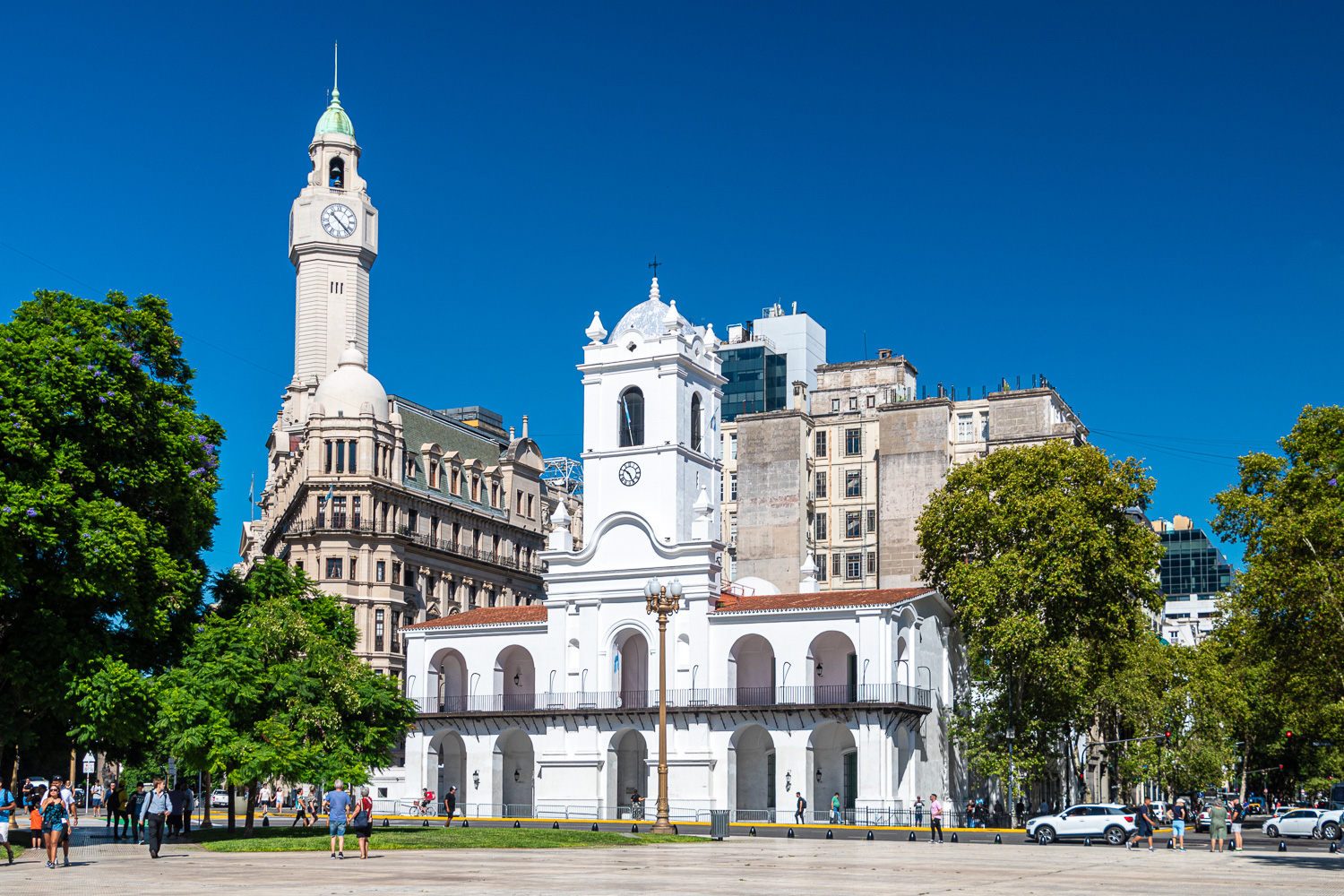 The Cabildo de Buenos Aires was the site of Spain’s colonial administration in the city and an important administrative building during the first century of Argentine independence. The building now houses the National Museum of the Cabildo and the May Revolution, and displays original artefacts and documents as well as interactive exhibits on the Spanish colonial era, the British invasions of 1806 and 1807, and the early days of independence.
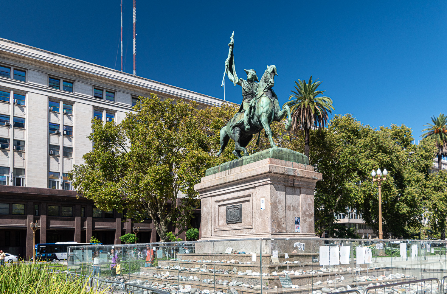 This statue depicts General Manuel Belgrano holding the Flag of Argentina. He took part in the Argentine Wars of Independence and designed what became the flag of Argentina. Argentines regard him as one of the main Founding Fathers of the country. During the 2020 pandemic, families who lost love ones placed an inscribed stone at the foot of the monument as an memorial.
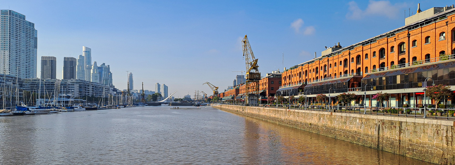 The next day we visited the old disused port area, which has been regenerated into businesses, shops, cafes and restaurants, with the old warehouses converted into modern luxury accommodation, very similar to the Docklands in London.
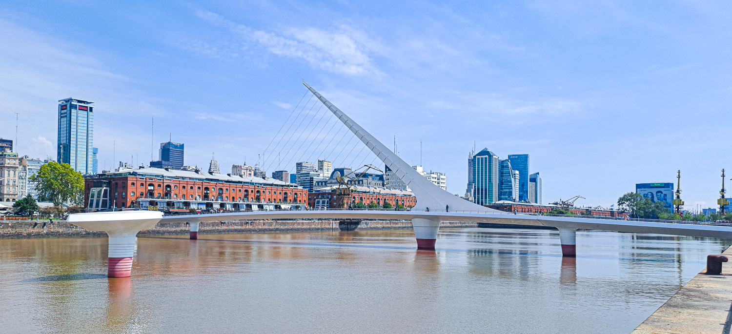 Crossing the old docks canal is a rotating footbridge called the El Puente de la Mujer (Women’s Bridge). The bridge represents a couple dancing the tango, with the white mast symbolising the man and the curve of the bridge, the woman. It has a large turning mechanism, allowing it to swing open to allow sailing ships to pass.
Nearby is the Costanera Sur Ecological Reserve, which covers 865 acres, and is the biggest and most biodiverse green space in the city.
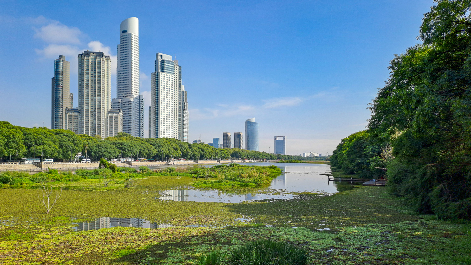 Despite its proximity to the busy downtown area, with the skyscrapers of Puerto Madero in plain sight, it’s a remarkably tranquil oasis of calm, and a haven for wildlife.
Along several winding paths leading around three lagoons to the River Plate, we observed several different species of birds.
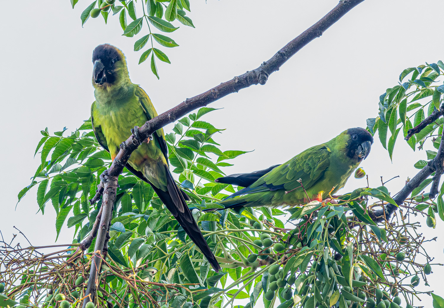 The Nanday Parakeet, also known as the Black-hooded Parakeet, is a medium-small, mostly green, parrot native to continental South America
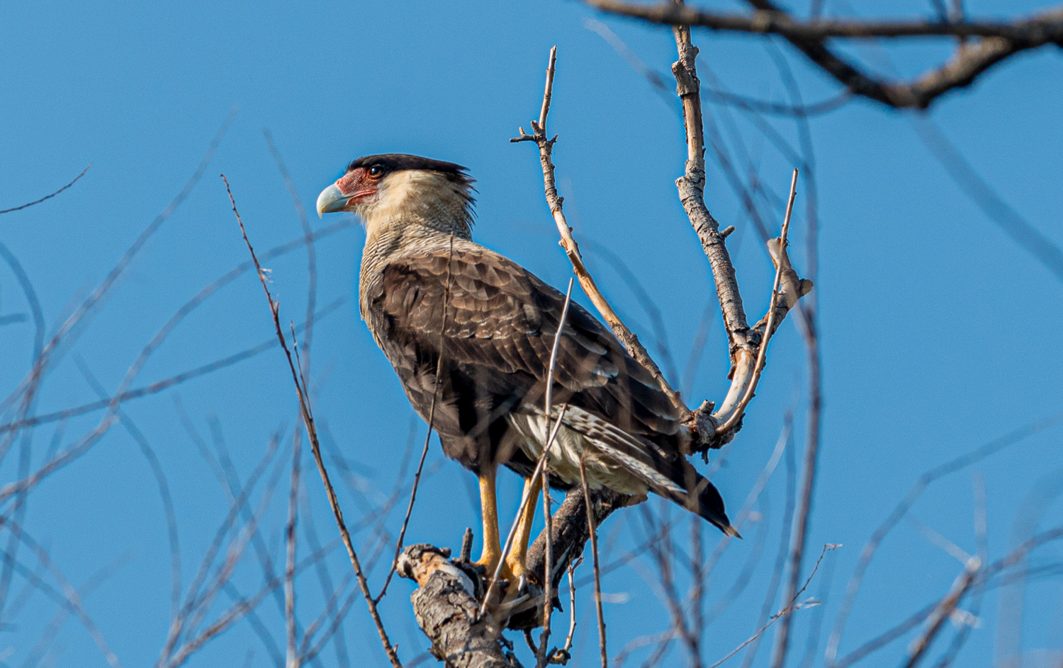 The Crested Caracara, also known as the Mexican eagle, is a bird of prey found throughout Central and South America
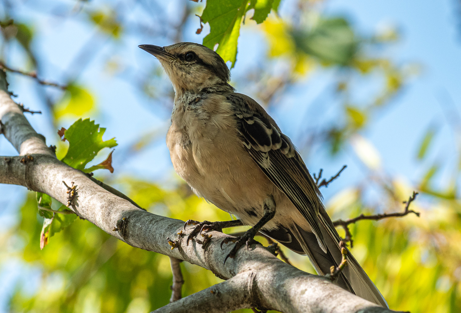 Northern Mockingbird
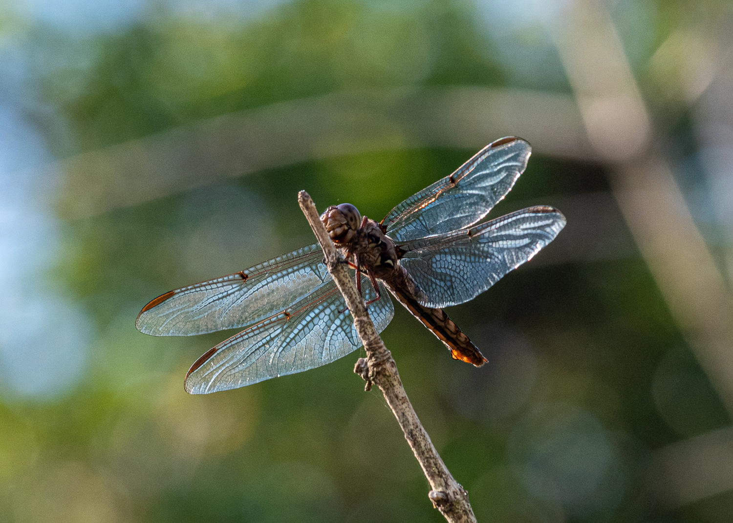 Dragonfly
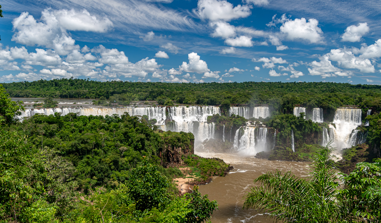
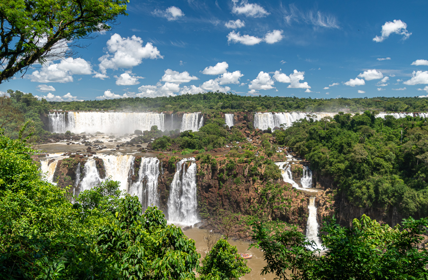
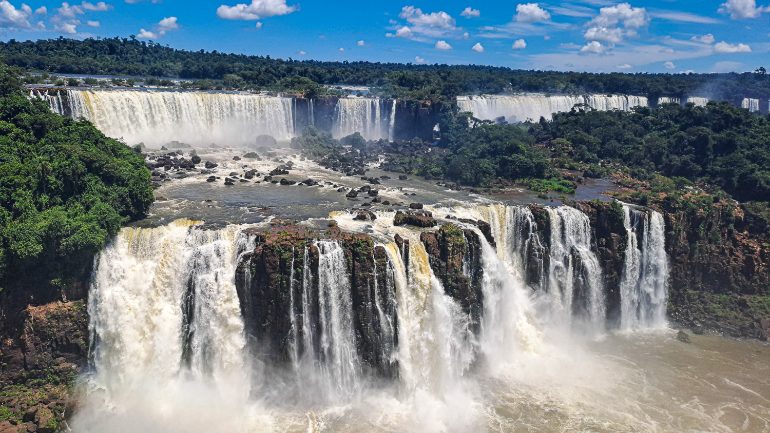
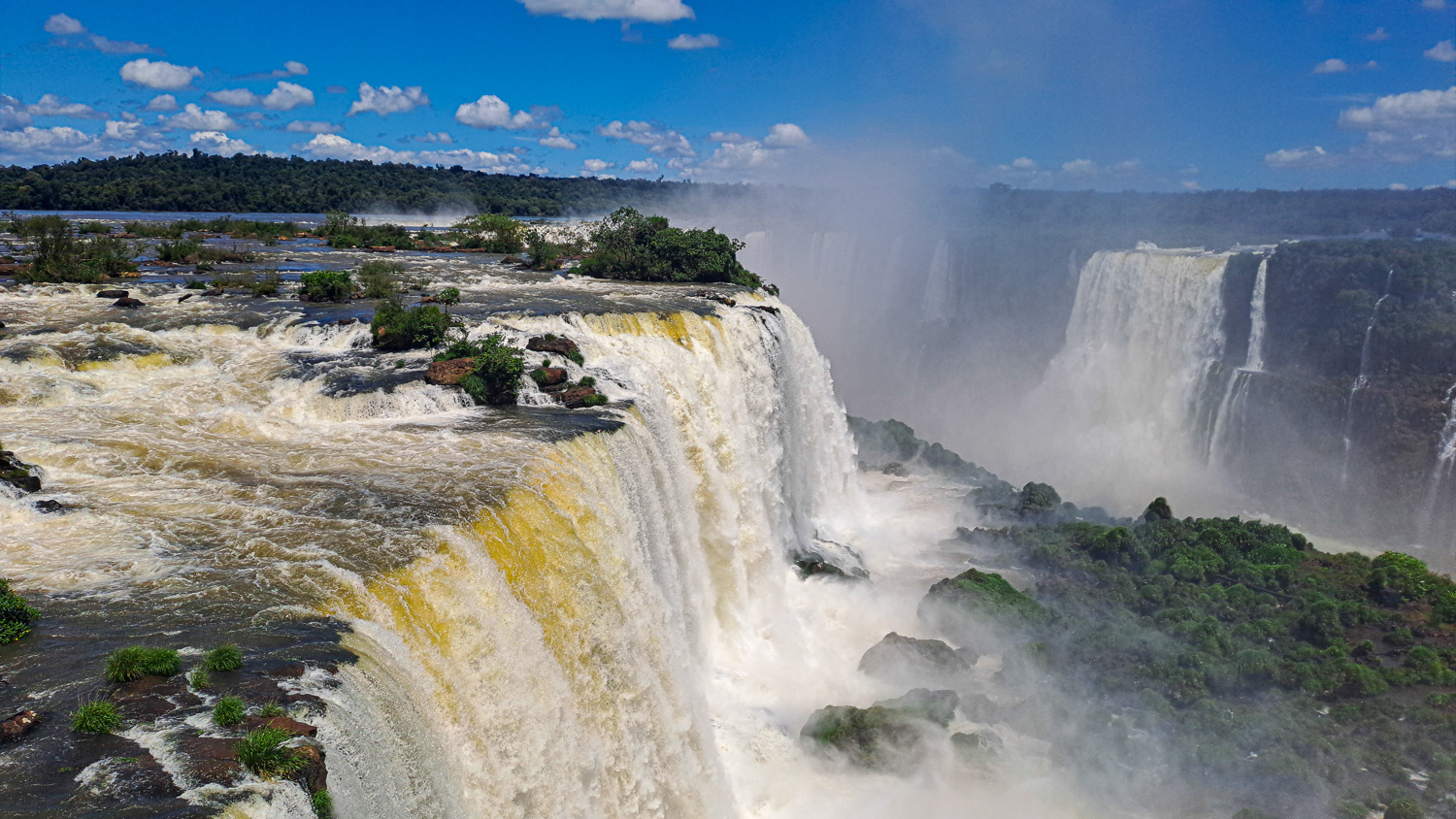
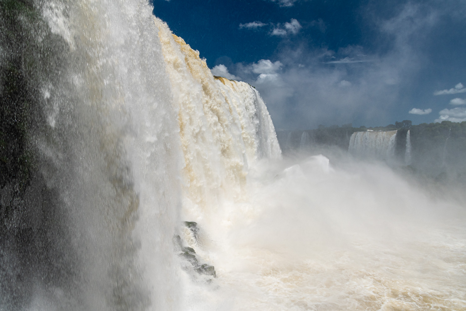
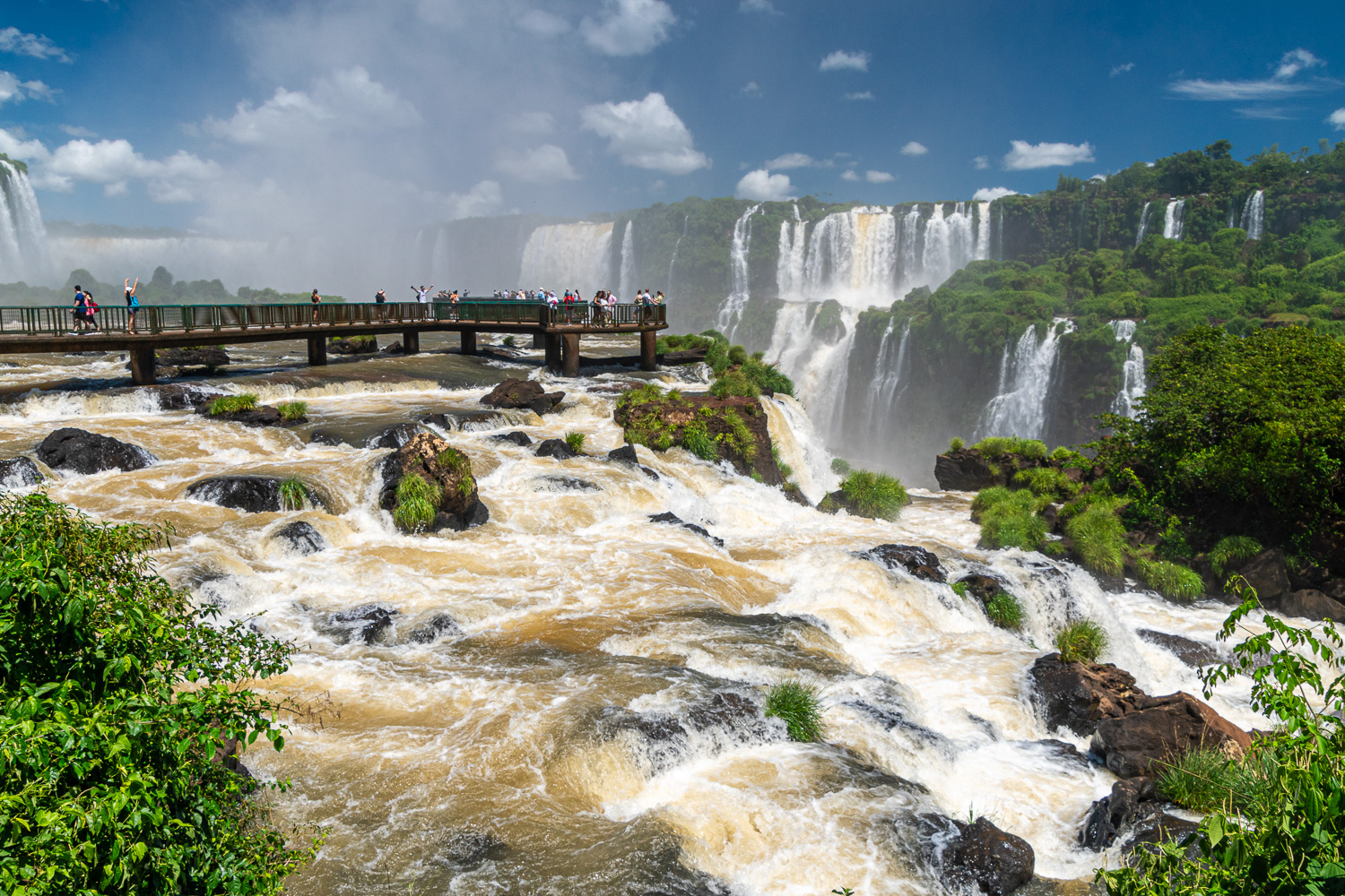
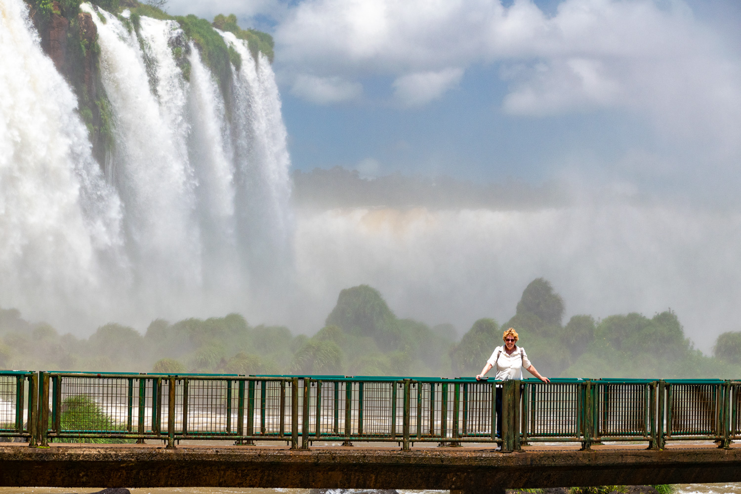
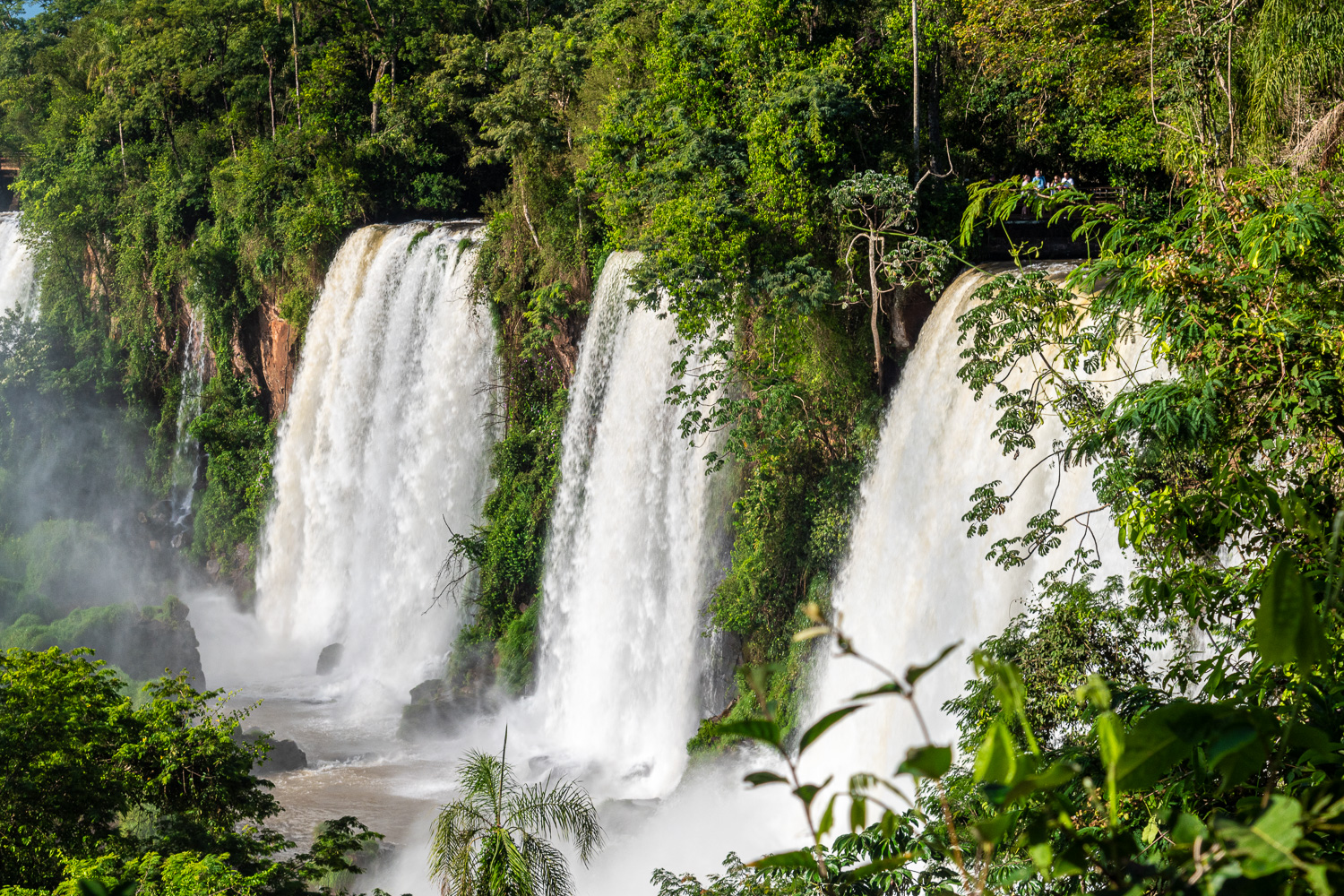
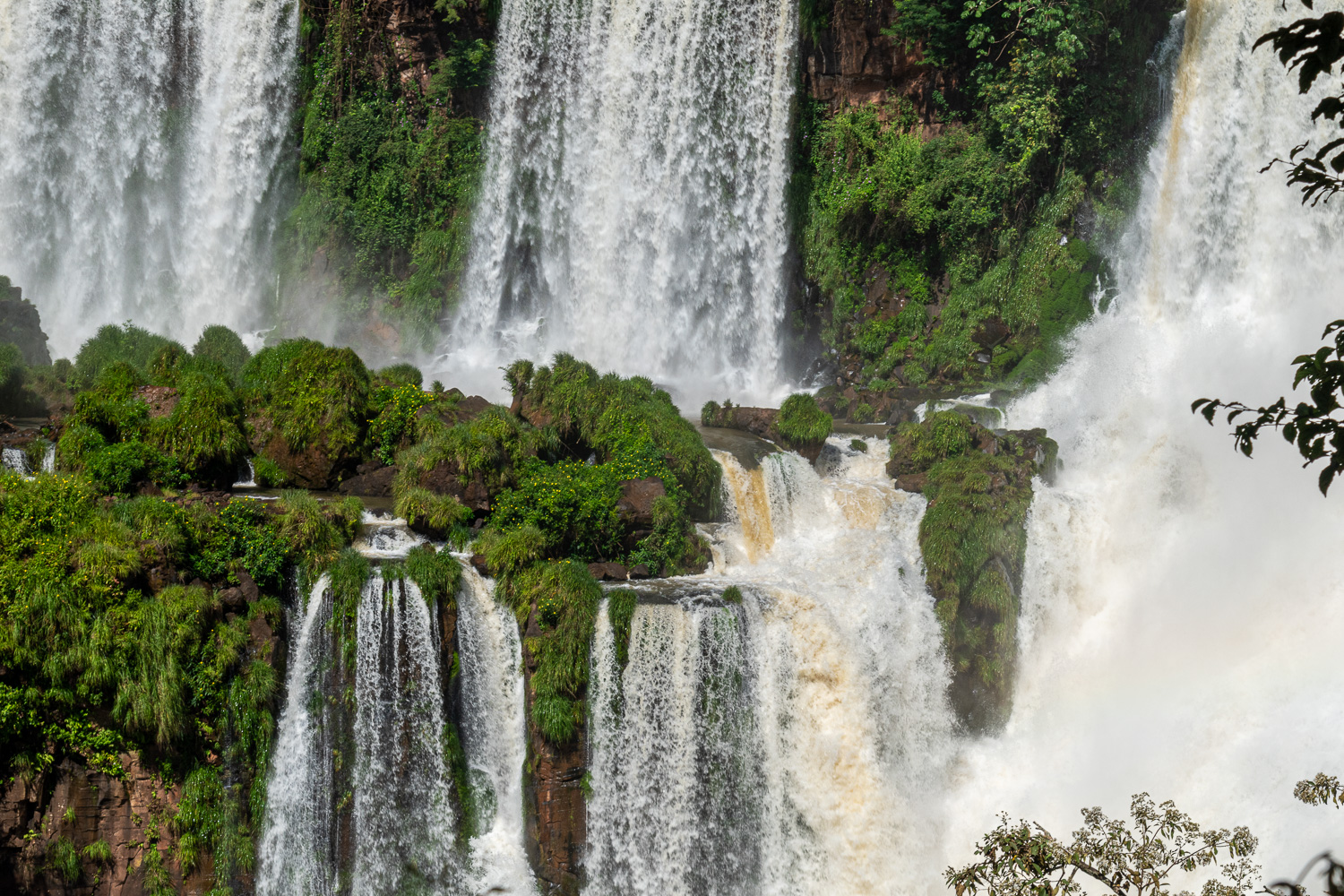
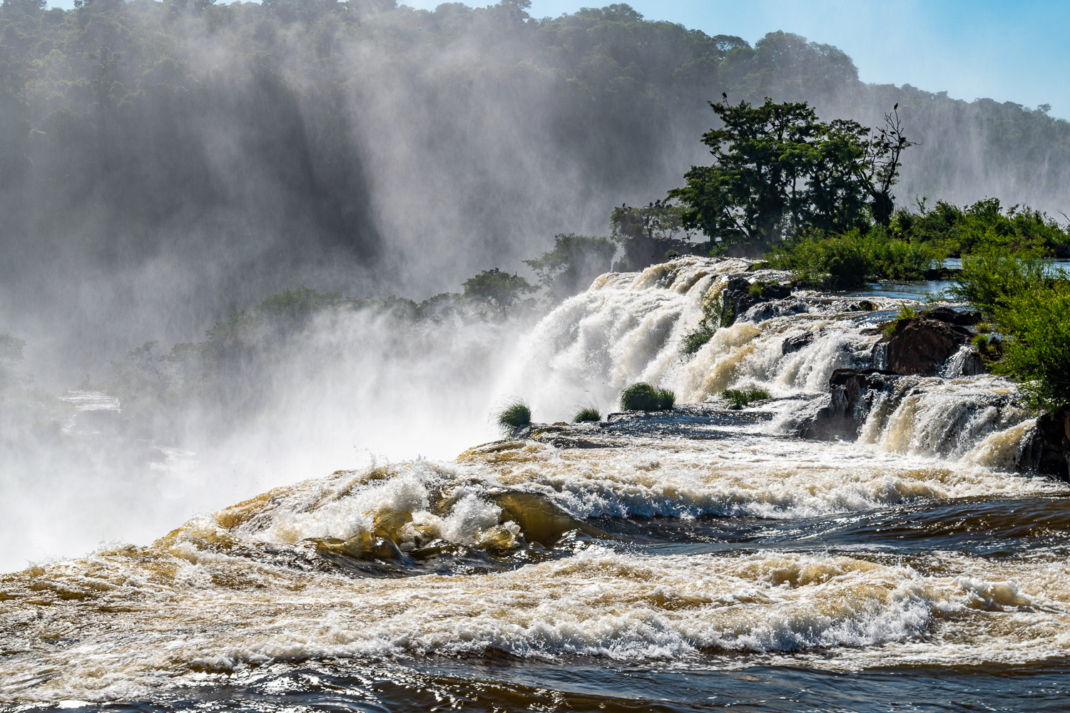
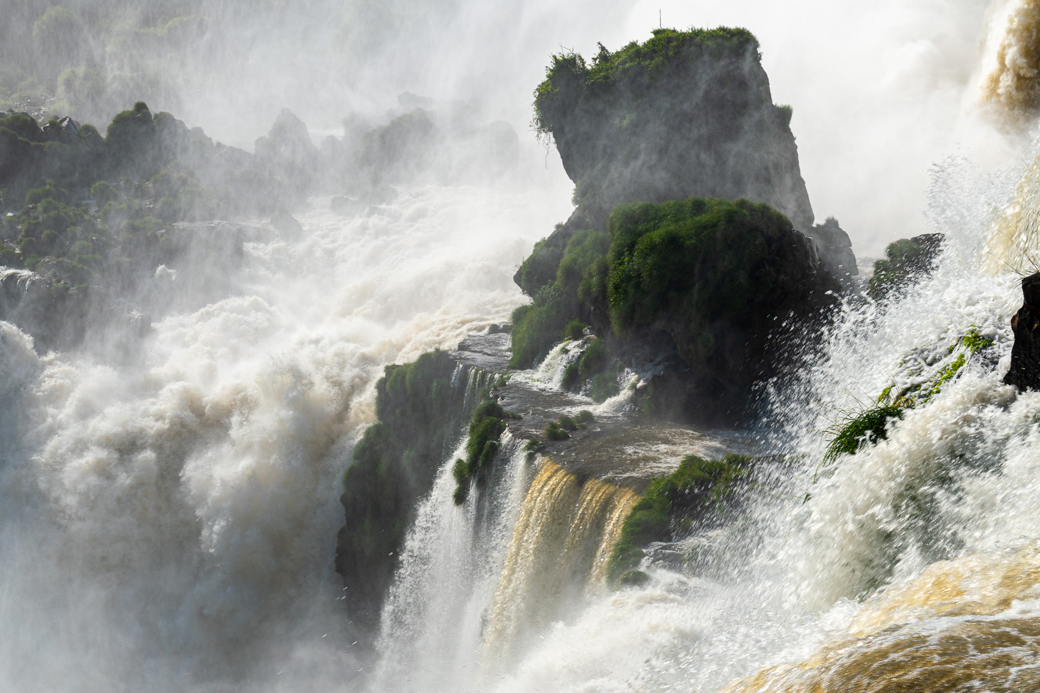
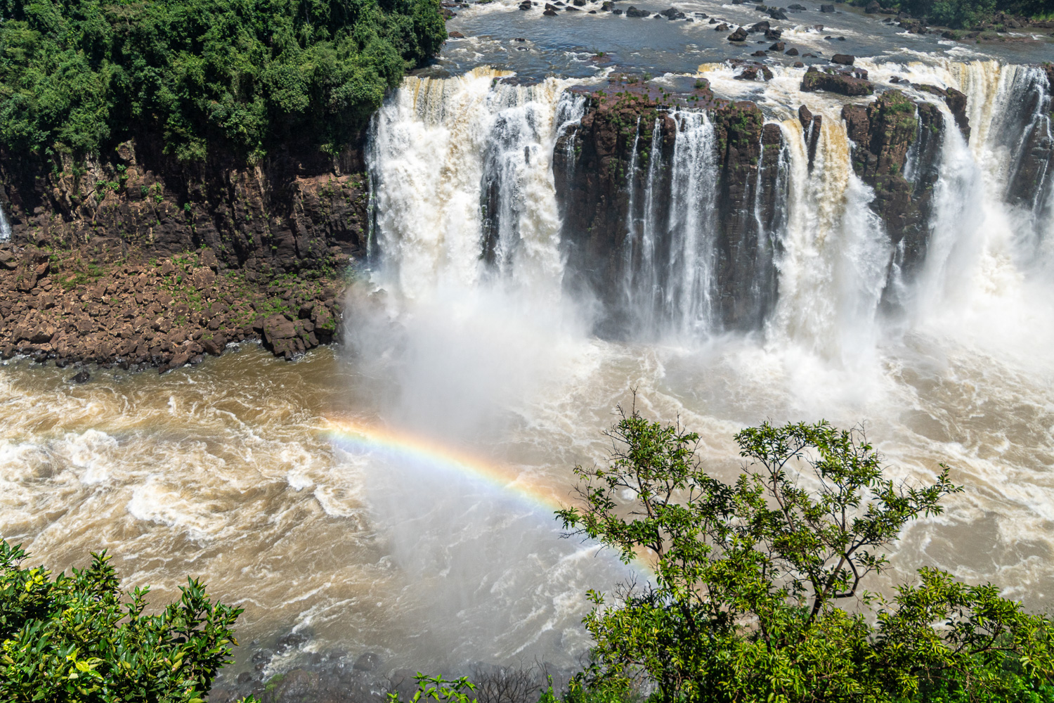
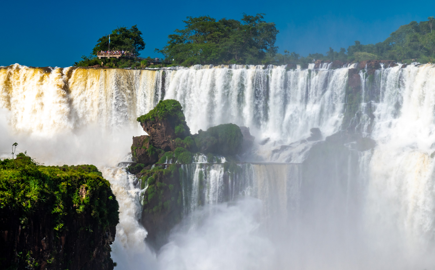
Iguazú Falls, Brazil & Argentina
Iguazú Falls are waterfalls of the Iguazu River on the border of the Argentine province of Misiones and the Brazilian state of Paraná. Together, they make up the largest waterfall system in the world. The falls divide the river into the upper and lower Iguazú. The falls can be explored from both the Brazilian and Argentinian sides.
Declared a World Heritage site by UNESCO in 1984, it is often revered as the world’s most spectacular waterfall. Iguazú Falls spans 1.7 miles in width, and features 275 individual waterfalls, with heights ranging from 196-270 feet.
On the day we arrived we visited the smaller Brazilan Falls in the afternoon. We then spent most of the next day exploring the larger Argentinian falls.
Iguazú Falls is one of the ‘New 7 Wonders of Nature’, and justifiable so – the scale and power of these falls is simply awesome, and no single photograph can capture this. Here are a selection of images that hopefully can convey some of the wonder that we were so lucky to witness.
Rio de Janeiro, Brazil
Rio de Janeiro is a huge seaside city in Brazil, famed for its Copacabana and Ipanema beaches, 125 ft high Christ the Redeemer statue atop Mount Corcovado and for Sugarloaf Mountain, a granite peak with cable cars to its summit. The city is also known for its sprawling favelas (shanty towns) and raucous Carnival festival.
A 2-night stay in this fascinating and very hot (35 deg C) city was our last stop before heading home. Here are some of the highlights.
Sugarloaf Mountain is a peak situated at the mouth of Guanabara Bay on a peninsula that juts out into the Atlantic Ocean. Rising 1,299 ft above the harbour, the peak is named for its resemblance to the traditional shape of concentrated refined loaf sugar. It is known worldwide for its two-stage cableway and panoramic views of the city and beyond. Sugarloaf Mountain became part of a UNESCO World Heritage Site in 2012.
Sugarloaf is one of several monolithic granite and quartz mountains that rise straight from the water’s edge around Rio de Janeiro.
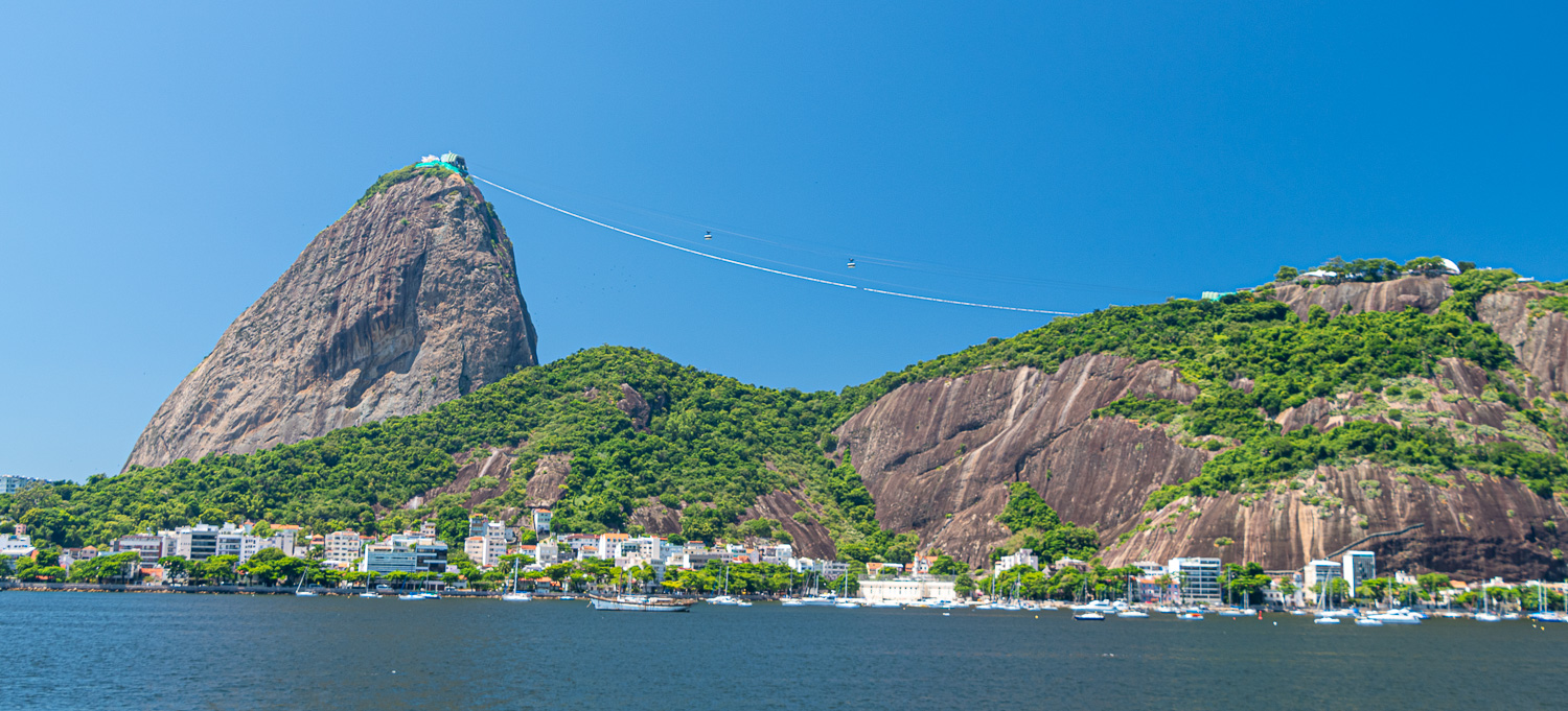 View from across the bay of Sugarloaf Mountain, on the left, and the second stage cable car. The green covering at the top of the mountain is building works for a new zip line attraction!
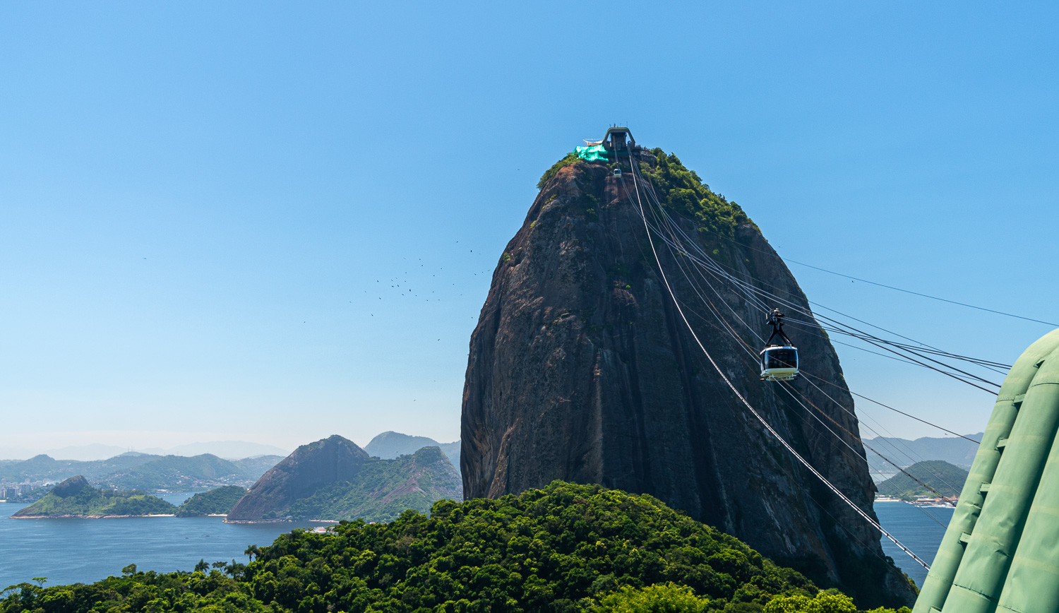 The second cable car up to the peak. The cable car was opened in 1912, and was the first in the world.
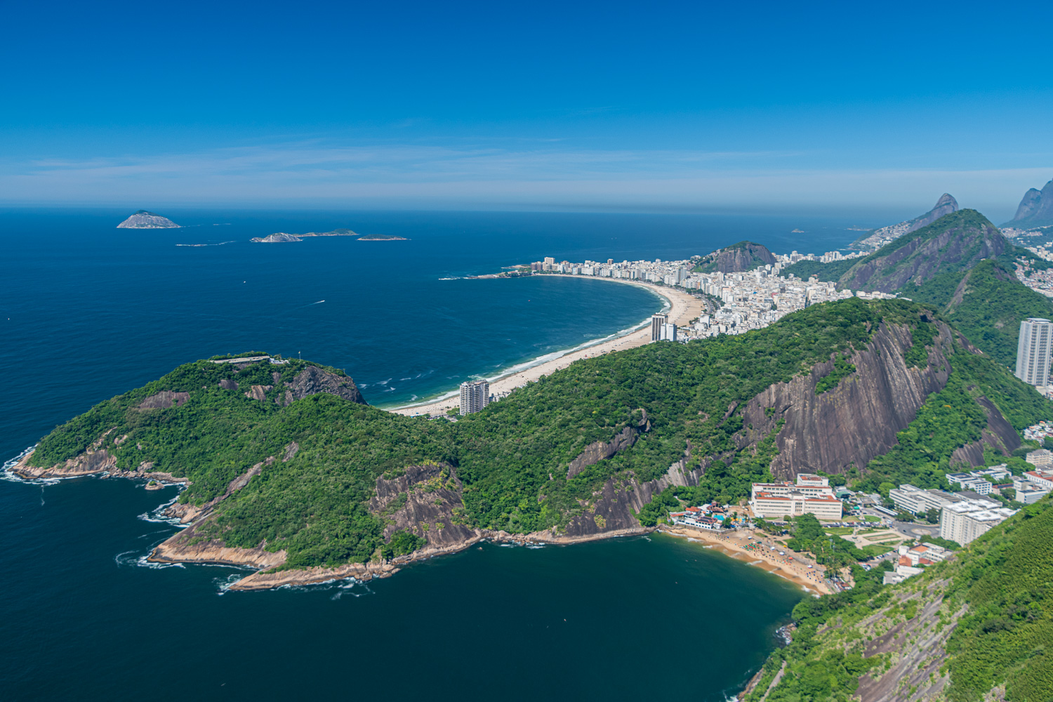 The long sweeping golden sands of Copacabana Beach
 The Christ the Redeemer monument looks down upon the city and lagoon
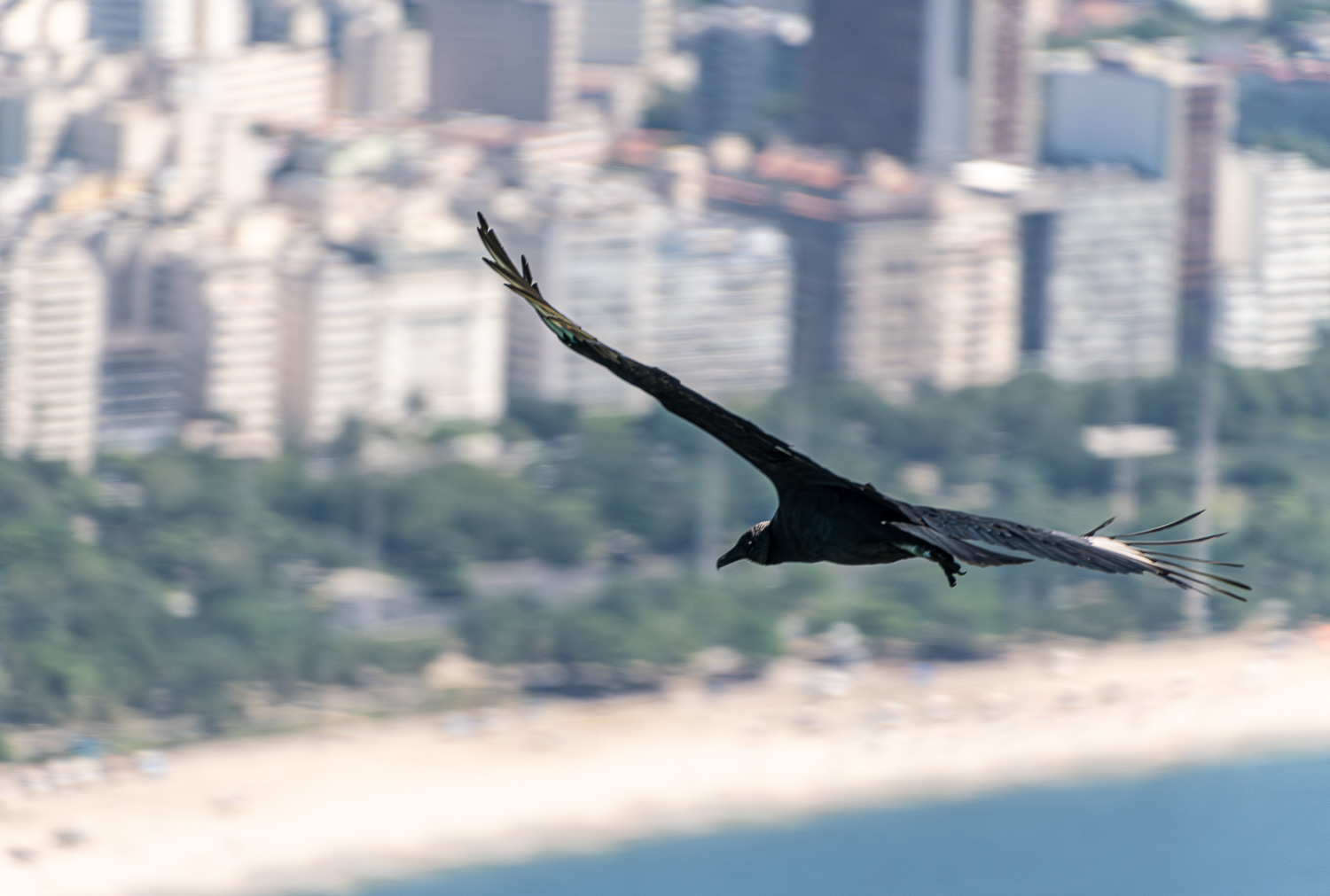 Black vultures glide around the mountain peak overlooking the city
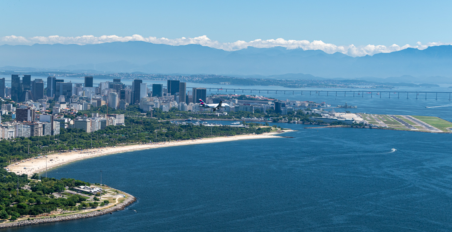 An aircraft makes a steep turn over the city on its approach to the domestic airport, which like many parts of the city has been built on reclaimed land
Favelas (‘slum’ or ‘shanty town’ in English) first appeared in the late 19th Century, built by displaced soldiers and later occupied by homeless former slaves. Favela growth reached a peak in the 1970s when many people moved from the countryside to the cities to take advantage of the economic growth of the country. Many, having no place to live and little money, moved into favelas. The word ‘favela’ comes from the name of a tree in Bahia that is known to irritate the skin after touching it. The soldiers that originally built the favelas came from Bahia and named the first favela after this tree, unknowingly creating the name that people would use for years to come.
While there are Rio favelas which are still essentially ruled by drug traffickers or by organized crime groups called milícias (Brazilian police militias), all of the favelas in Rio’s South Zone and key favelas in the North Zone are now managed by Pacifying Police Units, known as UPPs. While drug dealing, sporadic gun fights, and residual control from drug lords remain in certain areas, Rio’s political leaders point out that the UPP is a new way forward after decades without a government presence in these areas. However, it appears that funding for this initiative is dwindling and some of the UPPs are now being controlled by the gangs.
 The box-shaped, flat-roofed makeshift homes, stacked upon each other on the hillside, can be seen filling every spare area between the peaks and the more affluent developed areas.
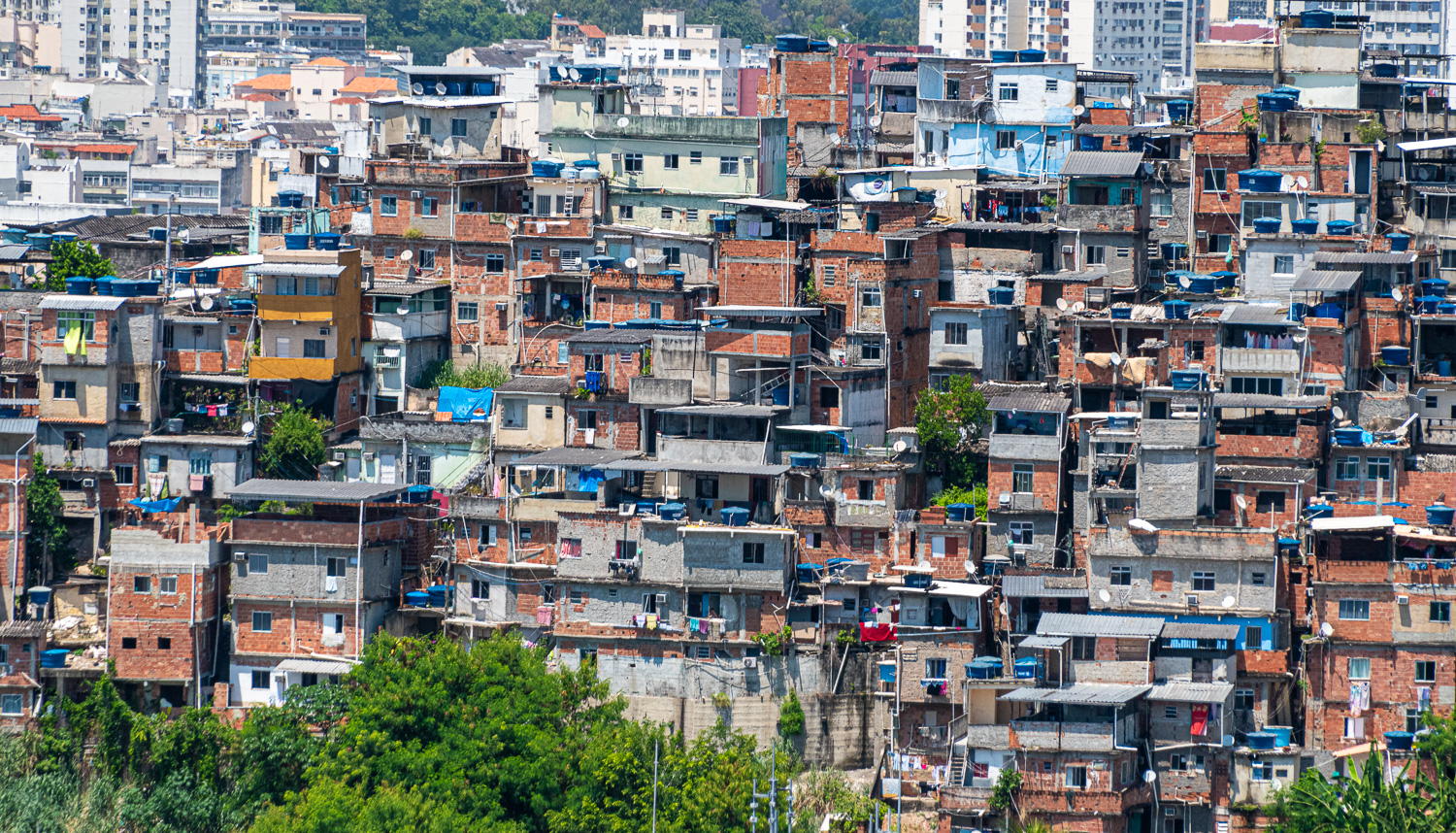 These flimsy built dwelings can be 4 ot 5 storeys high
We then headed into the city to visit the extraordinary Metropolitan Cathedral of Saint Sebastian. The New Cathedral, as it is sometimes called, was built in 1979 and is located in the centre of the city. It is conical in form with a 315 ft internal diameter and an overall height of 246 ft. Inside, the area has seating for 5,000, with a standing-room only capacity for 20,000 people. However, the stunning feature of this cathedral is its four rectilinear stained glass windows, which soar 210 ft from floor to ceiling. Joining the four stained glass panels is a glass cross in the roof.
 View of the conical shaped cathedral from Corcovado Mountain
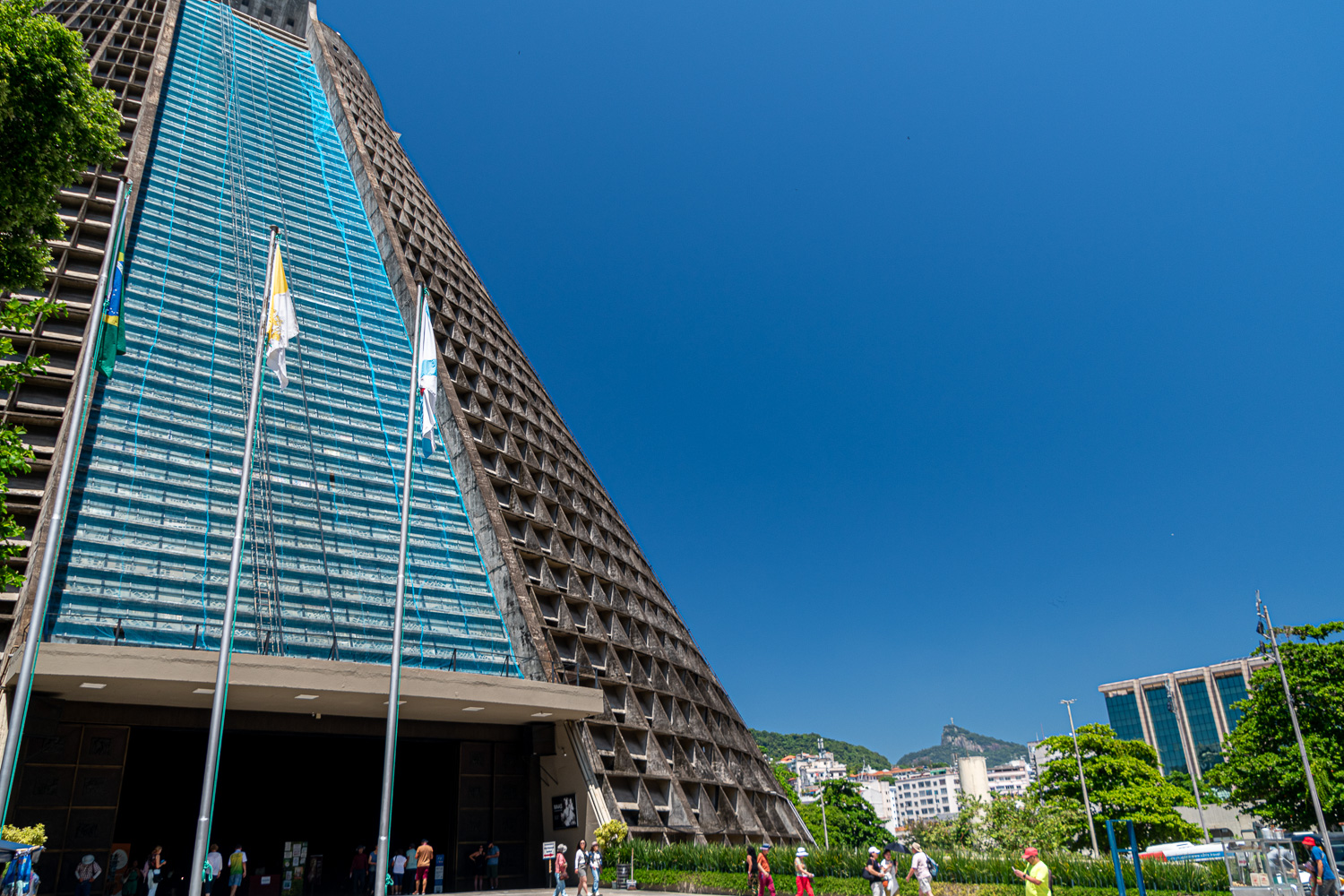 The entrance to this huge concrete structure
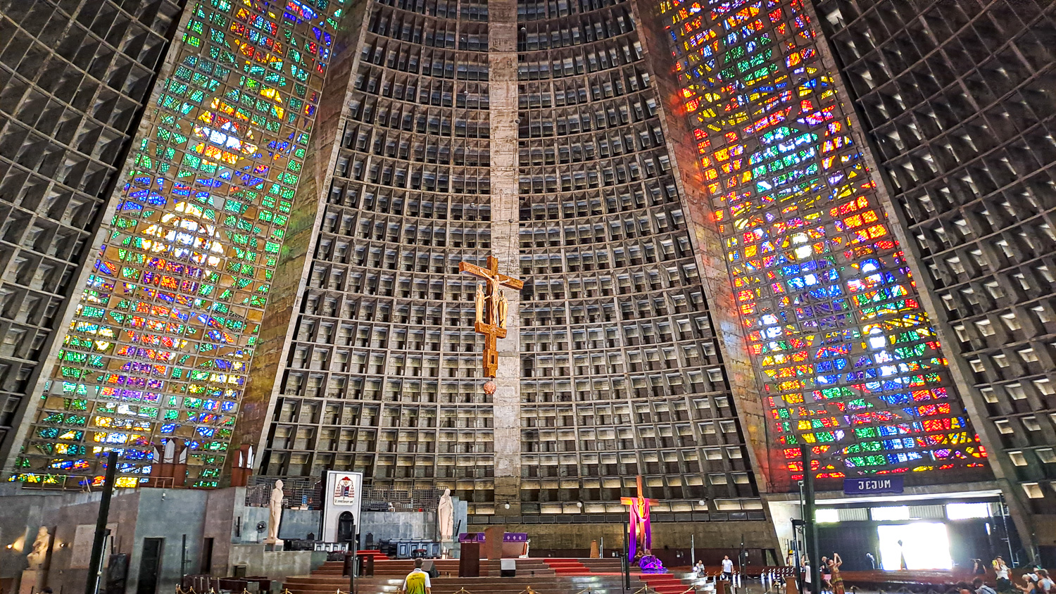 Two of the wonderful stained glass windows
We then took a funicular train up the 2,300 ft granite peak of Corcovado Mountain, to be face-to-face with the most famous monument in all of South America, Christ the Redeemer, who stands atop the peak amidst sensational views of the mountains and beaches of Rio. This is the most visited tourist attraction in Brazil.
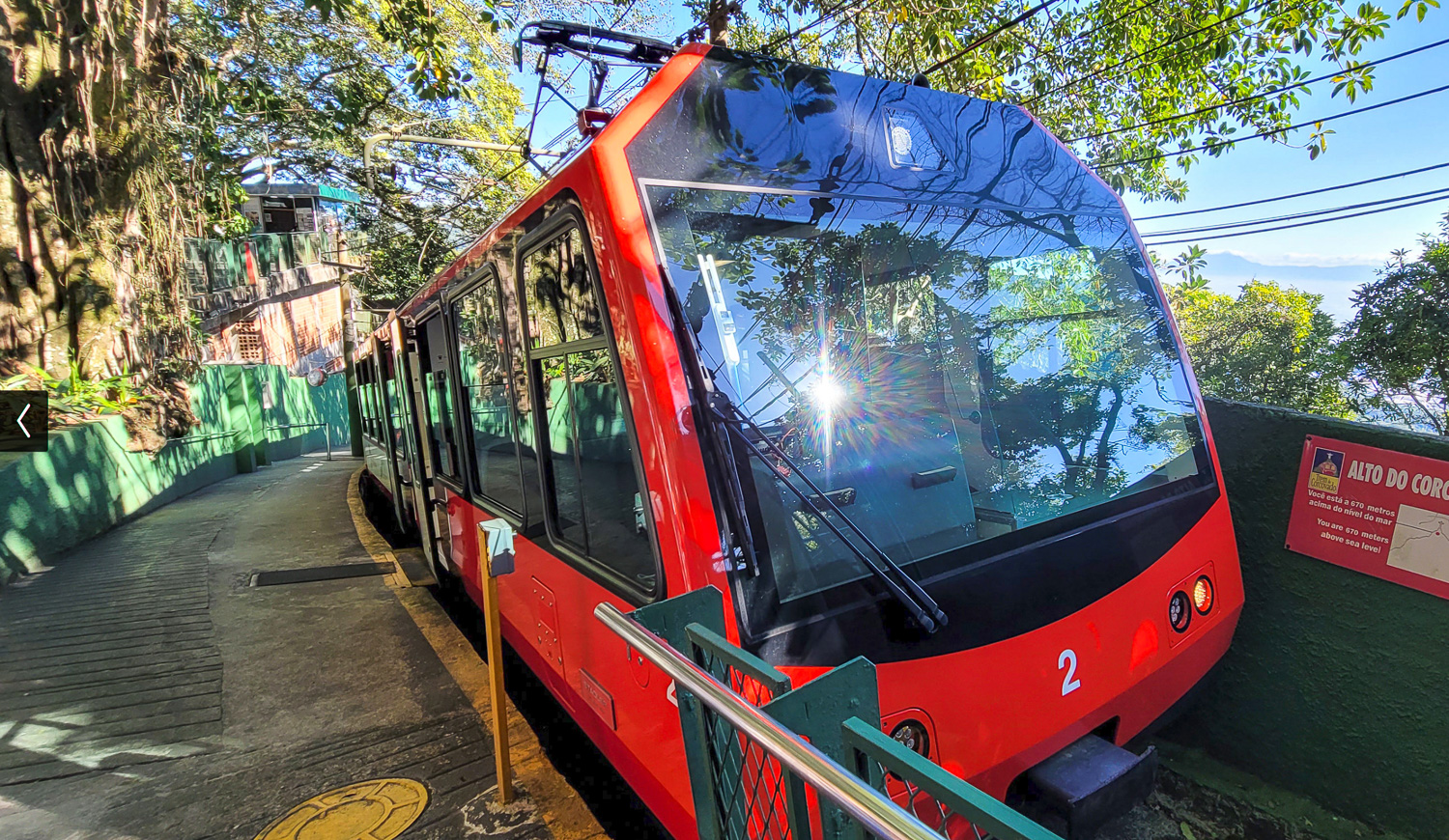 The funicular train takes 25 minutes to reach the summit.
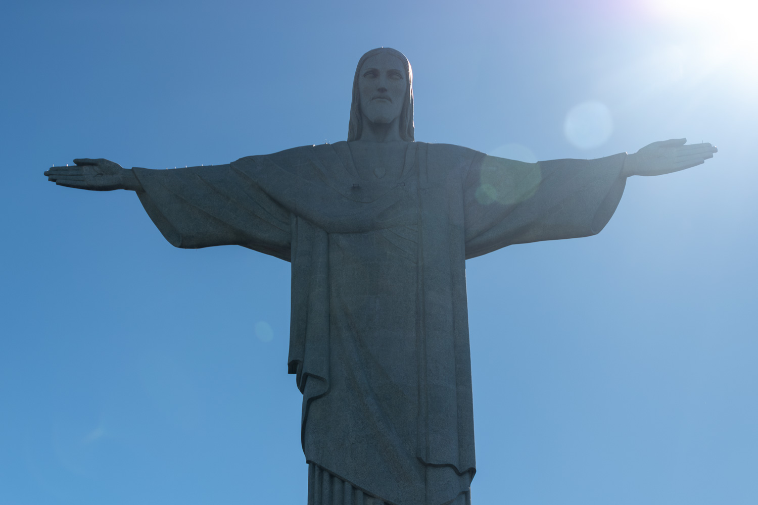 The statue was completed in 1931 and stands 98 feet tall, its horizontally outstretched arms spanning 92 feet. The statue has become emblematic of both the city of Rio de Janeiro and the whole nation of Brazil.
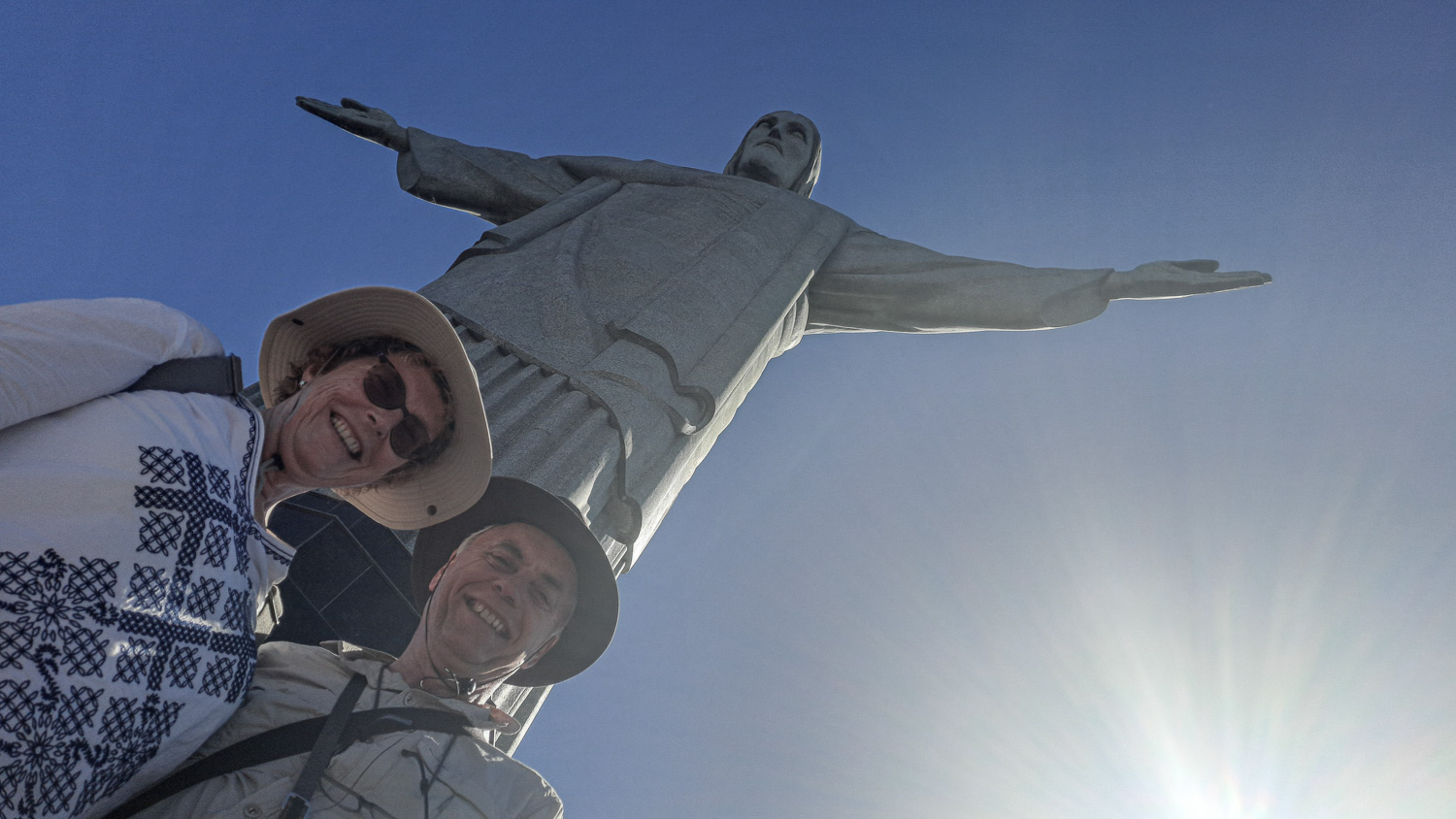 Our guide was lying on the ground to take this photo!
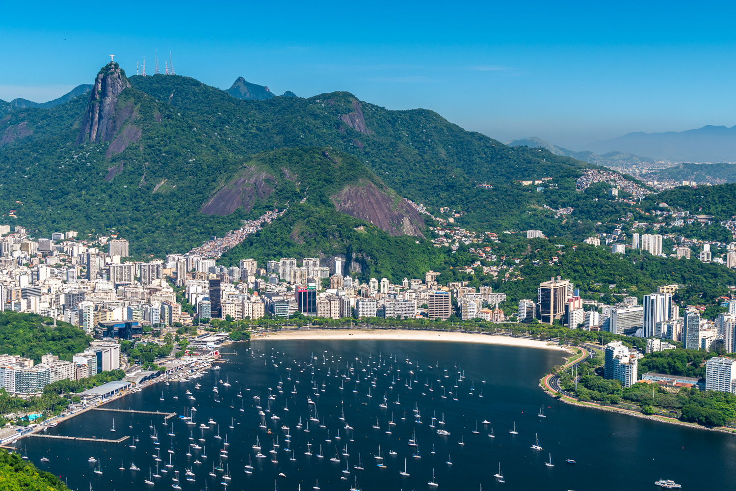
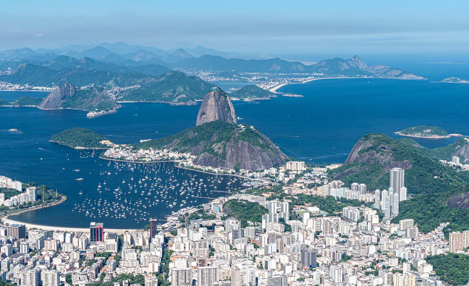 View across the city and lagoon to Sugarloaf Mountain
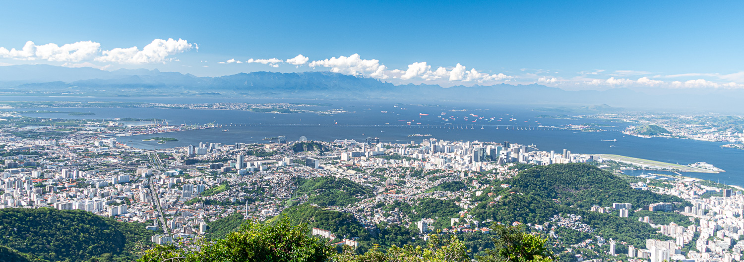 This panorama shows the 8-mile long Rio–Niterói Bridge spanning Guanabara Bay, connecting the cities of Rio de Janeiro and Niterói. It is currently the second longest bridge in Latin America. Its central span is 236 ft high in order to allow the passage of hundreds of ships entering and leaving the bay every month.
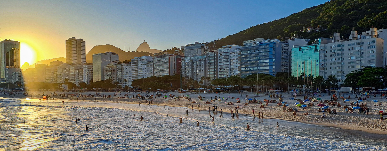
Our hotel was located at one end of the famous Copacabana Beach. Famed for its crescent-shaped 2.2 mile long beach, Copacabana is one of Rio’s liveliest neighbourhoods, drawing a cross-section of locals and visitors to round-the-clock activity along its sands and mosaic-tiled promenade.
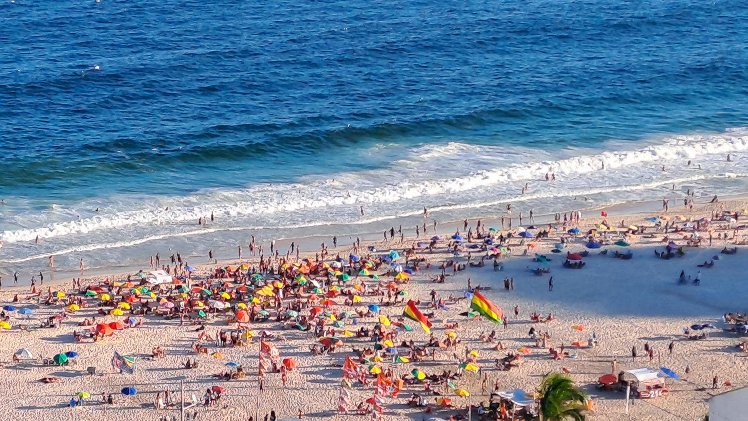 View of Copacabana Beach from the hotel roof-top bar
 The beach is still busy as the sun sets in the early evening – the Christ the Redeemer can be seen in the far distance
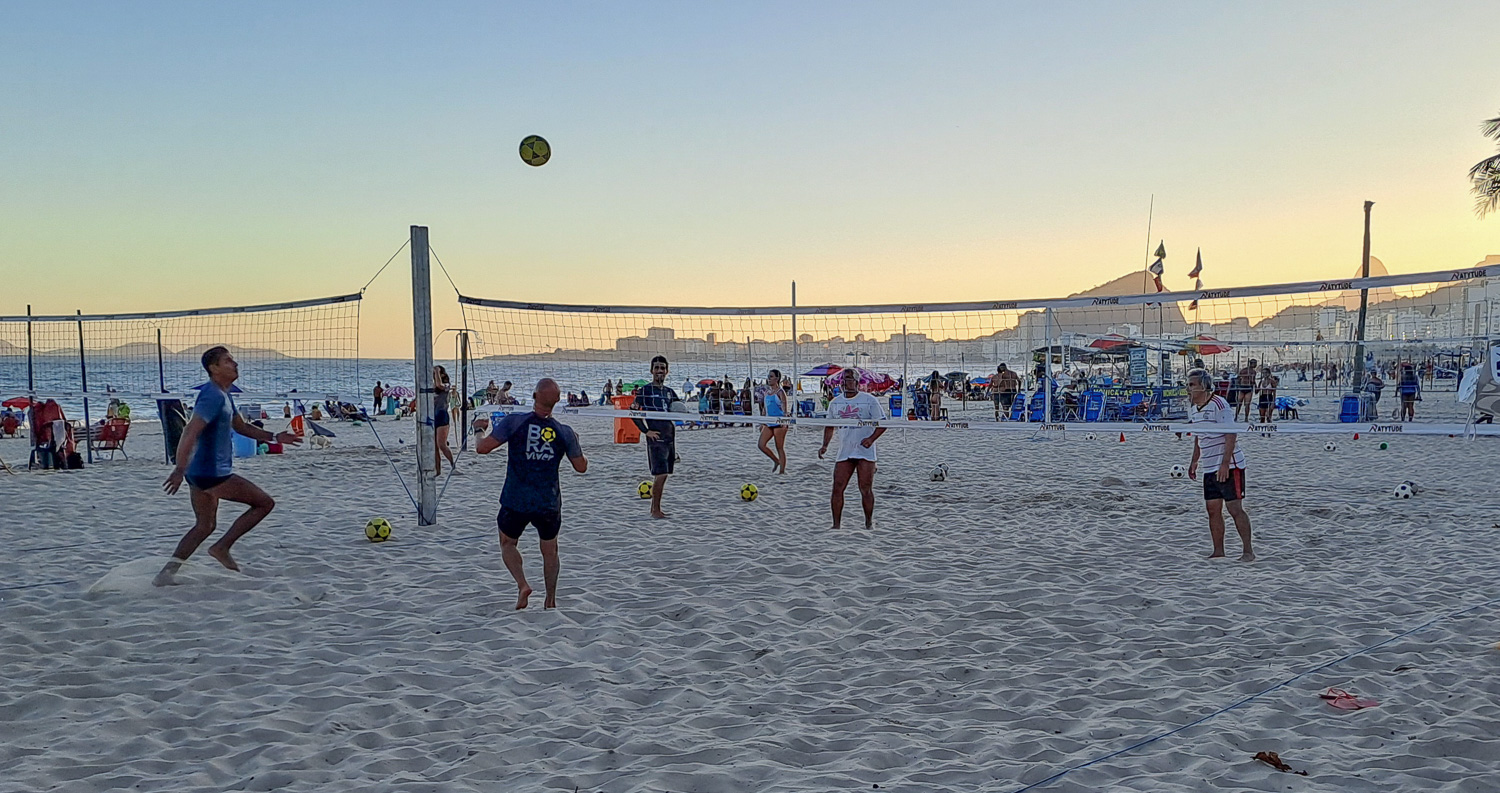 This is the beach sport that is becoming very popular, replacing the traditional volley ball. The very acrobatic game of Foot-Volleyball (Futevôlei) is a union of football and volleyball. The ball needs to pass to the other side of the net with the help of any part of the body except the arms, forearms, and hands as in football.
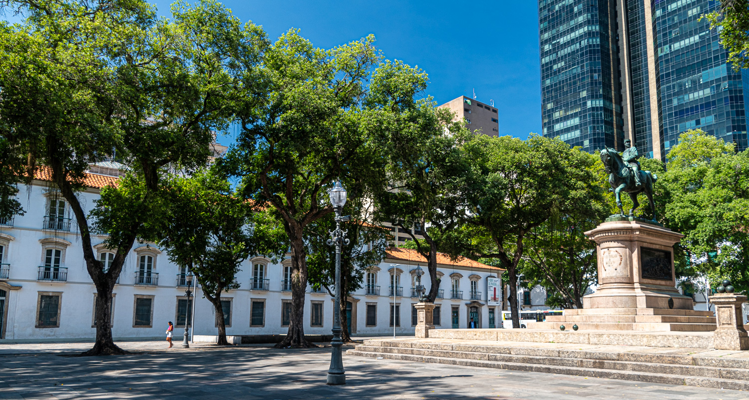
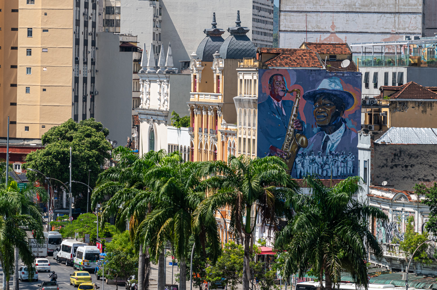
During the morning of the second day we explored different areas of the city centre and outlining areas.
 The Old Cathedral of Rio de Janeiro dedicated to Our Lady of Mount Carmel, served as the cathedral of the city from around 1808 until 1976. During the 19th century, it was also used as a Royal and Imperial Chapel by the Portuguese Royal Family and the Brazilian Imperial Family.
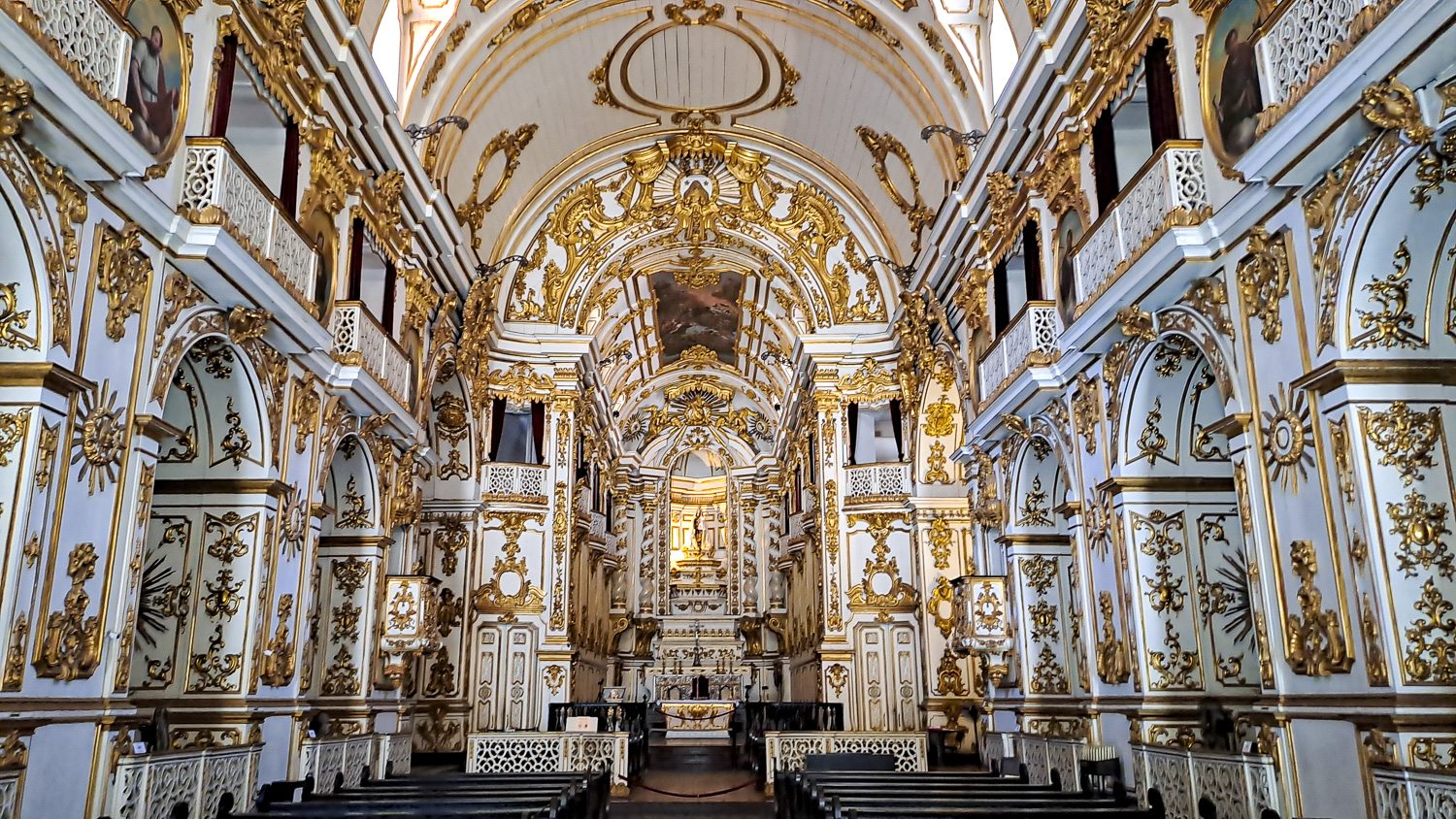 The stunning inside of the Old Cathedral
 The old port area was a military barracks where the Portuguese Royal Family originally lived when they fled Europe following the threat from Napoleon in 1807
Santa Teresa – With its cobbled streets and turn-of-the-century homes on the hill overlooking Guanabara Bay, this colourful neighbourhood is home to many of Rio’s artists, musicians and poets, and is one the most picturesque areas in the city.
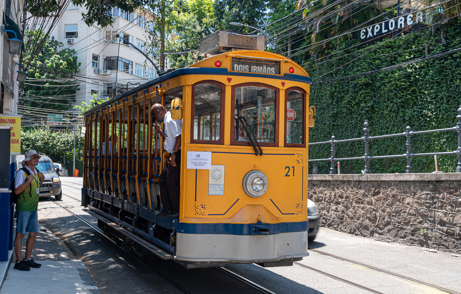 One of the best ways of visiting Santa Teresa is on the old tram, which was first operated in 1859, when it was pulled by donkeys. It starts in downtown, travels across the city’s famous Carioca Aqueduct, before climbing the narrow streets to Santa Teresa.
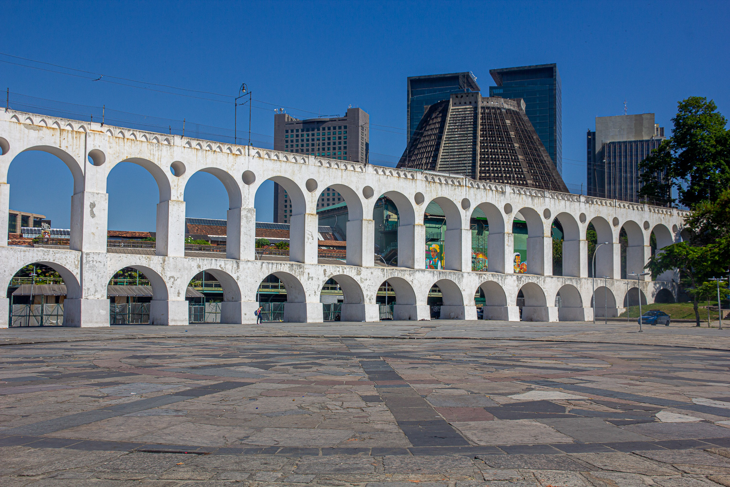 Carioca Aqueduct
 View from the old tram on top of the aqueduct
The ‘Escadaria Selarón’, also known as ‘The Stairs’, is a colourful, tile-lined stairway that links the neighbourhoods of Lapa and Santa Teresa. It was created by Jorge Selarón, an eccentric resident and ceramic artist. It took ten years to create, between 1990 and 2000, using tiles donated from around the world.
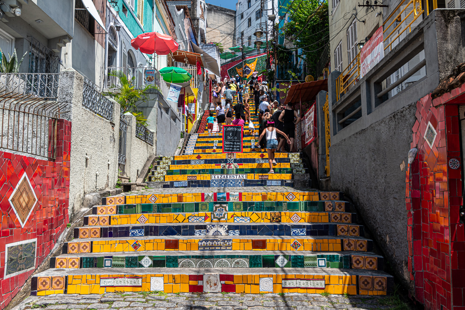 The Stairs are very busy and is the third most visited place in Rio, after Christ the Redeemer and Sugarloaf
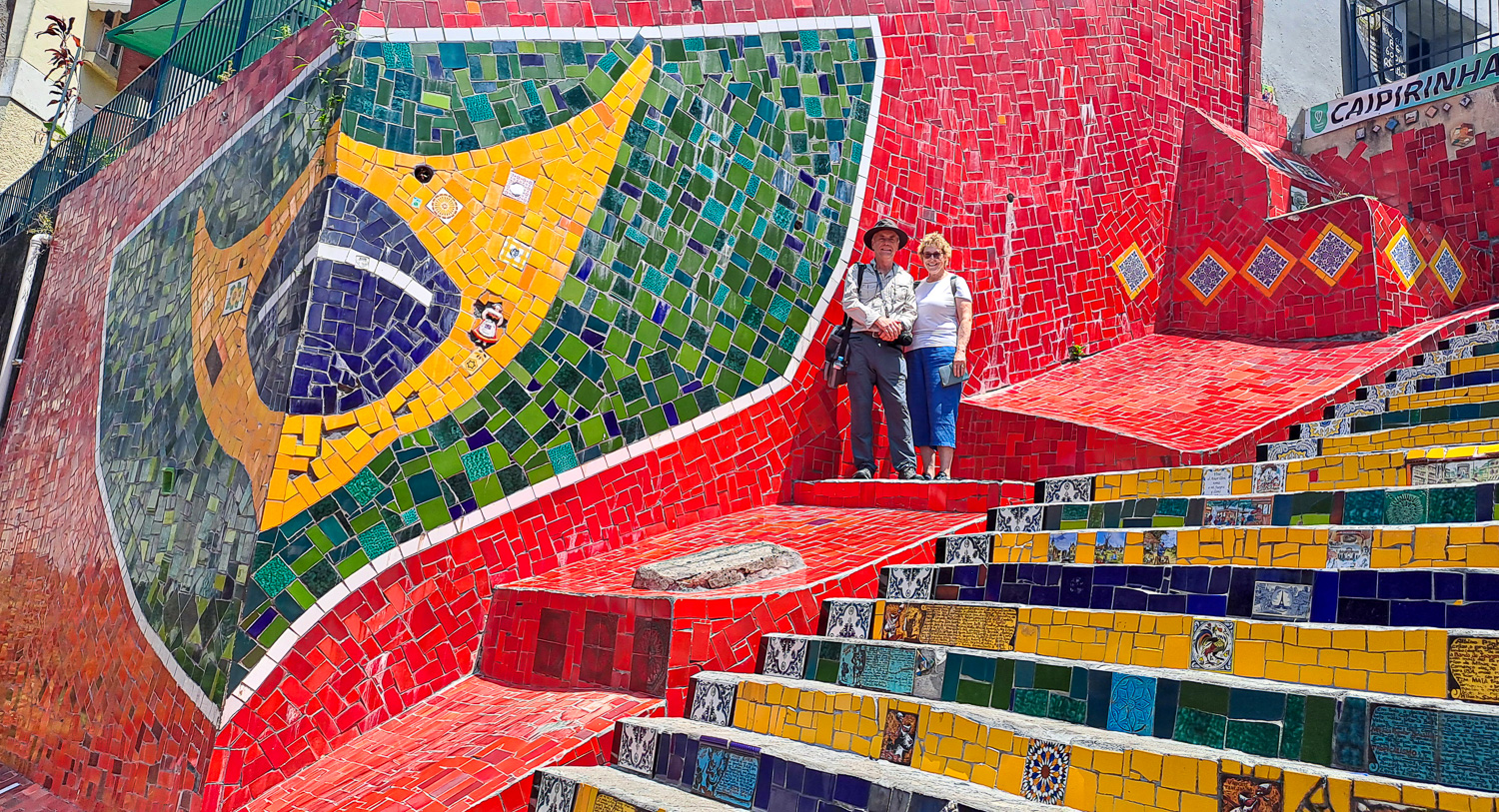 The Brazilian flag mural was added in 2010
Sadly that’s the end of a fabulous 2 months in Latin America as tomorrow we fly home. We hope to see you all in the very near future.
