Australia, the smallest continent and one of the largest countries in the world, lies between the Pacific and Indian oceans. Its capitol Canberra is located in the Southeast between the larger and more important economic and cultural centres of Sydney and Melbourne. This huge country extends from west to east for nearly 2,500 miles, yet has a population of only 27 million, which is predominantly located in coastal areas.
Australia has been called ‘the Oldest Continent,’ ‘the Last of Lands,’ and ‘the Last Frontier.’ It was the last continent, apart from Antarctica, to be explored by Europeans. At least 60,000 years before European explorers sailed into the South Pacific, the first Aboriginal explorers had arrived from Asia.
Our main focus in Australia is a 7-week road trip around Tasmania. After a stop-over in Singapore, our first stop was Melbourne.
Melbourne
Melbourne is the capital of the state of Victoria and is located at the head of Port Phillip Bay, on the Southeastern coast. The extensive metropolitan area, the world’s most southerly, has a population of more than 5 million and is the country’s second largest city.
Melbourne is Sporting capital of Australia, being home to the Australian Open, Melbourne Cup, the Australian Grand Prix and the AFL grand final. The city hosted the 1956 Summer Olympics, the first country outside of Europe and North America to do so.
Melbourne is widely known to have unpredictable weather where it can change from sunshine to rain and back again in an instant, often referred to having ‘four seasons in one day.’
Here are some highlights of the 3 days we spent in this delightful city:
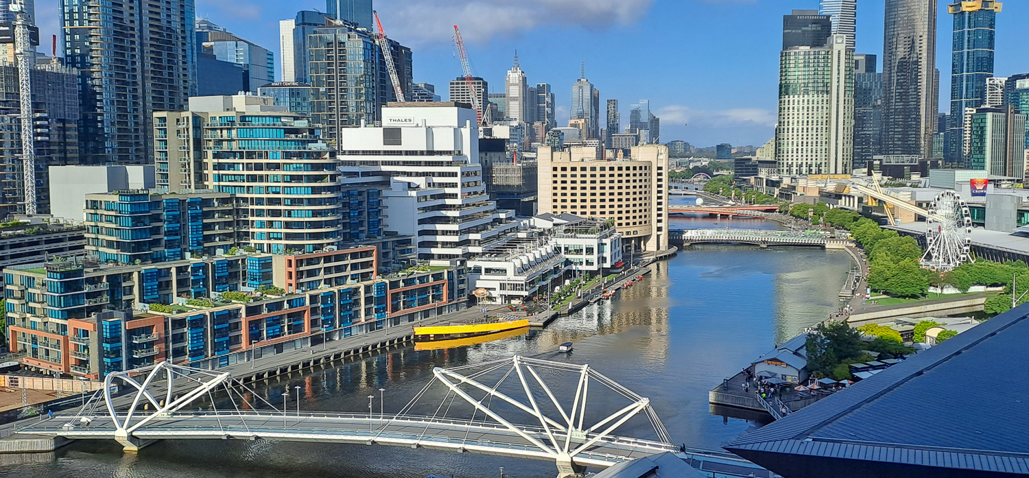 Part of Melbourne’s rich maritime history, the suburb of South Wharf now provides a popular location for dining, shopping and entertainment. This photo of South Wharf was taken from our Hotel window on the 10th floor!
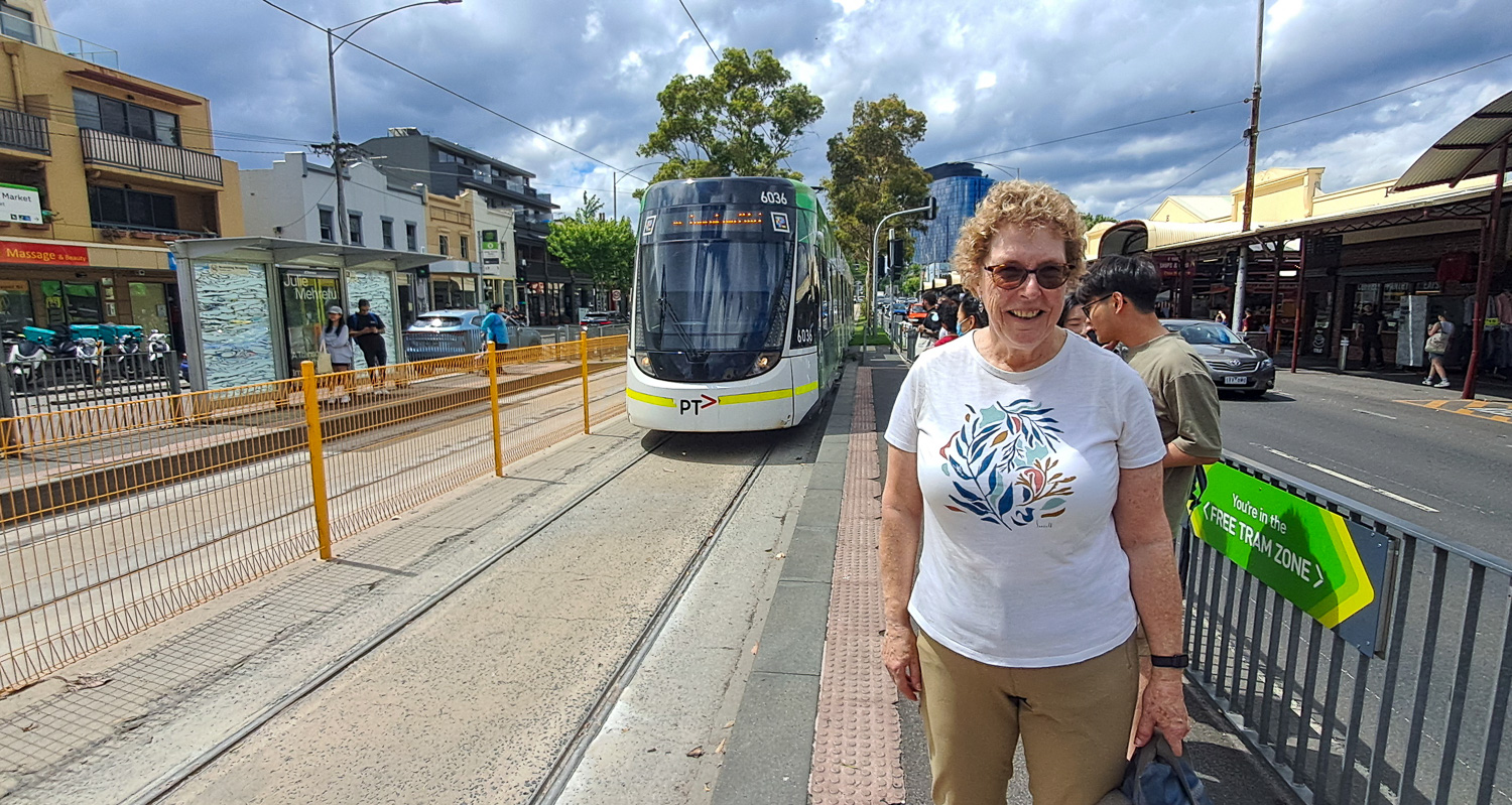 Trams – The tramway network is centred around the Melbourne central business district and consists of approximately 1,700 tram stops across 24 routes. In the centre of the city is the Free Tram Zone, in which everyone can ride the trams for free.
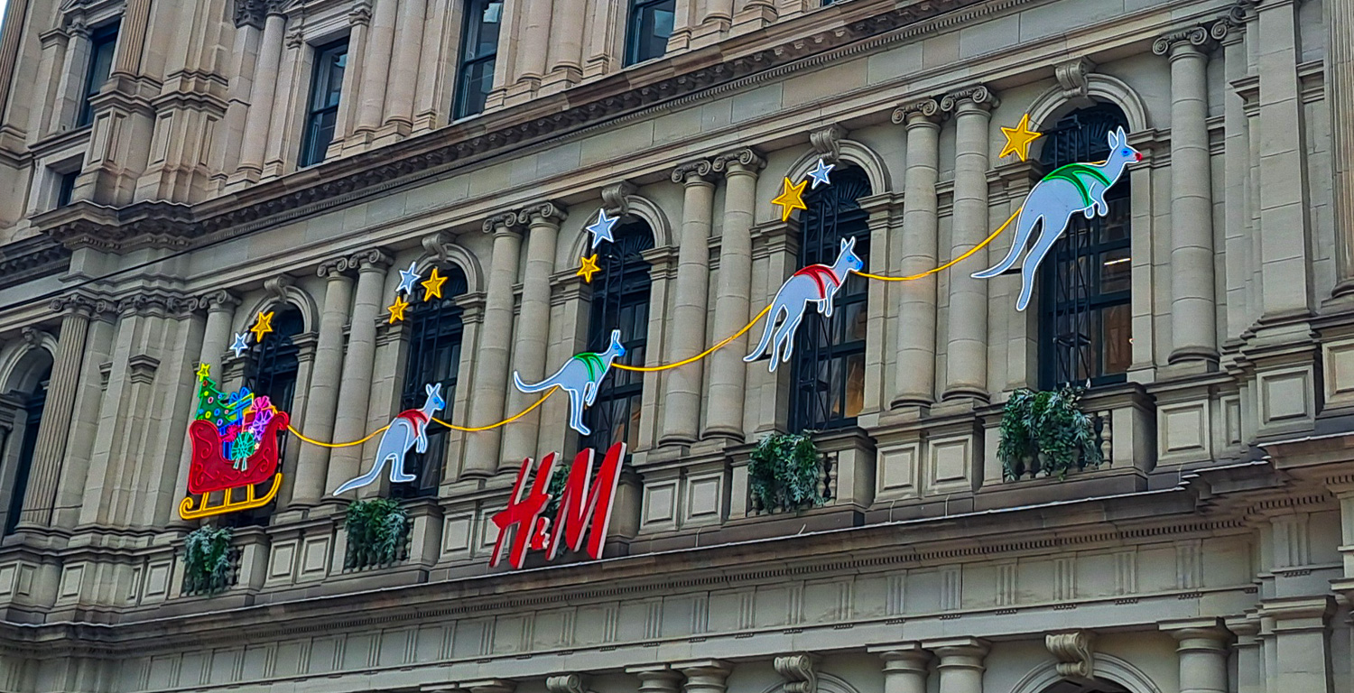 Melbourne at Christmas – The Australian version of Christmas doesn’t include Reindeers!
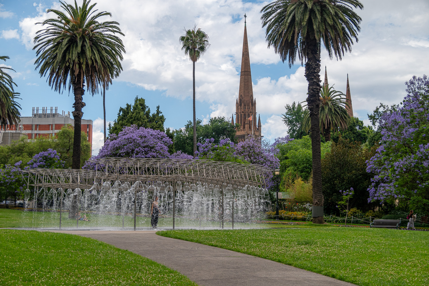 Coles Fountain – Located in Parliament Gardens, Coles Fountain is a striking counterpoint to the garden’s historical setting. Its stainless-steel tubing forms a geometrical frame some 10 feet high, from which water cascades into a shallow pool below. Walking inside the fountain provides respite on a hot day. The spires of St Patrick’s Cathedral can be seen in the background.
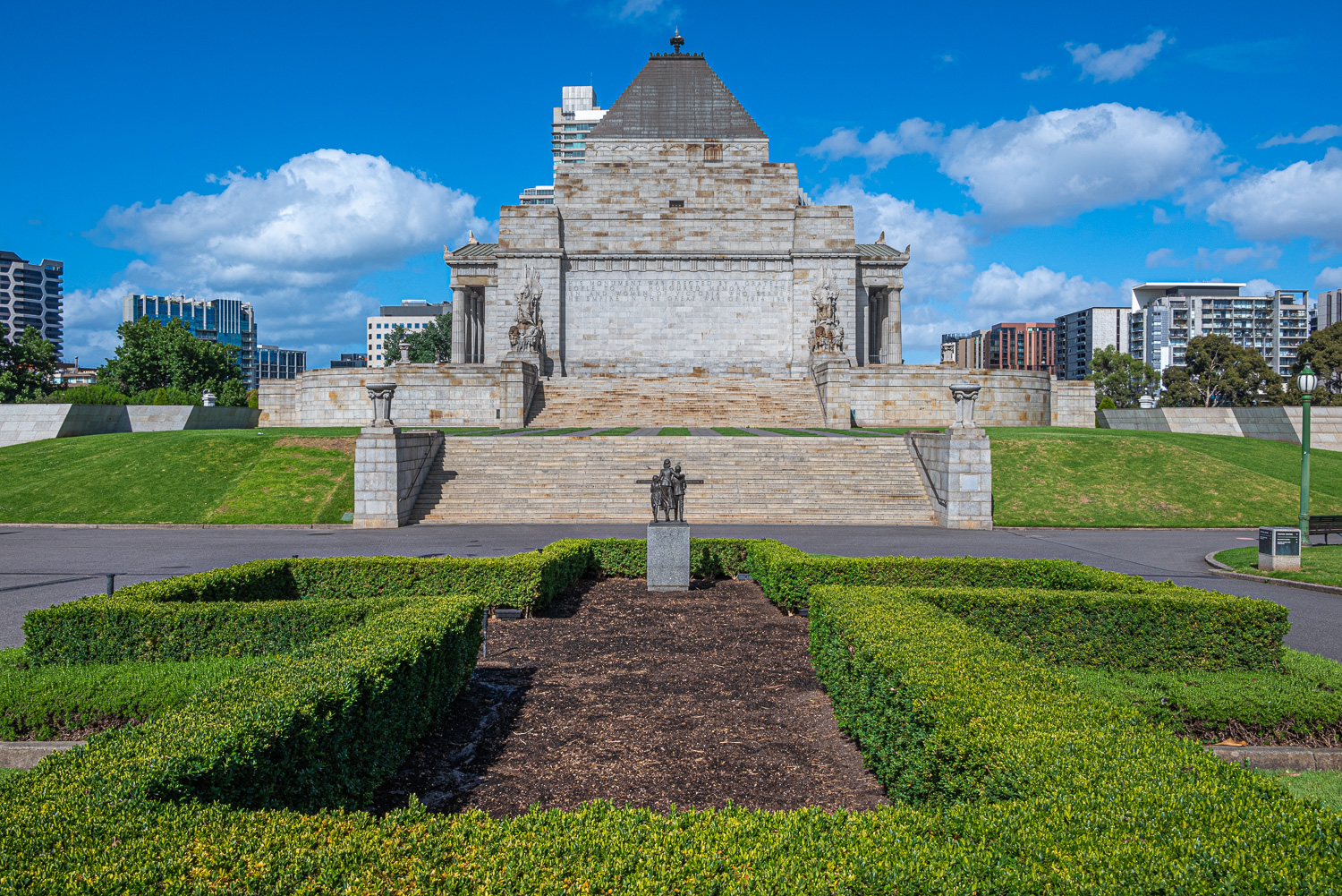
Shrine of Remembrance
The Shrine of Remembrance was built to honour the men and women of Victoria who served in World War I, but now functions as a war memorial to all Australians who have served in any war.
Galleries of Remembrance housed under the Shrine, explore over 800 objects, photographs, uniforms and works of art that illustrate the experiences of Australians at war and in peacekeeping operations from the 1850s to today.
This was an extraordinary building and experience.
 The Shrine was opened on 11 November 1934, and this year (2024) celebrated it’s 90th anniversary.
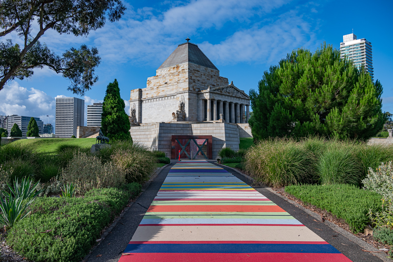 In recognition of it’s 90th birthday, the path to the main entrance was painted in multi-coloured stripes, called the Ribbon of Reflection. The walkway artistically represents the medals, and their colourful ribbons, awarded to those who have served.
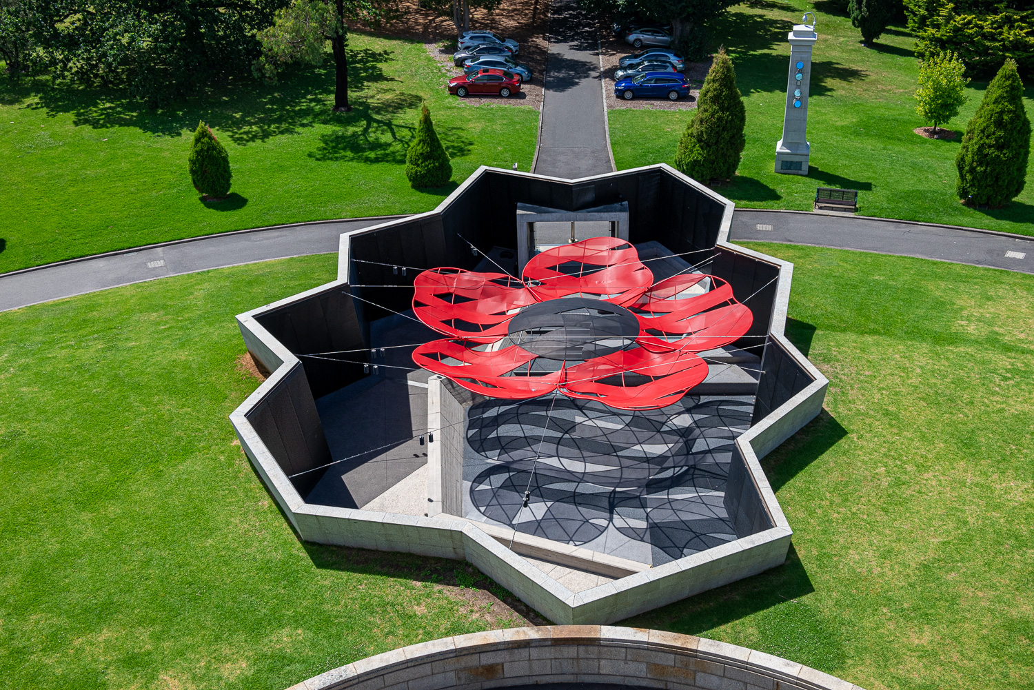 Later, four walled courtyards were installed surrounding the Shrine. Their jagged shape was an interpretation of the slit trenches of WWI. One courtyard houses a giant Poppy.
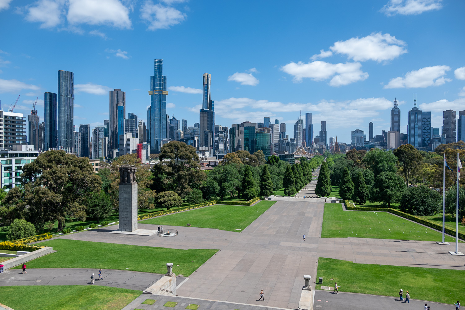 The view from The Balcony, at the top of the Shrine, provides unique perspectives of the Shrine and the more than 250 memorial trees and features of the 32-acre Shrine Reserve. Panoramic views of Melbourne highlight the Shrine’s prominent position and significance to all Australians.
In the foreground on the left is the Eternal Flame and the Cenotaph, a prominent structure with a sculpture that sits atop showing men in uniform from the 3 Australian services.
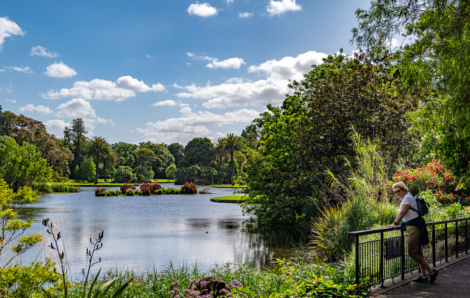
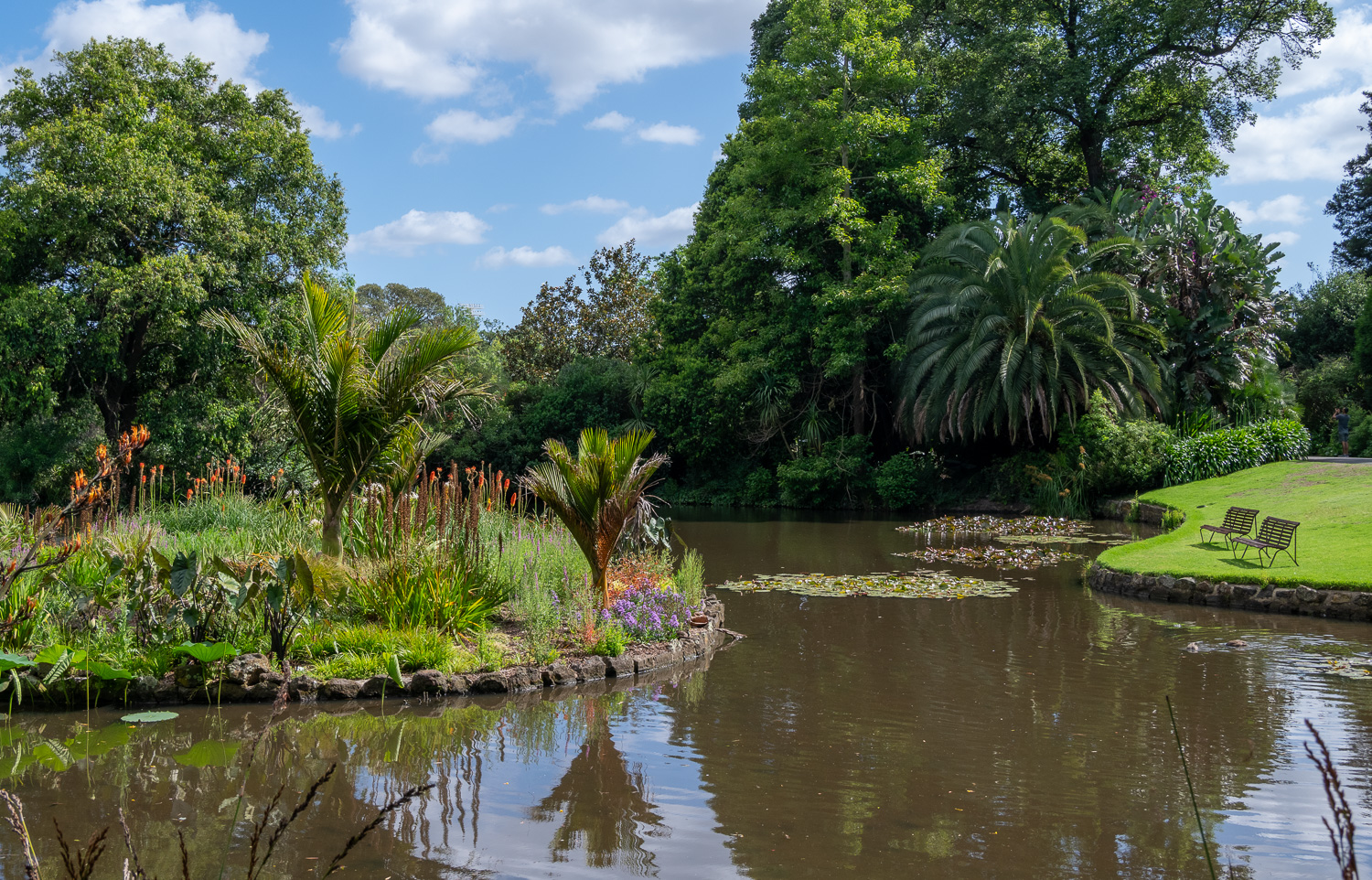
Royal Botanic Gardens Victoria
Attracting nearly 2 million visitors annually, the Gardens have been a part of the city’s cultural life for more than 170 years. With its stunning vistas, tranquil lakes and diverse plant collections, the Gardens are a place of delight. Here some of the flora and fauna we discovered whilst spending a lovely afternoon walking the Gardens:
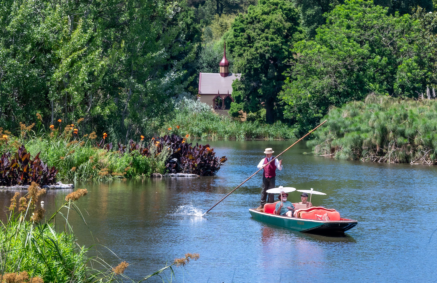 Punting on the Ornamental Lake – very English!
 One of the many great picinic spots!
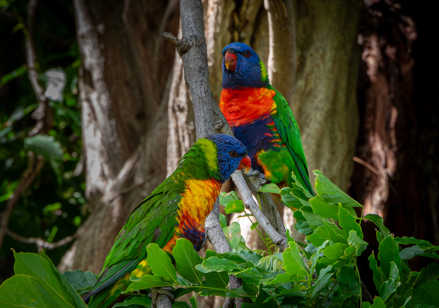 The Rainbow Lorikeet is a species of Parrot native to Australia. They mate for life and many pairs can be seen flying around the Gardens.
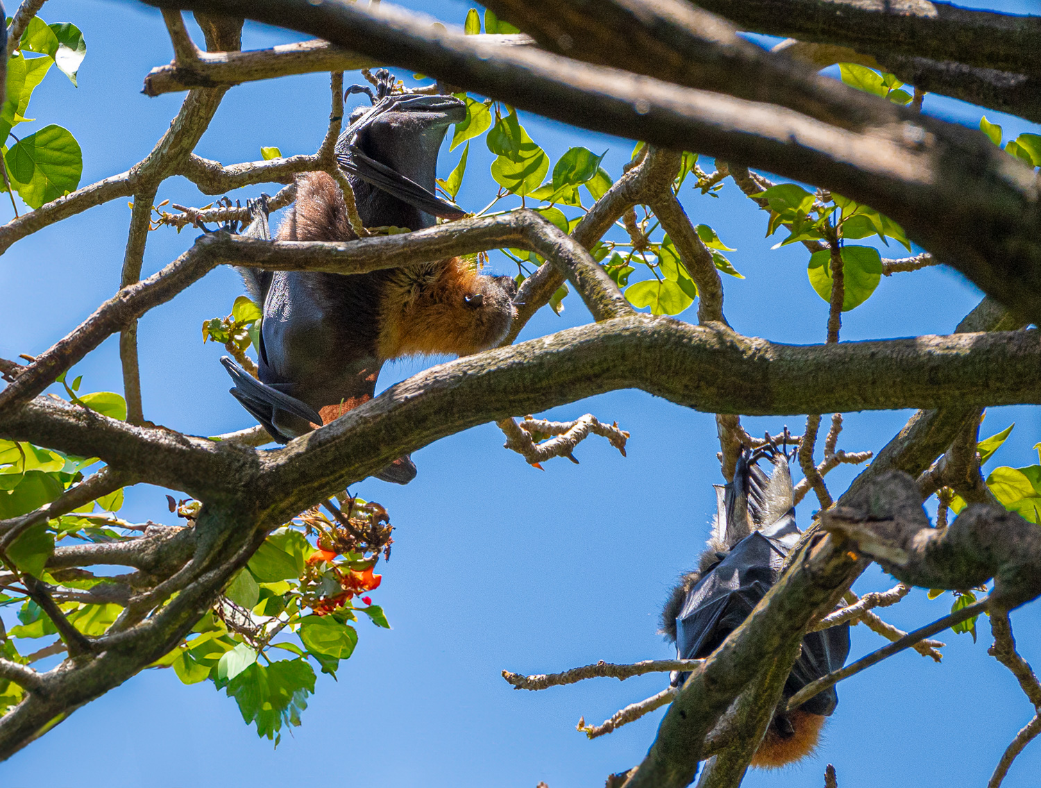 A colony of Flying Foxes nesting high up in the trees
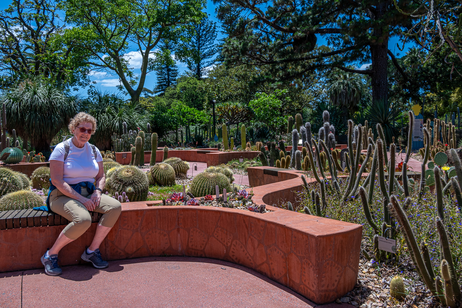 Charlotte enjoying a rest in the Arid Garden
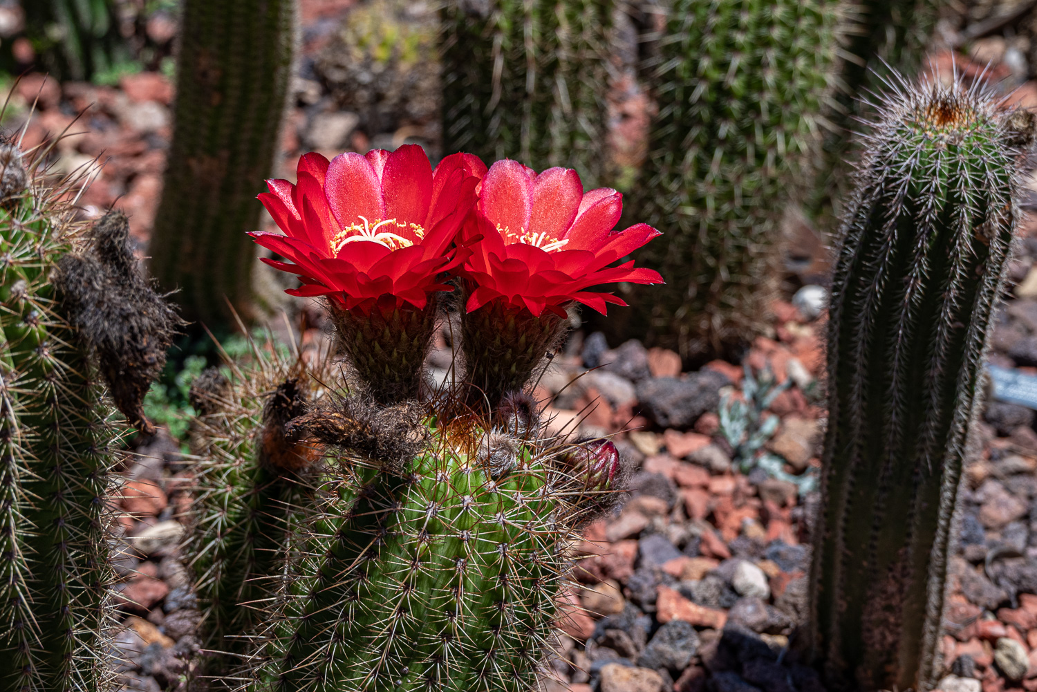 Red Torch Cactus – A columnar cactus with golden spines and bright red flowers
Great Ocean Road
Our last day in Melbourne was spent exploring the Great Ocean Road, a 170 mile stretch of scenic coastline, which provides breathtaking views of cliffs, beaches, and the famous Twelve Apostles.
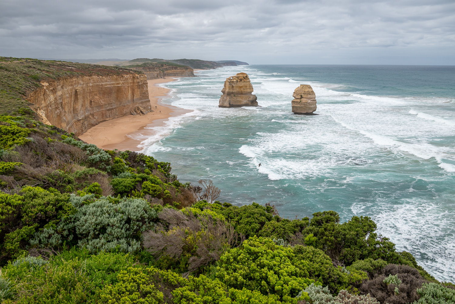
Our first stop was the Port Campbell National Park, which is famous for its incredible limestone formations that have found their form after millions of years of erosion. Whether it’s the unique and majestic 12 Apostles, the picturesque Loch Ard Gorge, this section of the Great Ocean Road is stunning and known as the shipwreck coastline.
 Gibson Steps – Gog and Magog are the names given to the two offshore stacks that may be viewed from both a cliff-top viewing platform and from beach level via the Gibson Steps. The 86 steps were carved into the cliff by local settler Hugh Gibson. These are not considered part of the 12 Apostles.
 View of Gog and Magog from the other side
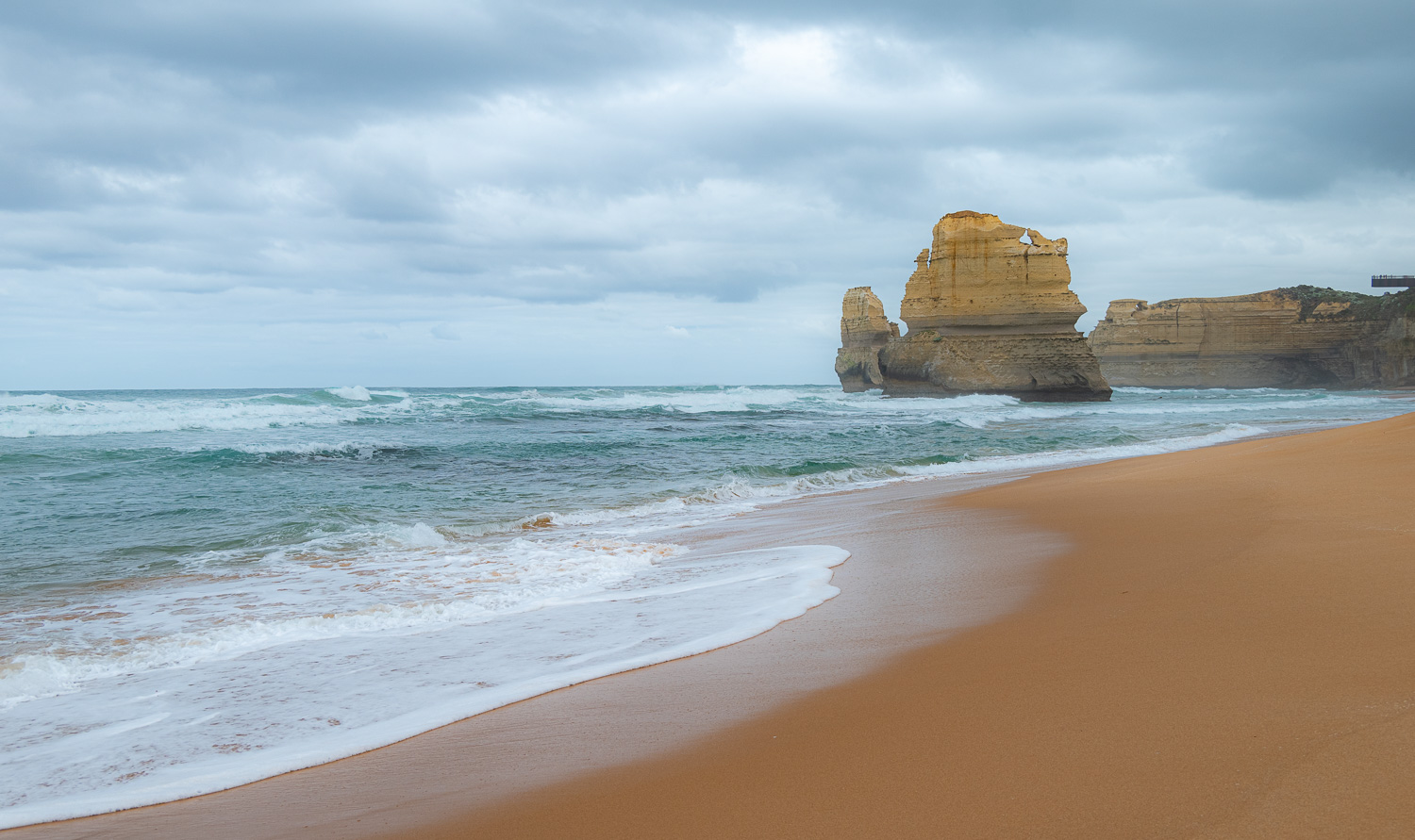
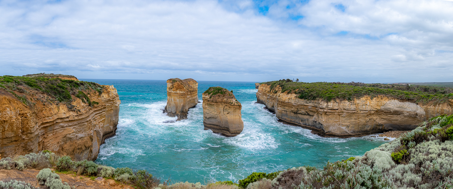
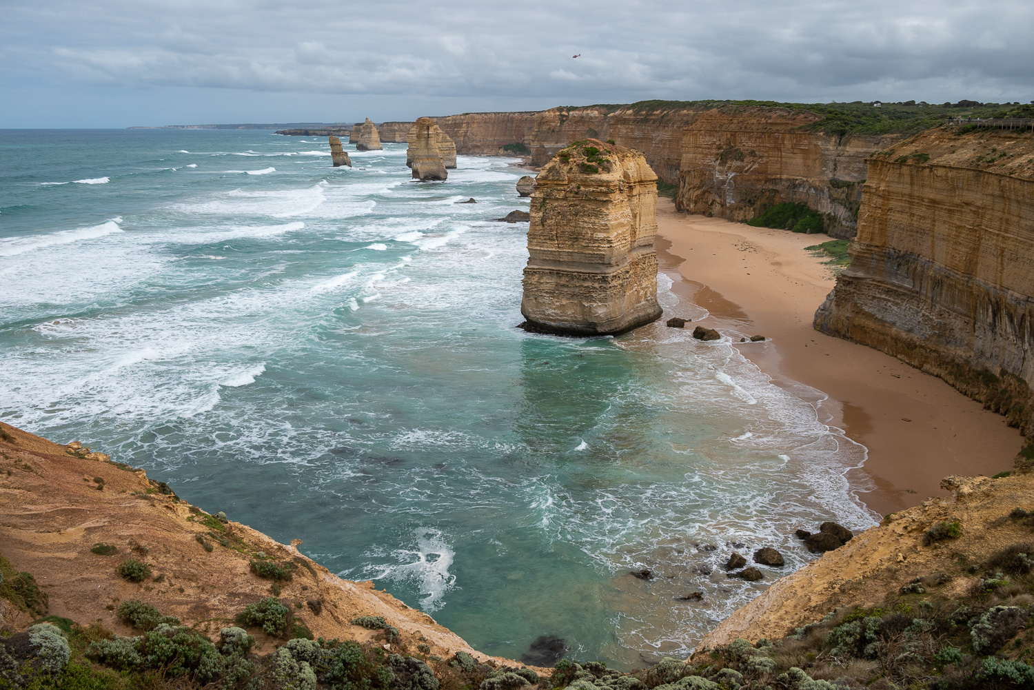 Each of the Twelve Apostles is a limestone sea stack, a type of coastal rock formation shaped by weathering and erosion. Some 10 to 20 million years ago the stacks formed part of the soft limestone cliffs of the mainland shoreline. Despite the name the Twelve Apostles, there are only 8 left standing as Mother Nature, time and the salty waters have caused several of the apostles to fall.
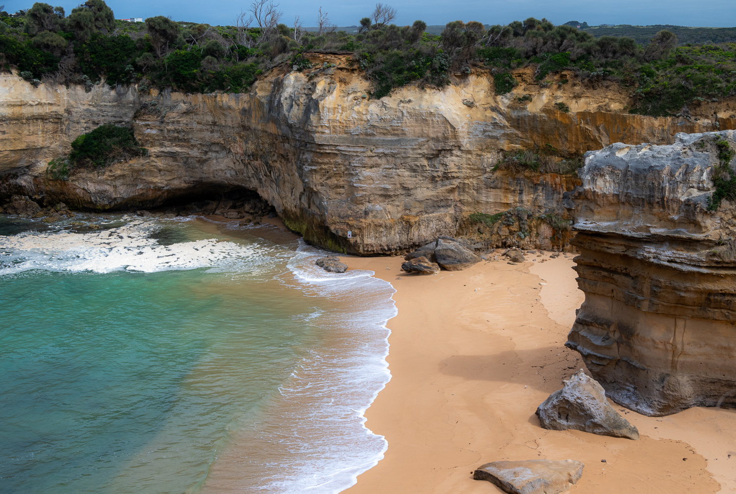 Loch Ard Gorge – The wondrous gorge drops down into a beautiful bay and inlet of cobalt blue waters and two giant cliffs. The gorge is named after the clipper ‘Loch Ard’ that was shipwrecked on 1 June 1878 near the end of a three-month journey from England to Melbourne. Of the 54 crew and passengers, only two survived, Thomas and Eva.
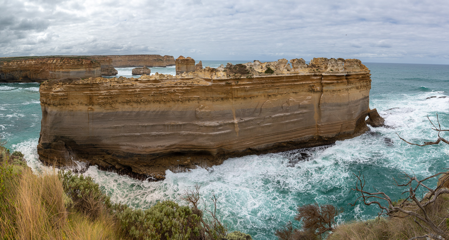
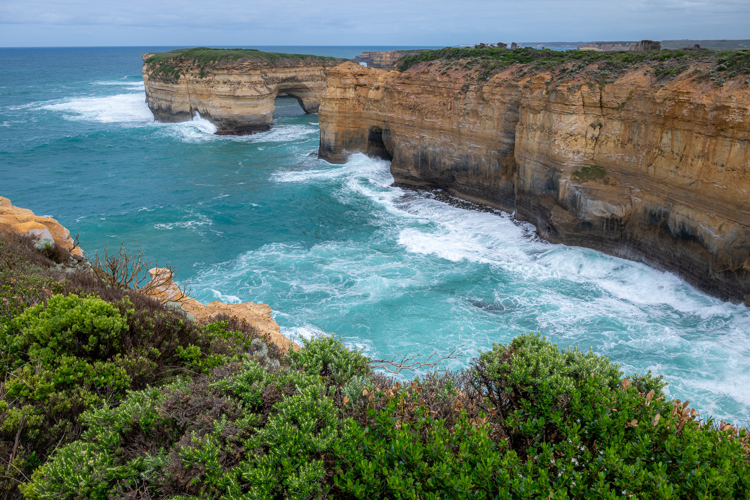 The rock formation with the arch at the entrance to the Gorge is called Mutton Bird Island and is known as the 9th Apostle.
 The Razorback, whose name comes from its jagged, narrow aesthetic, is one of the most awe-inspiring natural landmarks in the Port Campbell National Park. The sharp edges are caused by wind blown sea-spray, which hardens small areas of rock on the stack. The softer rock erodes away, leaving a rough jagged surface.
 These two stacks are named Thomas and Eva in memory of the two shipwreck survivors.
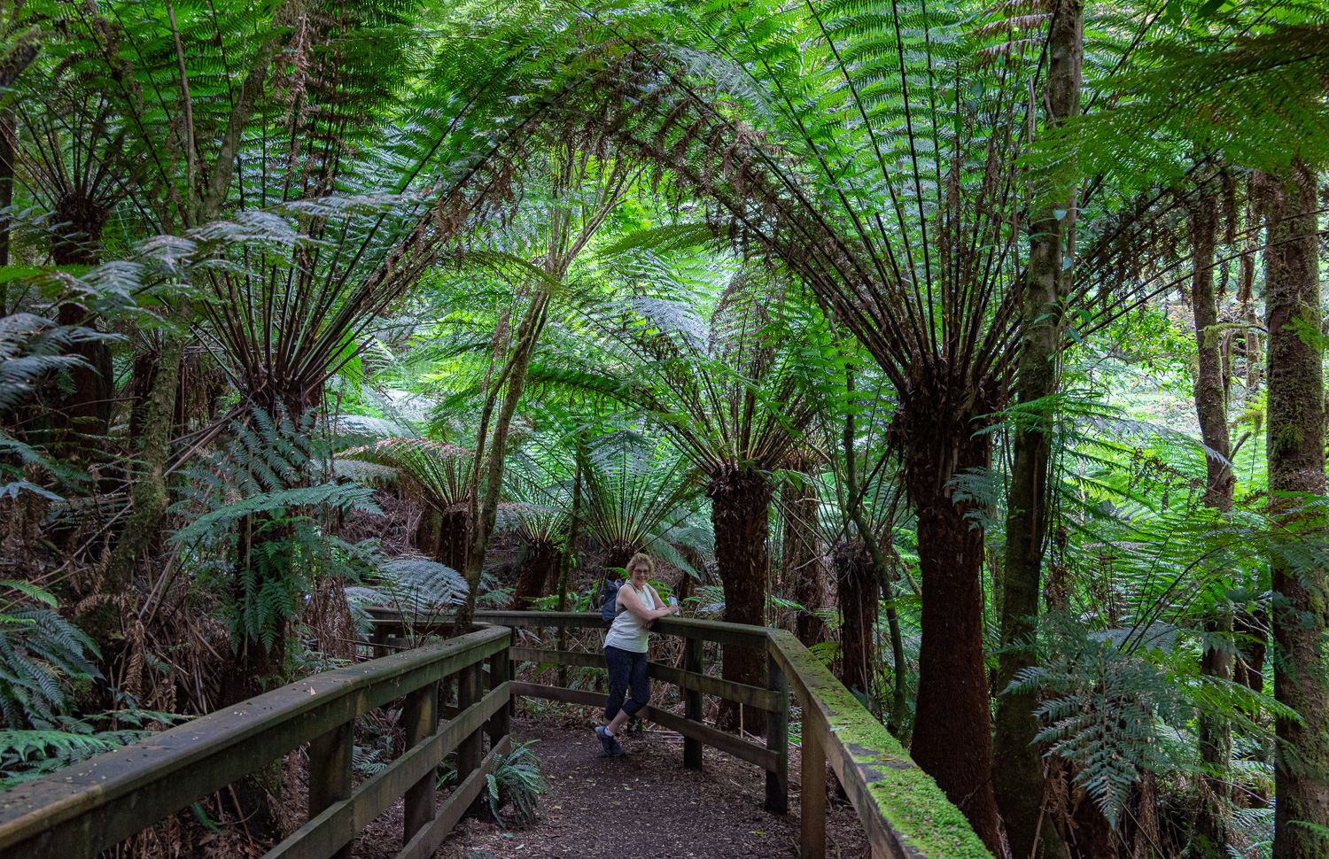 On the way back to Melbourne we did a rainforest walk in the Great Otway National Park at Melba Gully. It is a cool climate rainforest where some of the Eucalyptus Trees (also know in Australia as Gum Trees) can grow up to 500 feet. The forest contains a large number of huge tree ferns.
Finally we went on the hunt for two of Australia’s most iconic animals, Koala Bears and Kangaroos.
Koala Bears
In the wild they are solitary creatures who spend up to 20 hours a day sleeping in the branches of their favourite Eucalyptus Trees.
Female Koalas change partners regularly, and never mate with same male twice. They raise their young by themselves.
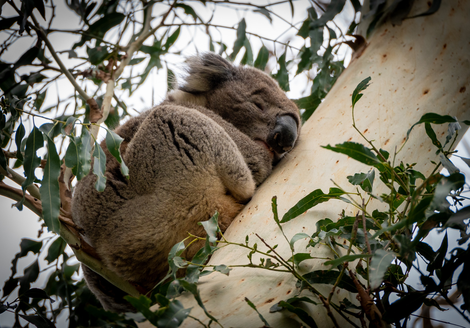 This female was fast asleep!
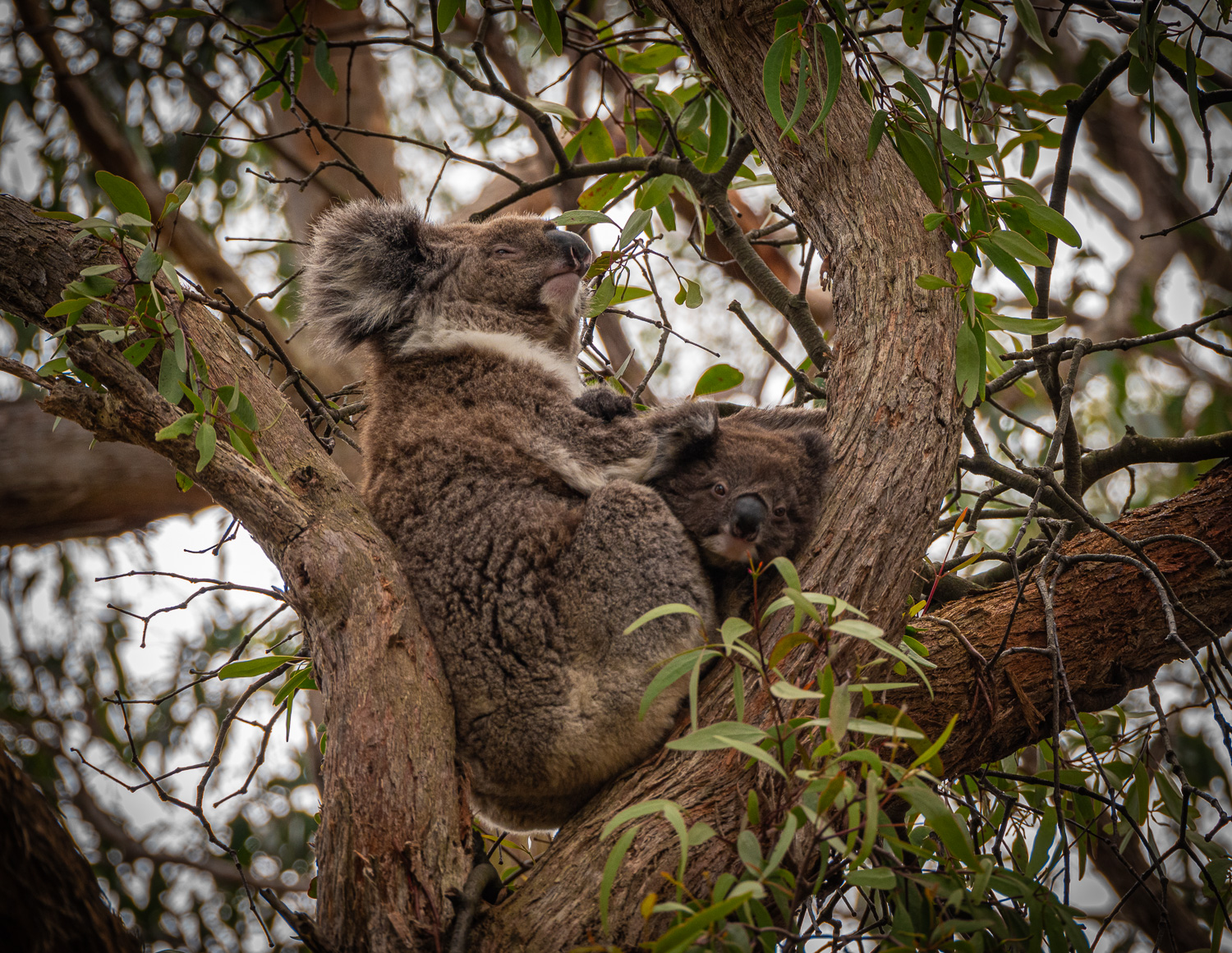 This mother and her joey were unusually wide awake. Joeys stay with their mother for up to 1 year.
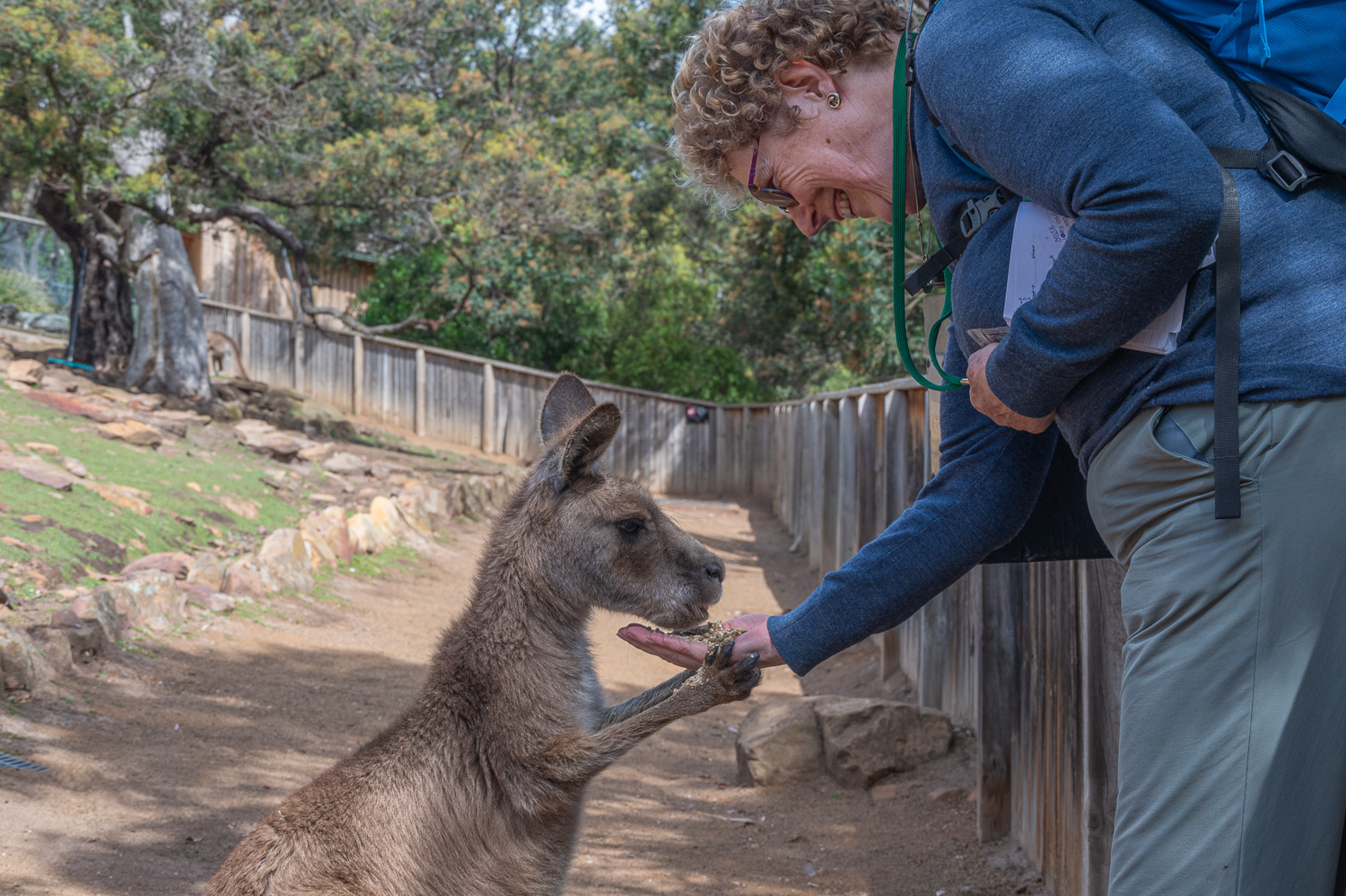
Kangaroo
There are approximately 50 million Kangaroos in Australia, nearly twice the population of its people.
The males are know as Boomers, the females are called Flyers, and the youngsters, Joeys. This is why the tail fin of Qantas aircraft carry the outline of a female Kangaroo, aka The Flyer.
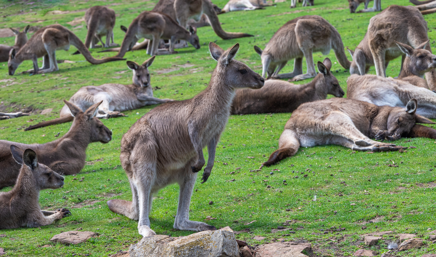
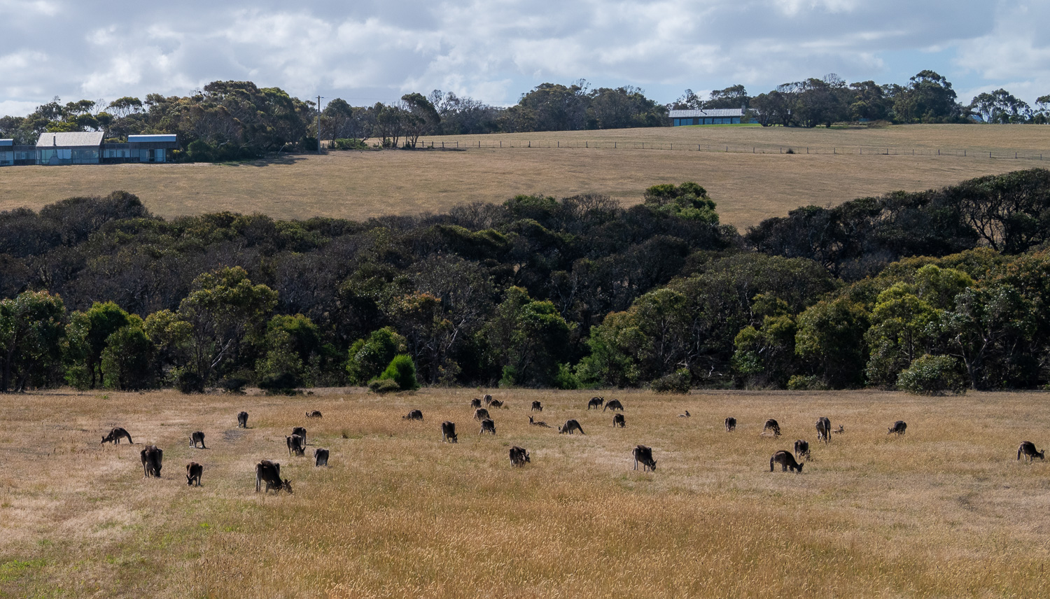 A ‘Mob’ of Southern Grey Kangaroos
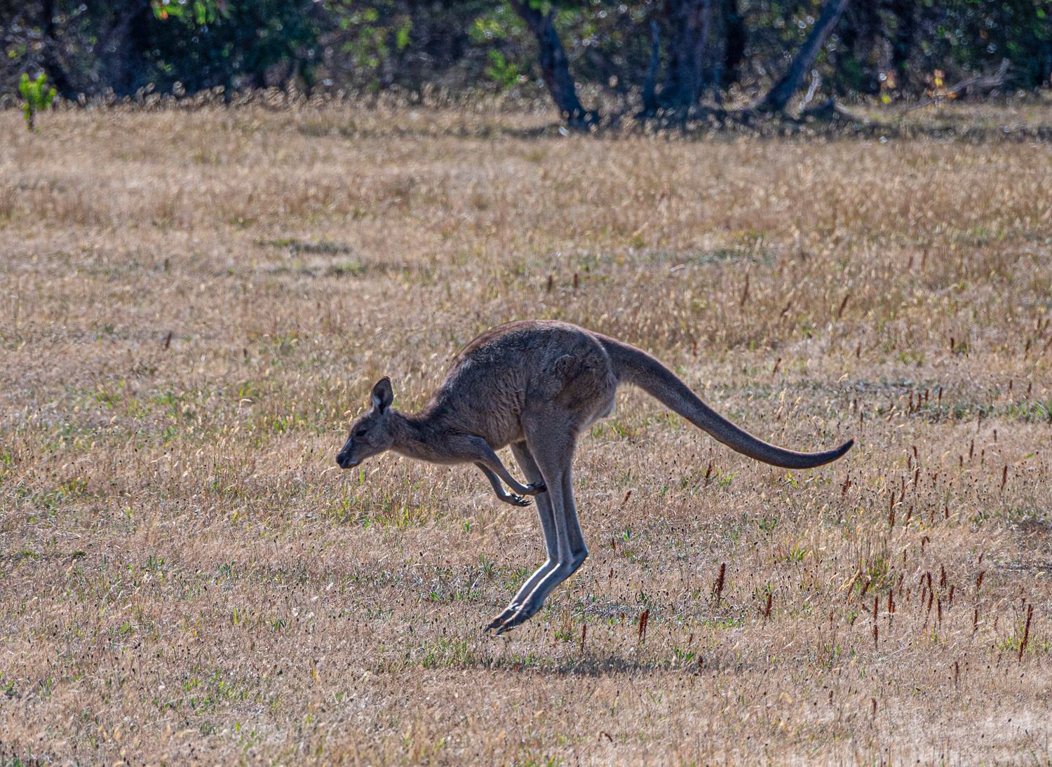 A female ‘Flying High’
Tasmania (Part 1)
Tasmania is an island State of Australia. It is located 150 miles to the south of the Australian mainland, and is separated from it by the Bass Strait. Tasmania is the 26th-largest island in the world. It is Australia’s smallest and least populous state, with a population of around 600,000.
Tasmania contains some of the most spectacular mountain, lake, and coastal scenery in the country, and much of its land is protected in national parks and reserves.
The first part of our Tasmanian tour was to explore the scenic east coast, starting in Hobart in the Southeast of the island.
Hobart
Hobart is the State capitol of Tasmania and is built around a beautiful harbour in the shadow of the spectacular Mount Wellington and lies on the west bank of the River Derwent estuary. It is Australia’s second oldest city, with a rich colonial and maritime history. It was first populated in 1804 by Europeans, as a penal colony.
Hobart is the ideal location to explore the Southeastern corner of Tasmania.
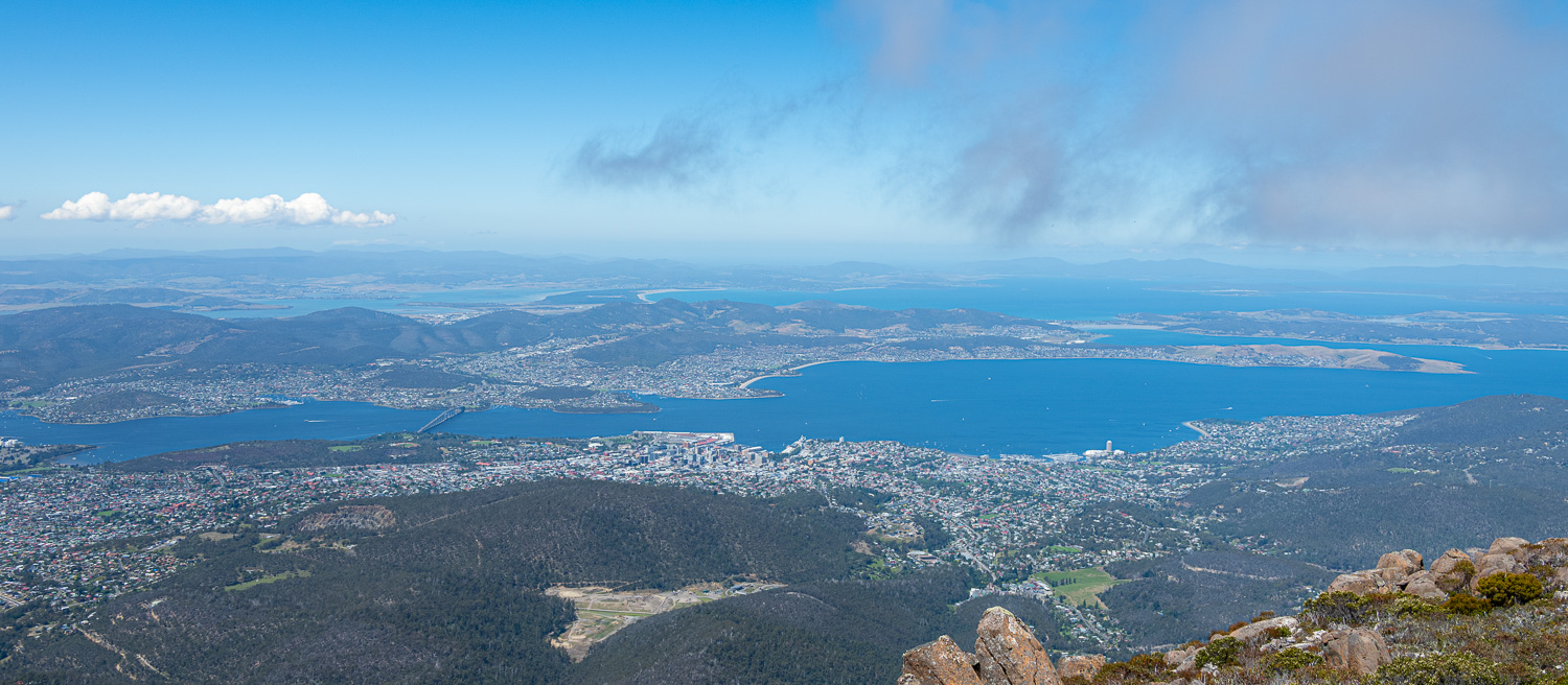 A panoramic view of Hobart city from the 4,160 ft. tall Mount Wellington
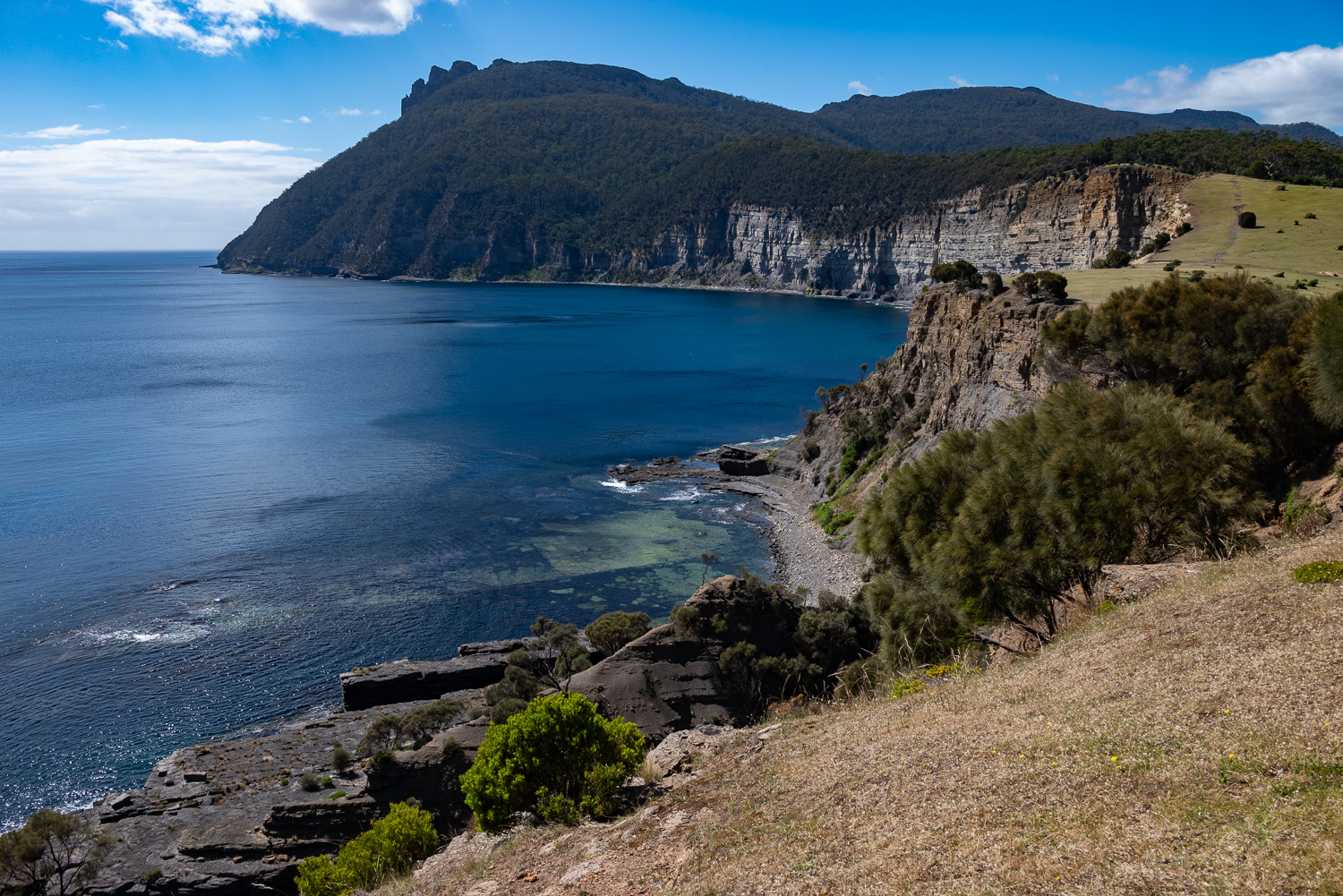
Tasman Peninsula
A 46 mile drive, south-east of Hobart, the Tasman Peninsula is connected to the Tasmanian mainland by a narrow isthmus called Eaglehawk Neck. The peninsula covers 200 sq. miles, of which about 20% is the Tasman National Park that is located in the eastern and southern coastal regions.
The peninsula was first explored by the Dutch navigator Abel Tasman in 1642. Its dramatic coastline and history, make it a popular tourist destination. By far the most popular attraction on the peninsula is the Port Arthur Penal Colony.
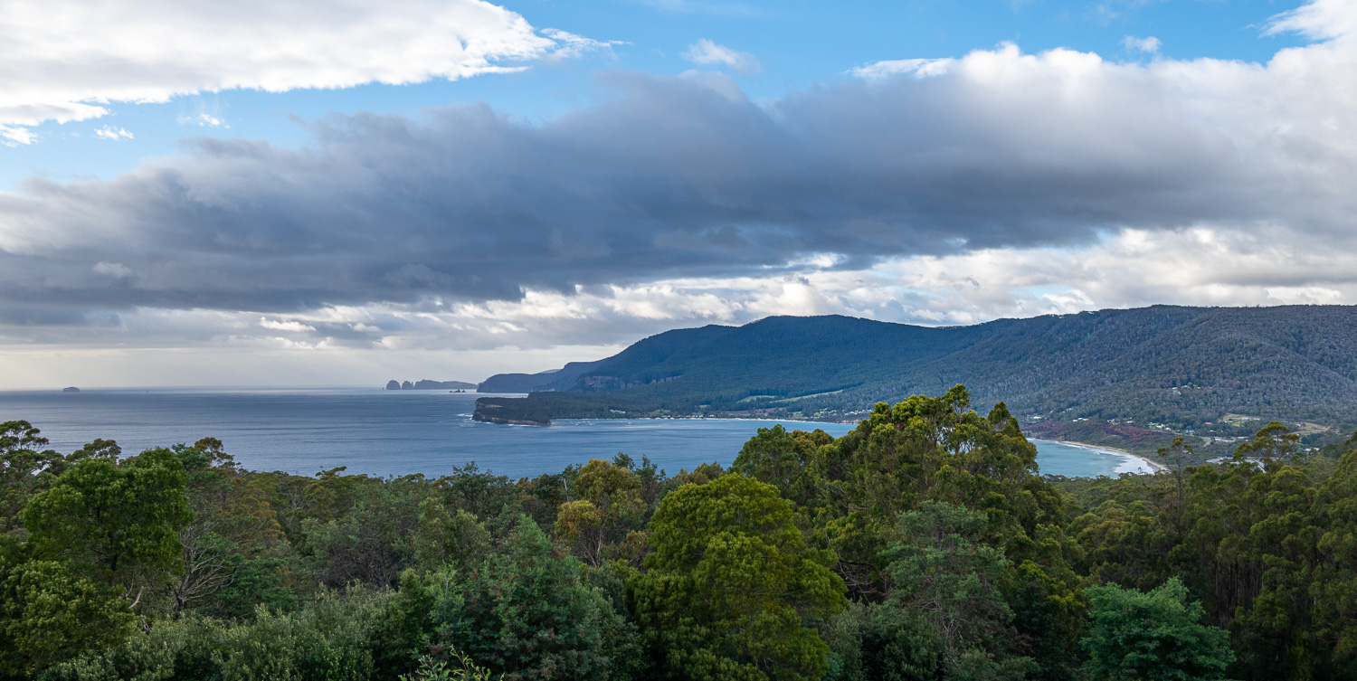 Tasman National Park Lookout, Pirates Bay – At the entrance to the peninsula is the sweeping vista of Pirates Bay, which is home to a number of coastal attractions.
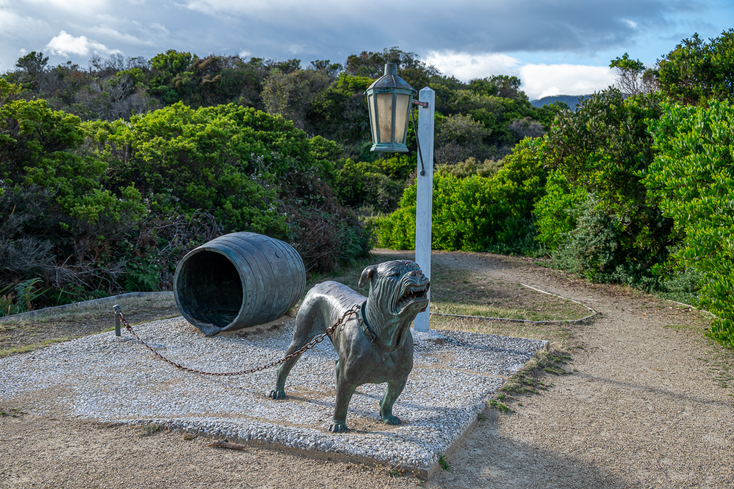 Eaglehawk Neck Historic Site – The isthmus at Eaglehawk Neck, which is only one hundred feet wide at it’s narrowest, is the reason Port Arthur was chosen as the site for a prison. For a convict to escape the peninsula on foot, they had to pass through this tiny strip of land. A line of nine dogs, tethered at short intervals, roused the soldiers if anyone tried to get by. The statue is a reminder of this effective line of defence, which was known as the ‘Dog Line’
 It was also a nice place to stroll along part of the beach in Pirates Bay.
A short detour from Eaglehawk Neck is the oddball village of Doo Town, which one passes through to visit the Tasman Peninsula’s most visited geological formations; The Blowhole and Fossil Bay Lookout, the Tasman Arch, and the Devil’s Kitchen.
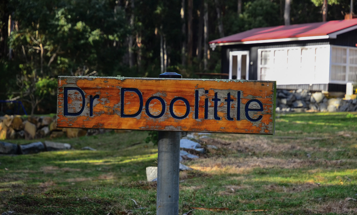 What makes Doo Town interesting is that every home’s name has to have the word ‘doo’ in it. In addition to Dr Doolittle, The examples we noted were Thistle Doo Me, Doo Drop Inn, Wattle-I-Doo and Katmandoo to name but a few!
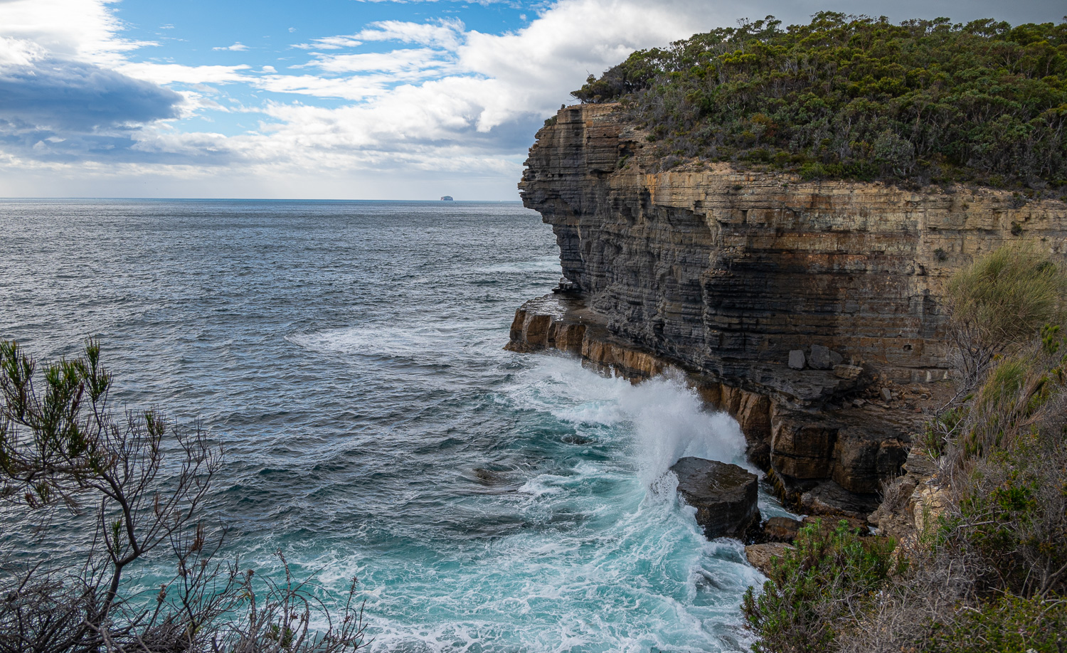 Fossil Bay Lookout offers views of the Tasman Peninsula’s dolerite cliffs and the ocean. The lookout is located at the end of a peninsula that juts into the Tasman Sea, next to the Tasman Blowhole.
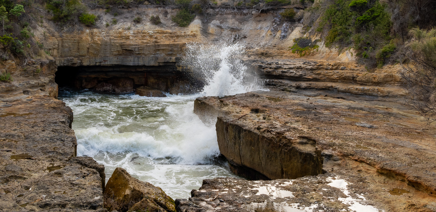 Tasman Blowhole – The water channels through a hole in the cliffs and slams against the rocks causing a spray of water.
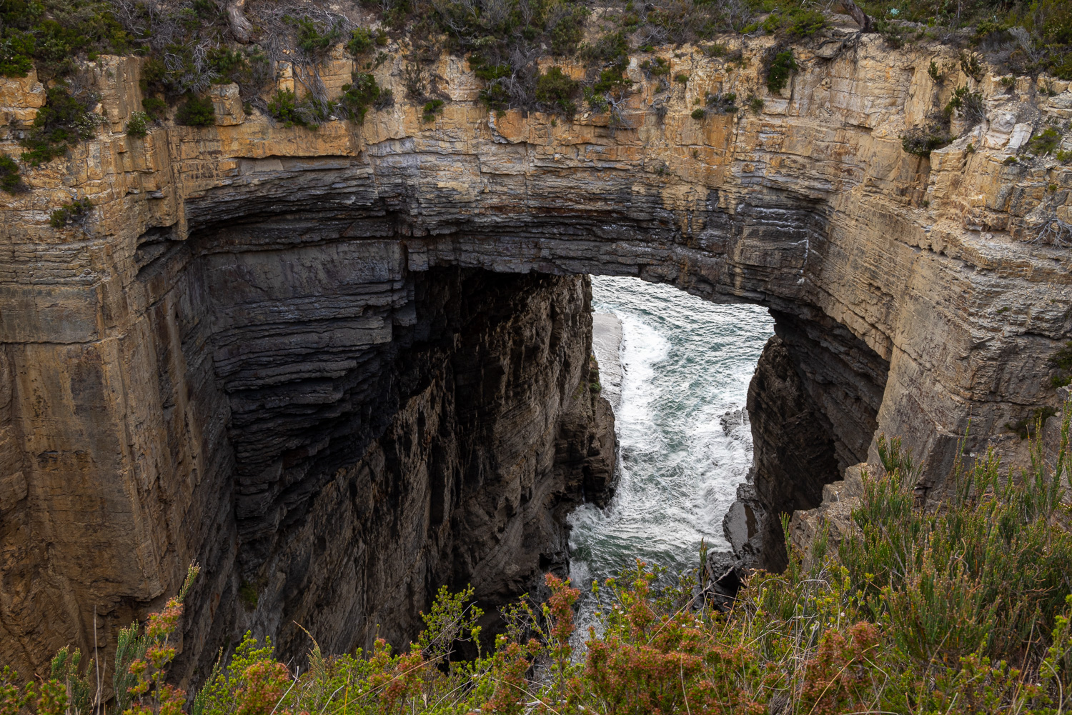 Tasman Arch is what’s left of a large sea cave, or tunnel, that was created by wave action from the Tasman Sea over many thousands of years.
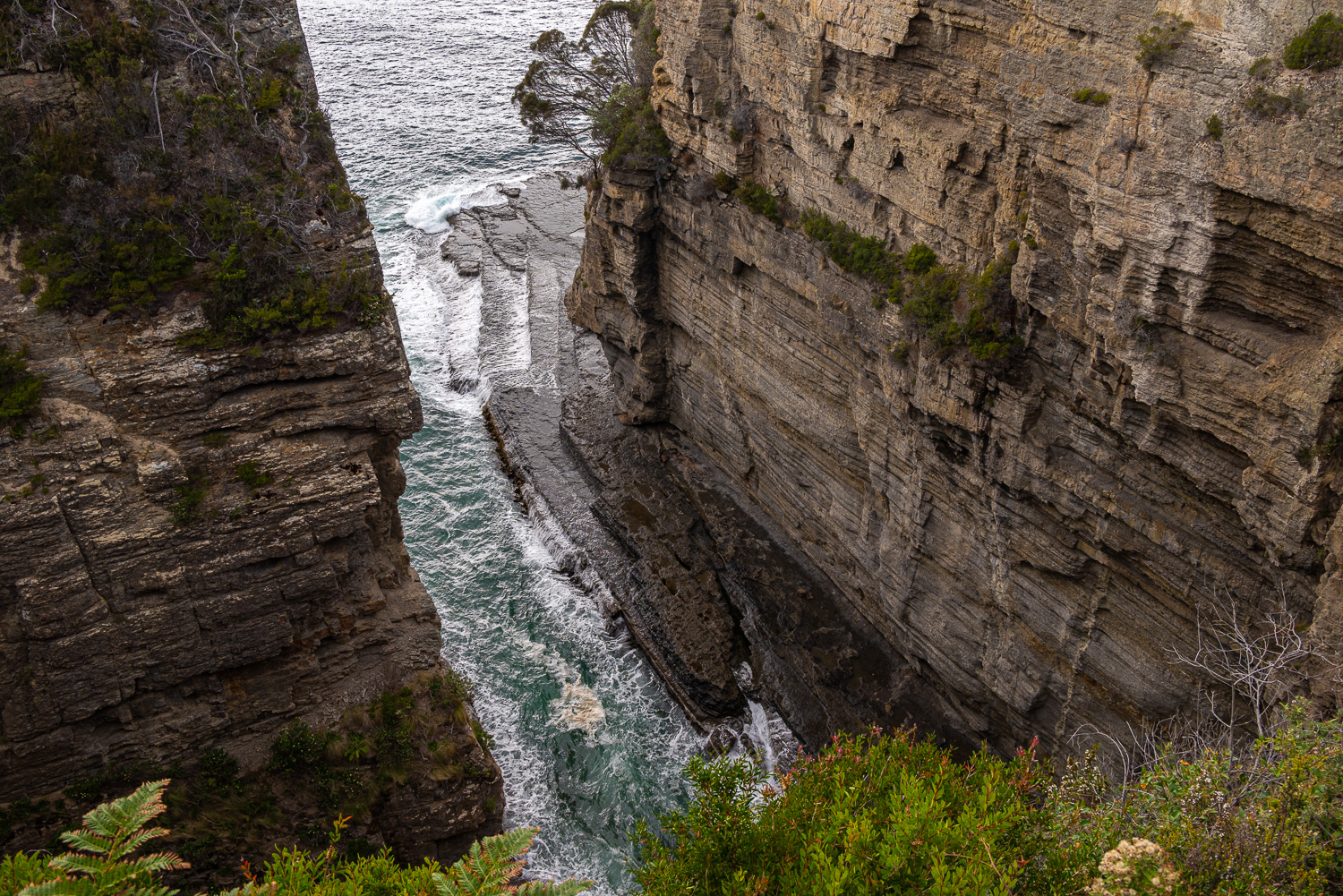 Devil’s Kitchen is a geological feature that probably started as a sea cave, then a tunnel, and developed into its modern form after the collapse of the roof.
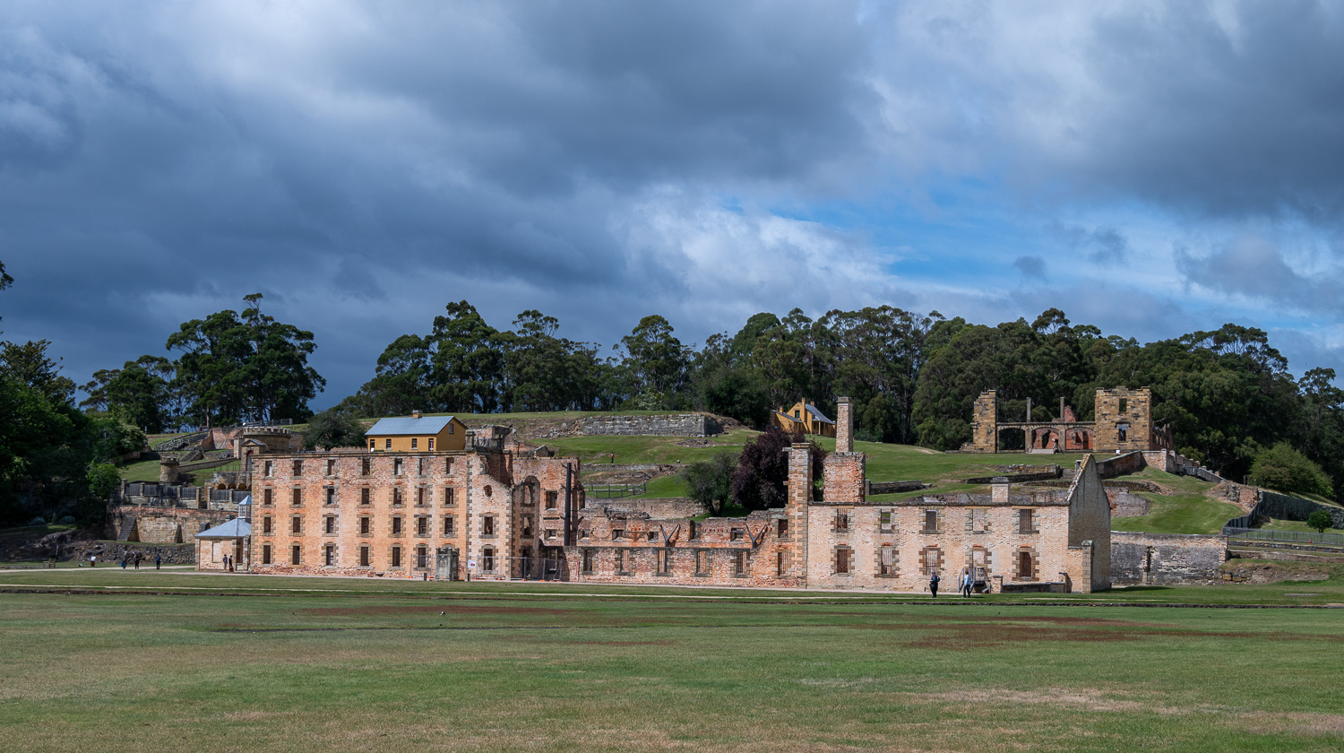
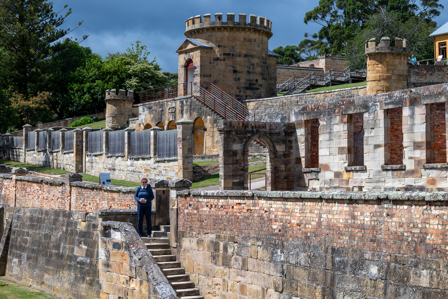
Port Arthur Historic Site
The UNESCO World Heritage-listed Port Arthur Historic Site is the best preserved convict settlement in Australia. Between 1830 and 1877, about 12,500 convicts served sentences here. The 100 acre site has more than 30 historic buildings and ruins to explore. Port Arthur was a Secondary Punishment station that held repeat offenders and the most dangerous prisoners.
 The Penitentiary building was originally constructed as a flour mill and granary in 1845 in an effort towards a self-sustainable settlement. Grain was ground by either a water-powered mill or, when the water flow was inadequate, by convicts walking on a treadmill – one of the harshest punishments at Port Arthur. It was converted into a penitentiary in 1854
 Guard Tower
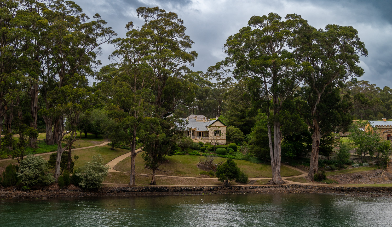 Commandant’s House – The Commandant was Port Arthur’s most senior official. A residence befitting his rank and position was erected on high ground on the fringe of settlement in 1833. The Commandant’s House, originally built as a simple wooden cottage, had a commanding view over the rest of the settlement. It evolved over the years to become a multi-room complex fringed by ornate gardens and pathways and separated from the rest of settlement by high masonry walls.
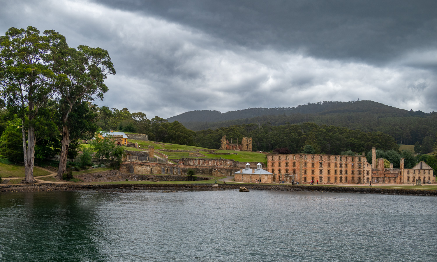 View of the colony from the bay. The ruins of the hospital can be seen at the top of the hill. This would have been a foreboding sight for the prisoners, when they first arrived by sea.
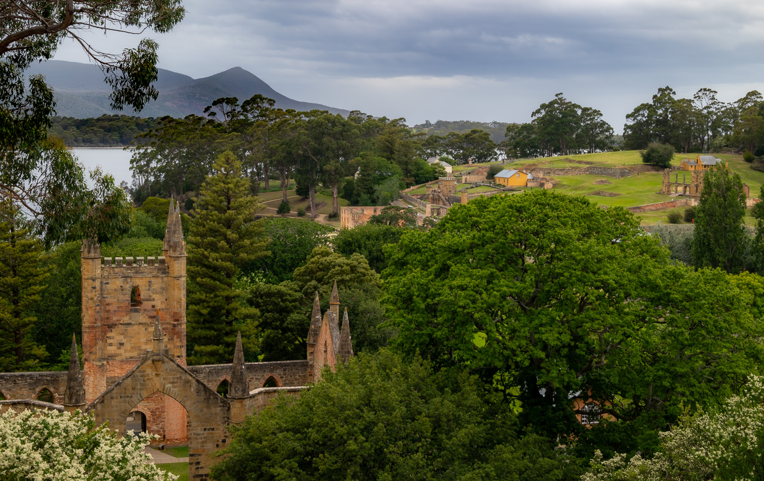 View of the penal colony with the Church in the foreground. Construction started in 1836 by the convicts using stonework that had been prepared by the boys from the juvenile establishment across at Point Puer. Once finished it could accommodate 1,000 worshippers.
Point Puer was the first sanctioned juvenile prison under British control and contained boys aged 9 to 17.
Bonorong Wildlife Sanctuary
The centre was established in 1981 as a sanctuary for injured and orphaned wildlife and is Tasmania’s most popular wildlife park. The centre has native animals which are extinct everywhere but Tasmania such as the famous Tassie Devil, Tasmanian Bettong, Eastern Quoll and Tasmanian Pademelon. The Sanctuary is dedicated to the rescue, rehabilitation, and preservation of native Australian animals. Where possible they will reintroduce rehabilitated animals into the wild.
This was a wonderful place to experience up close some of the most iconic and endangered animals of Tasmania. Many wild birds also frequent the sanctuary, adding to the enjoyment of Bonorong.
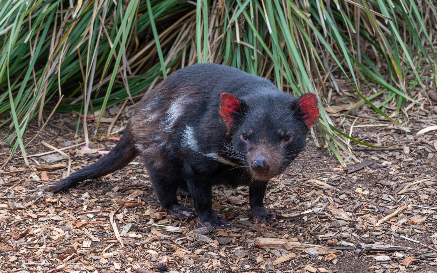 The Tasmanian Devil is native to Tasmania and is one of the islands iconic species. They are solitary animals and not territorial. These carnivorous mammals have a very strong jaw and can bite through bone. They are poor hunters and do not chase prey. They typically scavenge, feeding on the remains other animals. If a Devil finds a whole animal they will scream to call to others. This screaming continues to establish dominance, then they all share the kill.
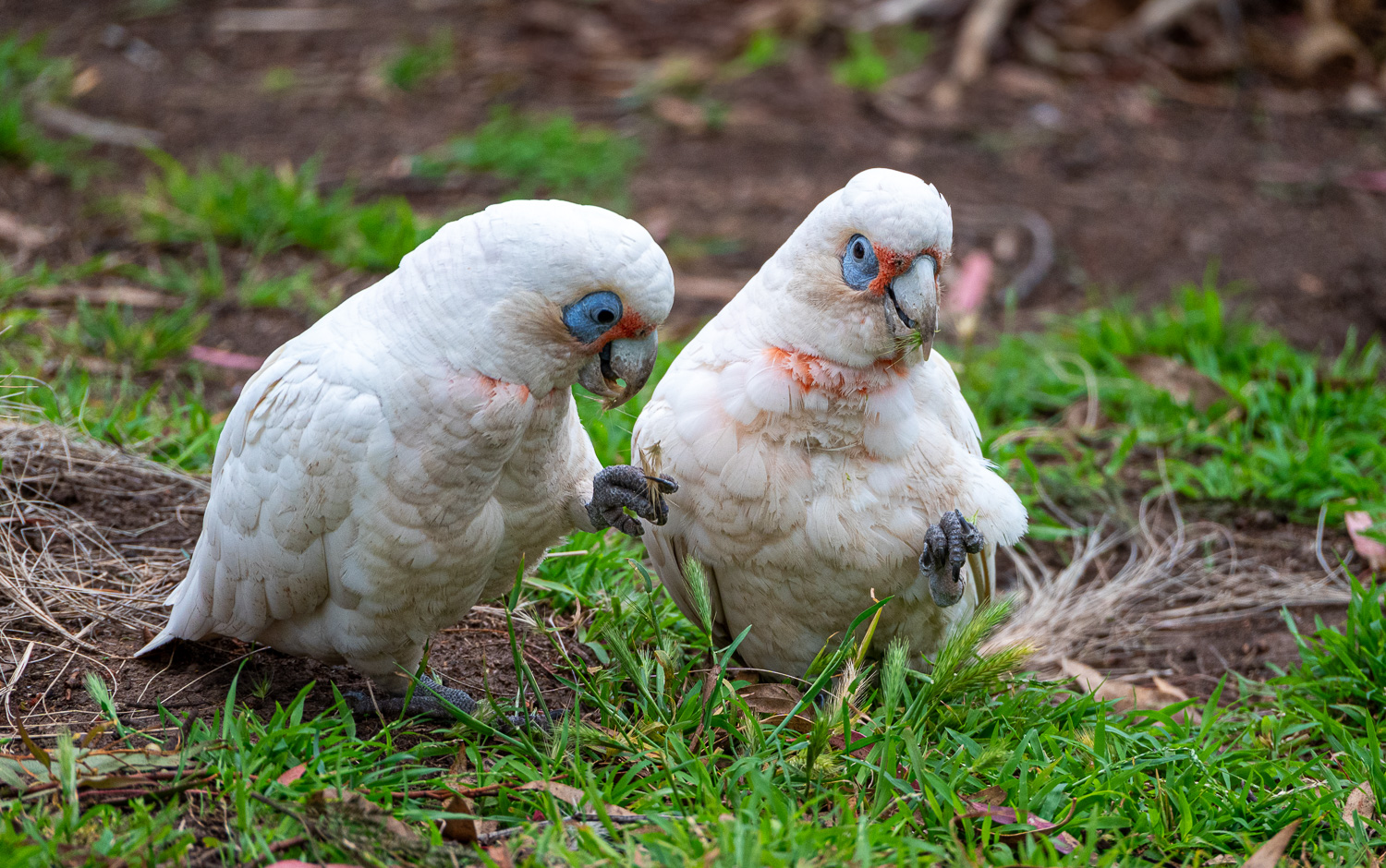 Little Corella, also known as Short-billed Corella is a white cockatoo native to Australia and southern New Guinea. They enjoy ground-feeding in the sanctuary.
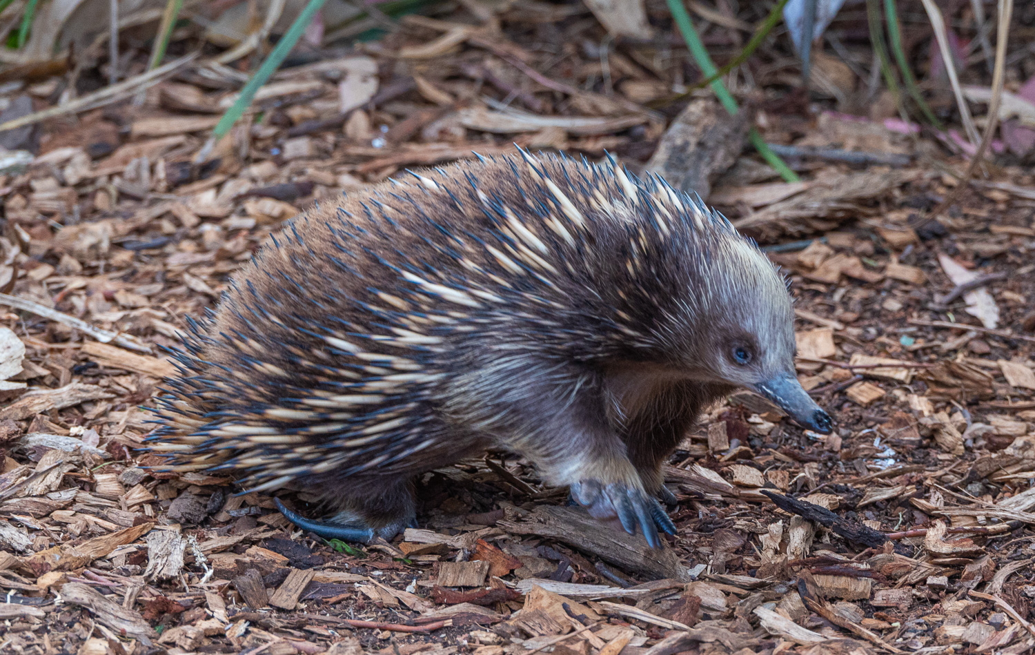 Echidnas (ee-kid-nuh), sometimes known as spiny anteaters, are quill-covered monotremes, which are the only group of living mammals that lay eggs, rather than bearing live young. The only monotremes living today are four species of Echidna and Platypus. The Echidna has remained unchanged since the time of the dinosaurs, around 150 million years ago. The Echidna burrows, eats insects and are good swimmers. They are widespread throughout Australia.
Echidnas live alone for most of the year. During breeding season, multiple males will follow a single female for days on end waiting for her to show attention to one of them. When they are moving, this is known as the ‘Echidnas Train’.
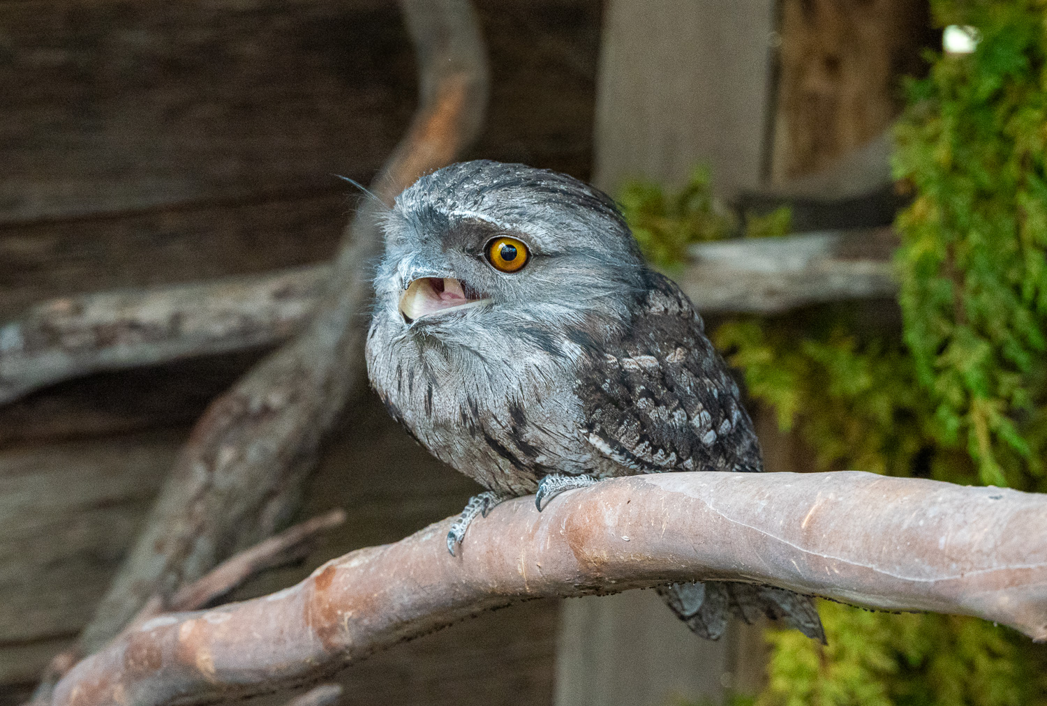 Tawny Frogmouth – These birds are related to the Night Jar and not Owls. They eat insects, lizards and rodents, hunting with mouths only. The inside of their mouth is yellow and fluorescent, attracting insects at night. They are stealthy, silent flyers, making no noise with their wings. They are often injured by vehicles at night chasing insects attracted by headlights. A number of these birds at the sanctuary only have one eye, and cannot be returned to the wild.
 The Forester kangaroo is the largest marsupial in Tasmania and the second in the world. Males can reach over 130 pounds and stand nearly 7ft tall. In the wild these animals are often hit by vehicles, so the sanctuary always have large numbers.
 They can be very friendly when food is on offer!
 Tasmanian Pademelons are short, stocky marsupials, looking like small kangaroos or wallabies. Pademelons’ short tails and compact bodies help them move through the dense vegetation of the forests where they prefer to live during daylight hours. At dusk they will venture into more open areas to feed. They are shy, solitary and nocturnal and as herbivores, feed on a wide variety of plants.
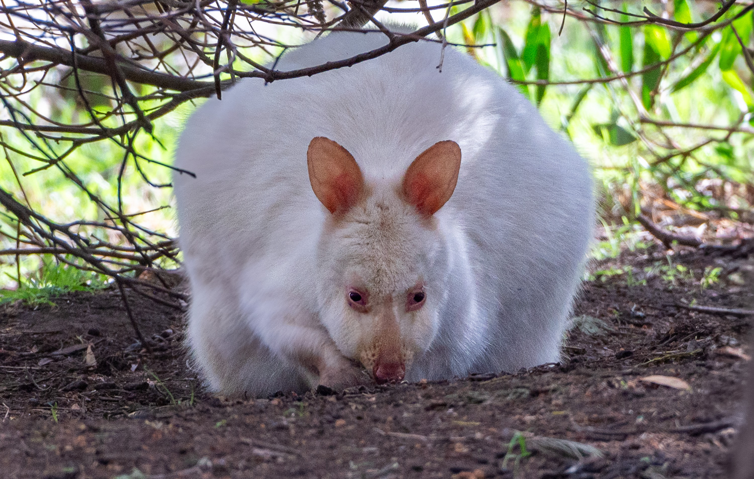 This rare Albino Pademelon is a permanent resident of the sanctuary as it would be too vulnerable to release into the wild.
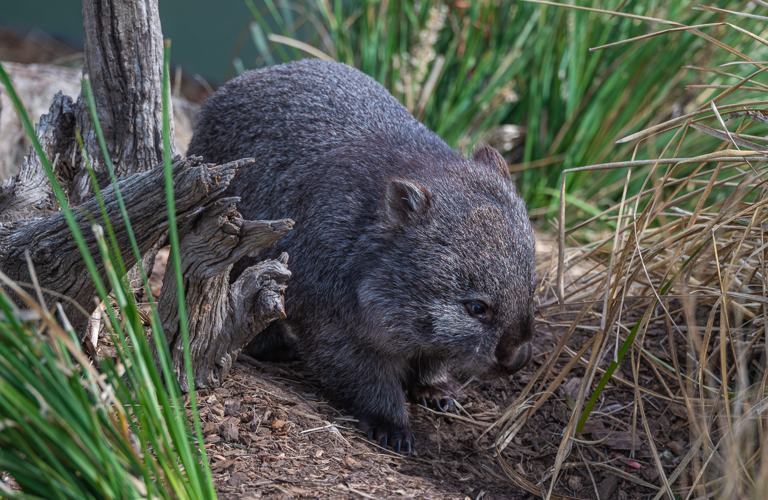 Bare-nosed Wombat (also known as the Common Wombat) are amongst the world’s largest burrowing animals. They are equipped with powerful limbs, short broad feet and flattened claws. They can dig a burrow up to 10 sq. feet across with a depth of 15 feet. Wombats are primarily grazers and their continuously growing incisors work as efficient cutters of grass. Wombats can grow to a length of 3 feet. A very unusual feature of these animals is that they produce cubed-shaped poo, which they use to mark their territory!
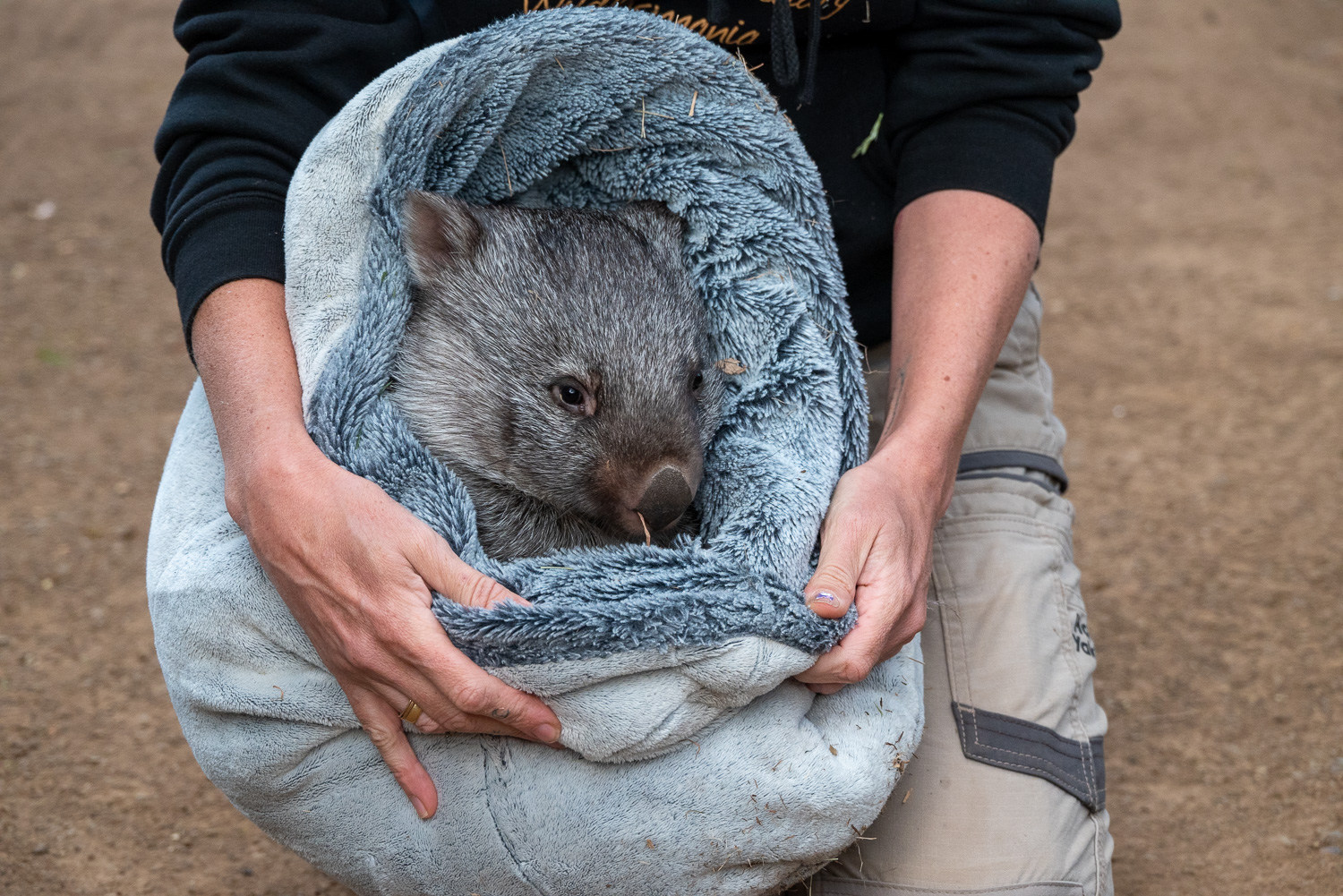 Weighing only 10 ounces, baby Wombat ‘Beany’ was found alive in it’s dead mother’s pouch following a car accident. ‘Beany’ is now 10 months old, having been reared at the centre. They hope to release her into the wild when she reaches maturity.
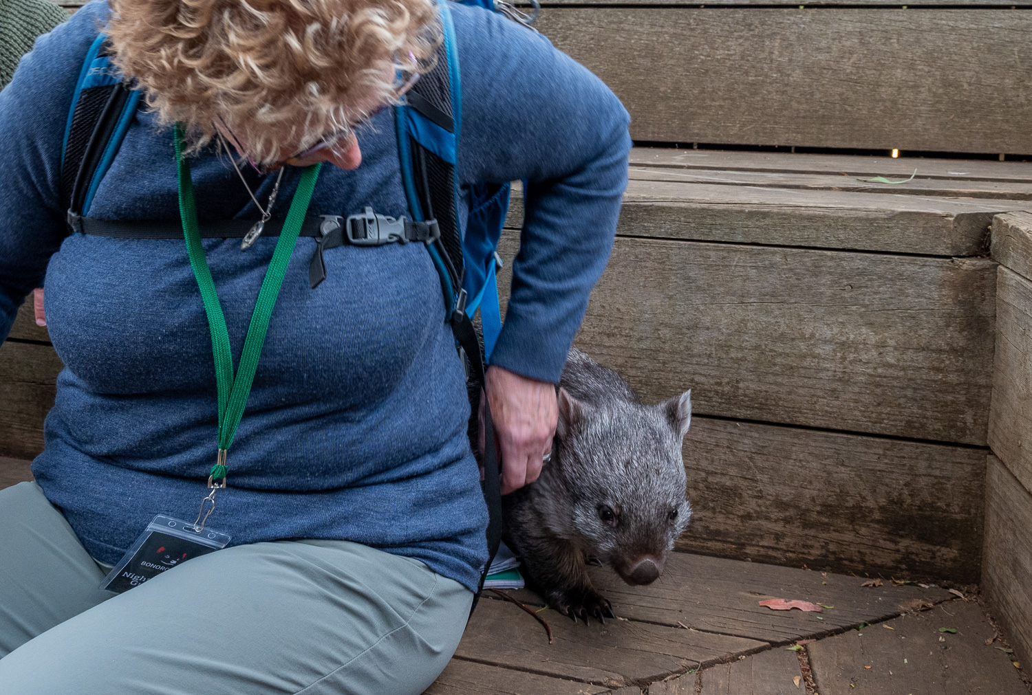 ‘Beany’ has taken to Charlotte!
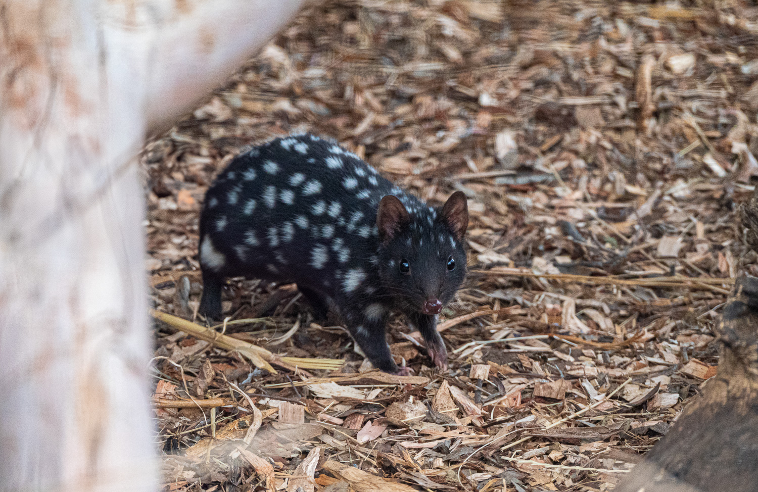
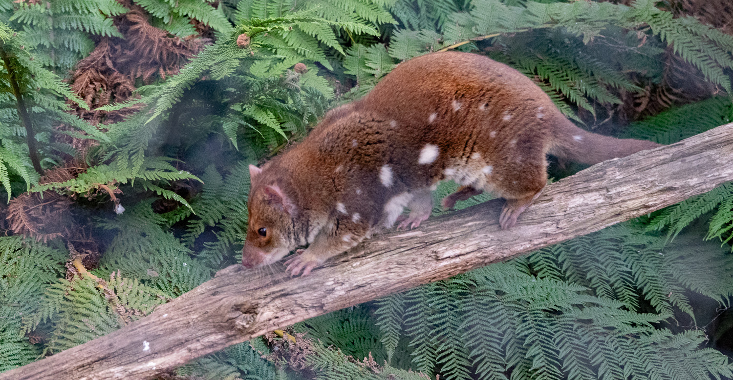 Spotted Tail Quoll (also known as Tiger Quoll) – Nicknamed the ‘Baby-faced assassin’, they will kill animals much larger than themselves, such as possums, wombats and wallabies. These solitarily carnivorous marsupials are apex predators and cousins to the Tasmanian Devil. They are a threatened species, mainly due to habitat loss and are very rare to spot in the wild.
 Eastern Quoll live in social groups and are not as aggressive as the Spotted Tail Quolls. They are now extinct in Australia, but are still in Tasmania in small numbers. The sanctuary has had particular success with a breeding programme for these animals, having released and rewilded 40 Quolls back to sanctuaries in mainland Australia, with the long-term aim to re-establish a population on the mainland.
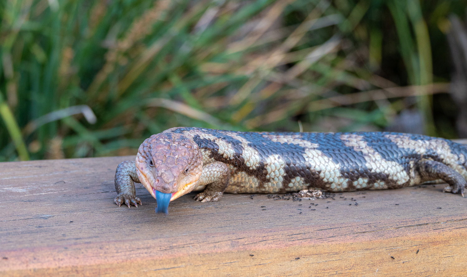 Blotched blue-tongued Lizards are native to Tasmania and unusually these cold-blooded reptiles give birth to live young.
Mount Field National Park
Mount Field National Park is one of Tasmania’s oldest national parks and is also one of its most diverse. The park is also part of the Tasmanian Wilderness World Heritage Area and home to some of the world’s tallest eucalypt forests, which intertwine with towering tree ferns . However, it is best known for its cascading waterfalls, including the breathtaking, three-tiered Russell Falls – arguably one of the most impressive waterfalls in Tasmania.
Of its many walking trails the most popular is the 4-mile long Three Falls Circuit, which is the one we walked. The walk includes the Russell Falls, as well as the Horseshoe and Lady Barron Falls.
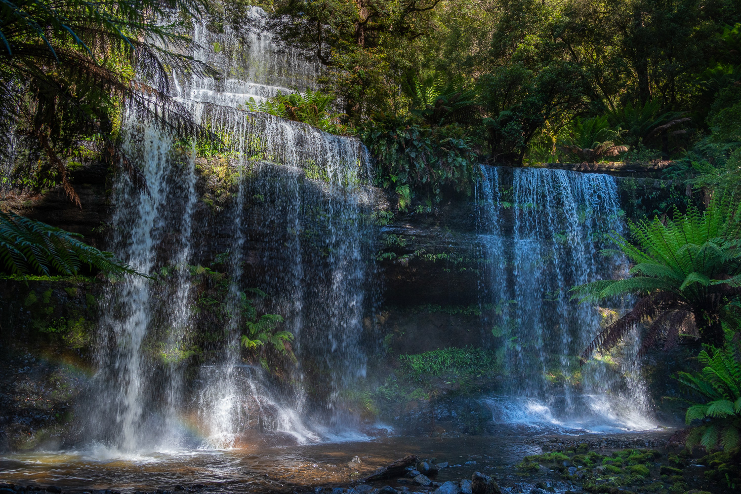 The 1,000 feet tall Russell Falls tiered–cascade waterfall on the Russell Falls Creek
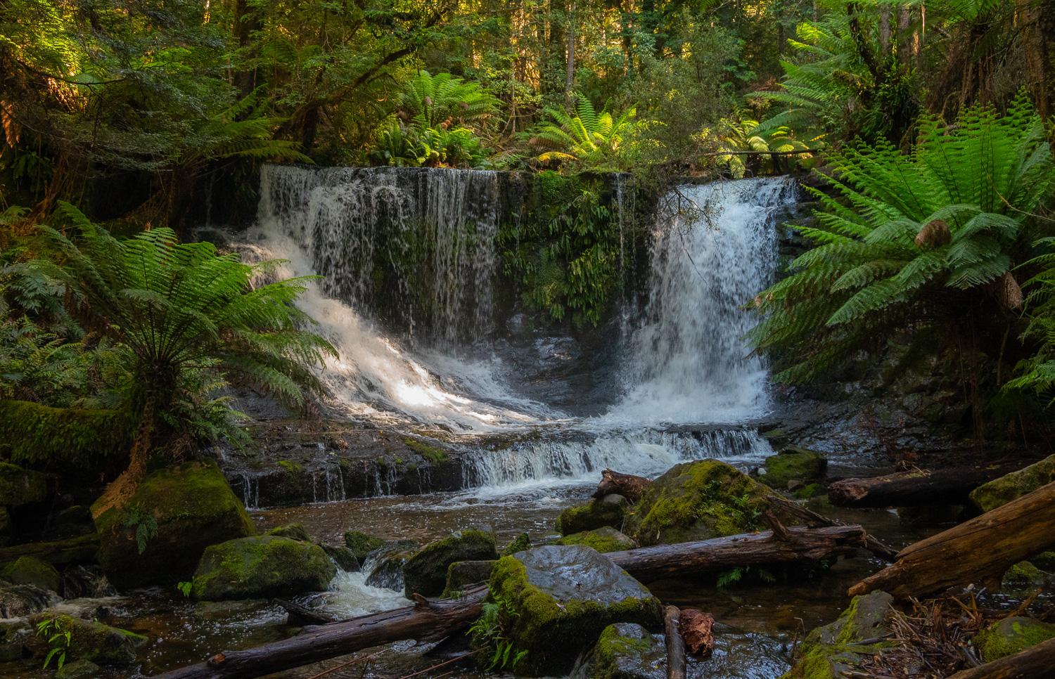 Horseshoe Falls is another tiered–cascade waterfall which drops 16 feet into a natural amphitheatre
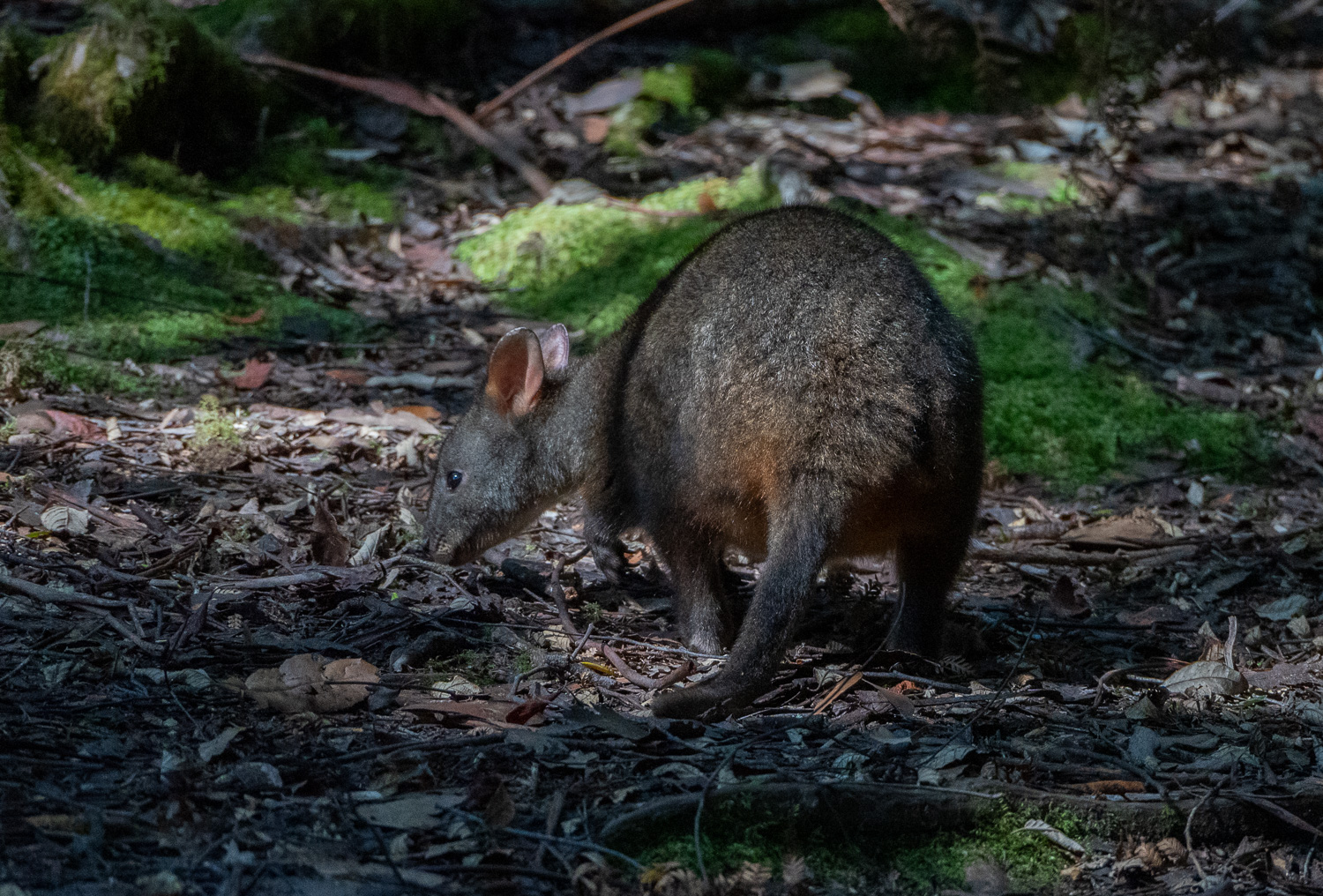 We spotted this Wallaby feeding in the woods
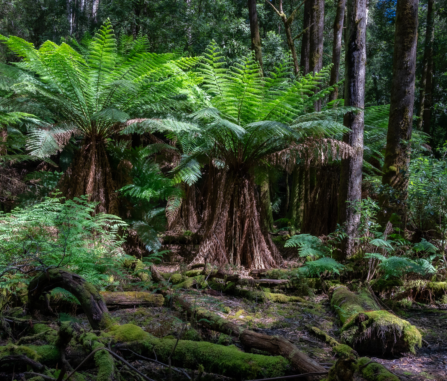 Huge Ferns are found throughout the forest
 Fire survival – Eucalyptus trees have evolved to harm themselves to survive. They shed flammable bark and release seeds that only grow after a fire. This creates a fire-prone environment, but eucalyptus trees are among the few trees that can germinate after a fire.
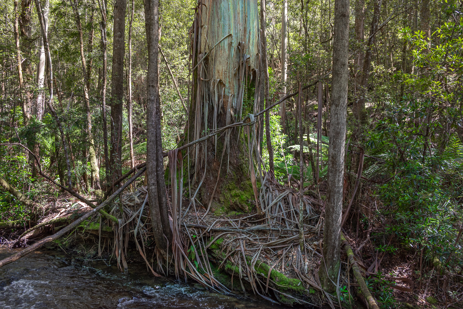
Some trees have striking patterns of stripes and flakes, and the peeling bark often exposes the brighter colours of the new bark forming underneath.
 The final tiered–cascade waterfall is the 25 feet high Lady Barron Falls, photographed to blur the water
Triabunna (try-uh-bun-ah)
Triabunna is a scenic port town that’s known for its natural beauty, history, and seafood. It is situated on the east coast at the edge of Spring Bay and close to Maria Island National Park and the small town of Orford.
Orford to Spring Beach Walk
This 7-mile round trip cliff-top walk started in the centre of Orford and ended at the delightful Spring Beach, following the coast around Spring Bay.
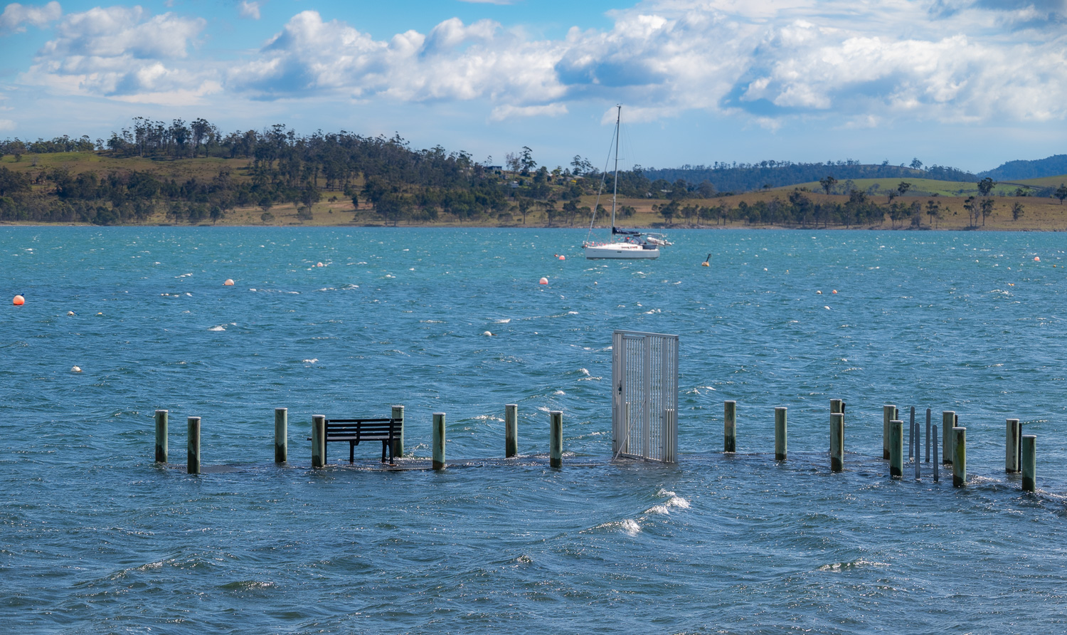 Our coffee stop was abandoned due to high tide!
 Interesting rock formations were visible all along the coastline
 Spring Beach ahead
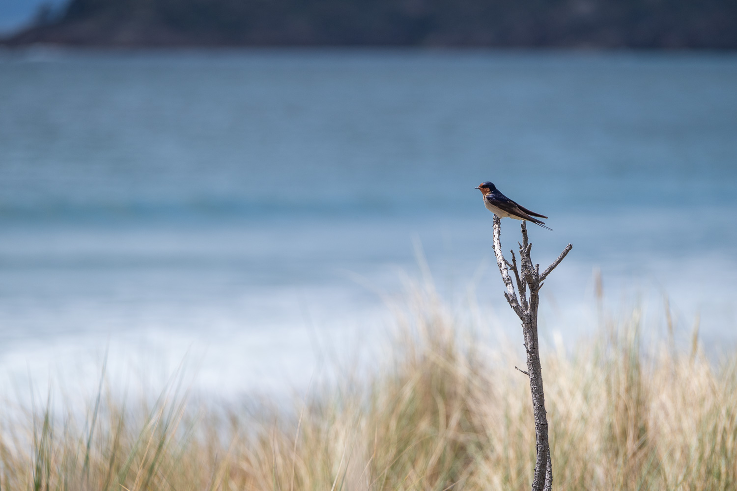 This lone Fairy Martin surveys the beach
Maria Island National Park
Blending extraordinary landscapes with teeming wildlife, this island National Park also happens to have one of Tasmania’s most fascinating histories. It is home to the World Heritage-listed convict probation site of Darlington. The island has some of the most visible and plentiful wildlife in Australia. Wombats wander among wallabies, Forester kangaroos, Cape Barren geese and one of the healthiest populations of Tasmanian Devils. Walking and cycling are the only ways to get about on car-free Maria Island.
We spent two days on and around Maria Island, the first day we took the ferry and hiked around some of the many trails. On the second day we cruised around part of the island as well explored Ile Des Phoque, a fascinating small island to the north of Maria Island.
The main hike we attempted was the 7-mile round trip trail to Bishop & Clerk, the second highest peak on the island at 2,100 ft. However, our research suggested that the very end of the hike was a very steep scramble over rocks, with a short climb up larger rocks to reach the summit. So we sensibly decided to skip the last part, and in the end we turned around about two thirds the way along the trail.
 The view along the coast to the Bishop & Clerk peak. The trail climbs from grassland, through open forest and tall woodland, to the rocky slopes and towering dolerite columns of the summit. These were named Bishop and Clerk because of the resemblance to a bishop, wearing a mitre, being followed by a clergyman.
 The coastline along the trail was dramatic
 View back down the coast at the half way point. This was probably one of the most spectacular coastal hikes we have ever done!
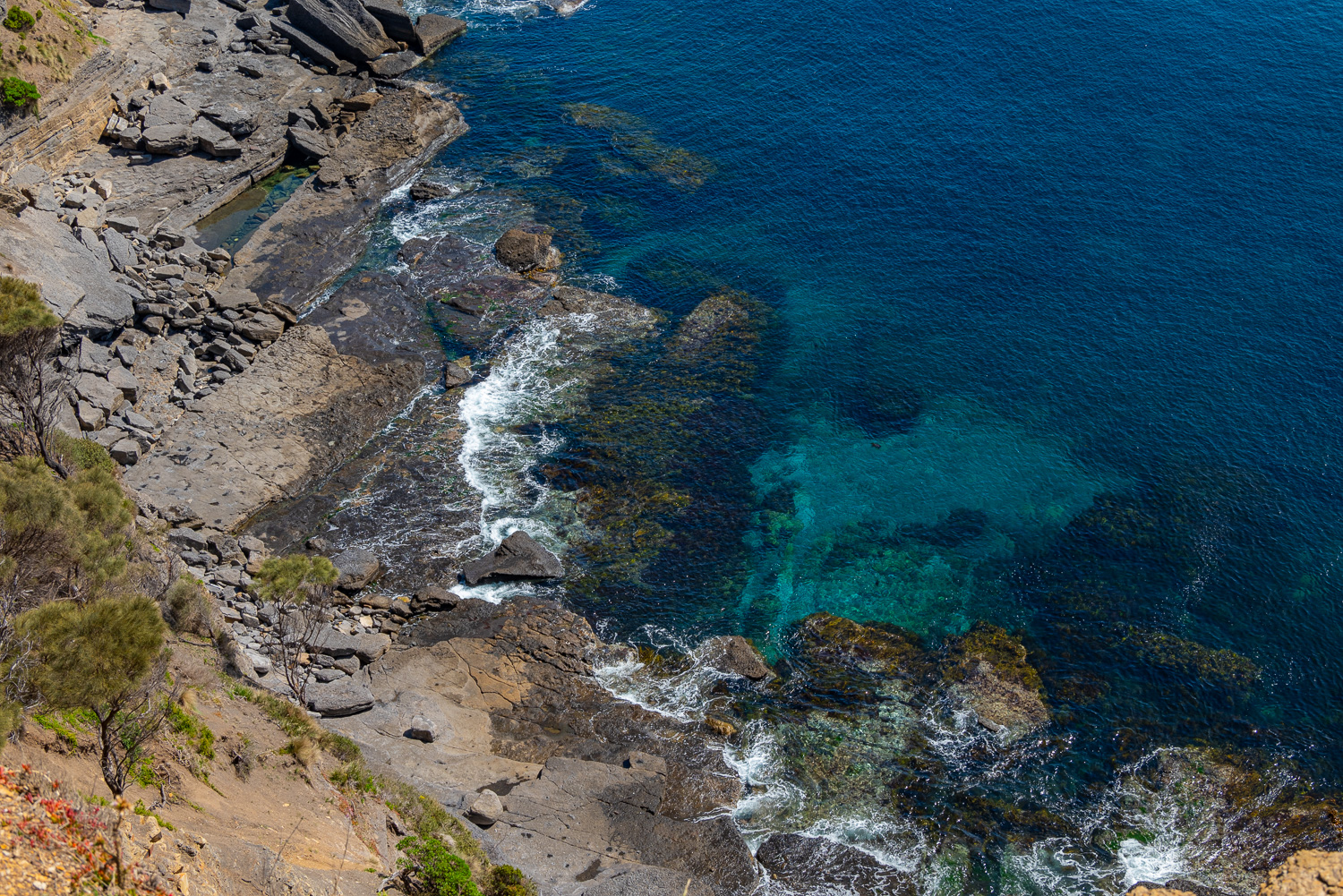
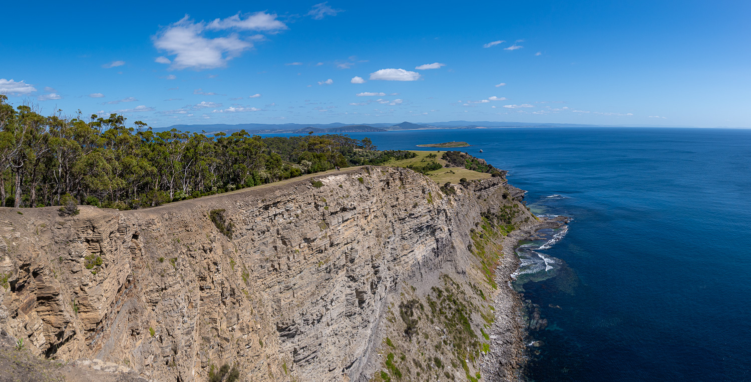
The early part of the trail passed the Fossil Cliffs. In the exposed rock face and loose rocks on the ground lie the fossilised remains of millions of sea creatures that are about 290 million years old. The dark rock containing the fossils consists of alternating beds of fossil-rich limestone and siltstone. In the 1920s, the limestone was briefly mined and used to make cement.
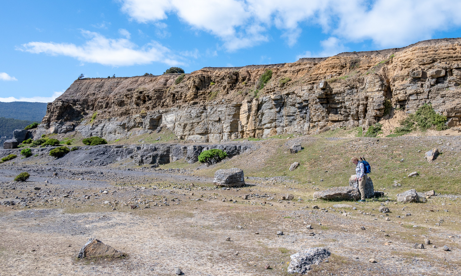 Charlotte fascinated by the fossil-rich rocks laying on the ground
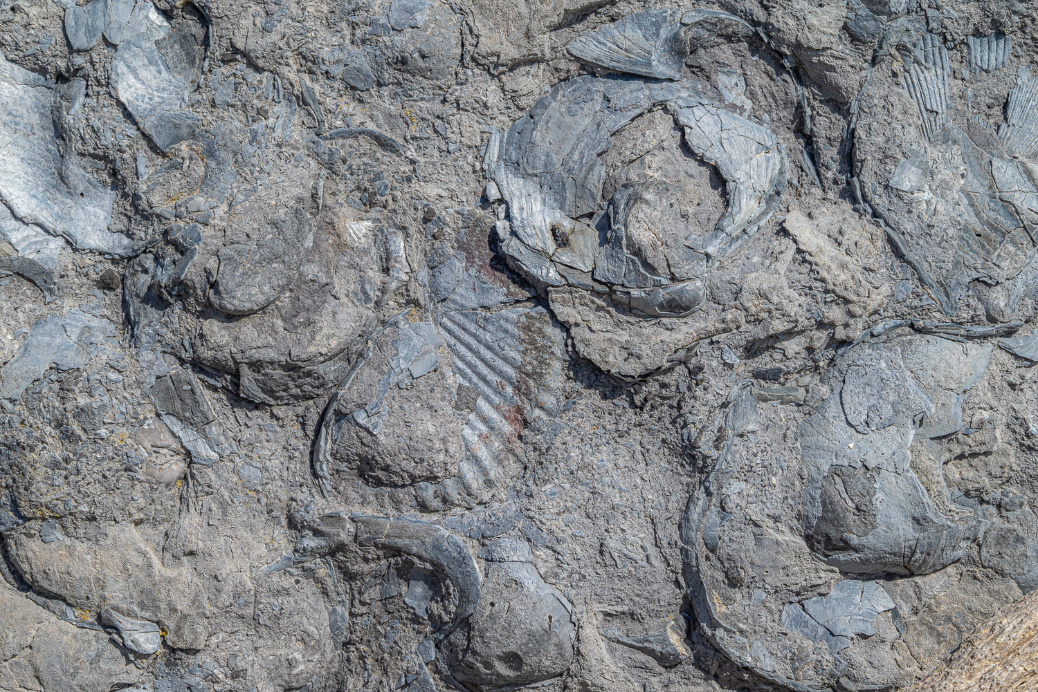 Fossilised rock, which include clams, sea fans, corals, scallop shells and sea lilies
Here is some of the wildlife we saw along the way:
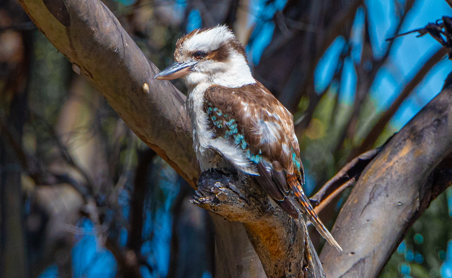 The Laughing Kookaburra is one of the larger members of the Kingfisher family and recognised by its voice. The chuckling voice that gives this species its name is a common and familiar sound throughout Tasmania. The loud ‘koo-koo-koo-koo-koo-kaa-kaa-kaa’ is often sung in a chorus with other individuals.
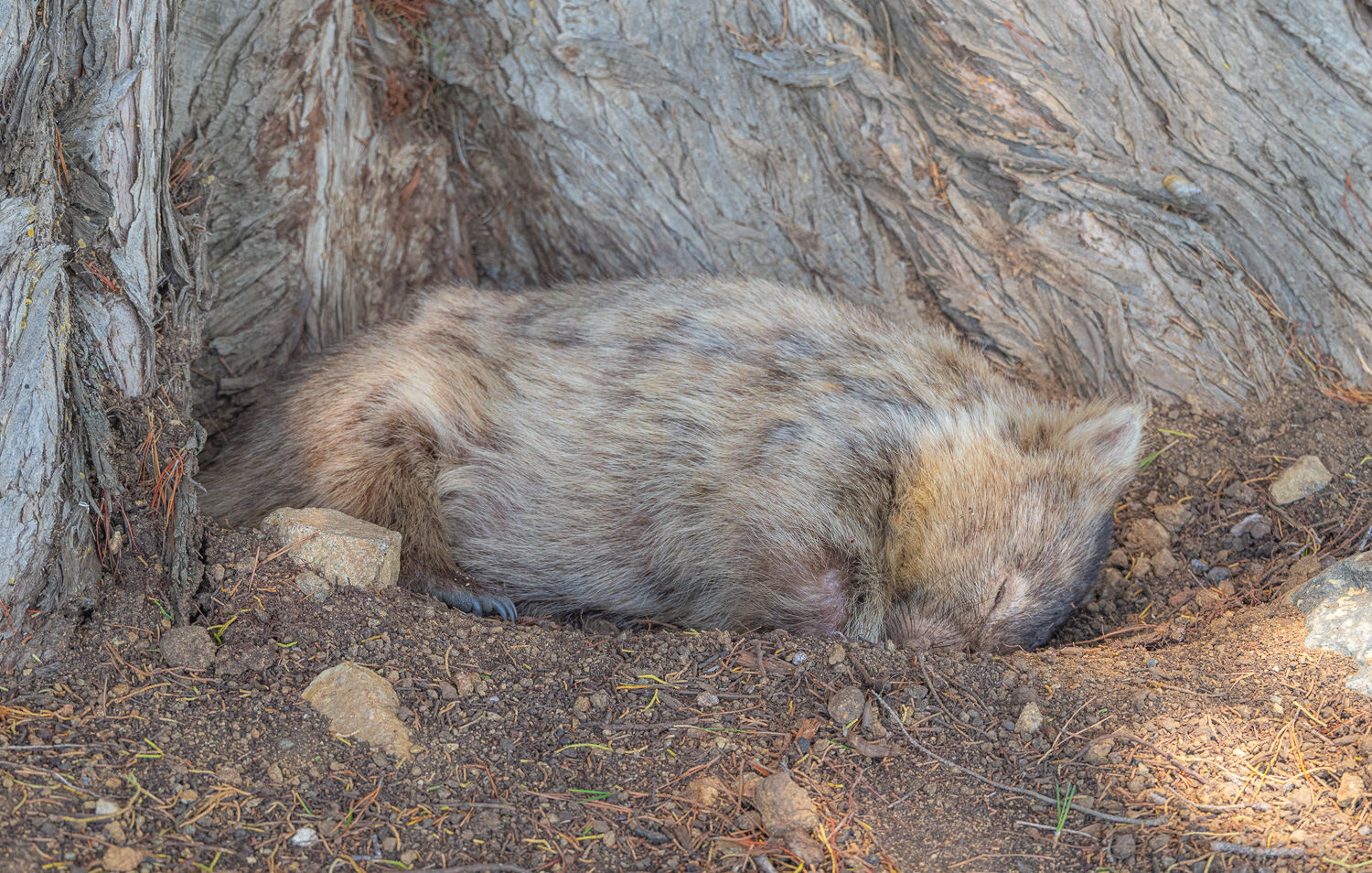 This ball of fur (aka, Wombat) was taking a nap in the midday heat, at the base of the tree
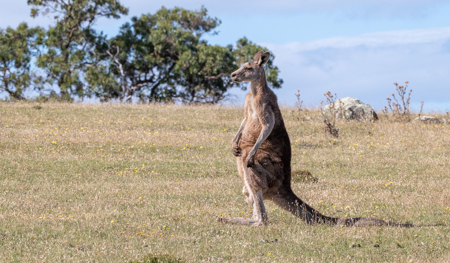 A Forester Kangaroo with an itchy belly!
Maria Island Cruise
The next day we were able to see a different perspective of Maria Island from the sea on a small boat.
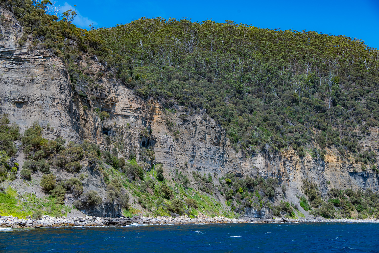 From the sea the shear scale of the Fossil Cliffs can be appreciated
 This permanent spring-fed waterfall has created a green algae garden at it’s base
 Due to the day-long high tides for this time of the year, we were not able to see the Painted Cliffs on our first day on the island, so this was a very unique opportunity to see them from the sea.
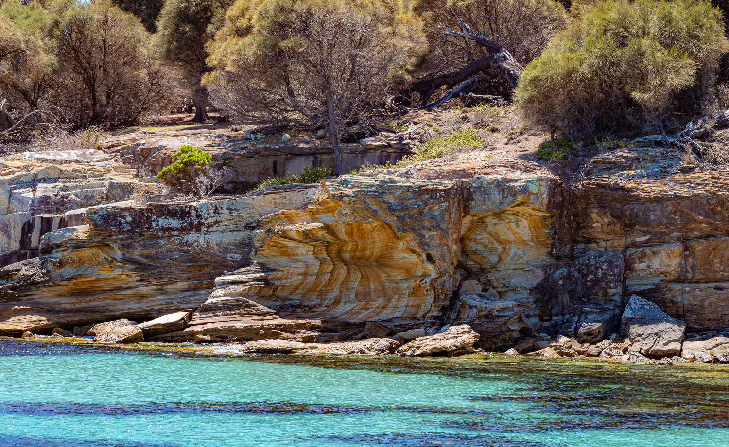
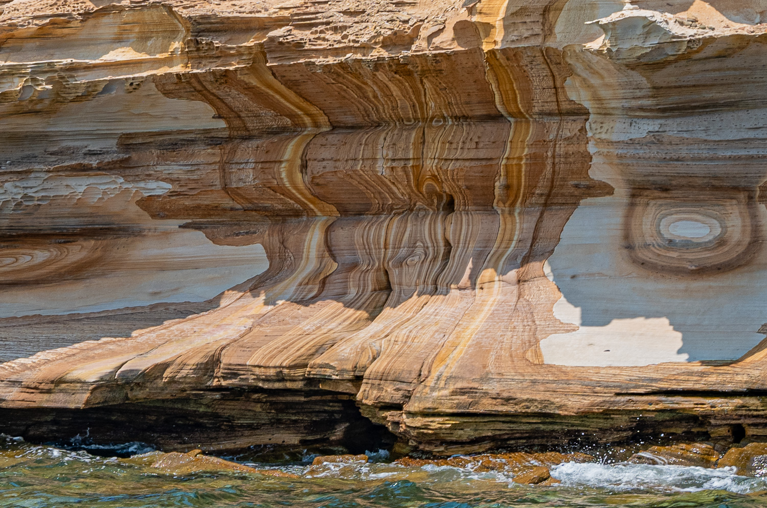
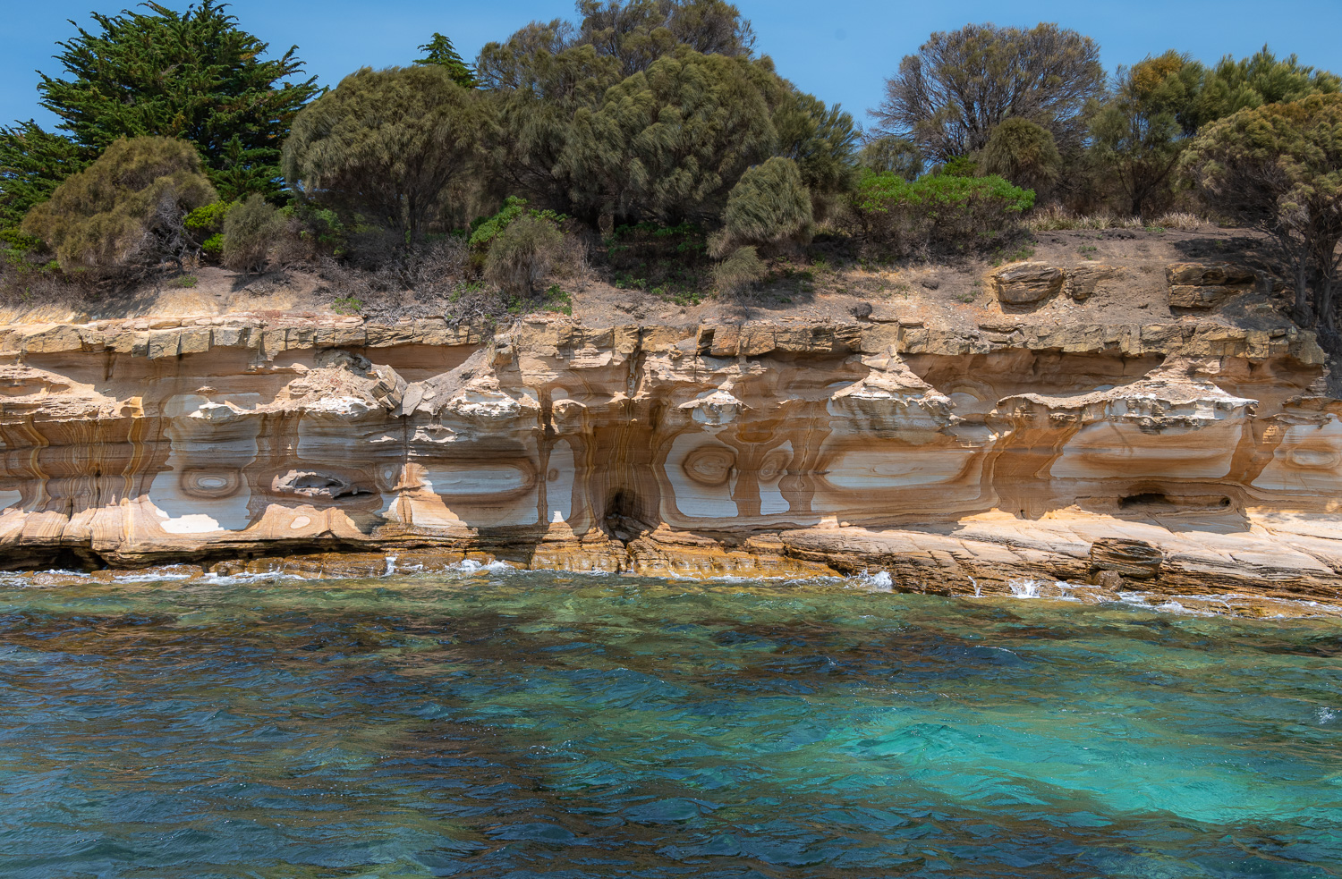 The patterns on the Painted Cliffs are caused by ground water percolating down through the sandstone and staining the rock. Wave action and sea spray have continued the erosion, resulting in beautiful honeycomb patterns, potholes and notches.
Ile Des Phoques (Island of Seals)
Leaving Maria Island the boat then headed for the Island of Seals.
Named by the French in 1802 during their exploration of Australia, the island was a site of seal hunting from at least 1805. Today it is a marine sanctuary and wildlife refuge, with a large colony of Grey Fur Seals, nesting Sea Eagles, Terns, Cormorants, and little Penguins. The island has the largest granite sea caves in Australia.
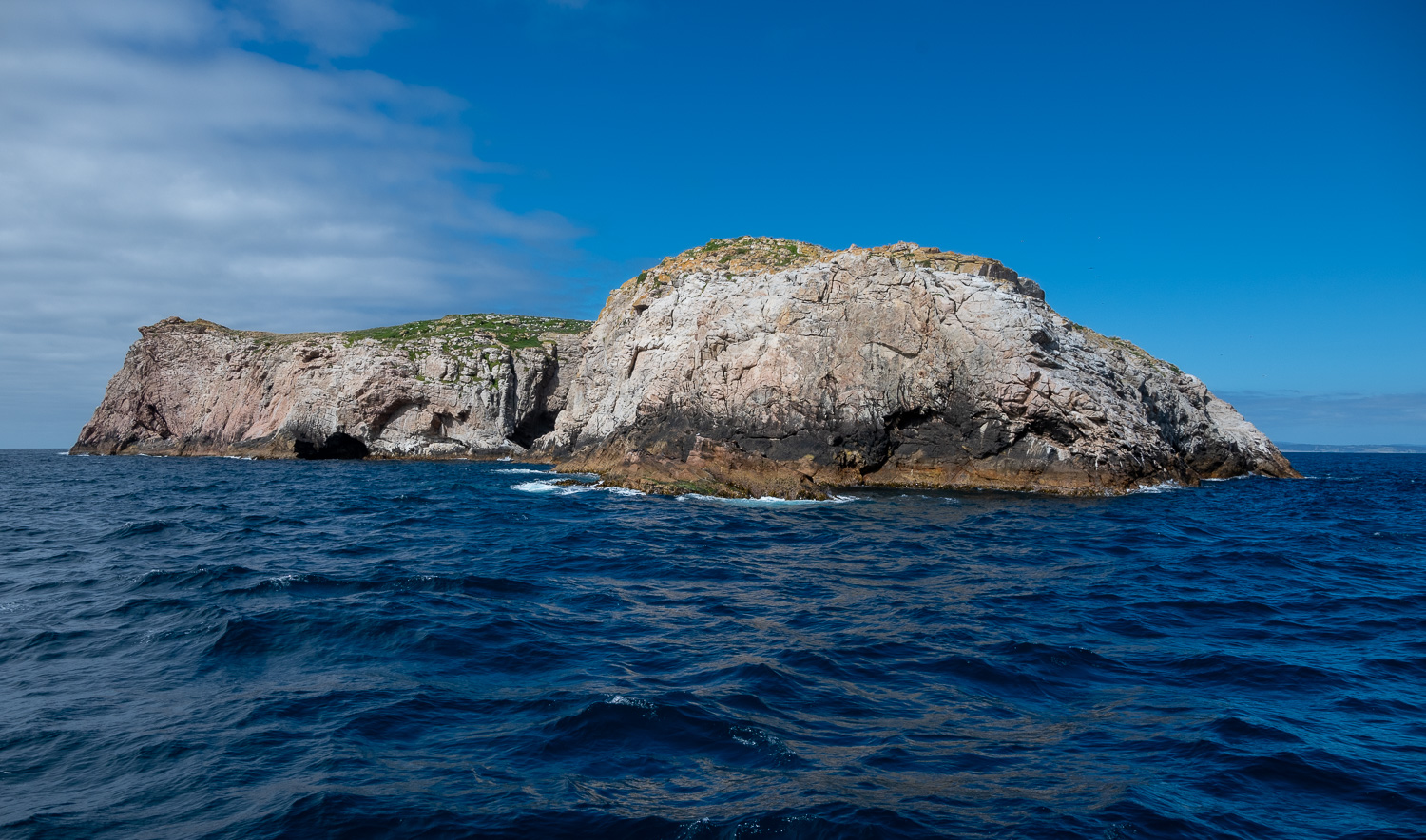 This small island is just 20 acres in size, yet is home to abundant wildlife and fascinating geology
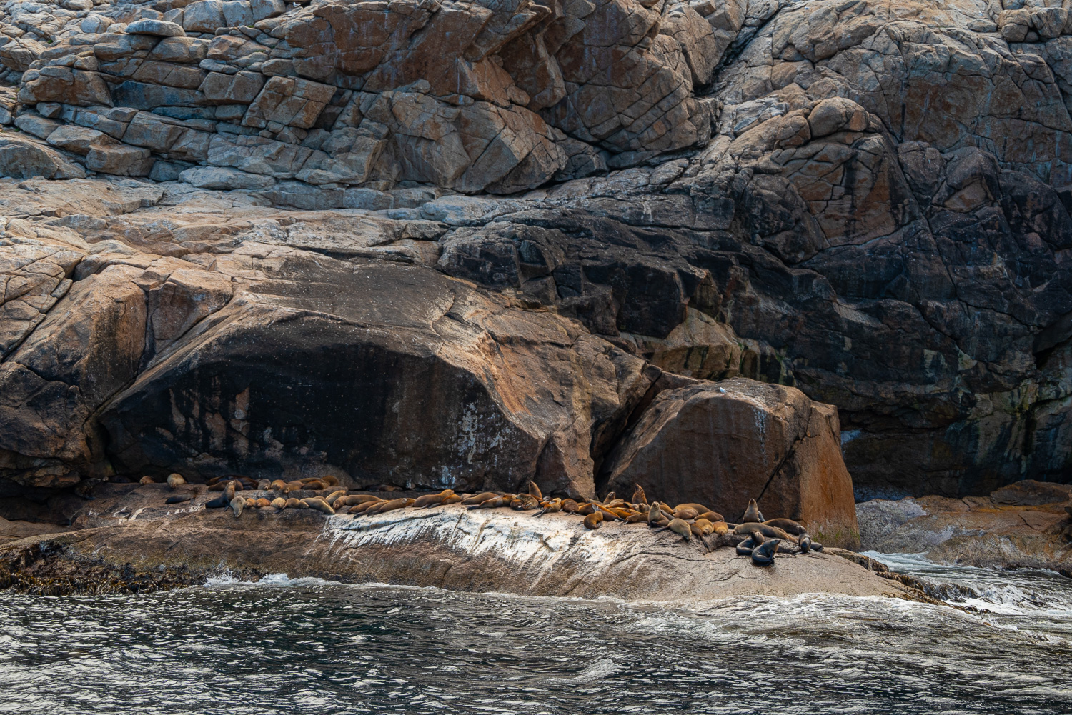 Grey Fur Seals – Many seal populations declined significantly in the 18th and 19th centuries due to hunting. Commercial seal hunting was finally banned in Tasmania 1923. Today the numbers on Ile Des Phoques have recovered and the resident colony now averages 500 seals.
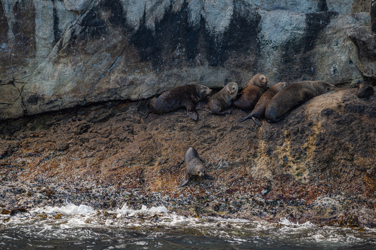 A pup tentatively approaches the water as adults look on
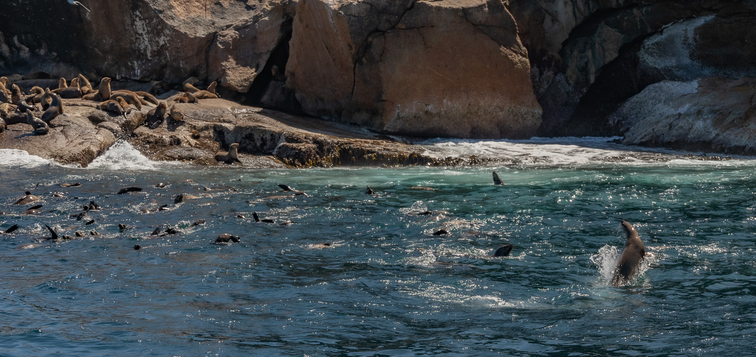 The arrival of our small boat largely unfazed the seals, most of whom carried on sleeping. However, the youngsters eventually came out to play and showed off for us!
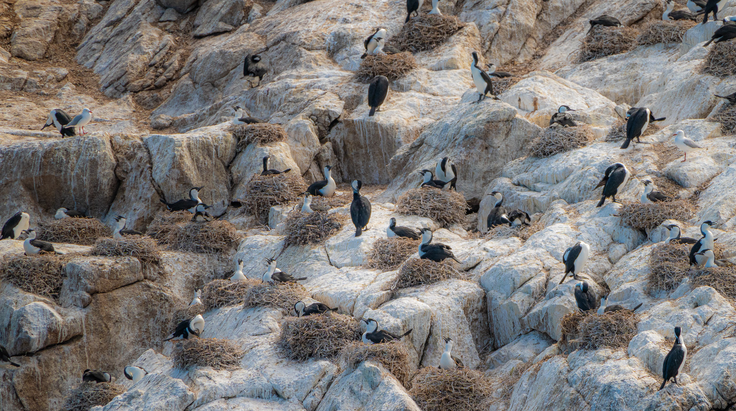 Black-faced Cormorants nesting on the cliff face
The boat repositioned to the other side of the island, so we could explore a sea cave.
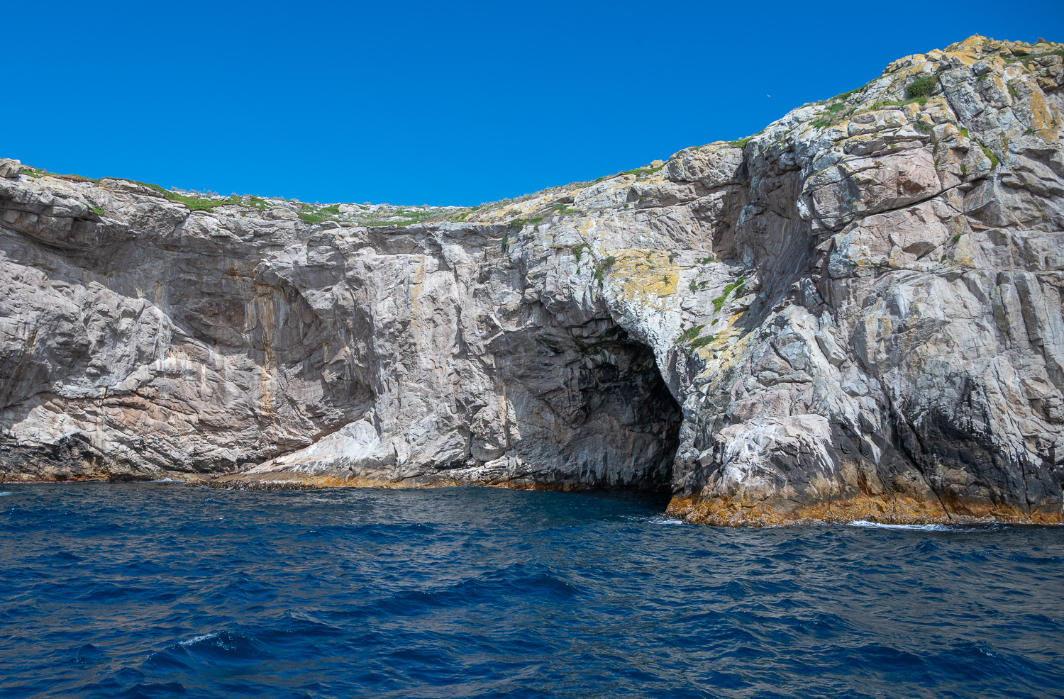 The approach to the entrance of this limestone sea cave didn’t give any clues to the wonders inside
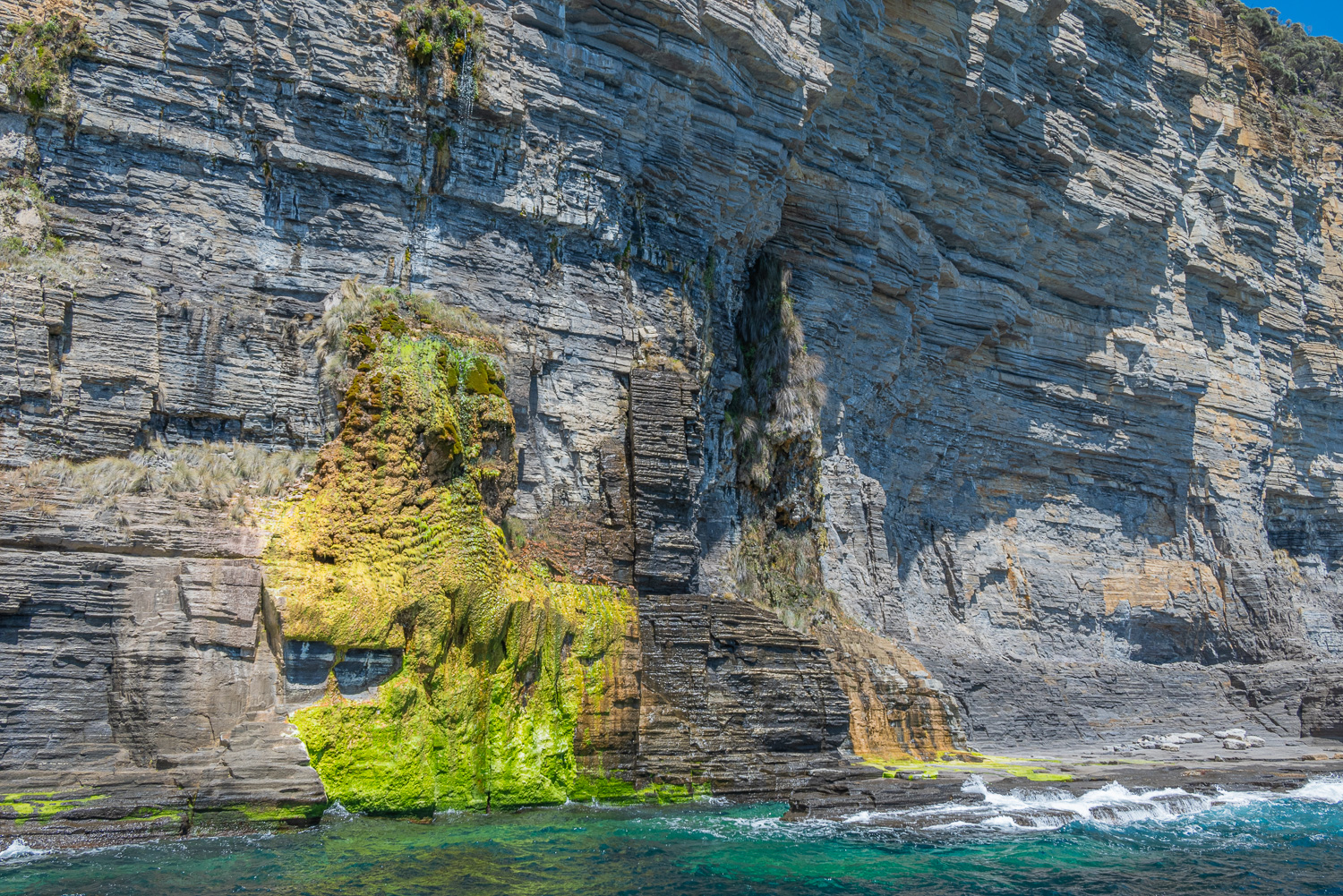
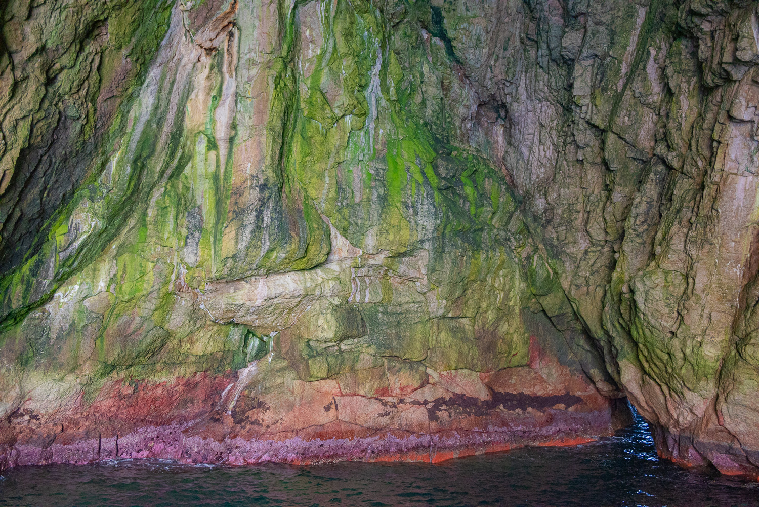
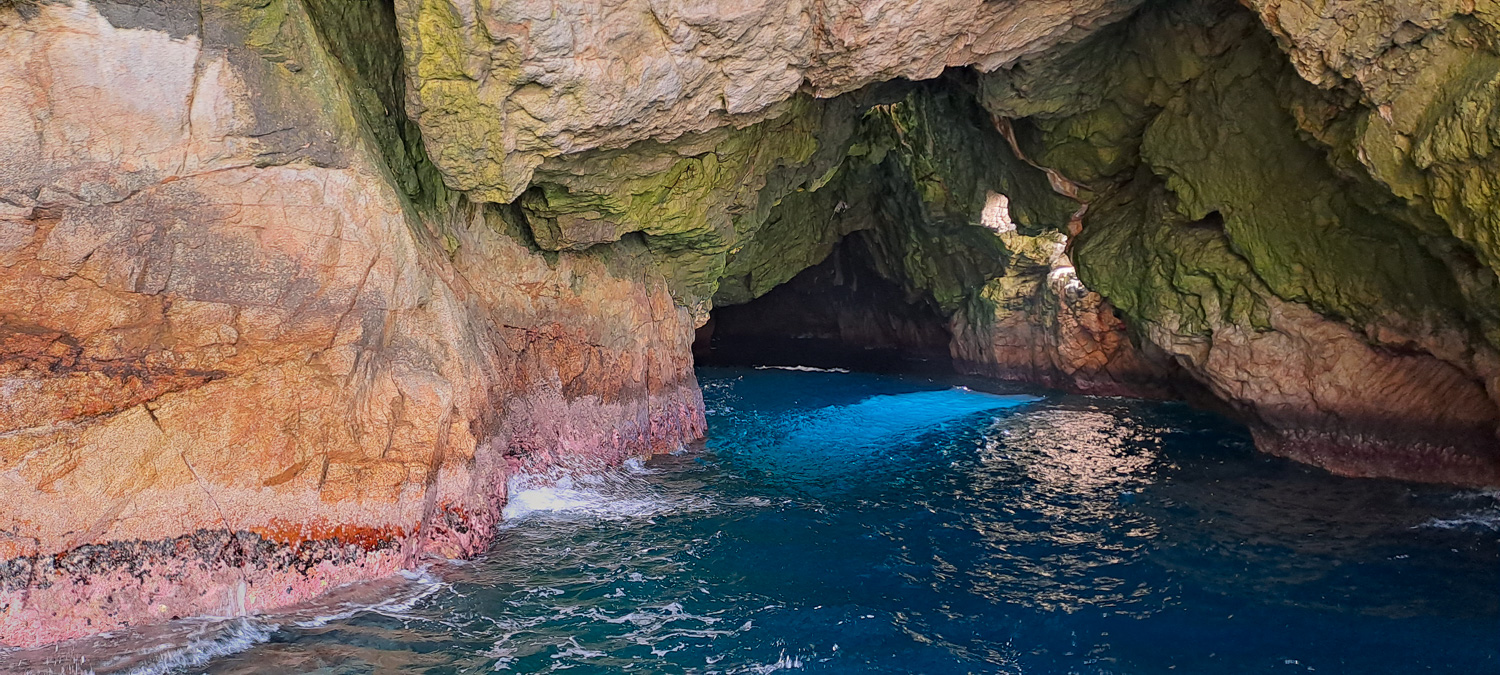 This giant cave is incredibly special. It is twice as deep underwater as it is high above and extends up to 250 feet inside the island, with a shaft of light streaming in from a natural window. The kaleidoscope of colours from the algae, light and water gives the cave a stunning rainbow effect.
 A wind-swept Charlotte clearly enjoyed the cave!
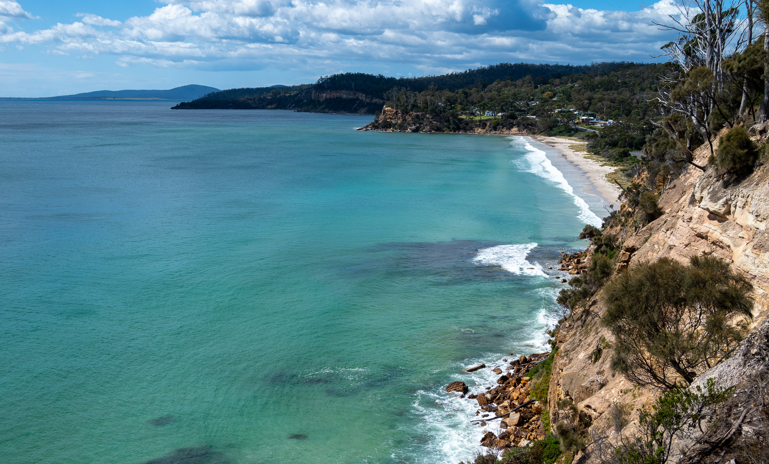
Bicheno (Bish-uh-no)
Bicheno is a relaxed beachside town, known for its seafood, wildlife, and coastal scenery. It is ideally located for access to the magnificent Freycinet National Park.
Redbill Beach
This little beach was just a short walk from our accommodation in Bicheno
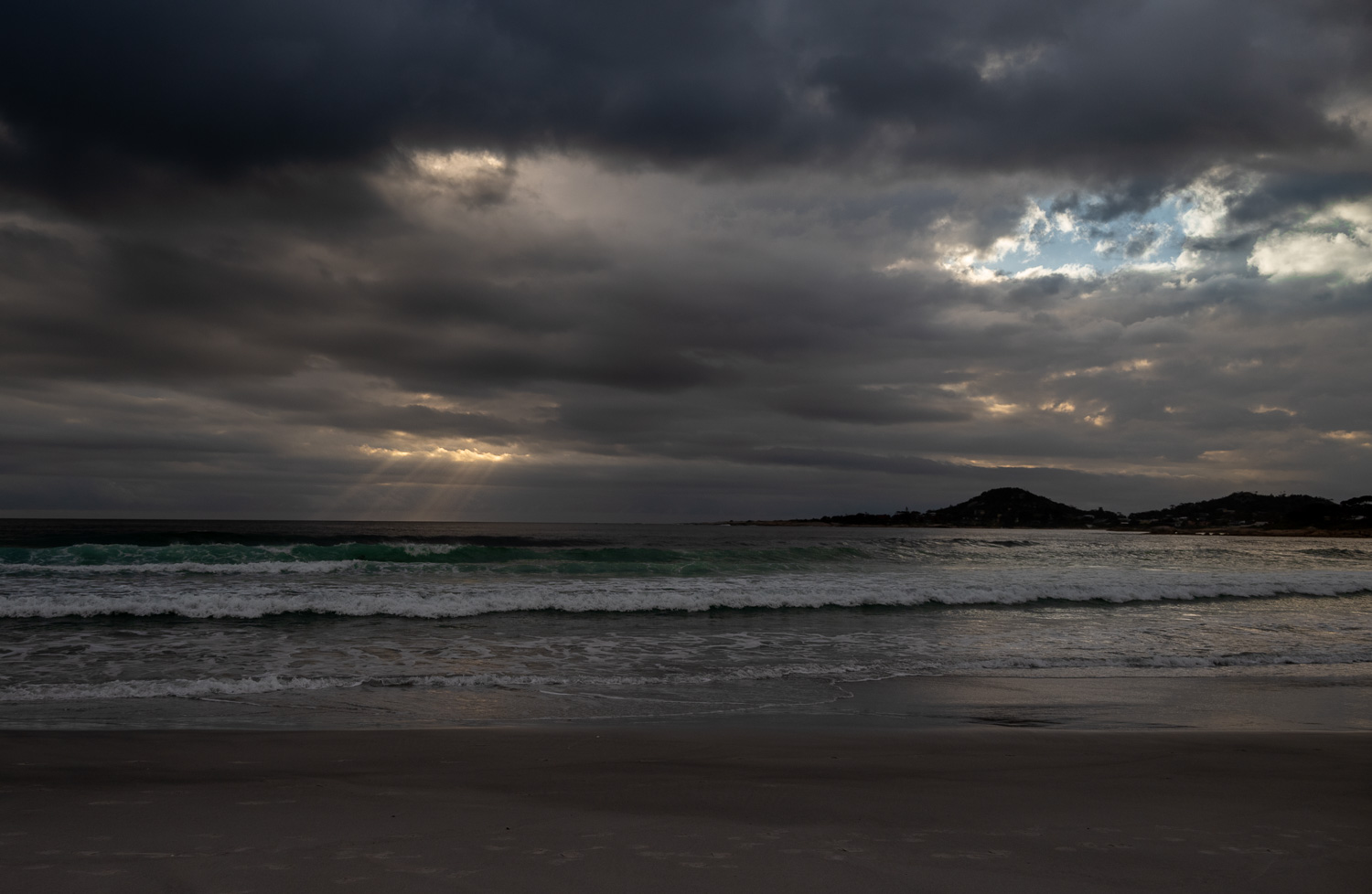 Dramatic early morning light across the beach
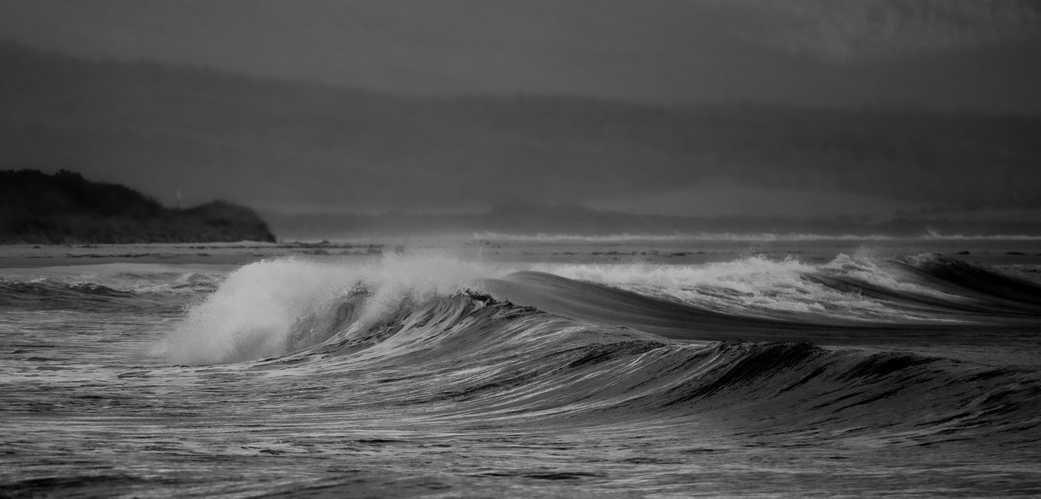 Beautiful wave formations roll into the beach
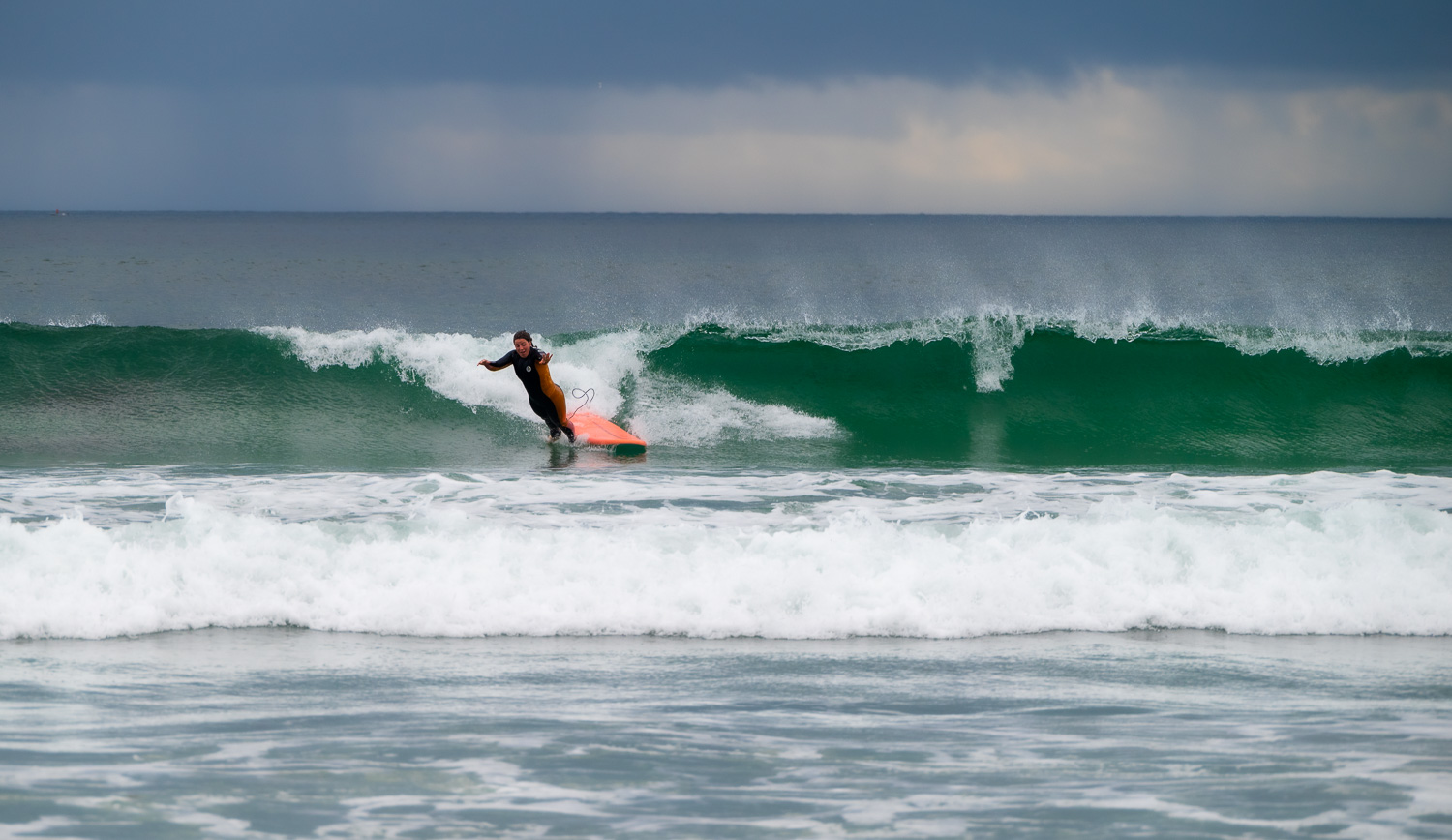 The beach is popular with surfers of all levels!
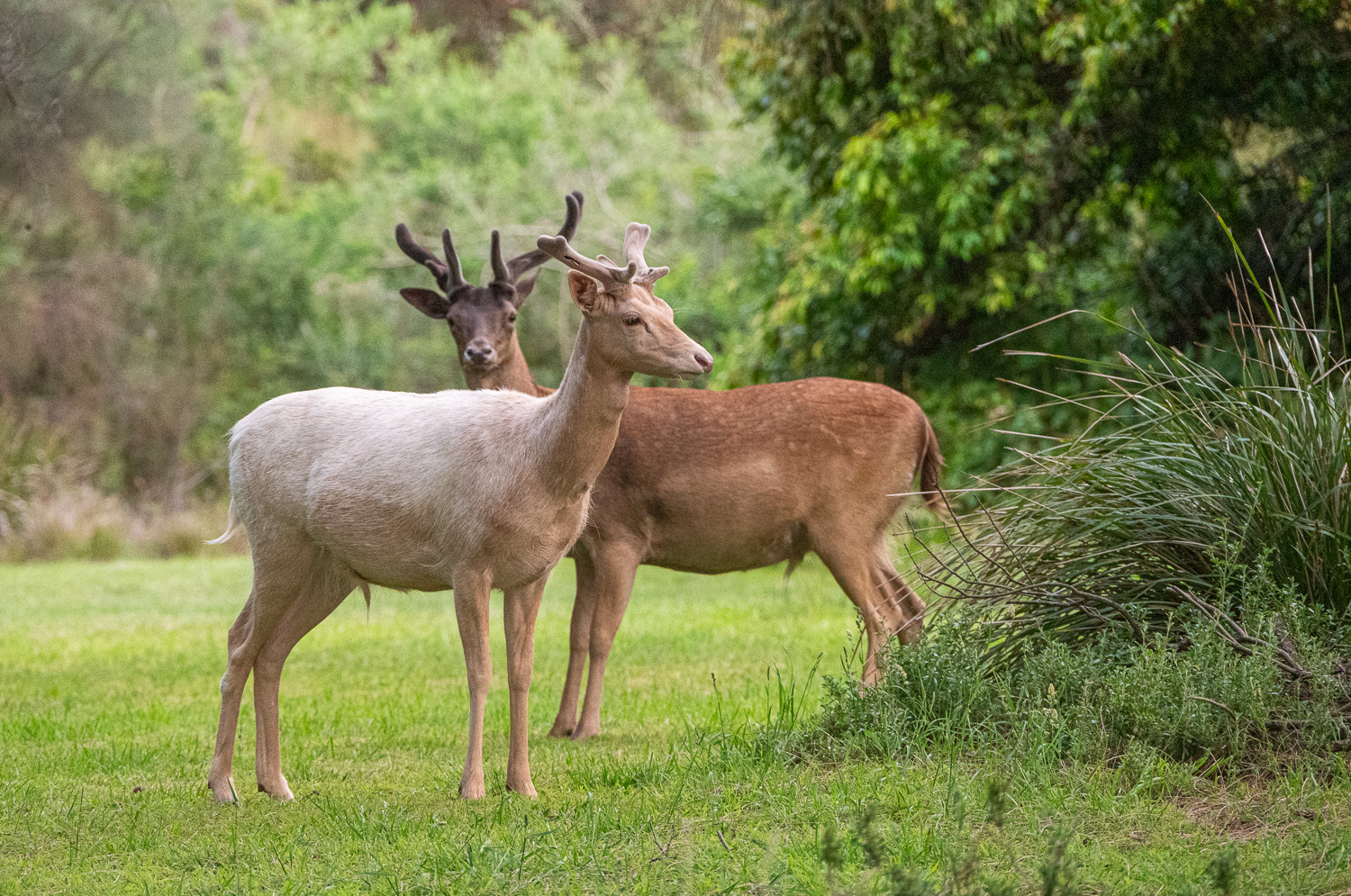 Two juvenile Fallow Deer near the beach
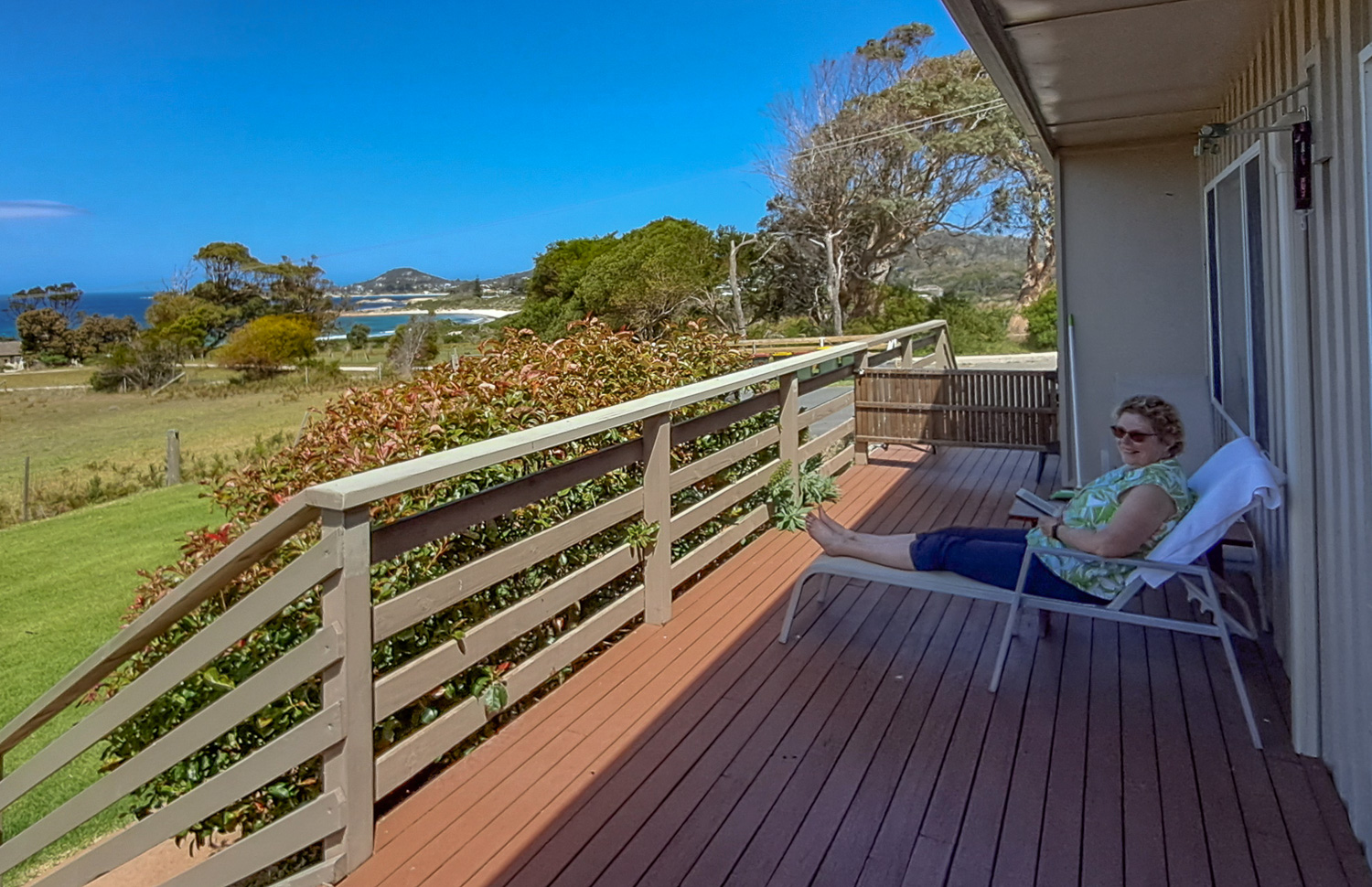 Charlotte enjoying the view of Redhill Beach from the verandah
Bicheno Foreshore Footway
This scenic waterfront walk starts at the end of Redbill Beach, and ends 2.5 miles later at the Bicheno Blowhole.
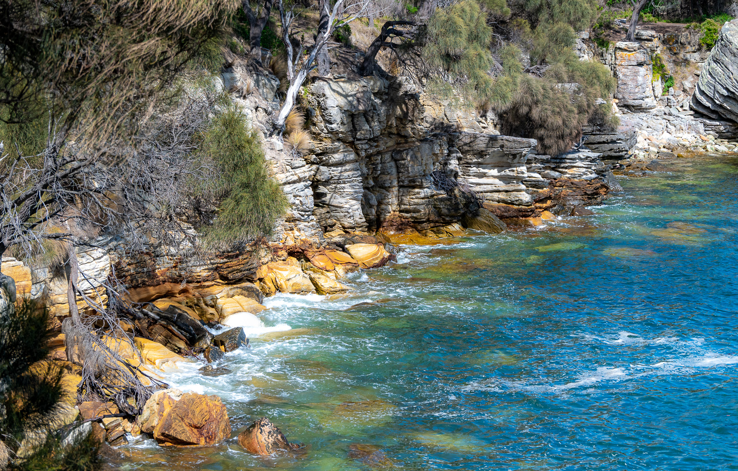
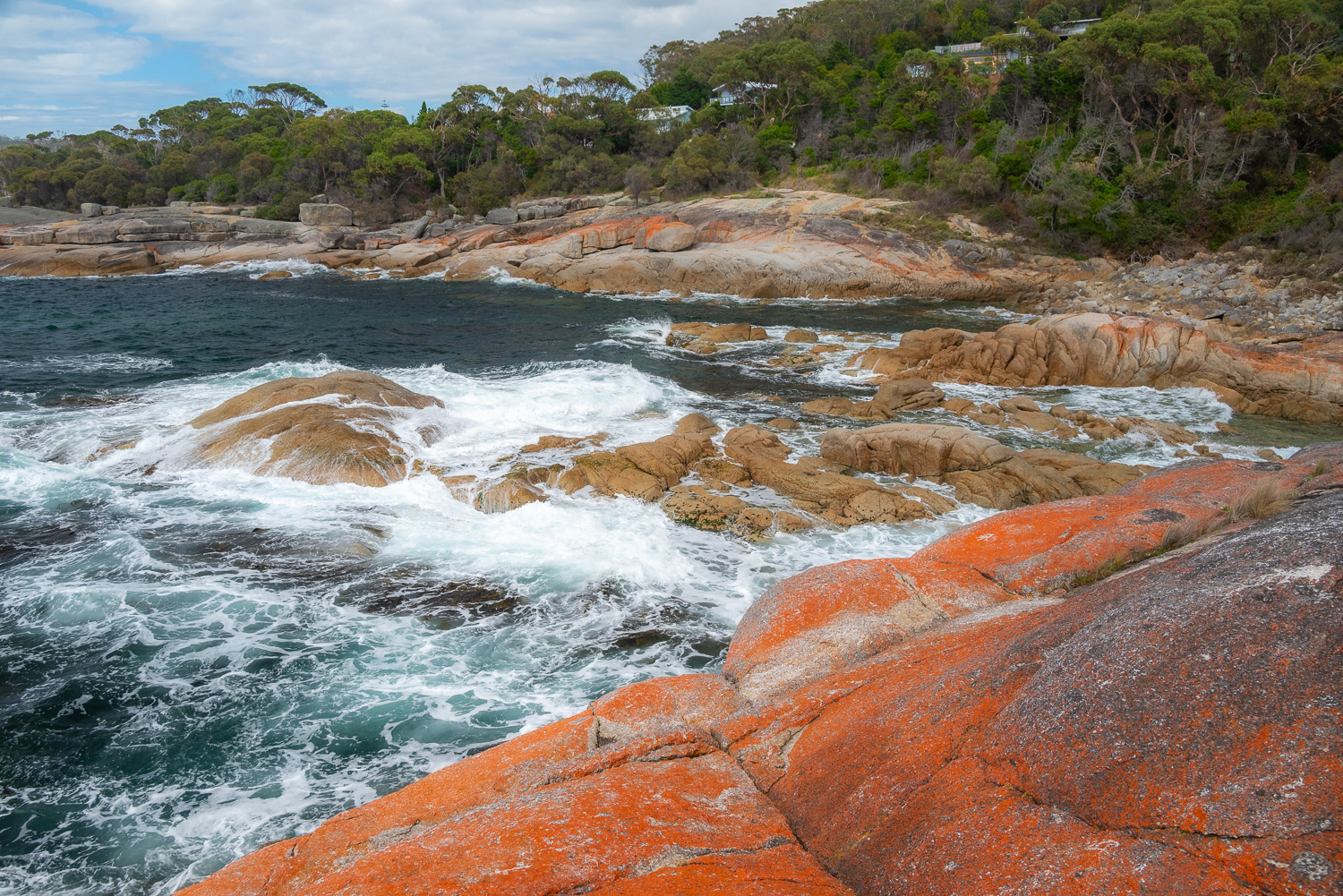 Much of the coastline around Bicheno is defined by the distinctive granite rocks dotted with orange lichen. When the high winds create crashing waves, the scenery is stunning.
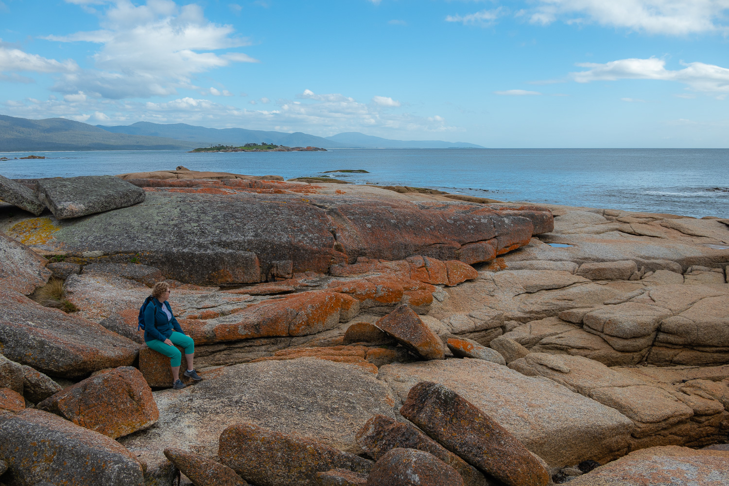 When the coast is sheltered from the wind, the scene can be very calm and serene
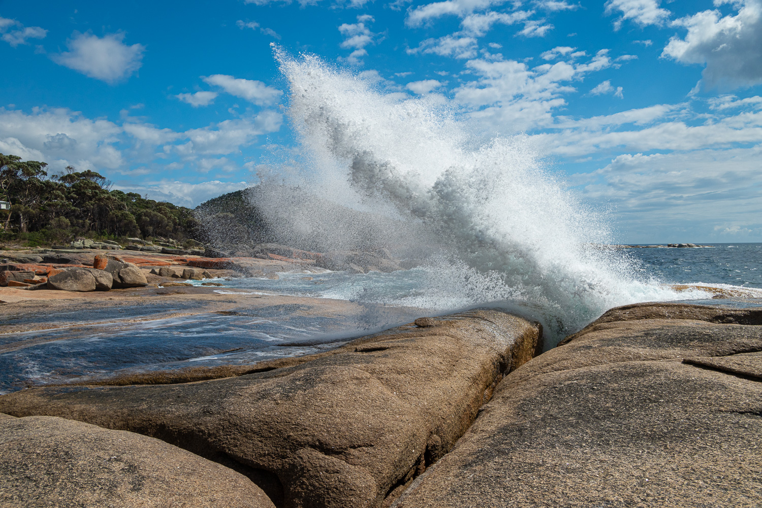 Bicheno Blowhole is a spectacular natural feature where water erupts out of a hole in the top of a sea cave
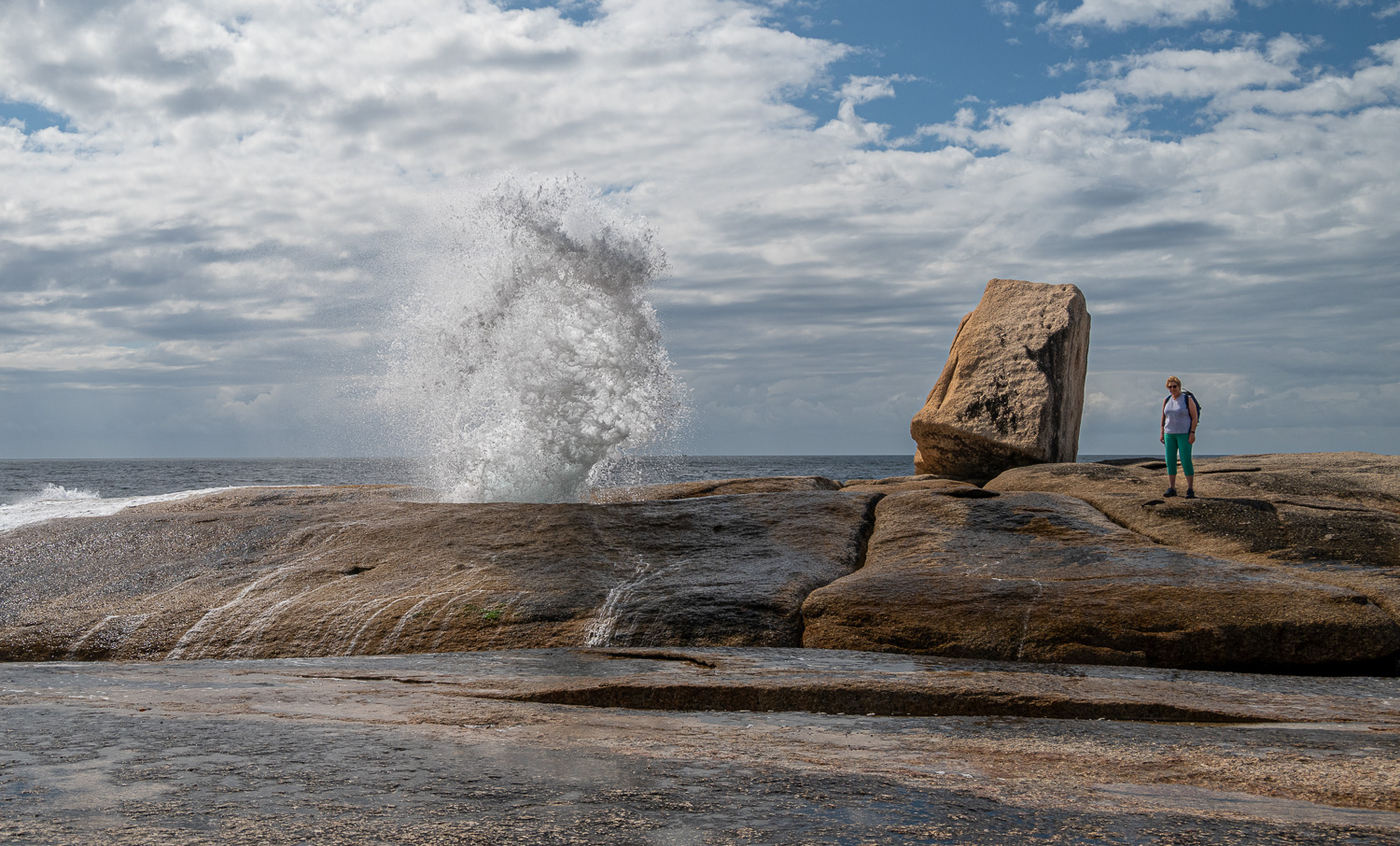 Charlotte poses for the camera, well away from the water…
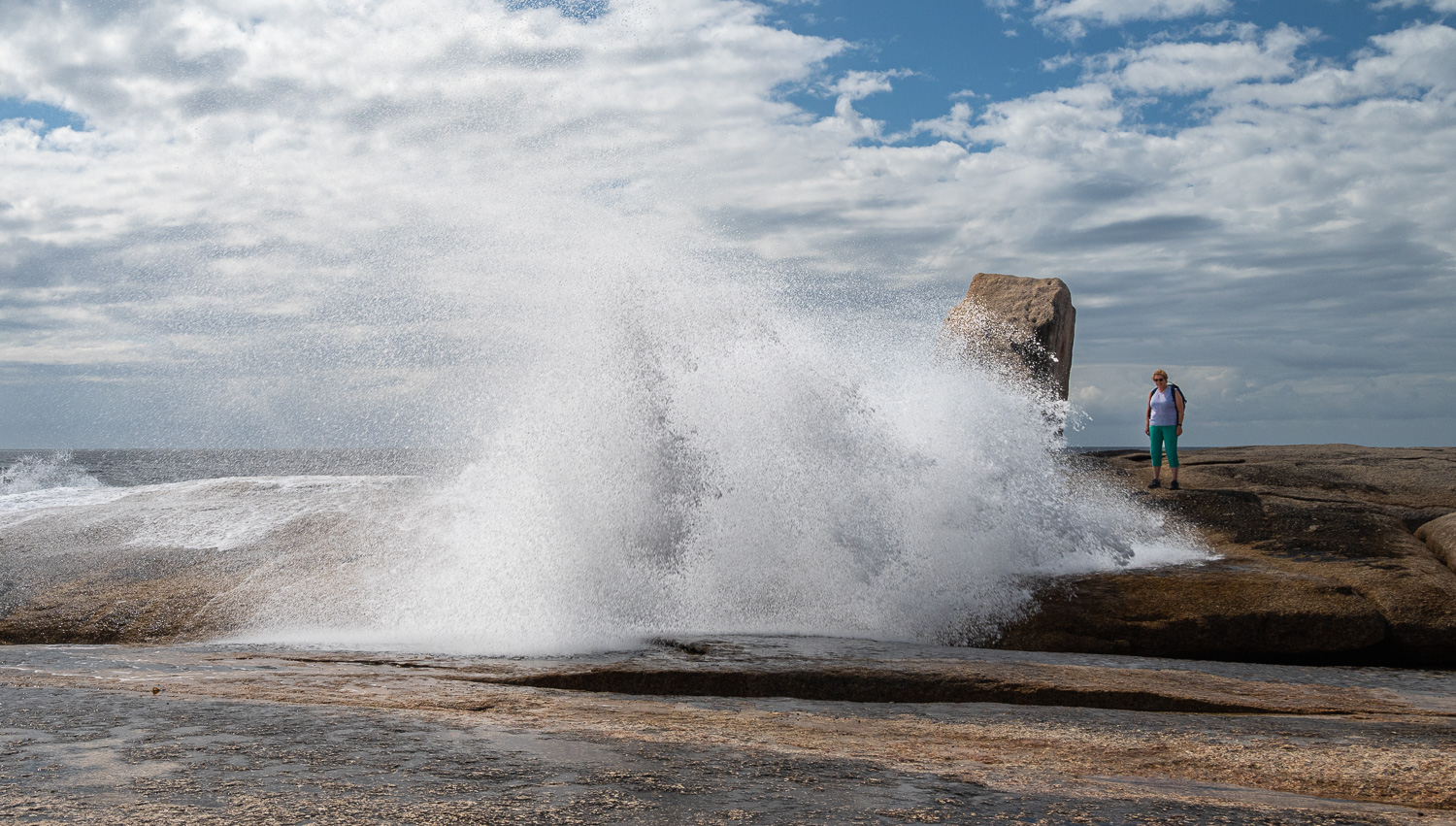 But of course nature is never predictable!
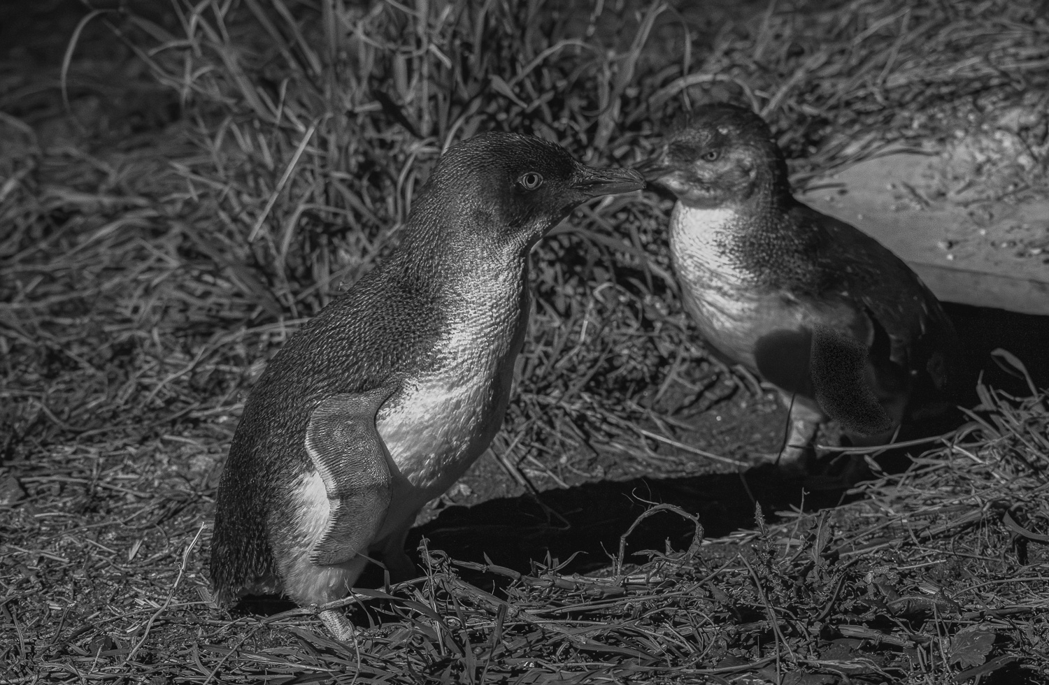
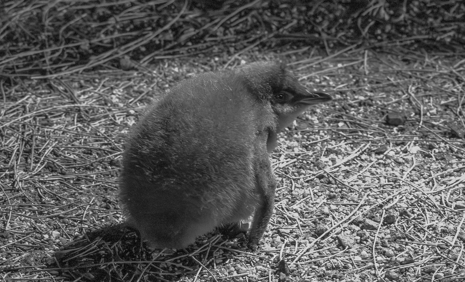
Bicheno’s Little Penguins
New Zealanders call this penguin the Little Blue Penguin or just Blue Penguin. Australians call it the Fairy Penguin or Little Penguin. These common names come from their small size (13 to 15 inches tall), the smallest of any of the world’s penguins, and the distinctive slate-blue or indigo-blue colouration of the feathers on the top of their body.
They are year-round residents at Bicheno. When they leave the land to forage for fish in shallow inshore waters, they do so in flocks at dawn under cover of darkness, spend the day at sea, and return to land at dusk, again in flocks. Their burrows are normally hidden in the dunes and the dawn to dusk behaviour in flocks provides them with protection from predators. The breeding season is August to February and they like to build their burrows under the sheltered ledges, shrubbery and rocks that lie just beyond the sand of the beach.
We visited a private rookery reserve at dusk to watch the penguins return up the beach to their burrows and their young. The area around the beach is illuminated with red light, which the penguins cannot see, but it allows us to see them!
 Parents outside their burrow
 A young chick waiting to be fed, but no sign of parents yet!
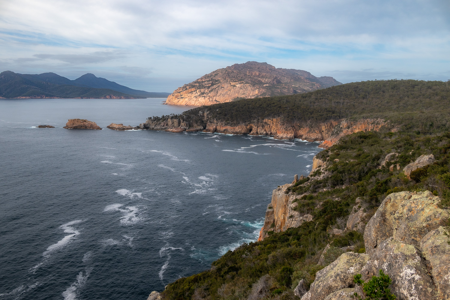
Freycinet National Park
The park occupies the majority of the Freycinet Peninsula and Schouten Island. The peninsula and National Park is located a short distance south of Bicheno. It is a place of natural beauty with pink granite mountains of The Hazards, white beaches and azure bays. It is home to one of Tasmania’s most famous vistas, Wineglass Bay.
Freycinet Peninsula is about 25 square miles in area, measuring about 14 miles long by 4 miles wide on average. Mount Freycinet at 2,011 feet, is the highest point on the peninsula.
We spent a couple of days exploring the park and here are some of the highlights:
Cape Tourville
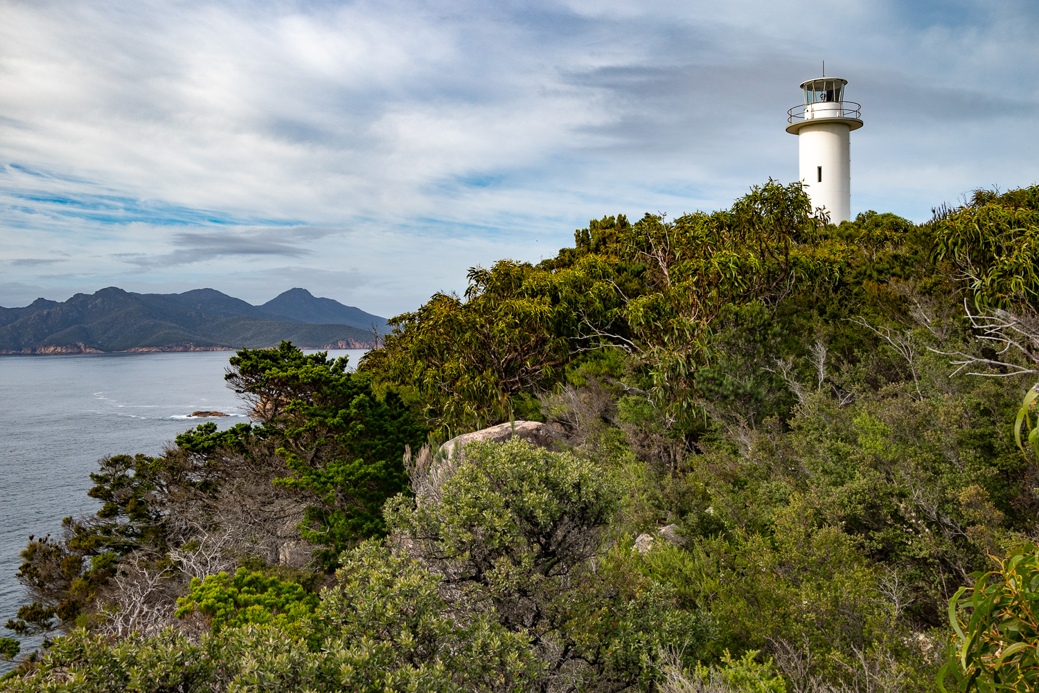 This short walk up to the lighthouse at Cape Tourville delivers remarkable coastal views of Freycinet National Park.
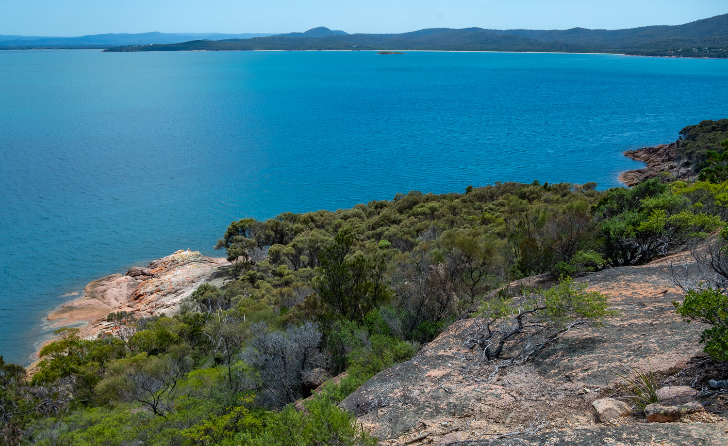
 View across Carp Bay to the Hazard Mountains, bathed in the soft early morning light
Sleepy Bay
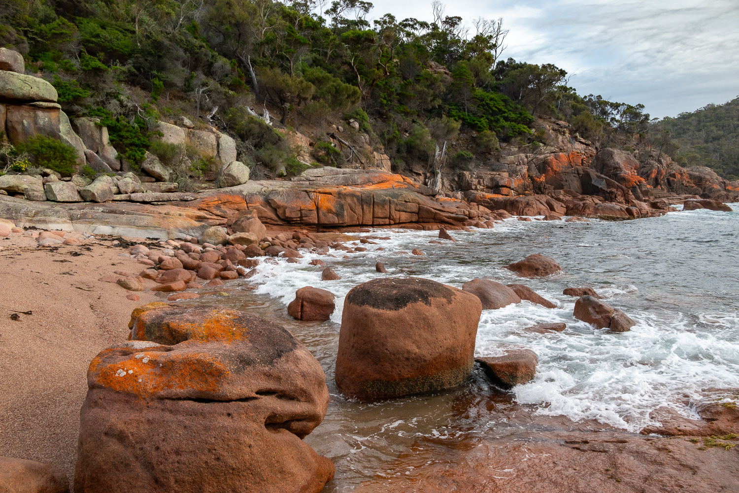 Sleepy Bay is a beautiful little bay with a gravel beach, encrusted with the orange lichen rocks that the East Coast of Tasmania is so well known for
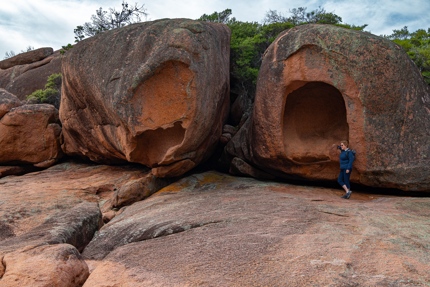 Many of these large stones were strewn about the beach
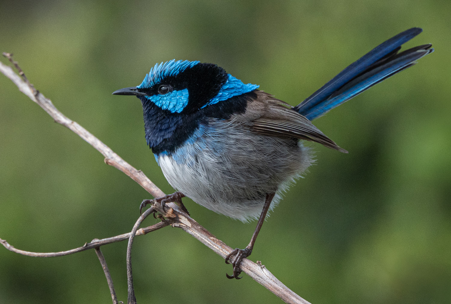 Male Superb Fairy Wren in his wonderful breeding plumage
Friendly Beaches
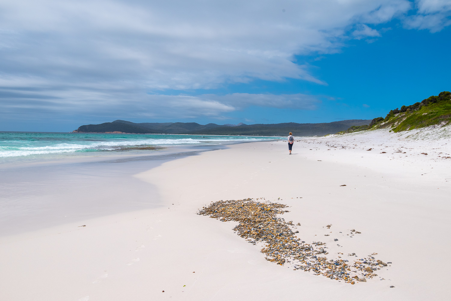 Spectacular views, miles of unspoilt white sand beaches and azure blue sea are what’s on show with this 7-mile long piece of Freycinet National Park coastline. The white sand is derived from the plentiful granite rock found in the park.
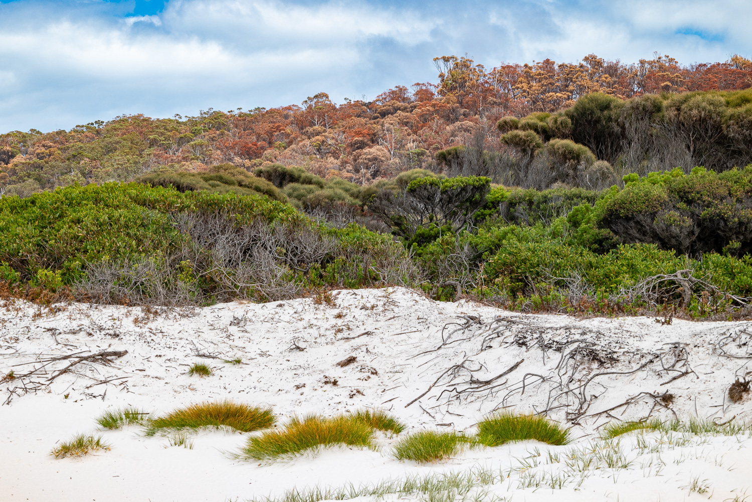 Sand dunes and colourful, wind-swept vegetation provide a backdrop to the beach
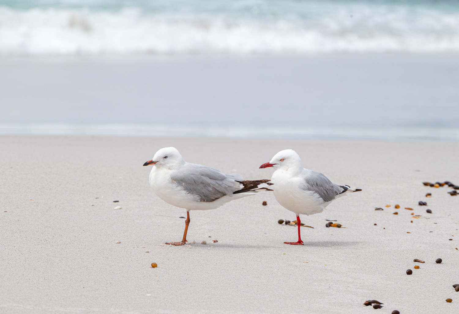 These Silver Gulls were balanced on one leg in the strong wind. When the legs are unfeathered, as in these gulls, the bird can lose precious body heat through the exposed skin. Keeping one leg tucked under body feathers while standing on the other helps the bird to keep warm – clever!
Wineglass Bay & Hazards Beach – Christmas Day Hike
This 9-mile circular hike started on the west coast of the Freycinet Peninsula with a 650 ft. ascent to the lookout point for Wineglass Bay. The lookout sits atop the shoulder between two peaks in The Hazards. This was followed by a descent down 1,000 steps to Wineglass Bay Beach, which is located on the east coast of the peninsula. Then a flat crossing of the isthmus to the west side of the peninsula and a trek north along the coast, firstly on Hazards Beach and then the rocky coastline of Great Oyster Bay.
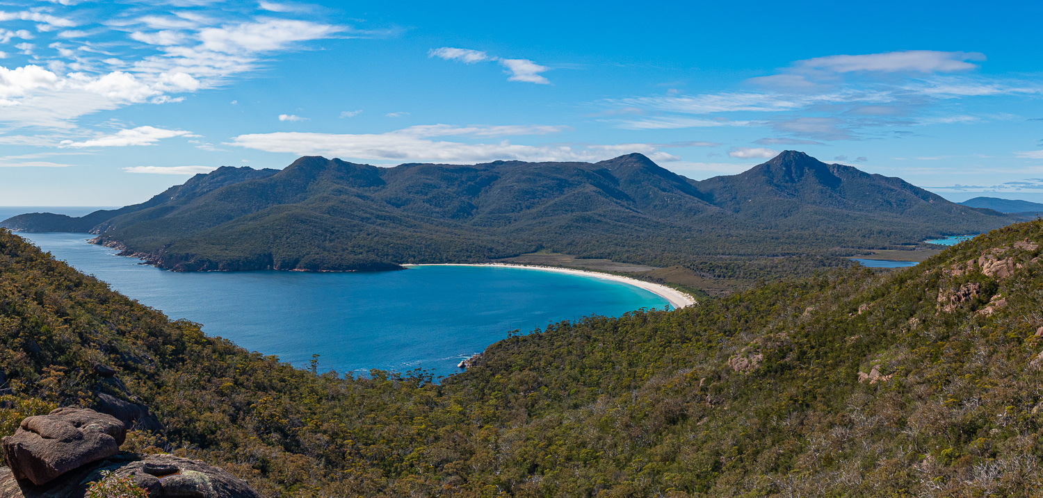 The view from the lookout across Wineglass Bay is one of Tasmania’s most celebrated views and is often seen on the front cover of holiday brochures. The lakes to the far right are part of the Hazards Lagoon.
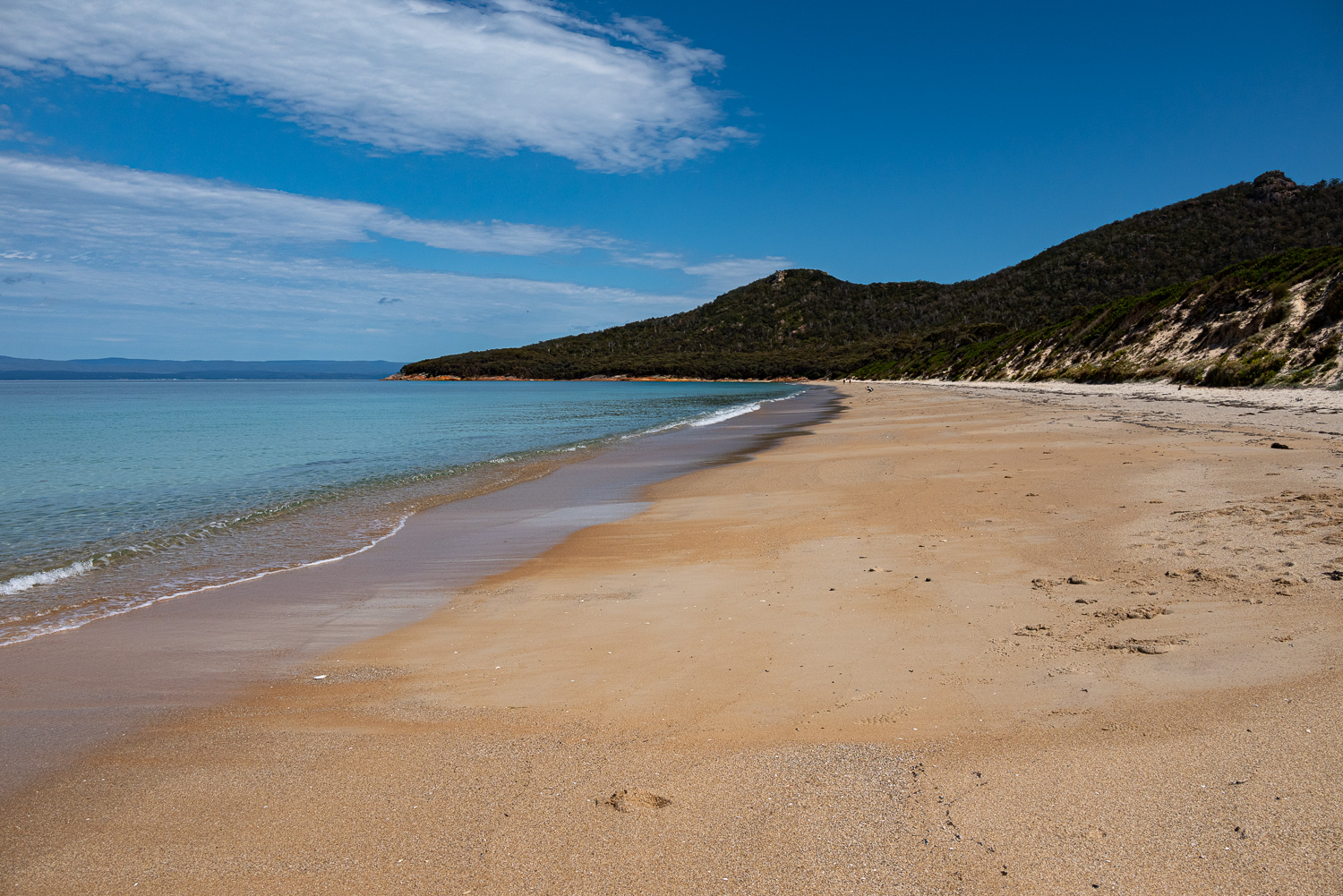
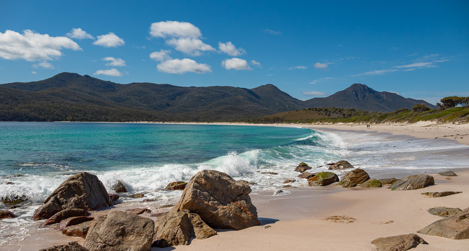 Wineglass Bay Beach is considered one of the top ten beaches in the world
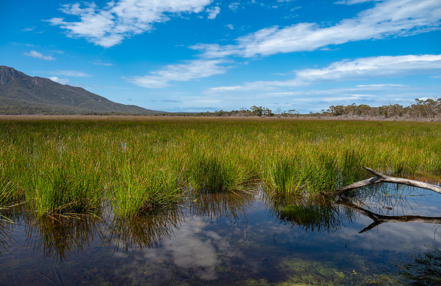 Crossing the isthmus alongside the Hazards Lagoon wetlands
 Back to the west coast of the peninsula and a walk along Hazards Beach
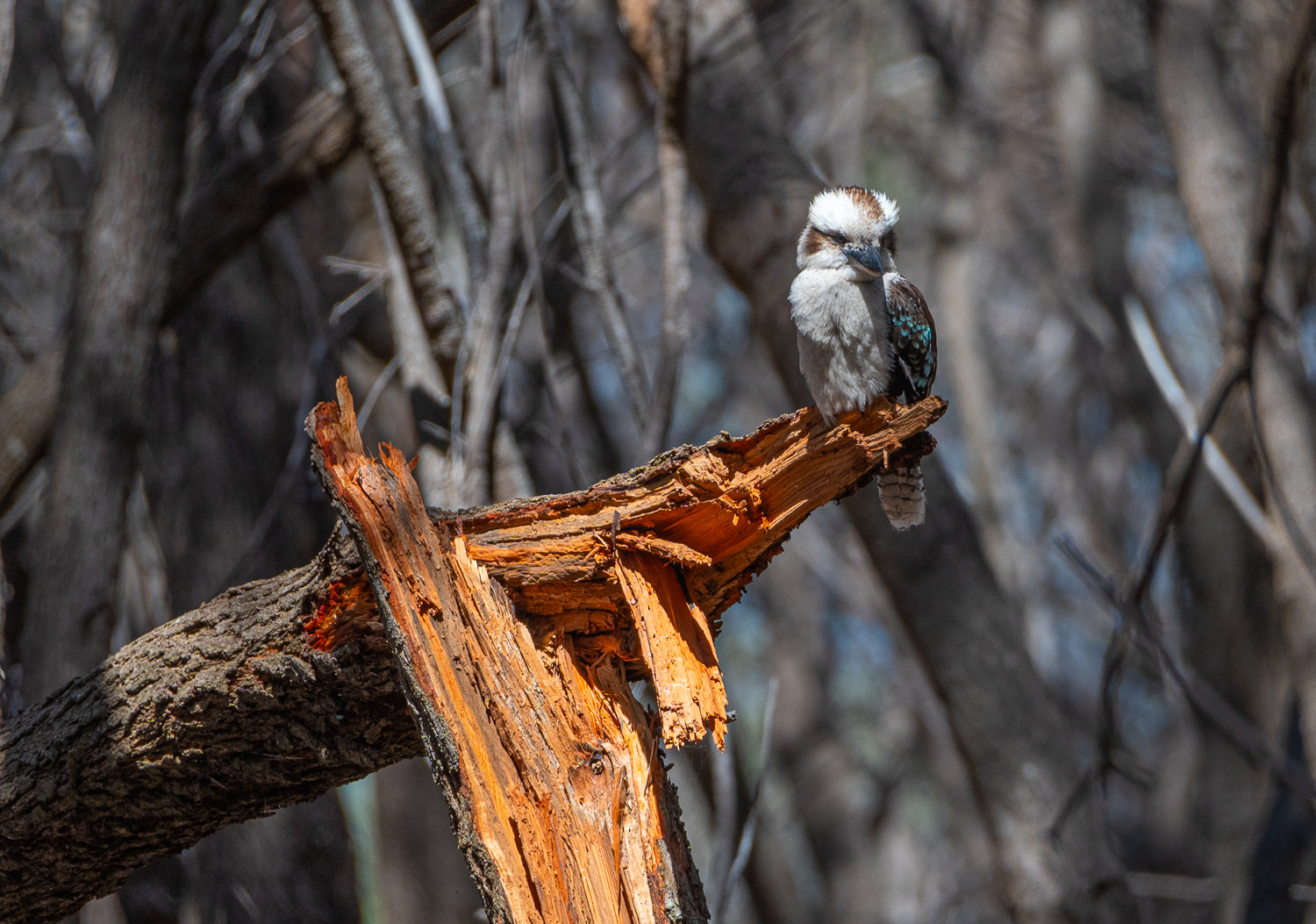 This Kookaburra stands out sitting on this burnt out tree
 The final part of the trek followed the rugged coastline overlooking Great Oyster Bay
This was a wonderful and challenging hike and a great way to spend Christmas Day and to mark the end of our exploration of the fabulous Freycinet National Park.
Sign-Off!
 We have yet to see a ‘Super-Roo’, that’s the giant Kangaroo that can lift up a car, but we are hopeful for a sighting in the coming weeks!
Merry Christmas to you all
