Continuing our tour of Tasmania, we explored the Northern areas of the island.
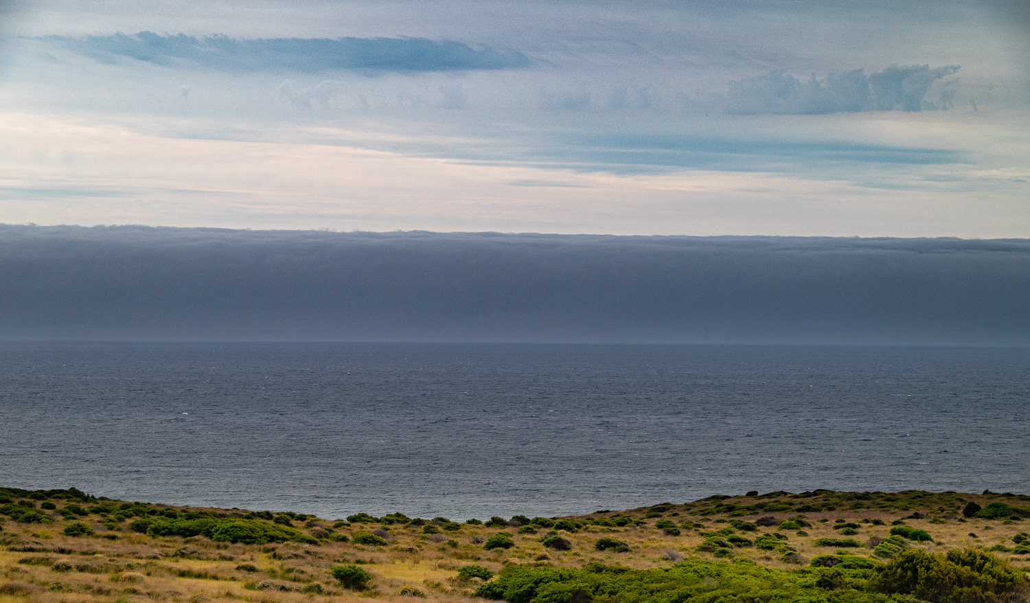
On route to our next destination we observed this fascinating cloud formation. A wall of cloud had developed off the coast, which was ‘sitting’ on the sea, completely detached from other cloud formations, and appeared to be rolling towards the shore. Apparently this is a rare form of Arcus Cloud, called a Roll Cloud. Roll clouds form when cold air moves under warm air, lifting the warm air and causing it to cool and condense into clouds.
St Helens
St Helens overlooks Georges Bay and is Tasmania’s second largest fishing port and is known as the State’s game fishing capital. The town offers easy access to the wonderful beaches of the Bay of Fires.
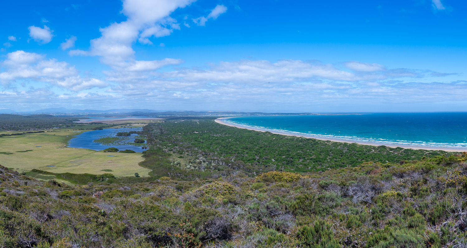
Bay of Fires
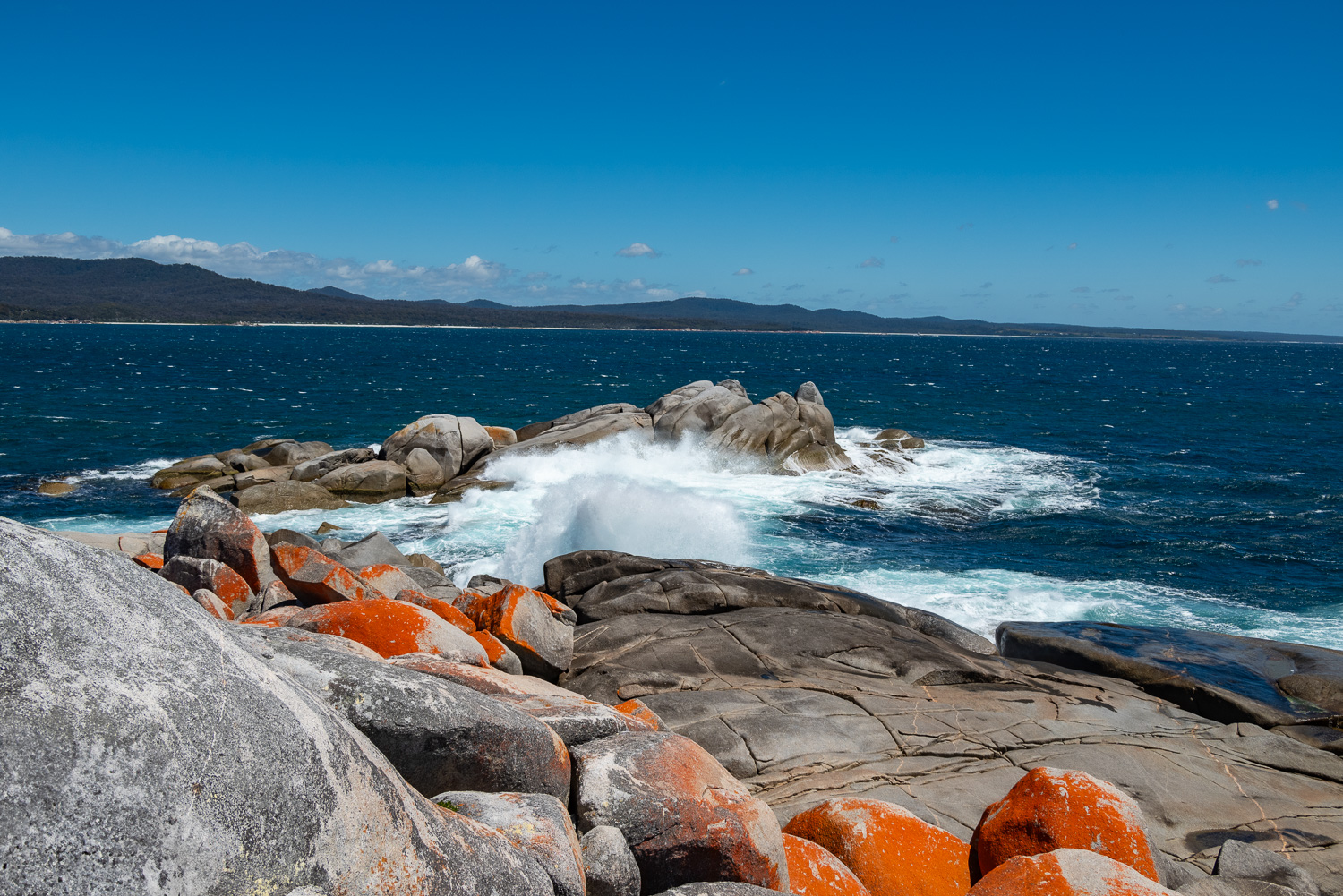
The area earned its name by English navigator Tobias Furneaux in 1773 when he saw fires burning along the coast, lit by Tasmanian Aboriginal people. However, he could equally have mistook it for the brilliant orange lichen that grows on the granite boulders lining the bay.
The Bay of Fires includes a gorgeous coastline that stretches over 30 miles from Binalong Bay (just north of St Helens) up to Eddystone Point, with a number of beautiful beaches and lagoons to explore.
We spent 2 days exploring the Bay of Fires, here are some of the hightlights:
 The start of the Bay of Fires coastline at Binalong Bay
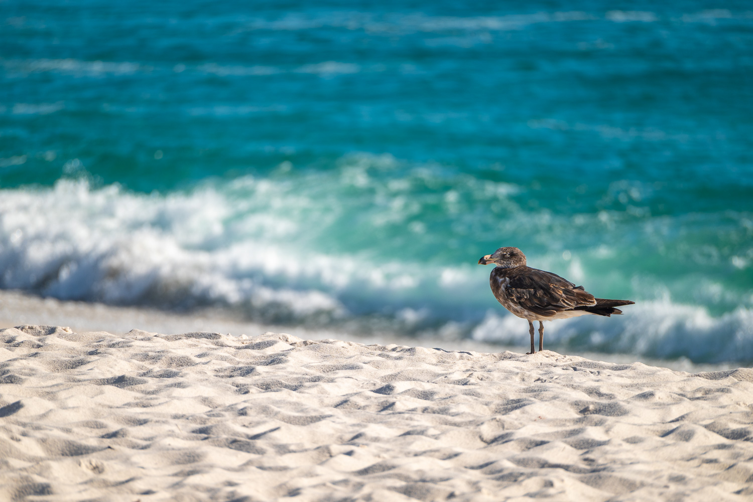 This juvenile Gull enjoying the solitude of Swimcart Beach
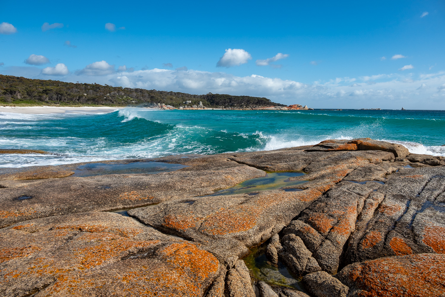 Intricate rock formations provide an interesting foreground to the azure blue sea and sweeping beach of Cosy Corner
 An early start meant we had Taylors Beach and many others to ourselves!
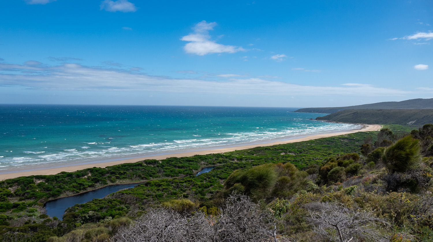
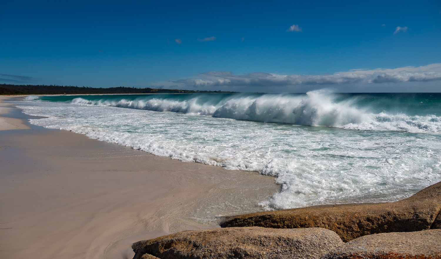 High winds were causing dramatic waves to roll along the length of Taylors Beach
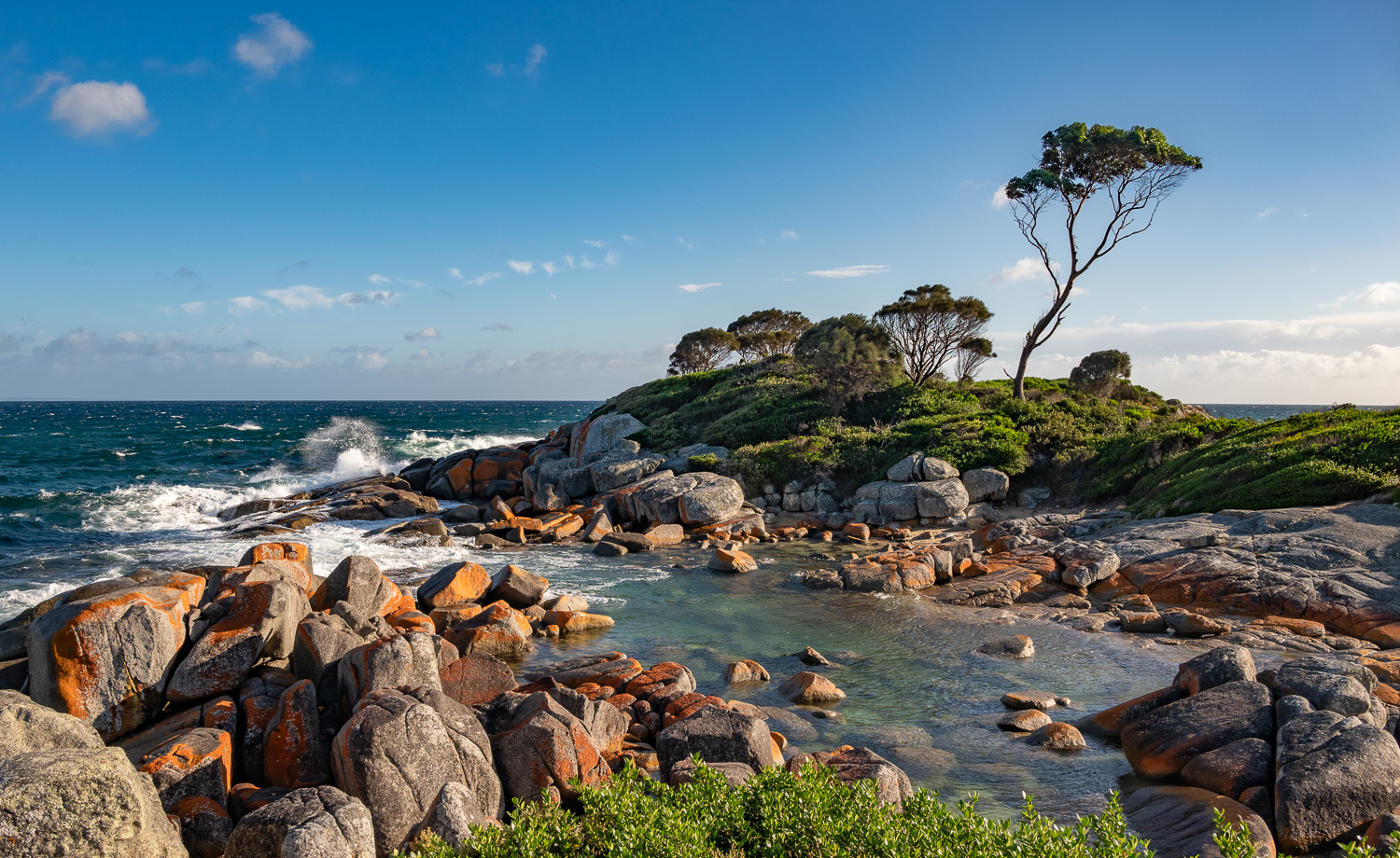
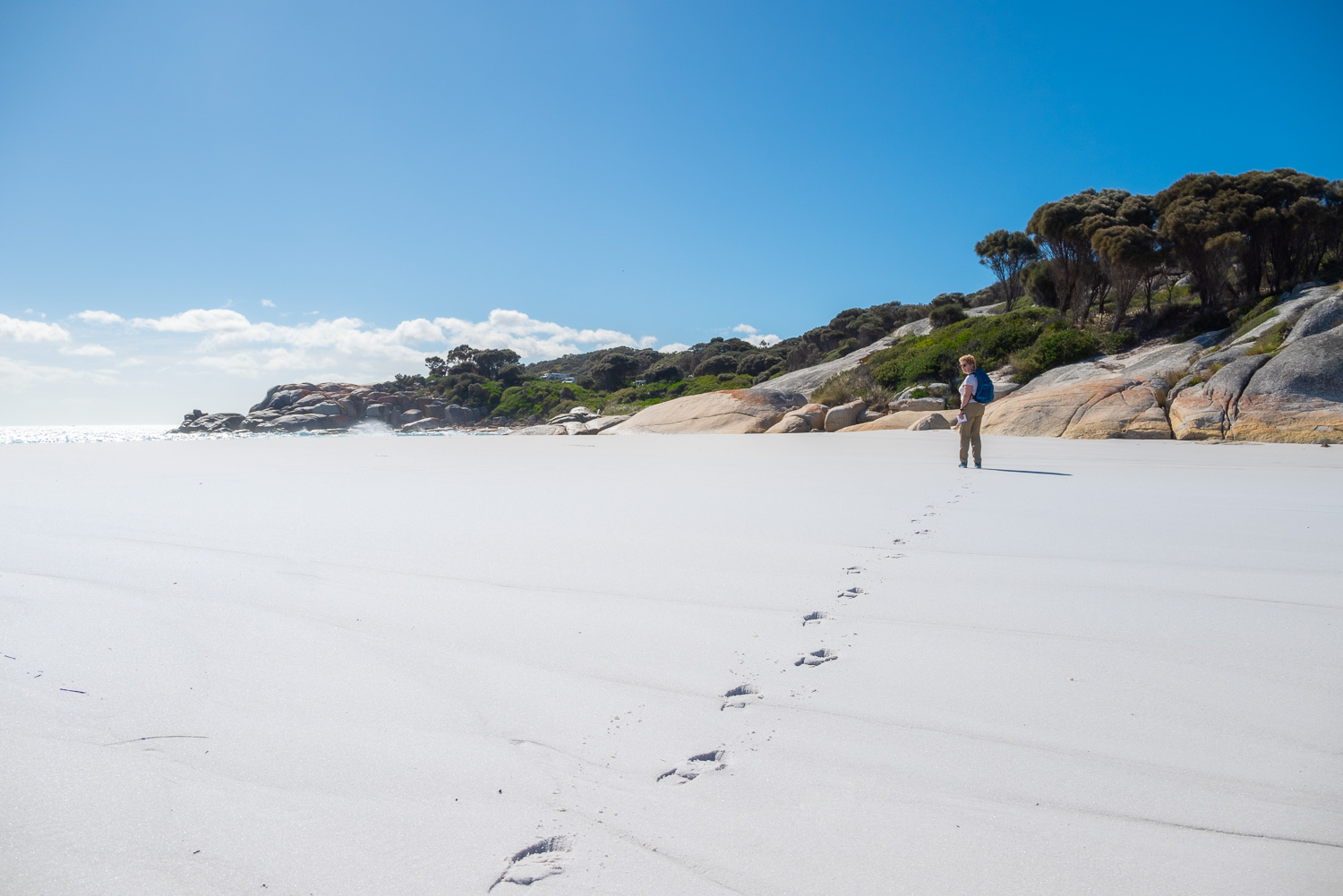
 After a short coastal walk from Binalong Bay, we found the beautiful Skeleton Point and the large orange lichen encrusted granite boulders
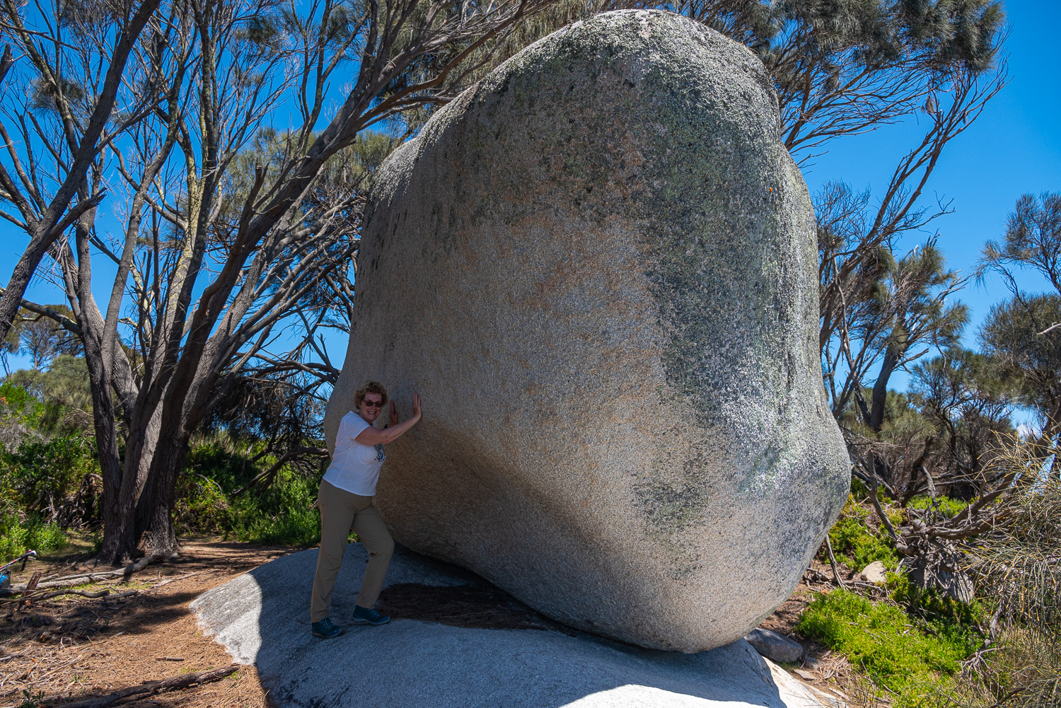 Further along from Skeleton Point is Grants Point, which is famous for its huge granite boulder that is perched on the clifftop – how it doesn’t topple over is a marvel!
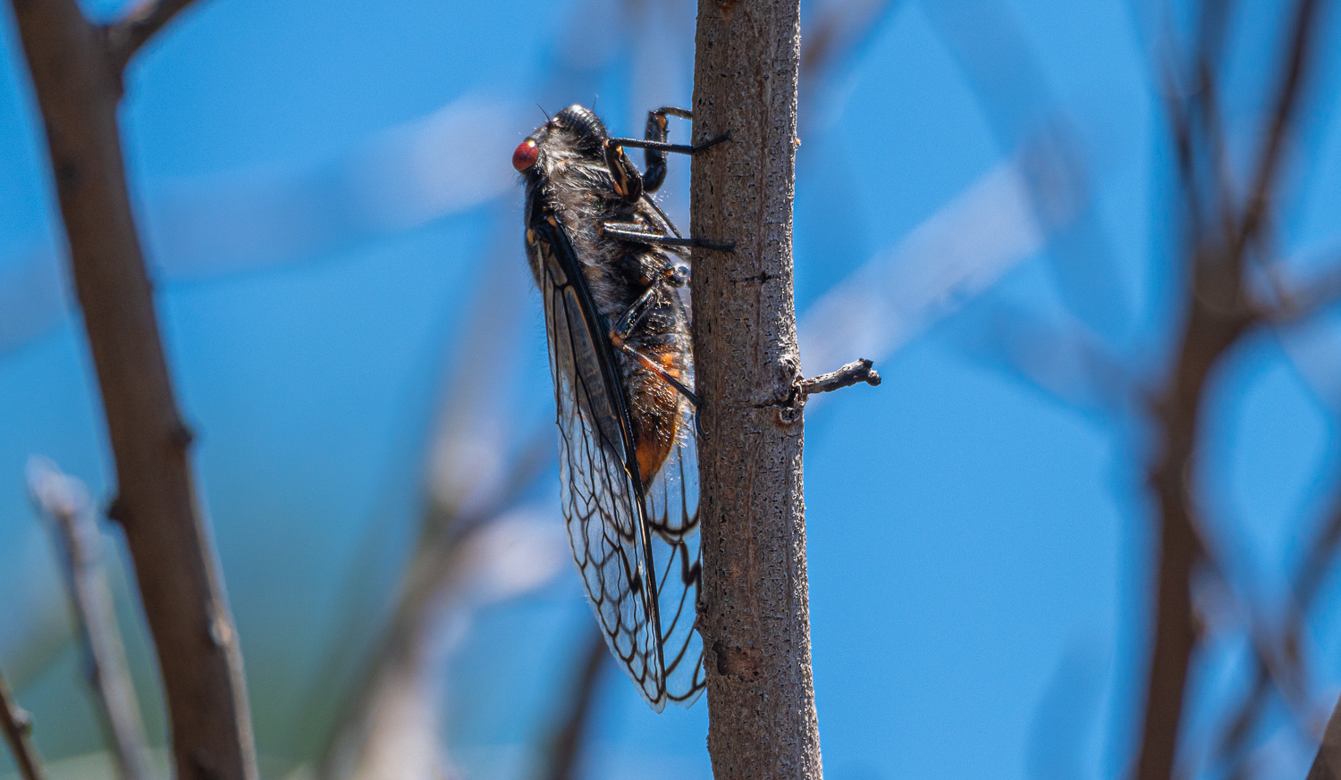 During our walk along the coast we could hear the deafening sound made by Cicadas. Male cicadas make a buzzing noise to attract nearby females. A special organ in their body, called the tymbal (no other animal has one) expands and contracts to create the loud sound.
We also visited some other interesting sites around St Helens:
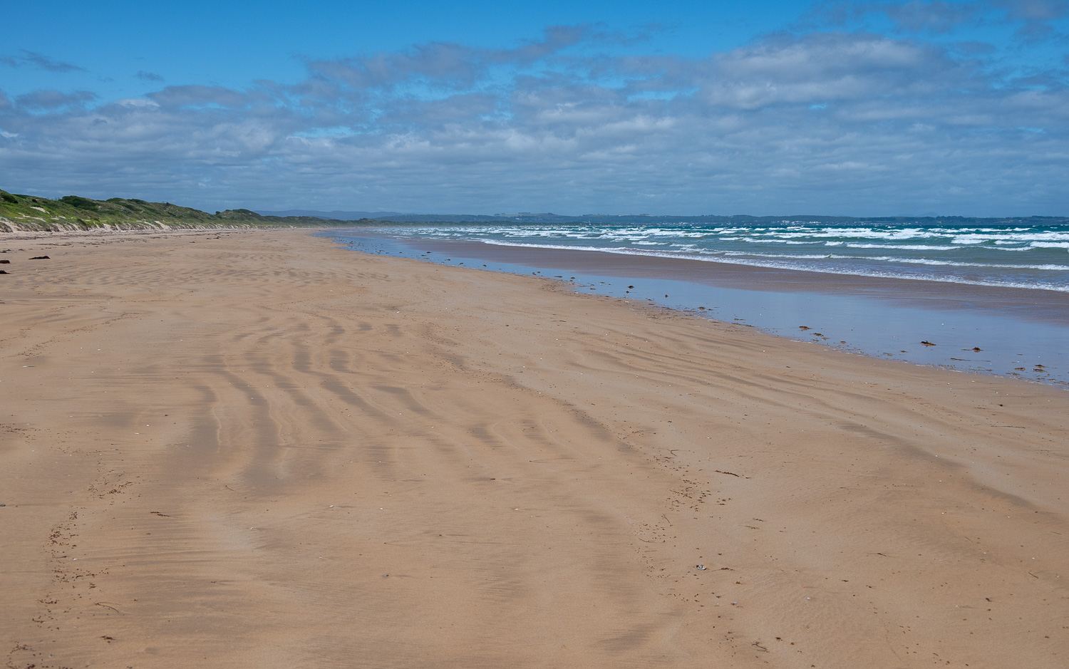
Peron Dunes
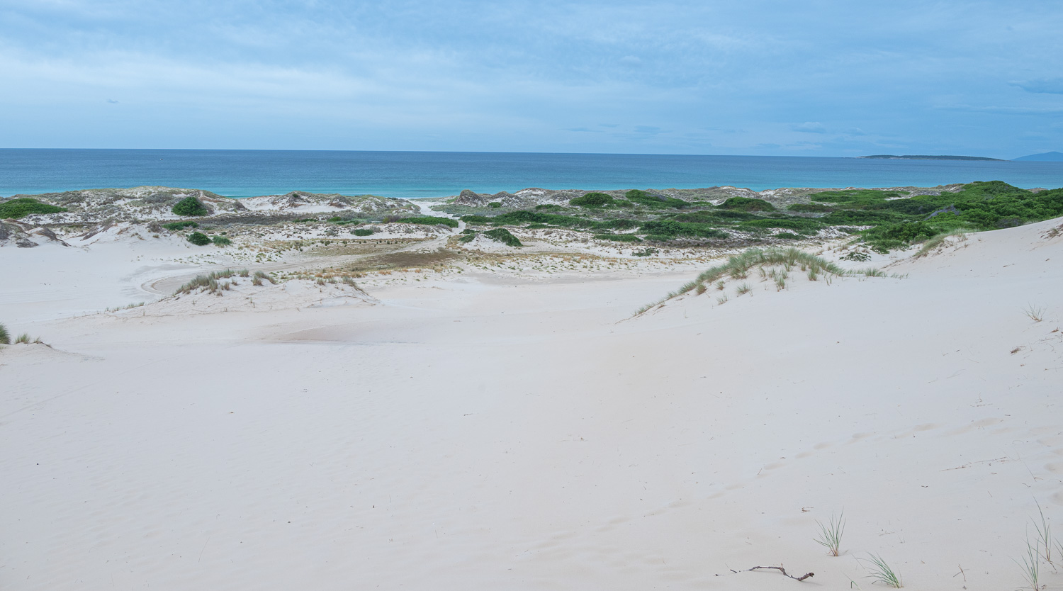 The pristine white sands of the Peron Dunes, in the St Helens Point Conservation Area, stretch for over 1 mile along the coast with the Tasman Sea
Goshen Pastures
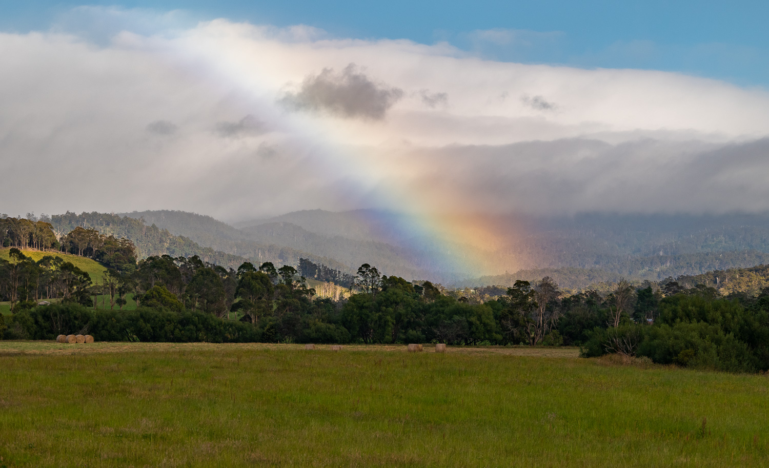 A few miles outside St Helens the landscape starts to change. Driving through an area called Goshen Pastures, you could easily believe that you are in the English countryside. The early morning low cloud on the hill created this unusual rainbow.
Halls Falls
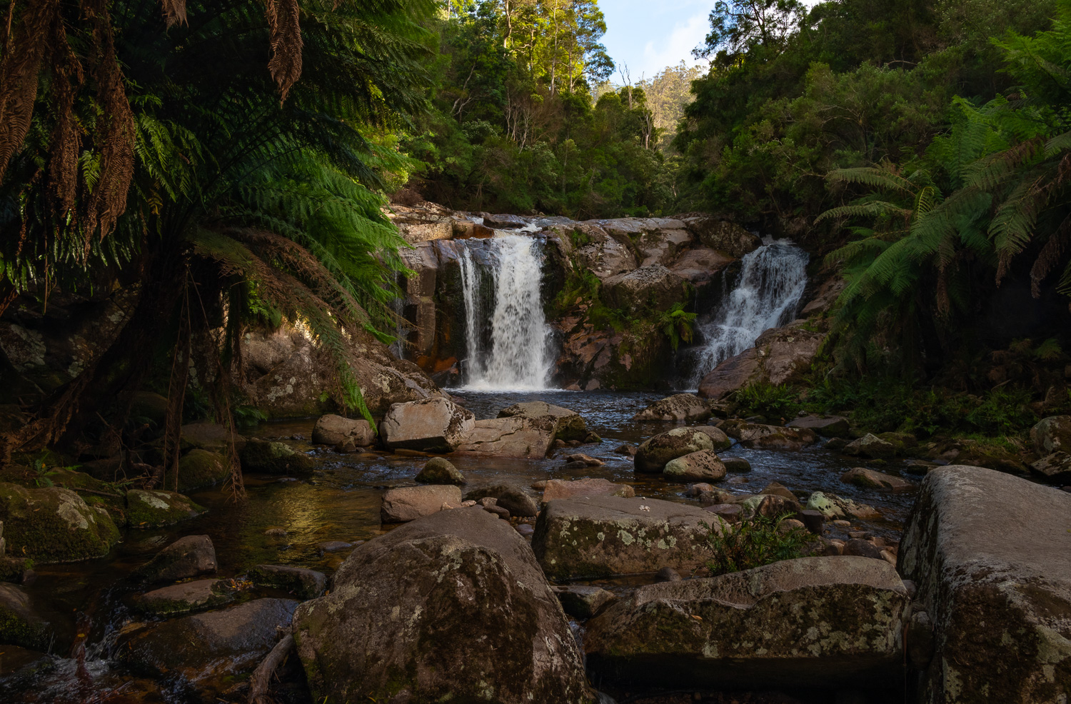 Halls Falls lies on the Groom River and drops from a hand-made, 19th Century weir located upstream from the waterfall. The weir was built at a time when Chinese workers were mining the region for tin.
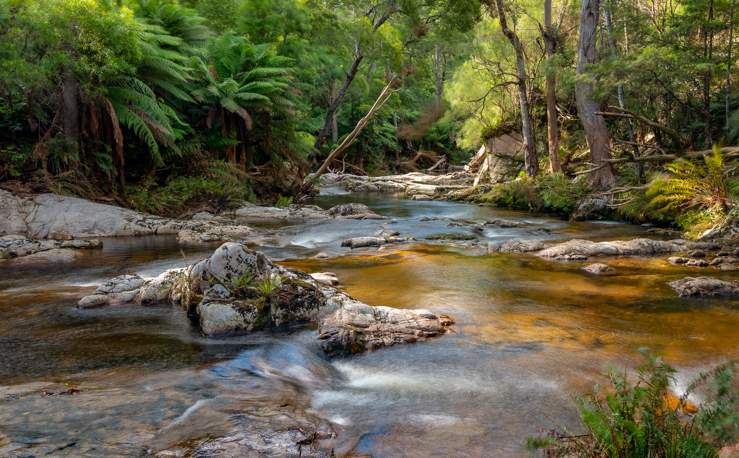 Upstream of the falls at the base of the weir
Launceston
Launceston is the largest city in northern Tasmania (and the third oldest in Australia, dating back to 1806). It’s situated at the confluence of three rivers – the North Esk, South Esk and Tamar. It’s famed for the Cataract Gorge, with panoramic views, walking trails, sculpted gardens and a chairlift. The vineyards of the Tamar Valley stretch Northwest along the Tamar River. Visitors can enjoy farmers’ markets, excellent cuisine, bars and wineries in this UNESCO City of Gastronomy.
There are many interesting places t0 visit within a few miles of the city.
Tamar Island Wetlands
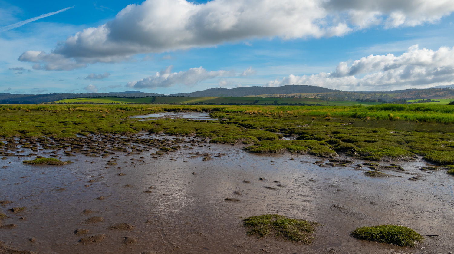 Located in the middle of the Tamar River north of Launceston, the 17 acre Tamar Island Wetlands reserve is accessed via a 2.5 mile round-trip walk on a boardwalk.
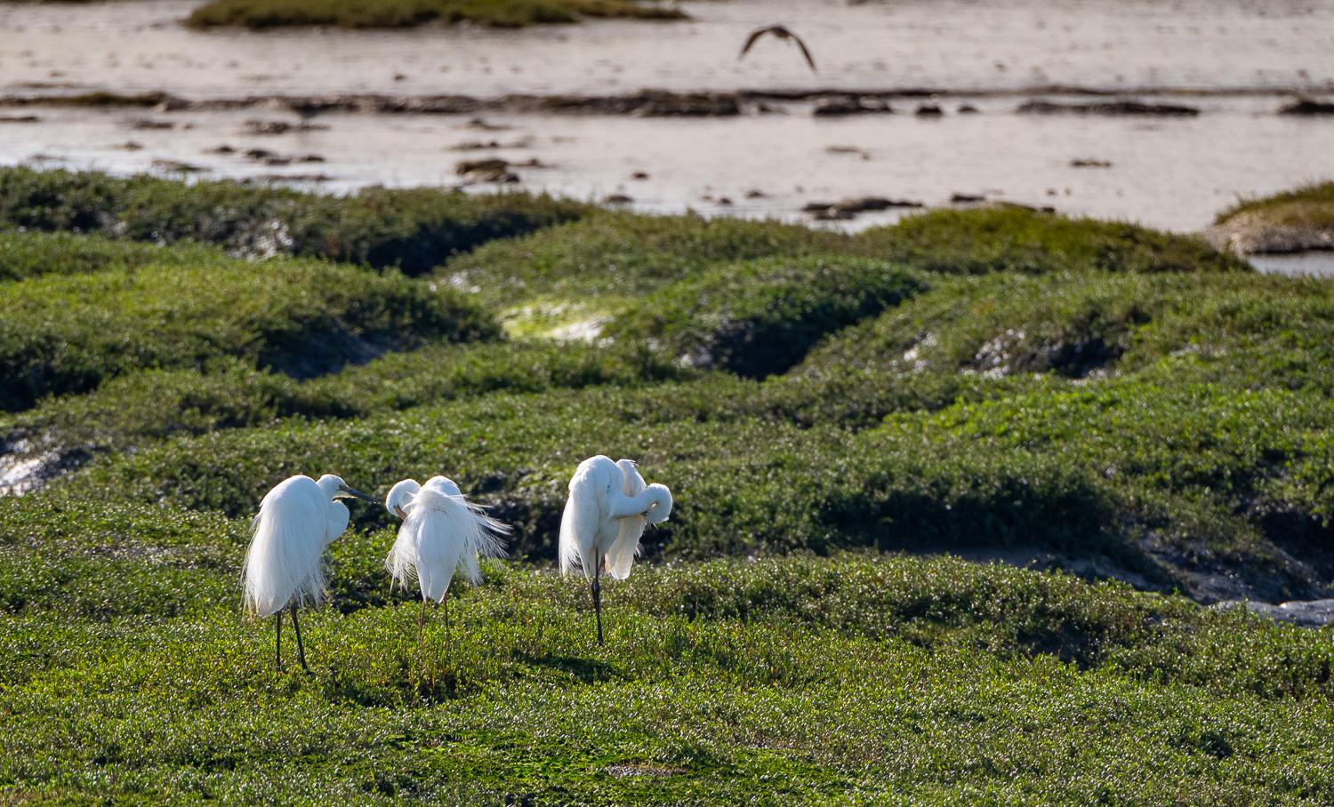 Three Great Egrets having a good preen!
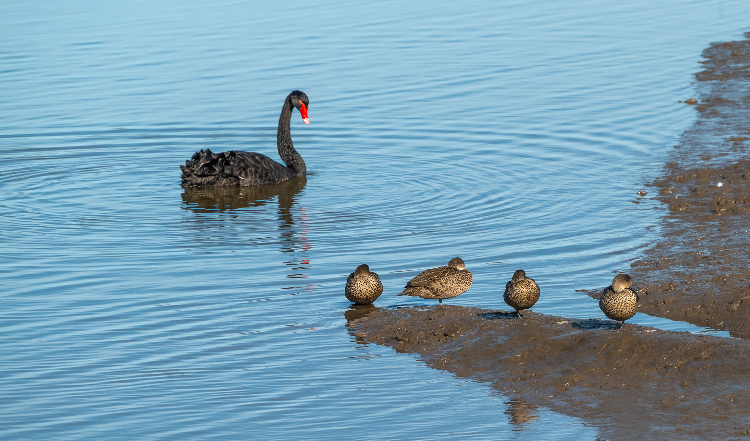 A Black Swan takes an interest in four female Australasian Shoveler’s
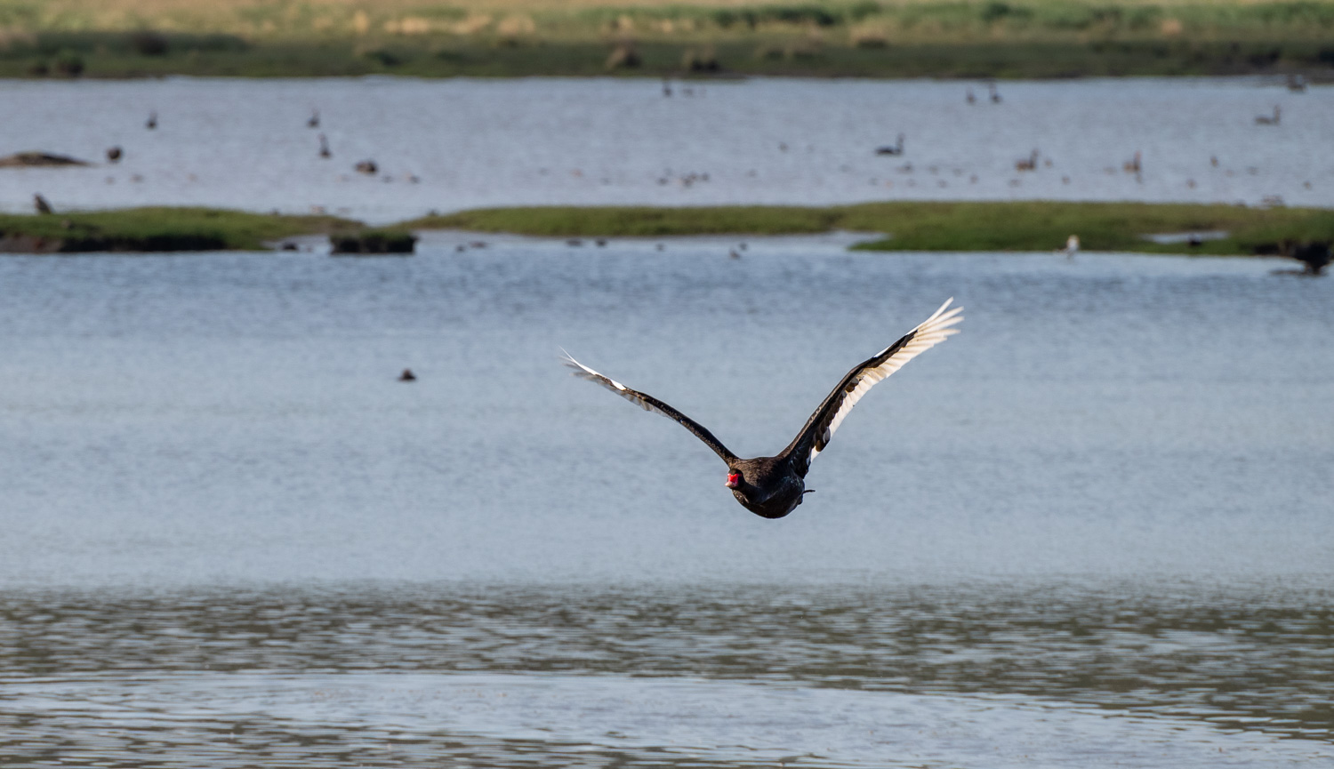 A Black Swan in flight
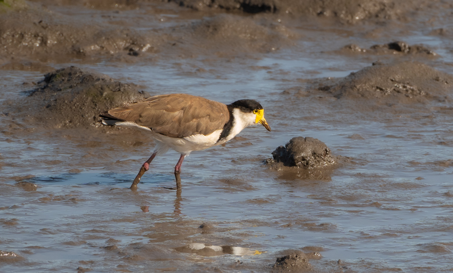 A Masked Lapwing searching for insects and worms in the mud
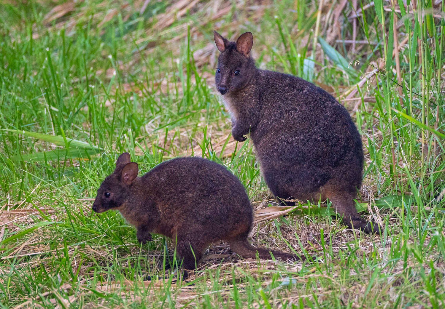 Mother and Joey Pademelon grazing near the broadwalk
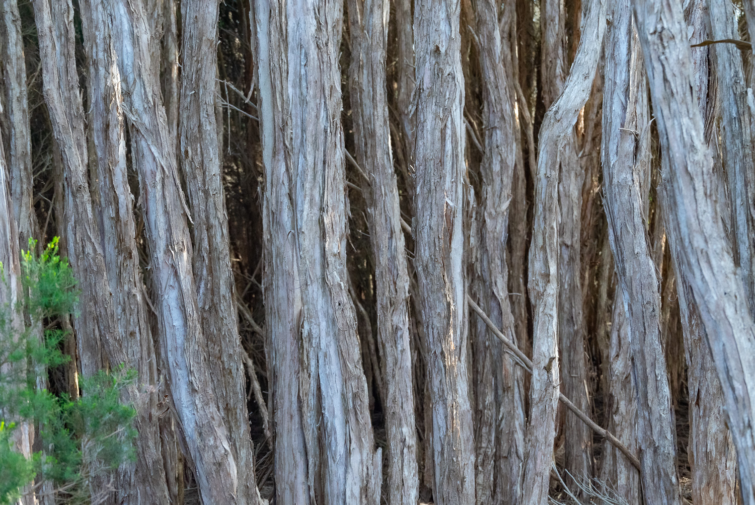 At the end of the trail were some Paperbark Trees. They are known for their distinctive papery bark, which is made up of thin layers of cork that separate into paper-like layers.
Cataract Gorge
Cataract Gorge is true urban wilderness; a 3-mile stretch of forested river reserve wrapped around a dramatic gorge, just a stroll from Launceston’s city centre.
Located on the South Esk River, the Gorge has walking trails, a swimming pool, the world’s longest single-span chairlift, a restaurant, cafe, a suspension bridge and panoramic lookouts with spectacular views. Peacocks and native wildlife add to the experience.
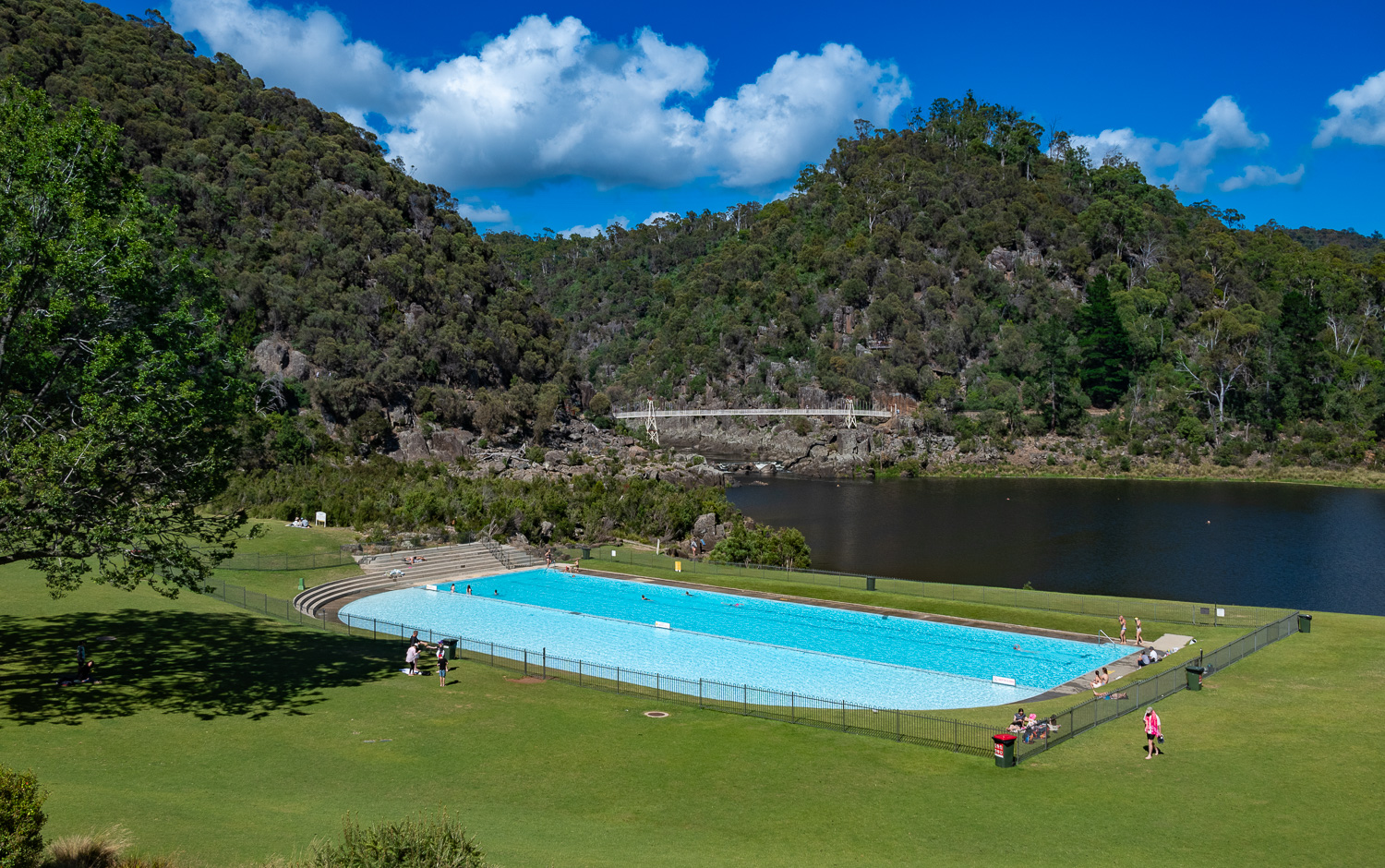 The swimming pool, basin lake and the Alexandra Suspension Bridge at the start of the Gorge
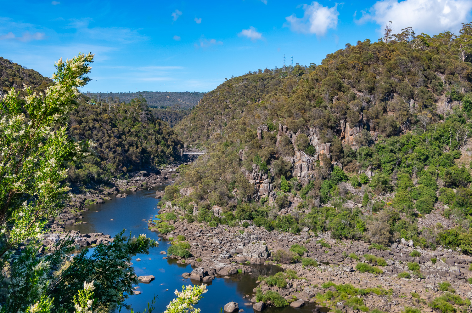 We walked the Duck Reach Trail, a 4-mile round trip up the Gorge along the South Esk River to the Duck Reach Suspension Bridge, which can be seen in the distance
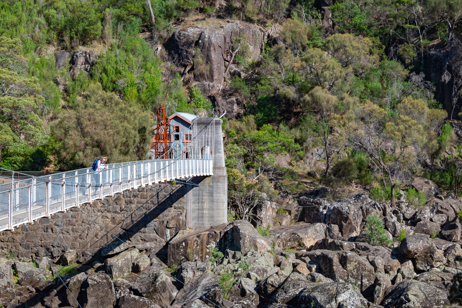 Charlotte on the Duck Reach Suspension Bridge looking down the Gorge
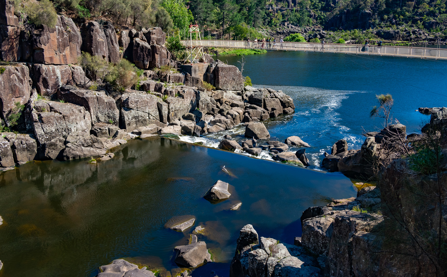 The silky still water of the South Esk River just before it crashes over the rocks at the weir into the basin lake under the Alexandra Suspension bridge
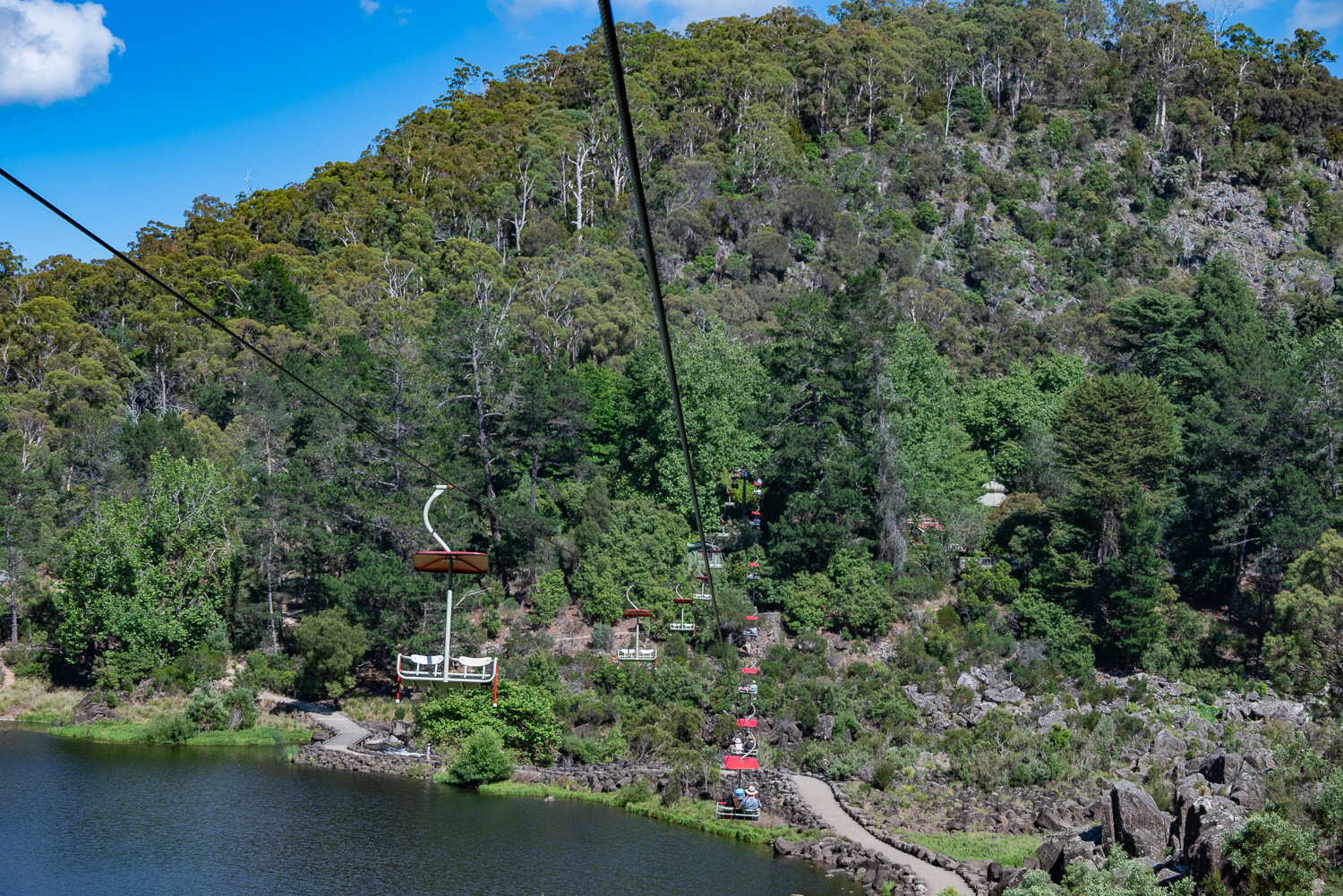 Taking a ride on the world’s longest single-span chairlift, nearly 1,500 feet long
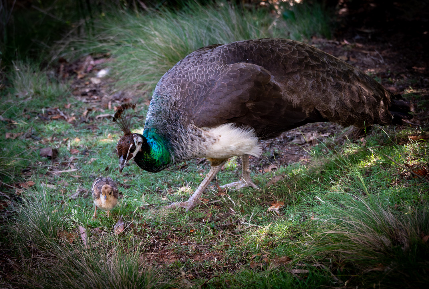 A Peahen and chick
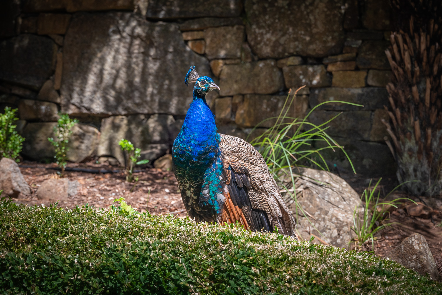 A resplendent Peacock
Narawntapu National Park (Na-rawn-tapu)
Narawntapu National Park is located on the northern coast of Tasmania and is a great place to get to know the local marsupials, such as Forester Kangaroos, Wallabies and Pademelons that are often grazing or resting on the open grassland near the visitor centre at Springlawn.
Narawntapu’s landscapes are diverse, including coastal heathlands and grasslands, wetlands and dry woodlands and sweeping sandy beaches.
We spent the morning hiking the 8-mile loop called the Archers Knob Trail, which starts from open grassland next to the visitor centre…
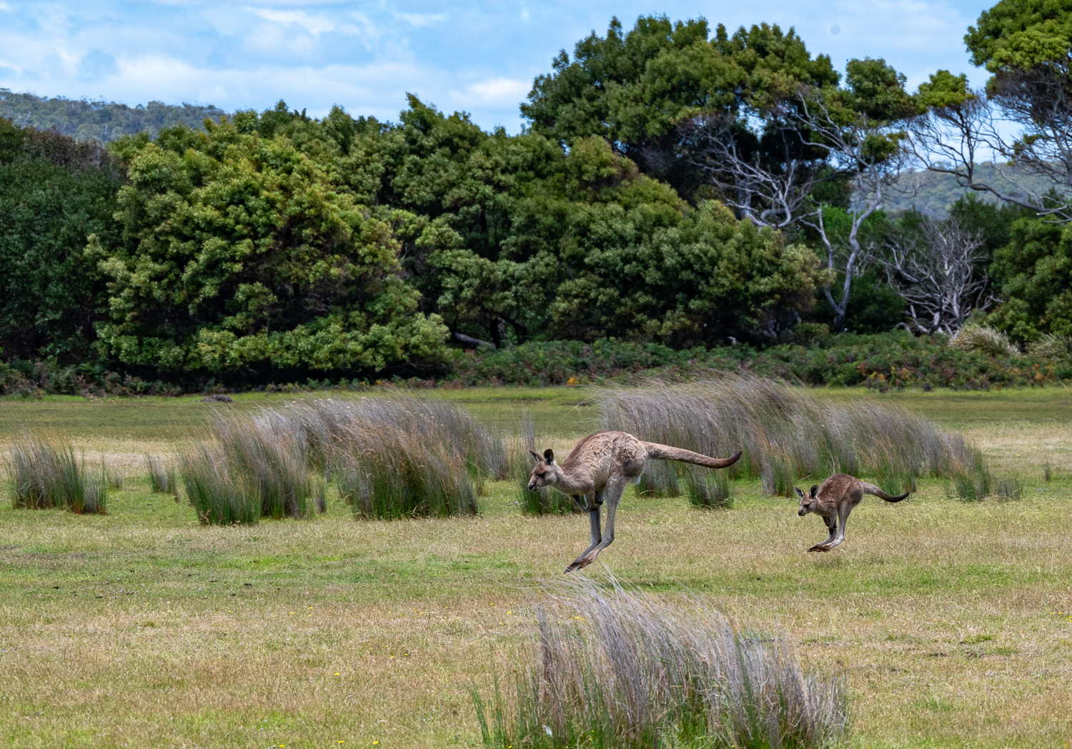 …where Forester Kangaroos play…
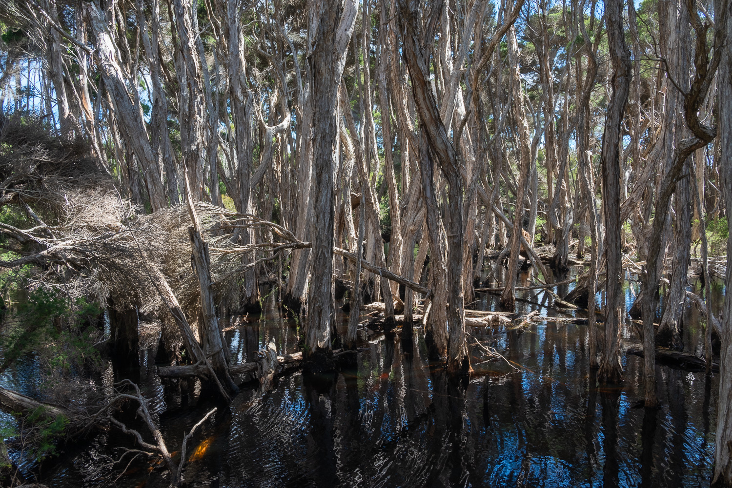 …then meanders through a paperbark swamp, on raised boardwalk…
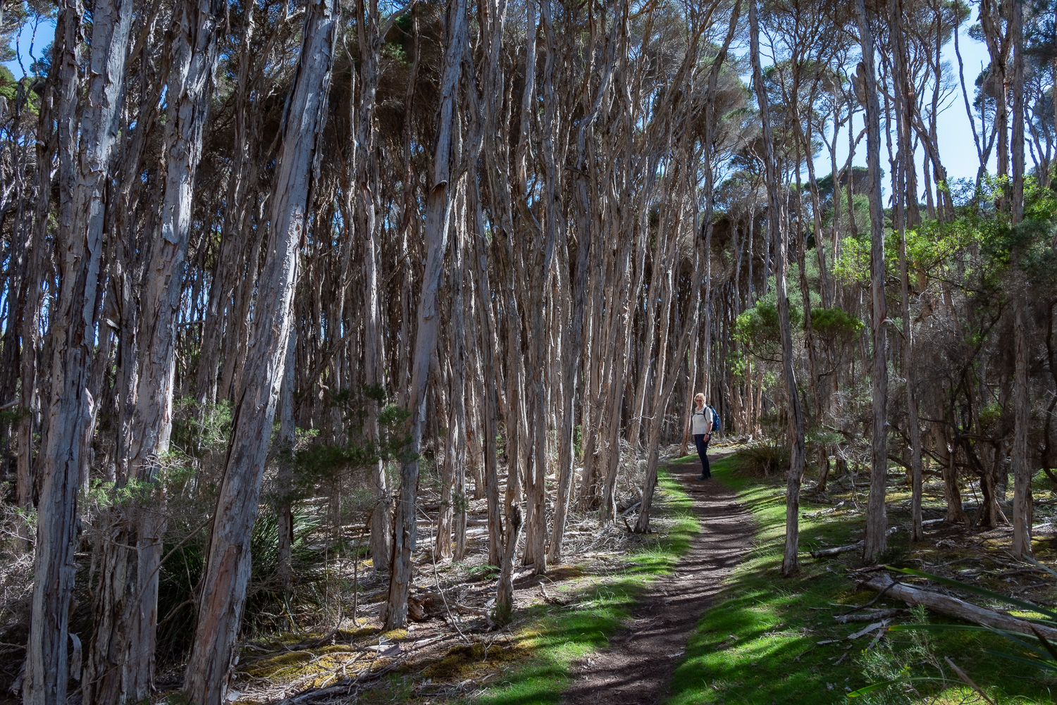 …and paperback forests…
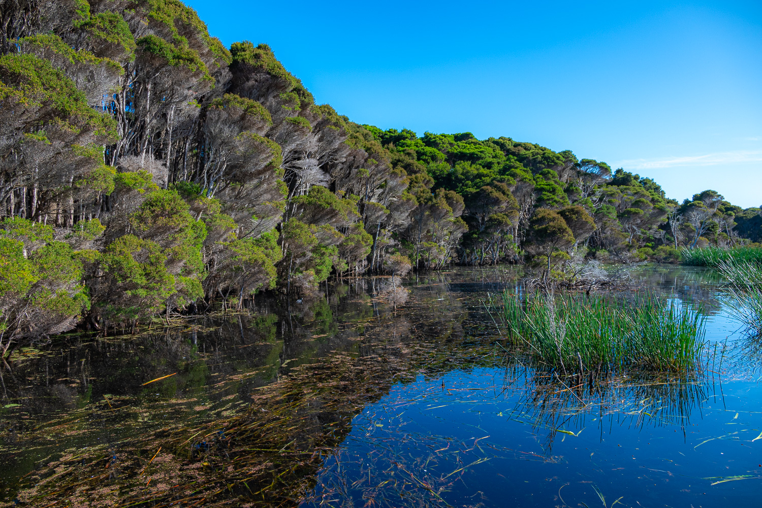 …to a bird hide with views across the lagoon…
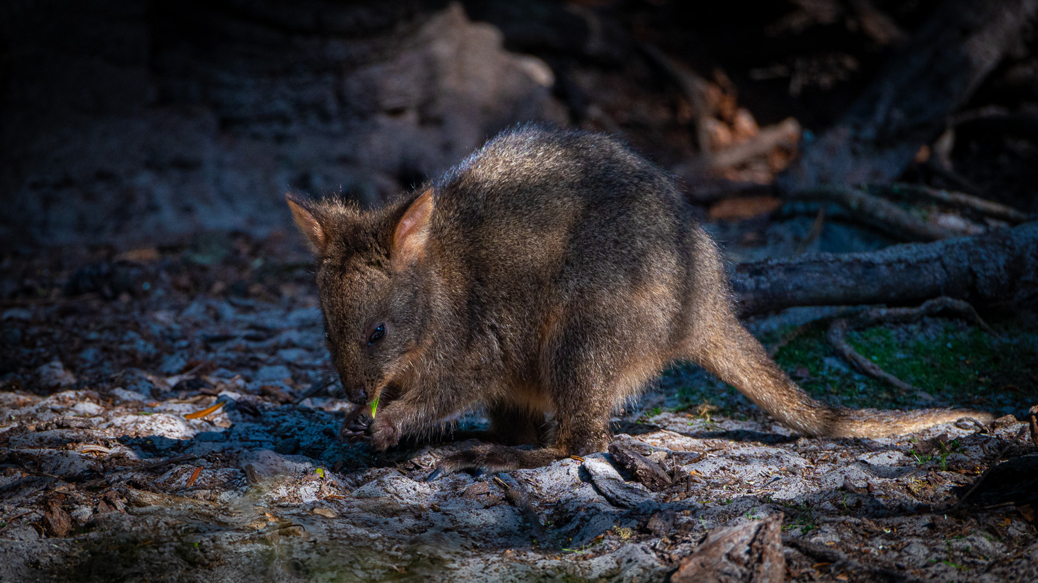 …and along the tracks joey Pademelons can be seen grazing…
 …then it’s on to 375 ft. high Archers Knob, which is reached via a zigzag track, with wonderful panoramic views of Bakers Beach, Springlawn and beyond…
 … then back down the hill with views of the brackish lagoons and Little Badger Head at the end of the beach…
 …and finally back to the visitor centre on the pristine sands of Bakers Beach.
Ulverstone
The Northern seaside town of Ulverstone lies at the mouth of the River Leven, on Bass Strait. It is known for its coastal parks and swimming beaches and excellent fishing in the river and estuary.
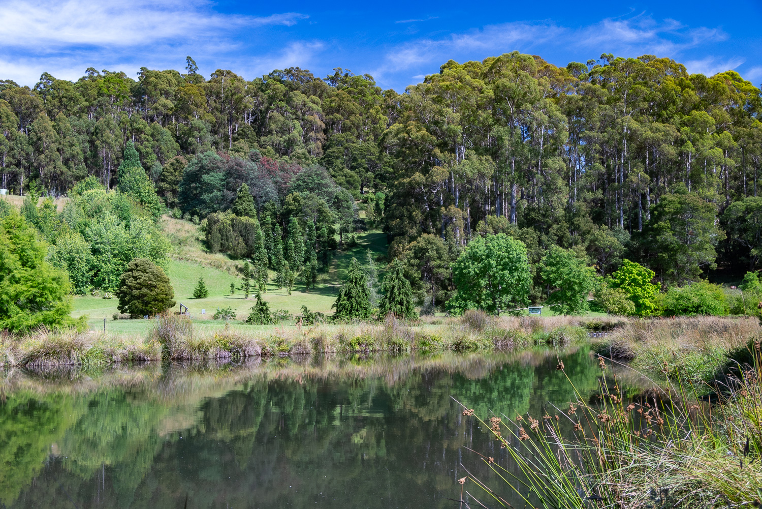
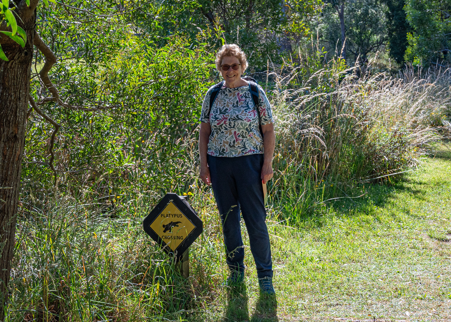
The Tasmanian Arboretum
The 160 acre Tasmanian Arboretum is a collection of trees of the temperate world in a beautiful and peaceful landscape.
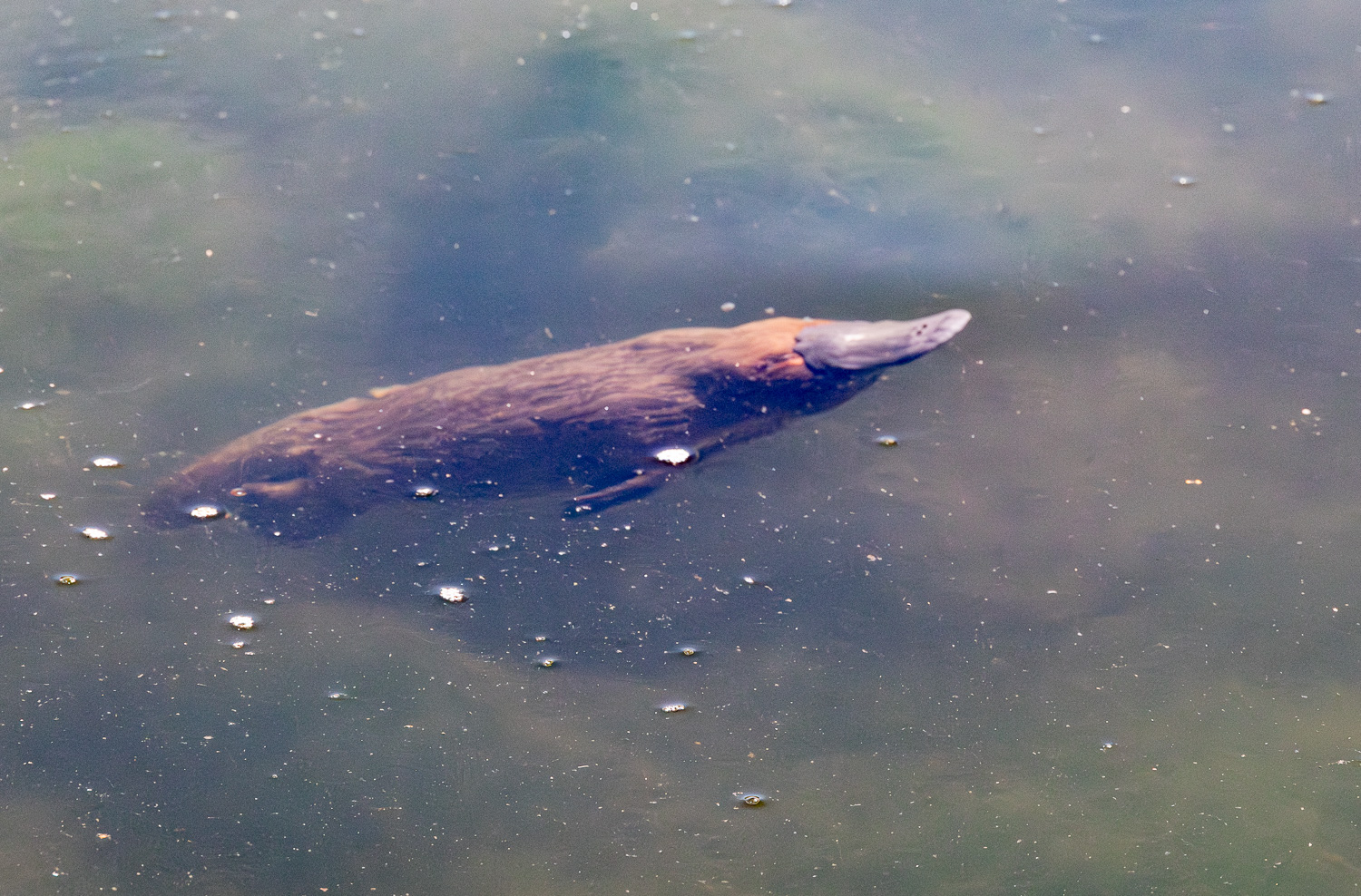
 At its centre is Founders Lake, which is home to a ‘paddle’ of Platypuses.
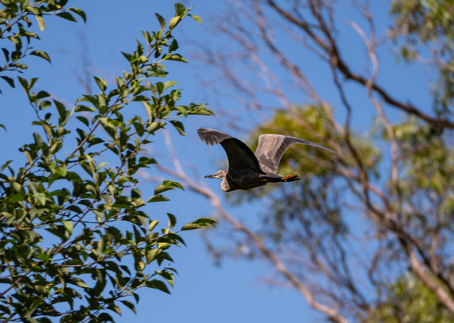 Blue Heron in flight
The Platypus sometimes referred to as the duck-billed platypus, is a semiaquatic, egg-laying mammal endemic to eastern Australia, including Tasmania.
Together with the four species of Echidna, it is one of the five existing species of monotremes, mammals that lay eggs instead of giving birth to live young. Like other monotremes, the Platypus has a sense of electrolocation, which it uses to detect prey in cloudy water.
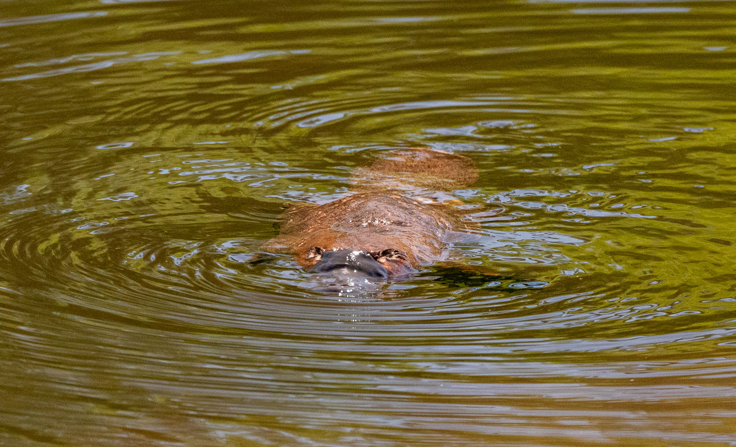
 Underwater about to surface
 The Platypus is a carnivore, feeding on worms, insect larvae, freshwater shrimp, and crayfish that it digs out of the riverbed with its snout or catches while swimming. It carries prey to the surface in cheek-pouches before eating it. The Platypus eats about 20% of its own weight each day, which requires it to spend an average of 12 hours daily looking for food.
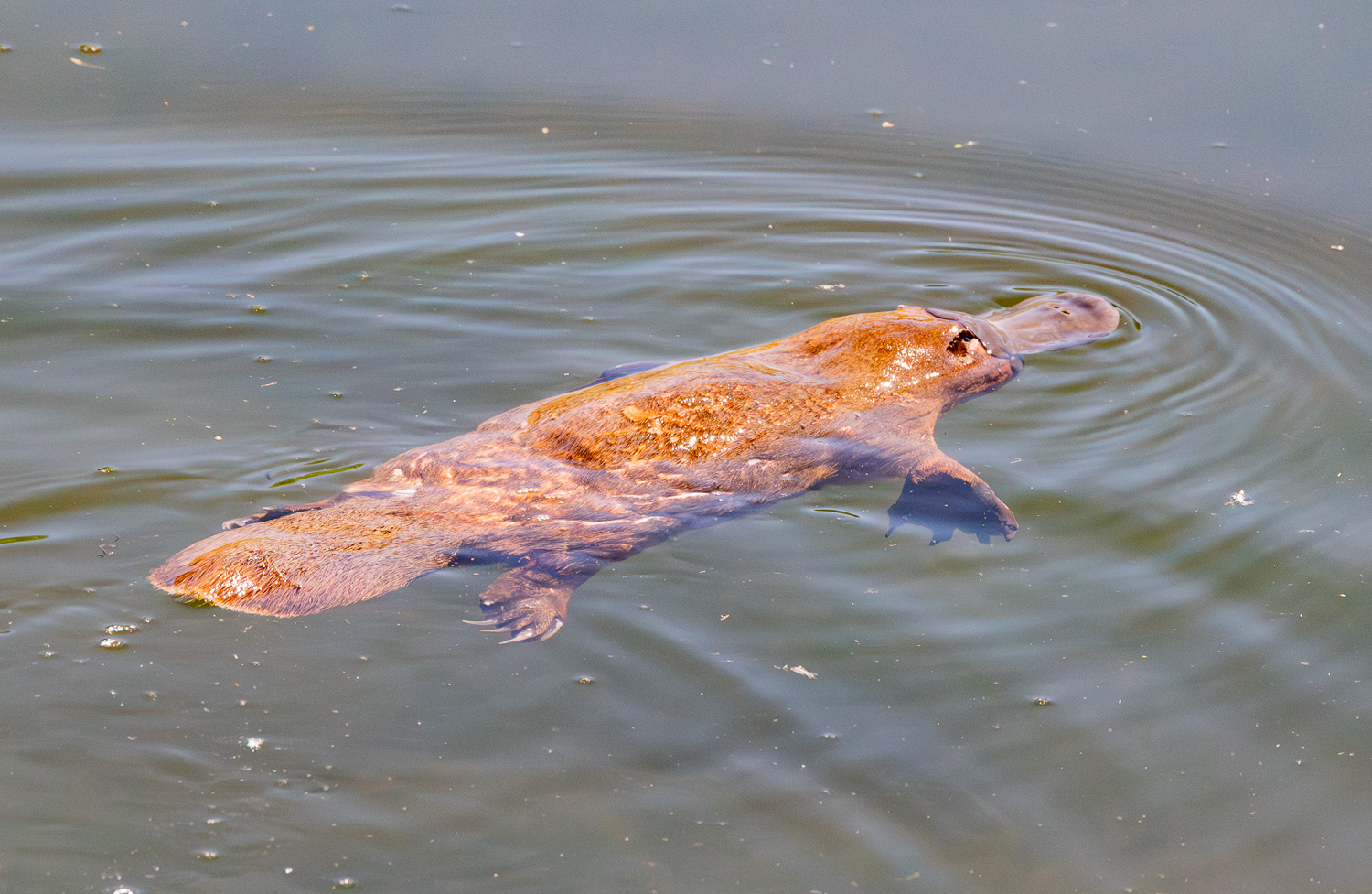 It is one of the few species of venomous mammals, as the male Platypus has a spur on the hind foot that delivers an extremely painful venom.
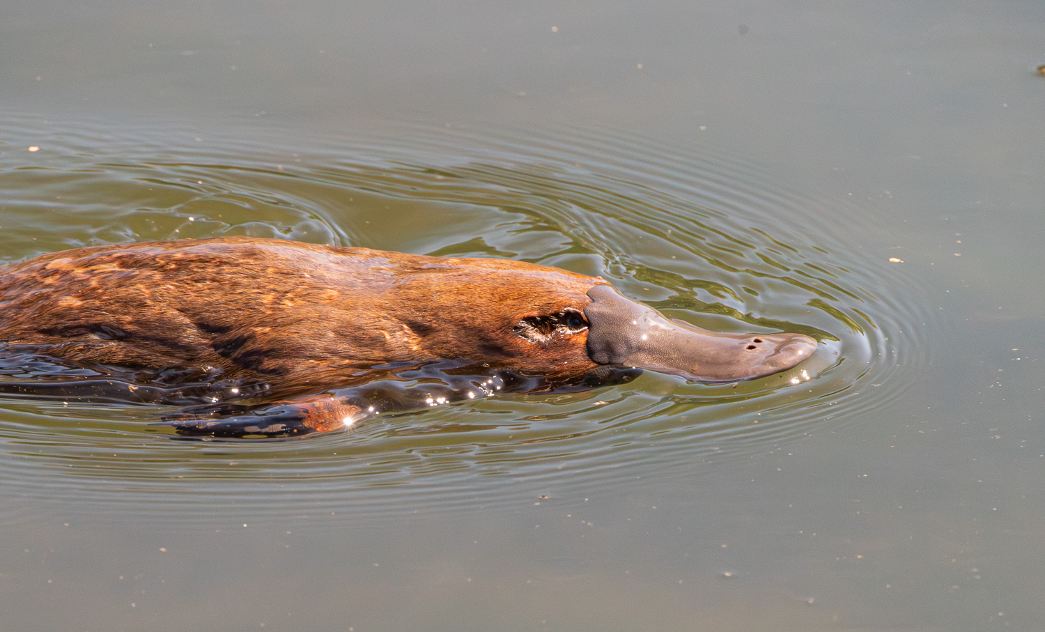 The unusual appearance of this egg-laying, duck-billed, beaver-tailed, otter-footed mammal at first baffled European naturalists. In 1799, the first scientists to examine a preserved Platypus body judged it a fake made of several animals sewn together!
 At night the Platypus comes ashore to sleep in their burrows, which are often at the rivers edge, but clearly they sometimes travel further!
Leven Canyon
The Leven Canyon is located just south of Ulverstone, yet feels a world away, with an entirely different landscape from the north coast. The Leven River cuts through the deepest limestone ravine in all of Tasmania and is easily viewable from the Cruikshanks Lookout.
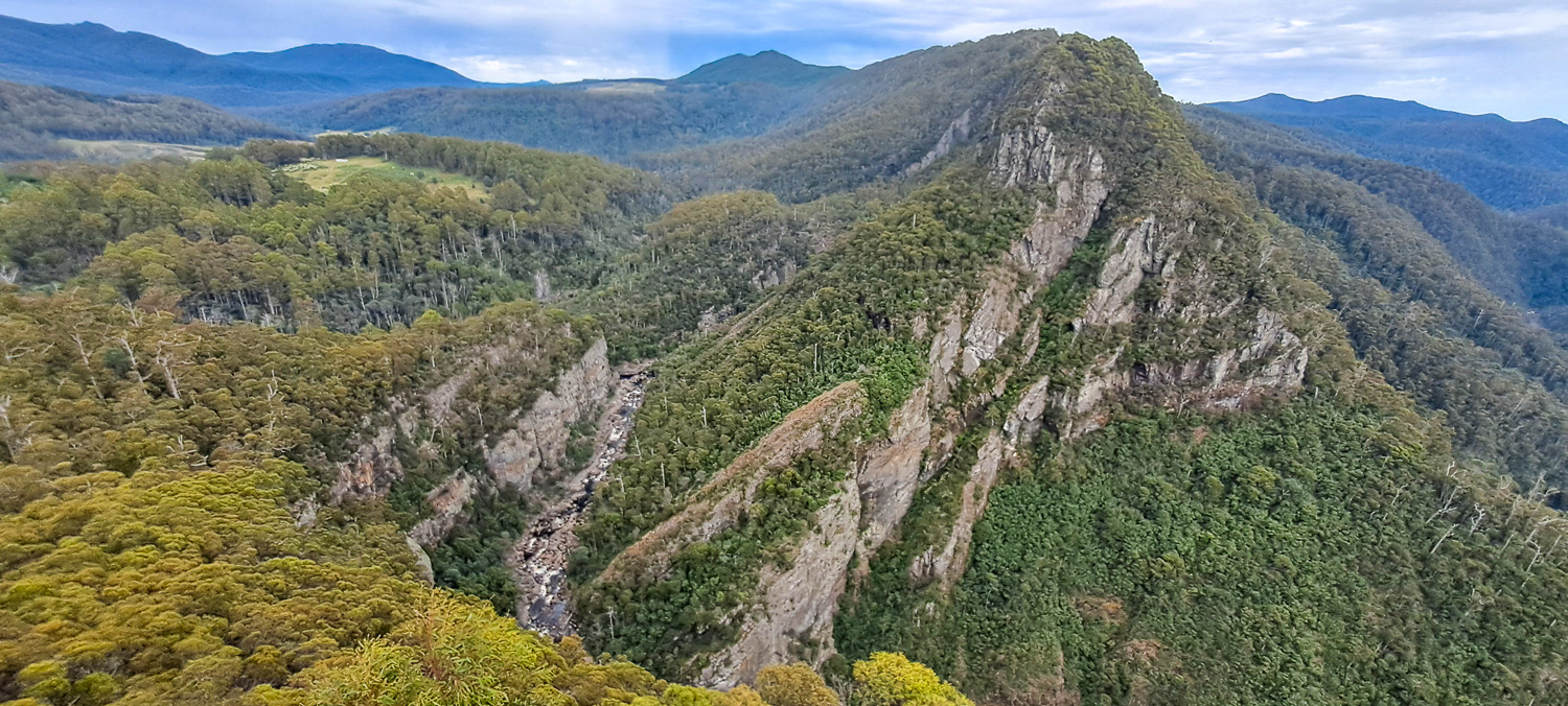 Cruikshanks Lookout offers fantastic panoramic views of the Leven River winding its way through this massive ravine, 900 ft. below
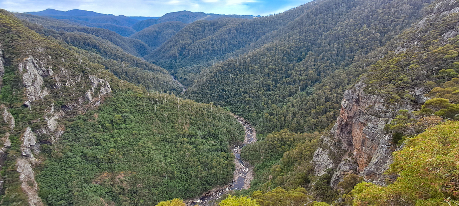
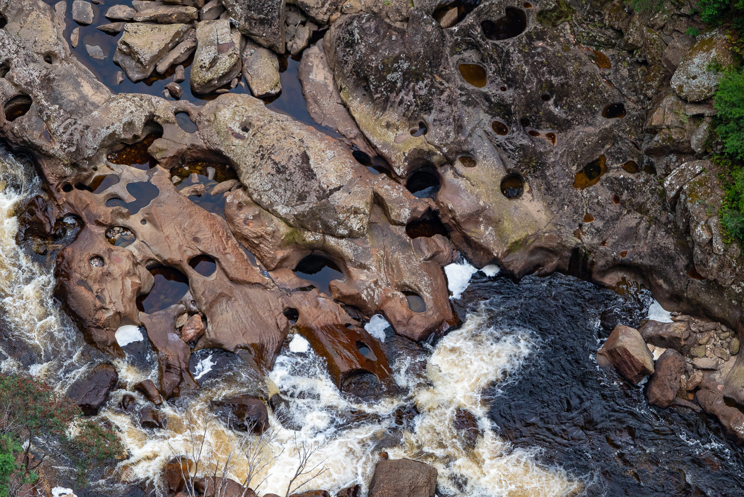 The Edge Lookout provides a closer look at the River Leven and its many waterfalls and rock formations on the floor of the canyon
Marakoopa Cave
Our last stop in Tasmania was Marakoopa Cave in the Mole Creek Karst National Park, which is located on the slopes of the Great Western Tiers; a collection of mountain bluffs that form the northern edge of the Central Highlands plateau.
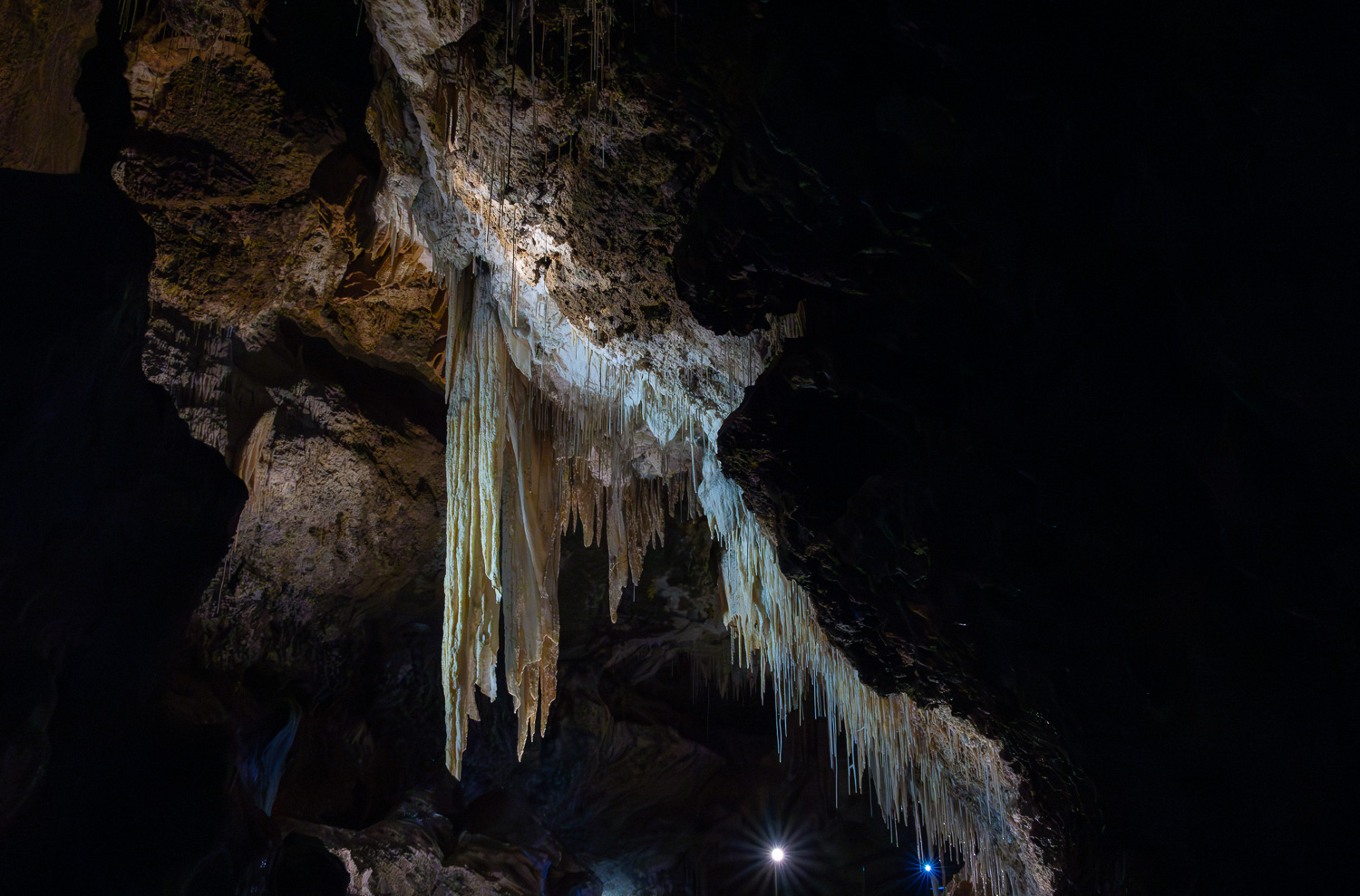
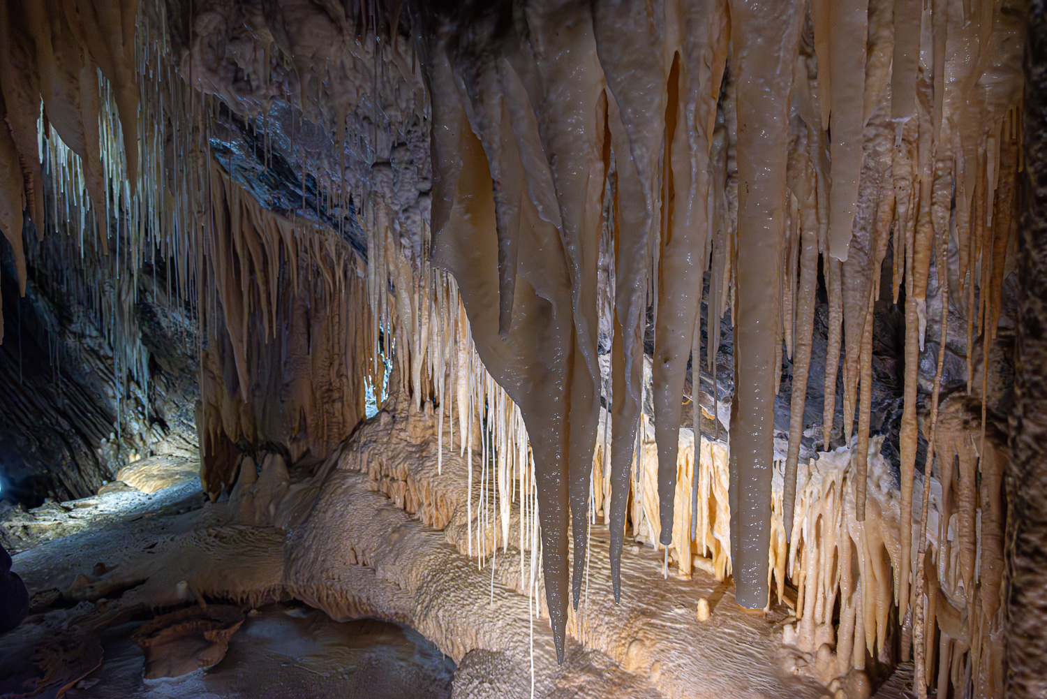
Delicate formations and beautiful colours of sparkling crystals, reflective pools, stalactites and stalagmites can be seen as you walk around this limestone cave system as part of a guided tour. At the end of the tour, as all the lights were turned off, we were given a starry display of glow worms on the cave ceiling.
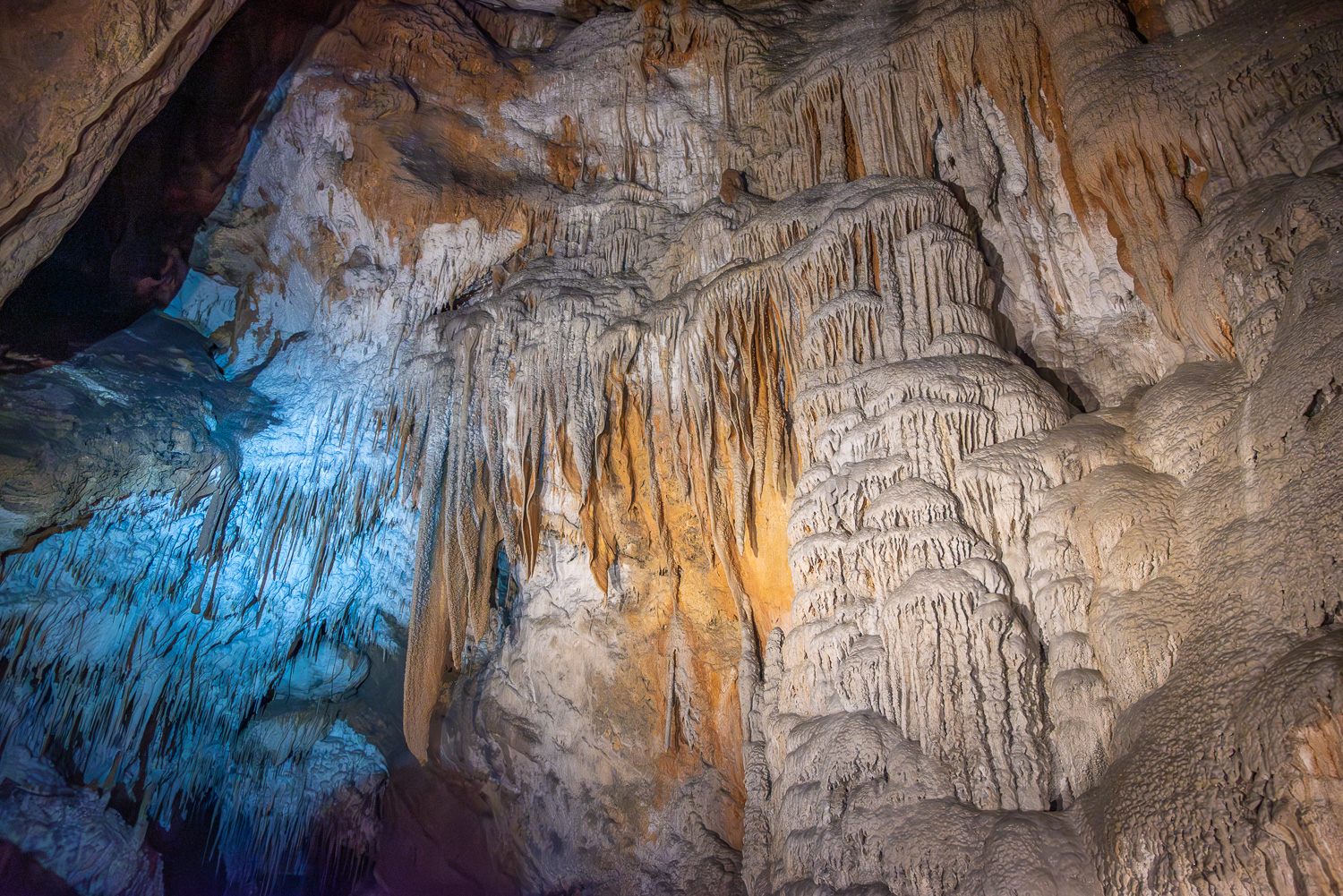
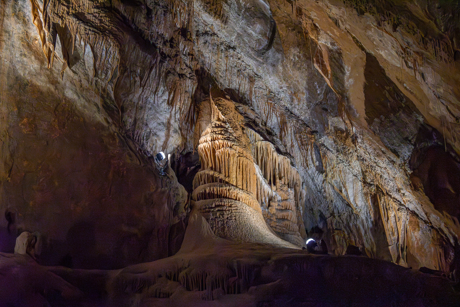 The Grand Cathedral chamber is named after this stunning formation as it resembles organ pipes!
