Our final port of call on the Pacific coast of Central America was Costa Rica.
Costa Rica has a similar history to many other Central American countries and gained its independence from Spain in 1821. However, it has not suffered as much, post-colonisation, as other countries in the region. The first democratic elections were held in 1889 and other than two brief periods of violence, democracy has been synonymous with Costa Rica.
Costa Rica still has a large agricultural sector including coffee, banana, pineapple and sugar exports. In the last twenty years, eco-tourism and technology have taken off and now make a considerable contribution to the economy. Costa Ricans enjoy one of the highest standards of living in Central America and land ownership is widespread. The country boasts a high literacy rate, a large middle class and a stable government that has functioned without an army for more than 60 years.
The main attractions for visitors are the golden beaches and comprehensive rainforests. Costa Rica alone provides 4.5% of the entire planet’s biodiversity and its rainforests cover 25% of its territory. A trip to a local rainforest was the focus for our visit. We went to a rainforest resort lodge that had an extensive network of hiking trails and spectacular hanging bridges. Below are some of the photos from our hike.
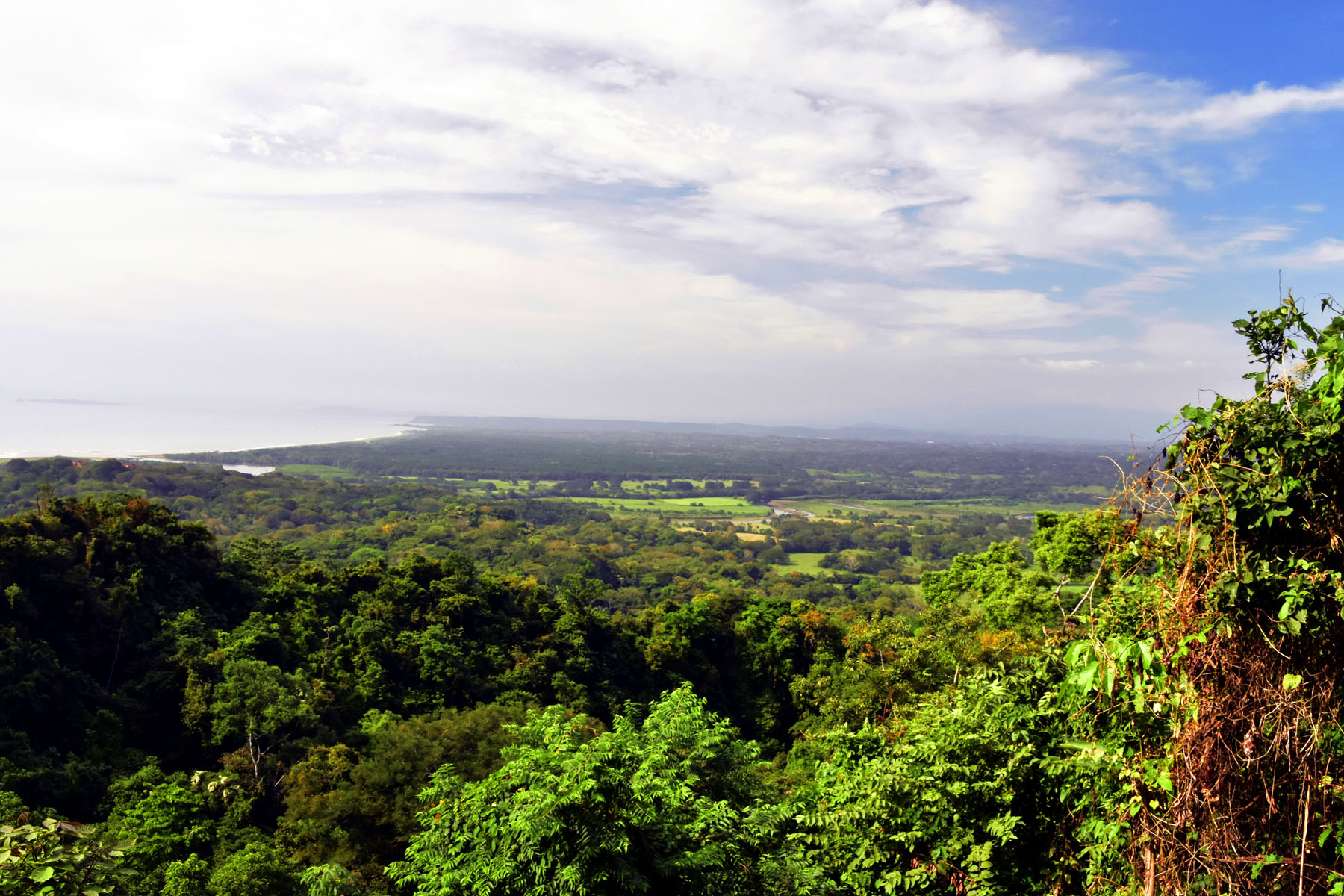 Costa Rica Rainforest – View across the canopy to the coast.
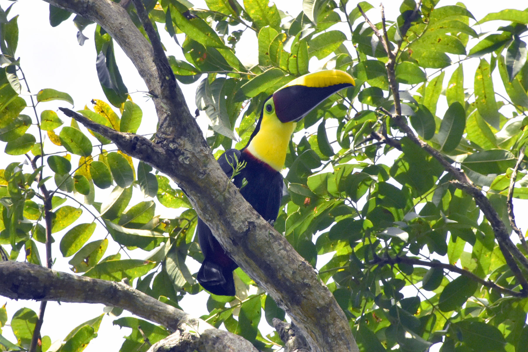 Costa Rica Rainforest – Yellow Chested Tucan.
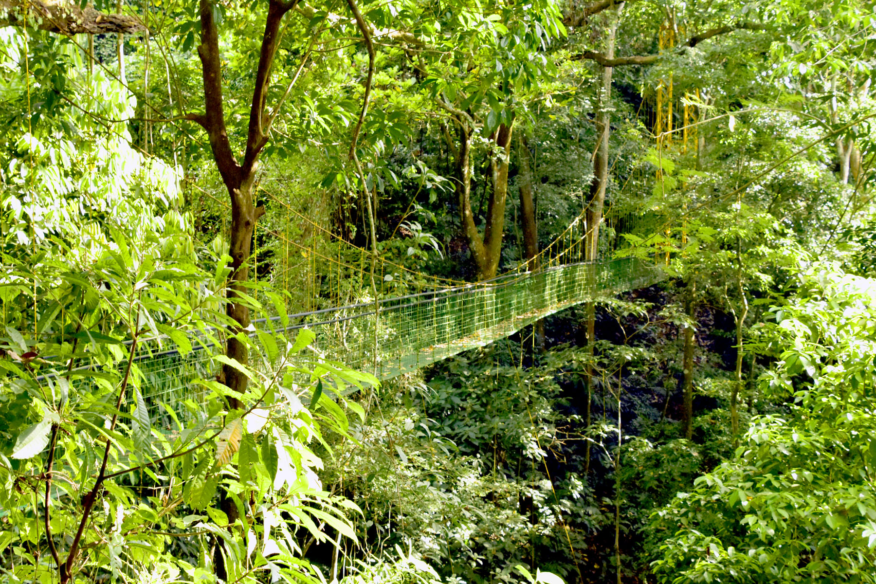 Costa Rica Rainforest – Hanging Bridge.
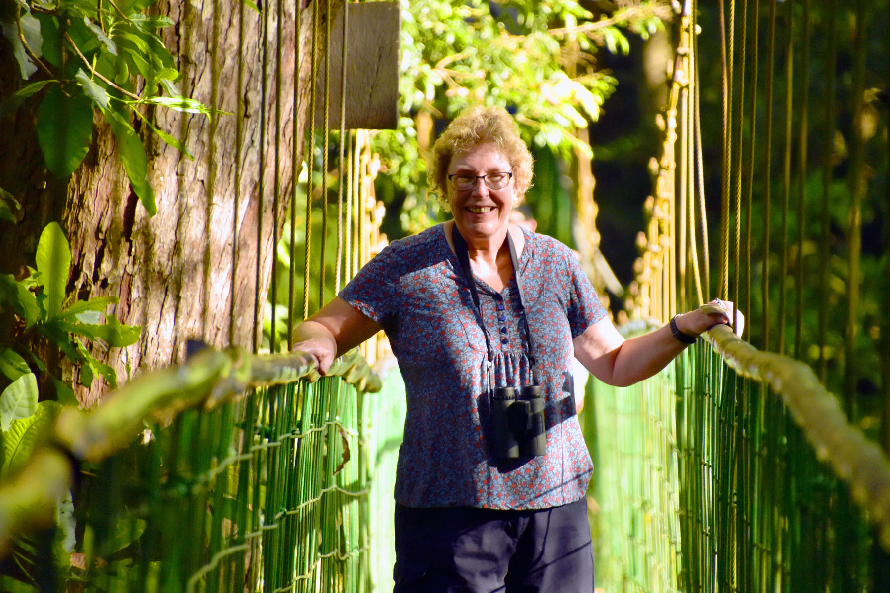 Costa Rica Rainforest – Hanging Bridge with Charlotte the intrepid explorer.
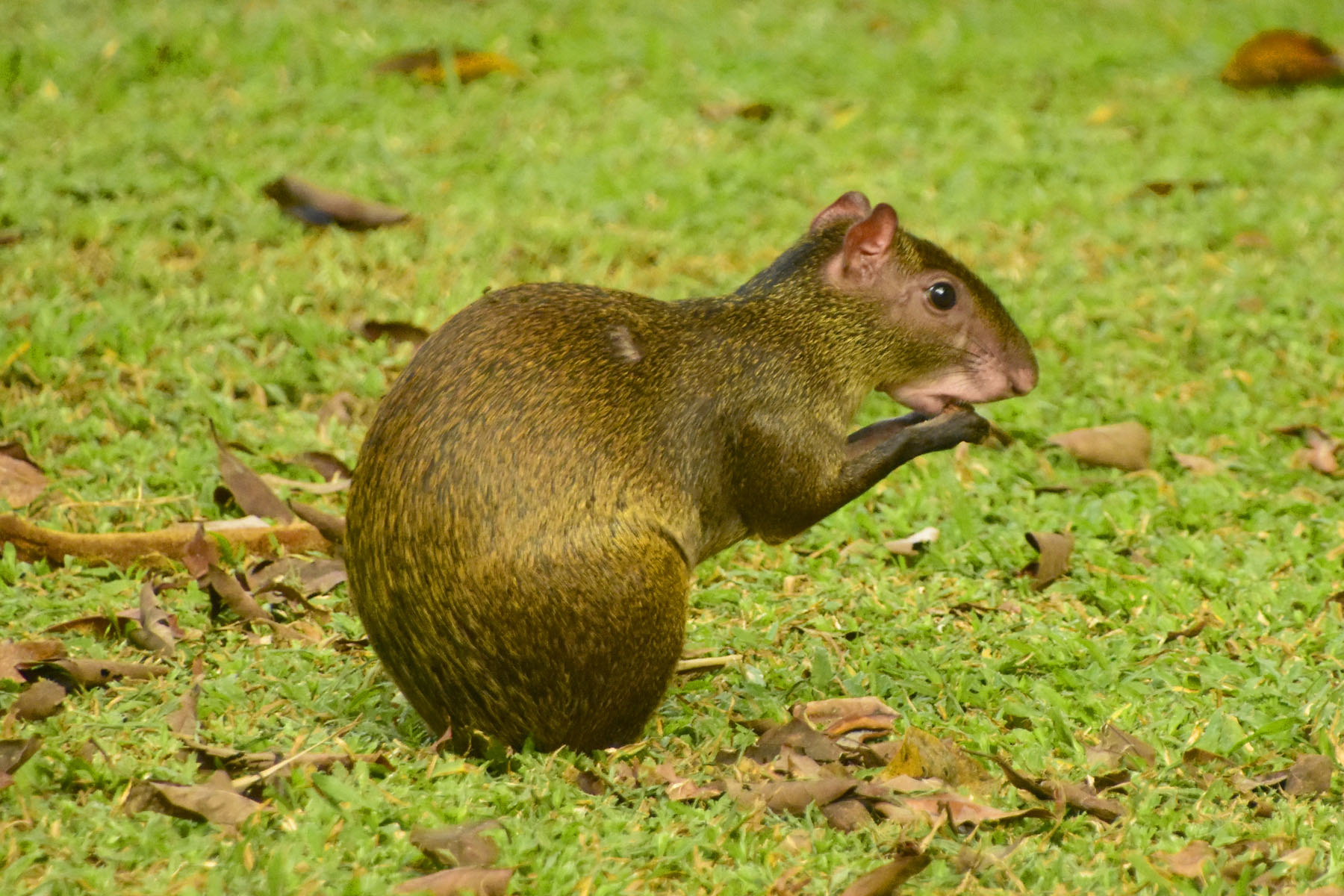 Costa Rica Rainforest – Agouti, Costa Rica’s Tropical Rodents.
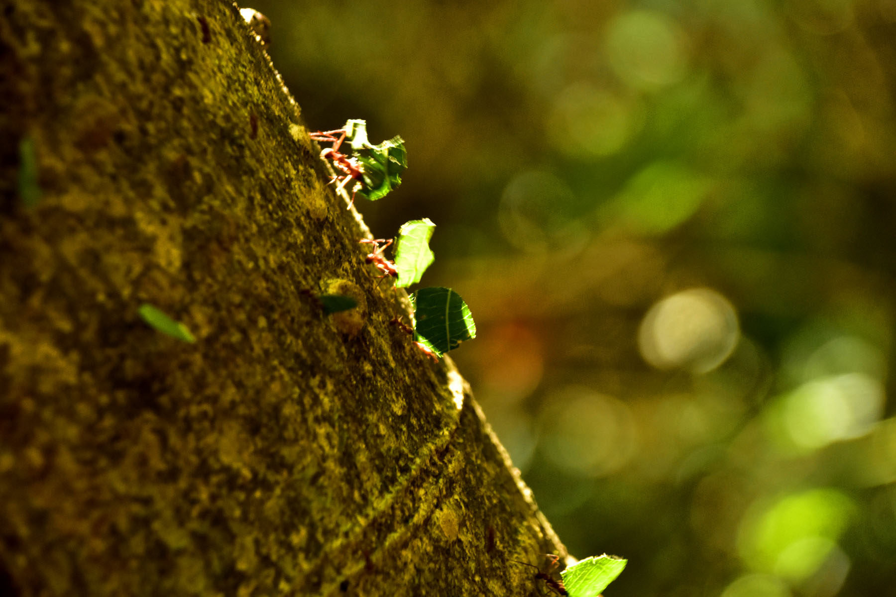 Costa Rica Rainforest – Leaf Cutter Ants climbing down a tree.
The next day was spent transiting the Panama Canal.
Following the failure of a French construction team in the 1880s, the United States commenced building a canal across a 50-mile stretch of the Panama isthmus in 1904. The project involved; digging through the mountains of the Continental Divide, constructing the largest earthen dam ever built, building the biggest locks ever envisaged and solving massive disease, sanitation and environmental problems. Many thousands of people lost their lives in the 10 years it took to build the canal. Opened in 1914, it is considered as one of the world’s greatest engineering feats. The original canal works and locks are still being used today.
In 2016 a new parallel canal was opened to accommodate larger ships, that were not envisaged at the beginning of the 20th century.
The Panama Canal is owned and administered by the Republic of Panama and connects the Pacific and Atlantic oceans (or more specifically, the Caribbean Sea). Ships sailing between the east and west coasts of the United States, which otherwise would be obliged to round Cape Horn in South America, shorten their voyage by about 8,000 nautical miles.
A series of locks at each end of the canal elevate shipping to 85 feet above sea level to a large man-made lake, then take them back down again to sea level at the other end. It takes between 8-10 hours to transit the canal. There is a complex set of rules that determine the transit fees for shipping, including how many passengers or cargo a ship is carrying. The largest cruise ship currently afloat is charged US$950,000 to transit the canal. The record fee was US$1.8m for a container ship.
From its opening in 1914 until 1979, the Panama Canal was controlled solely by the United States, which built it. In 1979, however, control of the canal passed to the Panama Canal Commission, a joint agency of the United States and the Republic of Panama, and complete control passed to Panama on December 31, 1999.
Panama City is located at the entrance to the Pacific side of the canal and was built with the proceeds from the canal. Panama is now the wealthiest country in Central America.
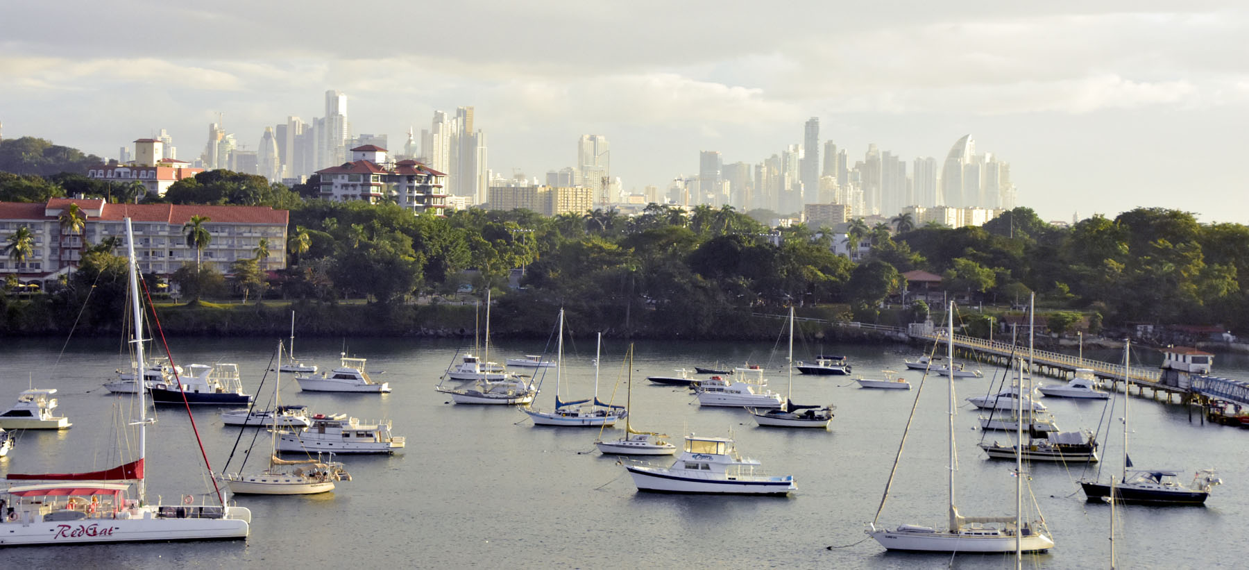 Panama Canal – Panama City.
The photo below shows the entrance to the new canal, with two ships, a container ship and a LPG carrier. It has sliding lock gates, in contrast to the traditional swing gates in the original canal, through which we travelled. The next photo shows the LPG carrier, viewed from the original canal, having been elevated in the lock – it looks like it’s suspended in the forest!
 Panama Canal – The new canal entrance.
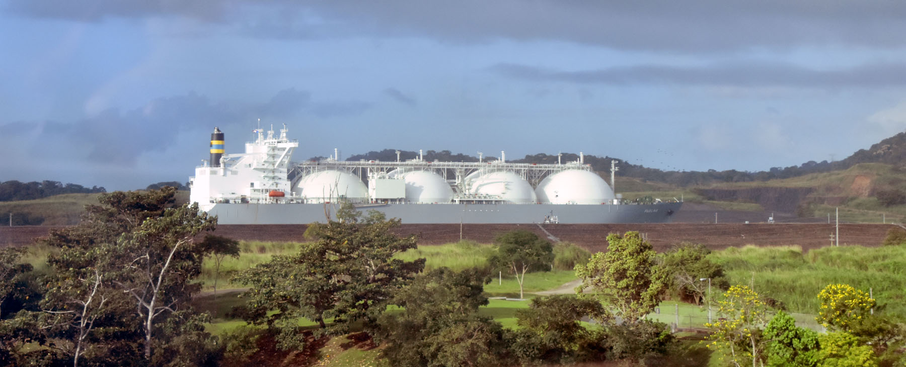 Panama Canal – LPG Carrier in the new canal.
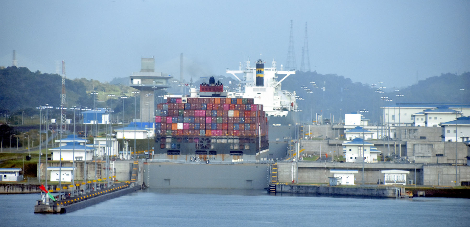
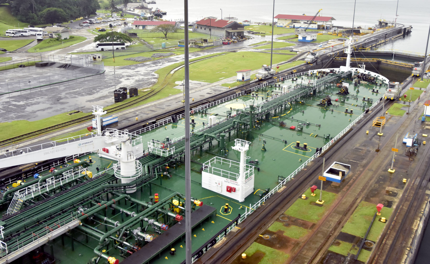
The first double-lock in the two channel entrance of the original canal is the Miraflores Lock. The Bulk Carrier entering the parallel canal has 4 locomotives using cables to keep the ship in the middle of the lock and for breaking. They do not tow; the ships transit under their own steam.
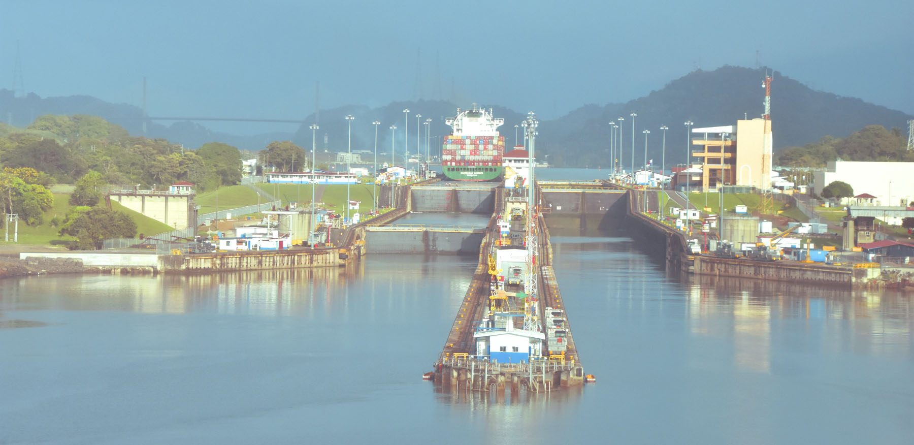 Panama Canal – Entrance to the original Canal
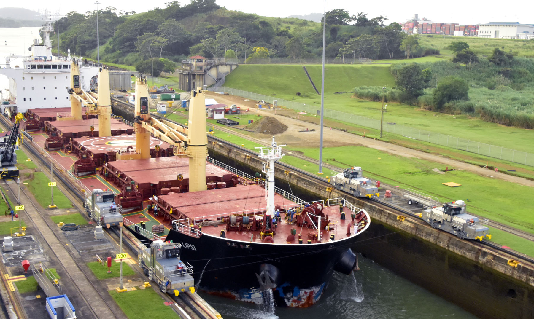 Panama Canal – Bulk Carrier entering the parallel lock with the help of 4 locomotives
After exiting the Miraflores Lock and then the Pedro Miguel Lock, the ship enters the man-made Gatun Lake. The lake loses approximately 56 million gallons of water for each ship transit. This water is replenished from the rainforest. The Centennial Bridge spans the entrance to the Gatun Lake.
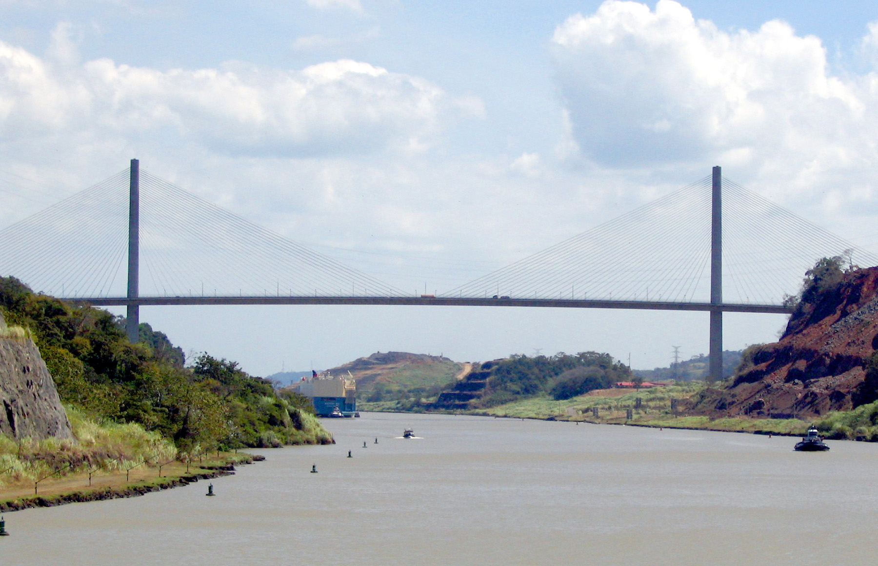 Panama Canal – Centennial Bridge
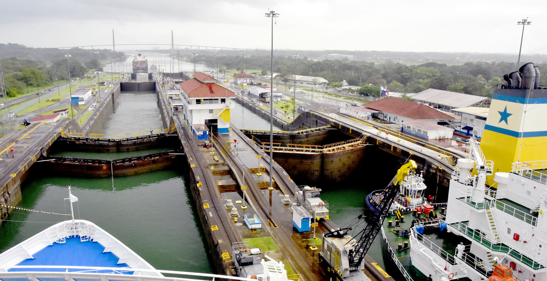
The final Gatun Lock at the exit of the canal allows the ship to drop the 85 feet to sea level using a single lock system. The super-tanker in the other channel of the lock passes through with only a few feet to spare either side. After exiting the canal and sailing under the recently opened Atlantic Bridge, its just 8 miles to the Caribbean Sea. However, there are about 35 ships waiting to enter the canal. They probably haven’t paid the additional advanced booking fee, so will have to wait on a first-come-first-served basis!
 Panama Canal – A super-tanker just fits in the channel of the Gatun Lock
 Panama Canal – Exiting the Gatun Lock with the Atlantic Bridge in the distance
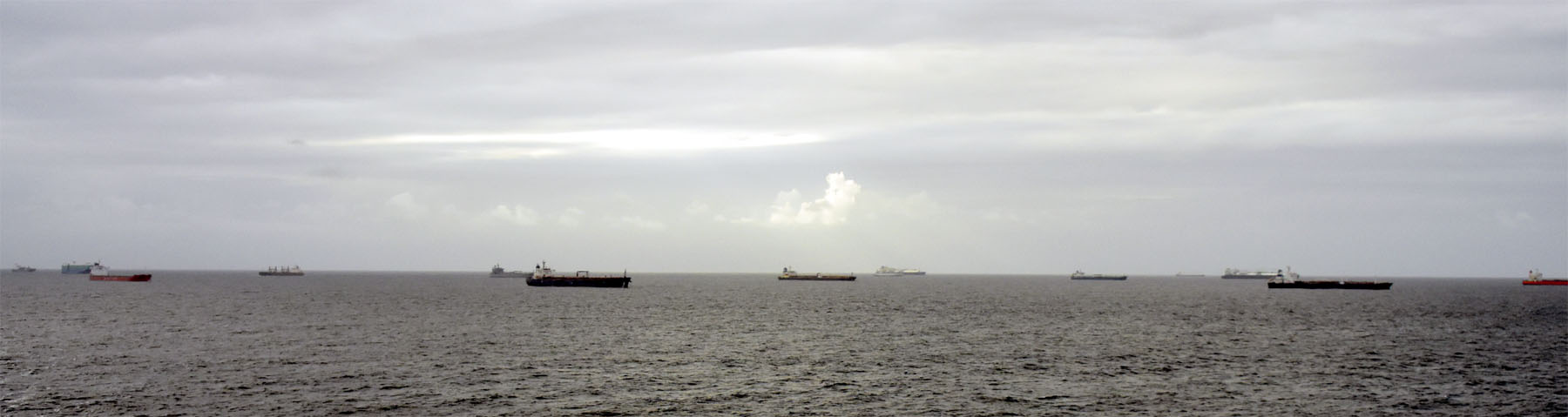 Panama Canal – Ships waiting to enter the canal
Our next port of call was the only place in South America that we visited. We were not sure what to expect in Cartagena, Colombia, having heard that the country was both stunningly beautiful and at the same time had significant problems associated with the drug cartels and crime.
Cartagena is a port city on Colombia’s Caribbean coast. With a population of 1.2m, it is the fifth largest city in Colombia and is a thriving economic centre with a tropical climate and is a popular beach destination.
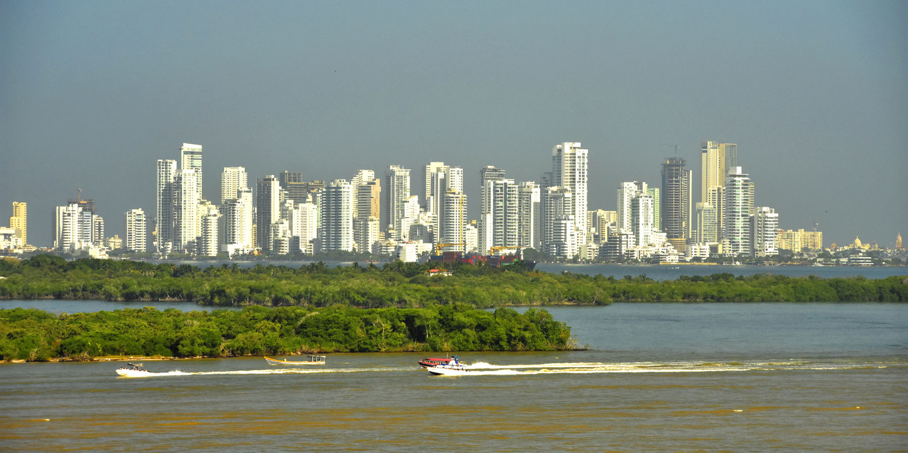 Cartagena, Colombia – The modern city skyline.
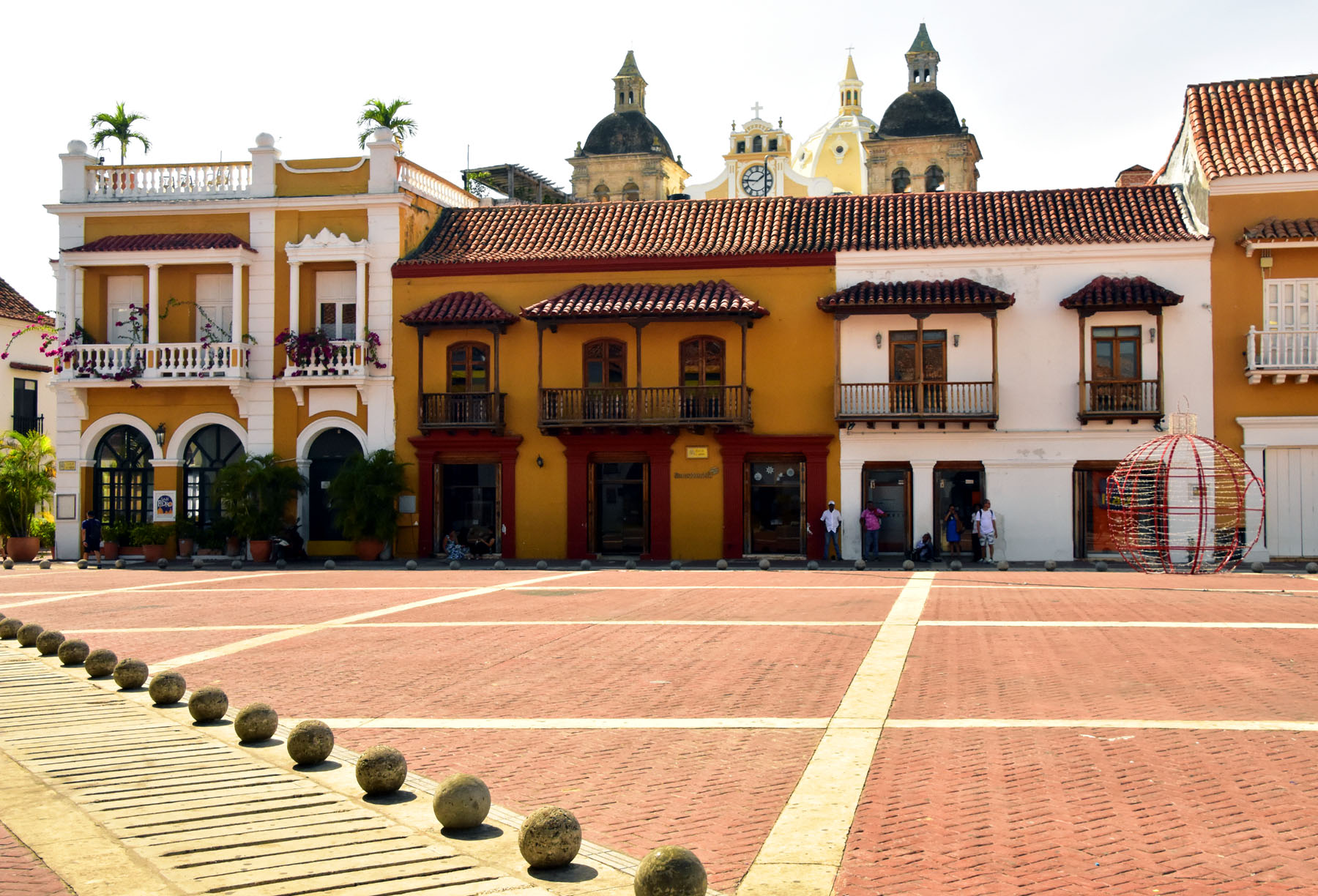
By the sea is the walled Old Town, founded by the Spanish in 1533, with squares, churches, cobblestone streets and colourful colonial buildings. It was the most beautiful of the colonial towns we have visited on this trip and it was very safe and easily accessible on foot.
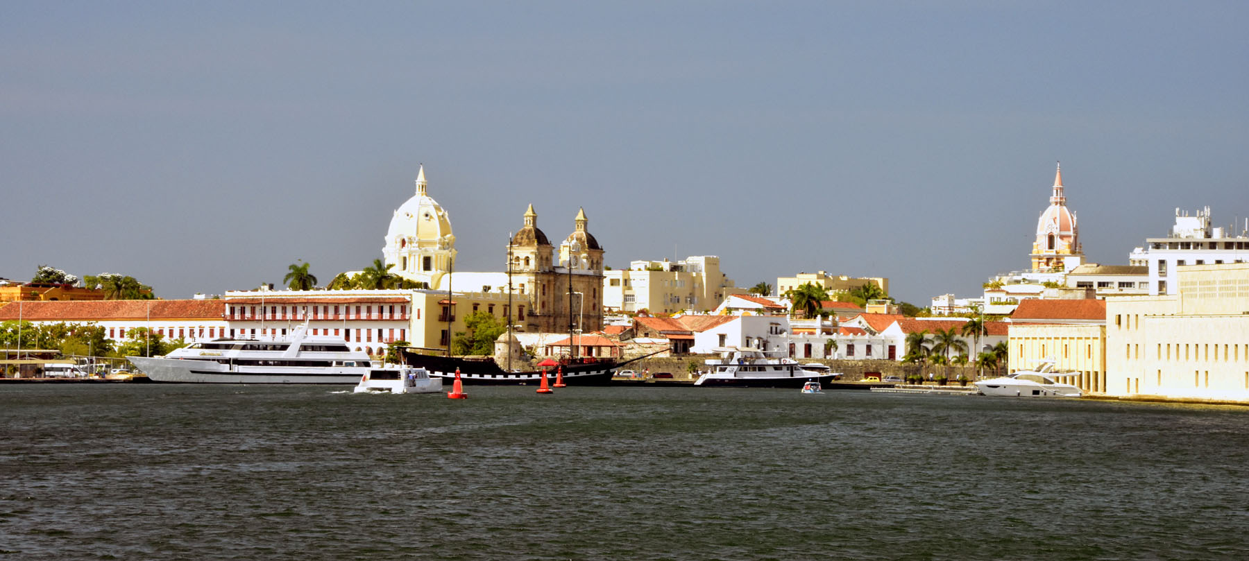 Cartagena, Colombia – The walled Old Town viewed from the sea.
During the colonial era it was a key port for the export of gold and silver to Spain and for the import of enslaved Africans. The city was a target for many British privateers. Francis Drake attacked the city in 1586 with 23 ships and 3,000 men. Drake burned 200 houses and the cathedral, departing only after a ransom was paid a month later.
Modern day Colombia strongly reflects it’s history as a colony of Spain. It is often referred to as the most Roman Catholic of the South American countries, and most of its people are proud of the relative purity of their Spanish language. The economy is traditionally based on agriculture, particularly coffee and fruit production, but industries and services are increasing in importance. Colombia is the most populous nation of Spanish-speaking South America. More than one-third of its inhabitants live in the six largest metropolitan areas, of which the capital Bogotá is the largest. The nation’s political instability has been historically tied to the unequal distribution of wealth, and the illicit trade in drugs remains a major disruptive factor in Colombian life.
Here are some photos of the Old Town
 Cartagena, Colombia – Plaza de la Aduana (Custom’s Square), the centre of the slave trade until 1851.
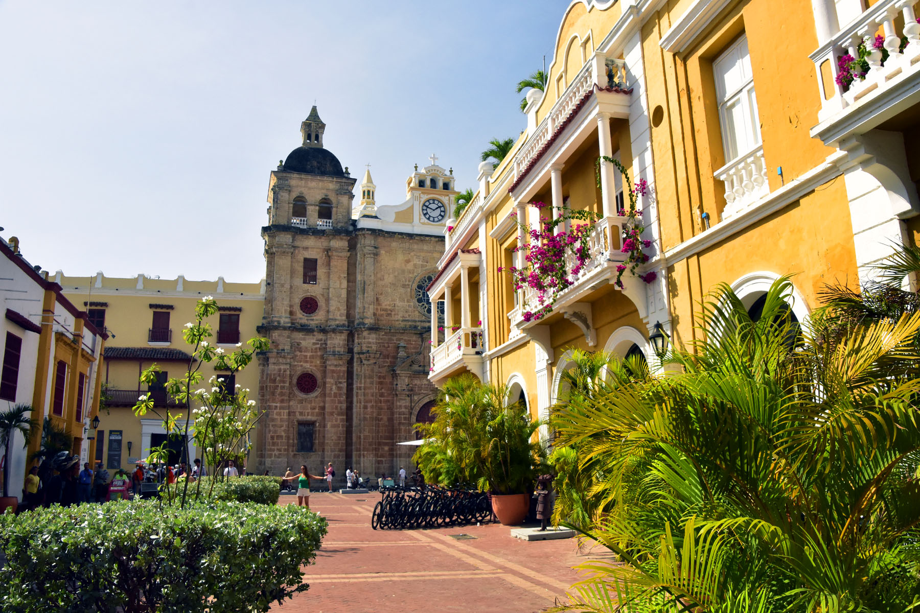 Cartagena, Colombia – Plaza San Pedro Claver, with the Church of San Pedro Claver in the background
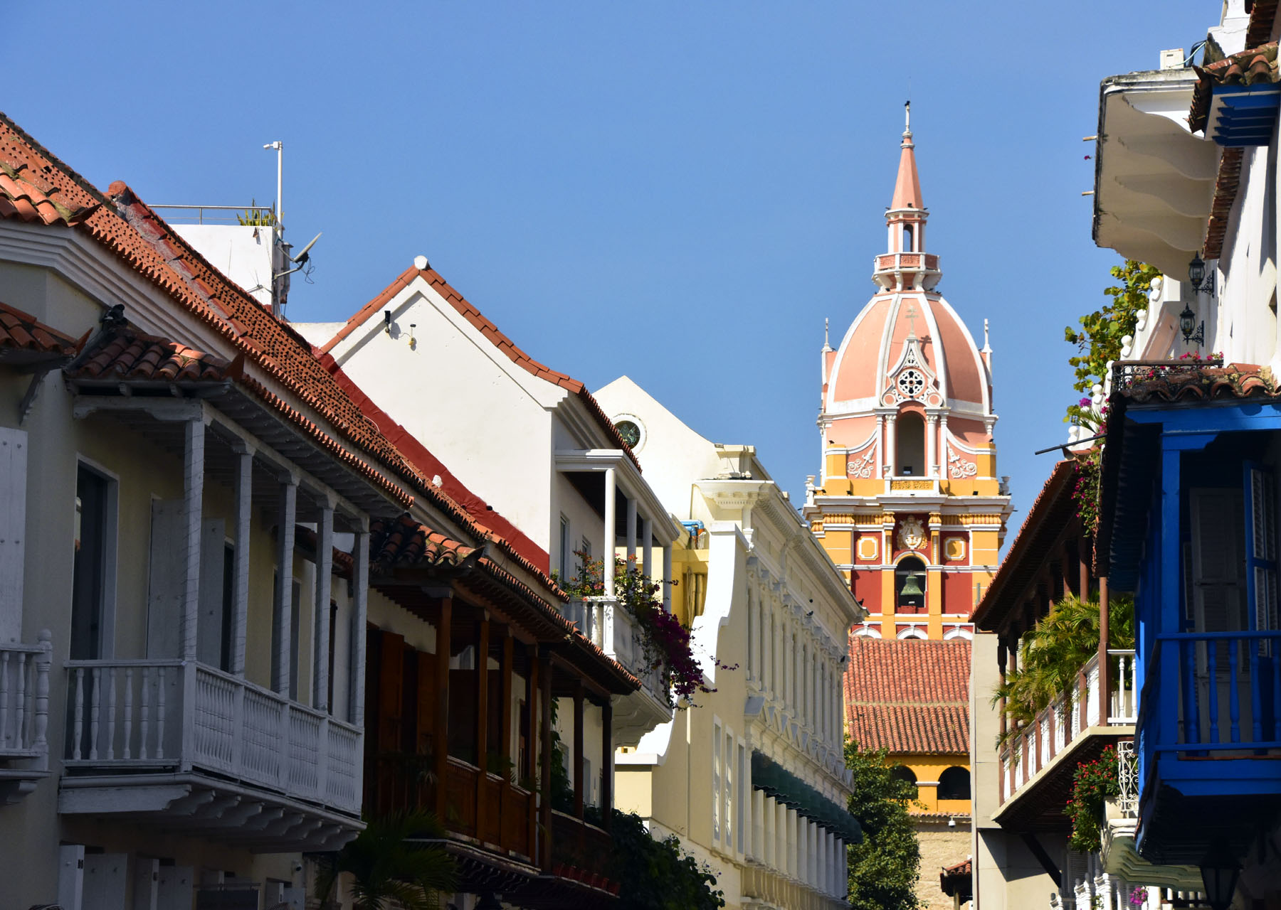 Cartagena, Colombia – The beautiful pink-coloured dome of the Cathedral of Cartagena dominates the view from many narrow streets.
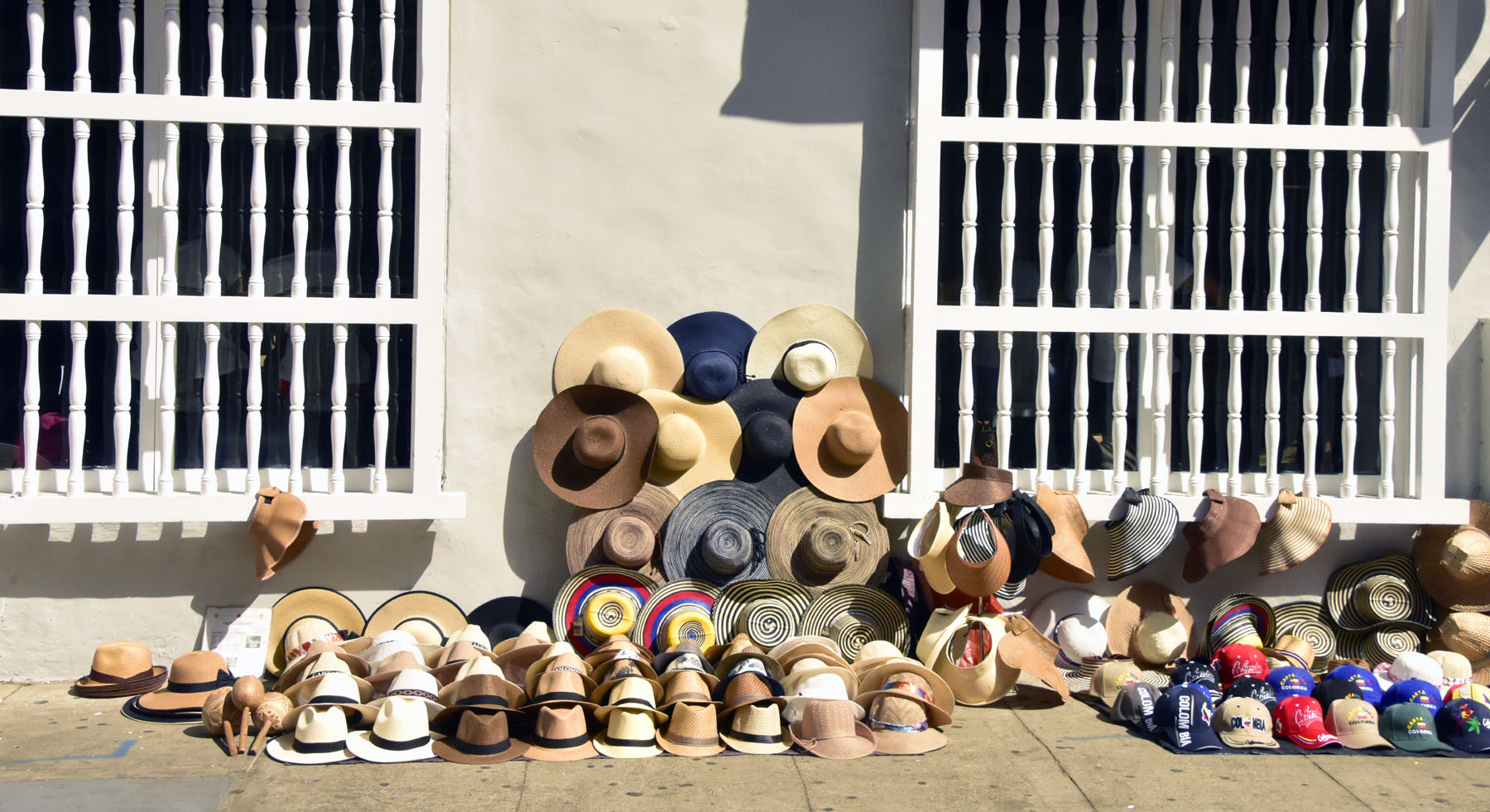 Cartagena, Colombia – Always something to buy in the Old Town.
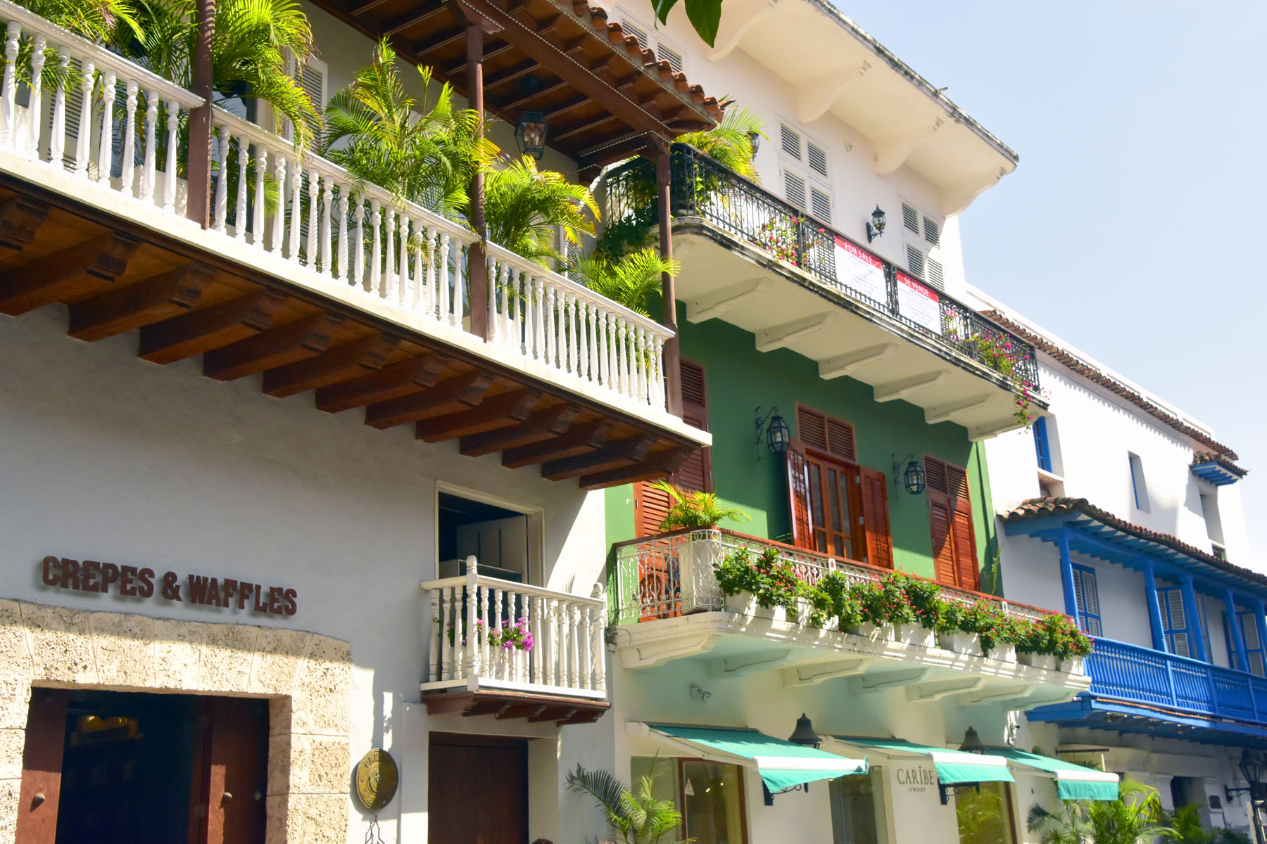 Cartagena, Colombia – Colourful facades with ornate balconies
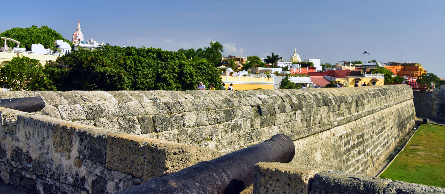 Cartagena, Colombia – The outer wall of the Old Town
Our last stop was in George Town, Grand Cayman in the Cayman Islands, which is an autonomous British Overseas Territory in the western Caribbean Sea. It is well known as a tax haven and a holiday destination with great beaches and world-class diving. It’s crystal clear waters, coral reefs and fabulous sea life also make it ideal for snorkelling. So we couldn’t give up the chance to spend a few hours on the sea, snorkelling on a local ship wreck and coral reef. It was probably one of the best places we have ever snorkelled!
Here are some photos from our snorkelling trip:
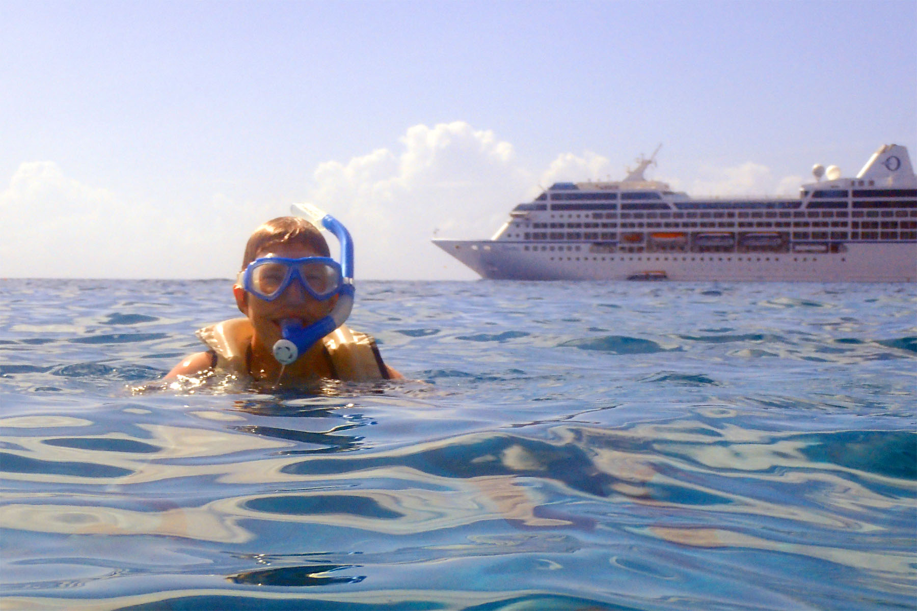 Cayman Islands Snorkelling – Charlotte in her element!
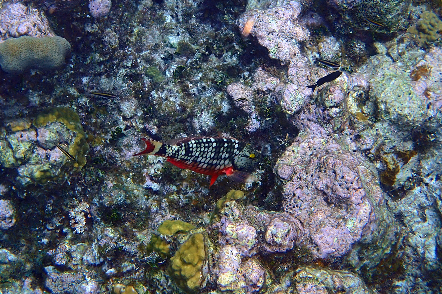
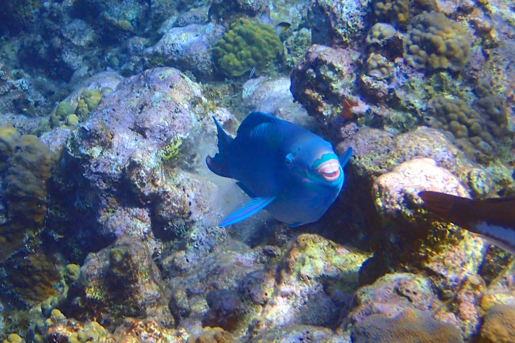 Cayman Islands Snorkelling – Parrot Fish
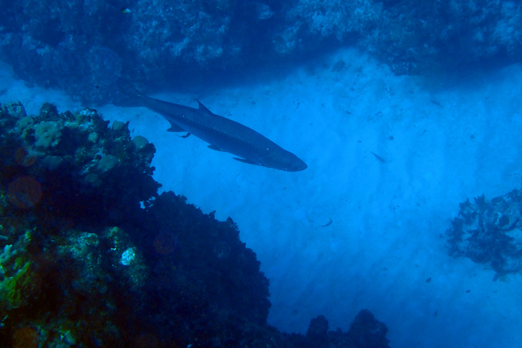 Cayman Islands Snorkelling – Large Tarpon Fish
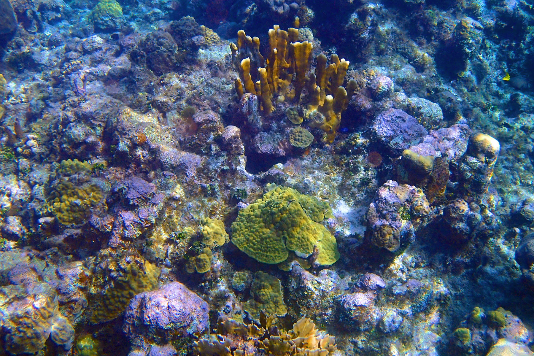 Cayman Islands Snorkelling – Coral Reef
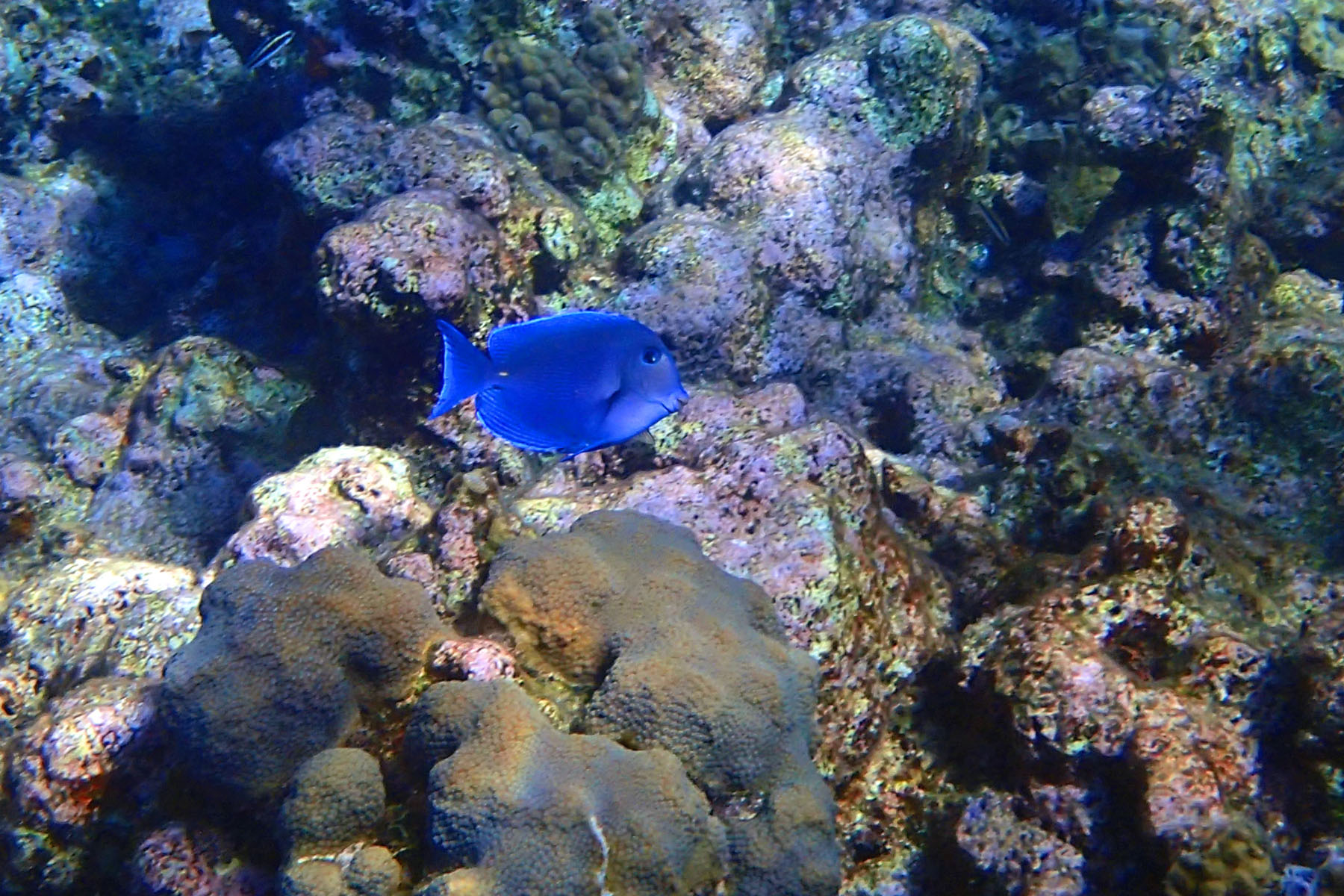 Cayman Islands Snorkelling – Blue Caribbean Tang Fish
 Cayman Islands Snorkelling – Juvenile Stoplight Parrotfish
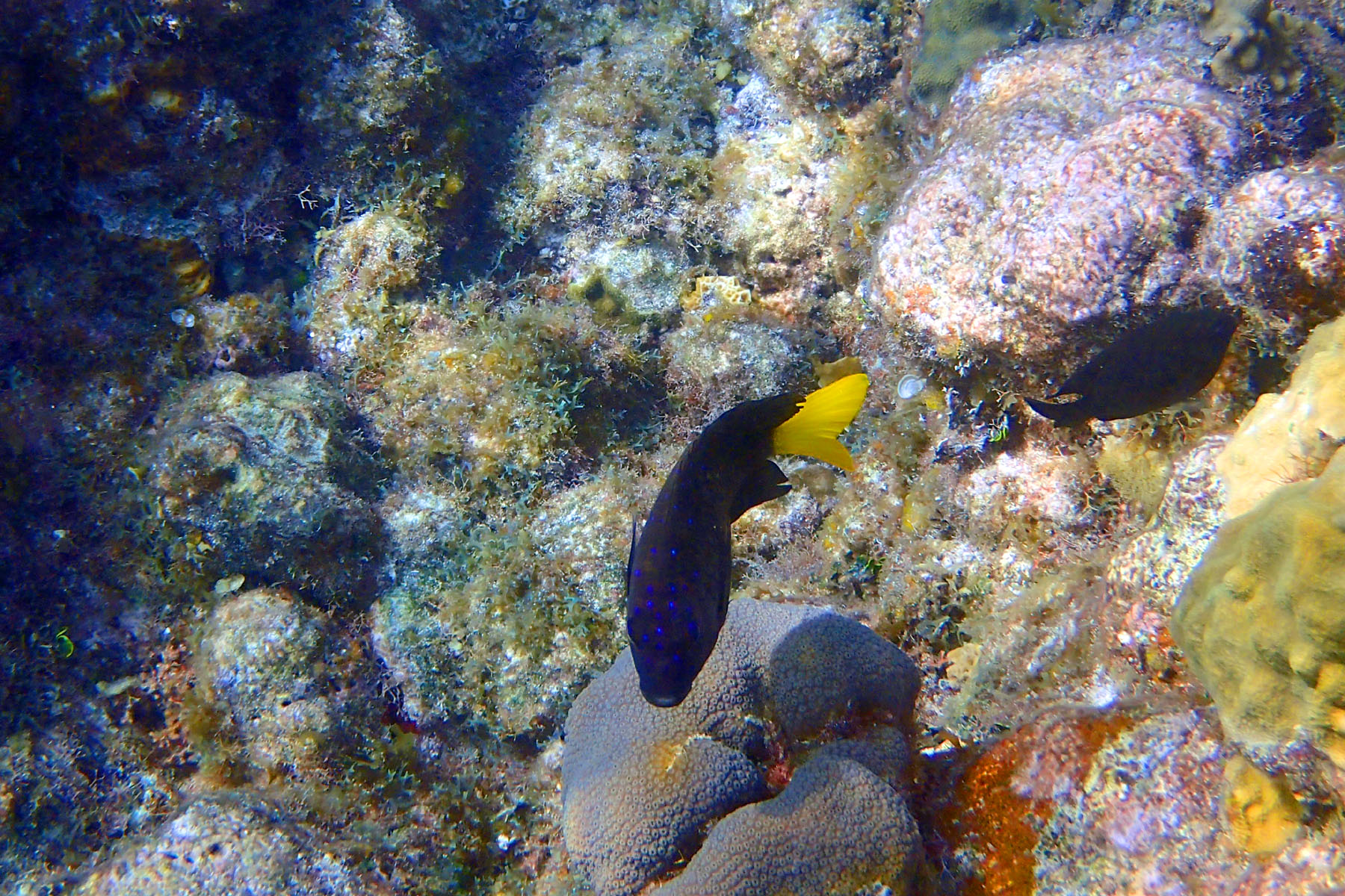 Cayman Islands Snorkelling – Yellow Tailed Damsel Fish
Tomorrow is our last day at sea on route to Miami and the end of our trip.
