The second leg of our Southern California road trip started with a 500 mile, 10-hour drive from Monterey on the west coast to Death Valley on the far eastern side of the State.
Death Valley was always going to be one of the highlights of our trip and it certainly lived up to our expectations – it was one of the most dramatic and beautiful places we have ever visited.
Death Valley is a desert valley and is the hottest, driest and lowest National Park in the USA and the largest south of Alaska, covering over 3,000 square miles. It is also home to the country’s lowest point, Badwater Basin, which lies at 282 feet below sea level.
In this below-sea-level basin, steady drought and record summer heat makes Death Valley one of the most extreme environments in the world. It’s natural beauty is reflected in its vastness and its diverse geology.
It is one of the hottest places in the world and is credited with the highest ever recorded temperature of 56.7 Deg C in July 1913. Fortunately the average temperatures in December are in the high teens, so the winter months are by far the best time to visit.
The best place to get a sense of the vastness of Death Valley is to visit Dante’s View, a 5,476 ft high viewpoint, overlooking the valley floor, with the Panamint Range of Mountains in the background. Its highest mountain is the snow-capped Telescope Peak (11,049 ft), which is over 20-miles away.
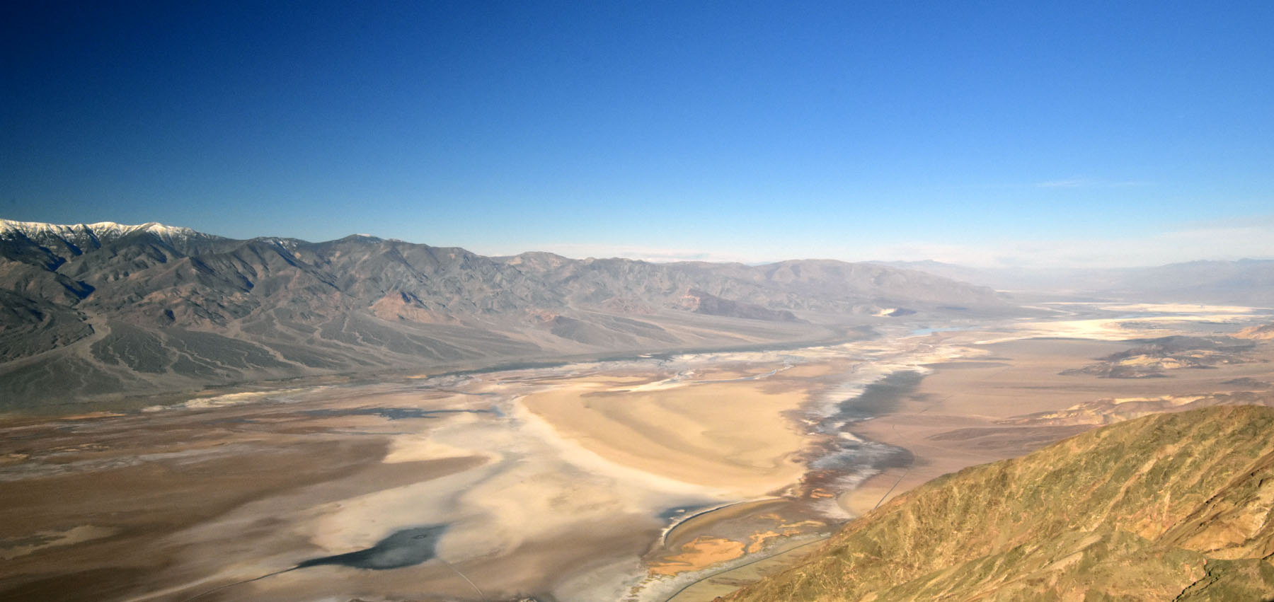 Death Valley – Dantes View
Below the viewpoint is Badwater Basin, the lowest point in North America. The white areas on the valley floor are often assumed to be snow, but are actually a thick layer of polygon salt formations. These can be explored on foot by walking about 1.5 miles out into the Badwater Basin.
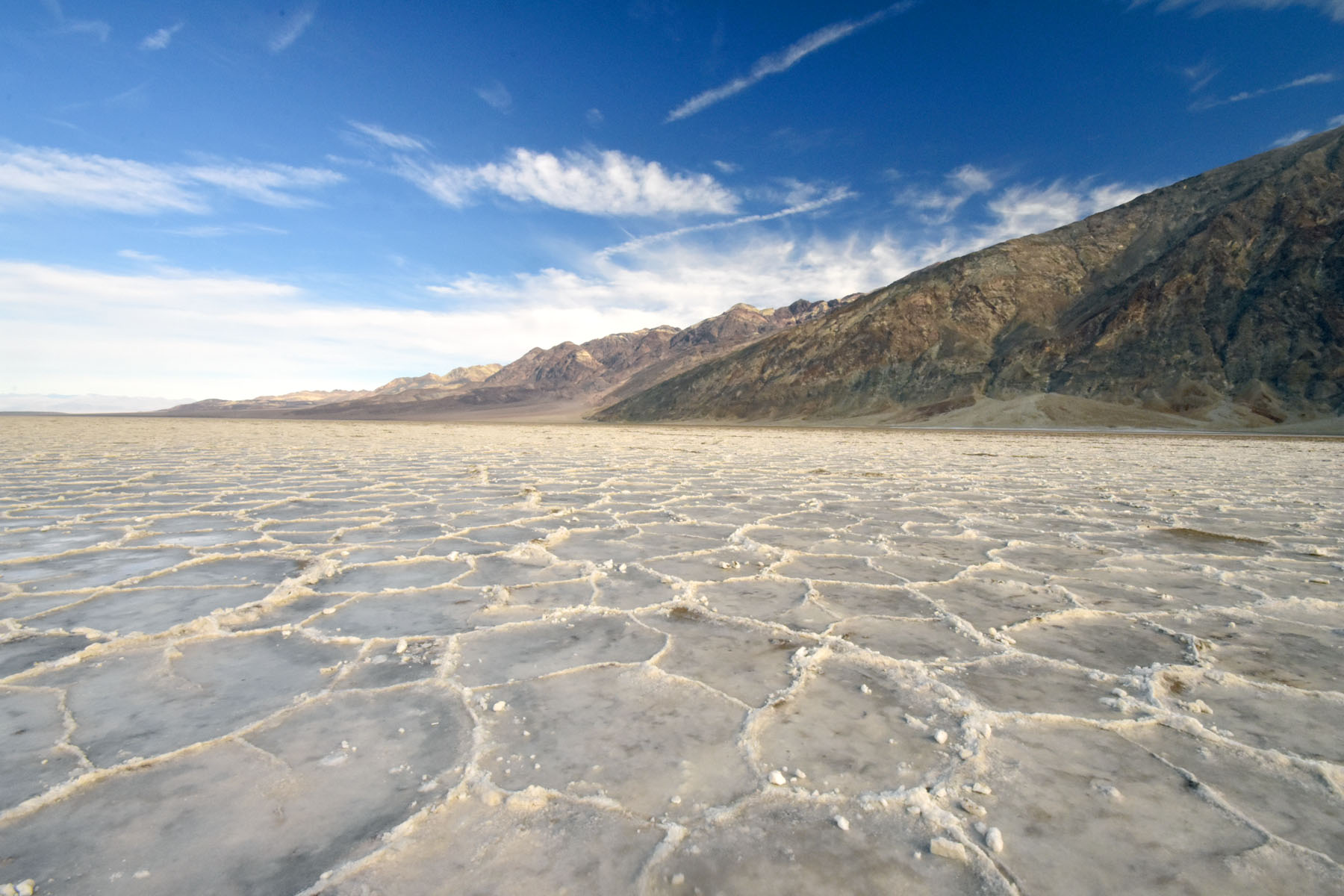 Death Valley – Badwater Basin
To view up close Death Valley’s wonderful geology, we hiked around Artists Palette, an unbelievable area of multicoloured, eroded hills. Oxidation of natural metal deposits in the mountains produce gorgeous shades of green, blue and purple that resemble an artist’s colourful palette.
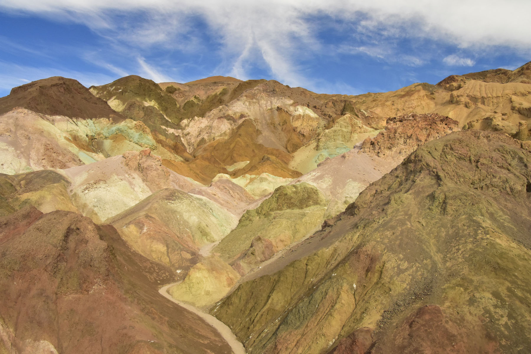 Death Valley – Artists Palette
Zabriskie Point is perhaps the most famous Death Valley viewpoint; an elevated overlook of a huge area of yellow-brown-black badlands at the edge of the Black Mountains, with the white salt flats in the main valley beyond.
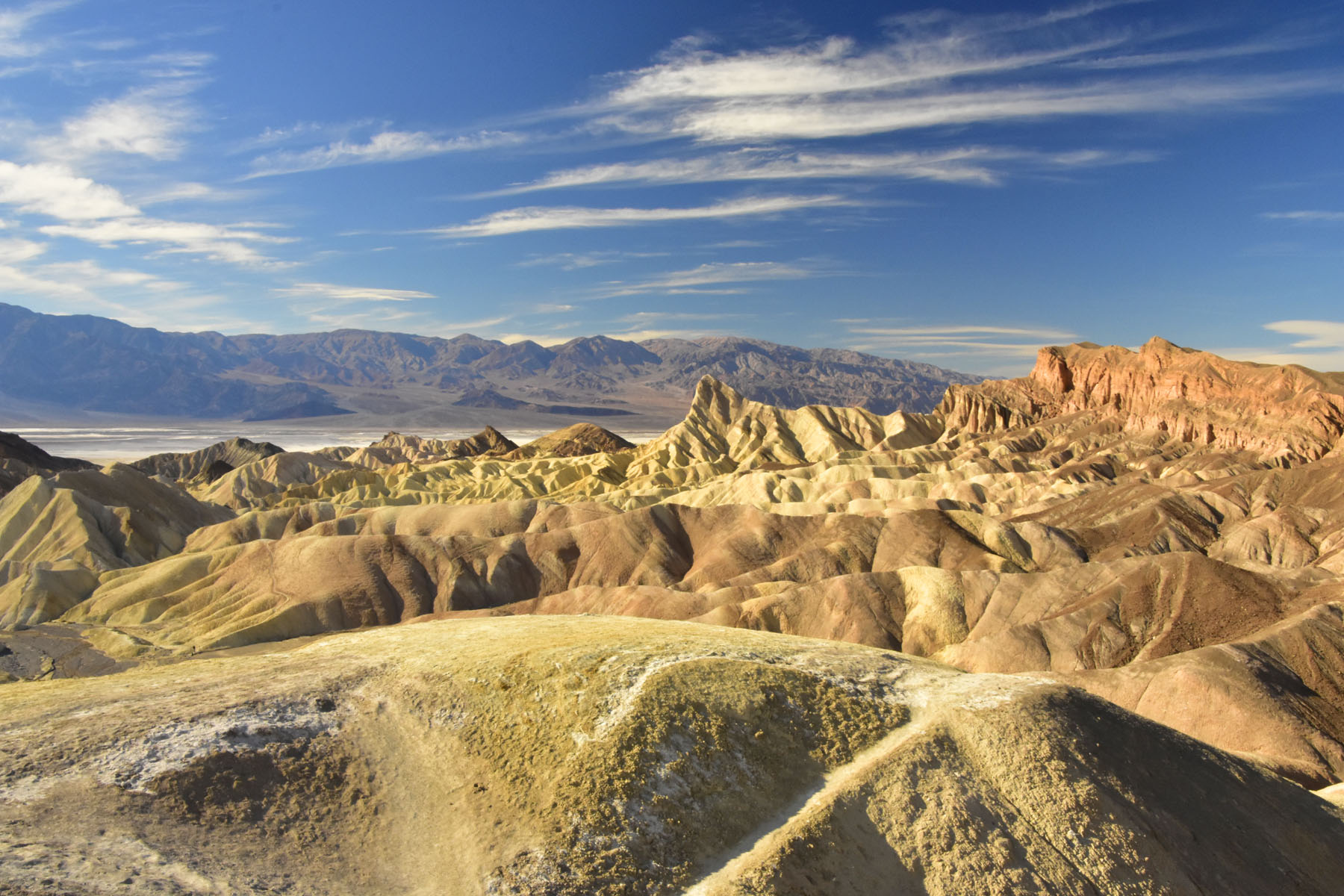 Death Valley – Zabriskie Point
A couple of other highlights during our 2-day visit to the Park were the Mesquite Flat Sand Dunes, a vast area of mountain-fringed sand dunes reaching 100 ft and the Ubehebe Crater. This half-mile-wide, 600 ft deep volcanic crater with its striped layers of sedimentary soil was stunning and a hike around its 2.5-mile long rim allowed us to see it from many different angles.
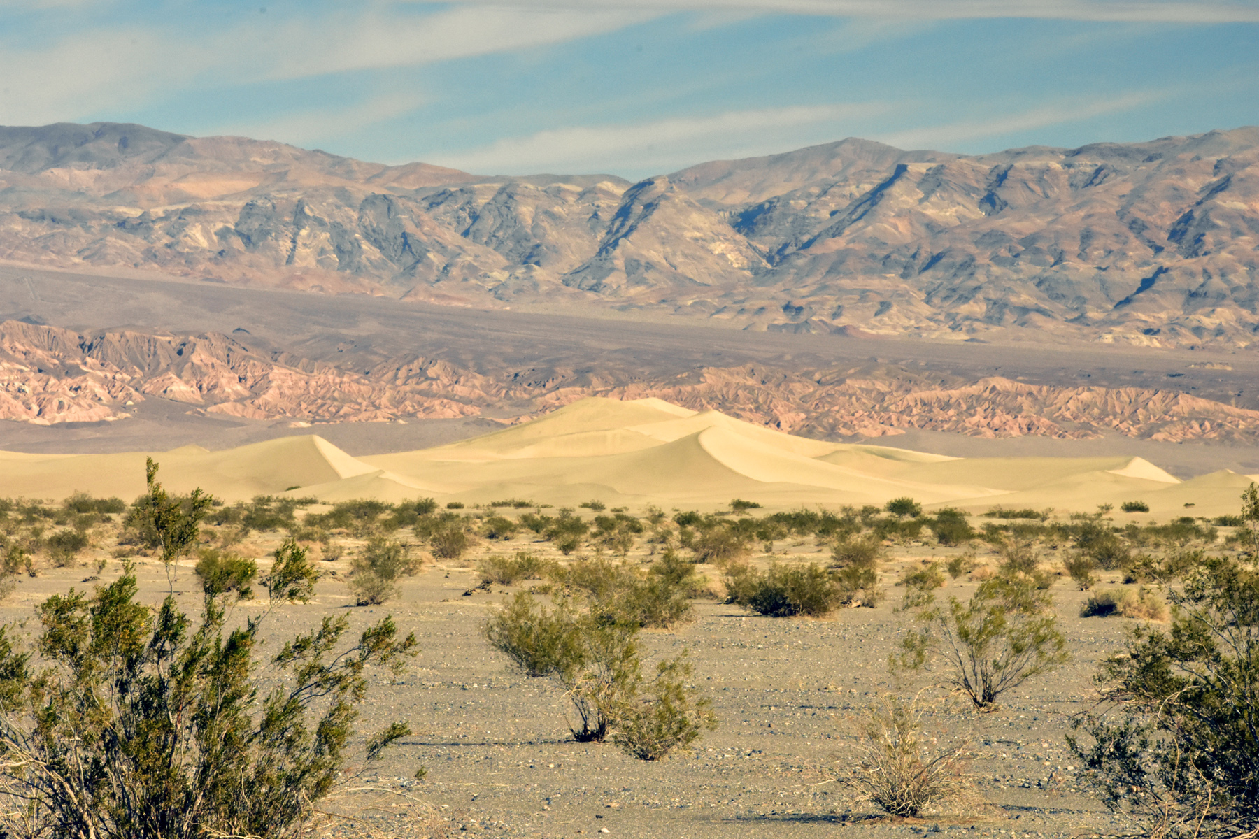 Death Valley – Sand Dunes
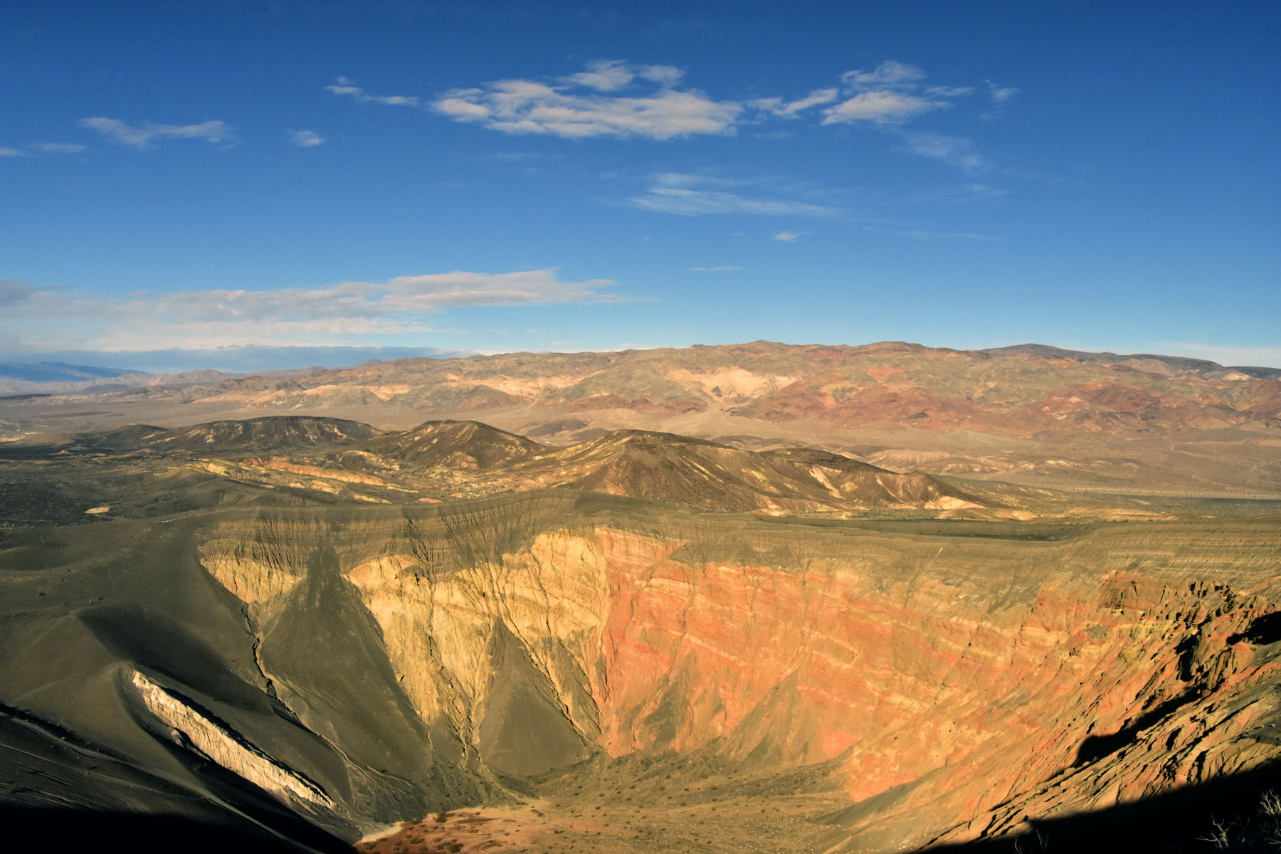 Death Valley – Ubehebe Crater
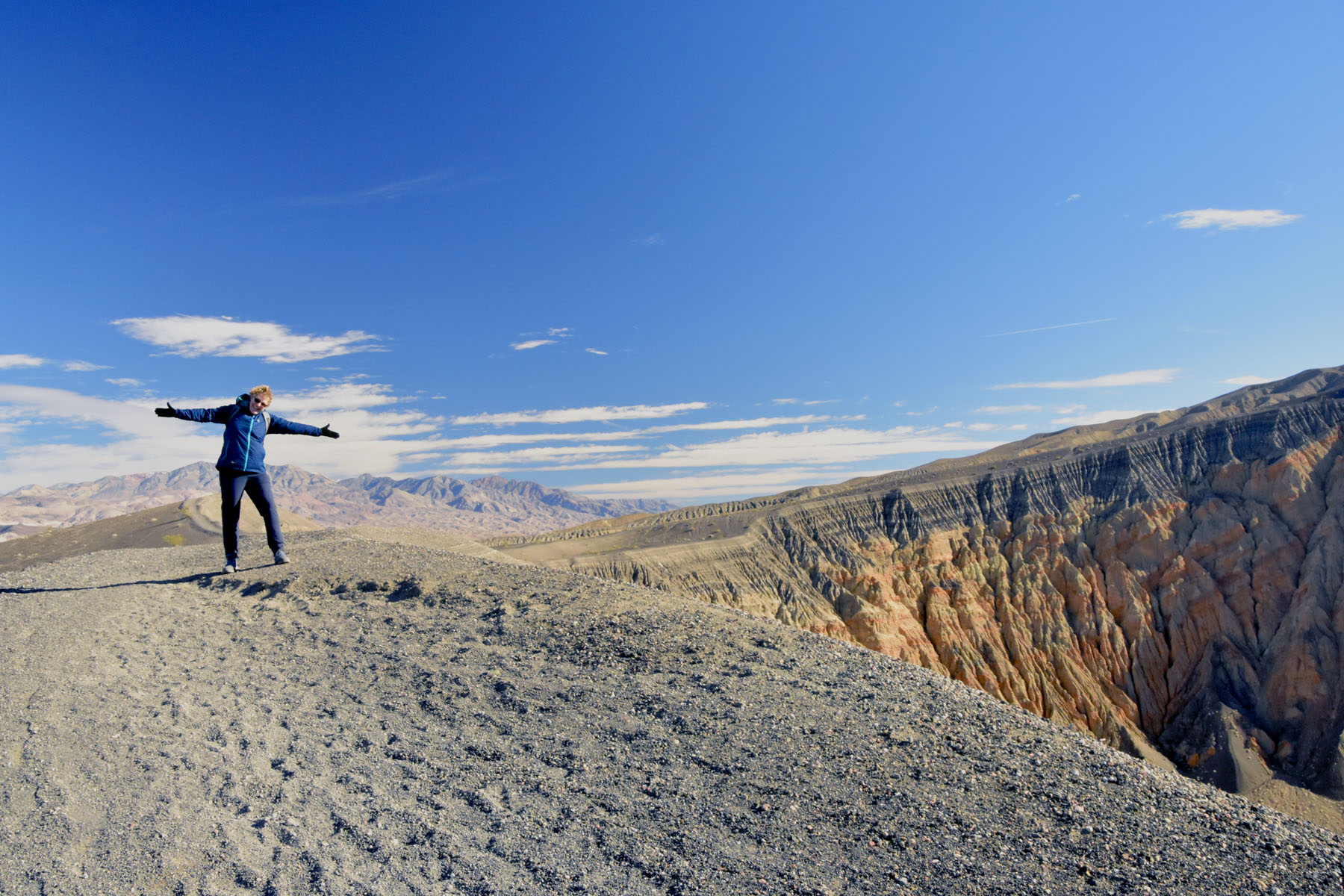 Death Valley – Hiking around the rim of Ubehebe Crater
We then headed off to our next destination, Las Vegas, just over the border into Nevada. This was not to taste the delights of the wacky hotels and casinos, but a staging post to explore the surrounding Nevada countryside and attractions – we did however, manage a walk along the Strip. As many of you know we like travelling at this time of year to avoid Christmas, but we forgot how much the Americans enjoy their over-the-top festive decorations, particularly in Vegas, the city of excess. The picture below shows the Christmas display in the foyer of the Bellagio Hotel, together with a very happy Charlotte!
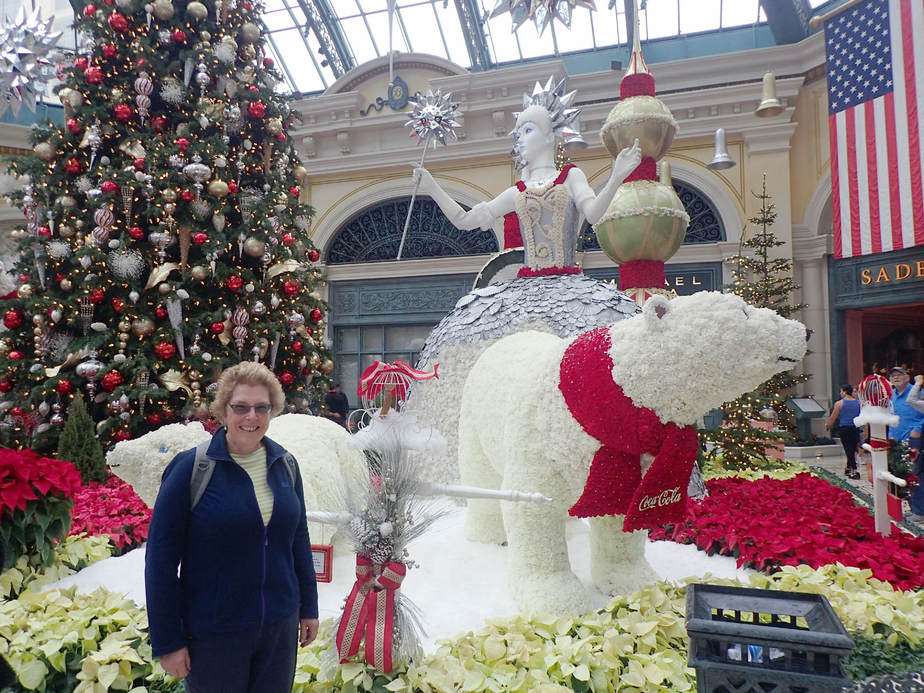 Las Vegas – Xmas at the Bellagio Hotel
The taxi’s in Vegas are put to good use advertising everything and anything that’s available to entertain or consume in the city, including Cannabis, which like many States in the US is now legal in Nevada.
 Las Vegas – Taxi advertising Cannabis
Our first trip out from Las Vegas was to see the Hoover Dam. At 726ft, it is the highest concrete arch-gravity dam in the USA and is located in the Black Canyon of the Colorado River, on the border between Nevada and Arizona. It was constructed between 1931 and 1935 during the Great Depression. Its construction was the result of a massive effort involving thousands of workers, and cost over one hundred lives. The dam is used for flood control, hydroelectric power, agricultural irrigation and domestic water supply. It was an amazing feat of engineering considering the era when it was built.
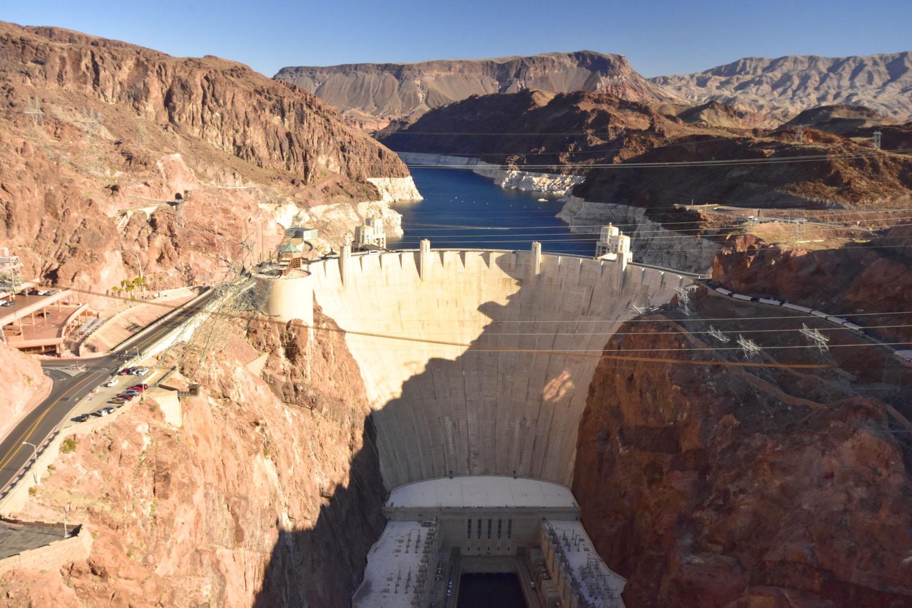 Las Vegas – Hoover Dam
We then took a 6-mile hike along a disused railway track that was originally built to supply materials for the construction of the Dam. The trail is located in the hills overlooking Lake Mead, the man-made lake created when the Hoover Dam was built. It is the largest reservoir in the USA and one of the largest artificial lakes in the world.
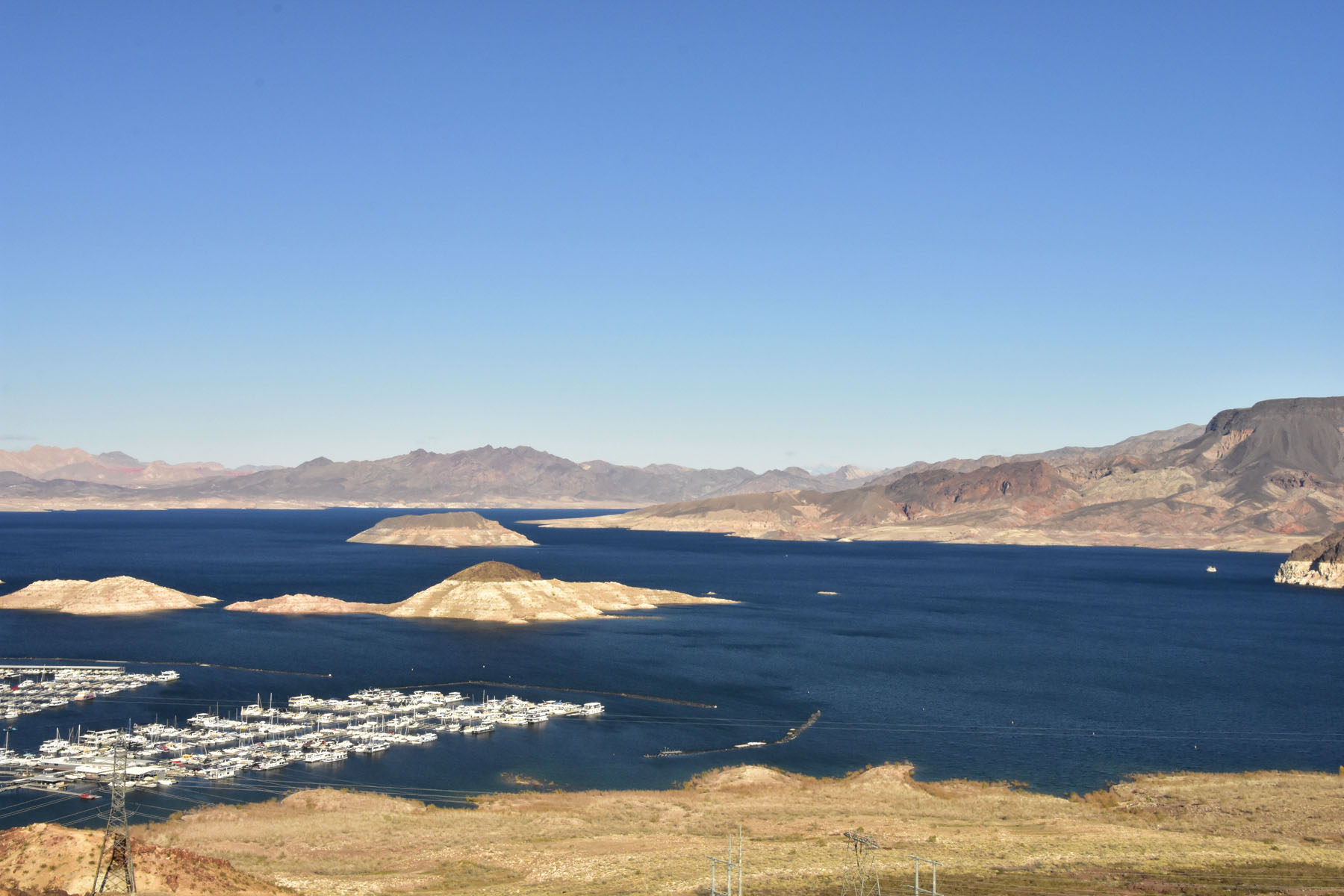 Las Vegas – Lake Mead
We also saw a small group of Desert Bighorn Sheep, which are found in the in the deserts of the Southwest and have adapted to living in the extreme heat of the summer and the cold of winter.
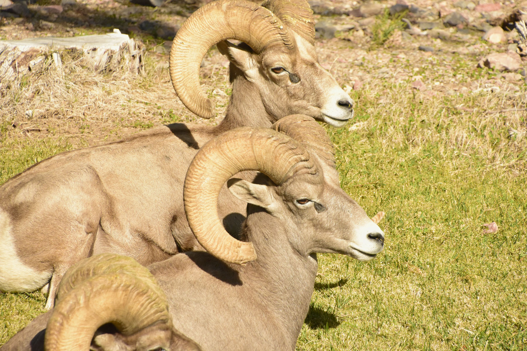 Las Vegas – Desert Longhorn Sheep
The next day we visited the Valley of Fire State Park, a 46,000 acre area that derives its name from red sandstone formations, the Aztec Sandstone, which formed from shifting sand dunes 150 million years ago. These features often appear to be on fire when reflecting the sun’s rays. Like a mini Death Valley, the geology was outstanding, creating beautiful vistas. It was a great day of driving and hiking around the park.

Las Vegas – Driving around Valley of Fire State Park
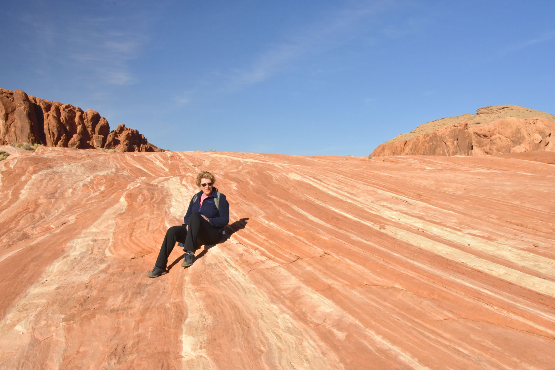 Las Vegas – Hiking around the Valley of Fire State Park
Leaving Las Vegas behind, we then headed for Palm Springs, California, the last leg of our road trip. Palm Springs is a staging post for visiting the Joshua Tree National Park.
One of the areas we wanted to experience when planning this trip was the Mojave Desert. Only when we finally completed the second part of the road trip in Western California and Nevada did we realise that the Mojave Desert is huge, encompassing Death Valley and Las Vegas, reaching down to north of Los Angeles. The desert occupies 47,877 square miles, the same size as England! Its boundaries are generally noted by the presence of Joshua trees, which are native only to the Mojave Desert. So a visit to Joshua Tree National Park was important for us to truly experience the desert.
Much of the Park resembled how we thought a desert should look like, a sweltering hot and arid place with sand, rocks and cactus – a bit like an episode of Bonanza without the cowboys! Fortunately the temperature was not sweltering, but a pleasant 18 deg C.
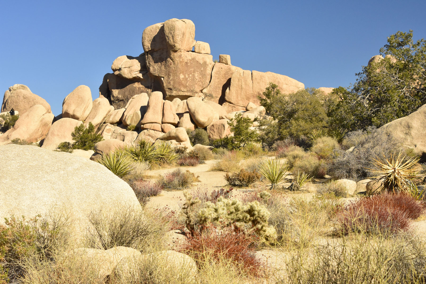 Joshua Tree National Park – Desert Landscape
As the story goes, the Park’s namesake, the Joshua Tree got it’s name from a group of Mormon settlers who crossed the Mojave Desert in the mid-19th century. The tree’s unique shape reminded them of a Biblical story in which Joshua reaches his hands up to the sky in prayer – they certainly had a vivid imagination!
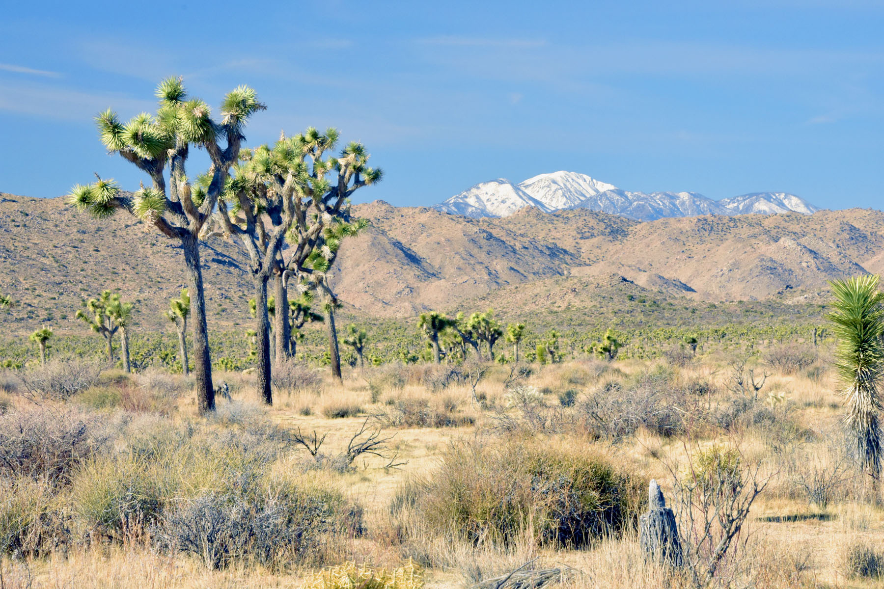 Joshua Tree National Park – The Joshua Trees
The young trees are called ‘Sprouts’, which is certainly the only sprout we are going to encounter this Christmas!
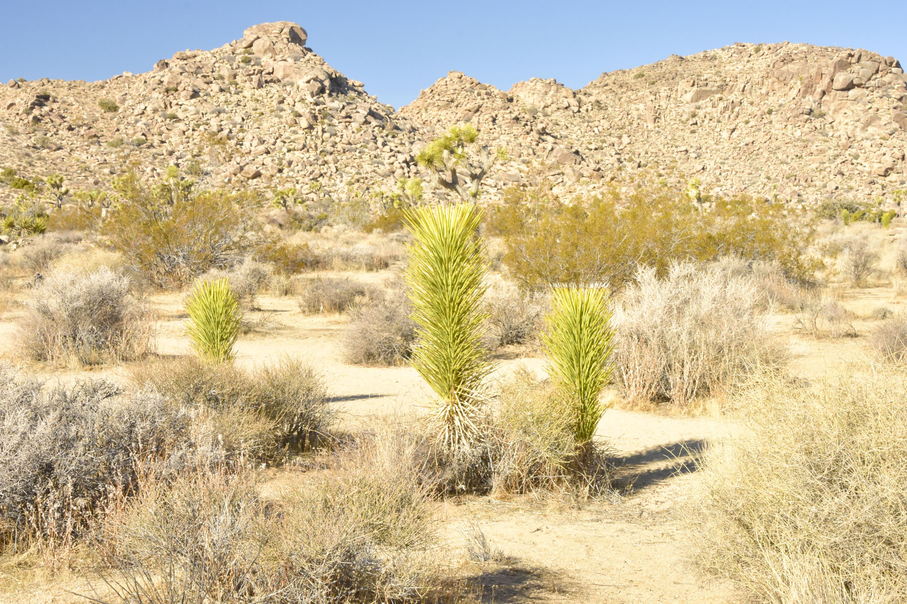 Joshua Tree National Park – Young Joshua Tree ‘Sprouts’
The Joshua Tree National Park also borders the Colorado Desert, and as we drove through the park from the Mojave to the Colorado desert, the landscape changed with less Joshua Trees creating a more desolate look. Suddenly, however, we came across a field of lush colourful Cholla Cactus, a wild garden covering several acres – nature never stops surprising us.
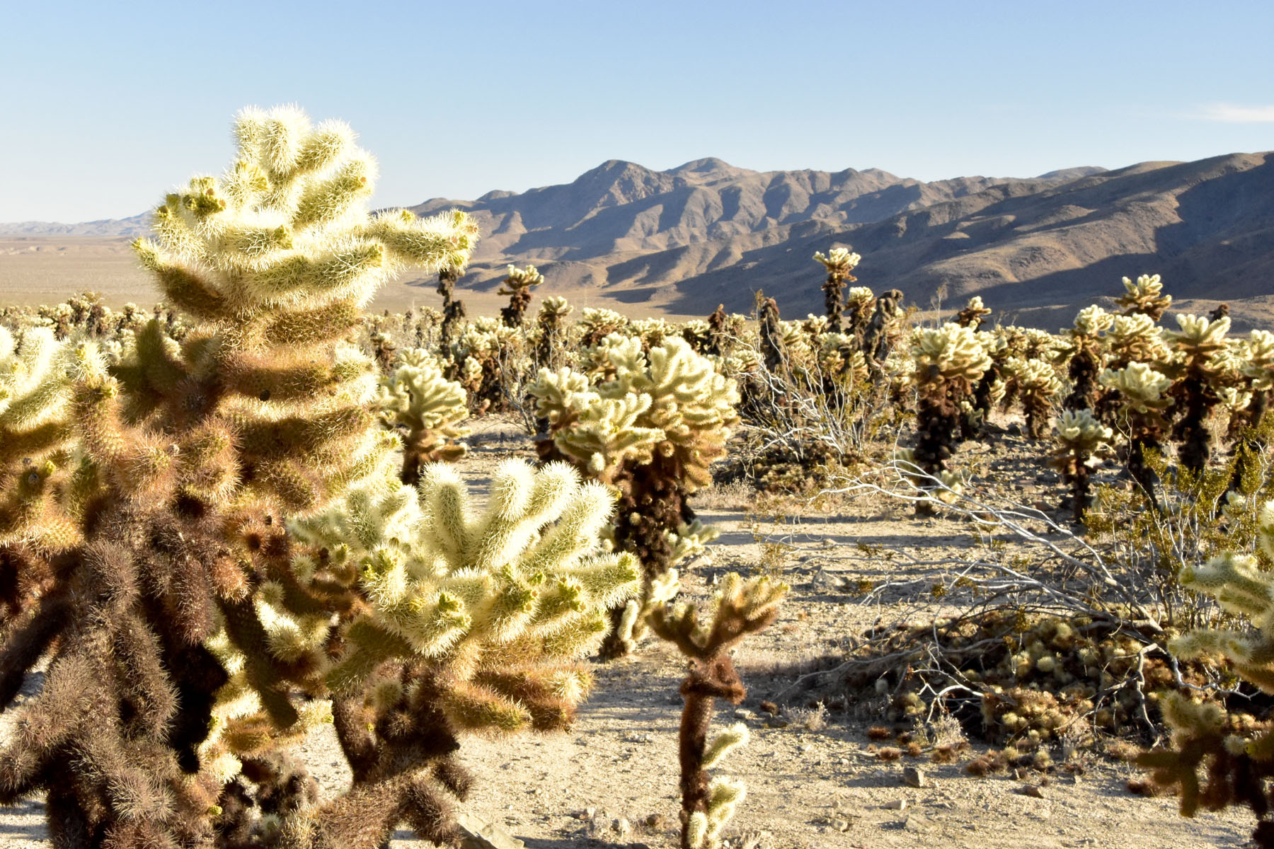 Joshua Tree National Park – Cholla Cactus Field
Today we spent a quiet day exploring the city of Palm Springs, or to put it another way shopping in the upmarket downtown area, with its boutiques, galleries and restaurants. Tomorrow we are returning to Los Angeles to board our ship for the tour of Central America – more on that soon.
