We rented a lovely house on Samish Island, which is a residential community between Anacortes and Chuckanut, in the northern part of the state not far from the Canadian border. If you flew due west from here you would land on Vancouver Island! It is actually no longer an island, but rather a small peninsula, due to a dike that was built in the 1930s. It is informally considered one of the ‘inner San Juan Islands’ along with other small islands to the east of the larger San Juan Islands. The dike area is known as the ‘flats’ and resembles the Somerset Levels or the Norfolk Broads.
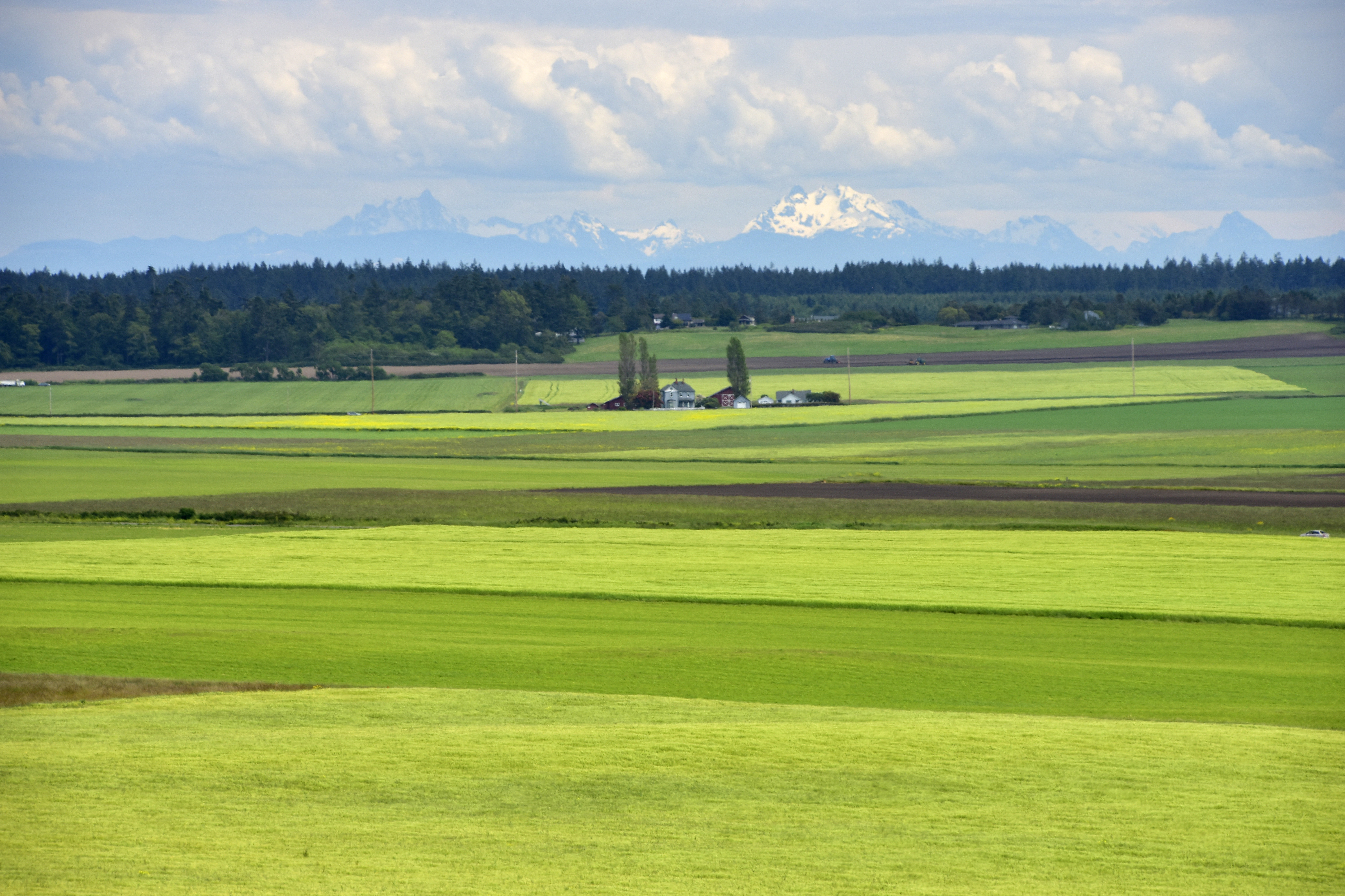
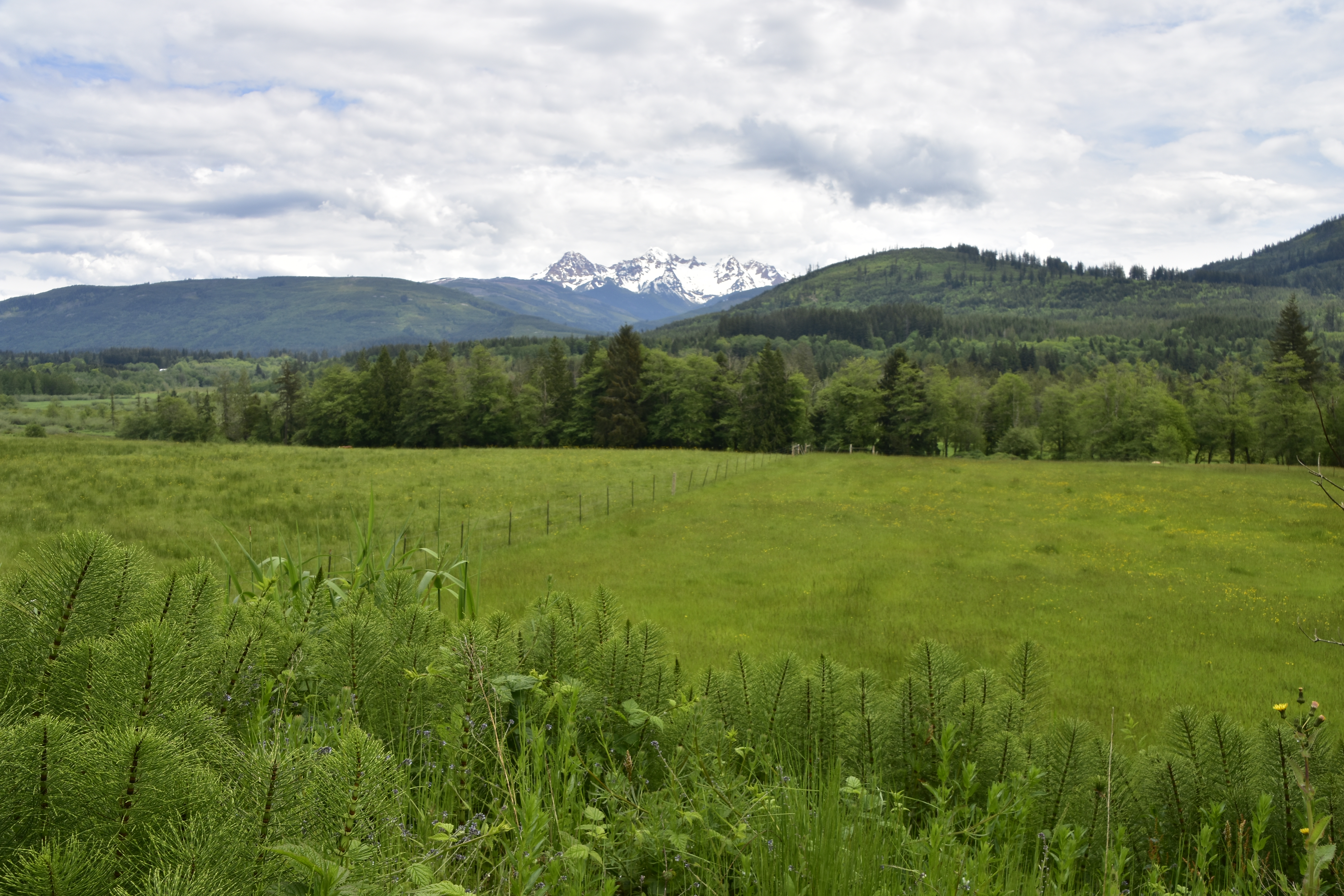
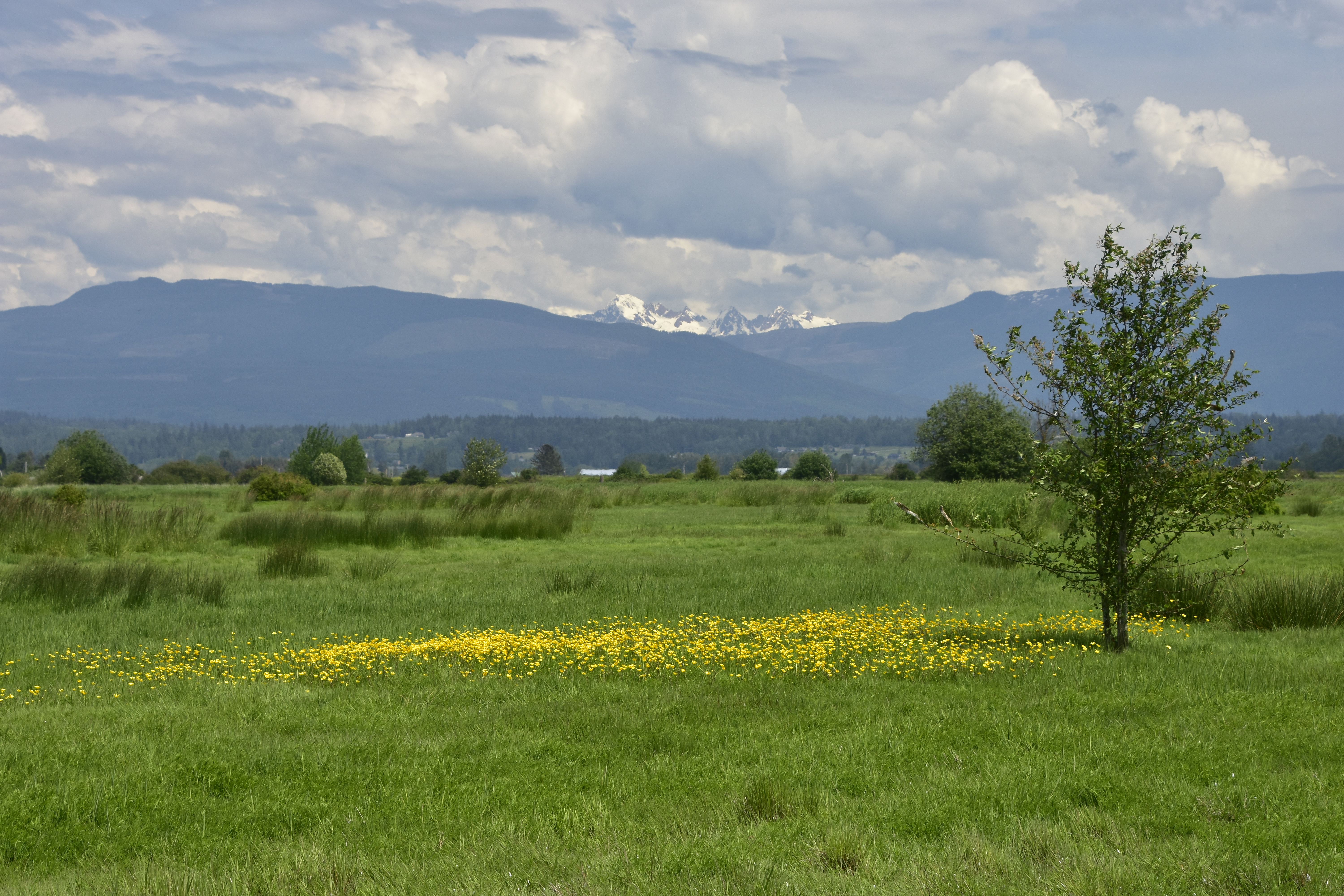 View across the Samish ‘flats’ to the Northern Cascade Mountains.
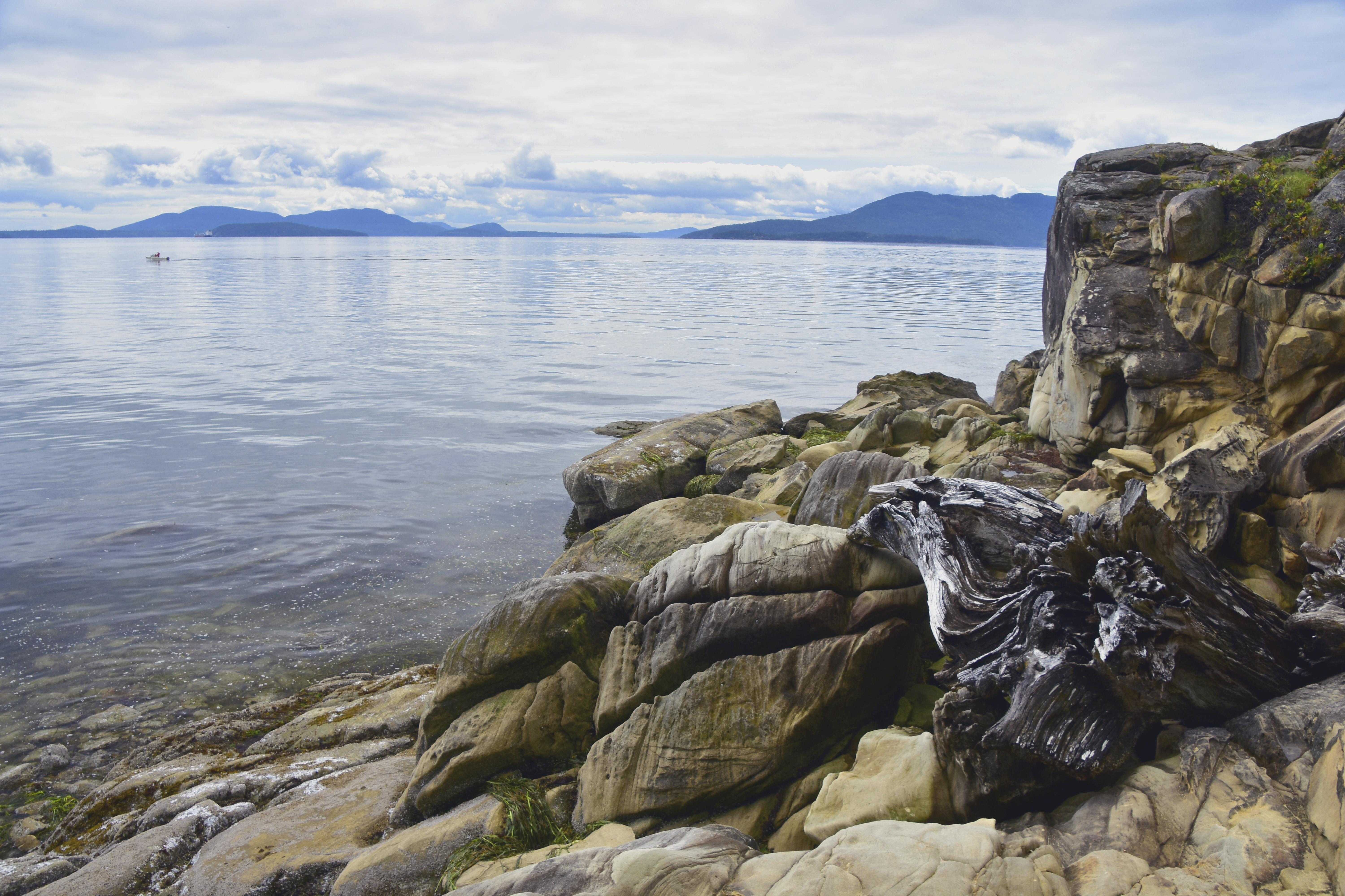
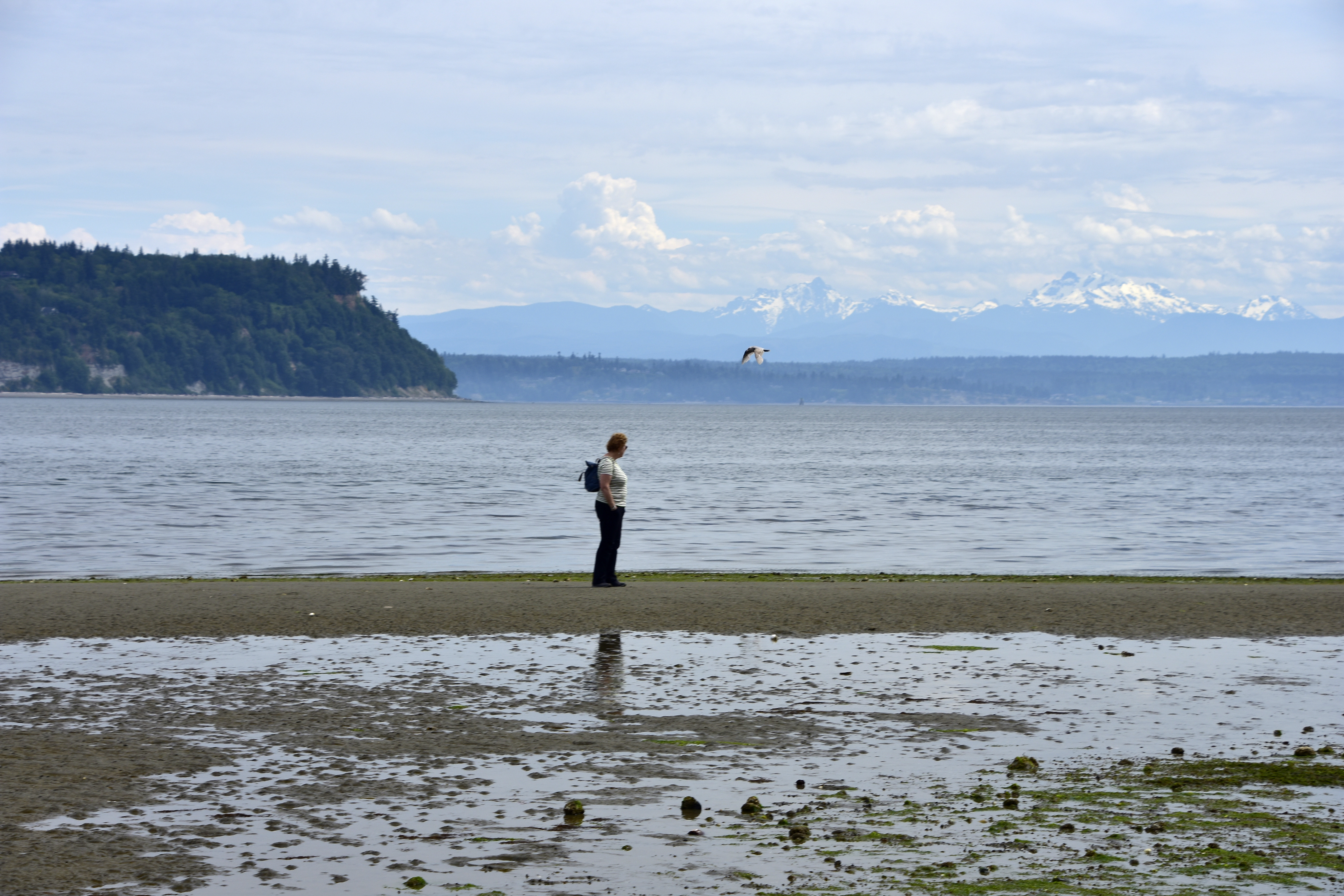
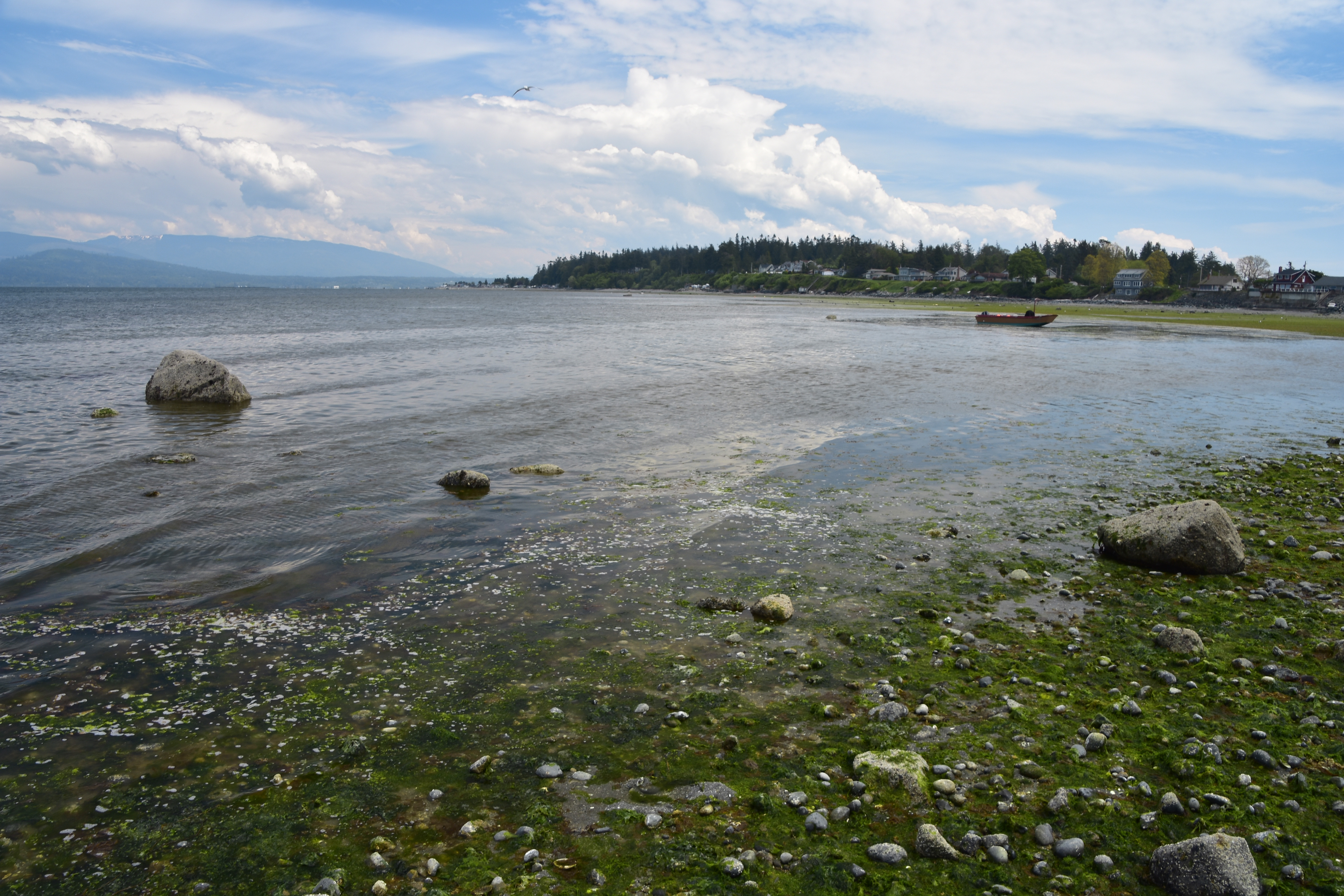 View from Samish Beach looking out over Samish Bay.
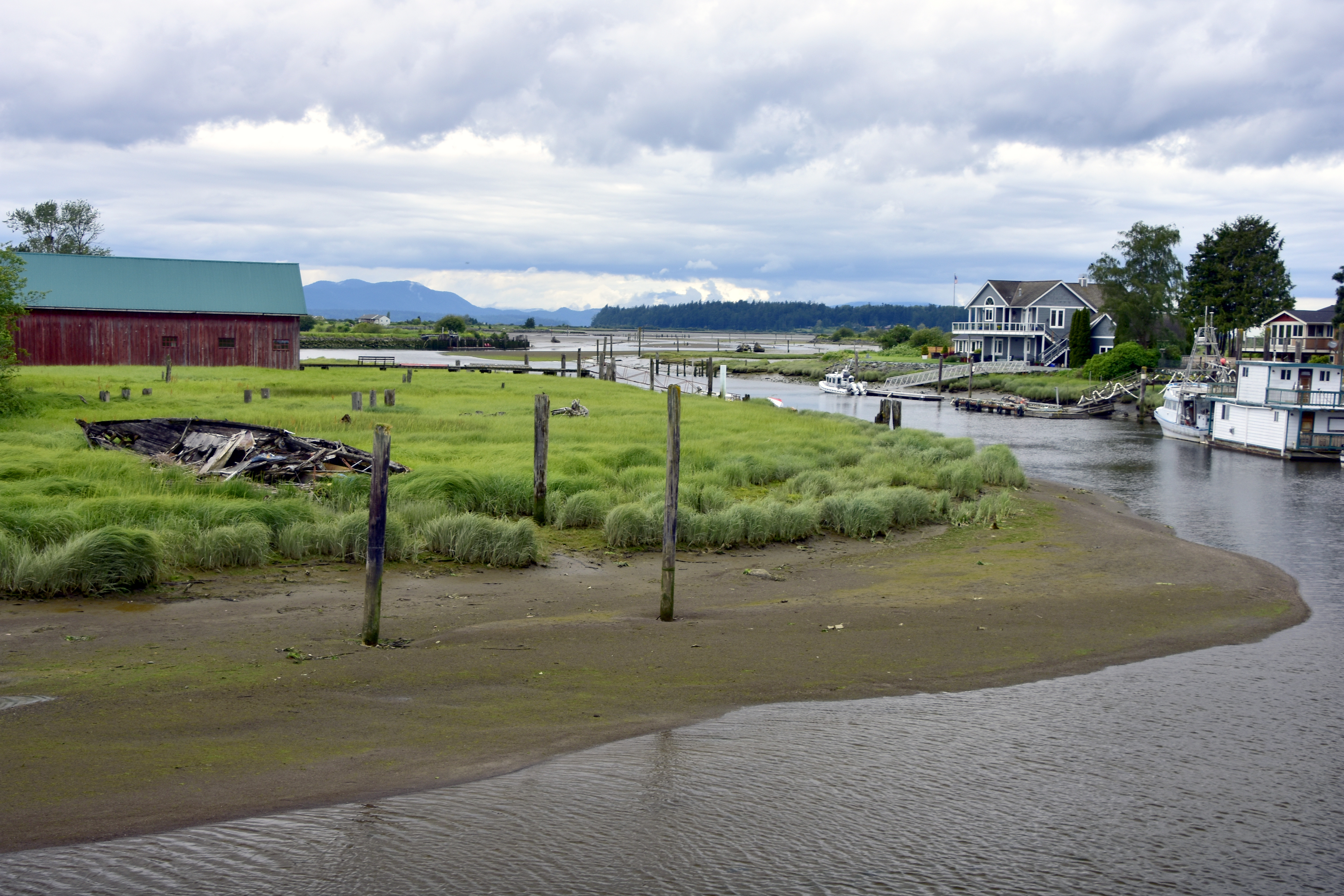 Canals and waterways run throughout the ‘flats’.
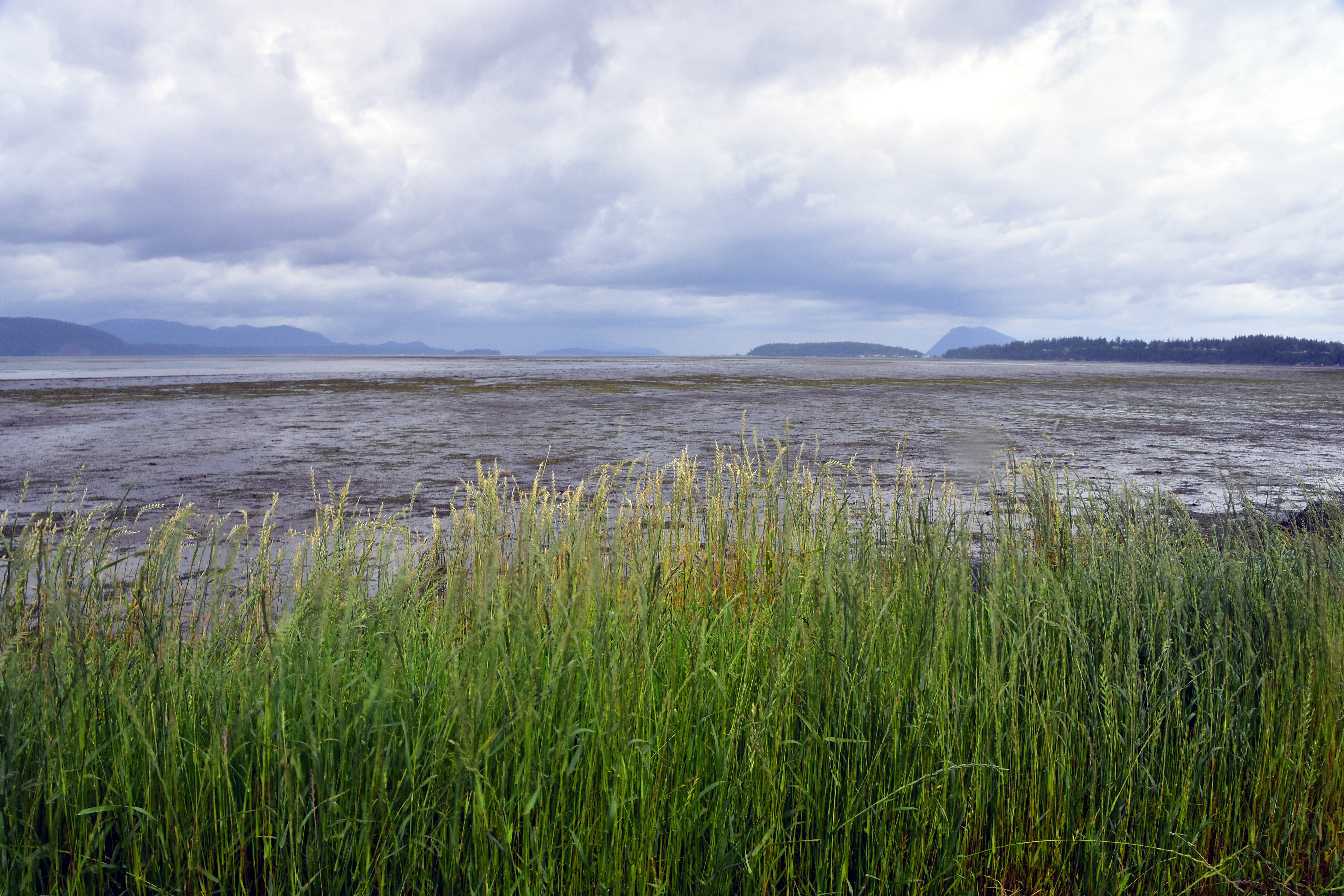 The mudflats of Padilla Bay, an estuary in Puget Sound at the saltwater edge of the Skagit River delta, located between the San Juan Islands and Samish Island.
San Juan Islands
The San Juan Island Archipelago consists of a staggering 172 islands, some only visible during extreme low tide, and well over 300 miles of shoreline. The islands are sandwiched between the North Washington coast to the East and Vancouver Island, Canada on the West.
Our first sight of the San Juan Islands was at Larrabee State Park, which was very close to where we were staying on Samish Island. The 2,683-acre Larrabee State Park was Washington’s first State Park. It fronts on to both Samish and Chuckanut Bays, offering sweeping views of the San Juan Islands.
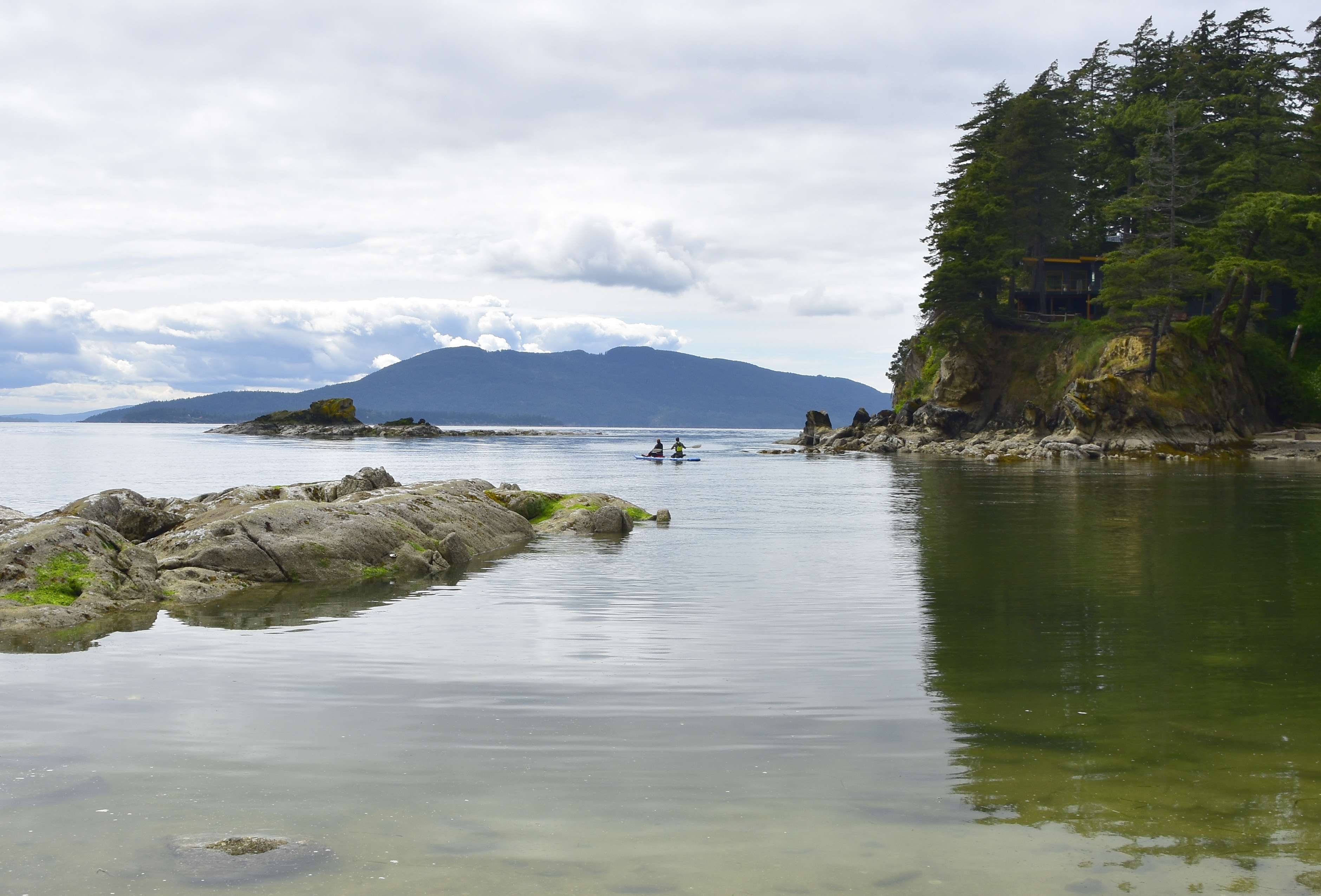
 View across Samish Bay to the San Juan Islands.
 Two canoeists leaving Wildcat Cove and heading out into Samish Bay.
Whidbey Island
Whidbey Island is in Puget Sound, north of Seattle and whilst technically not part of the San Juan Islands, it lays close-by to them to their southwest. It is a popular vacation destination for Americans due to its location, historic towns, diverse landscape and climate. Surrounded by the majesty of the Olympic Mountains and the Northern Cascades, this is a beautiful island to visit.
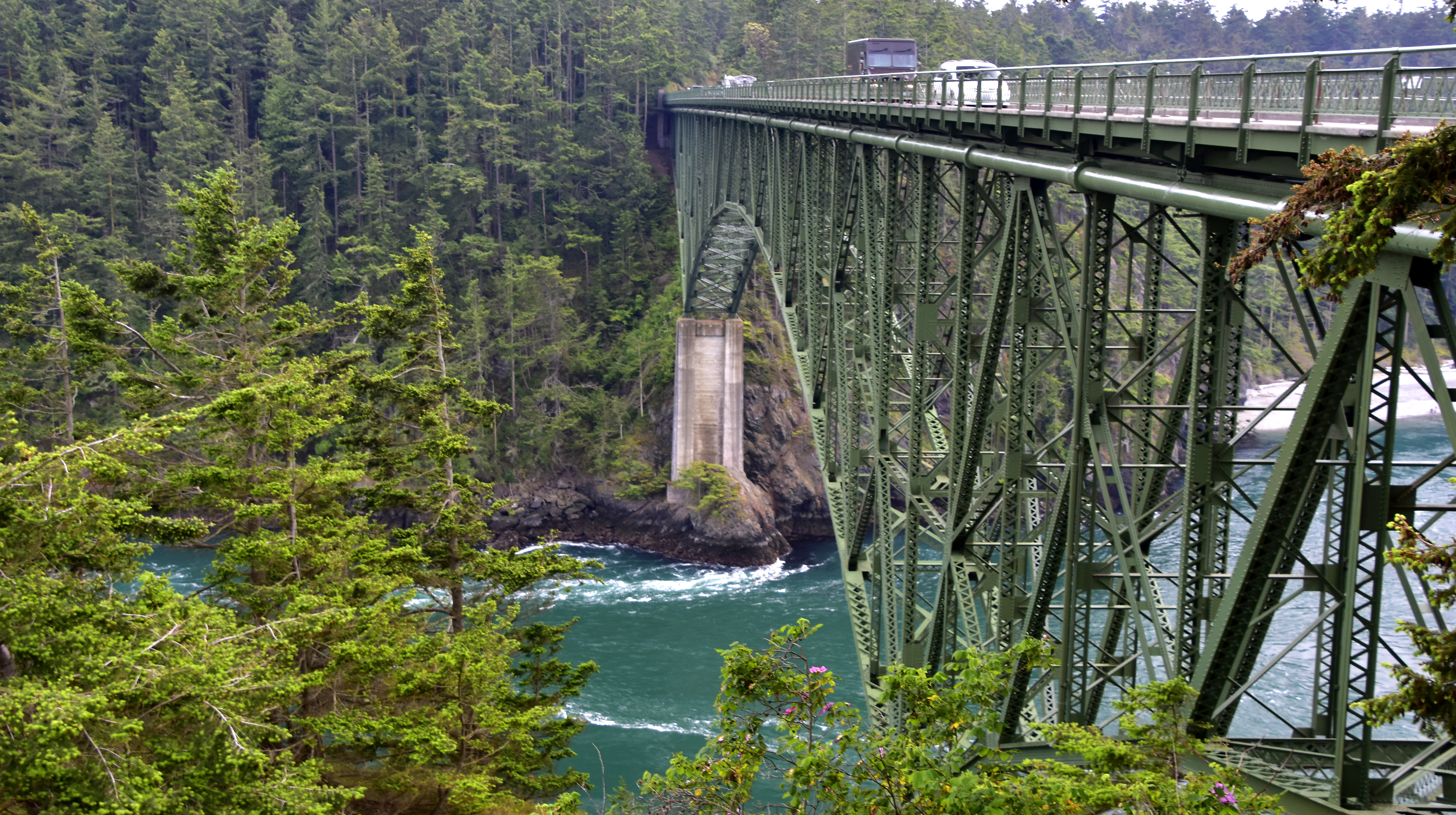 Whidbey Island is connected to the mainland by the Deception Pass Bridge, the common name for two, two-lane road bridges. Opened in 1935, the bridge has a total span of nearly 1,500ft. The turbulent waters of Deception Pass flow underneath the southern span of the bridge.
 Early morning in Coupeville, looking across Penn Cove to the Northern Cascades and sea mist in the Saratoga Passage.
 Charlotte taking a walk on the beach in Langley, on the south of Whidbey Island, looking across to the southern tip of Camano Island and the Northern Cascades.
 A small farm on the prairies in the Ebey’s Landing National Historic Reserve, with the dramatic backdrop of the 14,000ft. Mt Rainier in the background.
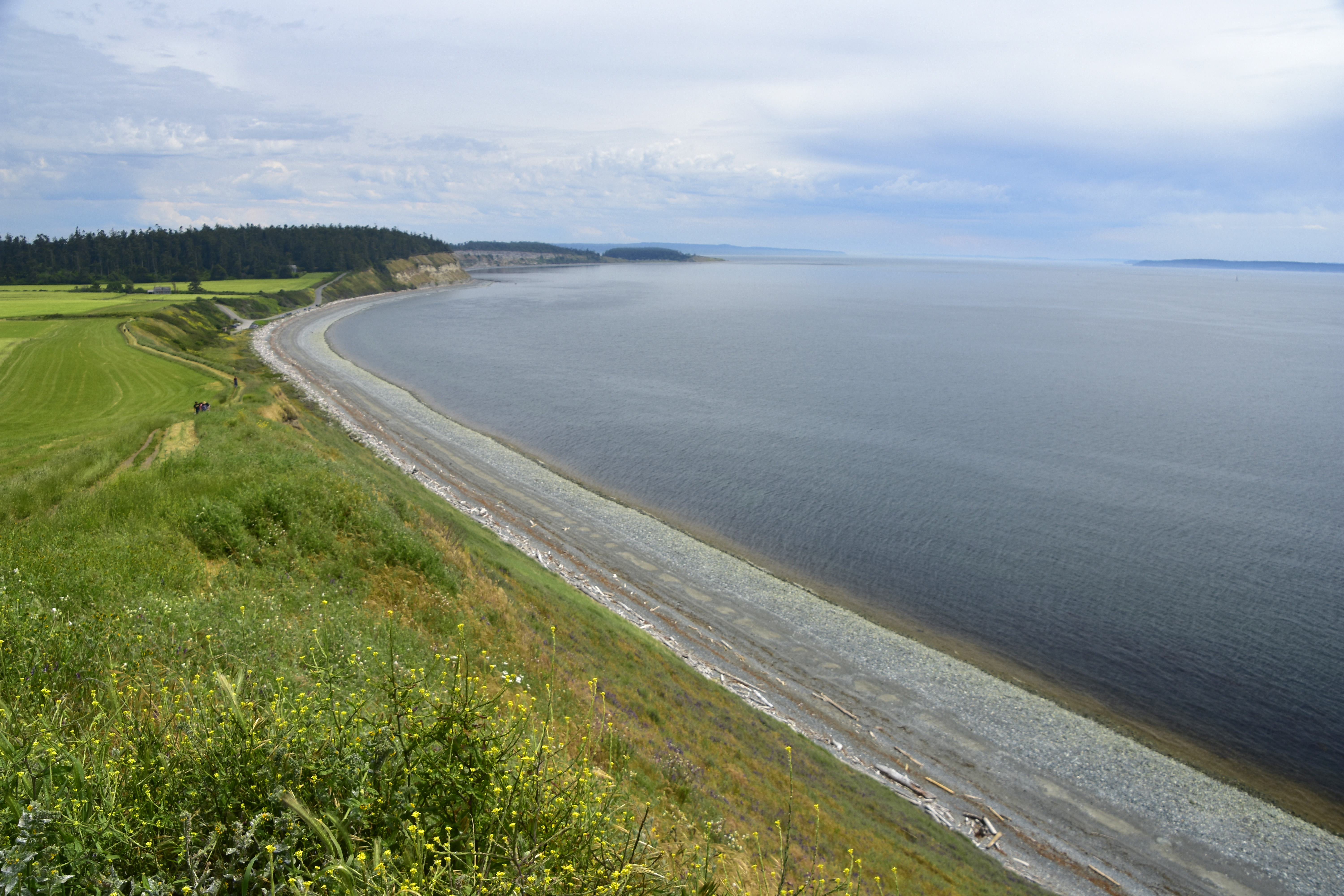 Lovely sweeping coastline and clifftop walk in Ebey’s Landing State Park on the north eastern side of Whidbey Island.
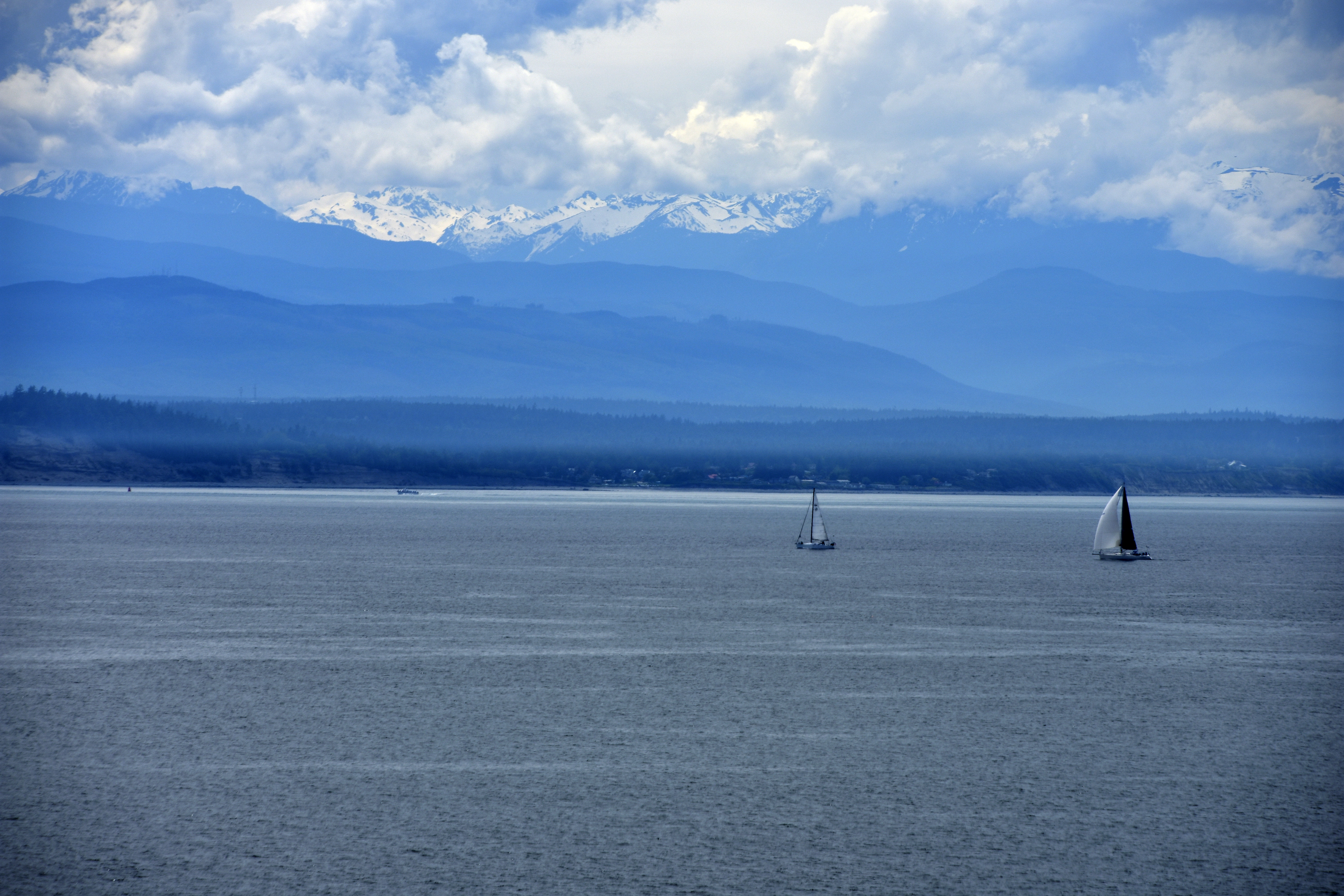 View from Ebey’s Landing State Park across Admiralty Inlet to the Olympic Mountains.
Orcas Island
We finally got to visit a real San Juan Island! Orcas Island is the largest and hilliest of the San Juan’s. It is reached by a 1 hour ferry trip from Anacortes on the mainland.
It is filled with small coves and bays, and has a number of excellent State Parks. We also spotted more wonderful birds of prey.
Our first stop was Obstruction Pass State Park (Who ever named these parks, clearly hadn’t been on the PR course!)
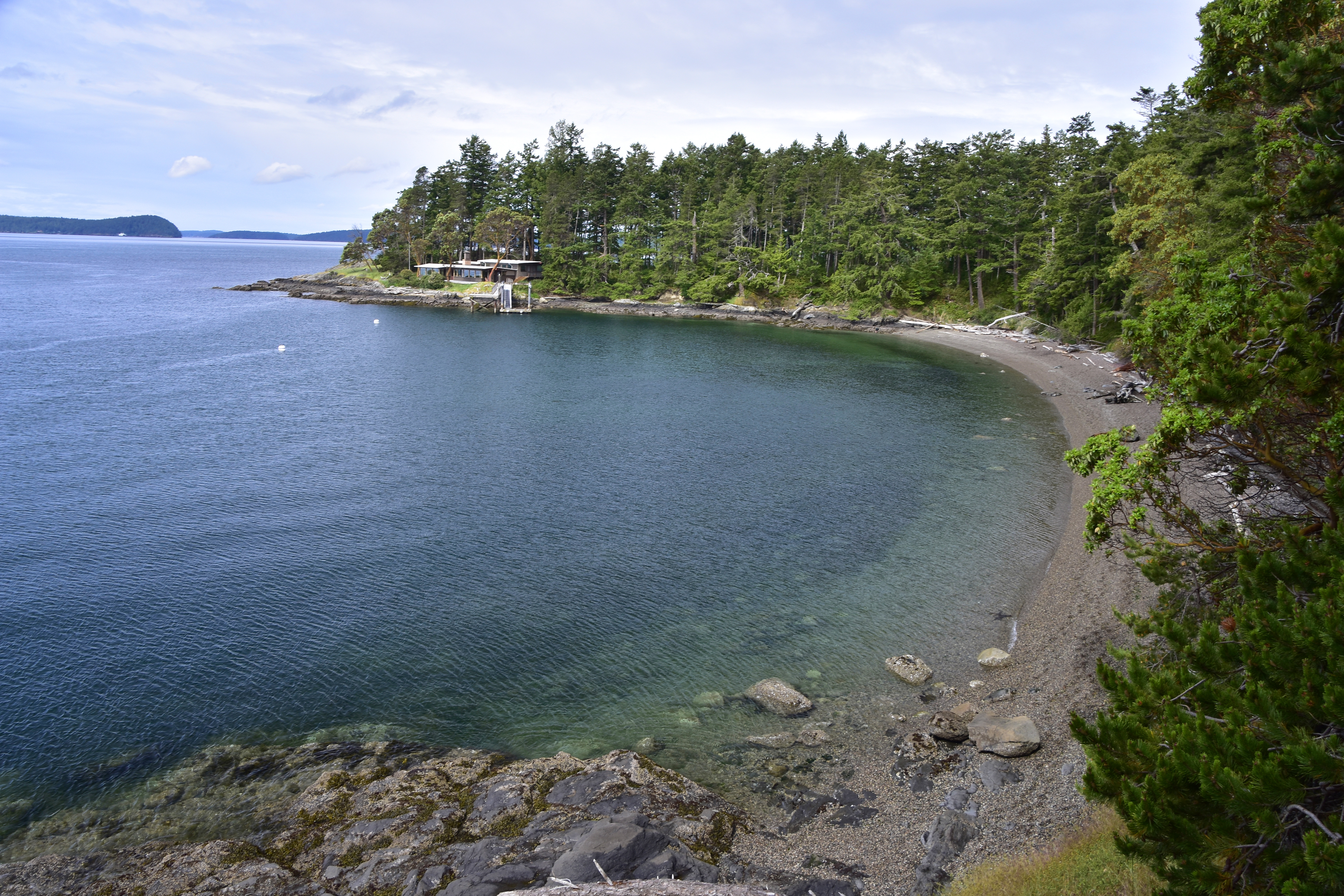 Spring Bay looking across Obstruction Pass to other San Juan Islands.
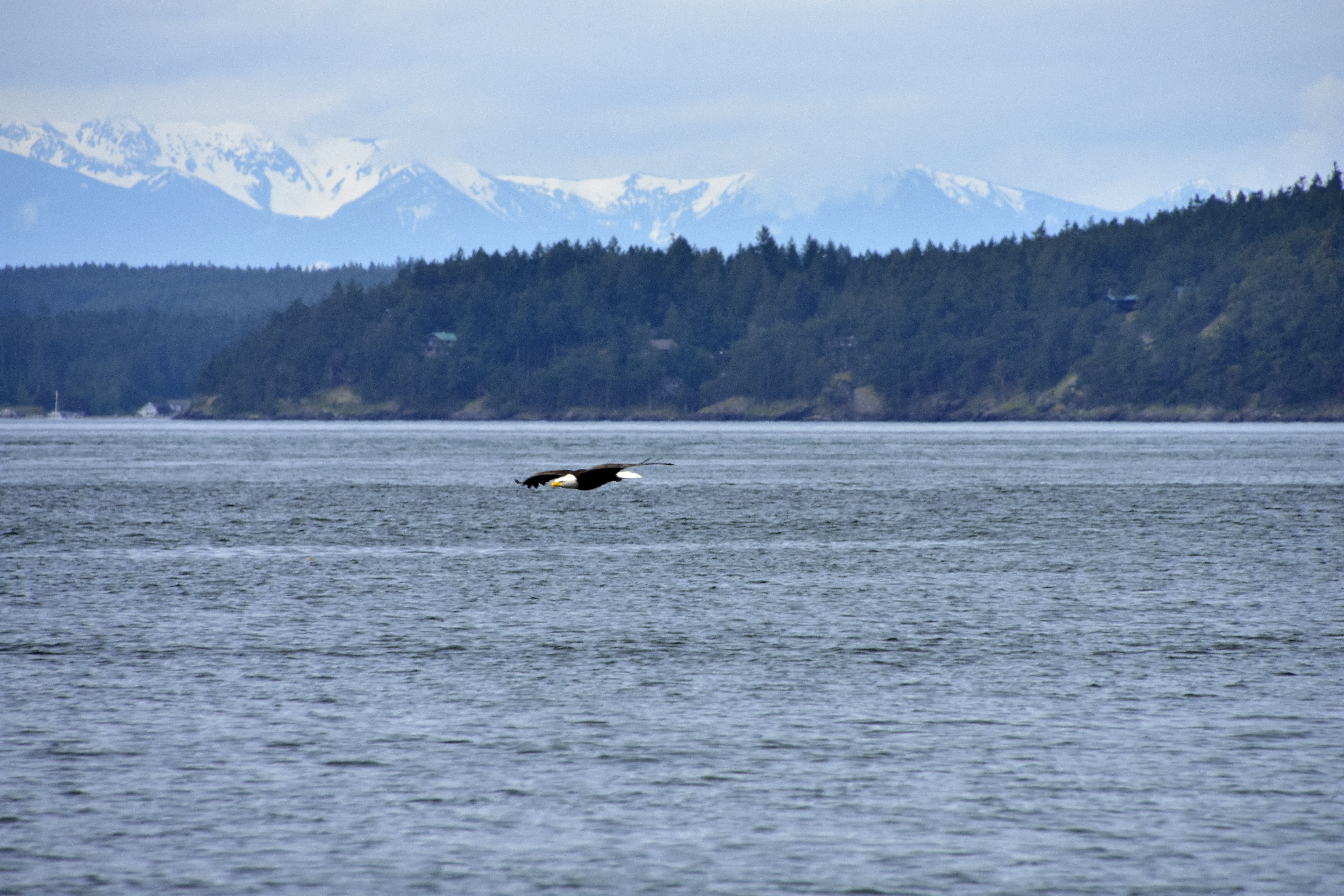 A Bald Eagle gliding low over Spring Bay, with Lopez Island and the Olympic mountains in the background.
Another small bay we discovered was Buck Bay, which was a shellfish farm. Here we found more birds of prey.
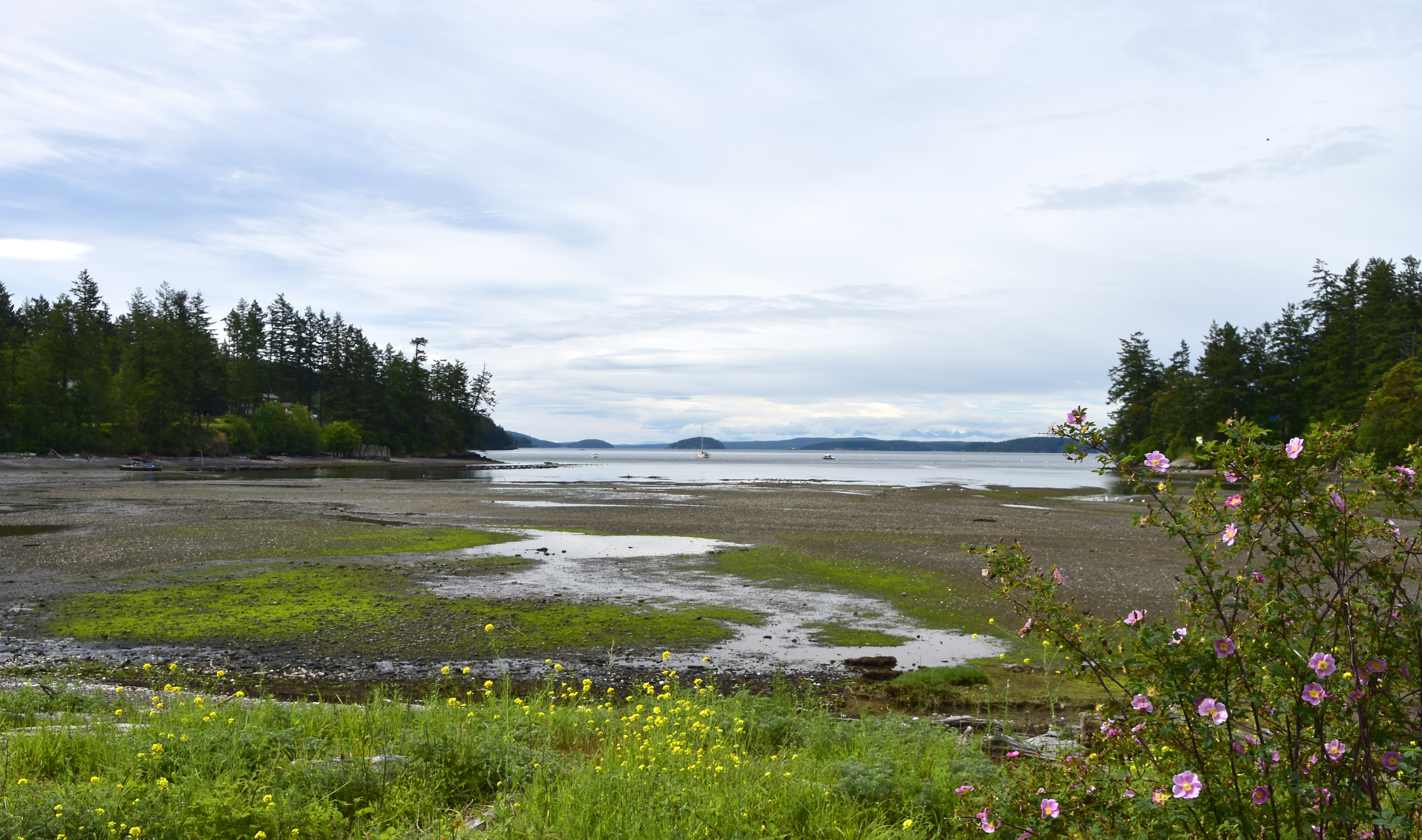 Buck Bay.
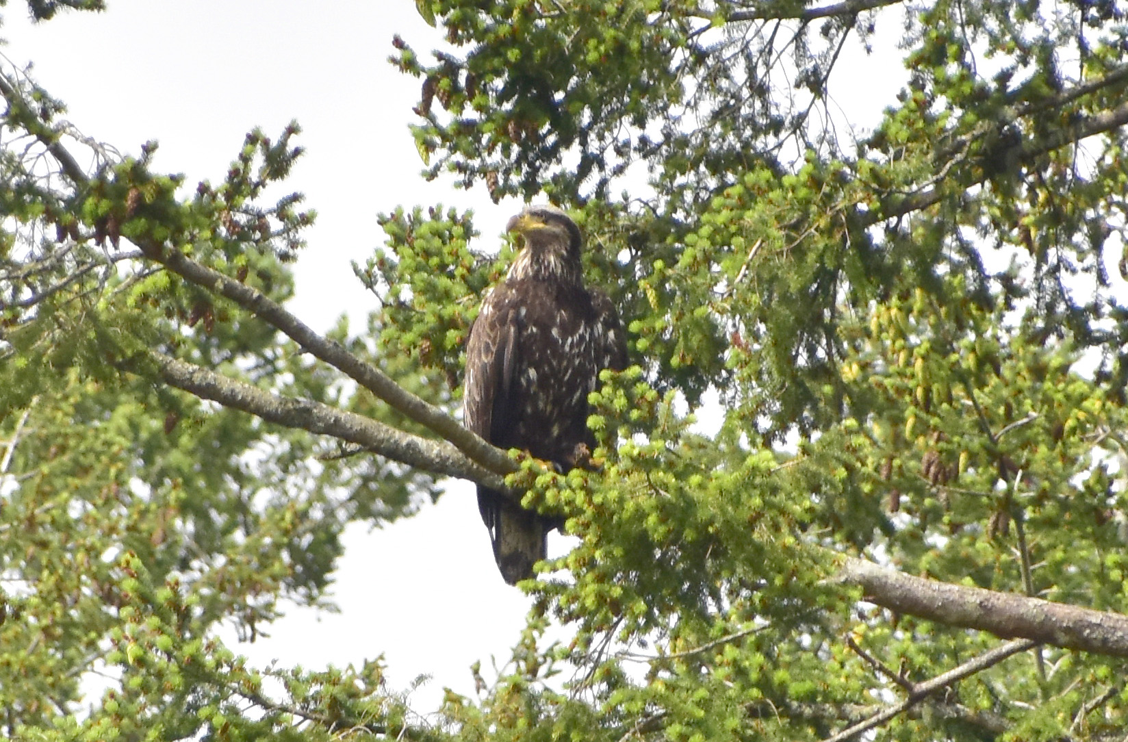 A juvenile Bald Eagle perched in the trees.
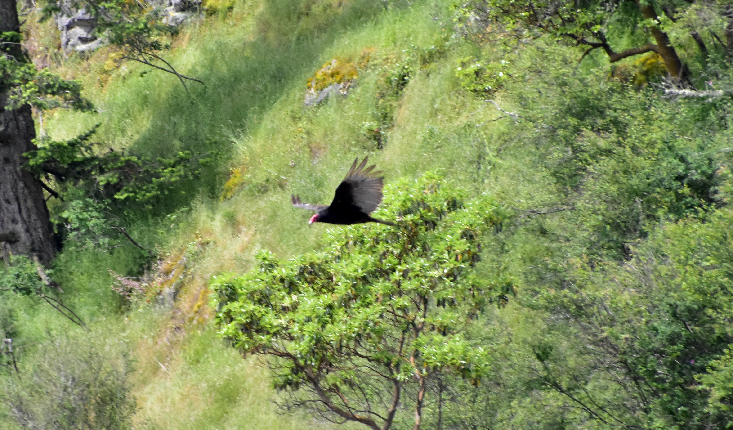 A Red-nose Vulture appears from the trees above the bay.
Our last visit on Orcas was to the Moran State Park, the jewel in the crown of the island. It is home to Mt. Constitution, which at 2,409 ft., is the highest point in the San Juan Islands. Atop the summit is a tower that offers panoramic views of the surrounding islands.
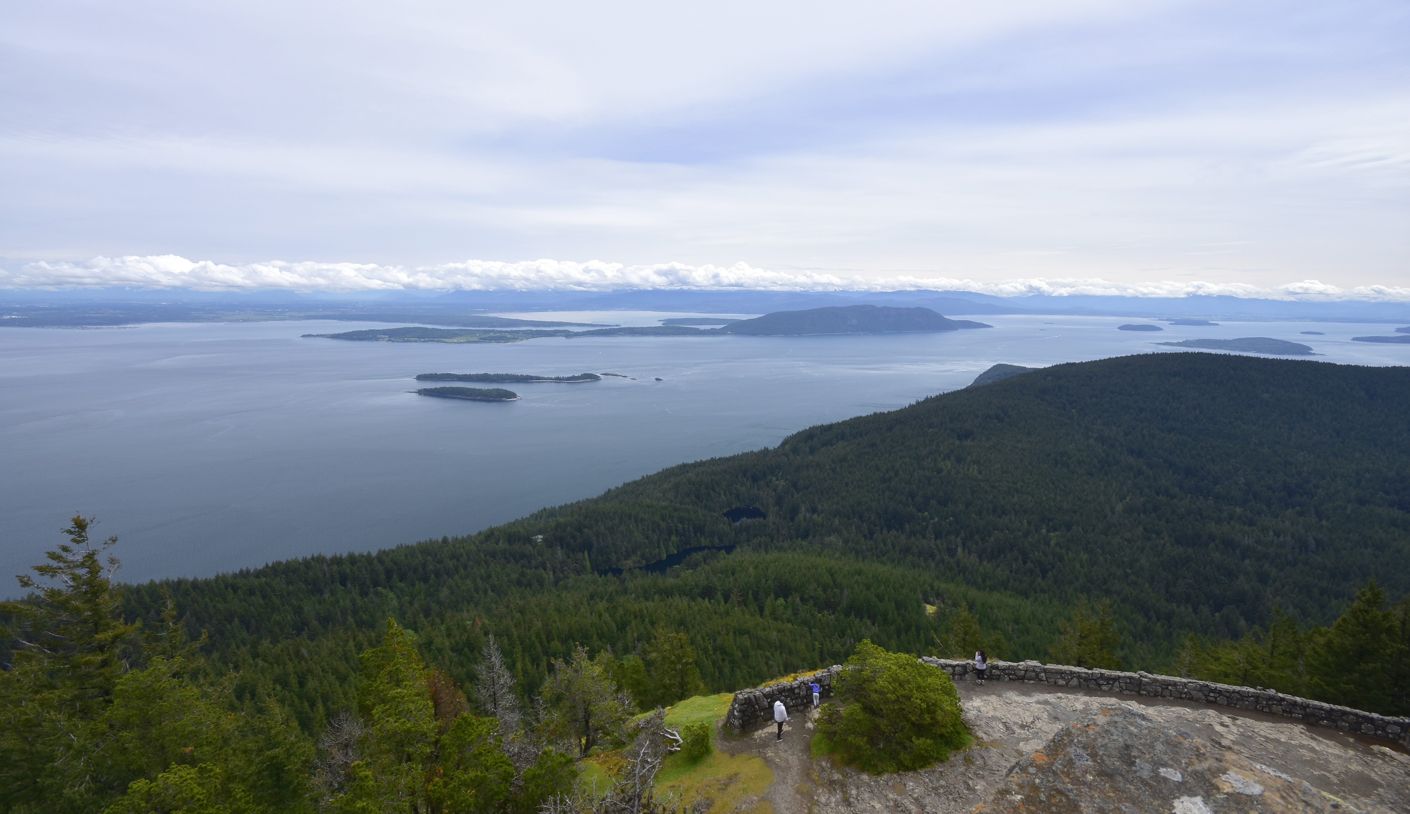 View from the top of the tower to the east and some of the other San Juan’s, with mainland Washington state and the cloud covered Northern Cascades in the background.
Before catching the ferry back to the mainland, we finished off a lovely day on the island with a 4-mile hike around Mountain Lake. The lake sits at nearly 1,000ft., in the shadow of Mt. Constitution.
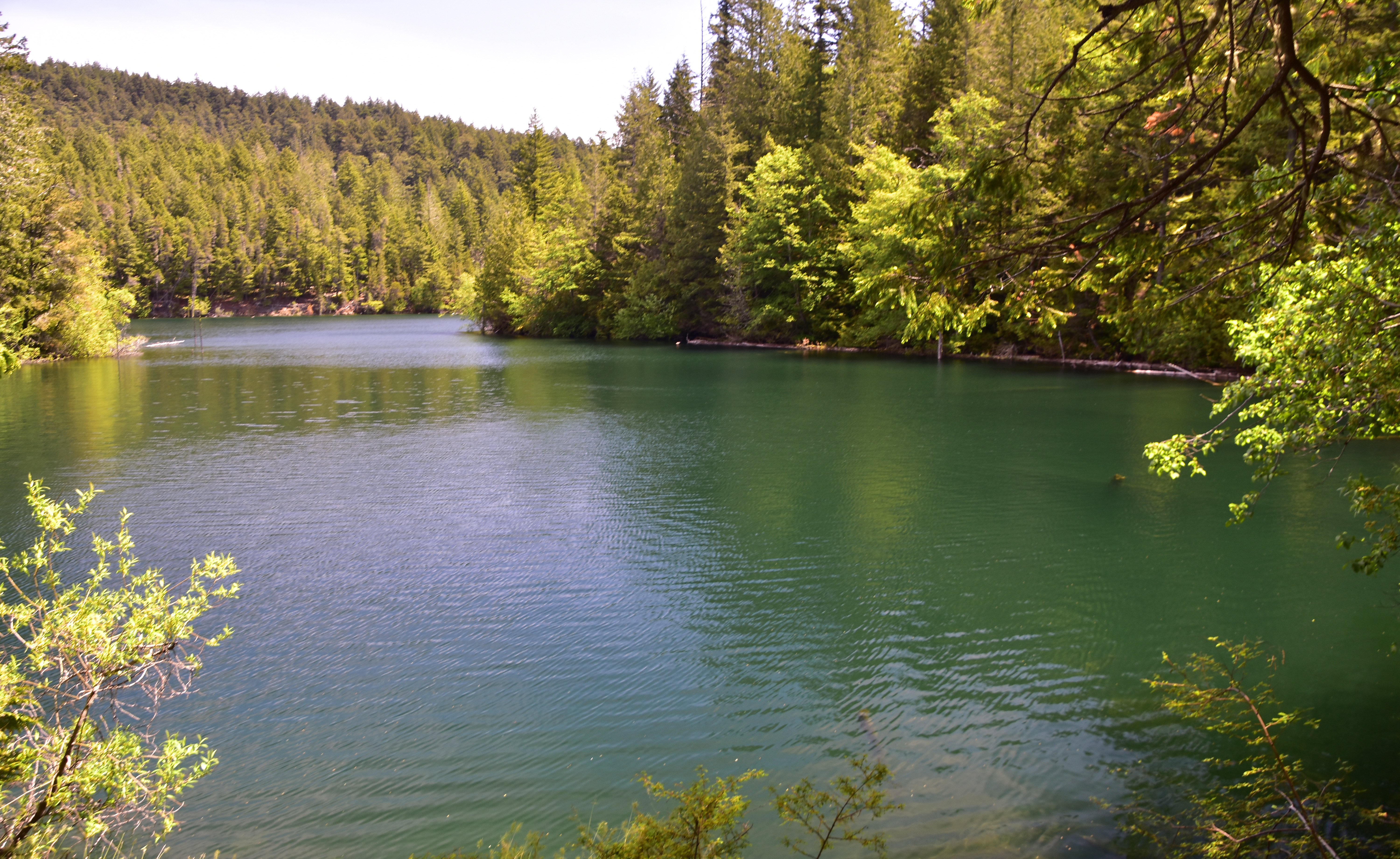 Mountain Lake.
Northern Cascades
The Northern Cascades are a section of the Cascade Range of mountains. The Cascade Range is part of a vast mountain chain that spans for over 500 miles, from northern California in the south to British Columbia, Canada in the north. The Northern Cascades has some of the most scenic and geologically complex mountains in the United States. The North Cascades National Park is the main focal point of the area.
We spent a couple of days exploring the Northern Cascades. The first day was a lovely drive down the Mt. Baker Scenic Byway and the second was a visit to the North Cascades National Park.
Mt. Baker Scenic Byway
State Route 542, otherwise known as Mt. Baker Scenic Highway, winds along the banks of the Nooksack River, through small logging communities, past waterfalls and alongside forests. This 58-mile drive ends at the base of the 10,781-foot volcano Mount Baker.
 Start of the scenic drive with the first look at the Northern Cascade peaks.
 Climbing higher into the mountains.
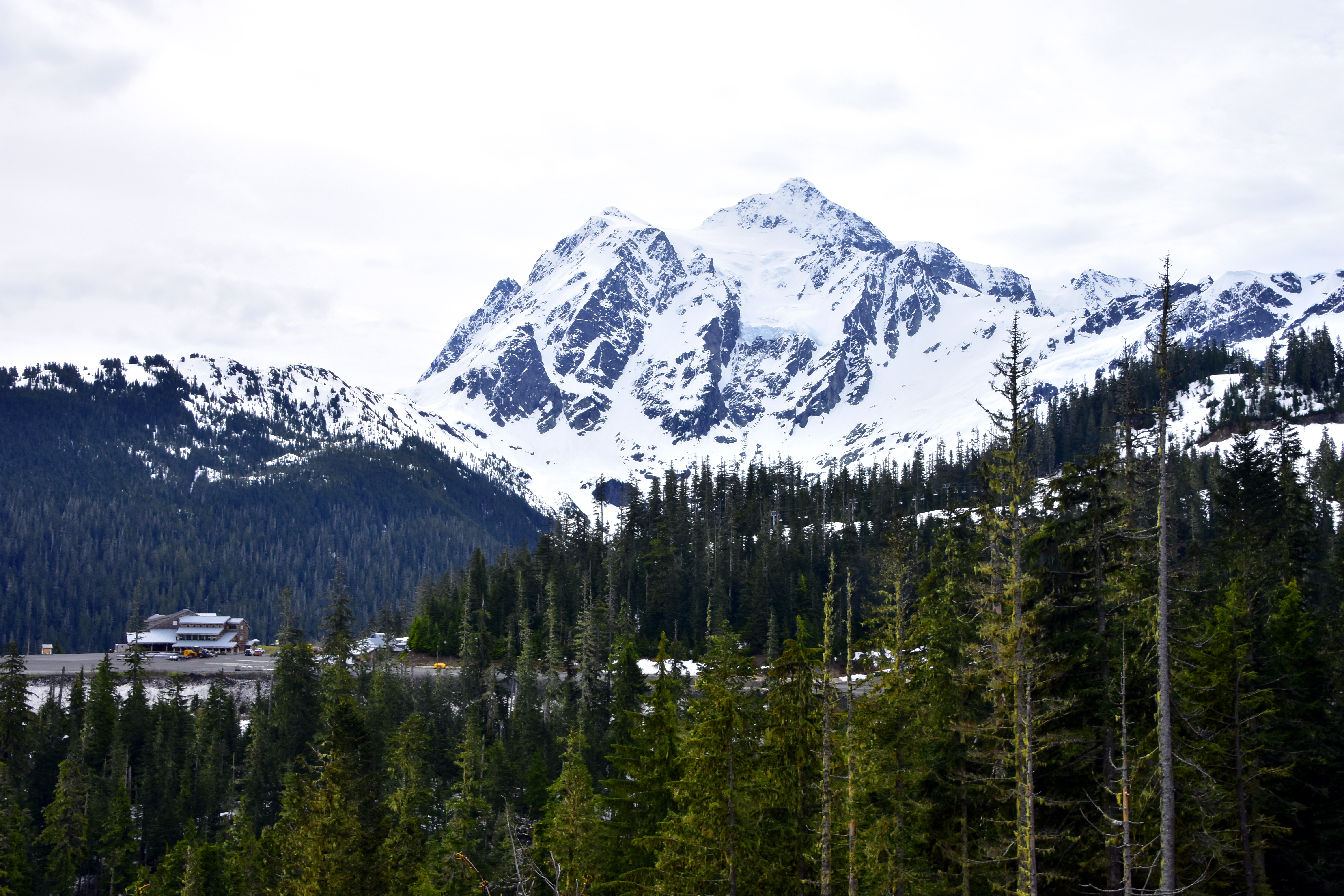 Mount Baker Ski Area (5,100 ft. elevation) dwarfed by the 10,781 ft. active glacier-covered volcano, which has the second-most thermally active crater in the Cascade Range after Mount St. Helens. It is the third highest peak in Washington State.
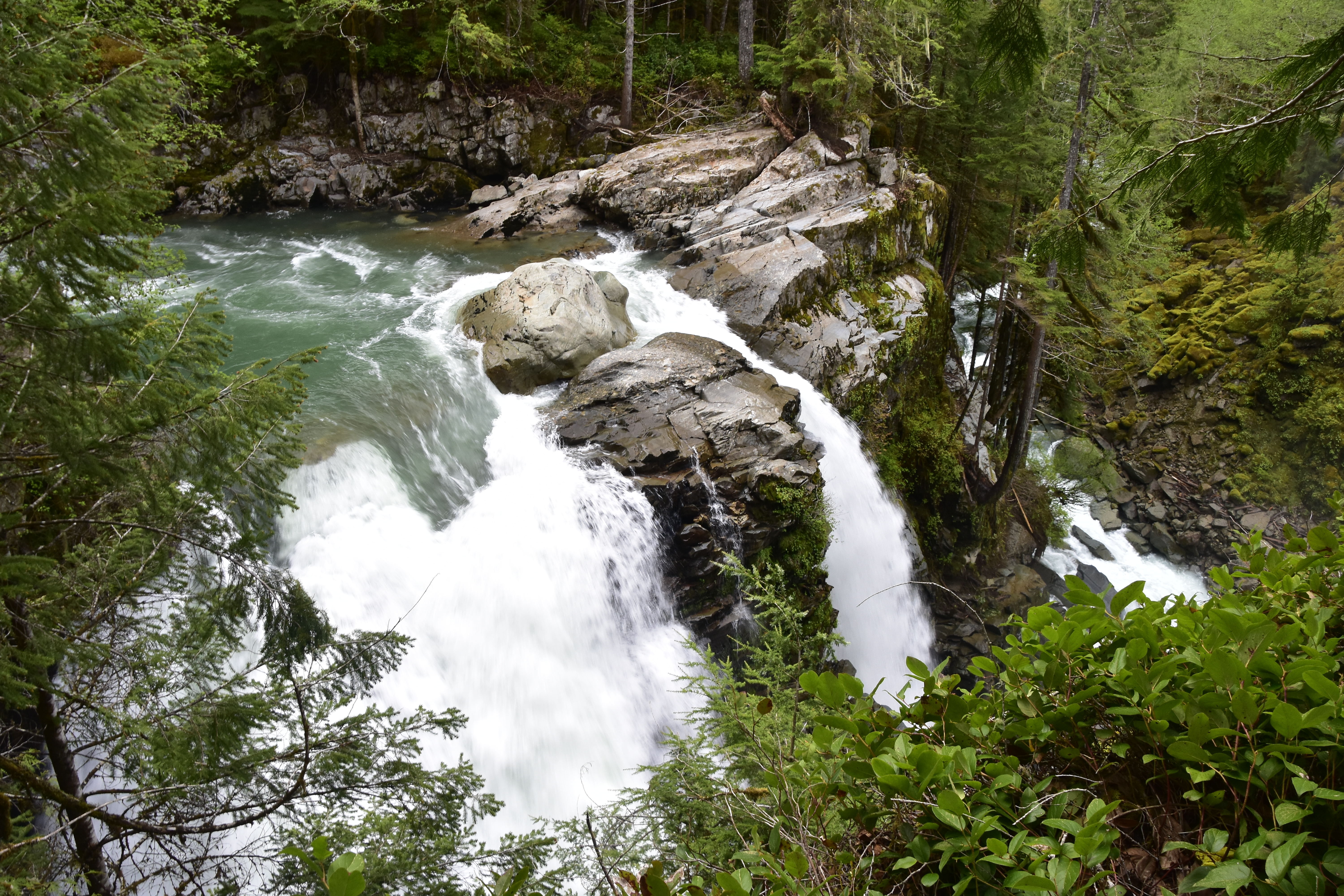 Nooksack Falls – The Nooksack River, which is 1,500 ft. above sea level, flows through a narrow valley and then drops 88 ft. in to a deep, rocky river canyon.
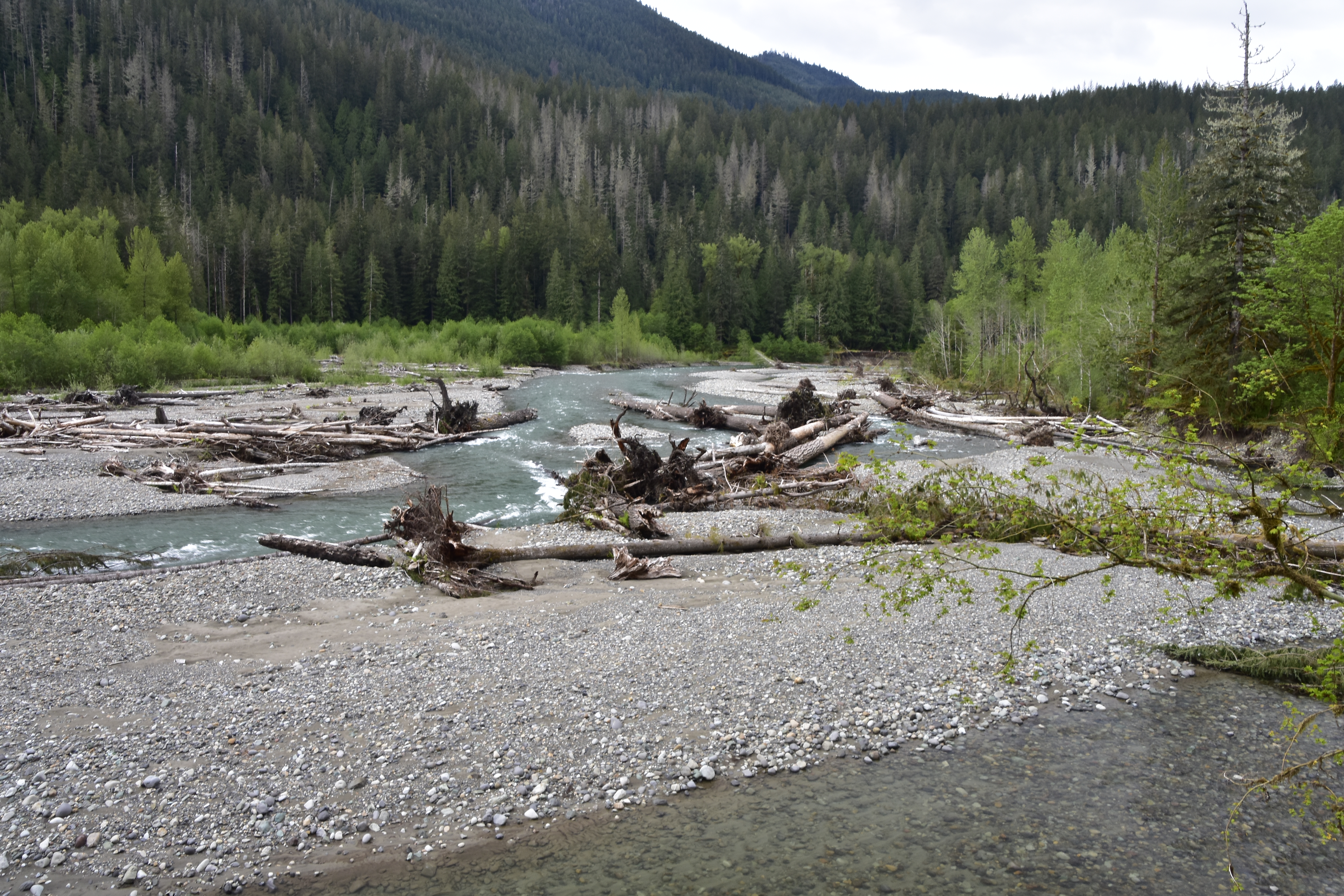 Nooksack River, further down the valley from the falls.
North Cascades National Park
North Cascades National Park’s rugged beauty is characterized by jagged peaks, deep forested valleys, cascading waterfalls and over 300 glaciers; more than any other U.S. park outside of Alaska.
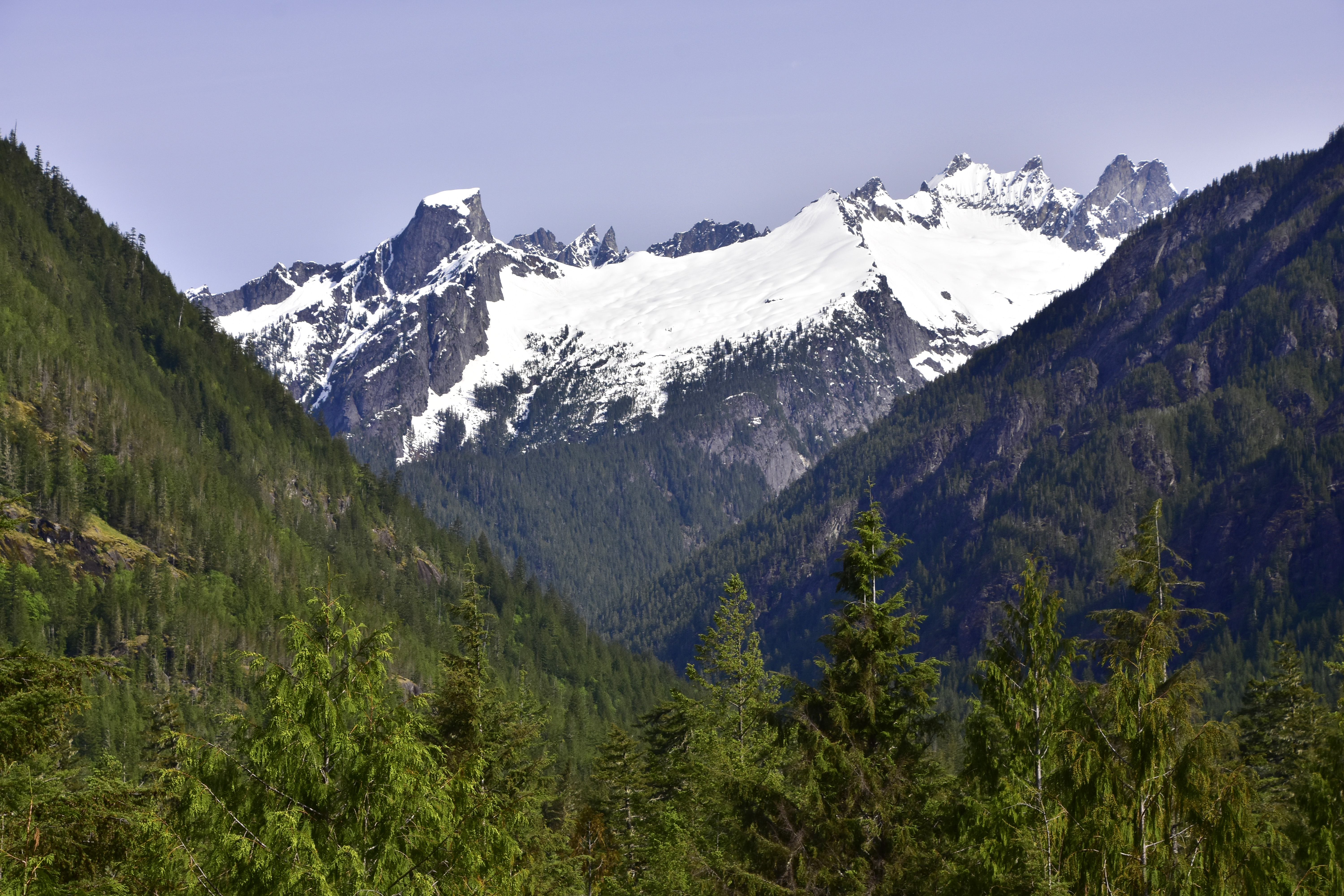 The Picket Range is a small, extremely rugged subrange, which has remained the wildest and most unexplored region in the North Cascades. The distinctive 6,000 ft. Pinnacle Peak on the left is known as the ‘Chopping Block’.
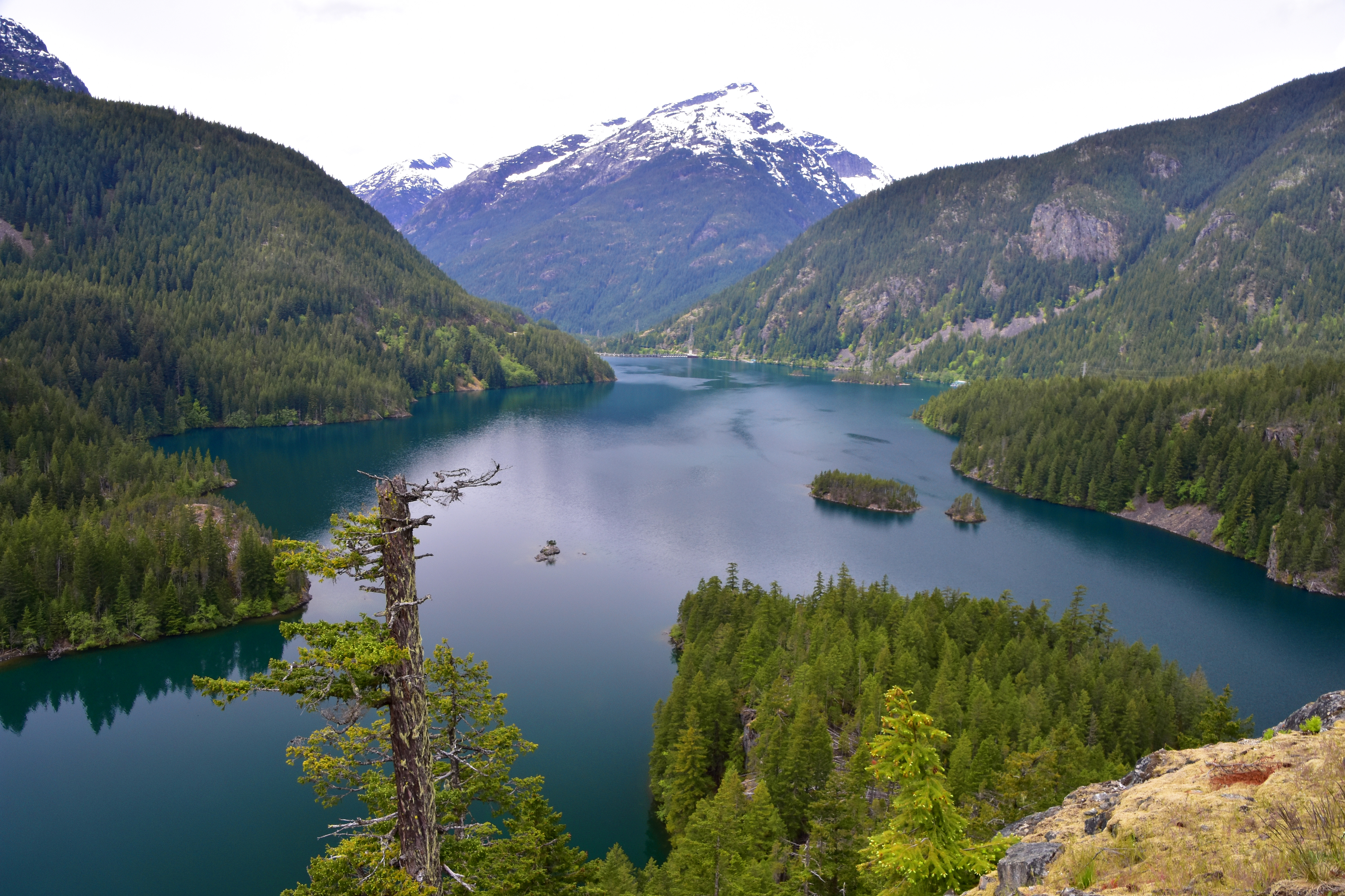 Diablo Lake is a reservoir created from the Diablo Dam, seen in the distance. It’s mirror-like, glacier-fed waters produce a beautiful colourful vista.
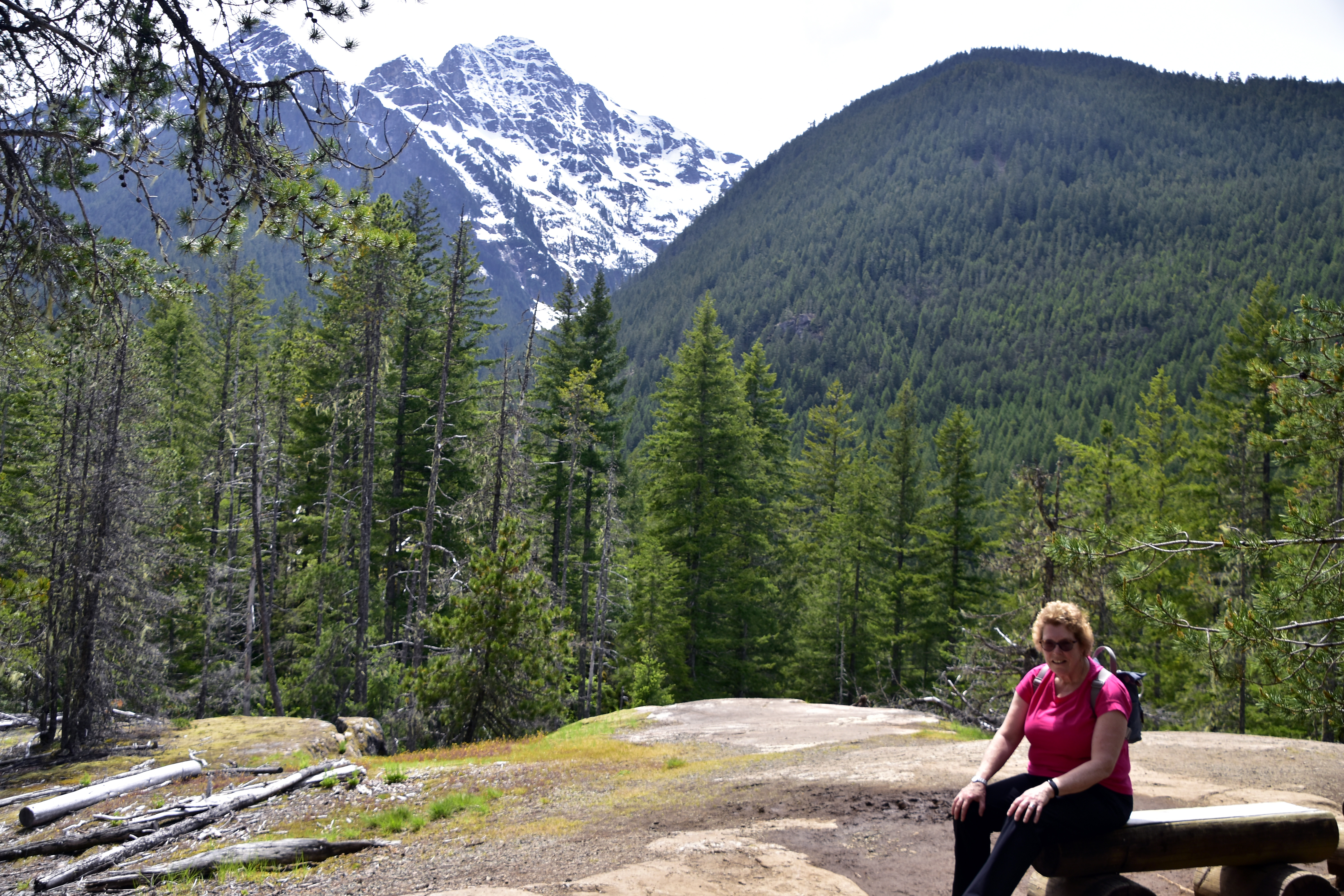 Charlotte enjoys the view whilst on a 4-mile, 400ft. hike near Lake Diablo.
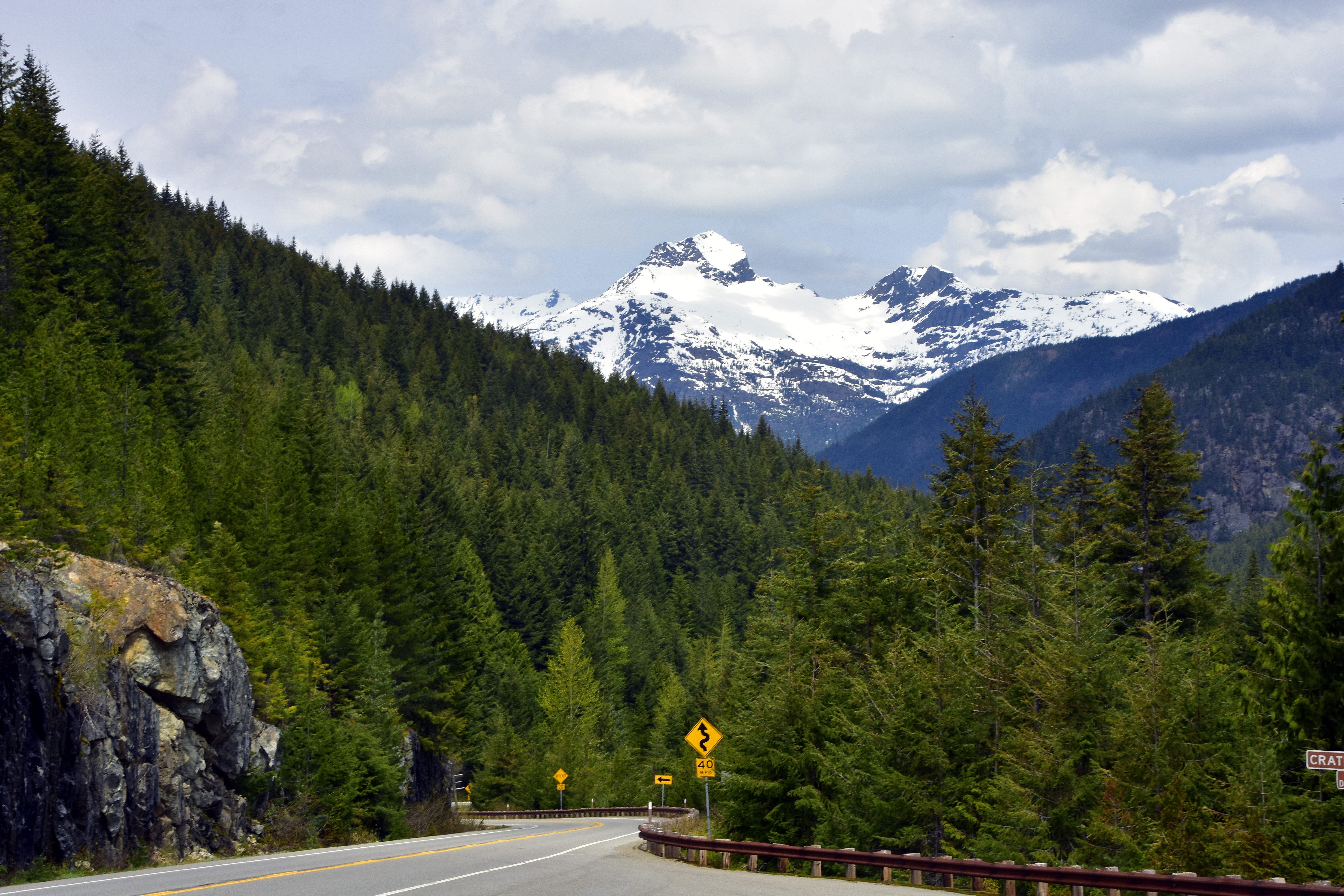 The 8,132ft. Crater Mountain is ever present as you drive along the North Cascades Highway.
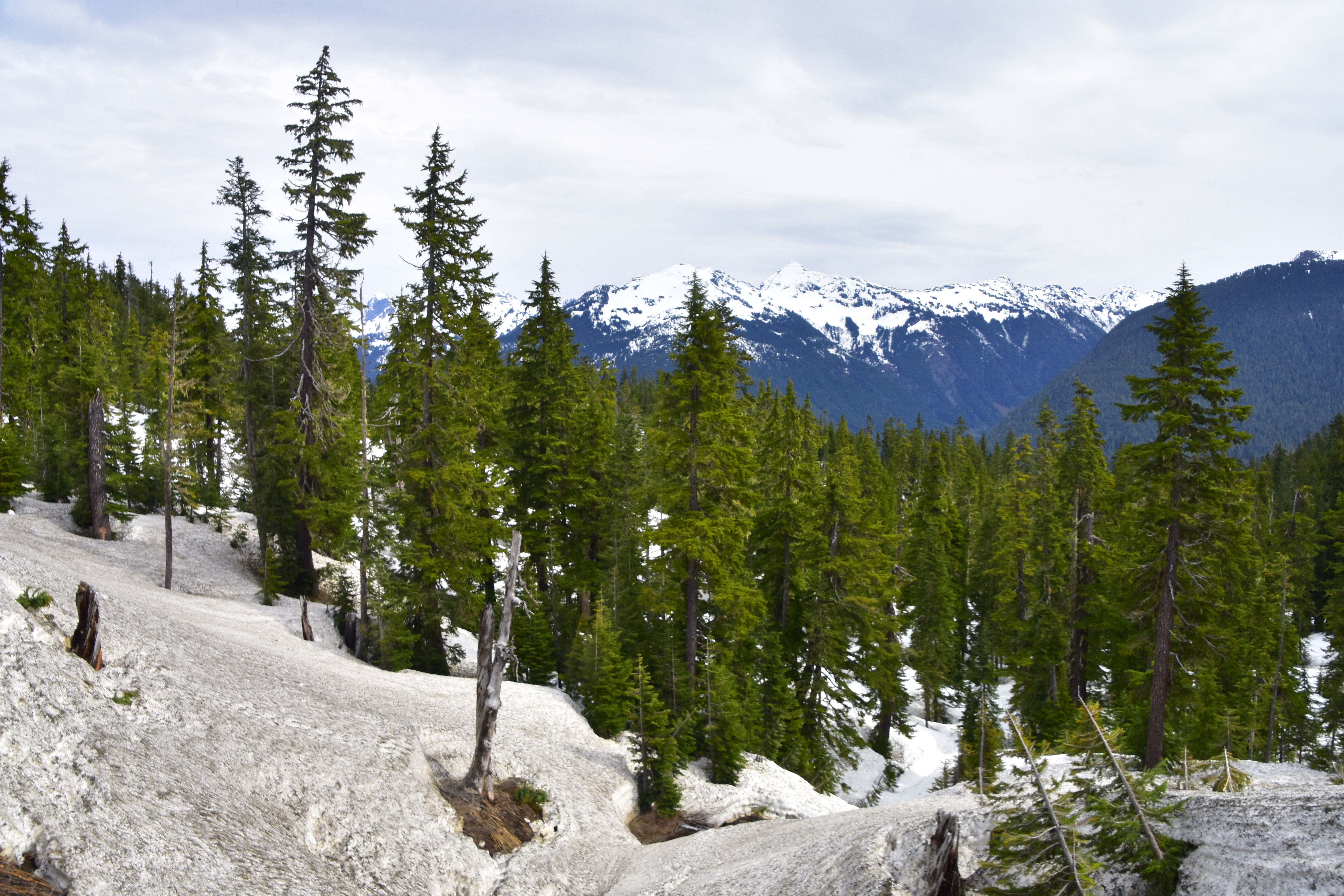
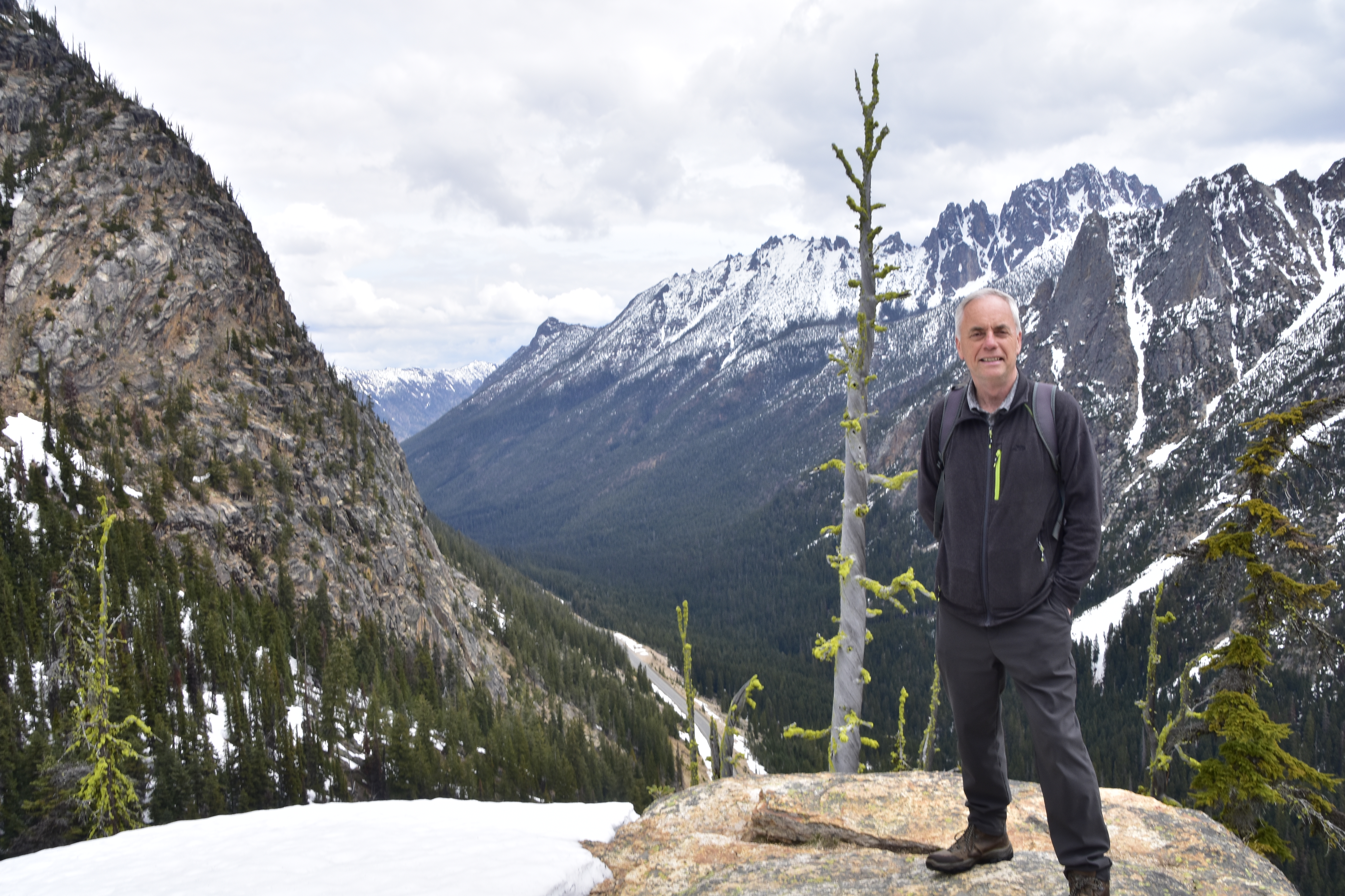 At nearly 6,000ft, the Washington Pass Overlook offers dramatic views across the Cascades. The road to the Pass had only just opened after the winter snow; however we still had a short hike through snow to get to the overlook.
Photo of the week: Beach Recycling
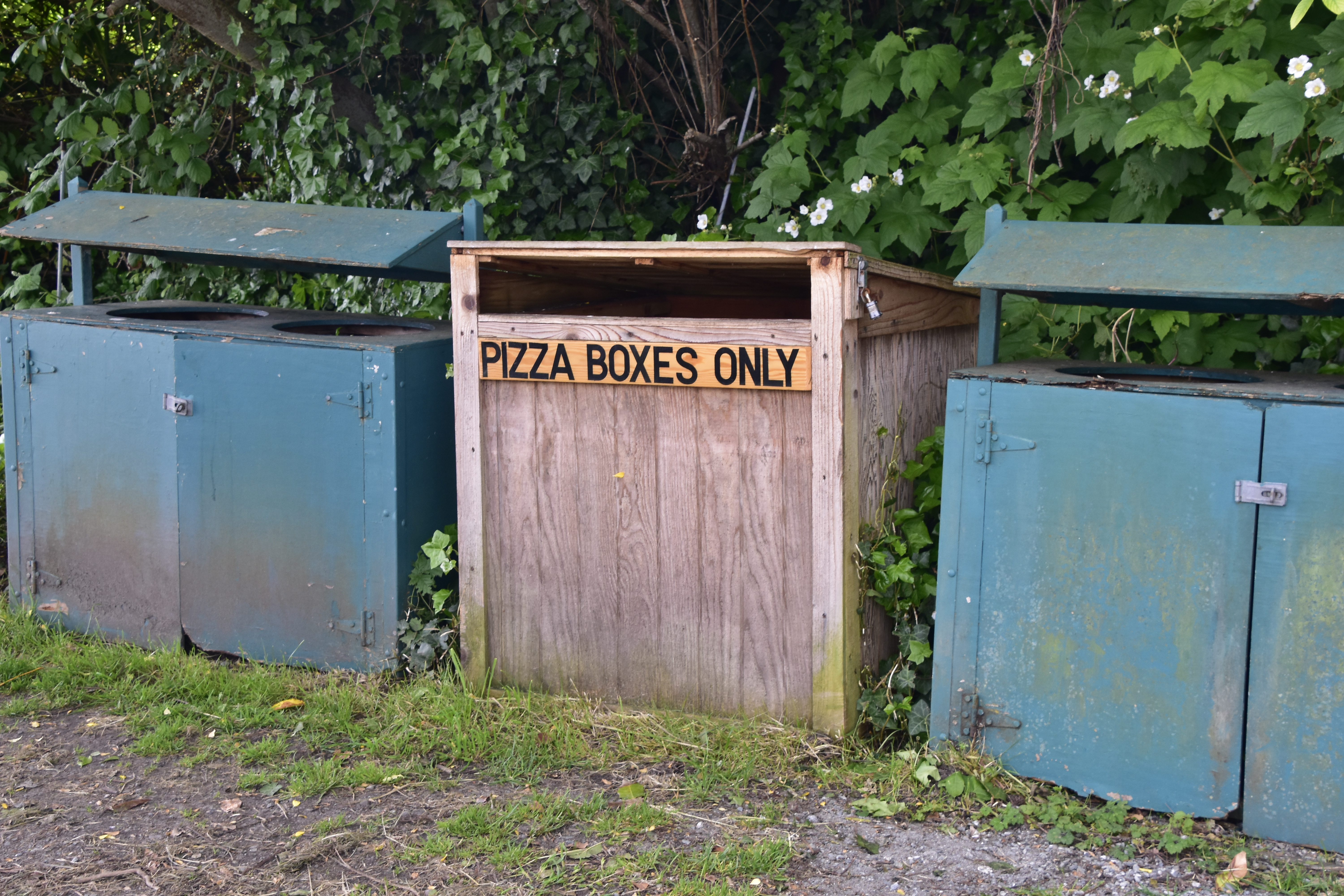 It’s great to see recycling bins on a Whidbey Island beach – what do you think American’s favourite food is?
Tomorrow we are leaving Washington State and heading for Wyoming to visit Yellowstone National Park.
